Limehouse Workshop – 2005

Limehouse Workshop: Twenty years ago today I led a small workshop of photographers around parts of Limehouse, stopping at a number of key places where I gave a short introduction and some suggestions then set them free for a quarter of an hour or so to take their pictures. And while I then gave those who seem to need it some support I also found time to make some pictures myself.

Limehouse Workshop - 2005

This was an area I’d photographed on a number of occasions over the years – and of course had revisited shortly before the workshop to check and plan our route. And on the day I made sure to be there well in advance in case there were any problems with transport across London. For once there weren’t and I arrived in time for an hour or so wandering and making pictures before we met up.

Limehouse Workshop - 2005
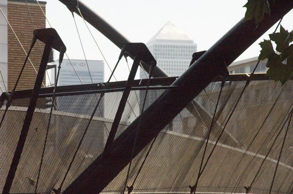
Canary Wharf tower and footbridge over Rotherhithe tunnel

Because of the preparation the workshop went smoothly and I also had a lot of material to write a post on My London Diary – though a lot less than I told people on the workshop about the area. Here it is below with the usual corrections.

Limehouse Workshop - 2005
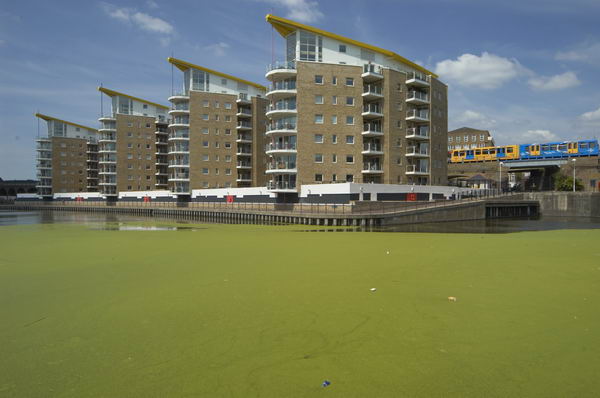
New flats built on top of LImehouse Link tunnel at Regents Canal Dock (Limehouse Dock), with DLR train.

Limehouse is an area of London, with a varied population and an interesting history. it grew up around the river and seafaring trades, including ship-building, and had many warehouses and similar buildings. as well as the river Thames with its national and international connections (the first voluntary passengers to Australia are said to have left from Dunbar Wharf, close to Limekiln Dock.) It gained more traffic through its two canals, the Regent’s Canal linking the Thames to inland England, including Birmingham and the midlands via the Grand Union Canal, and the Limehouse Cut, taking traffic from the Lea Navigation to the Thames by a safer route avoiding Bow Creek.

Limehouse Workshop - 2005

Much of the centre of Limehouse is occupied by the Regents Canal Dock. In the 1960s a new short length of canal joined the Limehouse Cut to this, enabling the separate lock from this to the Thames to be closed. A year or two later all commercial traffic on the canals ceased, leaving them for pleasure cruising.

Limehouse Workshop - 2005

A hundred years ago, docklands in general and Limehouse in particular was a closed world to those who lived outside the area. Lurid and racist stories, particularly those of Sax Rohmer, painted the area as a den of vice, run by the infamous (and totally fictional) Dr Fu Manchu. The area had become home to a number of Chinese and Asian sailors and their families, becoming London’s first Chinatown. Even thirty years ago there were still some signs of this, but [by 2005] most of the Chinese businesses and people have moved away to other areas, including Soho.

St Anne’s, Limehouse flying its naval White Ensign

Thomas Burke’s tales of Limehouse [Limehouse Nights: Tales of Chinatown] from the same era as Rohmer paint a more accurate and sympathetic view of the area and its English and Chinese population, although his language is fully of its time, with many terms that would now be considered derogatory. But Burke had been raised as an orphan in neighbouring Poplar and his Limehouse stories reflect a close knowledge of the people and the place. The figure who dominates his stories is not a sinister criminal warlord, but the old Chinese sage, Quong Lee.

More recently, Limehouse came under the diggers and cranes of the London Docklands Development Corporation. Canary Wharf was raised on its eastern edge, and the Limehouse Link tunnel excavated through the heart of the area. The need to build this route to join docklands with inner London meant that the LDDC had to get round a table with the local authority, leading to the first real attempt by them to take social considerations into account in their development plans.

More pictures and some captions begin here on My London Diary.


FlickrFacebookMy London DiaryHull PhotosLea ValleyParis
London’s Industrial HeritageLondon Photos

All photographs on this page are copyright © Peter Marshall.
Contact me to buy prints or licence to reproduce.


Disabled Lose Independence & Robin Hood Gardens Doomed – 2015

Disabled Lose Independence & Robin Hood Gardens Doomed: The Independent Living fund which enabled many disabled people to live useful and fulfilling lives ended on Tuesday 30th June 2015. After photographing the delivery of petitions ouside Downing St against its ending I went to Poplar for another visit to Robin Hood Gardens where a second attempt to get these important buildings listed had recently been rejected.


DPAC’s ILF Closing Ceremony – Downing St to Old Palace Yard

Disabled Lose Independence & Robin Hood Gardens Doomed - 2015
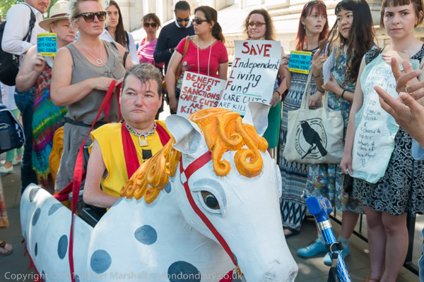
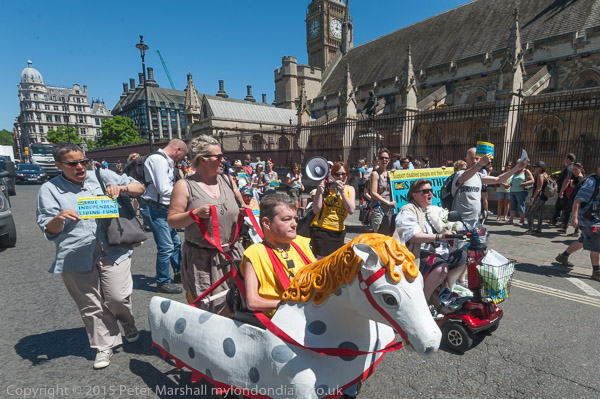
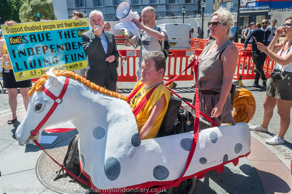
John Kelly as Schimmel, the equine star and proud battle horse of the Threepenny Opera

On the day the Independent Living Fund closed, campaigners for independent living for disabled people led by DPAC, Disabled People Against Cuts, presented petitions to the Prime Minister before marching behind the Threepenny Opera horse to Parliament to continue their fight for dignity and equality.

Disabled Lose Independence & Robin Hood Gardens Doomed - 2015

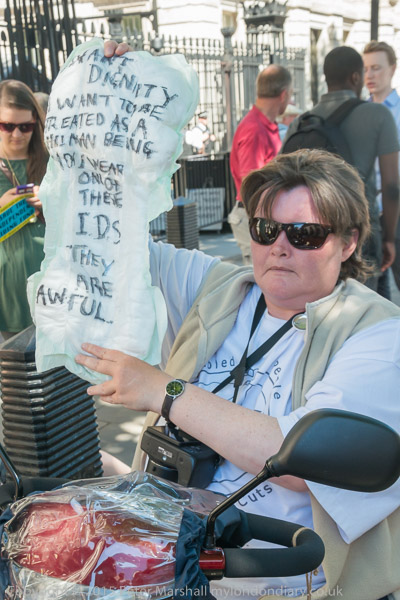
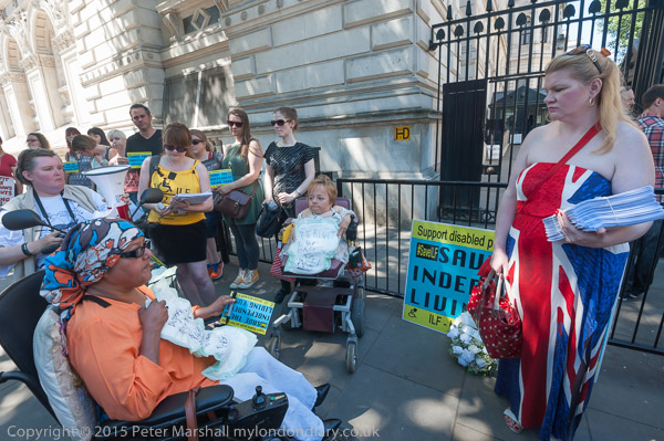
At the gates of Downing Street protesters wrote slogans on incontinence pads which losing the support means some will be forced to use. Paula Peters had this message for Iain Duncan Smith: ‘I want dignity – I want to be treated as a human – You wear one of these I. D. S. They are awful‘.’

Disabled Lose Independence & Robin Hood Gardens Doomed - 2015

As Secretary of State for Work and Pensions IDS was responsible for the decision to end this support, which had been introduced in 1988 to enable disabled people to live in their own homes and to pay for care, and in particular to employ personal assistants.

Disabled Lose Independence & Robin Hood Gardens Doomed - 2015

They had brought a petition with over 25,000 signatures to hand in and after this they marched to a rally at Old Palace Yard at the end of which a wreath with the message’s ‘RIP ILF’ was laid.

Disabled Lose Independence & Robin Hood Gardens Doomed - 2015

The government lost a legal challenge over ending the ILF but still closed it for new claimants on 1st July 2015. The responsibility for existing claimants in England was passed from the Independent Living Fund to local authorities who became responsible for care provision and all assessments. Support which had been well-administered became a post-code lottery.

DPAC’s ILF Closing Ceremony.


Robin Hood Gardens – Poplar

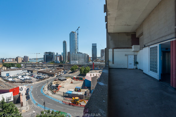
The end of the street in the sky – and it looks like the end for Robin Hood Gardens

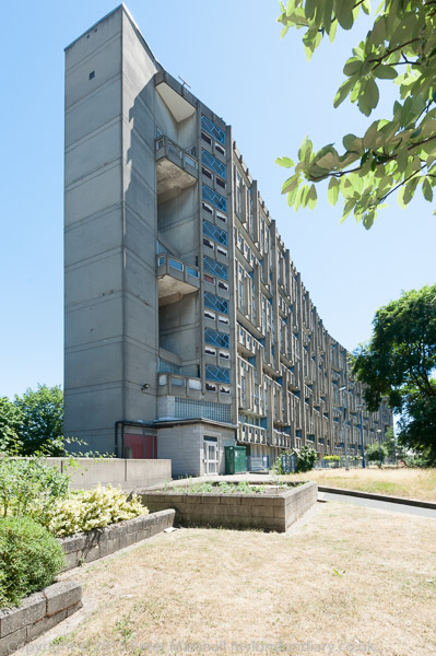
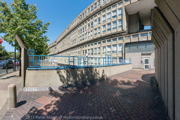
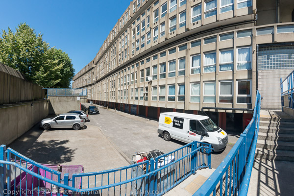
Robin Hood Gardens, designed by Alison and Peter Smithson and completed in 1972 was a nationally important and internationally recognised work of Brutalist architecture. Built for the London County Council with 213 flats, it was designed as two slab blocks, the east 10 storeys and the west 7 storeys on a difficult site next to one of London’s busiest roads – the Blackwall Tunnel Approach – but with a large and peaceful green inside.

There appears to be a forest between the two slabs of Robin Hood Gardens

It was very solidly built and the flats were generous, with wide ‘streets in the sky’ outside. Inside the flats next to the roadway you could hardly hear the traffic.

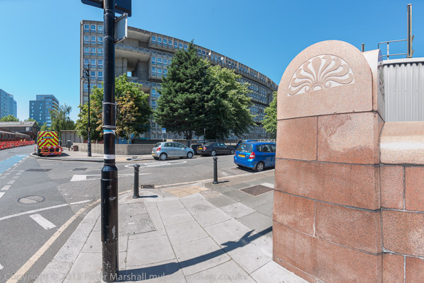
The East block seen from the decorated wall above the Blackwall Tunnel entrance

In 1965 ownership passed to Tower Hamlets Council who neglected the site, allowed the green to become overgrown and later actively demonised the estate and housed many problem families there.

Two tall walls of flats protecting a large open garden area

Following a visit there in 2009 on an Open House Day tour led by Bridget Cherry I commented it was “in many respects a fine solution to a difficult site with some superb landscaping in the large interior space. Deliberately encouraged to ruin by overcrowding and use as a sink estate by Tower Hamlets, it is now in a sorry state, but the decision not to list it is unfathomable (or perhaps simply political.) I hope the campaign to save it from demolition succeeds. “

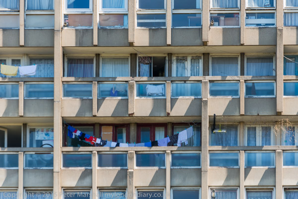
Most of the flats in the East block were then still occupied. They are large and desirable properties, but often have been used to house difficult residents.

During the New Labour government the listing advisory committee of English Heritage wanted to list it, but were overruled by the politicians, with then Minister of Culture Andy Burnham issuing a certificate of immunity in 2009 and allowing the local Labour Tower Hamlets council to proceed with plans for demolition and redevelopment of the area. But for the moment it was saved by the financial difficulties.

A tall concrete wall protected the flats from the traffic on Cotton St

The immunity expired in 2014 and a further attempt, backed by almost every well-known British architect, was then made to get it listed, but was rejected by Historic England, the body that now control listings.

Parking areas on the outside of each of the two blocks

An open letter signed by Richard Rogers and others stated:

"The buildings, which offer generously sized flats that could be refurbished, are of outstanding architectural quality and significant historic interest, and public appreciation and understanding of the value of Modernist architecture has grown over the past five years, making the case for listing stronger than ever."

Historic England went along with the local council’s views and judged that it “fails as a place for human beings to live“. This wasn’t the impression I got from talking to residents on my visits.

The top street on the east block the curve is from my fisheye lens

The defects of this and other soundly built modern estates that have been demolished – such as the Heygate at Elephant & Castle in Southwark can generally be easily and relatively cheaply overcome by refurbishment – improved door security, lift maintenance, window replacement, non-combustible cladding etc. The true reasons for demolition are financial, driven by the profits of the developers and also the financial problems of local authorities.

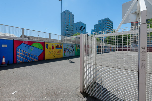
A large enclosed playground at the south end of the site

Demolition of sound buildings like this with the expectation of many years of useful service should be criminal. It represents a huge wastage of resources and an incredible carbon footprint both in the actual demolition and also for the rebuilding. The west block was demolished in 2017-8. The east block took around nine months to demolish and this was only completed in March 2025.

More at Robin Hood Gardens.


FlickrFacebookMy London DiaryHull PhotosLea ValleyParis
London’s Industrial HeritageLondon Photos

All photographs on this page are copyright © Peter Marshall.
Contact me to buy prints or licence to reproduce.


1995 Colour – Poplar, Bow, Leyton, North Woolwich & Silvertown

Poplar, Bow, Leyton, North Woolwich & Silvertown: These pictures come from a number of visits to areas of London working on several different projects and are my final selection of colour panoramas made in 1995. There are a few more colour images, including some panoramas I made in 1995 in the images in the Flickr album as well as many I have not digitised; some very similar to those online, others that I now find of less interest. Some of these were taken as a part of my project on the Greenwich Meridian in London – you can see a set of 16 images from this on the urban landscape web site.

Bow Locks, River Lea, Bow Creek, Bow, Tower Hamlets, 1995, 95p4-752

Bow Locks separate the tidal River Lea from the Lea Navigation and the Limehouse Cut which offers an alternative route to the Thames to avoid the winding and dangerous Bow Creek. First built in 1850 they were remodelled in 1930. At the highest Spring tides water from Bow Creek would overtop the locks and raise the level of the canals here – the locks were modified in 2000 to stop this and avoid the silting it caused.

London Galvanizers, Leven Rd, Poplar, Tower Hamlets, 5p4-743
London Galvanizers, Leven Rd, Poplar, Tower Hamlets, 95p4-743

The Poplar Gas Coompany built a local gas works here in the 1820s at the request of the Poplar Vestry after ratepayers lobbied them to provide gas street lighting. The site was cleared in 2011 and I was commissioned to photograph the removal of toxic earth from the site using barges on Bow Creek. Something around an eigth of the material was removed in this way, tides making the removal of more difficult. The original gasholders had to be built to special safety standards because of their proximity to the West India Dock wall. The last of the gasholders was removed in 2017.

London Galvanizers had modernised their galvanizing plant here in 1983-5 and were one of the most important jobbing galvanizers in London and the Home Counties.

Langthorne Rd, Leyton, Waltham Forest, 1995, 95p4-862

This street corner is close to the Meridian and I had stood here for some time outside the Chinese restaurant which was having some joinery work done. I liked the contrast between its orange paint and the blue on the opposite corner and the warm brown of the Birkbeck Tavern at right. I think I had made at least one exposure when a young girl in a red coat on roller skates came to see what I was doing – and I made this exposure as a red car come around, filling an otherwise rather empty grey space.

St Patrick's Catholic Cemetery, Langthorne Rd, Leyton, Waltham Forest, 1995, 95p4-841
St Patrick’s Catholic Cemetery, Langthorne Rd, Leyton, Waltham Forest, 1995, 95p4-841

The Meridian also passes through this cemetery and I chose a viewpoint which included the cemetery chapel with a fine group of monuments in the foreground, I think all for people of Italian origin.

Stratford Station, Great Eastern Rd, Stratford, 1995, 95p4-963
Stratford Station, Great Eastern Rd, Stratford, Newham,1995, 95p4-963

I’m unsure what this railway building to the east of the station was, perhaps a 1930s signal box. Parts of this area have now been redeveloped, and this has been behind fences for more than ten years and could stil be there, as least in part.

King George V Dock, Woolwich Manor Way, North Woolwich, Newham, 1995, 95p9-171

Finally four pictures from a walk along Woolwich Manor Way, this taken looking westwards along the south side of the King George V Dock. You can see the bridge over the dock entrance at right and the City Airport terminal and Canary Wharf at the end of the dock.

Royal Albert Dock Basin, Woolwich Manor Way, North Woolwich, Newham, 1995, 95p9-161

At left is the old swing bridge that took the road over the dock entrance from the basin. To its right is the elevated DLR and the pumping station at the centre of the Gallions roundabout. Further on only two buildings were standing along the side of the Basin, the Gallions Hotel and the Royal Docks Pumping Station.

Containers, Woolwich Manor Way, North Woolwich, Newham, 1995, 95p9-162

Land to the south of the Royal Albert Dock Basin just east of Woolwich Manor Way.

King George V Lock, Woolwich Manor Way, North Woolwich, Newham, 1995, 95p9-153

This swing bridge across the dock entrance is still there.

Royal Victoria Dock, Silvertown, Newham, 1995, 95p11-262

This was taken from Silvertown Way, looking across the Royal Victoria Dock. There are still cranes along the dockside here but the foreground now has flats. The Millenium Mills are still there, but there is nothing in the picture where the Excel Centre now stands and none of the other new developments on the north side of the dock. The council flats at the right have been demolished.

You can see these and some other colour pictures I took in 1995 at 1995 London Colour.


FlickrFacebookMy London DiaryHull PhotosLea ValleyParis
London’s Industrial HeritageLondon Photos

All photographs on this page are copyright © Peter Marshall.
Contact me to buy prints or licence to reproduce.


Limehouse Cut – 1990

The final post on walk in Limehouse on Sunday 6th January 1990 continued. The previous post from this walk is West India Dock Road & Limehouse Cut – 1990. As usual you can click on the images here to view larger versions on my Flickr pages.

Limehouse Cut, Railway viaduct, Limehouse, Tower Hamlets, 1990, 90-1c-12

Looking south towards the blockage across the canal through the bridge which carries the DLR over Limehouse Cut. At the right are the temporary buildings for the construction work on the Limehouse Link tunnel. The Limehouse Cut turns around to the right past the blockage to join Limehouse Dock and I think the industrial buildings you can see are in Brightlingsea Street.

Flood Barrier, Limehouse Cut, Limehouse, Tower Hamlets, 1990, 90-1c-15

I walked along the towpath to Commercial Road carried over the canal by Britannia Bridge, named for the Britannia Tavern which stood here until 1911, when it was probably removed to allow the bridge to be widened for traffic and also to allow for a towpath under the bridge.

At spring tides when the water rose to its highest it would overtop the old Bow Locks, with water flowing into both the Cut and the lower stretch of the Lea Navigation. This created a problem, particularly when the Cut was connected to the Limehouse Dock. In this picture you see the vertical guillotine gate which was fitted here after the Cut was taken over by British Waterways in 1948 enabling the canal to be isolated from the dock. It was removed soon after I made this picture.

You can also see the 1923 Empire Memorial Sailors’ Hostel on the corner of Commercial Road and Salmon Lane, built as a memorial to all the seamen who had lost their lives in the First World War. Later used as a hostel for the homeless and to house immigrants it had by 1990 been converted into luxury flats.

H W Bush, Mill Place, Limehouse, Tower Hamlets, 1990, 90-1c-16
Island Row, Mill Place, Limehouse, Tower Hamlets, 1990, 90-1f-66
Limehouse Basin, Northey St, Narrow St, Limehouse, Tower Hamlets, 1990, 90-1f-65

Taken from near to the end of Island Row. But my walk was coming to an end. I made only one more black and white picture, not yet digitised, of the Regents Canal Lock from Commercial Road on my way to Limehouse station.

But I had also carried a second camera body loaded with colour negative film and I made the occasional colour picture during the walk. Here are four of them:

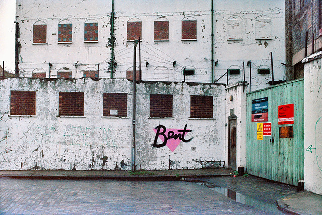
Stepney Transforming Station, Brightlingsea Place, Limehouse, Tower Hamlets, 1990, 90c01-01-73
Poplar Fish Bar, Poplar, Tower Hamlets, 1990, 90c01-01-62
Everite Autos, Poplar, Tower Hamlets, 1990, 90c01-01-64
Everite Autos Mill Place, Limehouse, Tower Hamlets, 1990, 90c01-01-64
Café, Poplar, Tower Hamlets, 1990, 90c01-01-52

FlickrFacebookMy London DiaryHull PhotosLea ValleyParis
London’s Industrial HeritageLondon Photos

All photographs on this page are copyright © Peter Marshall.
Contact me to buy prints or licence to reproduce.


London Walking Weekend – 2009

London Walking Weekend: Most weekends since the 1980s I’ve spent at least one day walking around London, often on my own but more recently mainly with others carrying banners and placards. But Saturday 6th June 2009 was a little different as it was designated as the Walking Weekend of the Story of London Festival, and I went to a couple of free events put on by the Heritage of London Trust and Pevsner Architectural Guides in east London, as well as doing a little on my own.

London Walking Weekend - 2009
London 2012 site

On Saturday morning I took a guided tour of St Mary Magdalene’s Church in East Ham led by Tara Draper-Stumm for the Heritage of London Trust, a charity which does a great deal of work in restoring buildings and sites in danger across the capital.

London Walking Weekend - 2009

It was a great guided tour of one of London’s most interesting churches, Grade 1 listed and “claimed to be the oldest parish church still in weekly use in Greater London“, large parts dating from the first half of the 12th century but of course greatly added to, altered and restored over the centuries, most recently in 1965-6.

London Walking Weekend - 2009

But I didn’t take any pictures, so nothing to post here from this tour. Back in the 1990s when I was a regular contributor to our National Building Record I often found myself waiting in the library there for my appointment and would pull a box file for an area of London from their shelves – to find it almost entirely full of photographs of old churches, many taken by their vicars back in the day when many were gentlemen of leisure with the money to take up photography. It rather put me off photographing them and on this morning I decided to simply experience the event, listen and look. But there is a fine illustrated tour of the church online.

London Walking Weekend - 2009
London 2012 site

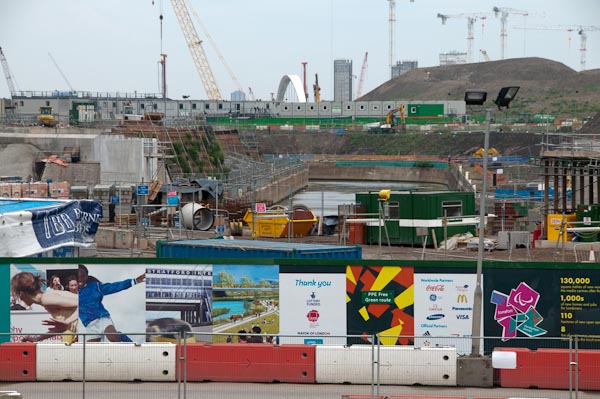
From there I had some time to spare before the afternoon walk and went to visit the huge building site on Stratford Marsh for the London Olympics, by then sealed off by miles of blue fence. It was something of a rush to take pictures to later make into panoramas as well as some other pictures before getting back on the DLR from Pudding Mill Station to Poplar.

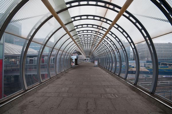
Footbridge at Poplar Station – a similar panoramic image I took on this footbridge a years earlier was used wrapped around two sides of a 12 inch record, ‘Limehouse Link’ and less impressively on the CD.

There I met someone whose name had been familiar for many years but I’d not met, Bridget Cherry, a leading architectural hisotrian whose name appears on the essential works for anyone with an interest in the subject, The Buildings of England, begun by Nikolaus Pevsner in 1951. She worked on many volumes, some with him, as well as becoming General Editor.

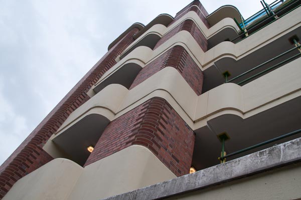
1930s streamlined moderne concrete at Constant House, refurbished and fitted with entrance doors

These books remain essential guides to anyone with an interest in architecture in England, and I walked most of the ‘perambulations’ in London from them, although my interests were rather wider than the buildings contained in them and my walks also took me to many other places. You can read more about this walk on My London Diary. Here I’ll include just a few of the pictures I took with captions and some brief comments.

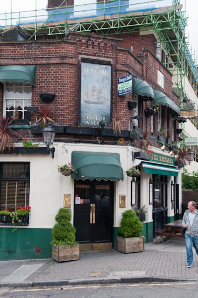
The 1930s pub ‘The Resolute’ , named for HMS Resolute, one of the ships sent in 1850 and 1852 to search for Sir John Franklin, lost in the N W Passage
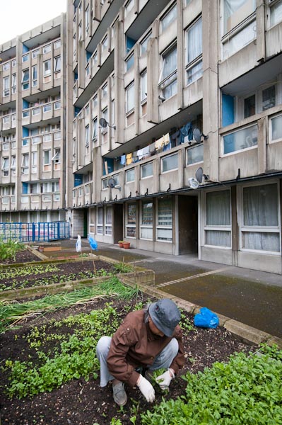
Robin Hood Gardens
Some gardening going on with residents growing salad crops

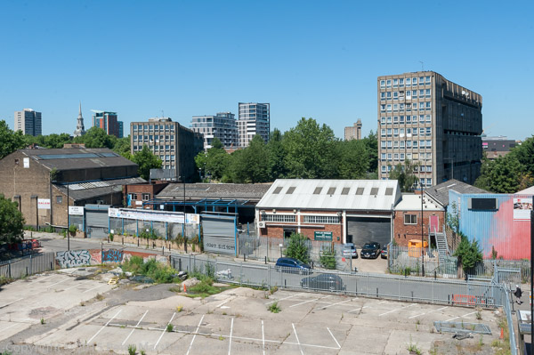
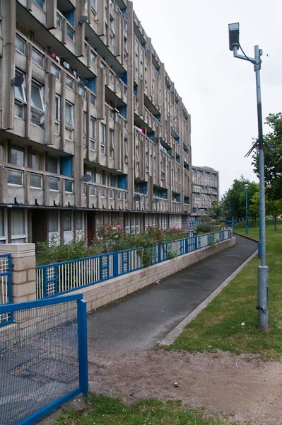
Robin Hood Gardens, designed in the late 1960s by Alison and Peter Smithson and completed in 1972, gained international recognition for its Brutalist architecture and was the highpoint of the walk. Its two long blocks enclosed a large garden area which was suprisingly quiet despite the site being alongside of one of London’s busiest roads. Neglected for years by Tower Hamlets council it was used to house many ‘problem’ tenants but by 2009 had largely recovered and become well regarded by those who lived there.

But the local authority had already decided to demolish it as a part of a ‘regeneration’ scheme. Attempts to list it scandalously failed – despite its international architectural significance – probably to protect the profits of the developers and demolition began in 2017 but was only finally completed in March 2015. Listing of large council estates became largely impossible under New Labour and expensive, highly profitable and environmentally disastrous schemes regeration schemes providing expensive but largely poorer quality buildings with little social housing have since obliterated estates – including some fine architecture – which could have been refurbished to modern standards at a fraction of the cost.

St Matthias Old Church built 1652-4 but exterior reworked in 19th centry and monument to Captain Samuel Jones

You can see many more of the buildings on the Poplar trail on My London Diary at Bridget Cherry – Poplar Trail.


FlickrFacebookMy London DiaryHull PhotosLea ValleyParis
London’s Industrial HeritageLondon Photos

All photographs on this page are copyright © Peter Marshall.
Contact me to buy prints or licence to reproduce.


West India Dock Road & Limehouse Cut – 1990

West India Dock Road & Limehouse Cut: My walk in Limehouse on Sunday 6th January 1990 continued. The previous post from this walk is Garford Street Limehouse – 1990. As usual you can click on the images here (except the panorama) to view larger versions on my Flickr pages.

Shops, West India Dock Road, Limehouse, Tower Hamlets, 1990, 90-1c-42

This area is close to the parish border of Limehouse and Poplar, but in popular imagination was certainly Limehouse, London’s first ‘Chinatown’. But by 1990 Chinatown had almost entirely moved to Soho, though a few elements remained, including the Peking Restaurant – though a few shops down the street is the Poplar Fish Bar.

Davey & Co, 88, West India Dock Road, Limehouse, Tower Hamlets, 1990, 90-1c-43

“In February 1885 Arthur Christopher Davey began a venture that throughout the 20th century evolved into a culture in the manufacture and supply of marine equipment. From humble beginnings in Leadenhall Street, the company soon moved to its famous address at 88, West India Dock Road, London E14, where it successfully traded for over 100 years.” The company is now based in Colchester.

Shops, West India Dock Road, Limehouse, Tower Hamlets, 1990, 90-1c-45

The Wah Ying Restaurant was another remanant of Chinatown – and you can see along the road the sign of the Peking Restaurant. In the distance are the warehouses of the West India Docks and beyond them the cranes building Cabot Square at Canary Wharf.

West India Dock Road was laid out at the same time as the West India Docks opened in 1802, a new road to give access to them, which was for many years a toll road. I think these buildings probably date from the 1870s or a little later after the tolls were removed.

The restaurant looks very much closed and the broken windows above suggest it was empty and derelict when I made this picture.

Blockage, Limehouse Cut, Limehouse, Tower Hamlets, 1990, 90-1c-46

The Limehouse Cut runs on a straight route through Poplar but curves around at its southern end. It was blocked here in 1990, possibly in connection with the building of the Limehouse Link tunnel between 1989 and 1993. But there was also work on the Cut around then, with the vertical guillotine gate on the north side of Britannia Bridge across the Commercial Road being removed.

Poplar Mods, graffiti, Railway Viaduct, St Anne's Church, Limehouse, Tower Hamlets, 1990, 90-1c-32
Poplar Mods, graffiti, Railway Viaduct, St Anne’s Church, Limehouse, Tower Hamlets, 1990, 90-1c-32

The tower of Hawksmoor’s St Annes Limeouse seen above the viaduct built for the London and Blackwall Railway and opened in July 1840, the second or third railway viaduct to be built in London, after the 1836 London to Greenwich viaduct and the the Hanwell viaduct, technically then outside London. The line went to Brunswick Wharf in Blackwall where passengers could board ferries and boats to other destinations down river or around the world.

I can tell you nothing more about Poplar Mods except that the graffiti tells us they are male “Hammers” fans. West Ham began life as a team for the workers of the last remaining shipbuilders in the area not far away on Bow Creek as the Thames Ironworks Football Club. From 1895 they played at Hermit Road in Canning Town, former home to Old Castle Swifts, Essex’s first professional team which had gone bankrupt, They became West Ham United in 1900 and moved to Plaistow, before in 2004 uniting with the Boleyn Castle football club and moving to their Upton Park ground where they stayed until 2016.

Limehouse Cut, Railway viaduct, Limehouse, Tower Hamlets, 1990, 90-1c-21

I think the next few pictures I made were taken from the block of flats immediately to the east of Limehouse Cut, Kiln Court, a medium rise block built as part of the Barley Mow Estate for the GLC in 1965-8. Back in 1990 many blocks still did not have security doors and it was possible to easily access shared areas.

Here you can see the Cut and the DLR viaduct across the north side of Limehouse Dock with its bridge and the Roman Catholic Church of Our Lady Immaculate & St Frederick on the corner of Island Row and Commercial Road.

I think the buildings on the far bank of Limehouse Cut were temporary offices and accommodation for the building of the Limehouse Link tunnel. The site is now occupied by housing at the end of Island Row.

Limehouse Cut, Limehouse Dock, Railway viaduct, Limehouse, Tower Hamlets, 1990, 90-1c-23

In this picture you can see across to Limehouse Dock with the Hydraulic Accumulator Tower next to the DLR viaduct at the right. At the left is the temporary blockage on the Limehouse Link.

Limehouse Cut, Limehouse Dock, Railway viaduct, Limehouse, Tower Hamlets, 1990, 90-1c-24

Sliding my shift lens to the left gave a view a little further towards the south and shows a little more of the Cut past the blockage and in the distance a small glimpse of the River Thames. This image was taken to create a panorama together with 90-1c-23:

Limehouse Cut, Limehouse Dock, Railway viaduct, Limehouse, Tower Hamlets, 1990, 90-1c-23-24

More from Limehouse Cut in the next post on this walk.


FlickrFacebookMy London DiaryHull PhotosLea ValleyParis
London’s Industrial HeritageLondon Photos

All photographs on this page are copyright © Peter Marshall.
Contact me to buy prints or licence to reproduce.


Garford Street Limehouse – 1990

Garford Street Limehouse: My walk in Limehouse on Sunday 6th January 1990 continued. The previous post from this walk is Around Emmett Street, Limehouse 1990. As usual you can click on the images here to view larger versions on my Flickr pages.

Garford St, Limehouse, Tower Hamlets, 1990, 90-1c-65

Garford Street is variously described as in Limehouse, Westferry and Poplar, although estate agents seem to prefer Canary Wharf, which is certainly isn’t, though fairly close by. Back in 1990 I think most of us thought it was Limehouse.

The 1994 LCC Survey of London deals with it in a chapter Limehouse Hole: The inland area. This tells us that a John Garford in the early 19th century had a wharf on the Thames at its western end on Emmett Street. Since the building of the Limehouse Link tunnel and the new route of Westferry Road for the Canary Wharf redevelopment it now starts around 200 yards to the east on Westferry Road. Its other end is still at the West India Dock Road.

I think the junction here is a part of the lost area on the north side of Garford Street. The chimney in the background is a remnant of the Lion Works, established here in “1896-7 by James Walker & Company, steam packing makers,” later Lion Packings Ltd who made “Patent metallic packing” here until around 1926. “The site was cleared for public housing in 1938–9” but as you can see the chimney survived until 1990.

Garford St, Limehouse, Tower Hamlets, 1990, 90-1c-51

Another view just a few yards from the previous image shows some large cable drums from AEI Gravesend. A notice tells those waiting for MOT tests at the Austin Rover garage where to queue.

Garford St, Limehouse, Tower Hamlets, 1990, 90-1c-53

This derelict warehouse building still has the remains of a hoist to the first floor entrance above its main door. There is now new housing on this site just to the west of the DLR railway bridge on the north side of the street.

Constables Cottages, Garford St, Limehouse, Tower Hamlets, 1990, 90-1c-54

These early 19th century houses on the south side of Garford St are Grade II listed.

Greig House, Garford St, Limehouse, Tower Hamlets, 1990, 90-1c-56

Greig House, Garford St, Limehouse, Tower Hamlets, 1990, 90-1c-56

Greig House, Garford St, Limehouse, Tower Hamlets, 1990,
Built 1902-3 as accommodation for officers from Scandinavian ships docked in London it was taken over in 1930 as a Salvation Army hostel, and later used to house male alcoholics and more recently as a residential detoxification centre for men and women with drug or alcohol problems. Grade II listed along with the cottages on Garford St.

Greig House, Garford St, Limehouse, Tower Hamlets, 1990, 90-1c-41

Greig House, Garford St, Limehouse, Tower Hamlets, 1990, 90-1c-41

A second view of Greig House which shows some of the buildings of the West India Dock on Hertsmere Road in the background as well as the cranes building parts of Canary Wharf around Cabot Square. You can read much more about this and the associated buildings on the Lost Hospitals of London site.

From here I walked across the West India Dock Road in Poplar where my next post on this walk will begin.


FlickrFacebookMy London DiaryHull PhotosLea ValleyParis
London’s Industrial HeritageLondon Photos

All photographs on this page are copyright © Peter Marshall.
Contact me to buy prints or licence to reproduce.


More Around the Meridian – 1995 Colour – Part 3

More around the Meridian – It’s seldom possible to actually walk for more than a few yards actually on the Greenwich Meridian in London and while planning my Meridian Walk I often wandered around considerably, having to make detours and also looking for the more interesting routes. So not all these images are exactly on the Meridian, but most were taken within a short distance from it.

Greenway, Abbey Lane, Abbey Rd, Stratford, Newham, 1995, 95p4-1151

When I began this project the Meridian was not marked on the Ordnance Survey or Street maps, and one of may first tasks was to get a ruler and pencil it on to them. In 1999 it was added to the OS maps of the area, but does not seem to be on the latest versions. In 1995 there were no smart phones with online maps and GPS which would have made things so much easier.

Greenway, Abbey Lane, Abbey Rd, Stratford, Newham, 1995, 95p4-1152

The Greenway was the recently rebranded path above the Northern Outfall Sewer which rans across East London from Hackney Wick to the sewage treatment plant at Beckton, going under the road here close the the bridge over Abbey Creek on the Channelsea River, where Abbey Lane becomes Abbey Road. You can see the bridge at the left of the picture.

Greenway, Channelsea River,  Stratford, Newham, 1995, 95p4-1153
Greenway, Channelsea River, Stratford, Newham, 1995, 95p4-1153

The Greenway is a great traffic-free cycle route for pedestrians and cyclists, running straight and level and this picture gives some evidence of that.

Channelsea River, Long Wall, Stratford, Newham, 1995, 95p4-1111

I’m not sure what this pipe was for, perhaps for taking gas across the river. Not far away on the other side of this tidal creek was one of the largest gas works in London – and you can still see its listed gasholders, though the view is likely to change soon with the site being redeveloped.

But behind me when I made this picture was the Abbey Mills sewage pumping station and on the edge of the creek below were the storm outfalls where sewage would be released after heavy rains. With the changing tides it would flow downstream a little and then could be taken miles upriver along the Prescott channel and the River Lea.

Gasholders, Leven Rd, Poplar, Tower Hamlets, 1995, 95p4-1332
Flats, East India Dock Rd, South Bromley, Tower Hamlets, 1995, 95p4-1321

I think the Meridian went through the centre of the taller gas holder at Poplar Gas works.

Flats, East India Dock Rd, South Bromley, Tower Hamlets, 1995, 95p4-1321

Another view with the gasholders in the background.

Clove Crescent, East India, DLR, South Bromley, Tower Hamlets, 1995, 95p4-1273

My pencilled line for the Meridian shows it going through both the water in the dock and the brick building at left which was the former Blackwall Power Station in both of these pictures.

Clove Crescent, East India DLR, South Bromley, Tower Hamlets, 1995, 95p4-1263

South of the East India Docks the line crosses the River Thames above and between the two bores of the Blackwall Tunnel, closer to the original western tunnel now used by northbound traffic. I couldn’t take photographs in the tunnel – though it was possible for those on foot to take a bus across, but these would have been rather boring in any case.

Blackwall Tunnel Entrance, Greenwich, 1995, 95p4-1672

This picture shows the southern entrance to the tunnel with its 1897 Grade II listed gatehouse by the London County Council’s Superintending Architect Thomas Blashill. In front of it a less ornate red and white striped arch with heigh and weight restriction signs and hangers to hit any overtall vehicles and hopefully prevent damage to the gatehouse.

Dorringtons, Blackwall Tunnel Southern Approach, Greenwich, 1995, 95p4-1551

One picture not I think actually on the Meridian but not far from it, taken from the long footbridge over the Blackwall Tunnel Southern Approach.

Riverside Path, Greenwich, 1995, 95p4-1762

My path continued south along the riverside path, with the Meridian going into the River Thames on the extreme left of this picture.

Riverside Path, Greenwich, 1995, 95p4-1742

I kept to the land continuing along a path I’ve walked many times and making a few more pictures.

Riverside Path, Greenwich, 1995, 95p4-1743

Like much of London’s riverside almost all of the industry has now gone, but some relics remain, though most of this part of my route is now lined by rather boring flats.

I rejoined the Meridian where it made landfall in Greenwich – where I made some of the pictures at the end of my earlier post.

More colour work from 1995 including some more panoramas in a later post.


FlickrFacebookMy London DiaryHull PhotosLea ValleyParis
London’s Industrial HeritageLondon Photos

All photographs on this page are copyright © Peter Marshall.
Contact me to buy prints or licence to reproduce.


Fathers, Turkey, Routemasters, a Christmas Market and Ethiopia – 2005

Fathers, Turkey, Routemasters, a Christmas Market and Ethiopia: Text and pictures from a busy day in London on Friday 9th December 2005, exhumed, corrected and slightly polished from the depths of ‘My London Diary‘ with links to the many more pictures of each event there.


Fathers4Justice: 24 Days of Christmas Chaos – Westminster

Fathers, Turkey, Routemasters, a Christmas Market and Ethiopia - 2005
Santas and Mama Santas protest at Church of England and Dept of Education & Skills, Westminster

I’ve photographed Fathers4Justice on several previous occasions. Today they were taking advantage of Christmas and the Father Christmas idea to protest against the Church of England. Being on a Friday, there were rather fewer father and mother Christmases (and Santa’s little helpers were mainly at school, though some of their dads behind the whiskers were pulling a sickie.) It was still an arresting sight to see so many figures dressed in red on the street, including some rather inflated figures in inflatable suits.

After rather a slow start events warmed up a bit outside the offices of the Church of England, and, a few yards down the road, the Department for Education and Skills. Of course our ‘serious crimes’ law now forbids the use of amplified sound in demonstrations, so the Fathers simply had to shout rather loud. The next place for a stop was of course opposite Downing Street, where there were more shouted comments. I left the march as it turned down Whitehall Place on its way to the Law Courts on Strand.
more pictures


Free Mehmet Tarhan – Turkish Airlines, Pall Mall

Fathers, Turkey, Routemasters, a Christmas Market and Ethiopia - 2005
Tahan is a gay conscientious objector held and tortured in aTurkish jail

Outside Turkish Airlines at the bottom of Haymarket there was a picket protesting against Turkish imprisonment of protestors, in particular Mehmet Tarhan, a gay conscientious objector. Recently, his 4-year sentence for refusing military service was overruled on procedural grounds, and he is to be retried for ‘insistent insubordination with the intent of evading military service.’

Fathers, Turkey, Routemasters, a Christmas Market and Ethiopia - 2005

London Transport – Last day for the Routemaster

Fathers, Turkey, Routemasters ,a Christmas Market and Ethiopia - 2005

The last proper bus service to use London’s signature Routemaster double-decker buses, route 159, ceased today, with its buses being replaced by more modern designs. I caught one of the last to run to take me down to Westminster, then photographed it. Although the official ‘last bus’ had already run, there were several others following on, with the final pair passing Big Ben 28 minutes after I made my picture.

Transport for London continued to use a few Routemasters running in London on two special short ‘heritage routes’ both running past Trafalgar Square, thus retaining one of our tourist attractions.

[Routemasters were first introduced in 1956 and the two ‘TfL heritage routes’ were ended in 2019 though you still see them operated by private companies in a variety of guises. Routemasters jolt, rattle and jerk on London’s streets but I do very much miss the ability to jump off and board them at the many halts and delays in the increasingly congested streets.]
more pictures


Victorian Christmas Market – Chrisp St, Poplar

Hat Trick – Jim and Bev James Singing Chimney Sweeps

Chrisp Street Market was part of an early post-war public housing redevelopment, the Lansbury Estate, built for the 1951 Festival Of Britain in a Docklands area that had suffered considerable bomb damage. Fifty or so years later it was beginning to show its age and there has been some tidying up and its pedestrian precincts are now rather tidier than a few years ago.

The market is bustling with life, more so than usual when I visited, as there were two days of a special Victorian Christmas event. There were various special stalls in the market, and also entertainers wandering around and performing on a small stage. Kids from two local schools had also come to perform but unfortunately I had to leave before they had really started.

I’d hoped to return on the following day, Saturday, when things would have been livelier, but in the end i just couldn’t make it.
more pictures


The Ethiopian Tragedy – Stop UK Support – Marble Arch

At Marble Arch there was a crowd gathering of Ethiopians from across Europe, come to protest at the British government’s support of an oppressive communist regime in their country. [Others describe Ethiopia as an authoritarian regime with poor civil and human rights.]

More than 70,000 people are detained by the regime, being tortured and dying in concentration camps. Britain is spending £30 million of our money to support the regime that is violating human rights there. The protestors want the British public to urge their MPs to support motions on the situation in Ethiopia and demand an end to these crimes.
more pictures


FlickrFacebookMy London DiaryHull PhotosLea ValleyParis
London’s Industrial HeritageLondon Photos

All photographs on this page are copyright © Peter Marshall.
Contact me to buy prints or licence to reproduce.


Reparations, North Woolwich & LouLou’s

Reparations, North Woolwich & LouLou’s: Thursday 1st August 2019 was a long and busy day for me with an Afrikan Emancipation Day protest, finishing a walk in North Woolwich I’d begun six months earlier and photographing an evening protest outside the exclusive Mayfair club LouLou’s.


Afrikans demand reparations – Brixton, London.

Afrikans demand Reparations, North Woolwich & LouLou's

People of African origin met in Windrush Square in the morning to demand an end of the Maangamizi, the continuing genocide and ecocide of African peoples and Africa on Afrikan Emancipation Day.

Afrikans demand Reparations, North Woolwich & LouLou's

After speeches & libations they marched from Brixton to Westminster with a petition calling for an end to acts of violence by Britain, the misuse of taxes and the stolen legacy plundered from Afrika under the British Empire and European Imperialism and demanding reparations.

Afrikans demand Reparations, North Woolwich & LouLou's

The protest was supported by Extinction Rebellion XR Connecting Communities who marched in an Ubuntu Non-Afrikan Allies bloc.

Afrikans demand Reparations, North Woolwich & LouLou's

I left the march as it went past Brixton Police Station on its way to protest outside the Houses of Parliament so I could have some lunch before going to take pictures elsewhere.
Many more pictures on My London Diary at Afrikans demand reparations.

DLR – Bank to North Woolwich

DLR HQ at Poplar

I’d taken the tube back into central London to have a quick lunch before taking the DLR from Bank to London City to King George V Dock station for the final section of the walk I had begun in February but had run out of time to finish because I’d had to take a roundabout route to get there as the direct DLR services were suspended following an accident.

Bow Creek

This time the trains were running properly. They start from Bank and so come into the station empty and I was able to chose my seat and for once I found myself sitting next to a clean window on my way to North Woolwich and took a number of pictures.

Tate & Lyle

Later on my way back to Canary Wharf from King George V I was less lucky and the windows were rather grimy, but I still made a few images.

More at DLR – Bank to London City Airport.


North Woolwich, Royal Docks & the Thames

The footpath goes across these gates of the entrance lock to Albert Dock Basin

I took a few pictures as I walked from the elevated King George V station at North Woolwich to the King George V Dock entrance and joined the path by the river.

The lock here is huge, 243.8m long and 30.48m wide. I’d first photographed the area back in the 1980s as a part of a wider project on the Docklands following their closure, both in colour but mainly in black and white – in the album 1984 London Photographs. Although the docks themselves remain, much around them has changed, although there are still some derelict areas.

The riverside path here is part of the Capital Ring, and continues north and over lock at the Albert Dock entrance to the curiously desolate Armada Green Recreation Area.

Here the path ends, with beyond it the former site of the Beckton Gas Works, used as a location for at least 17 films and TV series since its closure, though best known as a stand-in for Vietnam in the 1987 Full Metal Jacket. Past that is the Beckton Sewage Treatment Works, set up in 1864 as part of Joseph Bazalgette’s scheme to treat London’s sewage and still receiving it from all of London north of the Thames.

I had to turn inland, through more recent development and the refurbished Gallions Hotel around Alber Dock Basin. I went briefly under the new bridge to see again the East London University student residences, then went back and across it, taking more pictures from the bridge and the road on my way back to King George V station.

Many more pictures at North Woolwich Royal Docks & Thames.


LouLou’s stop exploiting your workers – Mayfair

Finally I joined the IWGB Cleaners and Facilities Branch outside the exclusive Mayfair private club LouLou’s where they were picketing and protesting for kitchen porters to be paid a living wage, be treated with dignity, respect and given decent terms and conditions including proper sick pay, holidays and pension contributions. Recently outsourced to ACT, porters want to be returned to direct employment.

Among those supporting them were Class War, and in the picture above Ian Bone confronts a police office asking why they protect and support the rich. Needless to say the officer had no answer to the question. In general the protesters were reasonably behaved and acting within the law, but police and security hired by the club worked together to try and prevent their protest being effective.

There were angry scenes as staff escorted wealthy clients of the £1800 a year club past the picket, particularly when some roughly pushed the protesters. Police repeatedly warned the protesters but not the security men or customers who had assaulted them. The security also tried to prevent the picket from handing their flier to the customers.

As at previous protests outside of the club, none of the security staff were wearing the visible SIA door supervisor licences required under the Private Security Industry Act 2001, but the police refused to take any action over this.

More pictures at LouLou’s stop exploiting your workers.