The final post on walk in Limehouse on Sunday 6th January 1990 continued. The previous post from this walk is West India Dock Road & Limehouse Cut – 1990. As usual you can click on the images here to view larger versions on my Flickr pages.
Looking south towards the blockage across the canal through the bridge which carries the DLR over Limehouse Cut. At the right are the temporary buildings for the construction work on the Limehouse Link tunnel. The Limehouse Cut turns around to the right past the blockage to join Limehouse Dock and I think the industrial buildings you can see are in Brightlingsea Street.
I walked along the towpath to Commercial Road carried over the canal by Britannia Bridge, named for the Britannia Tavern which stood here until 1911, when it was probably removed to allow the bridge to be widened for traffic and also to allow for a towpath under the bridge.
At spring tides when the water rose to its highest it would overtop the old Bow Locks, with water flowing into both the Cut and the lower stretch of the Lea Navigation. This created a problem, particularly when the Cut was connected to the Limehouse Dock. In this picture you see the vertical guillotine gate which was fitted here after the Cut was taken over by British Waterways in 1948 enabling the canal to be isolated from the dock. It was removed soon after I made this picture.
You can also see the 1923 Empire Memorial Sailors’ Hostel on the corner of Commercial Road and Salmon Lane, built as a memorial to all the seamen who had lost their lives in the First World War. Later used as a hostel for the homeless and to house immigrants it had by 1990 been converted into luxury flats.
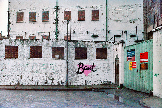
H W Bush, Mill Place, Limehouse, Tower Hamlets, 1990, 90-1c-16
Island Row, Mill Place, Limehouse, Tower Hamlets, 1990, 90-1f-66
Taken from near to the end of Island Row. But my walk was coming to an end. I made only one more black and white picture, not yet digitised, of the Regents Canal Lock from Commercial Road on my way to Limehouse station.
But I had also carried a second camera body loaded with colour negative film and I made the occasional colour picture during the walk. Here are four of them:
West India Dock Road & Limehouse Cut: My walk in Limehouse on Sunday 6th January 1990 continued. The previous post from this walk is Garford Street Limehouse – 1990. As usual you can click on the images here (except the panorama) to view larger versions on my Flickr pages.
Shops, West India Dock Road, Limehouse, Tower Hamlets, 1990, 90-1c-42
This area is close to the parish border of Limehouse and Poplar, but in popular imagination was certainly Limehouse, London’s first ‘Chinatown’. But by 1990 Chinatown had almost entirely moved to Soho, though a few elements remained, including the Peking Restaurant – though a few shops down the street is the Poplar Fish Bar.
Davey & Co, 88, West India Dock Road, Limehouse, Tower Hamlets, 1990, 90-1c-43
“In February 1885 Arthur Christopher Davey began a venture that throughout the 20th century evolved into a culture in the manufacture and supply of marine equipment. From humble beginnings in Leadenhall Street, the company soon moved to its famous address at 88, West India Dock Road, London E14, where it successfully traded for over 100 years.” The company is now based in Colchester.
Shops, West India Dock Road, Limehouse, Tower Hamlets, 1990, 90-1c-45
The Wah Ying Restaurant was another remanant of Chinatown – and you can see along the road the sign of the Peking Restaurant. In the distance are the warehouses of the West India Docks and beyond them the cranes building Cabot Square at Canary Wharf.
West India Dock Road was laid out at the same time as the West India Docks opened in 1802, a new road to give access to them, which was for many years a toll road. I think these buildings probably date from the 1870s or a little later after the tolls were removed.
The restaurant looks very much closed and the broken windows above suggest it was empty and derelict when I made this picture.
The Limehouse Cut runs on a straight route through Poplar but curves around at its southern end. It was blocked here in 1990, possibly in connection with the building of the Limehouse Link tunnel between 1989 and 1993. But there was also work on the Cut around then, with the vertical guillotine gate on the north side of Britannia Bridge across the Commercial Road being removed.
The tower of Hawksmoor’s St Annes Limeouse seen above the viaduct built for the London and Blackwall Railway and opened in July 1840, the second or third railway viaduct to be built in London, after the 1836 London to Greenwich viaduct and the the Hanwell viaduct, technically then outside London. The line went to Brunswick Wharf in Blackwall where passengers could board ferries and boats to other destinations down river or around the world.
I can tell you nothing more about Poplar Mods except that the graffiti tells us they are male “Hammers” fans. West Ham began life as a team for the workers of the last remaining shipbuilders in the area not far away on Bow Creek as the Thames Ironworks Football Club. From 1895 they played at Hermit Road in Canning Town, former home to Old Castle Swifts, Essex’s first professional team which had gone bankrupt, They became West Ham United in 1900 and moved to Plaistow, before in 2004 uniting with the Boleyn Castle football club and moving to their Upton Park ground where they stayed until 2016.
I think the next few pictures I made were taken from the block of flats immediately to the east of Limehouse Cut, Kiln Court, a medium rise block built as part of the Barley Mow Estate for the GLC in 1965-8. Back in 1990 many blocks still did not have security doors and it was possible to easily access shared areas.
Here you can see the Cut and the DLR viaduct across the north side of Limehouse Dock with its bridge and the Roman Catholic Church of Our Lady Immaculate & St Frederick on the corner of Island Row and Commercial Road.
I think the buildings on the far bank of Limehouse Cut were temporary offices and accommodation for the building of the Limehouse Link tunnel. The site is now occupied by housing at the end of Island Row.
In this picture you can see across to Limehouse Dock with the Hydraulic Accumulator Tower next to the DLR viaduct at the right. At the left is the temporary blockage on the Limehouse Link.
Sliding my shift lens to the left gave a view a little further towards the south and shows a little more of the Cut past the blockage and in the distance a small glimpse of the River Thames. This image was taken to create a panorama together with 90-1c-23: