Hull 2025 – An Evening Stroll: The second and final post of pictures I made on our first evening in Hull last week.
Part 1 of this post ended on Princes Dock Street. The pictures here are in the order I took them on Tuesday 12th August 2025 and the first image here was taken just a few yards further down the street.
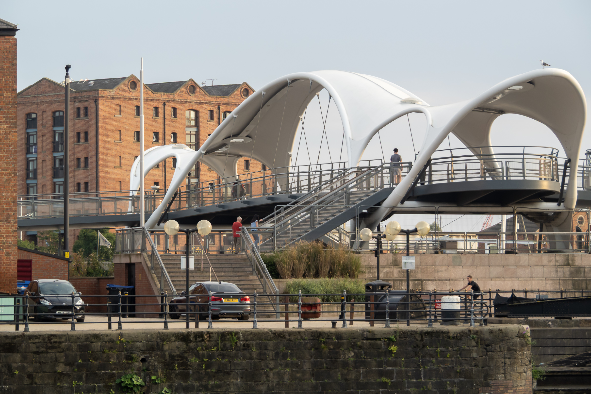
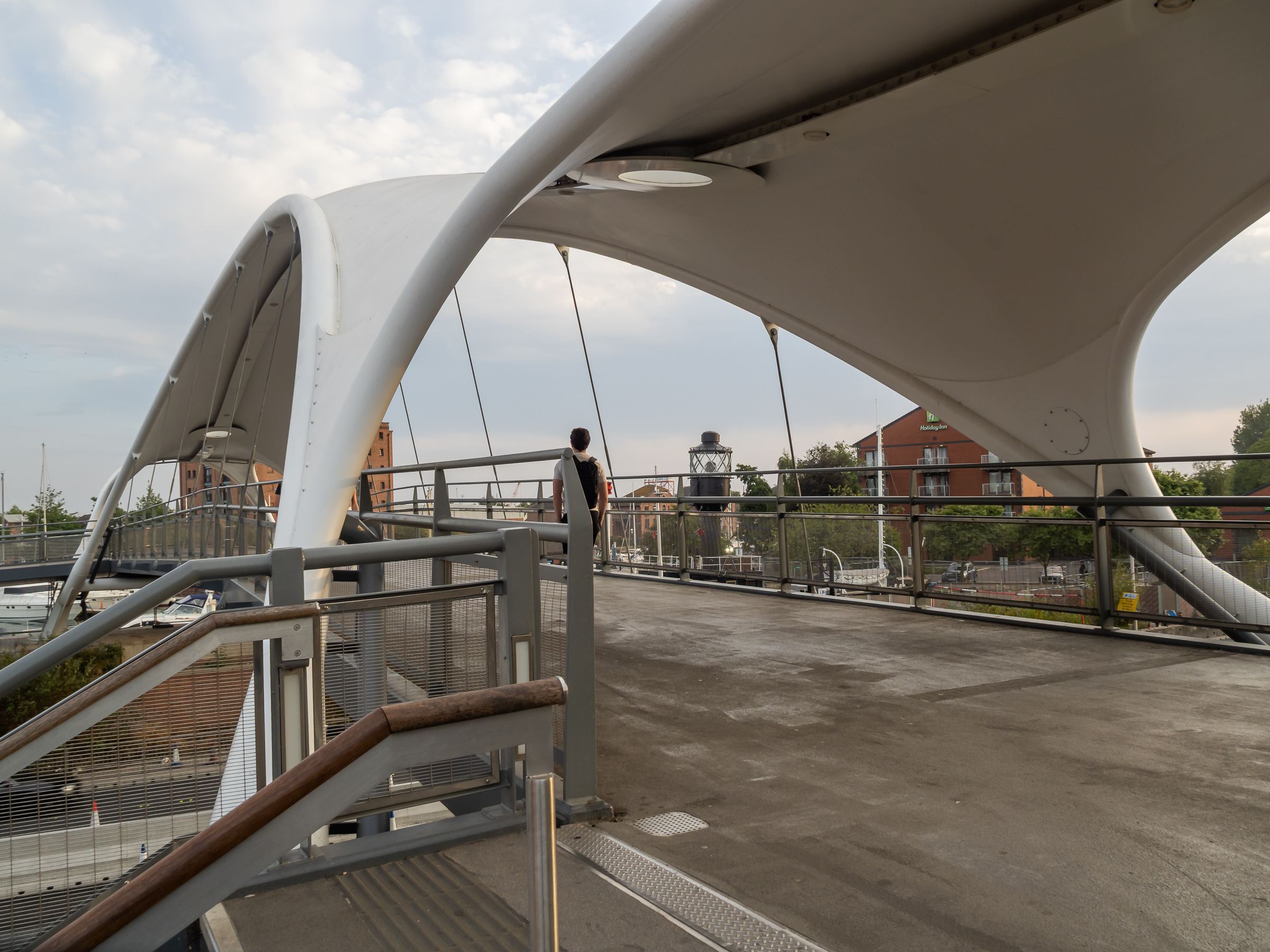
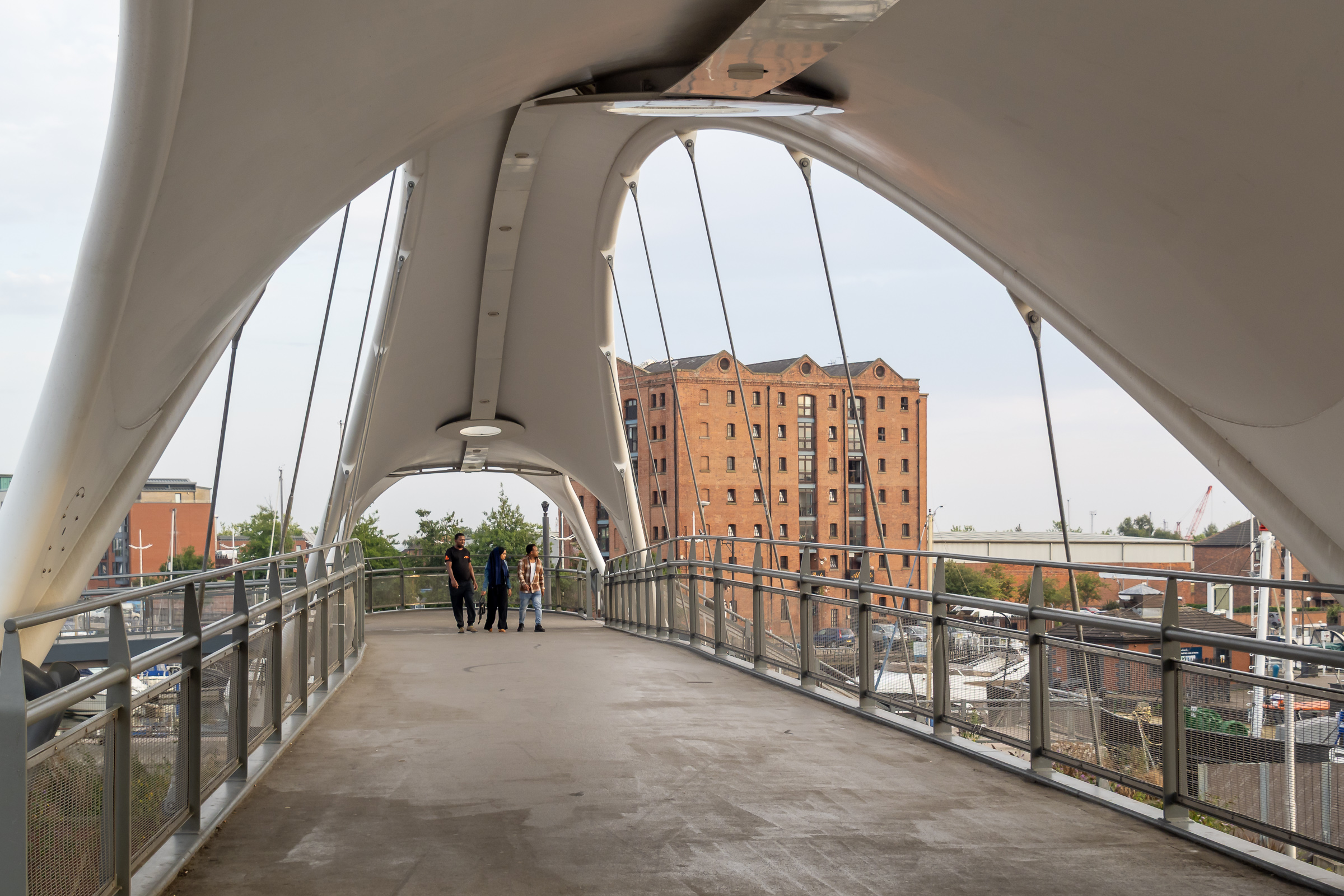
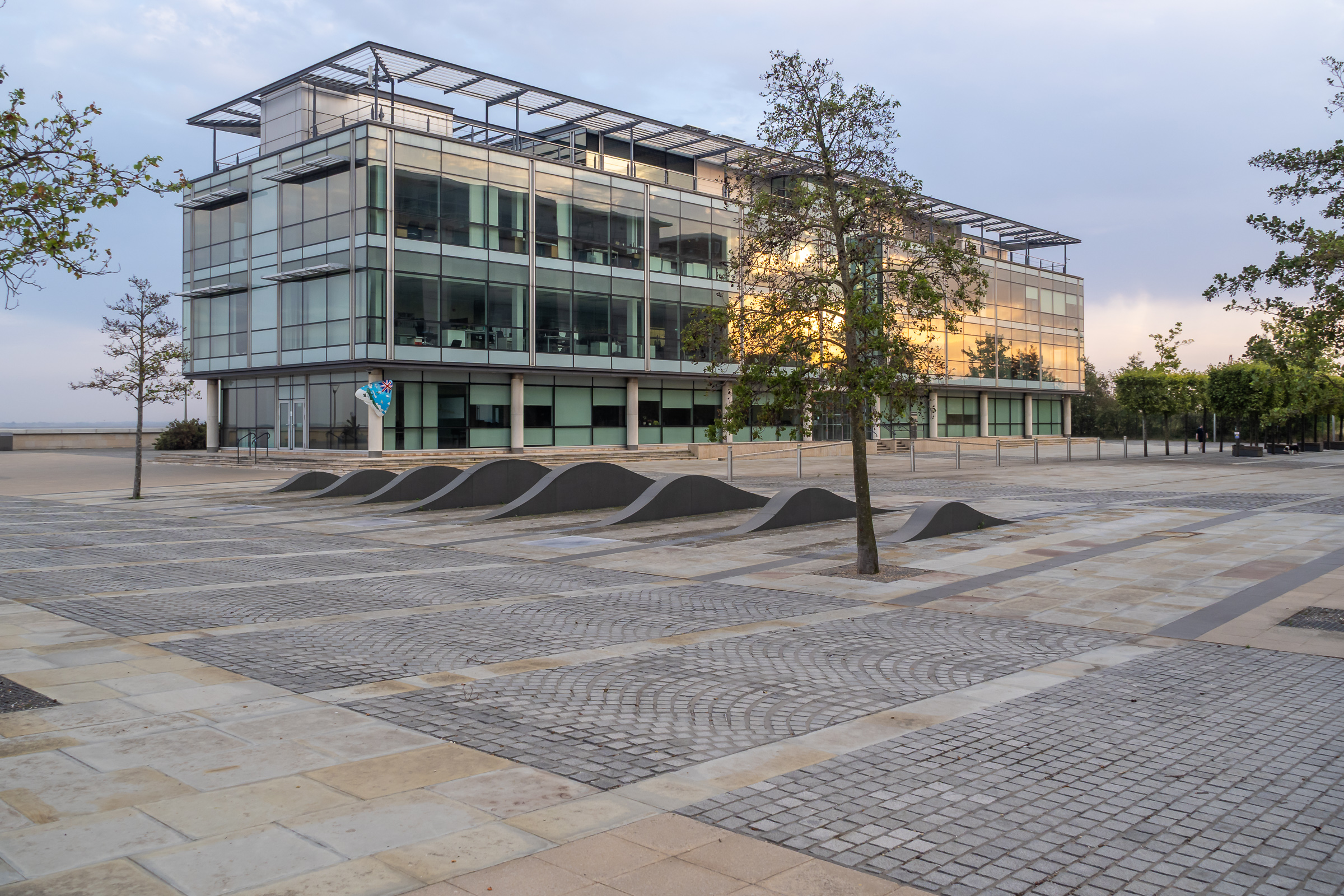
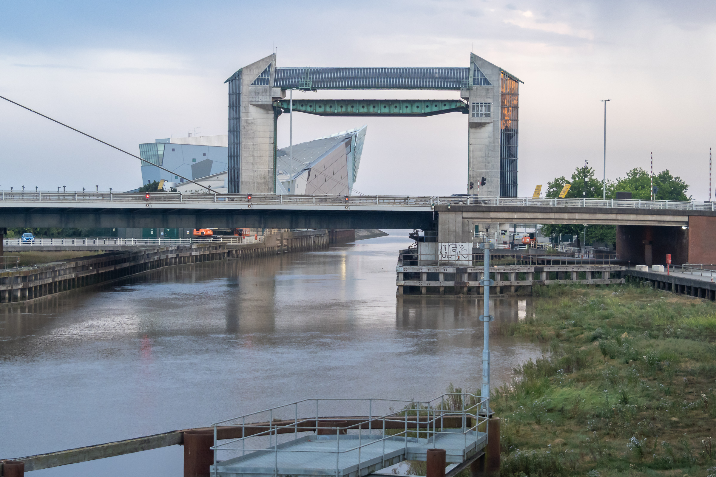
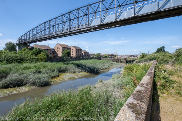
Humber Dock, now a marina, Railway Dock and the southern part of the Old Town have been brutally split from the rest of the city by the busy A63. Its hard to understand why the city council allowed this to happen with as it did, with so few places where this barrier can be crossed, and the provision of a rather odd footbridge, Murdoch’s Connection, is a rather unsatisfactory sop.
Fortunately we could manage the many steps up and down, otherwise we would have needed a fairly lengthy detour to where the road rises to cross the River Hull. This footbridge is perhaps more of a visitor attraction rather than a proper solution to access.
Murdoch’s Connection was named after Hull’s first female doctor, a house surgeon at the Victoria Hospital for Sick Children on Park Street and a suffragette, founding the Hull Women’s Suffrage Society in 1904.
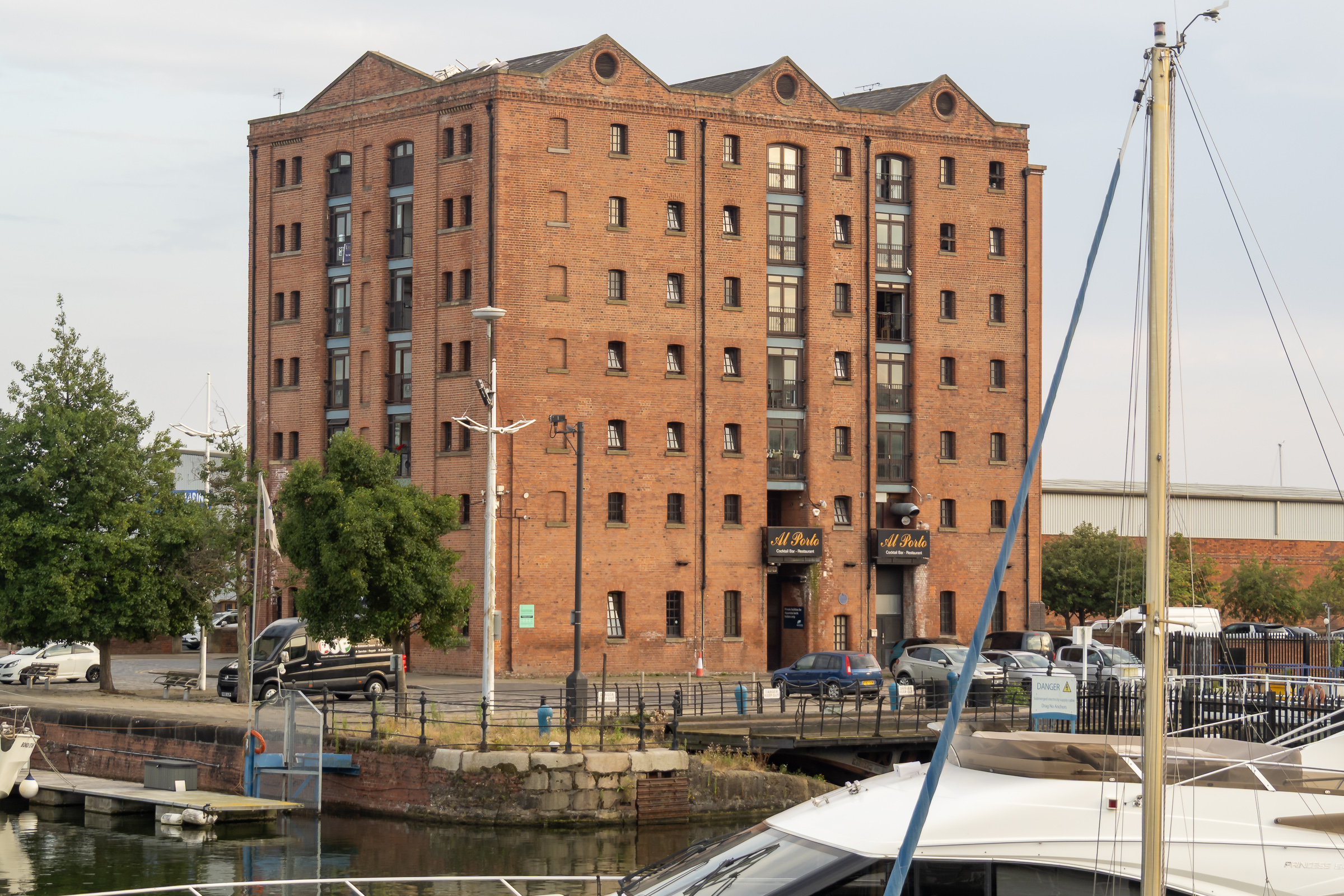
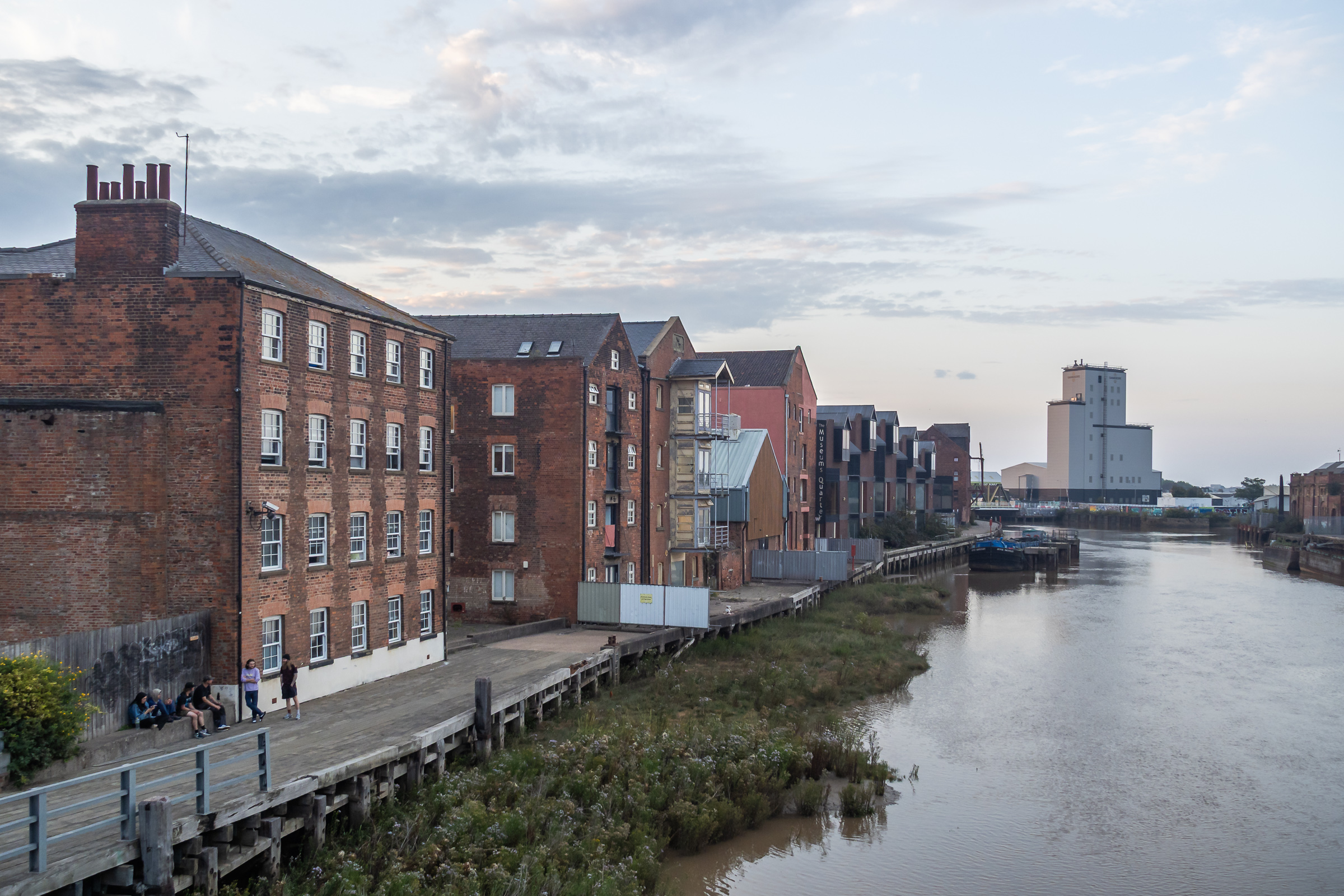
Too many of Hull’s dockside warehouses were demolished, but a few remain, including this fine block beside Railway Dock. I’d hoped to walk though Trinity Burial Ground, where I’d often sat in the past but that is now a building site.
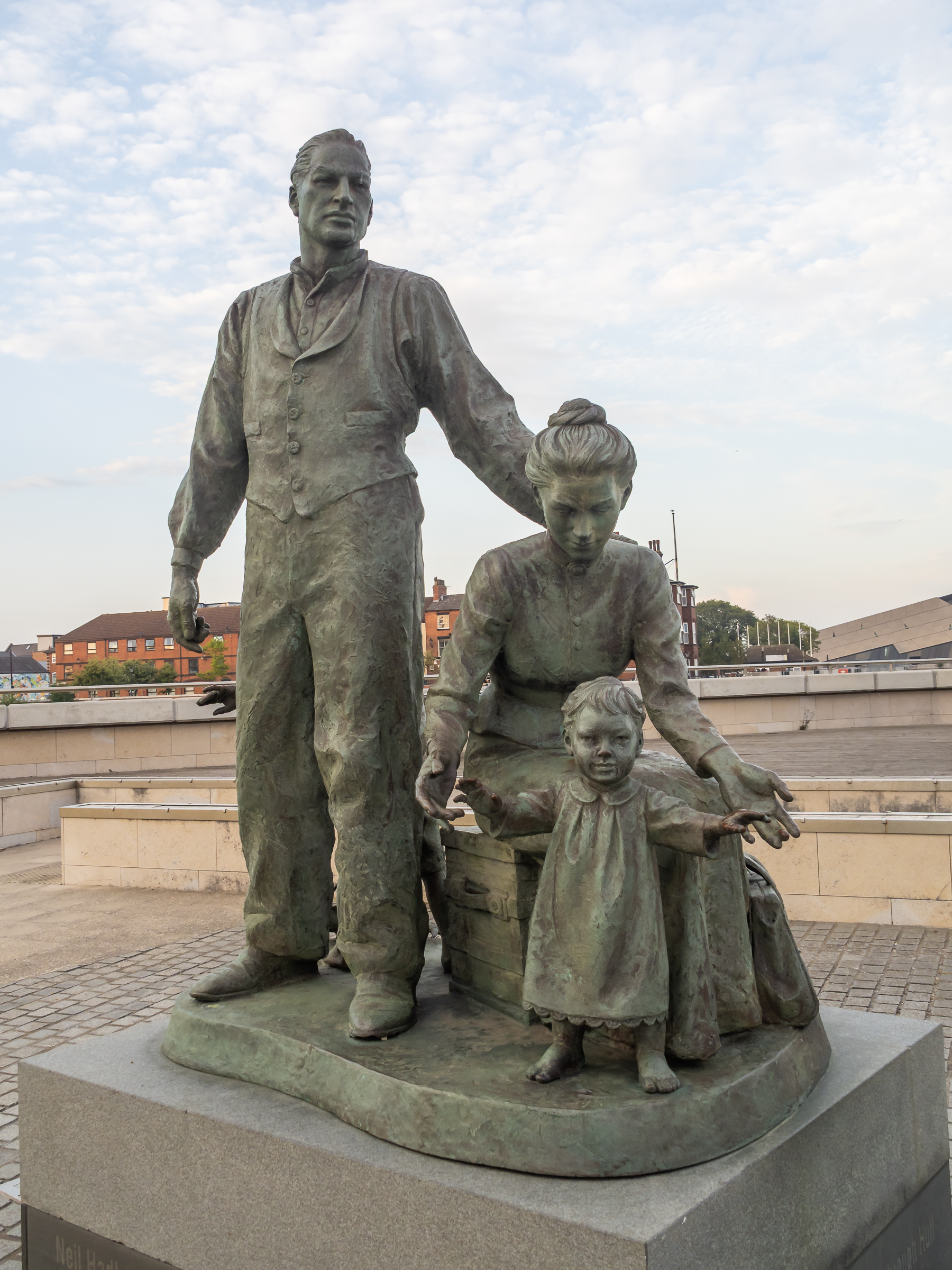
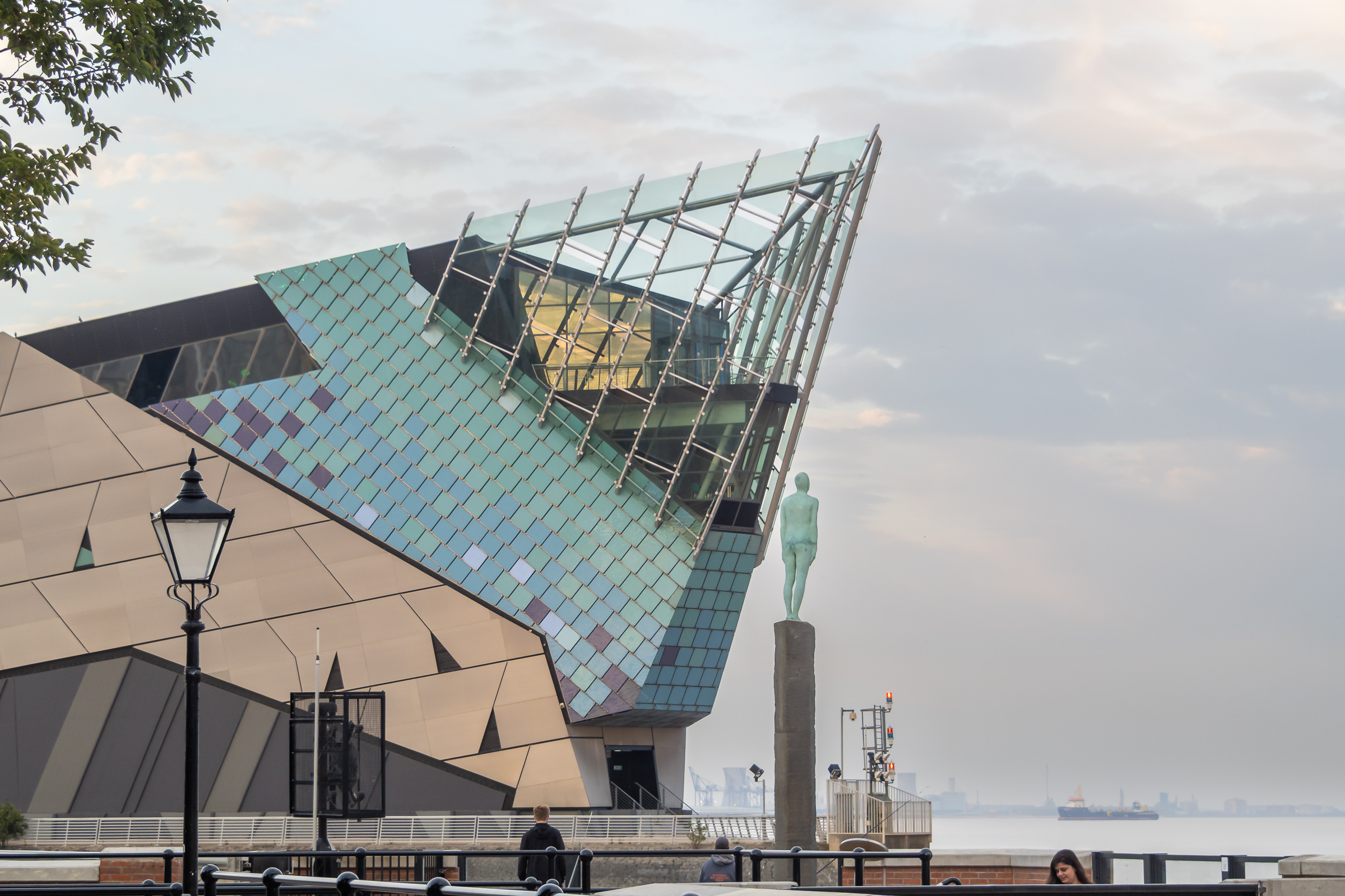
A statue by the Humber to the west of Humber Dock Basin, The Crossing, commissioned in 2001 commemorates the many migrants who came to Hull from Europe, mainly docking here to take the train to Liverpool on their way the the United States.
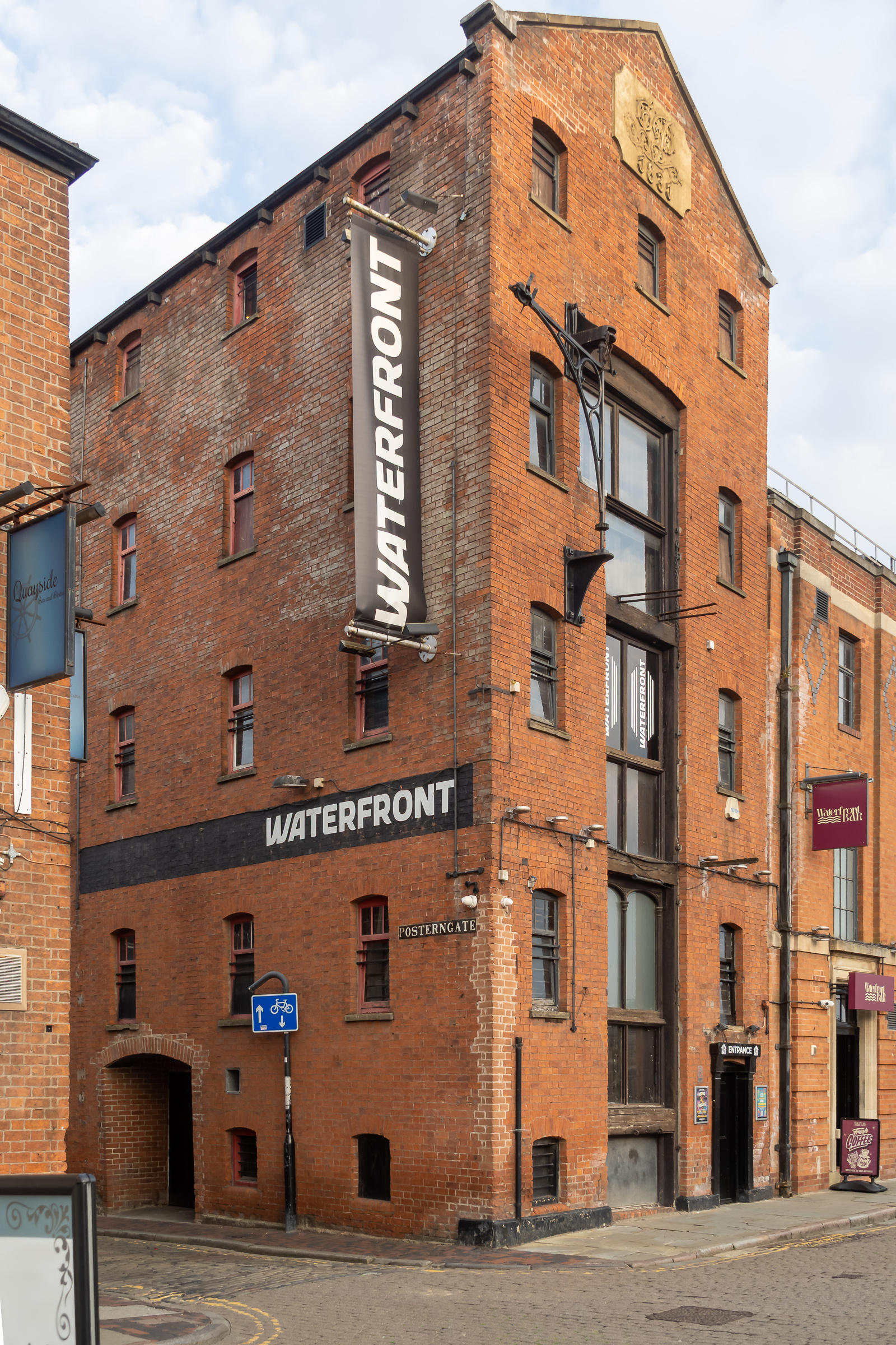
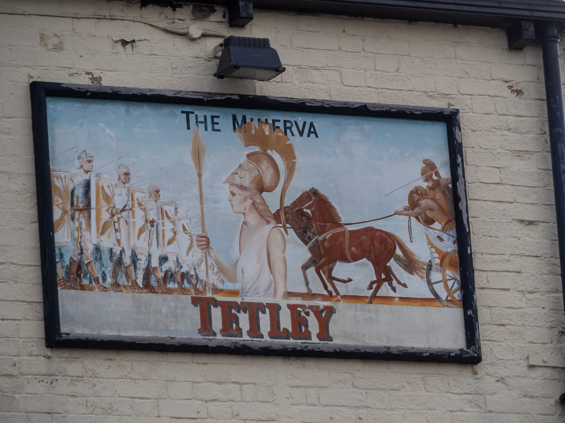
High on the wall of the Minerva pub is this sign, probably a little faded from when it was placed here. This time we didn’t go into the Minerva but continued our walk as the light was fading.
A path from Nelson Street leads along the side of the River Hull past the former Hull Central Dry Dock. In use until relatively recently this is now a performance area.
As you can see parts of the riverside walk in the ‘Old Harbour’ were closed and our plans to walk by the River Hull were cut a little short.
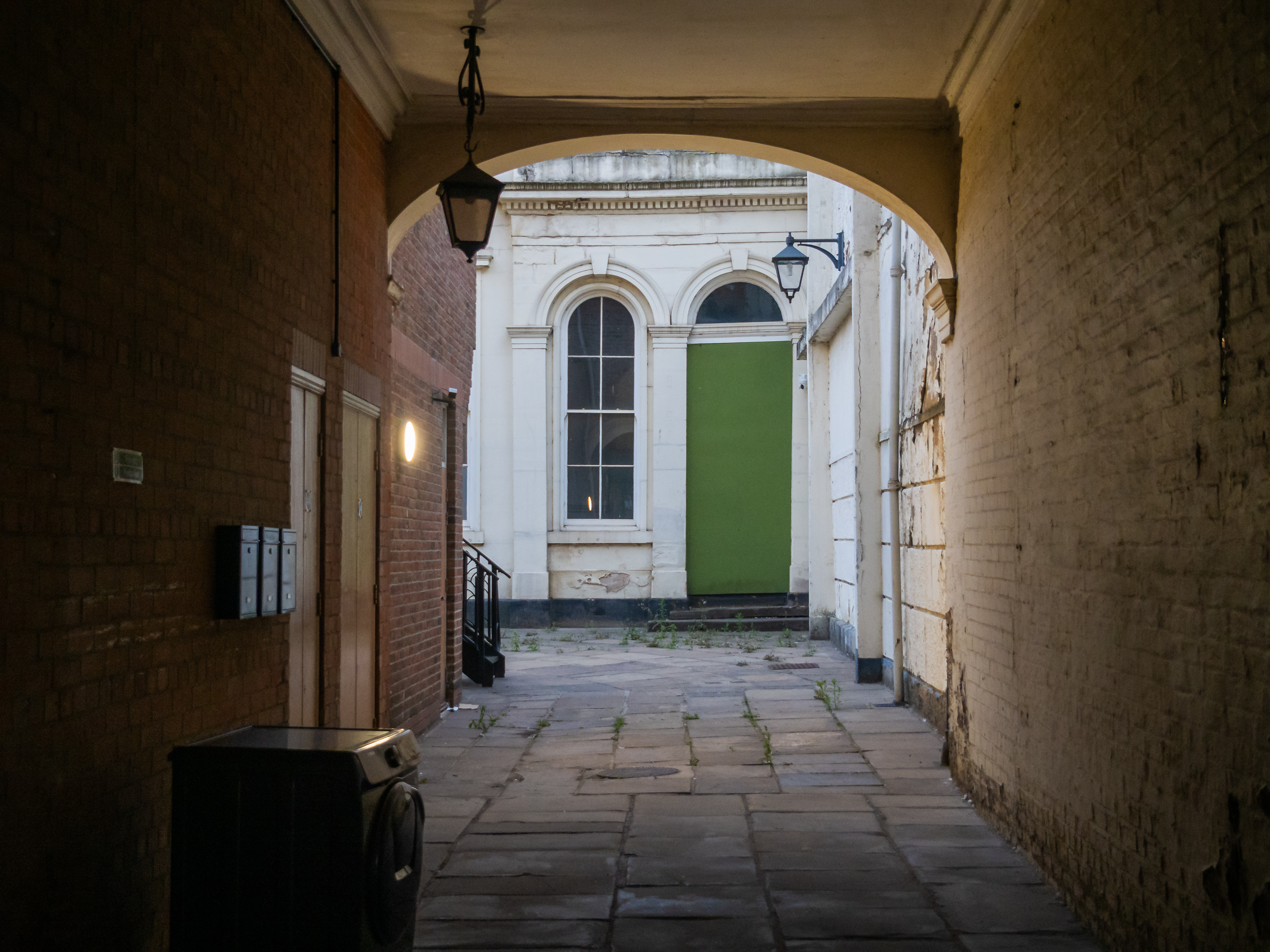
Instead we turned down Scale Lane and made our way back to the city centre along Silver Street and Whitefriargate.
More from our short stay in Hull later. You can see many more of my older pictures from Hull in albums on Flickr and on my Hull Photos web site – links below.
Darent Valley Path & Thames: The route we took on Saturday 4th July 2015 was new to my wife and son, but one I’d taken quite a few times before, both on foot and on my Brompton, but this time I left the bike behind and walked with them.
From Mill Pond Road, Dartford
Or rather more or less with them, as I often stopped or walked a few yards to one side or other to take pictures, and then had to scurry after them to catch up. Walking with a camera is very different from walking. My son does have a camera (one of the Fuji fixed lens X100 series) but takes far fewer pictures than me – and did much less running about.) But his captions are often rather more droll than mine, and seldom constrained by the 5W’s – Who What Where When Why.
Footbridge across the Darent
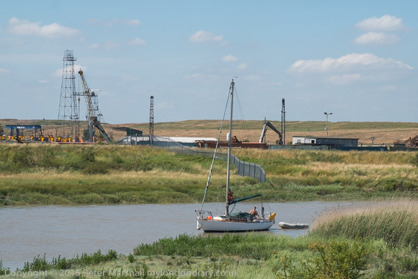
It was a bad day for this walk, hot and sunny with virtually no shelter between Dartford and Greenhithe along the banks of the Darent and Thames. But I’d heard that there would be a boat sailing up Dartford Creek, a rare occasion at the time and decided it would be good to photograph it.
This route is now one end of the Darent Valley Path, a 19 mile path which ends at Sevenoaks, most of which I’ve walked or cycled on other occasions, and the part beside the Thames is on the England Coast Path.
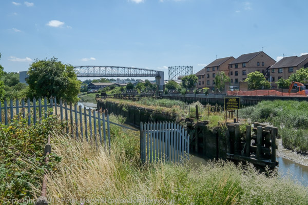
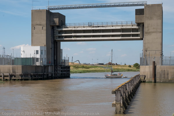
Dartford Half-Lock
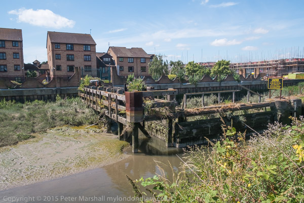
The Darent used to be navigable at least up as far as Dartford, where barges brought in and took out cargoes. Close to Dartford is a half-lock which holds back water above it when the tide goes out, long out of use but now slowly being restored to bring the waterway back into regular use.
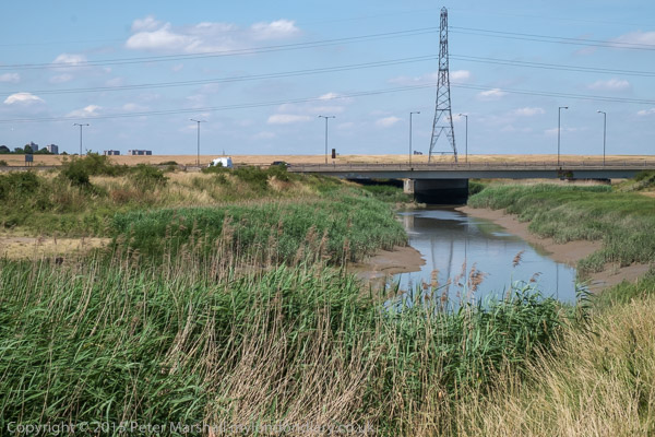
A fixed low bridge impedes navigation. This bypass was built as University Way, but the University never came so they renamed it Bob Dunn Way
There used to be a lock which craft could go through when then the tide was high enough downstream, but that was replaced by a fixed barrier. Boats can still go through in either direction close to high tide when their is enough water for them to clear the sill.
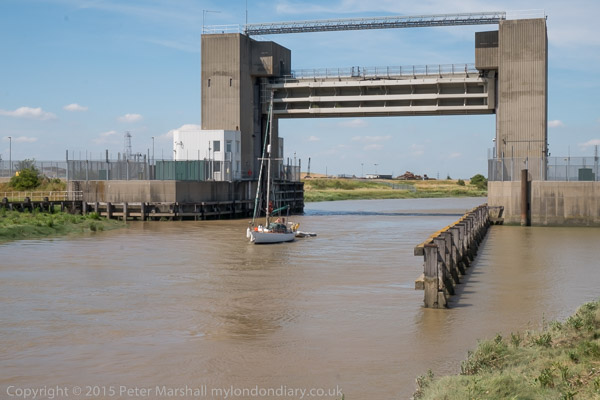
The yacht arrived later than expected and I had to run back to photograph it coming under the flood barrier. It was too late to get under the bridge on the same tide.
As well as the Darent, barges also went up the River Cray which joins the Darent downstream from the half-lock. This too is being brought back into leisure use.
Where the Darent meets the Thames
By the river in the centre of Dartford was the industrial estate dominated by the pharmaceutical manufacturing plant of Burroughs Wellcome who took over a former paper works here in 1889. In 1995 this became Glaxo Wellcome, the largest pharmaceutical company in the world. The works was wound down from 2008 by the then owners GlaxoSmithKline with manufacturing ending in 2013. Much of the site was empty by 2015 and now has large blocks of flats.
On the west side of Dartford Creek had been paper mills, but the last of these, owned by Wiggins Teape closed in 2009 and there was by 2015 housing on the site.
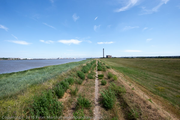
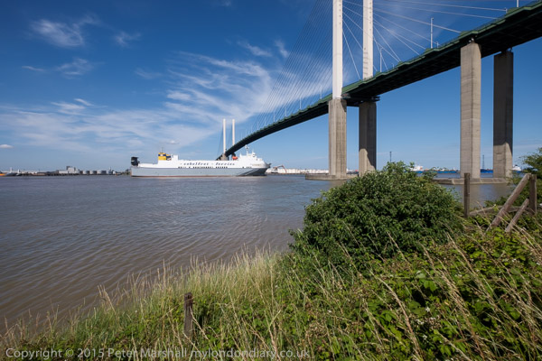
QEII bridge and Littlebrook Power station, River Thames, Dartford
When the third Dartford Bypass was built around 1988 barges were no longer bringing esparto grass and other raw materials for the paper works up the river and no thought was given to navigation. Boats that can lower masts or without them can creep under the road for a short time on a rising or falling tide when there is enough water to allow them to float but not high enough for the bridge to block their transit.
Riverside path at Littlebrook
Much of the land to the east of the creek was marshes, which made it a suitable location for the Wells fireworks factory, long closed. But I think it or an adjoining site was now in use for clay-pigeon shooting, and for much of this section of the walk we sounded under gunfire.
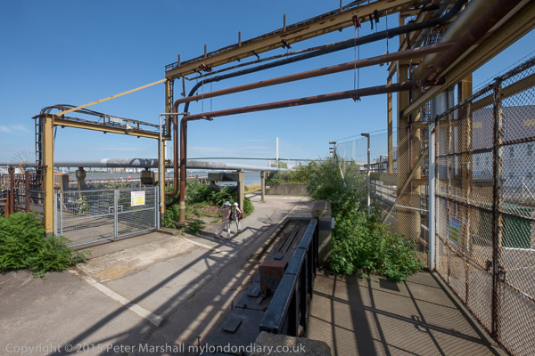
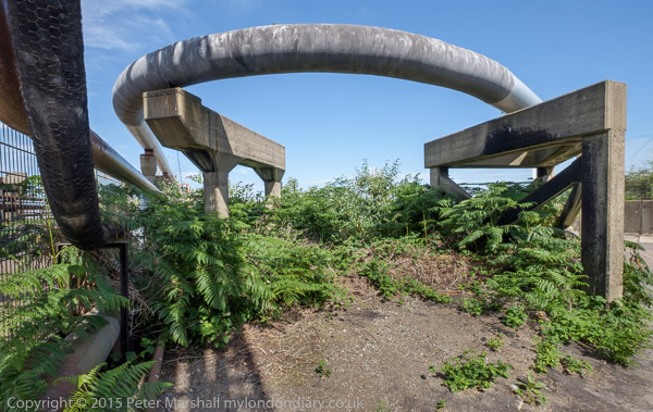
At the Littlebrook jetty
There had once been a pub, Longreach Terrace, and a ferry to Purfleet on the Thames close to the the mouth of Dartford creek, but both were long gone. It was here too that smallpox victims were brough ashore to the islolation wards of Orchard Hospital, demolished around 1975, part of the Joyce Green Hospital which was demolished around 2000.
The Purfleet to Zeebruge ferry goes under the QEII bridge
Further downstream on the banks of the Thames we passed Littlebrook power station – the final plant there, Littlebrook D, had ceased operation only four months earlier – before going under the Dartford QEII bridge and past Crossways Business Park. I had meant to climb up the hill to Stone Church, but missed the footpath and ended our walk in Greenhithe. But I was too tired anyway – and had stopped taking pictures on this last part of our walk.
The final post on walk in Limehouse on Sunday 6th January 1990 continued. The previous post from this walk is West India Dock Road & Limehouse Cut – 1990. As usual you can click on the images here to view larger versions on my Flickr pages.
Looking south towards the blockage across the canal through the bridge which carries the DLR over Limehouse Cut. At the right are the temporary buildings for the construction work on the Limehouse Link tunnel. The Limehouse Cut turns around to the right past the blockage to join Limehouse Dock and I think the industrial buildings you can see are in Brightlingsea Street.
I walked along the towpath to Commercial Road carried over the canal by Britannia Bridge, named for the Britannia Tavern which stood here until 1911, when it was probably removed to allow the bridge to be widened for traffic and also to allow for a towpath under the bridge.
At spring tides when the water rose to its highest it would overtop the old Bow Locks, with water flowing into both the Cut and the lower stretch of the Lea Navigation. This created a problem, particularly when the Cut was connected to the Limehouse Dock. In this picture you see the vertical guillotine gate which was fitted here after the Cut was taken over by British Waterways in 1948 enabling the canal to be isolated from the dock. It was removed soon after I made this picture.
You can also see the 1923 Empire Memorial Sailors’ Hostel on the corner of Commercial Road and Salmon Lane, built as a memorial to all the seamen who had lost their lives in the First World War. Later used as a hostel for the homeless and to house immigrants it had by 1990 been converted into luxury flats.
H W Bush, Mill Place, Limehouse, Tower Hamlets, 1990, 90-1c-16
Island Row, Mill Place, Limehouse, Tower Hamlets, 1990, 90-1f-66
Taken from near to the end of Island Row. But my walk was coming to an end. I made only one more black and white picture, not yet digitised, of the Regents Canal Lock from Commercial Road on my way to Limehouse station.
But I had also carried a second camera body loaded with colour negative film and I made the occasional colour picture during the walk. Here are four of them:
Darent Valley Path & Thames, Dartford, Kent. On Saturday 4th July 2015 I went by train with my wife and elder son to Dartford for a day’s walking mainly beside the River Darent and River Thames.
It was a hot summer day and the sky was blue with just a few small patches of white cloud. It probably wasn’t the best day to have chosen, as this was a walk with relatively little shade, but as usual there was a little breeze by the rivers to cool us slightly.
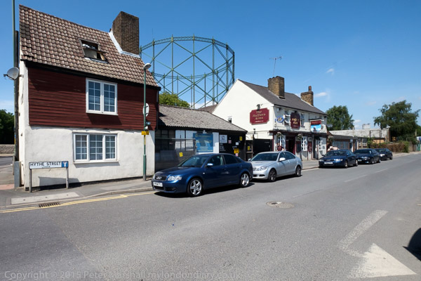
I’d walked (and cycled) along the paths we took several times before, first in the 1980s, but they were new to my companions. After taking a short look at the Darent in Dartford we made our way to Hythe Street. Its name means a landing place or small port, and the Darent was once an important navigation at least as far as the mills in the centre of Dartford. The has been a pub here since 1764 and the Hufflers Arms gets its name from the men who guided and pulled the barges up the river to here.
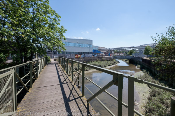
A footbridge takes the path across the Darent here, and past the backs of some industrial sites on towards the half-lock which stopped the river above it drying out at low tide, long derelict. It was something of a surprise to see a narrow boat moored close to it.
There has been a huge change here since 2015, with volunteers working on and around the lock and the river. You can read more about the work of the Dartford and Crayford Creek Restoration Trust on the Facebook page of the Friends of Dartford and Crayford Creek, and see some of the changes in the pictures there.
Later in the day I photographed a yacht making its way through the flood barrier from the Thames and going upriver. I heard afterwards that it had reached the recent bridge under the Bob Dunn Way bypass when the tide was just a fraction too high for it to creep underneath with its mast lowered.
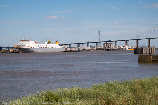
The Thames is pretty wide here and the channel deep enough to take fairly large ships, with the ferries including the ship in the picture operating regular contianer services to Rotterdam and Zeebrugge.
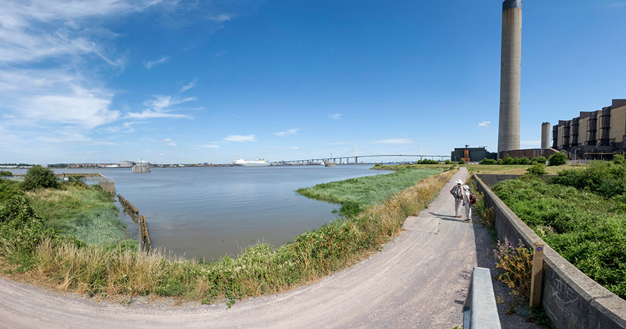
I made a few panoramic images, but the sky was a little empty and blue for it really to be a good day for that. This one which shows my two companions walking on ahead is interesting to me as I have managed to make use of the curvature inherent in these very wide angle views. The path on which I was standing to make the image was more or less straight, though in the picture it seems to bend at roughly a right angle.
The Littlebrook Power Station had only recently ceased operation, and we walked past some interesting structures there before making our way under the Dartford Bridge.
I was pleased that the ferry was leaving and I was able to take a series of photographs of it going under the bridge and sailing on downriver. Some of the pictures give a better impression of the relative heights of ship and bridge with an enormous amount of headroom for the passage.
By now I was getting tired, mainly from the heat and the lack of any shade, and I took few pictures on the rest of the walk to the station at Greenhithe. We didn’t see any sign of the path marked on the map which would have taken us up to the church at Stone as I had planned, but I think I was releived not to have had to climb up the hill, and perhaps didn’t look too hard. After all I’d been there and taken pictures on various occasions before. And if you are walking this way it’s worth the detour.
I only had time for a short walk on Friday 7th April 1989, cycling home furiously from the college where I was teaching at noon as I had no afternoon classes, picking up my camera bag and rushing to catch a train into London.
Canning Town, where I was heading, was on the other side of London and not then the easiest of places to get to before the DLR and Jubilee lines were completed. My journey involved a slow transit around North London on the line from Richmond on the North London Line to the old Canning Town station immediately north of the A13 East India Dock Road, next to Stephenson Street.
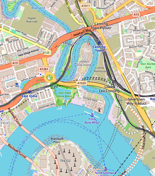
If you are not familiar with the geography of this area, a small clip from OpenStreetMap, slightly enhanced, will help. The East India Dock Road on this map is labelled Newham Way, which is here a flyover above the road itself. The former station I used was just to the north of this. Pura Foods was inside the loop which is now London City Island and there was no bridge across the river at the top of the bend.
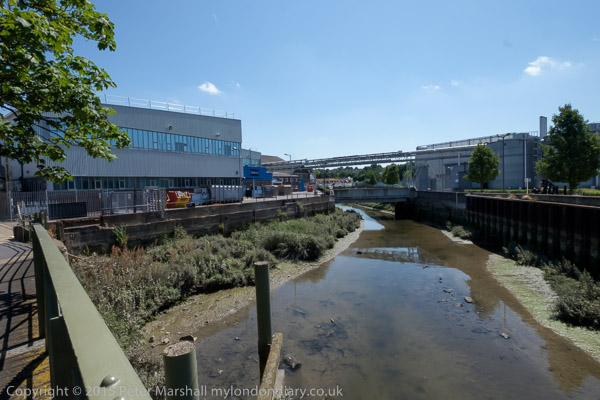
A subway close to the station entrance took me to the other side of this busy road, where I had a view of Bow Creek, northern end of its loop dominated by Pura Foods, looking across waste ground where the DLR would shortly run. The flood barrier on Bow Creek became redundant when the Thames Barrier was built.
I moved slowly west along the East India Dock Road, stopping to take occasional images. There was a considerable amount of waste including old tires dumped here, but it was also a working industrial area, with workers cars parked alongside the river.
Essex Wharf, Bow Creek, Pura Foods, East India Dock Rd, Canning Town, Newham, 1989 89-4b-26
The main business on this side of the river appeared now to be the sawmill, though I also photographed the sign board for Haughton Engineering, but I’m unsure whether they were still in business.
It seemed to me an area which cried out for some panoramic images, and I took a set of three overlapping handheld pictures – the left of the set above – intending to combine them – which back then would have involved cutting and pasting the three together, but later I found I couldn’t quite get them to match up. Even when it became possible to do this digitally I found I hadn’t quite made these precisely enough.
It was experiences like this that led me a couple of years later to save up and buy a proper panoramic camera – I think the first one cost me around a month’s wages.
London Sawmills, Bow Creek, Wharfside Rd, Canning Town, Newham, 1989 89-4b-13
I continued walking west, the road on a low viaduct giving me a good view of the area to the south, coming to a timber yard where Bow Creek flowed into the area, going down south towards Orchard Place before turning north to go back towards the East India Dock Road where I had taken the earlier images.
London Sawmills, Bow Creek, East India Dock Rd, Canning Town, Newham, 1989 89-4b-15
I’ll post about the second and final part of this short walk later.
Bow Common Lane, Bow Common, Tower Hamlets, 1988 88-7r-35
Although this image is labelled as being on Cantrell Road in my very skeletal notes written small in black ink on the contact sheet, it is actually still there next to the railway on the west side of the gasworks site in Bow Common Lane.
This fairly substantial house is on the edge of the gas works site mentioned in the previous post and I wondered if it might have been a part of this development, perhaps a manager’s house. The gasholder was removed in 2016-7
Bow Common, Tower Hamlets, 1988 88-7r-21
I’m fairly sure that Turnbull & Son Builders were not on Cantrell Road as my notes suggest, but certainly somewhere in Bow Common, possibly on Bow Common Lane, Devons Road or St Paul’s Way which were on my route. Little of the older industry in the area now remains.
Bow Common, Tower Hamlets, 1988 88-7r-23
Again there is a frustrating lack of information on the contact sheet, possibly because I was lost. So I’m unsure of the location of this detached Victorian house, but I think it may have been on Turners Road which I went down on my way to Clemence St.
Finally a location I can be sure of, as the block in the background has two signs on it. ‘No Ball Games’ is on not helpful, but over the entrance way just above the thighs of what looks to me a naked rudimentary female figure I can read ‘Gatwick House’.
Although Trevor Tennant (1900-80) entitled this ‘play sculpture’ Gulliver it still looks female to me. It is described in The Buildings of England London: East as “in Festival of Britain Spirit”, though it looks vaguely Henry Moore to me. Tennant in taught at various art colleges including Camberwell School of Art (1930-4). The sculpture commissioned by the LCC for the Locksley Estatew was probably installed when the block was built in 1954-6 and by the time I photographed it was deteriorating – perhaps due to some rather more robust physical play than anticipated. It was originally at the centre of a large sandpit with the base buried in the sand. I suspect the sand was removed after being too often used as a toilet for dogs, a common fate with sandpits in public places.
A gloomy building by a gloomy canal, close to St Anne’s Church which towers above the tree at right. This building at the rear of a ‘dangerous structure’ on Commercial Road opposite the church is still standing, though the lower structures to the right have been demolished. I think this is 777 Commercial Road, a former sail loft, part of the Grade II listed run of buildings here. According to the listing, 777 dates from 1893-4 and was designed by Marshall & Bradley and built by J.H. Johnson for Caird and Rayner. The site is now ‘Sailmakers’ a mixed-use development which will retain the building frontage.
The Flood barrier on the Limehouse Cut presumably became redundant after the building of the Thames Barrier. On the other side of Commercial Road you can see both St Anne’s Church over a billboard and Limehouse Town Hall.
The Empire Memorial Sailors’ Hostel, now called The Mission Building, was built in 1924 to house some of the many sailors in the city needing lodgings. Money to fund it came from an appeal organised largely by women from across the British Empire to save these men who might otherwise have spent the night and their earnings in the company of the oldest profession. They appealed for the funds to build it as a memorial to the 12,000 merchant seamen who were killed in the Great War.
The Grade II listed building originally had 205 single rooms (cabins) and appears to have been designed to the demands of a committee whose members advocated differing styles. It was enlarged in 1932 along Salmon Lane to meet the huge demand, but as the docks closed became a hostel for the homeless. It closed in 1985, presumably not because of any lack of homeless people but because of the cost of housing them, and in 1994 was sold off to a developer who converted it to a gated and portered residential development.
4-12 West India Dock Road, Limehouse, Tower Hamlets, 1988 88-7r-14
A little of the old West India Dock Road, this row of shops is now long gone. The large Grade II listed building at right is still there, built as the Passmore Edwards Sailors Palace, the Headquarters of the British And Foreigh Sailors Society in 1901, with a grand frontage including a crowned Britannia holding on each shoulder a strangely morphed galleon and child. The side view here is rather more utilitarian.
Sail Makers, Ships Chandlers, 11, West India Dock Rd, Limehouse, Tower Hamlets, 1988 88-7r-16
A sign over the door for Pastel Print shows its use in 1988, when local demand for sails, candles and other marine equipment has shrunk to zero. A plaque near the apex of the facade states ‘ERECTED AD.1860’. I think it has now been made into flats and offices retaining the facade.
The next part of my walk, going back into Bow and on towards Bromley-by-Bow will continue in a later post.
Clicking on any of the pictures will take you to a larger version in my album 1988 London Photos from where you can browse the album.