Darent Valley Path & Thames – 2015

Darent Valley Path & Thames: The route we took on Saturday 4th July 2015 was new to my wife and son, but one I’d taken quite a few times before, both on foot and on my Brompton, but this time I left the bike behind and walked with them.

Darent Valley Path & Thames - 2015
From Mill Pond Road, Dartford

Or rather more or less with them, as I often stopped or walked a few yards to one side or other to take pictures, and then had to scurry after them to catch up. Walking with a camera is very different from walking. My son does have a camera (one of the Fuji fixed lens X100 series) but takes far fewer pictures than me – and did much less running about.) But his captions are often rather more droll than mine, and seldom constrained by the 5W’s – Who What Where When Why.

Darent Valley Path & Thames - 2015
Footbridge across the Darent

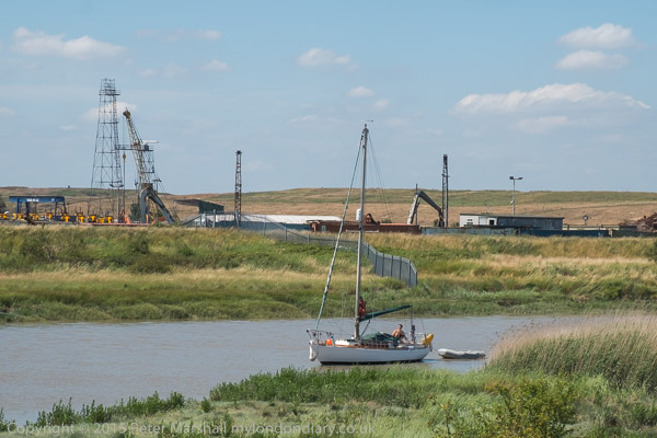
It was a bad day for this walk, hot and sunny with virtually no shelter between Dartford and Greenhithe along the banks of the Darent and Thames. But I’d heard that there would be a boat sailing up Dartford Creek, a rare occasion at the time and decided it would be good to photograph it.

Darent Valley Path & Thames - 2015

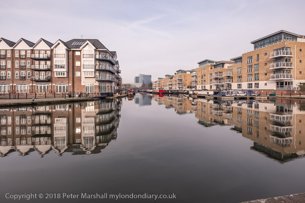
This route is now one end of the Darent Valley Path, a 19 mile path which ends at Sevenoaks, most of which I’ve walked or cycled on other occasions, and the part beside the Thames is on the England Coast Path.

Darent Valley Path & Thames - 2015
Dartford Half-Lock

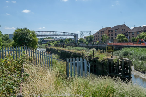
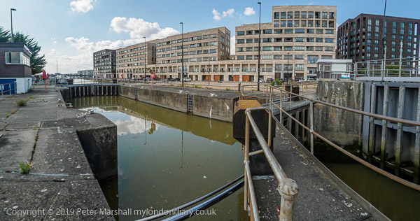
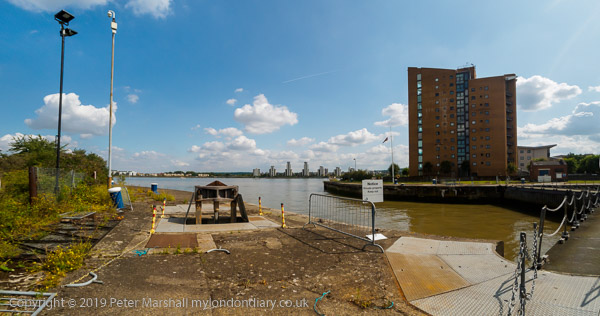
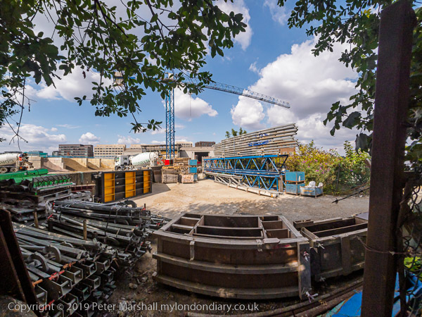
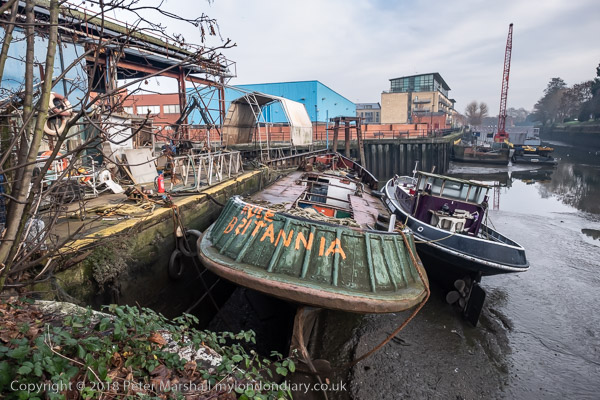
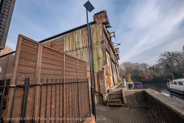
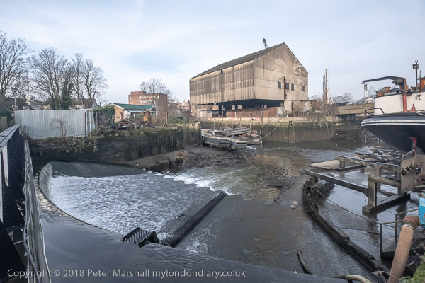
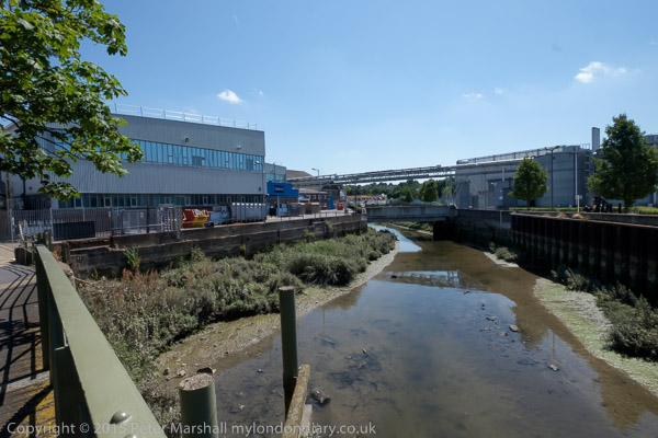
The Darent used to be navigable at least up as far as Dartford, where barges brought in and took out cargoes. Close to Dartford is a half-lock which holds back water above it when the tide goes out, long out of use but now slowly being restored to bring the waterway back into regular use.

A fixed low bridge impedes navigation. This bypass was built as University Way, but the University never came so they renamed it Bob Dunn Way

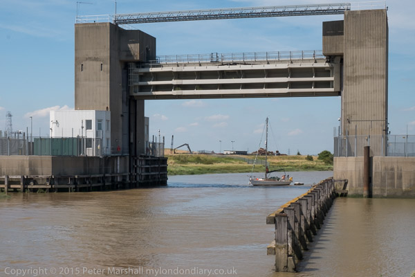
There used to be a lock which craft could go through when then the tide was high enough downstream, but that was replaced by a fixed barrier. Boats can still go through in either direction close to high tide when their is enough water for them to clear the sill.

The yacht arrived later than expected and I had to run back to photograph
it coming under the flood barrier. It was too late to get under the bridge on the same tide.

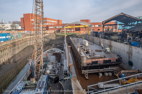
As well as the Darent, barges also went up the River Cray which joins the Darent downstream from the half-lock. This too is being brought back into leisure use.

Where the Darent meets the Thames

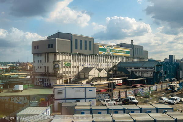
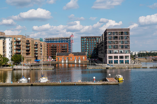
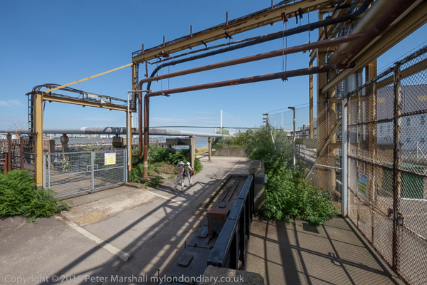
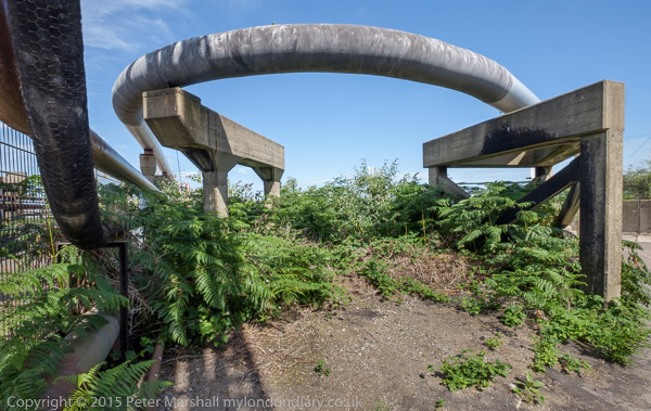
By the river in the centre of Dartford was the industrial estate dominated by the pharmaceutical manufacturing plant of Burroughs Wellcome who took over a former paper works here in 1889. In 1995 this became Glaxo Wellcome, the largest pharmaceutical company in the world. The works was wound down from 2008 by the then owners GlaxoSmithKline with manufacturing ending in 2013. Much of the site was empty by 2015 and now has large blocks of flats.

On the west side of Dartford Creek had been paper mills, but the last of these, owned by Wiggins Teape closed in 2009 and there was by 2015 housing on the site.

QEII bridge and Littlebrook Power station, River Thames, Dartford

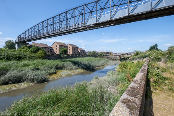
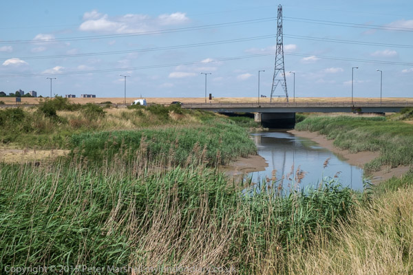
When the third Dartford Bypass was built around 1988 barges were no longer bringing esparto grass and other raw materials for the paper works up the river and no thought was given to navigation. Boats that can lower masts or without them can creep under the road for a short time on a rising or falling tide when there is enough water to allow them to float but not high enough for the bridge to block their transit.

Riverside path at Littlebrook

Much of the land to the east of the creek was marshes, which made it a suitable location for the Wells fireworks factory, long closed. But I think it or an adjoining site was now in use for clay-pigeon shooting, and for much of this section of the walk we sounded under gunfire.

At the Littlebrook jetty

There had once been a pub, Longreach Terrace, and a ferry to Purfleet on the Thames close to the the mouth of Dartford creek, but both were long gone. It was here too that smallpox victims were brough ashore to the islolation wards of Orchard Hospital, demolished around 1975, part of the Joyce Green Hospital which was demolished around 2000.

The Purfleet to Zeebruge ferry goes under the QEII bridge

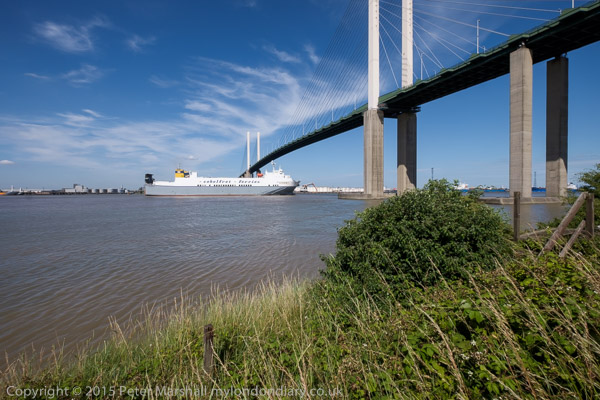
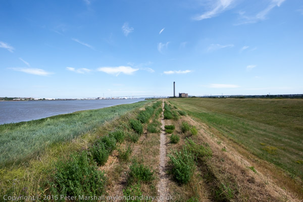
Further downstream on the banks of the Thames we passed Littlebrook power station – the final plant there, Littlebrook D, had ceased operation only four months earlier – before going under the Dartford QEII bridge and past Crossways Business Park. I had meant to climb up the hill to Stone Church, but missed the footpath and ended our walk in Greenhithe. But I was too tired anyway – and had stopped taking pictures on this last part of our walk.

More at Darent Valley Path & Thames.


FlickrFacebookMy London DiaryHull PhotosLea ValleyParis
London’s Industrial HeritageLondon Photos

All photographs on this page are copyright © Peter Marshall.
Contact me to buy prints or licence to reproduce.


Reparations, North Woolwich & LouLou’s

Reparations, North Woolwich & LouLou’s: Thursday 1st August 2019 was a long and busy day for me with an Afrikan Emancipation Day protest, finishing a walk in North Woolwich I’d begun six months earlier and photographing an evening protest outside the exclusive Mayfair club LouLou’s.


Afrikans demand reparations – Brixton, London.

Afrikans demand Reparations, North Woolwich & LouLou's

People of African origin met in Windrush Square in the morning to demand an end of the Maangamizi, the continuing genocide and ecocide of African peoples and Africa on Afrikan Emancipation Day.

Afrikans demand Reparations, North Woolwich & LouLou's

After speeches & libations they marched from Brixton to Westminster with a petition calling for an end to acts of violence by Britain, the misuse of taxes and the stolen legacy plundered from Afrika under the British Empire and European Imperialism and demanding reparations.

Afrikans demand Reparations, North Woolwich & LouLou's

The protest was supported by Extinction Rebellion XR Connecting Communities who marched in an Ubuntu Non-Afrikan Allies bloc.

Afrikans demand Reparations, North Woolwich & LouLou's

I left the march as it went past Brixton Police Station on its way to protest outside the Houses of Parliament so I could have some lunch before going to take pictures elsewhere.

Many more pictures on My London Diary at Afrikans demand reparations.


DLR – Bank to North Woolwich

DLR HQ at Poplar

I’d taken the tube back into central London to have a quick lunch before taking the DLR from Bank to London City to King George V Dock station for the final section of the walk I had begun in February but had run out of time to finish because I’d had to take a roundabout route to get there as the direct DLR services were suspended following an accident.

Bow Creek

This time the trains were running properly. They start from Bank and so come into the station empty and I was able to chose my seat and for once I found myself sitting next to a clean window on my way to North Woolwich and took a number of pictures.

Tate & Lyle

Later on my way back to Canary Wharf from King George V I was less lucky and the windows were rather grimy, but I still made a few images.

More at DLR – Bank to London City Airport.


North Woolwich, Royal Docks & the Thames

The footpath goes across these gates of the entrance lock to Albert Dock Basin

I took a few pictures as I walked from the elevated King George V station at North Woolwich to the King George V Dock entrance and joined the path by the river.

The lock here is huge, 243.8m long and 30.48m wide. I’d first photographed the area back in the 1980s as a part of a wider project on the Docklands following their closure, both in colour but mainly in black and white – in the album 1984 London Photographs. Although the docks themselves remain, much around them has changed, although there are still some derelict areas.

The riverside path here is part of the Capital Ring, and continues north and over lock at the Albert Dock entrance to the curiously desolate Armada Green Recreation Area.

Here the path ends, with beyond it the former site of the Beckton Gas Works, used as a location for at least 17 films and TV series since its closure, though best known as a stand-in for Vietnam in the 1987 Full Metal Jacket. Past that is the Beckton Sewage Treatment Works, set up in 1864 as part of Joseph Bazalgette’s scheme to treat London’s sewage and still receiving it from all of London north of the Thames.

I had to turn inland, through more recent development and the refurbished Gallions Hotel around Alber Dock Basin. I went briefly under the new bridge to see again the East London University student residences, then went back and across it, taking more pictures from the bridge and the road on my way back to King George V station.

Many more pictures at North Woolwich Royal Docks & Thames.


LouLou’s stop exploiting your workers – Mayfair

Finally I joined the IWGB Cleaners and Facilities Branch outside the exclusive Mayfair private club LouLou’s where they were picketing and protesting for kitchen porters to be paid a living wage, be treated with dignity, respect and given decent terms and conditions including proper sick pay, holidays and pension contributions. Recently outsourced to ACT, porters want to be returned to direct employment.

Among those supporting them were Class War, and in the picture above Ian Bone confronts a police office asking why they protect and support the rich. Needless to say the officer had no answer to the question. In general the protesters were reasonably behaved and acting within the law, but police and security hired by the club worked together to try and prevent their protest being effective.

There were angry scenes as staff escorted wealthy clients of the £1800 a year club past the picket, particularly when some roughly pushed the protesters. Police repeatedly warned the protesters but not the security men or customers who had assaulted them. The security also tried to prevent the picket from handing their flier to the customers.

As at previous protests outside of the club, none of the security staff were wearing the visible SIA door supervisor licences required under the Private Security Industry Act 2001, but the police refused to take any action over this.

More pictures at LouLou’s stop exploiting your workers.


Peckham and East Dulwich 1989

Courtyard, Peckham Rye Station, Rye Lane, Peckham, Southwark, 1989 89-4h-35

The day after my walk around King’s Cross, in part on a walk led by GLIAS, on Sunday 9th April 1989 I was back in London on my own, south of the river for a walk beginning in Peckham.

People have often asked my why I photographed the areas of South London, and although I tell them I also photographed the North, East and West, my interest was certainly was certainly inspired by a remarkable book, London South Of the River, by Sam Price Myers, published in 1949, illutstrated by some fine wood engravings by Rachel Reckitt.

Back in 1989 there was relatively little graffiti in the area, but much of the walls in the 1930’s building at the centre of the picture where an arcade leads left towards Rye Lane was covered fairly colourfully last time I visited. You can just see a little of the station at right through the first arch. The second arch on Station Way leads to Blenheim Grove,

Courtyard, Peckham Rye Station, Rye Lane, Peckham, Southwark, 1989 89-4h-36

Myers does not have a great deal to say about Peckham, but has an engaging enthusiasm for the subject matter. His short section on the area does, like me start at Peckham Rye Station, though I had probably not arrived by train but on a bus to Peckham from Vauxhall. The book also contains some decent photographs, though greatly weakened by the rather pallid reproduction of the era, by a number of photographers including Ursula Hartleben and Bernard Alfieri.

My copy, bearing the stamp of the Illustrated London News Editorial Library, was certainly £4 well spent, and I find a copy in rather better condition now offered for sale on the web for £555; the advert shows several of Reckitt’s illustrations, and another was posted by a friend on Twitter. You can still find copies of the book in similar condition to mine for a rather more reasonable price.

This picture is looking north up Station Way from outside the station entrance towards Holly Grove. My interest on this occasion was obviously rather more in the 1930s building than the Victorian station,

Shop, Blenheim Grove, Peckham, Southwark, 1989 89-4h-21

This was another part of the 1930s development in front of the station between it and Rye Lane, here with shops and flats above. I walked the few yards east into Rye Lane and continued south down this, taking few pictures as I had photographed this area on previous walks.

Matrix Gym, Rye Lane, Peckham, Southwark, 1989 89-4h-23

Continuing south, Rye Lane merges into Peckham Rye, and I often confused the two. The numbers on the door frame here are 257-261 and this was a part of the former Co-Op building at the bottom of Rye Lane, now demolished and replaced.

Lock, Peckham Rye, Peckham, Southwark, 1989 89-4h-12

The giant lock with its legend YALE LOCKS was became labelled the entrance to Ezel Court (which I think was just the flats above the shops), but I assume that at one time either 56 – here dealing with pets – or the shop to the left had sold locks. In recent years these have become a Mini Super Market and a restaurant. I had photographed this earlier in the year and another picture appears in my post Peckham Rye to Goose Green – 1989.

Houses, Kelmore Grove, East Dulwich, Southwark, 1989 89-4h-13

I continued down Peckham Rye to the junction where I turned to the west along East Dulwich Road. In 1879 this there were really substantial villas along the south of East Dulwich Rd, but by the early 90s Oakhurst Grove, Kelmore Grove and The Gardens at the back of these had been laid and lined with substantial family homes.

These beautifully decorated late Victorian houses are on the south side of Kelmore Grove, with slightly plainer examples on the other side of the road. Although only two storey, these are substantial semi-detached houses with a wide frontage with a large room on each side of the central hallway.

Houses, Oakhurst Grove, East Dulwich, Southwark, 1989 89-4h-14

The houses in Oakhurst Grove have alternate bays and rather curious towers in what are semi-detached three storey houses. The two doors in each pair are adjacent with only a room on one side and although taller they are less grand than those in the picture above. But they also have some fine brickwork and decorative elements.

This walk will continue in later posts.


St Omer & Arques 1993

Mostly I’ve photographed London over the past 50 or so years, with just a few earlier pictures that I think I have lost, including the first film I ever had processed, of ancient oak trees in Richmond Park back in 1962. It cost me 17s 6d to get it processed and it was years before I could afford to do more. I think all of the pictures are now lost. But I have also photographed elsewhere, particularly in Hull and Paris, and also on a number of holidays, some where I’ve perhaps taken photography more seriously than others. But I’ve always had a camera with me.

Cyclists, France

A few of those holidays have been cycling holidays, including a ride up the Loire valley and a couple of others in northern France. France is a better place to cycle than the UK for various reasons. It still has mile after mile of largely empty rural roads and French drivers have a much more positive attitude towards cyclists. More of them are cyclists themselves or have been.

le Marais Audomarois, St Omer, France

One such holiday was in late August 1993, when I went with my wife and two sons, aged 14 and 17 to northern France. Our rides were fairly leisurely with not the slightest whiff of Lycra and frequent stops for me to repair the punctures of the others or carry out other running repairs. My own bike, a 1956 Cinelli bought secondhand for me by my eldest borther for my 13th birthday performed without any such problems. I’ve recently scanned and put the pictures from our holiday into a Flickr album.

Water Tower, near Cassel, France

Two things made that difficult. One was the poor trade processing of the colour negative film I used, with one film having two large gouges across most frames along with some other damage which required extensive digital retouching. I tried out Photshops new AI filter which removed them perfectly – but also took out some other parts of the image, so I went back to doing the job manually.

Tower, Hauts-de-France, France, 1993, 93c08-01-71

But what took as much or rather more time was trying to identify the locations for many of the images. I’ve done my best, but some are still rather vague and others may be wrong. I’m hoping that some viewers on Flickr will help and tell me more. If you know the area around Calais, Ardres, St Omer, Arques and Cassel please do take a look. The pictures are rather mixed up in order, and I was using two cameras, both with colour negative film, for reasons I can not now understand.

Canal, Rue des Faiseurs de Bateaux, Saint-Omer, Hauts-de-France, France, 1993, 93c08-01-41

On 23 August 1993 we made an early morning start on a train to Clapham Junction and rode from there to Victoria. The train to Dover and the crossing to Calais for the four of us cost £42 for a fivee-day return ticket and our bikes travelled free. We arrived in mid-afternoon and an easy ride took us to the hotel we had booked in Ardres.

Bridge, Canal, Hauts-de-France, France, 1993, 93c08-01-43

The following day was a more difficult ride, and we had a nasty few minutes when Joseph’s chain came off and jammed between sprockets and hub far from any town or village, close to the high speed line then being built for Eurostar, work on which had involved us in a number of detours, and for years I’d look out of the window a few minutes after we came out of the tunnel and recognise the short uphill stretch were it happened.

Blockhaus d'Éperlecques, Éperlecques, France

Eventually after much sweating I managed to free it and we could proceed. For some reason we had decided to visit the Blockhaus d’Eperlecques, built in 1943 as a base to launch V2 rockets at Britain, but destroyed by bombing and now a French National Monument with some very large holes in its concrete roof.

Bridge, near St Omer, France

Our route to it involved a rather large hill but we were able to rest a bit and look around the site before continuing on our journey to St Omer. Here we found another slight problem with our French map, which showed what looked like a nice quiet route on to Arques. It turned out to be an abandoned railway track, complete with sleepers and impossible to ride. After struggling for a while we turned back and took the N42 instead and soon reached Arques.

L'Ascenseur à Bateaux des Fontinettes, Arques, France

At Arques we were just in time for the last guided tour of the day of the 1888 boat lift, L’Ascenseur à Bateaux des Fontinettes, modelled on the Anderton lift in Cheshire, replacing 5 locks and taking 22 minutes to transfer boats up and down by 13.13 metres – 43 ft. It was closed in 1967 as traffic had grown considerably and replaced by a single modern lock.

A la Grande Ste Catherine, Hotel, Hauts-de-France, France, 1993, 93c08-01-52

At Arques we had booked a three night stay at ‘A la Grande Ste-Catherine’ . Including breakfasts for us all and a couple of dinners for the two of us (our two sons wouldn’t eat proper French food) this cost 1832 Francs, then a little over £200. They ate frites and burgers from a street stall, though one night we did all manage to find food for all of us at a supermarket restaurant.

le Marais Audomarois,, St Omer, France

The next day we returned to look around St Omer, and then rode to Tilques, abandoning saddles for a boat trip around le Marais Audomarois, one of the more interesting parts of our visit.

Rooftops, Cassel, France

And for our last full day in France we took a ride to Cassel, a town on a hill that rises to the highest point on the Plain of Flanders, surrounded by flat lands in all directions, taking an indirect route via the Forêt Domaniale de Rihoult (Clairmarais), rather disappointing as it was full of noisy schoolkids from their colonies de vacances.

Radio Uylenspiegel, Cassel, France

It was a struggle up the hill to Cassel, and we were glad to rest for a while at the cafe inside the grim fortress of a Flemish language radio station – former a casino and I think the local Gestapo headquarters. Our ride back to Arques was by the direct route and began with a long downhill stretch where no pedalling was needed for a very long way.

A Cathelain,  Bavinchove, France

Finally came our last day, and I planned an easy route back to Calais, mainly beside canals. But the others objected and demanded a visit to the Eurotunnel exhibition on the way, which held us up considerably, not least because most of the roads had been diverted to build the high speed line and our map was fairly useless. We finally managed to catch the 19.15 ferry, a few hours before our ticket expired.

Many more pictures in the Flickr album Northern France – St Omer.


Peckham Rye to Goose Green – 1989

More from my walk in south London on Sunday 5th February 1989. The previous post was Around Rye Lane Peckham 1989.

Antiques, Lock, Peckham Rye, Peckham, Southwark, 1989 89-2c-62

There is still a doorway here between 56 and 58 Peckham Rye, but the lock above it has gone and it now has a sign for Ezel Court at 56 A and B and 58 A and B. The Antique shop was for some years Delta Tavern, an Arfican Restaurant, then a café called Pedler and most recently a bar and restaurant Good Neighbour. The building building to the right of the doorway is also now a bar.

At top left of my picture who just get a glimpse of the rather finely decorated upper storeys of the two late Victorian buildings at 58 and 60, though for some reason I didn’t bother to cross the road to photograph these.

Shop Window, Peckham Rye, Peckham, Southwark, 1989 89-2c-64

This window was just a few doors further down at No 64 and I liked the symmetry of its display, though broken by the two identical photographs of a woman looking in the same direction. I don’t think I was at all clear as to what was behind this window – or what the woman in her strongly patterned dress and gloves was meant to represent. And at the centre of the window display is a thick book on a table, a Thesaurus.

The attractive grille above the door is no longer there, and was probably salvaged and sold when the shopfront was updated. In more recent years this has been occupied by an estate agent, a pizza takeaway and beauty salons.

In the reflection you can see the extensive premises of G Austin & Sons Ltd offering secondhand furniture and antiques, now I think replaced by a three-storey block of flats.

Man, Regency Carriage Company, Peckham Rye, Peckham, Southwark, 1989 89-2c-65

I was always happy to photograph people who saw me taking pictures and wanted to have their picture made, though I very seldom took down details so I could give them pictures. So this young man, posing for me in 1989 will not have seen this picture, unless he has visited the page on Flickr only since January 2021 – it has never been published elsewhere.

The Regency Carriage Company has long gone from this site, though the building remains, rather altered. It was for some time an estate agents but has for around ten years been Rye Cars. But the yard in which the cars for sale were neatly aligned is now covered by flats.

St John the Evangelist, East Dulwich Road, East Dulwich, Southwark, 1989 89-2c-66

St John the Evangelist was built in 1865 to the designs of local architect Charles Bailey, but was badly bombed in 1940. Reconstruction began in 1947, incorporating the remaining apse and tower which dominate my picture and was completed in 1951.

House, East Dulwich Road, East Dulwich, Southwark, 1989 89-2c-52

126 East Dulwich Road faces the west end of Goose Green on the corner of Grove Vale and I liked the uncompromising stare of the head above its simple but impressive doorway.

Houses, East Dulwich Road, East Dulwich, Southwark, 1989 89-2c-53

A pair of doorways with heads, with a simiilar design and I think on the same row of houses facing Goose Green as the previous image.

Goose Green School, Grove Vale, East Dulwich, Southwark, 1989 89-2c-54

I walked a few yards north up Grove Vale to photograph this fine Grade II listed example of a school built as Grove Vale School for the School Board for London in 1900 to the Baroque Revival designs of T J Bailey

I turned around here and walked down to Lordship Lane where my next post on this walk will begin.


My account of this walk from 5th February 1989 began with A Pub, Ghost Sign, Shops And The Sally Ann.


Manchester Revisited

Manchester Revisited – May 5th & 7th 2017

Manchester Revisited
Two canals (Bridgewater and Rochdale) and four railways exemplify Manchester’s contribution to the industrial revolution

Pictures here are from walks in Manchester on Friday 5th May 2017 and the following Sunday while passing through the city. It was a short visit to a city I had hardly returned to for around 45 years.

Manchester Revisited
A magic bus crosses the canal

Although I grew up on the western edge of London, I spent most of the years between when I was eighteen and twenty-five in Manchester, at first studying for a degree at Manchester University and later after a short break returning to work for my doctorate at the Institute of Science and Technology.

My school had recommended Manchester for my university course, and I made my first visit there as a day trip for interviews – a very long day as the journey each way took over five hours. I didn’t see a great deal of the city that day, but I was made two unconditional offers of places and my headmaster when told advised me to stop preparing for Oxbridge entrance exams and accept Manchester, which I did. It was a decision that changed my life in various ways.

Castlefield

My course was disappointing – long hours in the lab and largely tedious lectures by staff with no training and little idea of how to teach, keen to get back to their researches. Sitting at a bench with a small plaque informing me that ‘Rutherford first split the atom here’ in 1917 was little compensation for a physics lecturer who seemed unable to explain even the simplest of concepts, though fortunately I’d studied enough of the subject at school to get a decent grade – and the same was true of my other subsidiary, Maths where I passed a rather curious end-of-year exam with 108%.

Knott Mill

But my real study was in the University Union and in the city itself, though I did enough work in my final year to get a decent grade – and to turn down offers of employment from big pharma who I found far too interested in profit rather than human good and also from the government’s explosives research lab from where I got a very long handwritten letter from one of the scientists working there about the exciting research they were doing – but I decided I really didn’t want to spend my life making better bombs.

The old canal dock area became a conservation area in 1980 and an Urban Heritage Park in 1982

I did get turned down for one job I would really have liked, working in the labs at Kodak in Harrow. I was really not sufficiently middle-class for them – and not interested enough in photography – I’d had an interest but never really been able to afford to pursue it, and dropping my camera in a lake in 1966 hadn’t helped – it never really worked properly again. I ended up getting a job in a lab ten minutes walk from my old home, but it disappointed in almost every way but the salary – at least 50% more than my father had ever earned. It didn’t last, and six months later I was back in Manchester.

River Irwell

Two years later I got married, not in Manchester but in Hull. We were both students still and had little or no money and spent our honeymoon in Manchester, with a day out on the Derbyshire hills and a day coach trip to the Lake District. We lived for the next two years on the two first-floor rooms of a small terraced house in Rusholme, close to Manchester CIty’s Maine Road ground.

New Quay St Bridge – Salford coat of arms

We moved away for me to do a course in Leicester. I’d taught for a couple of terms before just to the north of Manchester, and tried at the end of the year to get another teaching job in Manchester, but failed, ending up moving to Bracknell, where I was offered housing in a new flat on one of the new estates.

After we moved away from Manchester I think I went back once for a conference there and a weekend in Didsbury in the 1990s but not really again until 2017. We were on our way to a weekend conference a few miles to the north, and took an early train to have a few hours to look around the city. Our train came into Piccadilly, and we took a walk along the Rochdale canal and the Bridgewater canal before walking back close to the River Irwell to the city centre to catch our bus.

Doves of Peace sculpture by Michael Lyons, Manchester Civil Justice Centre

Back in 1970, the canals were still largely working areas, or mainly disused but still largely closed to the public; you could walk along some towpaths, but they were rather lonely and forbidding places. Now things are very different.

Mechanics Institute – where the TUC, CIS and UMIST began

We had time for a shorter walk on our way home, but mainly spent that in the People’s History Museum. The following year, 2018 we made a similar journey, but with less time for a walk, and then came back to stay for several days at the start of August as a part of a couple of weeks in various places celebrating our 50th wedding anniversary – including a celebration with family and friends in Hull.

More pictures from Manchester in May 2017.


After Christmas – Brentford to Hammersmith

After Christmas – Brentford to Hammersmith was one of our more interesting walks in London to walk off our Christmas excesses in recent years. For once I’m not sticking religiously to my usual practice and this was three years AND one day ago, and the four of us set out on 27th December 2018.

Often in recent years we’ve gone away in the period after Christmas to visit one of our sons and his family in Derbyshire, with some great walks in the areas around where they have lived, and there are pictures from these on My London Diary, but in 2018 my other son and his wife were staying with us and came for this walk.

Public transport in the period between Christmas and New Year is at best restricted and rather unreliable, and 2018 was no exception and this always limits our starting point. Even for this relatively local walk what would have been just a short direct train meant taking the train to Twickenham and then catching a local bus to Brentford. And on our return trip again a bus took us back to Twickenham for the train home. It meant less time for walking and we had to abandon the idea of actually going inside Chiswick House in order to complete the relatively short walk of 5-6 miles before it got dark.

Brentford, and particularly the Grand Union Canal where we began our walk is now very different from how I remember it – and indeed since I first went back to photograph it in the 1970s. Commercial traffic on the Grand Union came more or less to an end in the early 1970s. What was once canal docks and wharves by the lock where boats were gauged and tolls charged the sheds have been replaced by rather uglier flats and a small marina.

Walking by the canal towards its junction with the River Thames there are areas which still look much as they did years ago, and some rather more derelict than they were then. This is a side of Brentford invisible from the High Street but with much of interest. Probably in the next few years this too will disappear as gentrification advances.

Shortly before the lock leading to the Thames, the River Brent which is here combined with the canal runs over a weir to make its own way to the main river. There are still working boatyards in the area around here, though a little downstream more new flats and a part of the Thames Path here was closed and a short diversion was necessary.

We continued along past new riverside flats and a new private footbridge to the recently revivied boatyard on Lot’s Ait to an area of open space which was a part of the old gas works site, then along the riverside path past more new flats to Kew Bridge and Strand on the Green. Here it was warm enough to sit in the sun and eat our sandwiches before leaving the river to walk to Chiswick House Gardens.

I’d planned to get here for lunch, perhaps spending an hour or so going around the house and then perhaps a drink in the cafe, but there was no time thanks to the rail problems, so we briefly visited the toilets before heading on to St Nicholas’s Church and Chiswick riverside.

From there it was a straight walk by the river to Hammersmith Bridge, arriving around sunset with some fine views along the river – and then the short walk to the bus station for the bus back to Twickenham and the train home. The two bus journeys made our travel take much longer, but you do get some interesting views from the top deck of a double-decker and the journey was intereresting at least until it got too dark to see much.

More on the walk and many more pictures at Brentford to Hammersmith.


Camera Place and the Grosvenor Canal 1988

Camera Place, Chelsea, Kensington and Chelsea, 1988 88-5c-64-positive_2400
Camera Place, Chelsea, Kensington and Chelsea, 1988 88-5c-64

Having found there was a street in Chelsea named Camera Place I had to photograph it. It’s a short street and my picture shows around half of it, looking roughly west towards Limerston St. Chelsea used to have a Camera Square, Camera Street and Little Camera Street which have since disappeared, but as they were built in the 1820s they almost certainly have little to do with photography. By 1918 Camera Square had become something of a slum and the area was demolished, rebuilt as Chelsea Park Gardens with up-market housing in suburban garden village fashion, though retaining a rigidly square layout without the typical sinously curving streets.

The view in Camera Place has changed little; some new railings and the small tree is now rather large.

Elm Park Mansions, Park Walk, Chelsea, Kensington and Chelsea, 1988 88-5c-62-positive_2400
Elm Park Mansions, Park Walk, Chelsea, Kensington and Chelsea, 1988 88-5c-62

Elm Park Mansions has five large blocks around a courtyard, with one of the blocks (flats 25-54) occuping half the length of the north side of Camera Place, behind and to my right as I took the previous picture. The mansions with 189 mostly one and two bedroom flats were built by the Metropolitan Industrial Dwellings Company on land leased to them by Major Sloane Stanley in 1900. The Freehold for the property was taken over by the leaseholders in 1986 and since then the state of the properties has been improved. Two bed flats have sold in recent years for around £800,000.

Elm Park Rd, Chelsea, Kensington and Chelsea, 1988 88-5b-15-positive_2400
Elm Park Rd, Chelsea, Kensington and Chelsea, 1988 88-5b-15

Elm Park Road dates from 1875 when Chelsea Park House was demolished and the houses, many designed by George Godwin, were built between then and 1882. The central house in this picture, at 76 Elm Park Road for built for Paul Naftel, (1817-91) a Guernsey born watercolour painter and his wife and family who came to London in 1870. He moved here in around 1884 and the adjoining houses were also homes to landscape artists. Naftel later moved out to Strawberry Hill, Twickenham where he died.

Grosvenor Canal, Grosvenor Rd, Pimlico, Westminster, 1988 88-5e-12-positive_2400
Grosvenor Canal, Grosvenor Rd, Pimlico, Westminster, 1988 88-5e-12

The Grosvenor Canal was began by the Chelsea Waterworks Company who had leased the land from Sir Richard Grosvenor in 1722, and enlarged a creek there to supply drinking water and also to create a tide mill used to pump the water. When their lease expired in 1823, the then Earl of Grosvenor decide to put in a lock and turn the creek into a canal, extending it to a basin where Victoria Station now stands, around half a mile from the Thames. It opened in 1824 carrying coal, wood and stone into the centre of a rapidly growing area of London.

Grosvenor Canal, Grosvenor Rd, Pimlico, Westminster, 1988 88-5e-13-positive_2400
Grosvenor Canal, Grosvenor Rd, Pimlico, Westminster, 1988 88-5e-14

Victoria Station was built over the canal basin, and more of the canal closed in 1899 for a station extension. Westminster City Council bought what was left of it in 1905, then filled in more of it in 1927 for the Ebury Bridge estate.

Grosvenor Canal, Grosvenor Rd, Pimlico, Westminster, 1988 88-5e-14-positive_2400
Grosvenor Canal, Grosvenor Rd, Pimlico, Westminster, 1988 88-5e-14

The canal continued in use by the council taking refuse in barges from Westminster and other local authorities downriver to be dumped until 1995, making this vestigial canal the last in London in commercial use. In 2000 it began to be developed as an expensive waterside development, with the lock being retained but a boom across the entrance from the Thames prevents access for boats despite mooring pontoons inside the development.

Western Pumping Station, Bazalgette, Thames Water, Grosvenor Rd, Pimlico, Westminster, 198888-5e-15-positive_2400
Western Pumping Station, Grosvenor Rd, Pimlico, Westminster, 1988 88-5e-15

The Chelsea Water Works continued to extract water from the Grosvenor Canal until an Act of Parliament prevented extraction of water from the Thames in London in 1852 and they moved up-river to Surbiton. Sewage was increasingly becoming a problem as London grew and the ‘Great Stink’ of 1858 prompted Parliament into action, passing a bill in 18 days to construct a new sewerage system for London.

The solution by Joseph William Bazalgette was a system of sewers that delivered the sewage around 8 miles downriver to Beckton on the north bank and Crossness on the south, through main high level middle and low level sewers through North London and main and high level sewers in South London. The plans included stone embankments beside the river – the Victoria, Chelsea and Albert embankments which he designed.

Lamp post, Western Pumping Station, Thames Water, Grosvenor Rd, Pimlico, Westminster, 1988 88-5e-16-positive_2400
Lamp post, Western Pumping Station, Thames Water, Grosvenor Rd, Pimlico, Westminster, 1988 88-5e-16

Bazalgette didn’t do everything himself, but he kept a very close eye on every aspect of his great project, and some of the specifications he laid down – such as the use of Portland Cement – have kept the system running despite increasing demands since it was completed in 1875. Now it is being augmented by the new ‘Super Sewer’ running underneath the river, the Thames Tideway.

As well as engineering considerations, Bazalgette was also a stickler for the aesthetics and there are some fine examples of Victorian design in his works. The Pumping Station which housed the powerful steam engines needed to send the sewage on its way, as well as its chimney (in a picture above) and the Superintendents House here are all Grade II listed.


All photographs on this and my other sites, unless otherwise stated, are taken by and copyright of Peter Marshall, and are available for reproduction or can be bought as prints.


City Mill Lock & Blaker Rd

City Mill Lock, Blaker Rd,  Stratford Marsh, Stratford, Newham, 1990 90-9f-32 (2)_2400
City Mill Lock, Blaker Rd, Stratford Marsh, Stratford, Newham, 1990

City Mill Lock connected the tidal Waterworks River with the Bow Back Rivers which are a part of the Lea Navigation and thus at a constant level. There is another lock connecting the two systems further north where Carpenters Lock connects the Old River Lea to the start of the Waterworks River close to Carpenters Road. Both locks were built in the 1930s when considerable work was carried out, mainly to reduce flooding but also with the intent of increasing commercial traffic on the Back Rivers, particularly the City Mill River. But I think this never happened and by the 1960s these streams were seldom if ever used.

City Mill Lock, Blaker Rd,  Stratford Marsh, Stratford, Newham, 1983 36m-35_2400
City Mill Lock, Blaker Rd, Stratford Marsh, Stratford, Newham, 1983

The River Lea was at least theoretically navigable at the right stage of the tide some way further north – and of course much further by kayaks, though there are legal restrictions on parts of its many streams.

Since the Olympics, the tidal flow on the river has been regulated by a new lock on the Prescott Channel at Three Mills which I photographed in 2010. The original intention of British Waterways that the river above this point should be non-tidal but its level still varies, perhaps simply with the river flow.

City Mill Lock, St Thomas's Creek, Stratford Marsh, Newham, 1983 36m-22a-positive-2_2400
City Mill Lock, St Thomas’s Creek, Stratford Marsh, Newham, 1983

The lock gates had clearly seen rather better times and the lock was unusable. These gates were replaced as a part of the makeover of the area for the Olympics.

City Mill River, Stratford Marsh, Stratford, Newham, 1983 35v-15_2400
City Mill River, Stratford Marsh, Stratford, Newham, 1983

Just to the west of the lock, behind the lock keepers house, St Thomas’s Creek turns towards the north and becomes the City Mill River. A few boats were moored here, next to Blaker Rd.

City Mill River, Blaker Rd,  Stratford Marsh, Stratford, Newham, 1983 35v-13_2400
City Mill River, Blaker Rd, Stratford Marsh, Stratford, Newham, 1983

Continuing north beside the City Mill River along Blaker Road led to a footpath which went under the Northern Outfall Sewer in a tunnel. It was possible to access the Greenway walkway on the sewer from here.

City Mill River, Blaker Rd,  Stratford Marsh, Stratford, Newham, 198335v-26_2400
City Mill River, Blaker Rd, Stratford Marsh, Stratford, Newham, 1983

From where you could look down on the path and the railings beside the river.

City Mill River, Stratford Marsh, Stratford, Newham, 1983 35v-25_2400
City Mill River, Stratford Marsh, Stratford, Newham, 1983

This is the view looking back down the City Mill River towards City Mill Lock, now rather different.

City Mill River, Railway, Stratford Marsh, Newham, 1983 36m-43

The footpath led on past the Northern Outfall Sewer to a rather strangely angled basin taking the river under the main railway lines. From here you could continue walking beside the river and eventually reach the north end of Marshgate Lane and Carpenters Road.

The last time I tried to repeat this walk, in 2019, it was not possible, with work still taking place in the area and fences stopping me. As well as work still taking place after the 2012 Olympics, parts were blocked by work on Crossrail.

More pictures on Flickr.


All photographs on this and my other sites, unless otherwise stated, are taken by and copyright of Peter Marshall, and are available for reproduction or can be bought as prints.


Industrial Archaelogy 1988

Some photographs from a GLIAS (Greater London Industrial Archaeology Society) coach trip to Gloucestershire in 1988. For most of the time it rained, rather restricting my photography.

Lock gates, Lydney Harbour, 1988 88-7a-62-positive_2400

Lydney Harbour was built in 1810-3 to carry iron ore and coal from the Forest of Dean. These were brought to the harbour by a tramway built in 1809. Coal continued to be shipped from here until 1960 and the harbour only closed in 1977. It was scheduled as an ancient monument in 1985 and later reopened for leisure use More recently there have been some restoration work and a £2.1m Destination Lydney Harbour project began in June 2020 to develop the area for recreation and tourism. An outer Sea gate from the River Severn leads into a Tidal basin, then a lock connects to the dock and Lydney canal. The upper lock gate is a double gate to protect against high tides in the estuary.

The harbour is the mouth of the River Lyd, and a canal leads a mile inland to Lydney. The swing bridge across the canal between the upper and lower parts of the dock was Grade II listed in 1988. Apparently timber was still carried in barges along the canal until around 1980.

Cookson Terrace, Harbour Rd, Lydney, 1988 88-7a-43-positive_2400

Cookson Terrace on Harbour Rd is a row of cottages built in 1858 as a hotel and housing by the Severn and Wye Railway and Canal Company, Grade II listed in 1988.

Blast furnace, Gunns Mills, Flaxley, Forest of Dean, 1988 88-7b-63-positive_2400

Gunns Mills, Flaxley, Forest of Dean, Gloucestershire is a Grade II* Listed Building and a Scheduled Ancient Monument, being probably the oldest surviving blast furnace in the country, dating to 1683. The mill was named after William Gunne who owned an earlier mill on the site. A charcoal blast furnace built here in 1629 was demolished by Parliament in 1650. The furnace was rebuilt in 1683 but went out of use in 1743 when this became a paper mill which closed in 1879, after which some buildings on the site were used as farm buildings.

Gloucester Docks, 1988 88-7b-55-positive_2400

The main site for our visit was Gloucester Docks, a remarkable collection of fifteen Victorian dock buildings around the main basin, built in 1827 as the terminus of the ship canal from Sharpness, and the Barge Arm, provided at the same time to stop barges cluttering up the dock. A new dock, the Victoria Dock, was added in 1847 and further warehouses were added to deal with the increased foreign imports after the 1846 repeal of the Corn Laws.

As the size of vessels increased a new dock was built at Sharpness; larger vessels were unloaded there, with some goods being carried by barges up the canal, while smaller ships continued to use the canal. The docks remained busy until the 1960s but commercial traffic had largely disappeared by the 1980s. Since then the dock has become of popular leisure and residential area both for boaters and tourists.

Old Sharpness Canal entrance, 1988 88-7b-24-positive_2400

The Gloucester and Sharpness Canal was for some years the broadest and deepest canal in the world, intended to be 18ft deep and 86.5ft wide. Authorised in 1793, building was held up by financial difficulties and it was only completed in 1827. 16.3 miles long, it avoided a large loop in the River Severn with a dangerous bend. By 1905 traffic along it had reached 1 million tons a year. Our coach took us for a brief visit to the Old Sharpness Canal entrance, opened in 1827 but no longer in use, before going to Sharpness Dock, opened in 1874 to allow larger ships which could not use the canal to dock. This is still a working dock and most of the older buildings have been replaced by more modern structures.

Sharpness Docks, 1988 88-7c-51-positive_2400

I don’t actually remember much of that visit, but the photographs remain, around a hundred of them, though I’ve only included around 30 in the album. I do remember our coach back to London being held up on the motorway and arriving back in central London hours later than planned, having to run across Waterloo station to just jump on the last train home, minutes before midnight.

More pictures from the trip in a Flickr Album.


All photographs on this and my other sites, unless otherwise stated, are taken by and copyright of Peter Marshall, and are available for reproduction or can be bought as prints.