Manchester – May 2017: On Friday 5th May and Sunday 7th May 2017 we stopped in Manchester for a couple of short walks around the centre of the city on our way to and from an event in Rochdale. I had lived in Manchester from 1963-70 but hadn’t really looked at the city since I left.
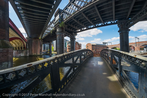
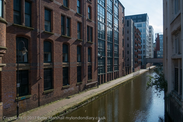
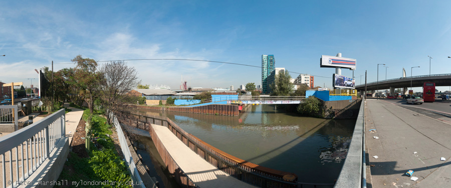
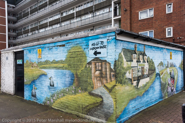
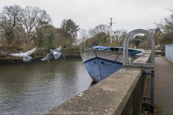
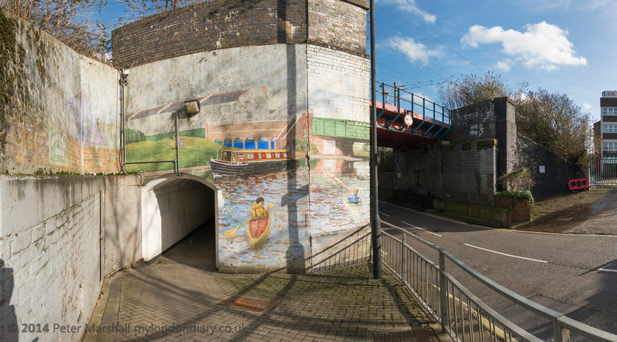
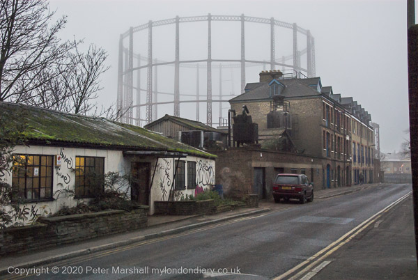
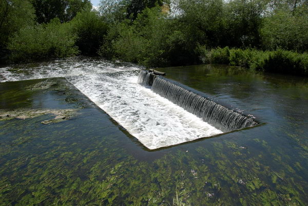
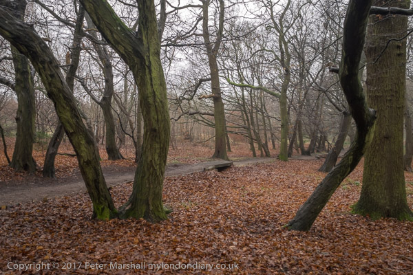
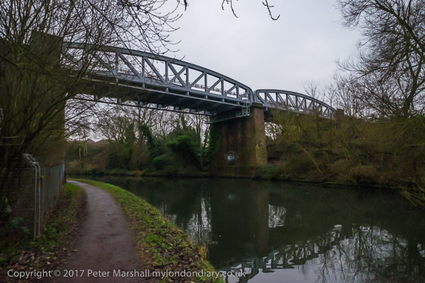
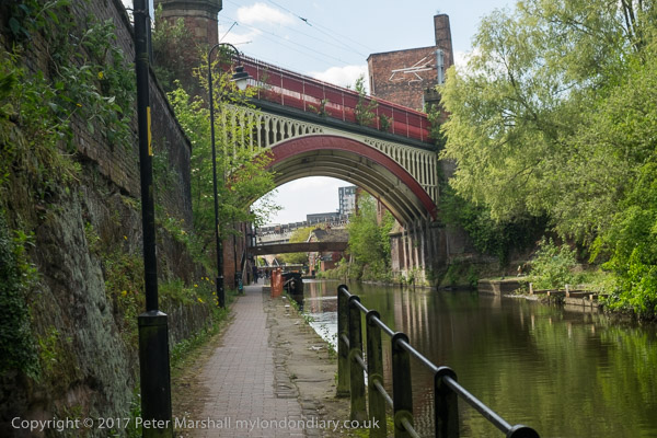
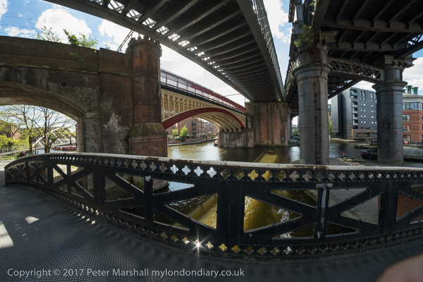
Two canals (Bridgewater and Rochdale) and four railways make this site exemplify Manchester’s contribution to the industrial revolution
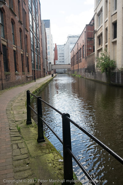
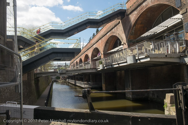
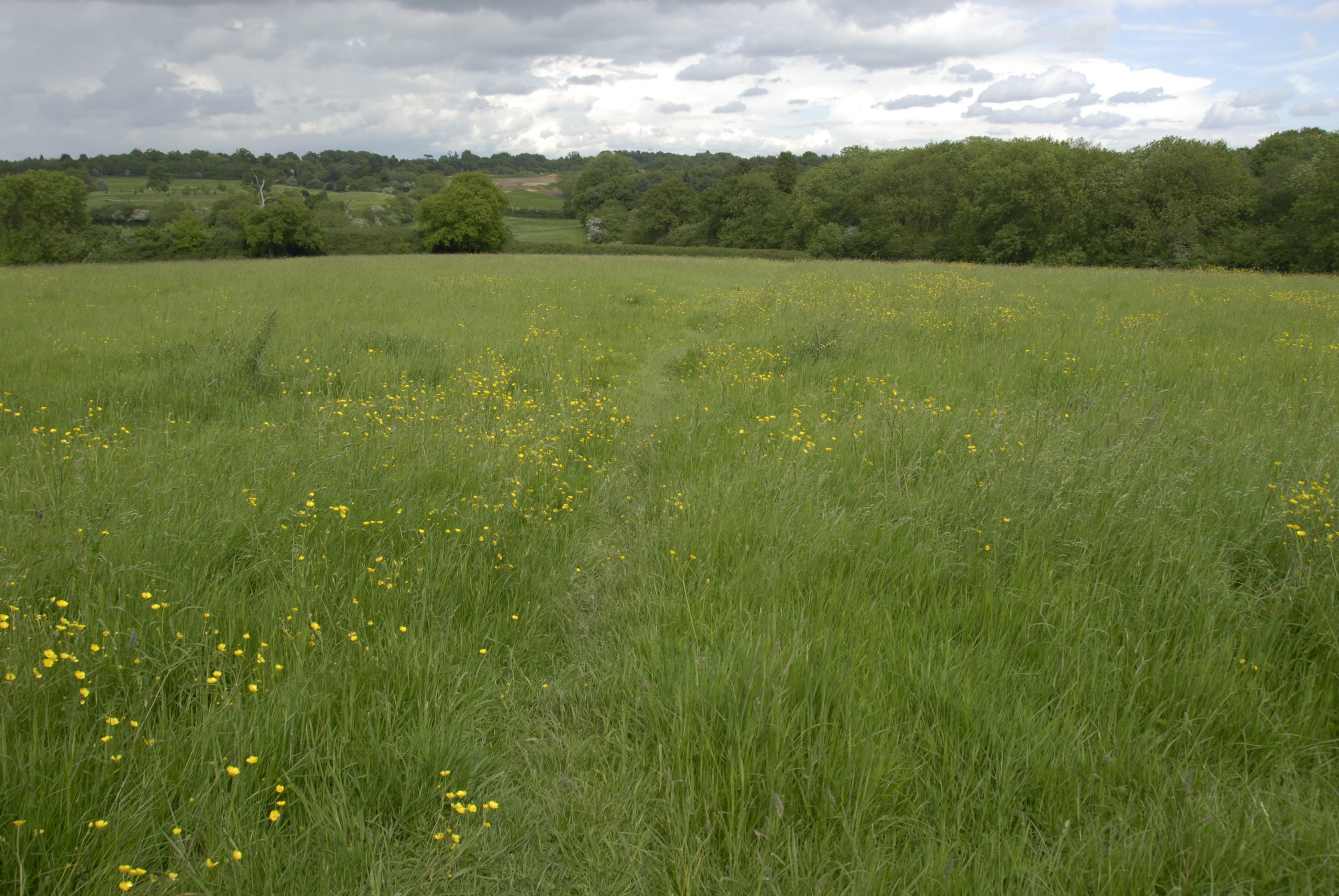
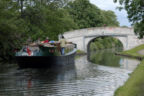
One major change since the 1970s had been the opening up of the canals, including those which run through the centre of the city. These had played a large part in the industrial revolution which had really established the city and on the Friday we went for a walk along the Rochdale Canal from close to Piccadilly Station where our train had left us and along to the Bridgewater Canal – the first canal in Britain which did not follow the path of an existing river, and the second ‘modern’ canal in our industrial revolution. It opened on 17th July 1761 to bring coal from the Duke of Bridgewater’s mines at Worley to the then rapidly expanding cotton town of Manchester.
On My London Diary you can read more about our walk and our return to the centre of Manchester which we had hoped to make beside the River Irwell, but had to detour where paths were closed.
St Georges Island and Bridgewater CanalRiver Irwell
It was perhaps this walk which decided us to return the following year to stay in Manchester for a few days and see more of the city.
We had less time on our way home on Sunday and spent an hour at the highly recommended People’s History Museum but I did take a few more pictures as we walked to the station.
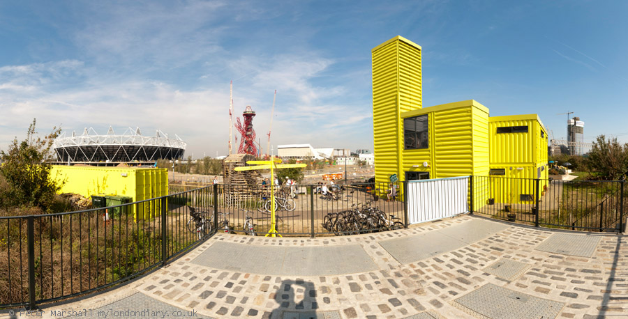
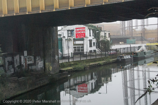
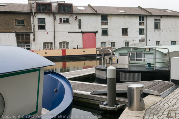
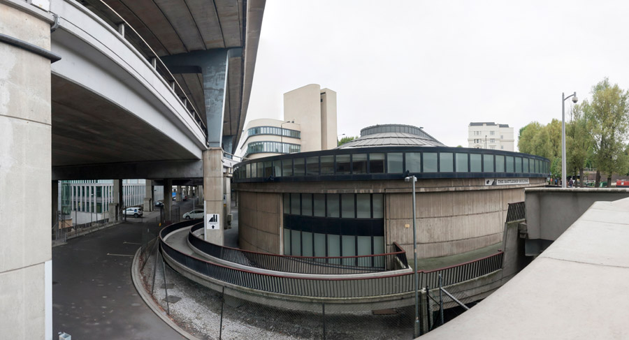
Lea Navigation & Olympic Site: Saturday 1 October 2011 was a fine day and I decided to go early to Stratford and take a photographic walk around Bow & Stratford Marsh, before a meeting at the View Tube on the Greenway overlooking the Olympic site.
I took the Jubilee Line to Stratford and then walked over the footbridge leading to the Carpenters Estate and then on to Stratford High Street. A great deal of new building was taking place there, including a new bridge to carry the Olympic crowds across the busy road on a route from West Ham station along the Greenway. The bridge was demolished shortly after the games ended.
This section of the Greenway – the path on top of Bazalgette’s Northern Outfall Sewer rebranded in the 1990s – was closed off by fences and I kept on walking down the High Street. A few yards along was one of the few remaining commercial sites, though by then derelict and for sale. It was demolished and the site flattened for the Games, though it was only five years later than penthouses on the new block here were offered for sale.
A few yards off the High Street was City Mill Lock, now behind a row of flats. I continued on to the Lea Navigation. The industrial sites on the High Street had now been cleared and there were now huge advertising structures.
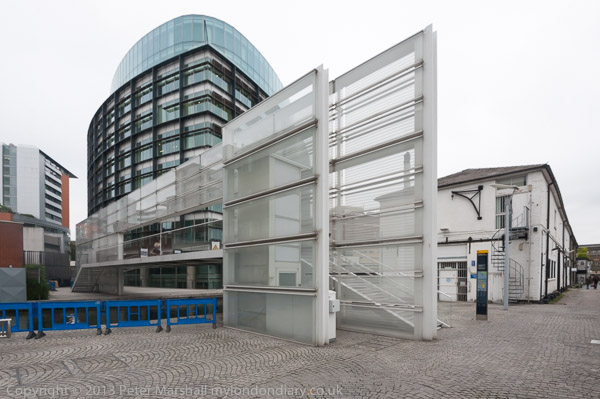
I had come mainly with the intention of making panoramic images, but these don’t display well on this blog, but you can see them larger on My London Diary. A footway now carries the towpath under the Bow Flyover and the High Street and then across the canal where the towpath continues on the opposite bank.
I made far too many pictures around this part of the canal before I could drag myself away, although the sky was not at its best for panoramic images and I would have prefered more distinct clouds rather than the large areas of blue. Only the first section of Cook’s Road was still open, but I could walk along beside St Thomas’s Creek to Marshgate Lane and then make my way to the bright yellow View Tube.
Here I was one of five photographers taking part in what was billed as a ‘Salon de Refuse Olympique‘, showing our artistic responses to the area. It was interesting to see the very different work that the five of us presented. You can read more about this in a post published here two days after the event in 2011, Northern Outfall Sewer 1990, 2005, 2010… which includes the three pictures I contributed for a forthcoming book as well as a lengthy text based on my presentation.
The Olympics have certainly changed this area, and the changes which were showing back in 2011 have continued. Many more pictures – both panoramic and normal aspect ration – in my post on My London Diary at Lea Navigation & Olympic Site.
As a child I grew up in Middlesex, by then a rather truncated county on the north and west of London, though once it had included the cities of London and Westminster and many of London’s Metropolitan boroughs north of the Thames and west of the River Lea. Brentford, a couple of miles from where I was born, was the nearest thing the county had to a county town, though it had few if any of the normal attributes of one, with no town-hall or other public building.
Often on Bank Holidays our father would take us on a 237 bus from Hounslow to Kew Bridge Station, the route going through Brentford High Street where it was often held up as we gazed through the top deck windows at the sites. Under the railway bridge leading to Brentford Docks where we might see a steam hauled goods train, over the canal bridge where the locks and dock area were normally busy with barges,past the Beehive on the corner of Half Acre with its tower topped by a giant beehive and on through the noisy, smelly gas works to Kew Bridge.
We walked across Kew Bridge and then turned down the side of Kew Green to the gate of Kew Gardens, where a penny – an old penny, 240 to the pound led us into the extensive gardens where we could wander all day. This was before the days of garden centres and my father would always have a small pair of scissors in his pocket to take the odd cutting or pick up a seed or two on our walks.
Later, in the early and mid 1950’s I would ride my bicycle around much of Middlesex and Surrey – and that included Brentford, but I think it was only much later when I became a photographer that I really explored the area and found out what an important communication link it had been. Brentford is where the inland waterways system with the busy Grand Union Canal joined the River Thames, just a few miles upriver from the great Port of London.
In 1978 three of my photographs from Brentford were published in Creative Camera Collection: No. 5, a prestigious collection of contemporary photography published by Coo Press, the publishers of the monthly magazine Creative Camera and edited by Colin Osman and Peter Turner. It wasn’t the first time my work had been published but was great to be on the pages with some very well known photographers, including one who much later became a friend, John Benton-Harris.
Brentford has changed greatly since then, with much of the riverside now lined with expensive flats rather than commerce and industry. The gasworks site became a riverside park and an arts centre, where I took part in and helped organise a number of exhibitions. But there is still enough of the old Brentford untouched, though less each time I go there.
I first returned in the 1990s, when I was teaching a few miles down the road, bringing students to see shows there and to wander around the area taking pictures. Later I came back for walks on my own or with friends, such as this one on Saturday 26th March 2016 with my elder son. Brentford hadn’t been my first choice by railway engineering works that week end made travelling out further to the east of London impossible.
As well as making ‘normal’ pictures with lenses giving a horizontal angle of view of between 10 and 84 degrees (focal lengths 20 to 200mm) there were some pictures where I felt an even wider view was needed and I made some panoramss with a roughly 145 degree angle of view. The pictures above and below illustrate the difference.
We didn’t end our walk in Brentford, but continued on past Syon House to Isleworth where we ate our sandwiches in a relatively sheltered square before following the Duke of Northumberland’s River through Mogden Sewage Works to Kneller Park and then Whitton Station for the train home. You can see a much wider range of pictures online on My London Diary at these three links: Syon, Isleworth & Mogden Riverside Brentford Panoramas Riverside Brentford
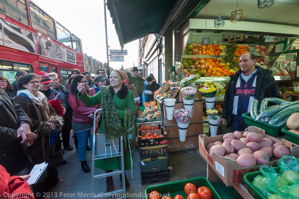
Harlesden, Willesden, Mary Seacole & a Wassail: Sunday 2nd February 2014, ten years ago today was a pleasant winter day, not too cold and with some sunshine and light clouds, perfect for panoramas, so I went early to have a walk around the area before going on to photograph the wassail in Willesden Green.
Harlesden, Willesden & Mary Seacole
It was long ago on one of the dirtiest trains imaginable, windows think with dust so I could hardly see outside that I first came to Willesden Junction Station from Richmond on the North London Line which ran to the City and Broad Street Station. Upgraded to run to North Woolwich in the 80s with new rolling stock the line became a key way for me to travel to photograph around north London. Nowadays the line is part of London’s Overground, since 2016 run by Arriva Rail London, a part of Deutsche Bahn and rather cleaner, with trains running to Stratford.
Willesden Junction, which links with the Bakerloo line and another Overground service from Euston to Watford Junction is not in Willesden but in Harlesden and has platforms at two levels, and also has mainline trains rushing past without stopping. Apparently, according to Wikipedia, in earlier years it was was nicknamed “Bewildering Junction” or “The Wilderness” because it contained such a maze of entrances, passages and platforms and it is still rather like that.
If you can find it, a footpath leads over the mainline tracks next to the line from Richmond and Clapham Junction through an industrial wasteland and eventually to Hythe Road. Google Maps even dignifies it with a name, Salter Street Alleyway. Turning left at into Hythe Road takes you to Scrubs Lane, but going right can take you to the Grand Union Canal, with a bridge leading across to the tow path. I did both.
The blue sky with clouds was perfect weather for panoramas, and I took a number going back and forth a little in the area, across the Scrubs Lane bridge and back. At the corner of this bridge is a memorial garden to Mary Seacole (1805-81) who nursed many British soldiers in the Crimean War as well as working in her native Jamaica and Panama and Cuba, funding her medical work from the proceeds of her general store and boarding house in Jamaica. The garden, on the canal bank next to Mitre bridge, on Scrubs Lane, not far from where she was buried in St Mary’s Catholic cemetery, Kensal Green, was begun in 2003, shortly before the 2005 bi-centenary celebration of her birth.
The garden, now rather overshadowed by a new development, was a pleasant place to sit in the sun and eat my sandwiches before making my way to Willesden Green for the Wassail. Pictures from the walk start here on My London Diary and include more panoramas as well as other pictures.
Willesden Wassail – Willesden Green
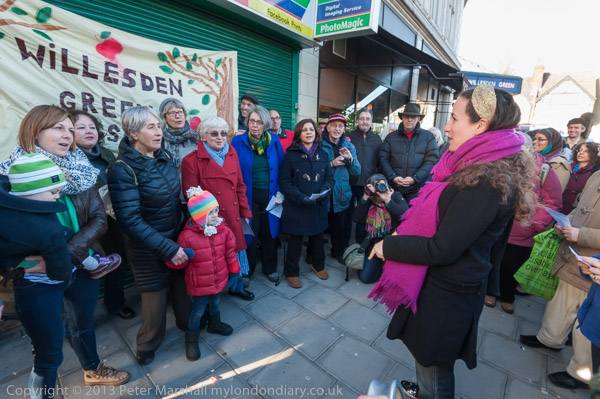
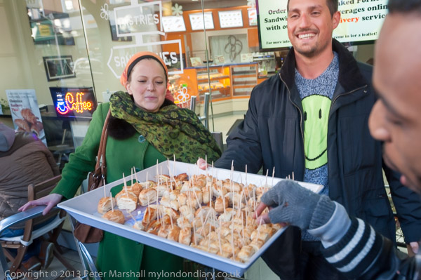
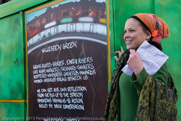
This was the fifth Urban Wassail in Willesden High Street organised by Rachel Rose Reid to celebrate local shopkeepers who give Willesden Green its character and help to create a vibrant community.
The wassail is described as a “small free festival run by and for people from Willesden Green” and also celebrates the work of all who live there and create the neighbourhood and brought together artists and volunteers from the area including James Mcdonald, Berakah Multi Faith Choir, Poetcurious, Errol Mcglashan and several others, with more performing later after the wassail.
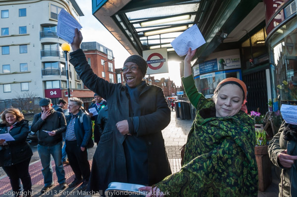
The group met at Willesden Green Station, though unfortunately this was closed for engineering works on the day. Here there was a performance from ParkLife singers, a local community choir run as a not-for-profit co-operatvie and led by Charlotte Eaton, before Rachel Rose Reid introduced us to the first shopkeeper who told us a little abor her shop, Daisychain Florist, with all of the 70 or so people present repeating her words in Occupy ‘mike-check’ style.
Then everyone sang a Wassail Song, borrowed from the Carhampton Wassail, with the shop name in place of its “Old Apple Tree”. You can read this on My London Diary.
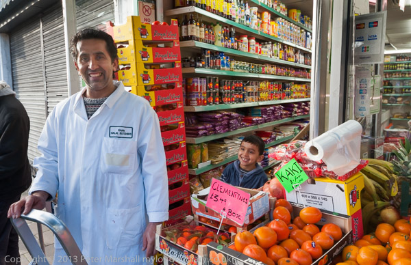
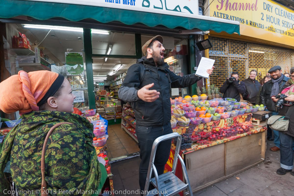
The same pattern was repeated at a number of shops along the High Stret including Hamada supermarket, Khan Halal Butchers, Pound.com, Corner Barber Shop, Red Pig, Fornetti, Mezzoroma and Buy Wise.
There were other stops on the route for poetry and songs, including one in the yard at the front of Sainsbury’s, one of relatively few chains in the area.
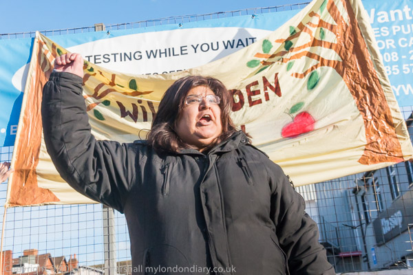
Here we were also told about the campaign to save the Queensbury Pub on Walm Lane from demolition, with a petition of over 4,000 signatures to Brent Council against the demolition of this ‘Asset of Community Value’ and its replacement by a 10 storey block of flats. The pub had been open since 1895 but was bought by developer Fairview New Homes (North London) Ltd in 2012. Brent turned down the development, but the developer, now called Redbourne (Queensbury) Ltd put forward new plans in 2018. Again these were refused by the council but the developer’s appeal succeeded. The pub vlosed in 2022-3 and was demolished in October 2023 to build 48 flats. The development is supposed to include a new pub.
The Wassail ended with a number of poetry performances opposite the Willesden Green Library building site, after which we moved to the neighbouring cherry tree for a final wassail after which everyone let off the party poppers and decorated the tree with ribbons. It was slightly less noisy version of the traditional banging pans and firing guns in order to wake up the apple trees.
The wassailers then moved to the Bar Gallery in Queens Parade on the corner of Walm Lane, where refreshments were available and there were to be more performances. I went along but then realised it was time for me to start my journey home and left.
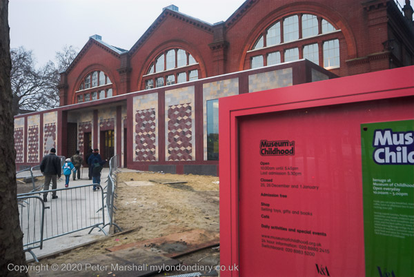
A Murky Solstice in Bethnal Green – Quite a few years earlier I’d photographed some of the panels on the south side of the Museum of Childhood next to Museum Gardens on Cambridge Heath Road.
The Grade II listed iron-framed building was originally part of the extensive museum complex in South Kensington built in South Kensington in 1856-7, but was taken down in 1865-7 when the V&A building there was extended and reassembled in Bethnal Green where it opened as Bethnal Green Museum in 1872.
Since then it has gone through a number of identities as a museum, housing agricultural products and works of art, then an art museum with a growing children’s collection, and in 1974 it became the Museum of Childhood. Renovated and extended in 2005-6 it work on this was just finishing though it had reopend when I took these pictures. It closed again in 2019 to be transformed into ‘Young V&A’.
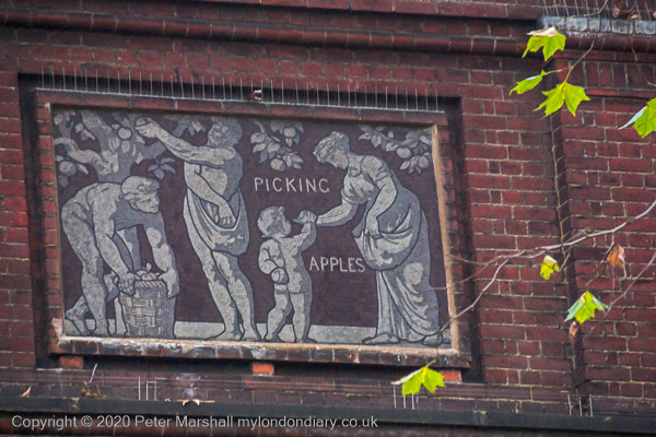
My interest was in the mosaic panel in each bay facing the park illustrating agriculture and the arts and sciences which had been designed by F.W. Moody, the Instructor in Decorative Art at the National Art Training School and responsible for much decoration at the V&A and elsewhere in South Kensington and assembled by his female students in the South Kensington Museum mosaic class.
I’d been asked to supply a picture of these mosaics to be used in the book ‘The Romance of Bethnal Green’ by Cathy Ross, ISBN 978-1-901992-74-8 along with some of my other pictures I’d taken on film in the 1980s and 90s, but I wasn’t happy with the quality of the film image.
So after lunch on Thursday 21st December 2006 I set out for Bethnal Green to make a replacement digital image using my Nikon D200. But I hadn’t really worked out how long it would take me to get there across London and that the sunset was at 15.53. Nor that it was a rather dull day with some slight fog in the city. By the time I was on site it was decidedly gloomy.
But there was enough light for me to made a decent job of it with the digital camera, taking the colour images in this post (and more) which I later converted to black and white for publication. And after taking these pictures I took a walk up Cambridge Heath Road to the Regents Canal and made a few more pictures around there before
Here’s the paragraph I wrote at the time:
Thursday was a cold dark day, the mercury hanging on zero and grey in the air, a fog which never quite cleared. I needed just one more picture for the project on Bethnal Green and emerged from the Underground half an bour before the shortest day of the year officially turned to night. Having done what I had to do, I kept walking as it got darker still, and more lights came on.
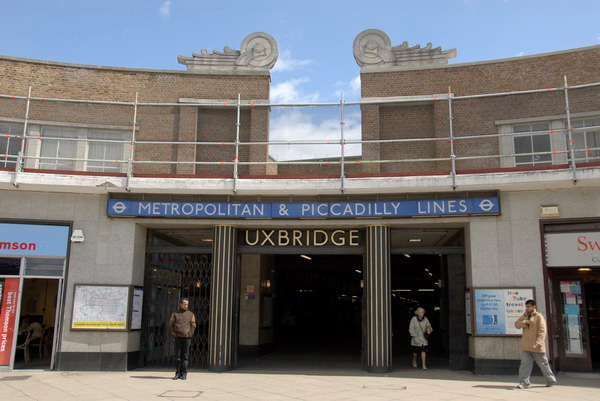
London Loop – Uxbridge to Moor Park: Monday May 29th 2006 was the Late May Bank Holiday for that year, the day which replaced the Whit Monday Bank holiday in 1968, though at first for a trial 5 year period, only becoming a final replacement in 1971. Unlike Whitsun it came in a regular place, saving us having to do esoteric calculations to find the date o0f Easter, and then add on 50 days for Pentecost. This year, 2023, the Late May Bank Holiday actually falls on Whit Monday, but that isn’t usual. Though some people still call it Whit when it isn’t.
We had decided to go on a walk on the bank holiday, and we had been following the various stages of the London Loop, a kind of walkers M25 around the outskirts of London. The section we had reached began at Uxbridge and ended at Moor Park.
Although the M25 has made journeys around London much easier for those in cars, there is no equivalent for public transport. I live only 8 miles as the crow flies from Uxbridge station it took us a train, two buses and well over an hour to get there.
From then on it was fairly plain sailing, or rather walking, though much of the first half of our route was on the towpath of the Grand Union Canal. We covered section 12 which ends in Harefield and section 13 which goes on to Moor Park. The two add up to around nine and a half miles, with another mile or to the station at each end. The two links give maps and details and also short notes on points of interest in the walks, so I don’t need to add to them.
We didn’t have these pdfs, but a copy of the book about the whole loop published five years earlier. Perhaps some things had changed but I think the directions given were at times in any case rather too vague to be useful. However the small reproductions of the OS Maps it contains soon let us work out the correct path. Nowadays of course you can get the maps and route guides on your phone, which can also tell you exactly where you are. Unless like me a few years ago when you get lost in a dense forest where there is no GPS (and no phone signal.)
On My London Diary right at the bottom of the May 2006 page there is a short text about the day which includes “most of it was pretty boring, far too much green. The book giving the route is pretty hopeless in places too, which is perhaps why there were parts of it that very few people seem to have found, with badly overgrown paths” and also points out that back in 2006, the London Loop was still “an almost unsigned footpath route“. I think the waymarks are now much improved.
The piece concludes with what should have been a link to the pictures simply reading “coming shortly” though there is a previously unlinked page with a set of them. The next page and the rest of the pictures are still missing. But probably I had decided the 25 that are there are enough to give a good impression for the walk.. I’ve uploaded just one extra to go with this post.
Mostly I’ve photographed London over the past 50 or so years, with just a few earlier pictures that I think I have lost, including the first film I ever had processed, of ancient oak trees in Richmond Park back in 1962. It cost me 17s 6d to get it processed and it was years before I could afford to do more. I think all of the pictures are now lost. But I have also photographed elsewhere, particularly in Hull and Paris, and also on a number of holidays, some where I’ve perhaps taken photography more seriously than others. But I’ve always had a camera with me.
A few of those holidays have been cycling holidays, including a ride up the Loire valley and a couple of others in northern France. France is a better place to cycle than the UK for various reasons. It still has mile after mile of largely empty rural roads and French drivers have a much more positive attitude towards cyclists. More of them are cyclists themselves or have been.
One such holiday was in late August 1993, when I went with my wife and two sons, aged 14 and 17 to northern France. Our rides were fairly leisurely with not the slightest whiff of Lycra and frequent stops for me to repair the punctures of the others or carry out other running repairs. My own bike, a 1956 Cinelli bought secondhand for me by my eldest borther for my 13th birthday performed without any such problems. I’ve recently scanned and put the pictures from our holiday into a Flickr album.
Two things made that difficult. One was the poor trade processing of the colour negative film I used, with one film having two large gouges across most frames along with some other damage which required extensive digital retouching. I tried out Photshops new AI filter which removed them perfectly – but also took out some other parts of the image, so I went back to doing the job manually.
But what took as much or rather more time was trying to identify the locations for many of the images. I’ve done my best, but some are still rather vague and others may be wrong. I’m hoping that some viewers on Flickr will help and tell me more. If you know the area around Calais, Ardres, St Omer, Arques and Cassel please do take a look. The pictures are rather mixed up in order, and I was using two cameras, both with colour negative film, for reasons I can not now understand.
On 23 August 1993 we made an early morning start on a train to Clapham Junction and rode from there to Victoria. The train to Dover and the crossing to Calais for the four of us cost £42 for a fivee-day return ticket and our bikes travelled free. We arrived in mid-afternoon and an easy ride took us to the hotel we had booked in Ardres.
The following day was a more difficult ride, and we had a nasty few minutes when Joseph’s chain came off and jammed between sprockets and hub far from any town or village, close to the high speed line then being built for Eurostar, work on which had involved us in a number of detours, and for years I’d look out of the window a few minutes after we came out of the tunnel and recognise the short uphill stretch were it happened.
Eventually after much sweating I managed to free it and we could proceed. For some reason we had decided to visit the Blockhaus d’Eperlecques, built in 1943 as a base to launch V2 rockets at Britain, but destroyed by bombing and now a French National Monument with some very large holes in its concrete roof.
Our route to it involved a rather large hill but we were able to rest a bit and look around the site before continuing on our journey to St Omer. Here we found another slight problem with our French map, which showed what looked like a nice quiet route on to Arques. It turned out to be an abandoned railway track, complete with sleepers and impossible to ride. After struggling for a while we turned back and took the N42 instead and soon reached Arques.
At Arques we were just in time for the last guided tour of the day of the 1888 boat lift, L’Ascenseur à Bateaux des Fontinettes, modelled on the Anderton lift in Cheshire, replacing 5 locks and taking 22 minutes to transfer boats up and down by 13.13 metres – 43 ft. It was closed in 1967 as traffic had grown considerably and replaced by a single modern lock.
At Arques we had booked a three night stay at ‘A la Grande Ste-Catherine’ . Including breakfasts for us all and a couple of dinners for the two of us (our two sons wouldn’t eat proper French food) this cost 1832 Francs, then a little over £200. They ate frites and burgers from a street stall, though one night we did all manage to find food for all of us at a supermarket restaurant.
The next day we returned to look around St Omer, and then rode to Tilques, abandoning saddles for a boat trip around le Marais Audomarois, one of the more interesting parts of our visit.
And for our last full day in France we took a ride to Cassel, a town on a hill that rises to the highest point on the Plain of Flanders, surrounded by flat lands in all directions, taking an indirect route via the Forêt Domaniale de Rihoult (Clairmarais), rather disappointing as it was full of noisy schoolkids from their colonies de vacances.
It was a struggle up the hill to Cassel, and we were glad to rest for a while at the cafe inside the grim fortress of a Flemish language radio station – former a casino and I think the local Gestapo headquarters. Our ride back to Arques was by the direct route and began with a long downhill stretch where no pedalling was needed for a very long way.
Finally came our last day, and I planned an easy route back to Calais, mainly beside canals. But the others objected and demanded a visit to the Eurotunnel exhibition on the way, which held us up considerably, not least because most of the roads had been diverted to build the high speed line and our map was fairly useless. We finally managed to catch the 19.15 ferry, a few hours before our ticket expired.
Six years ago on New Year’s Eve we walked with a couple of family members from Sudbury to Brentford. This year because of rail and health problems none of our family are staying with us and “South Western Railway services between 18 December and 8 January are subject to change and may not operate”, so if the weather is fine we will probably do a rather shorter walk from home.
The trip in 2016 to Sudbury Hill station was reasonably fast; a short train journey then a bus and a couple of short hops on the Piccadilly line got us there in a little under an hour and a half, and within a few minutes we were walking along suburban streets to Horsenden Wood, where we walked to the top of the hill.
Unfortunately it was a dull and damp day, and we could only see the extensive views this part of the walk would have given us had the air been clear dully through the murk, but the path up through the wood was enhanced by the slight mist. We walked down the hill to cross the Grand Union Canal.
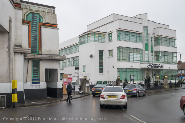
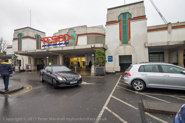
Soon we reached the highpoint of the walk for some of us, the 1930s trading estate leading to the Art Deco Tesco on Western Avenue, designed by Wallis, Gilbert and Partners and built in 1933 for Hoover, along with the 1930s moderne canteen, now an Asian restaurant. We chose the Tesco both for a tiny bit of shopping and the toilets, then walked west to the footbridge to cross the busy road.
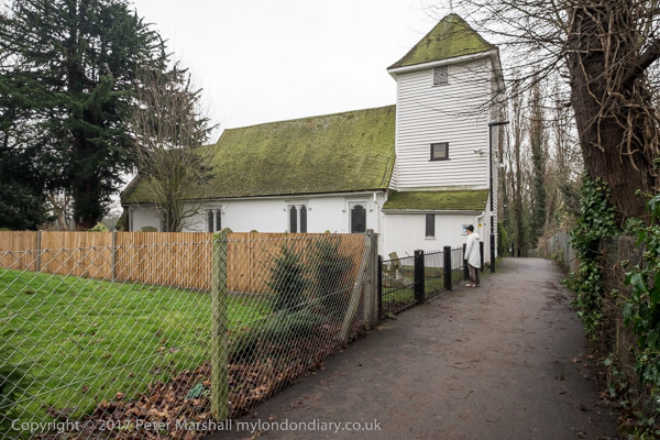
Almost immediately on the path the other side of Western Avenue we came to St Mary the Virgin Perivale, now used for concerts, with just an occasional service.
This Grade I listed redundant church dates in part from the 13th century and was the smallest church in Middlesex (outside London.) We explored its graveyard and sat down on a rather damp seat there to eat our sandwiches in what was either heavy drizzle or light rain.
The next section of the walk took us beside the River Brent, another of London’s minor rivers and like the rest of our walk going to Brentford, though we had to make some deviations to follow roads and footpaths. This was a relatively quiet and sometimes boring section of the walk, though its always good to walk beside the river, and there was a rather dumpy viaduct for a doomed railway, a council estate and a long foot path to a Cuckoo Lane where no cuckoos were to be heard except for our ludicrous imitations.
Things got more interesting again when we reached Hanworth Church, and early work of George Gilbert Scott who later called it ‘a mass of horrors’ and Brent Lodge Park, where I ignored the pleas of some of my cfo-walkers and led us firmly away from a tea-room – we were already and hour or so behind schedule if we were to finish the walk during daylight.
Brunel really knew how to build a viaduct, and here was the first major engineering work on the new Great Western Railway in 1836-7, with 8 semi-elliptical arches each of 70 ft span and rising 19 ft supported on hollow brick piers – the first time these were used in a railway viaduct. 886 ft long, the height to the parapet is 81 ft, and when built it was 30 ft wide to carry two broad gauge lines. Later it was widened to 55ft with a third pier added to each existing pair, and it could then take four standard gauge tracks, which were laid in 1892. We walked under this impressive structure beside the River Brent to the south side which is the earlier part and carries the arms of Lord Wharncliffe, chair of the committee that gave permission for the GWR.
We continued by the Brent to join the Grand Union Canal, another earlier great engineering acheivement along with the rest of the canal system, at the Hanwell flight of locks. Our route now ran along the towpath, so navigation was simple, all the way to the Great West Road.
There was still just enough light to take a few photographs, but my companions were flagging and our walk was getting slower and slower.
By the time we reached the road for the short walk to Brentford Station it was truly dark and they had slowed to a snails pace, and despite my urging them to catch the next train we arrived there to see it just departing, for once dead on time, though we were an hour and a minute later then planned. It had been a good walk but would have been better without the 29 minutes wait there for the next train.
You can see many more pictures from the walk on My London Diary at New Years Eve Walk.
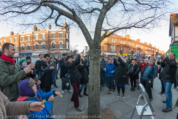
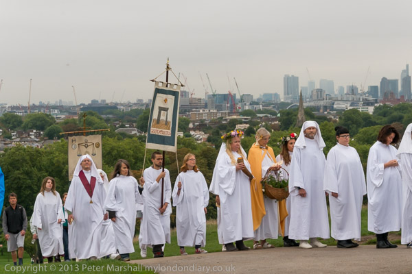
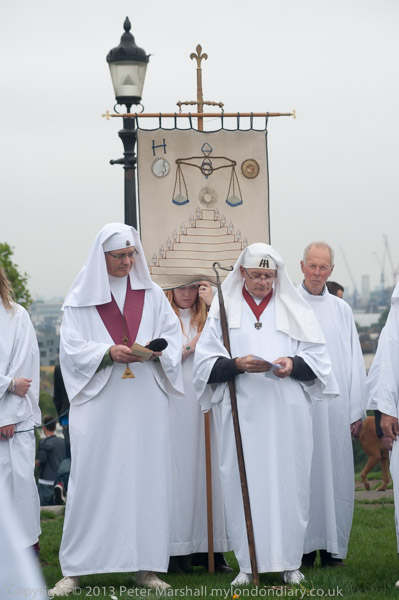
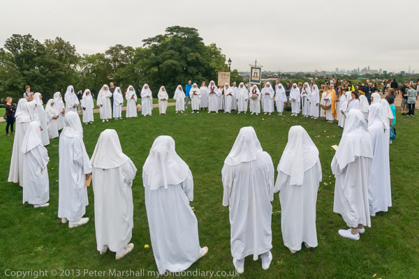
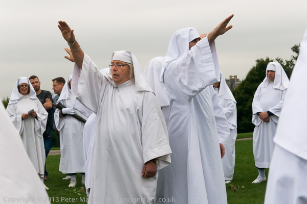
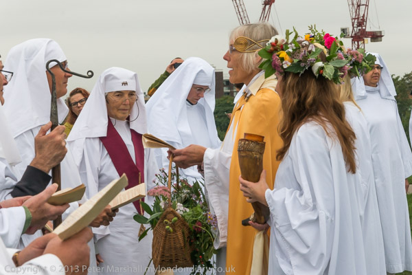
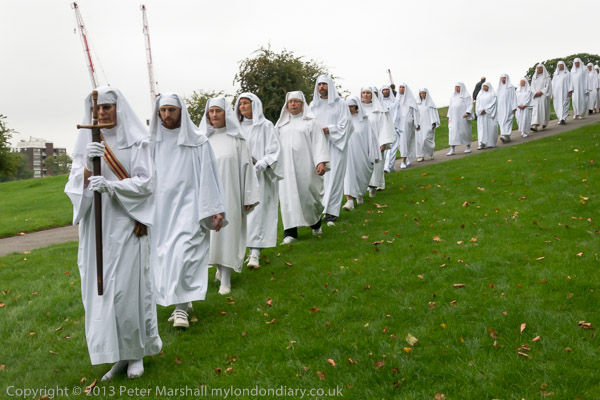
On Sunday 22nd September 2013 Druids carried out their annual Autumn Equinox (Alban Elued) ceremony on Primrose Hill at noon and later in the day women from the radical fundamentalist Islamist organisation Hizb ut-Tahrir Britain marched from Paddington Green in protest against the chemical attacks and massacres of women and children by the Assad regime in Syria. Between the two events I spent some time taking pictures around the Paddington Arm of the Grand Union Canal.
Druids Celebrate Autumn Equinox – Primrose Hill
Every year for a little over 100 years the Druid Order have celebrated the Autumn Equinox on Primrose Hill, a site of historical significance in the history of Druidism and the re-invention of a Druidic tradition. Here on the Autumn Equinox in 1716 John Toland made a call for a meeting of Druids a year and a day later at the Apple Tree Tavern in Covent Garden, and on Midsummer’s day 1792 Iolo Morganwg (1747-1826) held the first meeting of the Gorsedd of the Bards of the Isle of Britain, the precursor of the modern Eisteddfod.
Morganwg was the bardic name of Edward Williams and his work “was a prime force behind the cultural revival that saw the birth of modern Wales” according to the University of Wales Centre for Advanced Welsh and Celtic Studies whose web site describes him as “a profoundly complicated character: a struggling provincial poet in London, a manipulator and victim of the world of literary patronage, a radical, a medievalist, a forger of pasts, an opium eater and a forceful and opinionated critic.”
Most of the Druidic traditions we now have come from forged manuscripts he produced in particular the “Gorsedd Beirdd Ynys Prydain” (“The Gorsedd of Bards of the Isles of Britain”.) It was only in the twentieth century that the extent of his imaginative forgeries became clear. But although his work came almost entirely from his own extremely fertile imagination it had a dramatic effect in creating a new view of the Welsh nation.
The Druid Order made its first recorded appearance at the Summer Solstice at Stonehenge in 2021, though its founder, the remarkable George Watson MacGregor Reid, a trade union and Labour party activist with a great interest in oriental mysticism was probably there 3 years earlier. In 2014 he returned for the Solstice describing himself as a High Priest and “the direct successor of the Chief Druids who have been” and dressed in a very similar manner to that still adopted by The Druid Order.
I’ve photographed the Equinox ceremonies of the Druid Order, Spring at Tower Hill and Autumn on Primrose Hill on several occasions and have been impressed by the solemnity and spirituality of those taking part. Whatever its origins, it is a movement which respects the Earth and is peace loving and free-thinking with the apparent aim of developing themselves through being rather than through intellectual learning.
My account on My London Diary gives quite a detailed description of the event both in pictures and text so I won’t repeat that here.
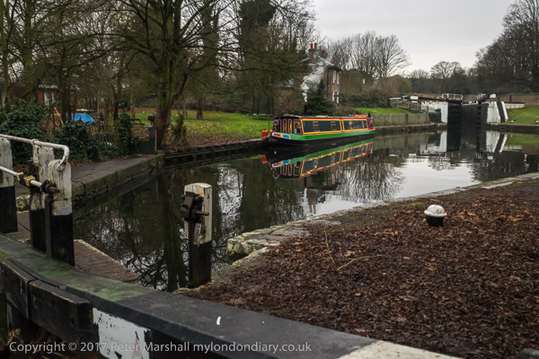
The main line of the Grand Union Canal enters the River Thames at Brentford, from where it was possible for goods to travel along the river to London, but a direct canal route was obviously desirable and only two years after the Act of Parliament for the main route to Brentford was passed a further Act to allow the construction of a canal joining the this to a canal basin at Paddington, then on the western edge of London. This opened in 1801.
Unusually there are no locks on the 22km of the Paddington Arm – and you can travel a total of around 43 lock-free miles along the pound made up by it the Grand Union and Regents canal.
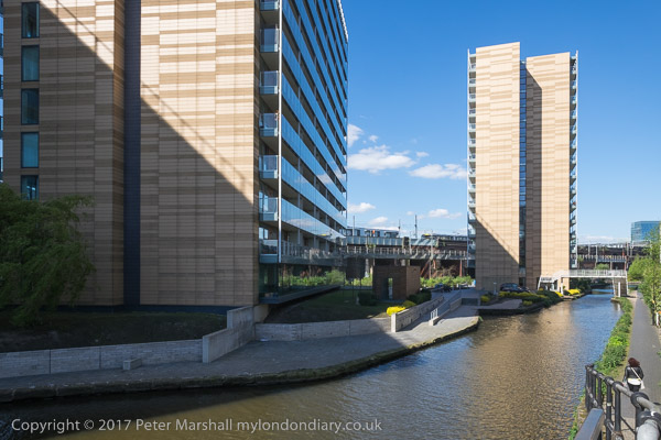
The area around the final length of the Paddington Arm from Little Venice to Paddington Basin has been the site of huge redevelopments in the past thirty or so years. A few older canalside buildings remain. Much of the land and paths open to the public in the area are on private land.
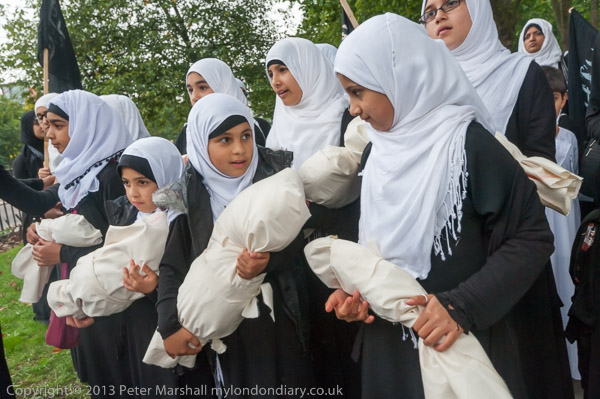
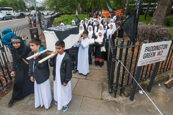
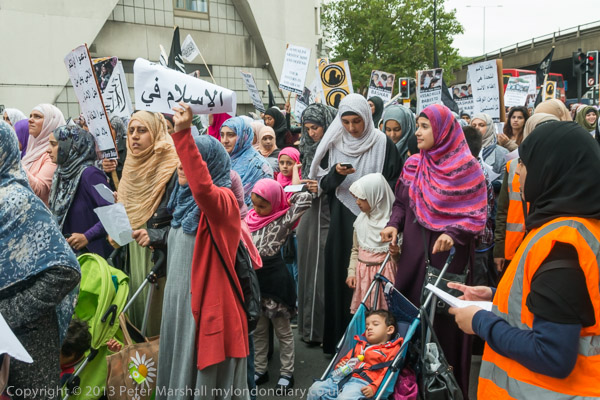
Hizb ut-Tahrir Women March for Syria – Paddington Green
Over a thousand woman gathered on Paddington Green for a march to the Syrian Embassy to show solidarity with women and children in Syria and to condemn the chemical attacks and massacres being carried out by the Assad regime.
Hizb ut-Tahrir oppose Western military intervention in Syria but call for the replacement of the current corrupt rulers in Islamic states by a Khilifah (caliphate), a state that will truly implement Islamic values and end the corruption and oppression of the current states. They call for Muslims to rise up and get rid of corruption, and in particular of “the criminal regime of the butcher Bashar Al Assad” in Syria, and for “Muslim armies to mobilise and replace the rule of the dictator with the rule of Allah.“
At the front of the march children carried a small coffin and other children and women carried bundles representing dead children. There were a few young boys taking part, but I saw few men – just one small group with a banner and a heavy public address system – and the event was clearly led by the women, almost all of whom were wearing headscarves, with very few in niqabs or burqas which covered the whole face.
At most other Hizb ut-Tahrir protests I’ve photographed there have been clearly separate groups of men and women, and I’ve sometimes had problems with male stewards for photographing the women, though not from the women themselves. At this event most seemed keen to be photographed to help get their message across. I left the march which was going to the Syrian Embassy in Belgrave Square at Edgware Road.
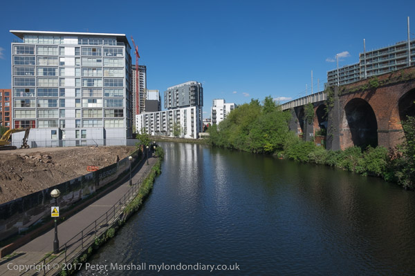
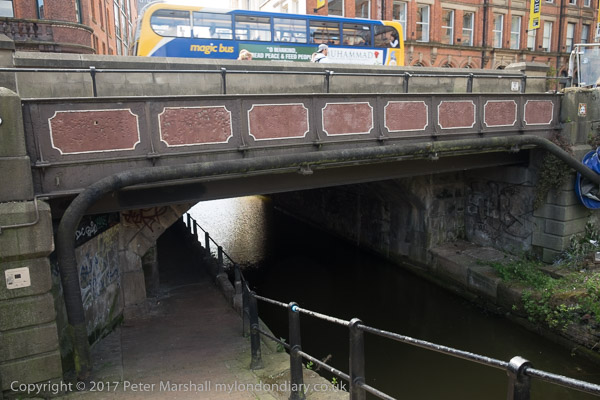
Two canals (Bridgewater and Rochdale) and four railways exemplify Manchester’s contribution to the industrial revolution
Pictures here are from walks in Manchester on Friday 5th May 2017 and the following Sunday while passing through the city. It was a short visit to a city I had hardly returned to for around 45 years.
A magic bus crosses the canal
Although I grew up on the western edge of London, I spent most of the years between when I was eighteen and twenty-five in Manchester, at first studying for a degree at Manchester University and later after a short break returning to work for my doctorate at the Institute of Science and Technology.
My school had recommended Manchester for my university course, and I made my first visit there as a day trip for interviews – a very long day as the journey each way took over five hours. I didn’t see a great deal of the city that day, but I was made two unconditional offers of places and my headmaster when told advised me to stop preparing for Oxbridge entrance exams and accept Manchester, which I did. It was a decision that changed my life in various ways.
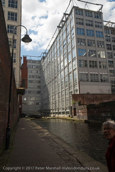
Castlefield
My course was disappointing – long hours in the lab and largely tedious lectures by staff with no training and little idea of how to teach, keen to get back to their researches. Sitting at a bench with a small plaque informing me that ‘Rutherford first split the atom here’ in 1917 was little compensation for a physics lecturer who seemed unable to explain even the simplest of concepts, though fortunately I’d studied enough of the subject at school to get a decent grade – and the same was true of my other subsidiary, Maths where I passed a rather curious end-of-year exam with 108%.
Knott Mill
But my real study was in the University Union and in the city itself, though I did enough work in my final year to get a decent grade – and to turn down offers of employment from big pharma who I found far too interested in profit rather than human good and also from the government’s explosives research lab from where I got a very long handwritten letter from one of the scientists working there about the exciting research they were doing – but I decided I really didn’t want to spend my life making better bombs.
The old canal dock area became a conservation area in 1980 and an Urban Heritage Park in 1982
I did get turned down for one job I would really have liked, working in the labs at Kodak in Harrow. I was really not sufficiently middle-class for them – and not interested enough in photography – I’d had an interest but never really been able to afford to pursue it, and dropping my camera in a lake in 1966 hadn’t helped – it never really worked properly again. I ended up getting a job in a lab ten minutes walk from my old home, but it disappointed in almost every way but the salary – at least 50% more than my father had ever earned. It didn’t last, and six months later I was back in Manchester.
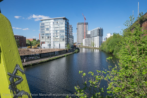
River Irwell
Two years later I got married, not in Manchester but in Hull. We were both students still and had little or no money and spent our honeymoon in Manchester, with a day out on the Derbyshire hills and a day coach trip to the Lake District. We lived for the next two years on the two first-floor rooms of a small terraced house in Rusholme, close to Manchester CIty’s Maine Road ground.
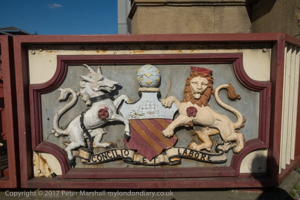
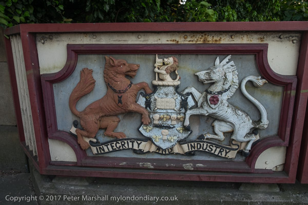
New Quay St Bridge – Salford coat of arms
We moved away for me to do a course in Leicester. I’d taught for a couple of terms before just to the north of Manchester, and tried at the end of the year to get another teaching job in Manchester, but failed, ending up moving to Bracknell, where I was offered housing in a new flat on one of the new estates.
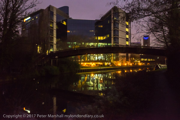
After we moved away from Manchester I think I went back once for a conference there and a weekend in Didsbury in the 1990s but not really again until 2017. We were on our way to a weekend conference a few miles to the north, and took an early train to have a few hours to look around the city. Our train came into Piccadilly, and we took a walk along the Rochdale canal and the Bridgewater canal before walking back close to the River Irwell to the city centre to catch our bus.
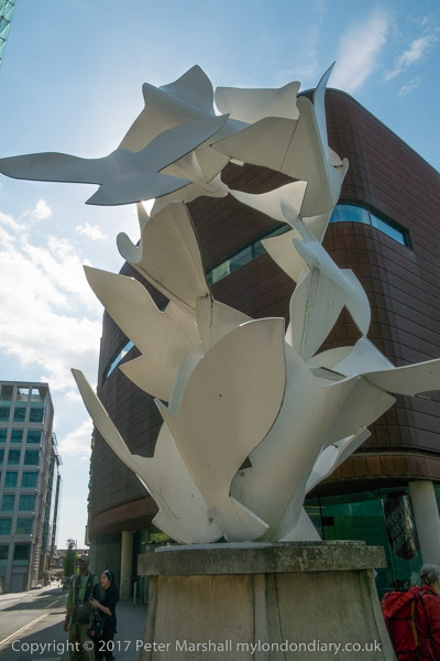
Doves of Peace sculpture by Michael Lyons, Manchester Civil Justice Centre
Back in 1970, the canals were still largely working areas, or mainly disused but still largely closed to the public; you could walk along some towpaths, but they were rather lonely and forbidding places. Now things are very different.
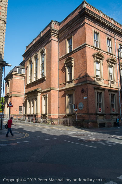
Mechanics Institute – where the TUC, CIS and UMIST began
We had time for a shorter walk on our way home, but mainly spent that in the People’s History Museum. The following year, 2018 we made a similar journey, but with less time for a walk, and then came back to stay for several days at the start of August as a part of a couple of weeks in various places celebrating our 50th wedding anniversary – including a celebration with family and friends in Hull.