Rainham and Hornchurch – 2006

Rainham and Hornchurch: On Thursday 11th May 2006 I put my Brompton folding bike on the train for the journey across London to Rainham Station. The journey, around 31 miles in a straight line, though rather longer on the ground, took me almost two hours on three trains, one Underground. As usual I took a book to read and relaxed on the journey.

Rainham and Hornchurch - 2006
Containers on Rainham Marshes

Rainham is in Havering, part of Greater London and is the last station out to the east on the C2C rail service where the Travelcard I used covered. I did several rides and walks from here into Essex over the years, but I on this one stayed inside Greater London.

Rainham and Hornchurch - 2006
Mural of previous industry in the area and Tilda Rice works

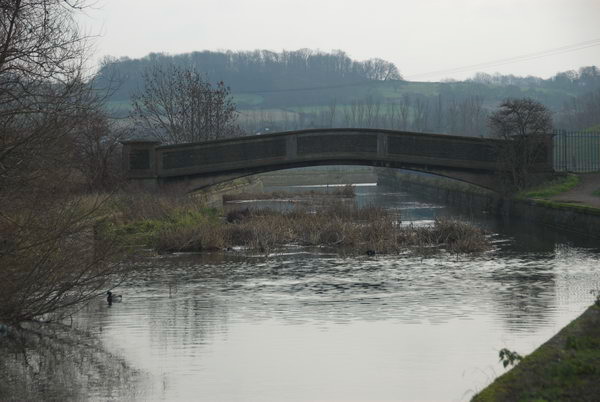
The first part of this bike ride followed the route of the London Loop path around the outskirts of London, which at that date came to a dead and desolate end at Coldharbour Point. The path now continues to end in Purfleet, and if you have the stamina you can continue walking on a riverside path which ends at Tilbury Docks before having to retrace your steps to Grays.

Rainham and Hornchurch - 2006
Derelict concrete barges in the Thames built for the Mulberry Harbour used for the D-Day landings

I didn’t write much about the ride back in 2006, and I didn’t ride very far. After returning from the end of the path I had a short ride west along the A13, which I don’t recommended as it is certainly not cycle friendly with much fast-moving traffic. The Mardyke Estate, where I went after that is now called ‘Orchard Village’ which at least avoids confusion with the Mardyke, a small river a few miles to the east. I continued roughly north through South Hornchurch, finally ending my ride at the District Line station of Elm Park.

Rainham and Hornchurch - 2006

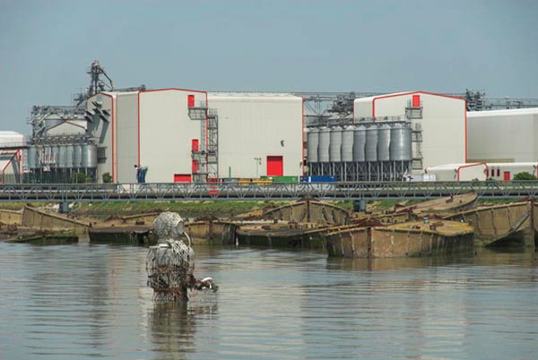
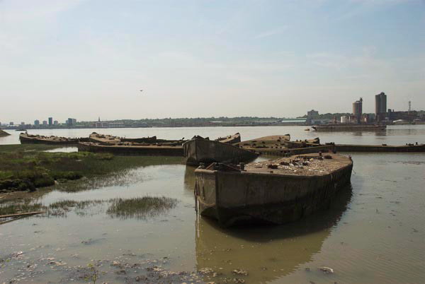
The sculpture in the river facing the barges and the Tilda Rice plant is Diver: Regeneration by local sculptor John Kaufman, who died in 2002, not long after it was placed here in the mud in 2000. Some of the funding for it came from the landfill company which carried waste here to raise parts of the marshes above sea level.

Waste Transfer Jetty – Landfill is raising much of the below sea-level marshes

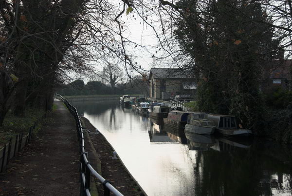
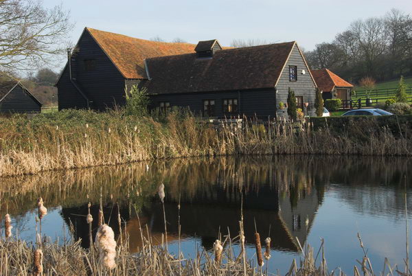
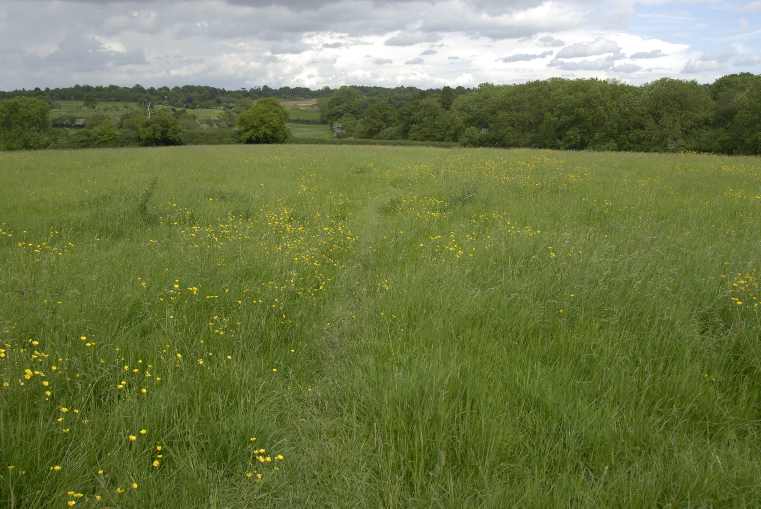
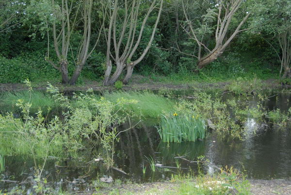
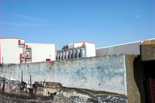
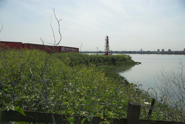
My pictures don’t reflect the nature of the area which has large areas of open with marshes and country parks and two rivers flowing through it, the Beam River and the Ingrebourne which flows into the Thames at Rainham Creek. I think it is also an area which has seen considerable regeneration since 2006 in the London Riverside area of Thames Gateway redevelopment.

Coldharbour Point and the barbed wire where the London Loop then ended

Here’s my account with the usual minor corrections from 2006:

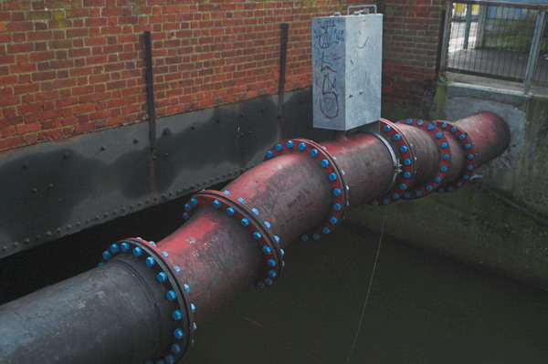
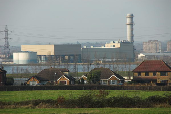
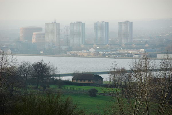
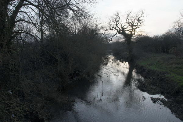
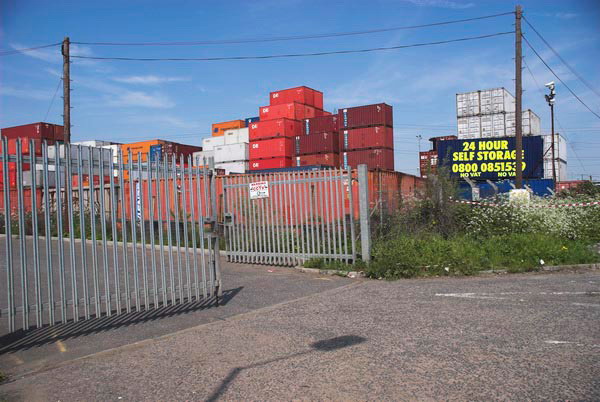
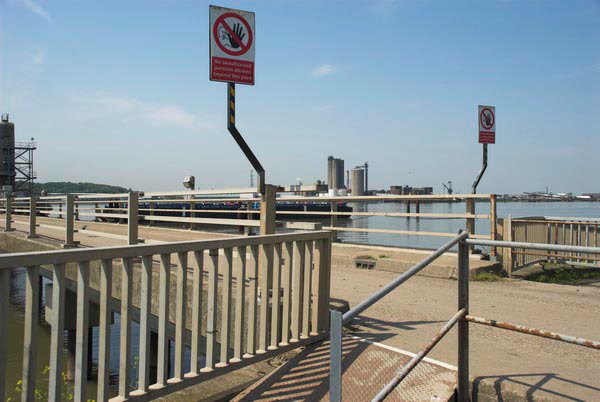
Rainham is at the eastern edge of London, an area of marsh, industry, warehouses, container stacks, dereliction and landfill on the Essex (north) bank of the Thames, cut across by the elevated A13 trunk road which sweeps across the creek and on over the marshes to Purfleet, alongside the new Channel Tunnel Rail Link.

Rainham Creek from the A13

One day the Thames Path will continue past Coldharbour Point, but for the moment it’s a dead end. I eat my sandwiches and then turn back, making my way up onto the elevated roadway, but the views are disappointing.

Mardyke Estate, South Hornchurch

At the next roundabout west I take a look around, leave the main road and then head north, past disused areas of the Ford Dagenham site and up through the Mardyke Estate and South Hornchurch.

At Elm Park the heat of our first hot day if the year – 25 Celsius in the shade, but I’ve been constantly in sun – gets to me and I give up and take the Underground towards home.

One of many houses decorated for the Cup Final. Unfortunately West Ham lost to Liverpool

The heat has buckled some of the rails and the District Line train has to crawl along, more or less at my cycling speed, but at least I can just sit and rest.

There are more pictures from the ride here.


FlickrFacebookMy London DiaryHull PhotosLea ValleyParis
London’s Industrial HeritageLondon Photos

All photographs on this page are copyright © Peter Marshall.
Contact me to buy prints or licence to reproduce.


London Loop – Enfield Lock to Chigwell

London Loop – Enfield Lock to Chigwell – If you want a good walk on the outskirts of London to walk off a little of the excesses of Christmas I can recommend this section of the London Loop. In the book guide we – myself my wife and my elder son – used on 28th December 2006 it was section 13, but now appears to be split into two parts as Sections 18 and 19. You can download excellent walk guides from Inner London Ramblers. Bits can be muddy so you need walking boots.

London Loop - Enfield Lock to Chigwell

It’s not a particularly long walk and starts and ends at stations. Photographers always add a little by wandering around a bit and running up slopes to get a better view. But back in 2006 a little under 9 miles was fine for me, though now I might prefer to split it into the two sections.

London Loop - Enfield Lock to Chigwell

The rail journey to Enfield Lock takes around an hour and a half for us, changing from the Victoria Line to Greater Anglia at Tottenham Hale, and coming home from Chigwell which is on the Central Line just a little longer. The walk itself at a moderate pace with a stop to eat our sandwiches a little over 4 hours, and in December to finish in daylight means starting walking around noon, though we made it a little earlier and arrived at Enfield Lock just after 11am.

London Loop - Enfield Lock to Chigwell

My first picture online came not long after, although the rather decorative length of piping in the top picture may not appeal to all. I think it was over the Turkey Brook, though I can’t exactly remember the location. But soon we were walking past the 1907 Lee Conservancy Offices at Enfield Lock and then a short distance beside the Lea Navigation.

London Loop - Enfield Lock to Chigwell

Then we crossed the navigation taking the footpath to Sewardstone walking to the north of King George’s Reservoir and following one of the branches of the River Lea and then crossing another wide flood relief channel and then coming to something that looks rather more like a proper river.

The route from here is uphill for some way. Somewhere we passed two horses heads and and on the Sewardstone Road a nursing home.

A few yards along the busy road (its the A12) we left and continued uphill, pausing at times to admire the view across the Lea Valley.

Here we got another view of the rather mysterious structure that had loomed above the Lea Navigation which is Enfield Power Station, built in 1997-9, a gas-fired power station built partly on the site of the decommissioned Brimsdown Power Station.

A little further on there were more views, across the reservoirs to Ponders End. But soon we came to more rural scenes including the pond and houses of Carrolls Farm.

The next section of the walk involved a lot of woods and is part of Epping Forest and also includes the Scout camp at Gilwell. The IL Ramblers notes recommend an alternative route which gives better views, but we only had the book and I made few pictures on this section – none of which are on the web.

We stopped to eat our sandwiches beside Queen Elizabeth’s Hunting Lodge on Chingford Plain where we also bought crisps and soft drinks to go with them, and sat around rather too long before taking a look at the building and then continuing.

Here we got a little lost in Epping Forest as the directions in the book were perhaps rather less clear than those online, so I think our route was just a little different to that intended. We found the Butler’s Lodge, but despite the promise in the book it was not serving tea.

There were some views on our way, but the suburbs here are not really picturesque. I think the river in the picture below is the Roding rather than the Ching which was more of a small ditch where we crossed it.

Parts of the route led along roads and perhaps the best that can be said for them are that they were downhill – and by this time I was getting tired. Eventually we came to the station and sat down and waited for a train.

There are a few more pictures as well as those above on My London Diary.


FlickrFacebookMy London DiaryHull PhotosLea ValleyParis
London’s Industrial HeritageLondon Photos

All photographs on this page are copyright © Peter Marshall.
Contact me to buy prints or licence to reproduce.


London Loop – Uxbridge to Moor Park

London Loop - Uxbridge to Moor Park
Spot the path

London Loop – Uxbridge to Moor Park: Monday May 29th 2006 was the Late May Bank Holiday for that year, the day which replaced the Whit Monday Bank holiday in 1968, though at first for a trial 5 year period, only becoming a final replacement in 1971. Unlike Whitsun it came in a regular place, saving us having to do esoteric calculations to find the date o0f Easter, and then add on 50 days for Pentecost. This year, 2023, the Late May Bank Holiday actually falls on Whit Monday, but that isn’t usual. Though some people still call it Whit when it isn’t.

London Loop - Uxbridge to Moor Park

We had decided to go on a walk on the bank holiday, and we had been following the various stages of the London Loop, a kind of walkers M25 around the outskirts of London. The section we had reached began at Uxbridge and ended at Moor Park.

London Loop - Uxbridge to Moor Park

Although the M25 has made journeys around London much easier for those in cars, there is no equivalent for public transport. I live only 8 miles as the crow flies from Uxbridge station it took us a train, two buses and well over an hour to get there.

London Loop - Uxbridge to Moor Park

From then on it was fairly plain sailing, or rather walking, though much of the first half of our route was on the towpath of the Grand Union Canal. We covered section 12 which ends in Harefield and section 13 which goes on to Moor Park. The two add up to around nine and a half miles, with another mile or to the station at each end. The two links give maps and details and also short notes on points of interest in the walks, so I don’t need to add to them.

We didn’t have these pdfs, but a copy of the book about the whole loop published five years earlier. Perhaps some things had changed but I think the directions given were at times in any case rather too vague to be useful. However the small reproductions of the OS Maps it contains soon let us work out the correct path. Nowadays of course you can get the maps and route guides on your phone, which can also tell you exactly where you are. Unless like me a few years ago when you get lost in a dense forest where there is no GPS (and no phone signal.)

On My London Diary right at the bottom of the May 2006 page there is a short text about the day which includes “most of it was pretty boring, far too much green. The book giving the route is pretty hopeless in places too, which is perhaps why there were parts of it that very few people seem to have found, with badly overgrown paths” and also points out that back in 2006, the London Loop was still “an almost unsigned footpath route“. I think the waymarks are now much improved.

The piece concludes with what should have been a link to the pictures simply reading “coming shortly” though there is a previously unlinked page with a set of them. The next page and the rest of the pictures are still missing. But probably I had decided the 25 that are there are enough to give a good impression for the walk.. I’ve uploaded just one extra to go with this post.