Posts Tagged ‘Thames Gateway’

Thames Gateway – Essex 2007

Saturday, May 24th, 2025

Thames Gateway – Essex: I didn’t write much about my bike ride in south Essex on 24th May 2007, though the pictures on My London Diary tell the story of my route. I began at Rainham on the edge of Greater London in the London Borough of Havering.

It wasn’t a linear ride but one where I went back and forth rather extensively exploring some of the areas.

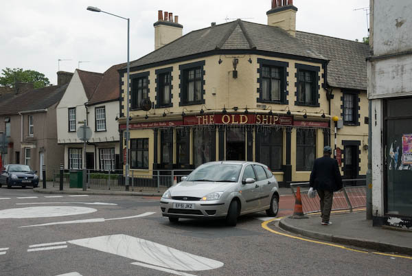
Next came the village of Aveley, where the Old Ship has a pub interior “of Outstanding National Importance” but I didn’t go inside.

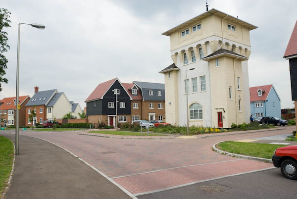
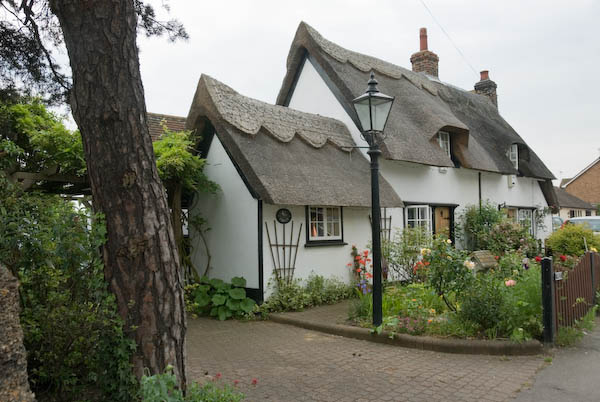
I photographed the Mar Dyke at North Stifford along with a number of houses, some thatched and cycled around the Stifford Green estate on site of Stepney Boys Home built around ‘The Tower’. This had been an approved school and then a community home until it closed in 1994.

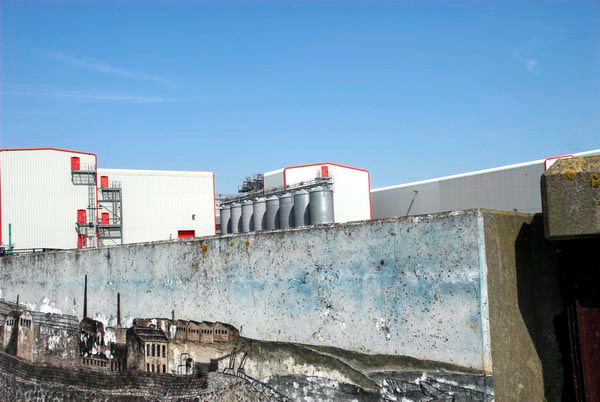
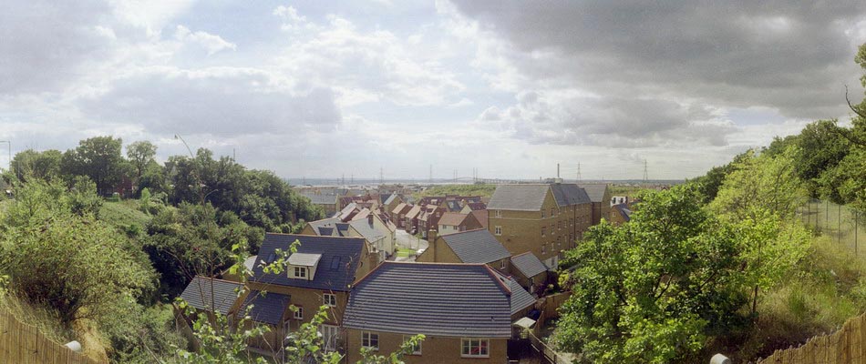
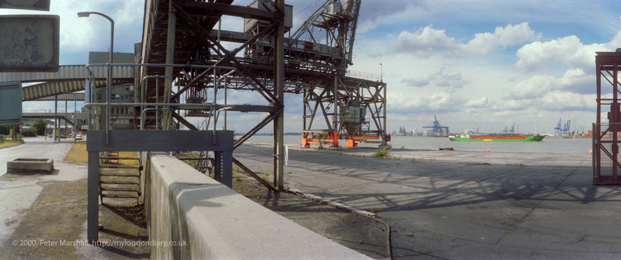
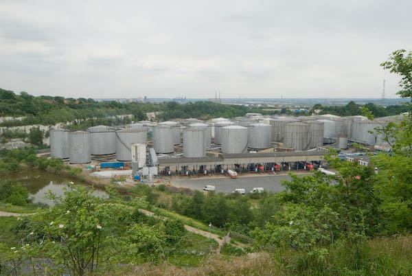
Next came Chafford Hundred, an area where chalk was extensively quarried from 1874 until the last quarry closeed in 1976. In 1986 a proposal by Blue Circle Industries, West Thurrock Estates and Tunnel Holdings to build 5,000 homes on derelict land was approved and the first were completed in 1989.

Parts of the area were still in industrial use in 2007 and there is a nature park with extensive lakes and ditches.

Lion Gorge, Chafford Hundred

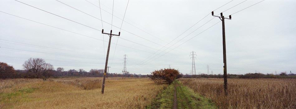
From there I cycled a little deeper into Grays before going to Orsett Fen and Orsett and Horndon on the Hill which has a rather fine old pub I also didn’t go inside. Cycling and beer really don’t mix well with modern traffic.

There are more impressive ancient buildings, a reminder of the wealth that once came from the wool trade.

I made my way via Bulphan towards Upminster where I could use my railcard to start my journey home.


Here is the short text I wrote back in 2007 – with the usual corrections. The cost of the ticket I bought then is now £15.30 – an increase of around 9% above inflation – another of the costs of privatisation.

Thursday I bought an expensive ticket – just up from £6.60 to £7.90 – for a one-day railcard for Greater London from Staines, and put my folding bike aboard the train, changing to reach Rainham, Essex, (L B Havering) on the furthest edge of London from where I live.

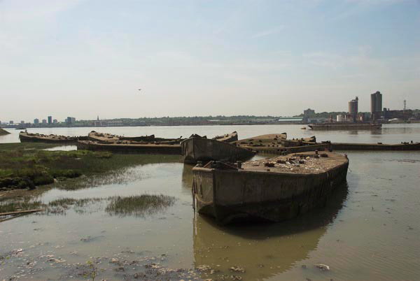
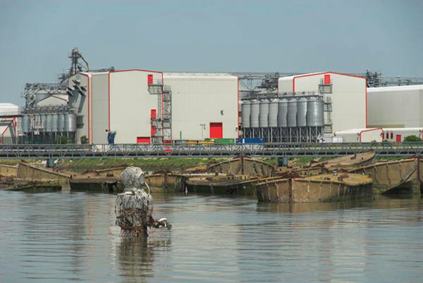
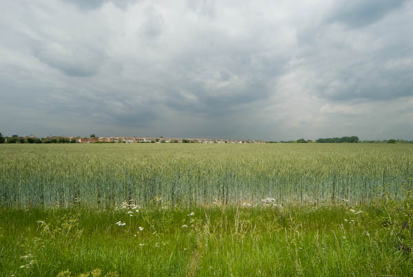
Don’t let anyone tell you Essex is flat. O boring. Over a few hundred yards you can move from idyllic thatched cottages to post-industrial dereliction; from dramatic man-made scenery with lakes and chalk gorges to densely packed modern housing estates. From farms owned by city millionaires to council tower blocks.

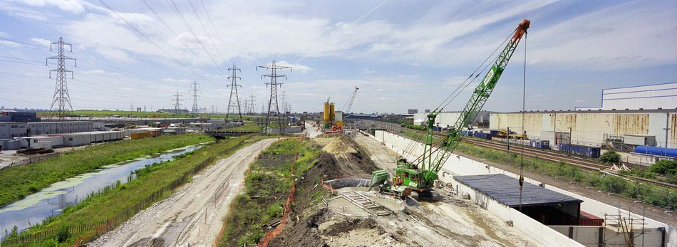
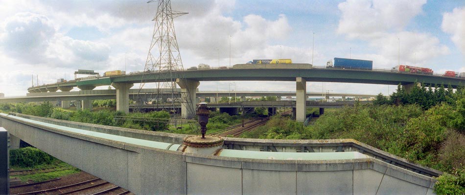
Most of my winding route took me through Thurrock, one of the major growth sites of the Thames Gateway area.

There are many more images from this ride on My London Diary, beginning here.


FlickrFacebookMy London DiaryHull PhotosLea ValleyParis
London’s Industrial HeritageLondon Photos

All photographs on this page are copyright © Peter Marshall.
Contact me to buy prints or licence to reproduce.


Rainham and Hornchurch – 2006

Sunday, May 11th, 2025

Rainham and Hornchurch: On Thursday 11th May 2006 I put my Brompton folding bike on the train for the journey across London to Rainham Station. The journey, around 31 miles in a straight line, though rather longer on the ground, took me almost two hours on three trains, one Underground. As usual I took a book to read and relaxed on the journey.

Rainham and Hornchurch - 2006
Containers on Rainham Marshes

Rainham is in Havering, part of Greater London and is the last station out to the east on the C2C rail service where the Travelcard I used covered. I did several rides and walks from here into Essex over the years, but I on this one stayed inside Greater London.

Rainham and Hornchurch - 2006
Mural of previous industry in the area and Tilda Rice works

The first part of this bike ride followed the route of the London Loop path around the outskirts of London, which at that date came to a dead and desolate end at Coldharbour Point. The path now continues to end in Purfleet, and if you have the stamina you can continue walking on a riverside path which ends at Tilbury Docks before having to retrace your steps to Grays.

Rainham and Hornchurch - 2006
Derelict concrete barges in the Thames built for the Mulberry Harbour used for the D-Day landings

I didn’t write much about the ride back in 2006, and I didn’t ride very far. After returning from the end of the path I had a short ride west along the A13, which I don’t recommended as it is certainly not cycle friendly with much fast-moving traffic. The Mardyke Estate, where I went after that is now called ‘Orchard Village’ which at least avoids confusion with the Mardyke, a small river a few miles to the east. I continued roughly north through South Hornchurch, finally ending my ride at the District Line station of Elm Park.

Rainham and Hornchurch - 2006

The sculpture in the river facing the barges and the Tilda Rice plant is Diver: Regeneration by local sculptor John Kaufman, who died in 2002, not long after it was placed here in the mud in 2000. Some of the funding for it came from the landfill company which carried waste here to raise parts of the marshes above sea level.

Waste Transfer Jetty – Landfill is raising much of the below sea-level marshes

My pictures don’t reflect the nature of the area which has large areas of open with marshes and country parks and two rivers flowing through it, the Beam River and the Ingrebourne which flows into the Thames at Rainham Creek. I think it is also an area which has seen considerable regeneration since 2006 in the London Riverside area of Thames Gateway redevelopment.

Coldharbour Point and the barbed wire where the London Loop then ended

Here’s my account with the usual minor corrections from 2006:

Rainham is at the eastern edge of London, an area of marsh, industry, warehouses, container stacks, dereliction and landfill on the Essex (north) bank of the Thames, cut across by the elevated A13 trunk road which sweeps across the creek and on over the marshes to Purfleet, alongside the new Channel Tunnel Rail Link.

Rainham Creek from the A13

One day the Thames Path will continue past Coldharbour Point, but for the moment it’s a dead end. I eat my sandwiches and then turn back, making my way up onto the elevated roadway, but the views are disappointing.

Mardyke Estate, South Hornchurch

At the next roundabout west I take a look around, leave the main road and then head north, past disused areas of the Ford Dagenham site and up through the Mardyke Estate and South Hornchurch.

At Elm Park the heat of our first hot day if the year – 25 Celsius in the shade, but I’ve been constantly in sun – gets to me and I give up and take the Underground towards home.

One of many houses decorated for the Cup Final. Unfortunately West Ham lost to Liverpool

The heat has buckled some of the rails and the District Line train has to crawl along, more or less at my cycling speed, but at least I can just sit and rest.

There are more pictures from the ride here.


FlickrFacebookMy London DiaryHull PhotosLea ValleyParis
London’s Industrial HeritageLondon Photos

All photographs on this page are copyright © Peter Marshall.
Contact me to buy prints or licence to reproduce.


1995 Colour Part 4 – Around Dartford

Wednesday, January 29th, 2025

1995 Colour Part 4 – Around Dartford: More of my panoramic images. These were taken in and around Dartford in Kent in March 1995 on a walk which took me from the centre of the town and along by the River Thames to an area close to the QEII Dartford Bridge. All these were taken on Sunday 19th March 1995. Dartford is a part of the Thames Gateway area around the Thames Estuary.

Dartford

Gasholder, Hythe St, Victoria Rd, Dartford, 1995, 95p03-531

I walked up Hythe Street and then turned right to a path that led me to a bridge across Dartford Creek.

Bridge, Dartford Creek, Nelsons Row, Dartford, 1995, 95p03-533

Dartford Creek is the tidal creek of the River Darent and was once important navigable creek to wharves in the centre of Dartford. Work has now been going on for years to restore the half-lock and make the creek navigable again. I made more panoramic images along the footpath beside the creek later in the year, but on my first visit was keen to get to the River Thames and left the Creek to walk up Joyce Green Lane and Marsh Street to the River Thames.

Littlebrook

Littlebrook Power Station, Dartford Bridge, QEII Bridge, River Thames, Dartford, 1995, 95p03-612

The first power station at Littlebrook was coal fired and opened in 1939 and was joined by a second in 1949 and a third in the 1950s with the final station Littlebrook D shown here opening in the 1980s. The earlier stations had been converted to burn oil by 1958 and were all decommisioned by 1981 when the final station began to be put into use. This continued to produce power until 2015 and was finally demolished in 2019. You can read much more detail on Wikipedia.

River Thames, Dartford Bridge, QEII Bridge, Dartford, 1995, 95p03-631

Google’s map now shows Littlebrook Beach as a ‘tourist attraction’ but I’m fairly sure I was the only person there on the day I made this picture.

Jetty, Littlebrook Power Station, Dartford Bridge, QEII Bridge, River Thames, Dartford, 1995, 95p03-643
Littlebrook Jetty, Dartford Bridge, QEII Bridge, River Thames, Dartford,  1995, 95p03-661
Littlebrook Jetty, Dartford Bridge, QEII Bridge, River Thames, Dartford, 1995, 95p03-661
National Power, River Thames, Dartford, 1995, 95p03-663

Crossways

As I walked along the path beside the river taking these and rather more black and white images I kept looking for a gate or gap in the fence betweent the riverside path and Crossways I could go through, but there was none. It was only when I got to Stone Marshes that I was able to leave the river and then walk along St Mary’s Road and into Crossways Business Park.

Warehouse, Crossways Business Park, Crossways, Dartford, 1995, 95p03-873

The area has been considerably expanded now, with a new major road to Greenhithe as well as new housing and commercial development.

Lake, Crossways Business Park, Crossways, Dartford, 1995, 95p03-733

The lake now has much new development around it, including a pub, The Wharf on Galleon Boulevard, close to where I made these pictures

Lake, Crossways Business Park, Crossways, Dartford, 1995, 95p03-721
Lake, Crossways Business Park, Crossways, Dartford, 1995, 95p03-723

I walked back into Dartford taking quite a few more black and white images but no more panoramas. The black and white pictures from this walk start here.


FlickrFacebookMy London DiaryHull PhotosLea ValleyParis
London’s Industrial HeritageLondon Photos

All photographs on this page are copyright © Peter Marshall.
Contact me to buy prints or licence to reproduce.


Estuary

Tuesday, May 16th, 2023

Ten years ago on Thursday 16th May 2013 I was pleased to attend the opening of the exhibition Estuary, held to mark the 10th anniversary of the Museum of London Docklands at West India Quay, a short walk from Canary Wharf. I was delighted to be one of the dozen artists in various media to be included, with ten of my panoramic images from my work on the north and south banks of the Thames.

Estuary opening

I’d begun photographing the lower reaches of the Thames back in the 1980s, then working largely in black and white and my work concentrated on the then fast disappearing industrial sites along the river. At first I worked on the Kent bank on the south of the river, having a particular interest in the cement industry that occupied and had radically changed much of area between Dartford and Gravesend. Later I also worked along the north bank.

Estuary
Cement works, Northfleet, 2000

Estuary is a term that has various definitions, and both its upstream and downstream limits have, as Wikipedia states, “been defined differently at different times and for different purposes.” For my own purposes it has been rather elastic, usually beginning at the Thames Barrier and going east as far as it was convenient to travel by public transport, on foot or by bicycle from convenient stations. In earlier years I went further along the Kent bank by car in some outings with friends including Terry King as far as Sheppey.

Estuary
Cement works, Northfleet, 2000

The exhibition had come as a surprise. The ten picture in it were from around a hundred images the Museum of London had bought from various of my projects for its collection a few years earlier and I think the first I knew about it was when I received the invitation to the opening, or perhaps by an email a couple of weeks before that.

Estuary
Greenhithe, 2000

These pictures all dated from the early years of this century, those from Kent in 2000 and from Essex in 2004 and all were in panoramic format. In 2000 I was working with two swing lens cameras, a Japanese Widelux F8 and a much cheaper Russian Horizon 202. Both work with rotating lens and a curved film plane, invented by give Friedrich von Martens in his Megaskop-Kamera in 1844, but instead of the daguerrotype plates he worked with use standard 35mm film, producing negatives around 56x24mm.

Chafford Hundred, 2004

The two cameras have a similar field of view horizontally around 130 degrees and have a cylindrical perspective which renders lines parallel to the film edges straight but gives an increasing curvature to horizontal lines away from the centre of the image. The image quality of the two is very similar but the cheaper camera has a rather more useful viewfinder.

Dagenham, 2004

By 2004 I had two further pieces of equipment which extended my panoramic photography. One was a new camera, the Hassleblad X-Pan, which had generally received rave reviews. I found it rather disappointing at first and it was only after I added the 30mm wideangle lens that it became useful for me. The X-Pan is a standard rectilinear camera design but gives negatives 65x24mm rather than the normal full-frame 36x24mm. The horizontal angle of view it produces with the 30mm is at the limits of rectilinear perspective, before stretching at the edges becomes too apparent, and is considerably less than the swing lens cameras at 94 degrees. The lens comes with a separate viewfinder that fits on the top of the camera, but does make operation a little less convenient.

West Thurrock, 2005

The second, and very important for working along the north bank was a Brompton folding bicycle, which enabled me to travel the greater distances needed there. Of course I also used this and the X-Pan for later pictures elsewhere.

Mucking, 2005

You can see more of these pictures in two sections of the Urban Landscapes web site, which also includes work by other photgraphers, both British and overseas. Some of the pictures I’ve chosen for today’s post were in the Estuary show, but others were not – I have a rather larger body of work to select from than the Museum, some of which appears in my book Thamesgate Panoramas.

Northfleet, 2000

The site has separate sections on the Thames Gateway in Essex and Kent, as well as from my Greenwich Meridian project in 1994-6 and a wider selection of panoramic work from around London from 1996-2005, though there is much more that I still have to put on-line. Some is also now on Flickr.