More From the Woolwich Free Ferry: I went on the ferry across to North Woolwich, taking pictures while I was on the ferry, I think mainly in black and white.
Woolwich Ferry, River Thames, Woolwich, Greenwich, 1994, 94-810-51
Taken while I was waiting at Woolwich for vehicles and passengers could come off the ferry.
Woolwich Ferry, River Thames, Woolwich, Greenwich, 1994, 94-811-42
At North Woolwich while vehicles were still driving off and foot passengers were boarding for the journey to Woolwich.
Riverside Path, River Thames, North Woolwich, Greenwich, 1994, 94-810-12
I got off the ferry at North Woolwich and took a short walk along the riverside path, making this picture and then returning to catch the ferry back. This screw was in the path. The ferry terminal is at right.
Woolwich Ferry, River Thames, Woolwich, Greenwich, 1994, 94-810-32
I don’t know whether the pictures below on the ferry were made on the outward or return journey.
Woolwich Ferry, River Thames, Woolwich, Greenwich, 1994, 94-810-33
Woolwich Ferry, River Thames, Woolwich, Greenwich, 1994, 94-810-41
Soon I was back in Woolwich and taking more pictures there – to be in a later post.
Bow Creek and Poplar Panoramas: It was before Christmas that I posted the previous set of panoramic images I made in July 1994 along the DLR between Poplar and Beckton, DLR – Connaught Rd & Bow Creek 1994. Here is the final set I made then.
Another picture taken from the East India Dock Road, looking down at Wharfside Road and the sawmills with their address on Barking Road. The road layouts here have changed with the building of Newham Way flyover and I think Barking Road which earlier began at the ‘Iron Bridge’ over Bow Creek now only starts at the roundabout about 250 yards or so to the east.
As the noticeboard states the entrance to the site is from Wharfside Road on the opposite side of the road, and any driver unfortunate to read the sign would be faced with a long detour to reach it.
M&J Reuben Ltd was founded in 1895 and seems to have moved from the area in 2004 when the then managing director David Reuben retired. London Sawmills Ltd also had timber sheds at Hercules Wharf in Orchard Place closer to the mouth of Bow Creek.
Bow Creek appears on both sides of this roughly 130 degree view, upstream at right, flowing under the bridges and in a long loop and coming up at the left past Pura Foods where London City Island now is, before turning round the other side of Pura foods to flow down to the Thames.
Bow Creek, East India Dock Rd, Canning Town, Tower Hamlets, Newham, 1994, 94-720-12
Moving a few yards to the west along East India Dock Road I made this picture standing on the bridge. The Iron Bridge, built in 1810, was the first road bridge to use cast-iron columns and made a new lower route across Bow Creek. It has now been replaced and the current bridge is concrete.
On the left of the river is Essex Wharf, with the sawmills out of picture to the left. The first bridge on the river, a pipe bridge for a large gas pipe, was demolished soon after, but its brick piers remain. The second bridge is now the ‘Blue Bridge’ though in my picture it is grey. A third, a disused single track rail bridge, is hidden by those in front.
Construction work, South Bromley, Tower Hamlets, 1994, 94-721-62
A little further on but I think still on or close to the East India Dock Road I made this picture looking across a construction site, the DLR, Bow Creek and Pura Foods. I think that the tunnel which connects East India Dock Road to Aspen Way is under the site here.
Aspen Way, East India DLR, South Bromley, Tower Hamlets, 1994, 94-720-51
East India Dock Station on Aspen Way, looking west. At left is the Telehouse South and the Blackwall Tunnel ventilation shafts. Then along the horizon some 1930s council flats and buildings aroudn Canary Wharf including the tower. On the other side of the DLR viaduct is the Grade II listed former hydraulic pumping station in Naval Row and over the dock wall the ugly 1990s buildings on the former East India Dock.
DLR, Poplar, Tower Hamlets, 1994, 94-721-11
Finally a view through the rear window of a DLR train on its way from Poplar to Canary Wharf. Poplar Station can just be seen under the long footbridge across the DLR and the Wes India Dock Road. At left is the DLR line towards Tower Gateway.
The next post in this series of my colour pictures will feature pictures made in July 1994 here and elsewhere using a normal camera.
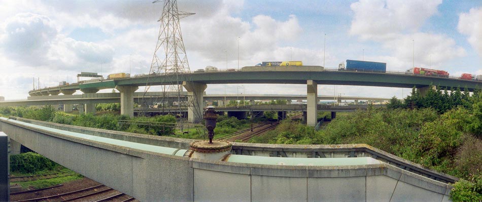
The road layout in this area has changed completely since 1994, but you can see at right the DLR Beckton branch going over the concrete lead-up to the Connaught Bridge. I think GATE 30 at extreme left is to the Excel site and the Connaught Tavern is hidden by the trees in the centre of the picture – and so this road was the old Connaught Road which led to the old swing bridge. I think where I was standing is now the middle of a hotel car park.
Bridges, Bow Creek, East India Dock Rd, East India, Tower Hamlets, Newham, 1994, 94-719-61
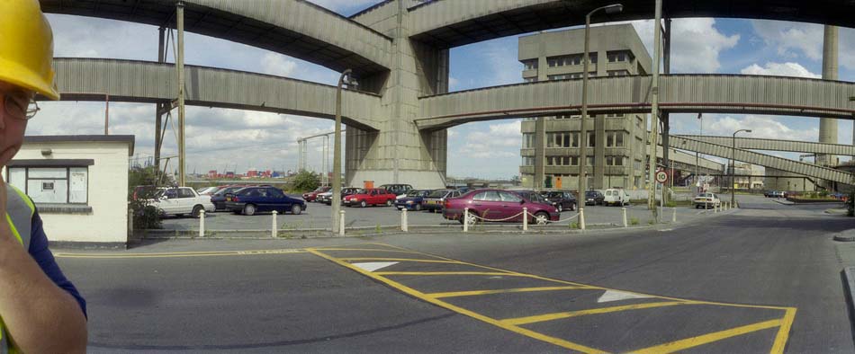
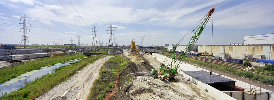
I moved around a mile and a half west and four stops along the DLR line to Canning Town and one of my favourite areas around Bow Creek, which here does two more or less 180 degree turns before flowing into the Thames. These two ‘bridges’ are a few yards south of East India Dock Road and I think both were built as pipe bridges to carry gas across the river.
Only the brick end supports of first remain on each bank. The metal bridge in the centre of the image is also a footbridge, now painted blue and leading across the river to the ecology park. Just beyond it, almost completely hidden is a third bridge, a long disused rail bridge. At left are the sheds of a timber yard.
Further East on the East India Dock Road I made this panorama with a sawmill in Wharfdale Road. Beyond that road is a train on the DLR line, and over the top of this you can see the Pura Foods factory on the site where London City Island now is.
A few yards further east on East India Dock Road gave this view of Bow Creek, curving 180 degrees around Pura Foods. Locals were pleased to see this London City Island factory go as you could smell it across much of Canning Town.
A few yards away I used a crane to frame the image of Pura Foods on its not quite island site. At right of the picture is a bridge across the DLR leading to a riverside walk to Canning Town Station. Although I managed to walk across Reuben’s Bridge several times, it has been mainly locked for the last thirty years, despite being a useful short cut to the riverside station entrance.
Apparently it was closed because people were throwing stones from it onto the DLR, and more recently in 2019 a survey determined that it is non-compliant with current Health & Safety Legislation, Building Regulations, British Standards and associated supplementary guidance.
The initial plans were for the riverside walkway to lead all the way to Trinity Buoy Wharf at the mouth of Bow Creek – and a competition was held and awarded for a new footbridge to enable this – but then the plans were dropped. Until a new bridge was built for London City Island the riverside entrance to Canning Town station only led to two dead ends.
I spent a long day in July 1994 travelling up and down the recently opened Beckton Extension, taking some pictures from the trains but also getting off at every station and explouring the area around the stations, sometimes at some length. The previous set of pictures, DLR – Beckton Extension – 1994, began from around the end of the line at Beckton, and these images start with those from a walk from the next station along, Gallions Reach.
In the 2000s there was a plan to extend the DLR from here to Dagenham Dock, but these were cancelled in 2008; now plans have been approved for an extension to a Beckton Riverside station and on under the Thames to Thamesmead.
From the Gallions roundabout you can go north and south along Woolwich Manor Way or take the more recent roads, Royal Albert Way, Royal Docks Road and Atlantis Avenue. My picture was made from Woolwich Manor Way looking roughly north. In the centre of the roundabout is a pumping station, which I think is a 16-sided building, though I always lose count. On top in its centre is a small 8 sided pimple. Locally listed, it was built for Thames Water in 1974.
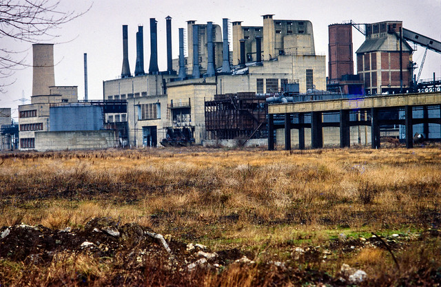
Ruins, Beckton Gas Works, Beckton, Newham, 1994, 94-717-61
Beckton Gas Works were built on the East Ham Levels from 1868-1870 by the Gas Light and Coke Company which had been founded in 1812 by Frederick Albert Winsor and was not only the UK’s first gas company but the first public gas company in the world. It was for some years the largest gas works in Europe and until 1969 produced gas for industry and homes across much of East London.
The site was named Beckton after then company chairman Simon Adams Beck and covered a huge of 550 acres. As well as giving room for the huge works, its site on the Thames well to the east of London meant that larger colliers could bring coal to it than to the gas works closer to the city.
As well as town gas, the site also contained the Beckton Product Works which became the largest UK manufacture of tar and ammonia by-products. Beckton was a huge local employer, providing jobs for as many as 10,000 men.
For many years after it closure the site remained derelict and was used in a number of films, most notably Stanley Kubrick’s Vietnam War film ‘Full Metal Jacket’. Back in 1994 there was little left on the site which is now largely a retail park.
I’d taken a few pictures in the area in black and white and colour ten years earlier when more of the works where still there – such as this one:
Beckton Gas Works, Beckton, Newham, 1984
[If you open the image you can browse a few more on Flickr.]
I went up to the station platform and made this picture as I waited for a train to arrive. At right you can see the Thames Water pumping station in the middle of the Gallions roundabout. On the left others waiting on the platform can be seen in a mirror. Beyond that is the Royal Albert Dock and in the distance the hills on the other side of the Thames. In the sky is a plane shortly after take-off from London City Airport.
Beckton Park Station, DLR, Beckton, Newham, 1994, 94-717-31
I can’t remember if I got off the train first at Cyprus station or continued directly to the next stop, Beckton Park. The two stations are fairly similar and both are in the centre of roundabouts in the Royal Albert Way, built for the LDDC and opened in 1990.
DLR, Royal Albert Dock, West Beckton, Newham, 1994, 94-717-11
I got back on a train to go to the next stop on the line, Royal Albert, where I took a walk around the area beside Royal Albert Dock dock, making this picture from its west end looking east down the dock. In the distance is a DLR train approaching and to the left is the road leading the the Connaught Bridge. I think the brick structure at left of picture is a ventilator for the railway tunnel below.
Connaught Bridge, Royal Albert Dock, Silvertown, Newham, 1994, 94-717-12
I made this from a temporary footpath across the channel between the Royal Victoria and Royal Albert Docks a few yards to the west of the Connaught Bridge. Under the bridge is the full 1.75 miles of the Royal Albert Dock, built in 1875-80 and opened by the Duke of Connaught. The dock finally closed to commercial traffic in 1981.
In 1984 I got permission to go onto the site and photograph the remaining buildings – virtually all now demolished. They had no great architectural value but were an important part of London’s history. You can see some of the black and white pictures I took in the book The Deserted Royals – there is a good preview with over 40 pictures on the website and the PDF version is reasonably priced – and rather more, including colour work on Flickr – in the two albums 1984 London Photographs and 1984 Docklands Colour.
More Docklands colour from 1994 in my next post in this series.
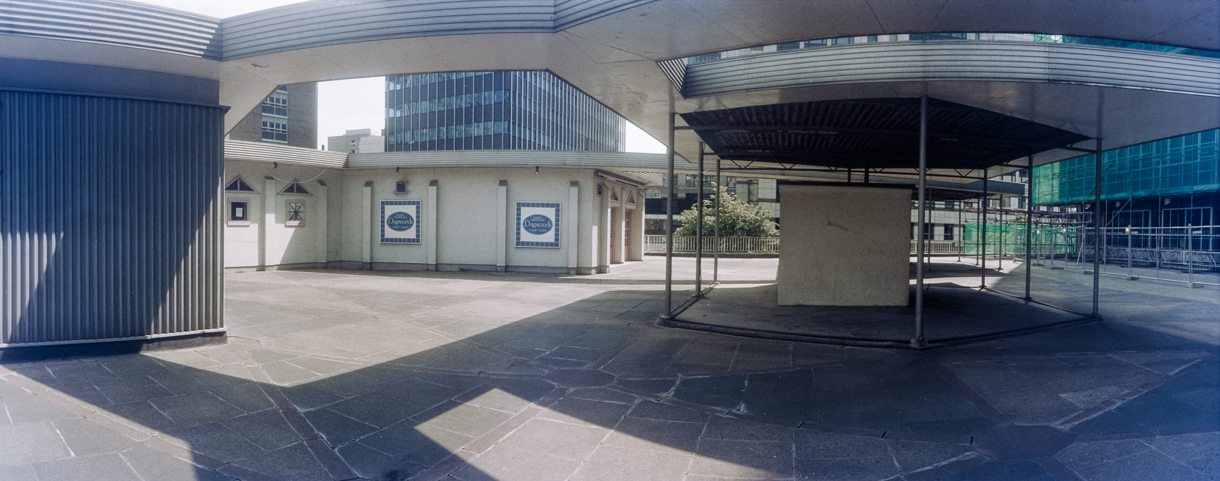
Around the Highwalks – Wood Street: London’s ambitious series of ‘highwalks’, aimed at separating movement on foot from traffic began after World War 2 when the City began to rebuild after extensive war damage – a process that really sprung into action on a large scale in the 1950s.
Highwalk, Wood St, City, 1994, 94-708-21
As Wikipedia states, “In 1947 architect Charles Holden and planner William Holford” had put forward a blueprint for “a network of first-floor walkways that would connect buildings across the City.”
Wood St, Escalator, London Wall, City, 1994, 94-709-31
The City of London Pedway Scheme was later adopted by the City of London Corporation and to get planning permission by the 1960s all new developments were required to include first floor access to walkways. It worked where there had large areas destroyed by bombing – such as the Barbican, but elsewhere these walkways were often dead ends leading nowhere.
Wood St, Escalator, London Wall, City, 1994, 94-709-12
Although London had suffered greatly from the bombing, much survived – and many damaged buildings had been restored in the immediate aftermath of the war. Although some of the city’s older buildings were demolished there was an increasing recognition of the value of many of them. The 1944 Town and Country Planning Act had given the government power to create a statutory list of buildings of special architectural interest – and those powers were increased in the 1947 Act.
Green Cuisine, Highwalk, Wood St, London Wall Citry, 1994, 94-709-21
Listing of buildings began seriously after this, and many buildings in the City gained some protection from demolition – and a resurvey in 1968 began to add more to the lists. It became increasingly clear that the Pedway scheme would never be able to produce a really coherent scheme over most of the City and by the mid-1980s it was effectively discontinued.
Highwalk, St Alphage Highwalk, London Wall, City, 1994, 94-710-22
Since then some parts of the walkway system have been lost, while some areas still remain. Around London Wall while some parts of it were closed. The part of the St Alphage Highwalk in these pictures had been demolished but it was partly replaced by a new section during redevelopment around 2017.
Highwalk, St Alphage Highwalk, London Wall, City, 1994, 94-710-12
Another problems with the Pedway is that London’s transport systems – buses and Underground largely leave passengers at street level. Getting to the highwalks generally requires going up steps and most people would prefer to simply continue to their destination at street level.
Highwalk, St Alphage Highwalk, London Wall, City, 1994, 94-710-11
For those with disabilities which make steps difficult or impossible this is a real barrier. There were very few places where escalators were provided to ease the problems as these were expensive.
More panoramic images from the City Highwalks in a later post.
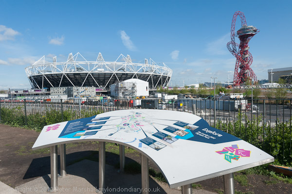
Walking the Olympic Area – Unless my memory has failed me (which it often does these days) the two day course I ran on Saturday 21st April 2012 and Sunday 22nd was my last formal teaching session. I think I have turned down a few requests to run workshops since as they are rather tiring.
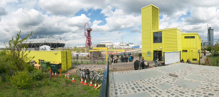
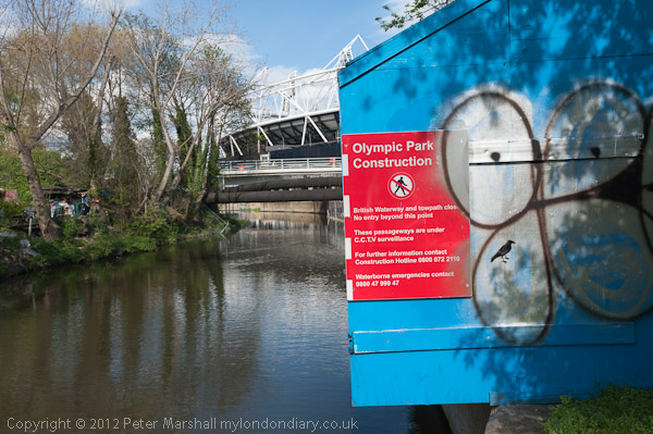
I can’t remember exactly how the course came about, but the venue was the View Tube, now run by Poplar HARCA for the local community, which had opened on the Greenway overlooking the London Olympic site in 2010, as a cafe and education centre. A set of bright yellow boxes it then had an upper floor viewing area overlooking the building site.
I’d been photographing the area on and off since 1982 – and you can see many of the pictures I took on a web site, The Lea Valley. I think the course will have begun with me showing some of those pictures and talking about them before taking the participants out for some fairly short walks around Stratford and Stratford Marsh, or at least those areas still open to the public. The pictures here are all from the two days of the course.
Travelling across London to the area I had to give myself plenty of time in case there were any travel delays, so I arrived well before the course was due to start on both days and was able to walk around and make a few pictures then.
While leading the students around the area I was mainly involved with facilitating them making images, but did manage to make a few for myself, and I think I also stayed on a little after the day finished for some more.
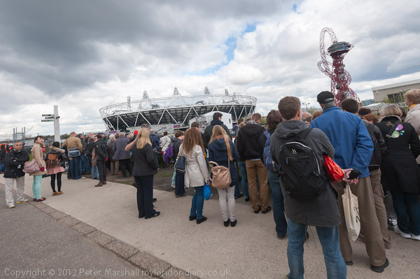
On the Saturday we went along the southern edge of the site and into Stratford Westfield and up to the John Lewis viewing area before returning for a lunch break for the students when I made some panoramas close to the View Tube while eating my sandwiches. Parts of the area were quite crowded with others who had come to view the site. Fortunately there were considerably fewer on the workshop than in this picture.
After lunch I took everyone along the Greenway, into Fish Island, across Old Ford lock, down the towpath to Bow Flyover and then to Pudding Mill Lane station.
We met again on Sunday morning at Pudding Mill Lane station. Again I’d arrived early and had already made some pictures before the walk began up the Greenway to Hackney Wick, through Fish Island to White Posts Lane before returning over Old Ford Lock to the View Tube.
I had requested those taking part to work with digital images – and I think almost all had done so. Lunchtime gave them a chance to review the pictures they had made and we then were able to see and discuss the work, though unfortunately we could only see the pictures rather dimly as the teaching area, although it had a nice large touch screen, had no blinds on its windows.
You can see more of the pictures I made on the two days on My London Diary, including some of the panoramic images. All my pictures were taken on a Nikon D700 camera, I think all with the laser-sharp Nikon 16-35 f4.0 lens. The panoramas were made with the same lens, taking a series of 5-10 exposures and digitally stitching these together using PTGui software, probably the most powerful and flexible photo stitching application available. Photoshop now does a decent job with simple panoramas but has fewer options.
Panoramic images don’t display well on this blog, so apart from the one at the top of the post showing the View Tube you will need to go to My London Diary to see more. Most of those I took showing the actual Olympic site on these two days are panoramic. Olympic Course Day 1 Olympic Course Day 2
Asylum and Vauxhall to Battersea: I don’t often look back at posts from the early years of My London Diary for several reasons. Before I redesigned the site some time in 2008 there were no links to individual stories which makes linking to them trickier, and the stories and pictures come at different positions down the monthly page. Also in the early years I wrote entirely in lower case, something I now find an annoying affection. And back them the software for converting raw digital images wasn’t quite as good and the images are sometimes a little lacking in colour quality.
So here I re-present my post for Monday 10th April 2006 in a more convenient fashion. I’ve updated the text to conventional capitalisation, corrected a few spellings (back then I wrote in software without a spell-checker) and made a few minor changes to make the text easier to follow. The pictures – both those in this post and the larger number I link to on My London Diary are exactly as posted in 2006. Communications House was demolished in 2013-4 and new offices erected on the site which is now home to a number of businesses but no longer used by the Home Office.
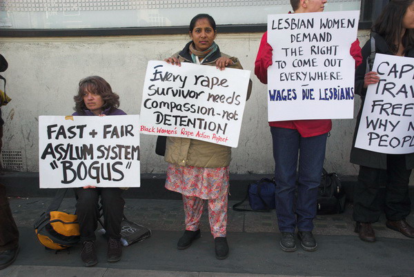
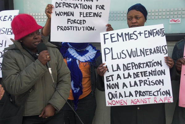
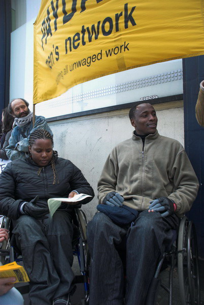
Against Detention and Deportation – Communications House, Old Street
If you are an asylum seeker in Britain you have to sign on regularly at one of the Home Office locations. When you enter the doors of Communications House next to Old Street station (or any of the other locations) you cannot be sure that you will ever come out. Despite the regulations, some asylum seekers have been bundled onto planes and flown back to the country from which they have fled, others have found themselves banged up in detention centres such as Harmondsworth for years with no trial or appeal.
On Monday 10th April 2006, various groups including the All African Women’s Group, African Liberation Support Campaign Network, Payday Men’s Network and Women Of Colour formed a line along the front of the building over the lunch hour to protest and hand out flyers about the unfair treatment of refugees and asylum seekers.
This was a part of a global action demanding justice and proper legal rights for asylum seekers and others without proper legal documentation, calling for an end to racist discrimination and inhumane policies.
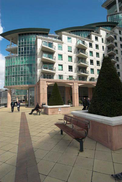
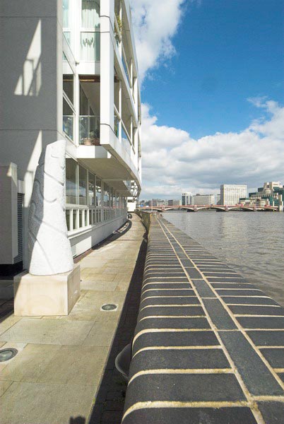
New Flats Along the Thames – Vauxhall to Battersea
I had to leave for a little business elsewhere, then took advantage of the decent weather to take a walk along the Thames from Vauxhall to Battersea on my way home. As you can see I walked a little along the south bank, then back to Vauxhall Bridge to go along the north bank. Later I went on both banks between Chelsea Bridge and Battersea Bridge.
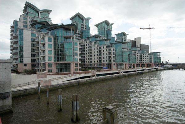
What was not long ago a totally industrial reach of the river is now largely lined by expensive riverside blocks of flats. St Georges Wharf is on the site of the Nine Elms Cold Store, and is now largely finished except for a tower whose slim 181 metre cylinder will soar far above the 72 m of the existing flats.
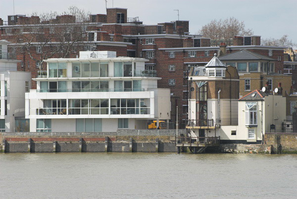
Along Grosvenor Road on the north bank are Rivermill House, the Panoramic, Crown Reach, and a survivor from the past, Tyburn House, followed by Eagle Wharf, with Eagle House and 138.
One minor gain for the public from this is increased access to the riverside, with new developments having a public footpath on the bank. But when soon all you will be able to see is the flats on the other bank, this perhaps isn’t a great gain.
In Pimlico there are often great contrasts between council or Peabody estates and millionaire apartments across the road on the river side, and some pricey stuff in some of the squares. A few yards makes a huge difference in price – and the newer buildings have often blocked the views some council tenants used to have of the river.
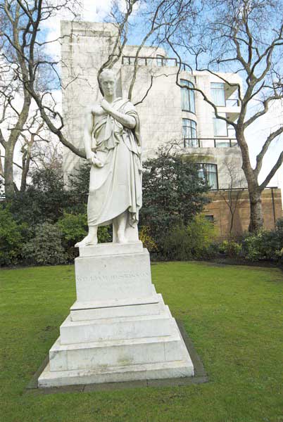
William Huskisson, Statesman 1770-1830. The main claim to fame of this MP for Liverpool was the he was the first to be killed in a railway accident, when knocked down by ‘Rocket’ during the opening ceremony of the Liverpool & Manchester railway on 15th September, 1830. Pimlico Gardens
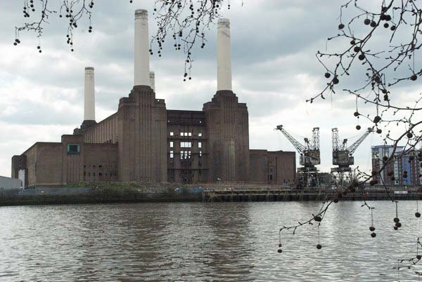
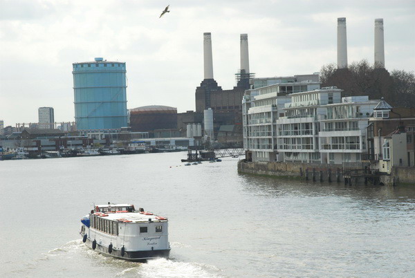
Across the river are views of Battersea Power Station, gutted and largely left to decay by various developers over the years, roofless. Despite their efforts it still stands, its brickwork and four tall chimneys dominating the area.
The waterworks building on the north bank is also still there, and next to it around the canal a new Grosvenor Waterside is nearing completion.
Across Chelsea Bridge, between it and the power station is Chelsea Bridge Wharf, another huge development. Its a relief to be able to walk across the new bridge under Chelsea Bridge into the peace of Battersea Park with its Peace Pagoda. Next to Albert Bridge is a small wild area that looked very spring-like in some dramatic light under grey clouds.
There are more new flats and offices past Albert Bridge, including Foster and Partners building. It’s stunning close to, but seen from across the river is rather disappointing. Their Albion Riverside next door is a futuristic structure, like some vast mothership landed on the riverside, a fungus from which spores are doubtless emerging to colonise the country.
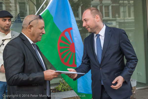
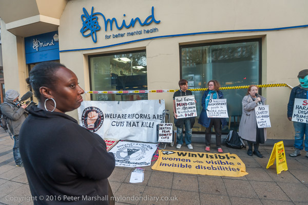
Roma, Olympic Park and Mind: After a morning protest by Roma at the Czech Embassy in Kensington I took a walk around the Olympic Park in Stratford before joining the Mental Health Resistance Network (MHRN) and Disabled People Against Cuts (DPAC) who were holding a Halloween Demo at the national office of Mind.
Roma protest Czech Murder – Czech embassy, Kensington
Ladislav Balaz, Chair of the Roma Labour Group and Europe Roma Network and others had come to hand in a letter calling for the murder of a young Romani man by neo-Nazi skinheads in Žatec to be properly investigated.
The man who had lived in the UK until a year ago was a second cousin of Balaz. He was set upon as he went to buy cigarettes at a pizzeria.
Most cases of murders of Roma in the Czech Republic are dismissed by police as accidents and they have already issued false stories about the victim, claiming he was mentally ill and attacked people. The Roma demand justice and equality for everyone in Czech Republic and the elimination of any double standards of justice. Several of the protesters made speeches in Czech as the letter was presented.
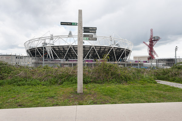
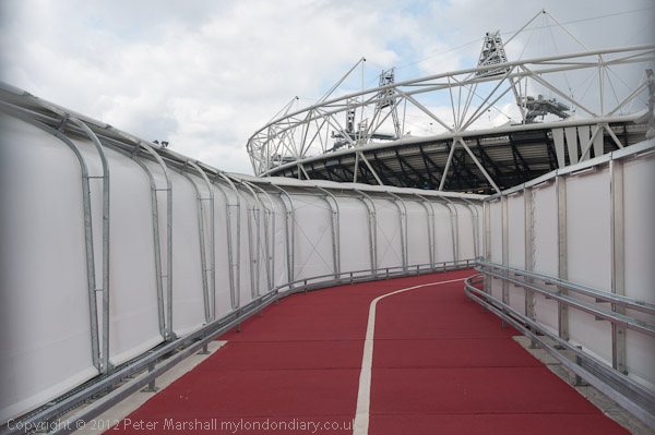
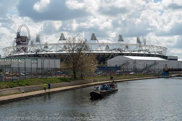
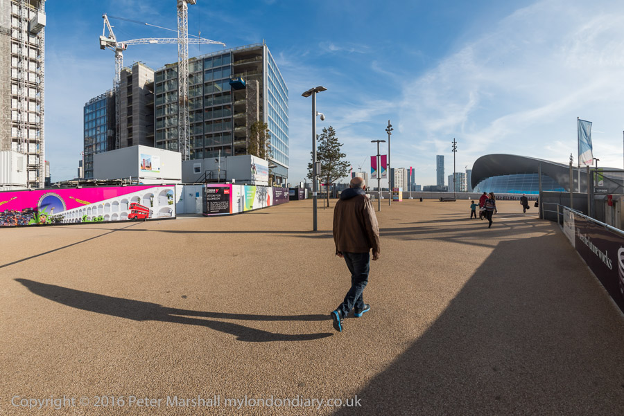
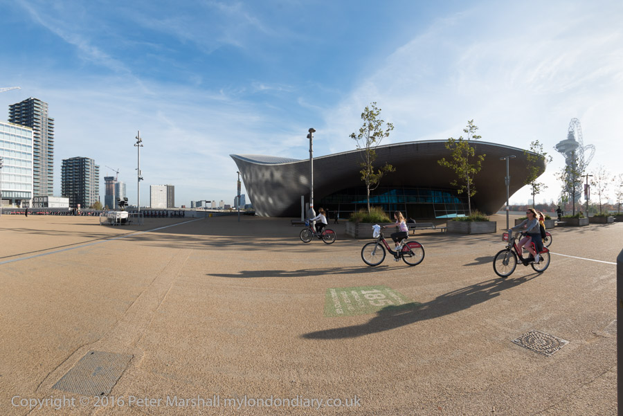
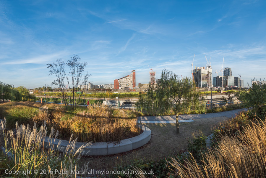
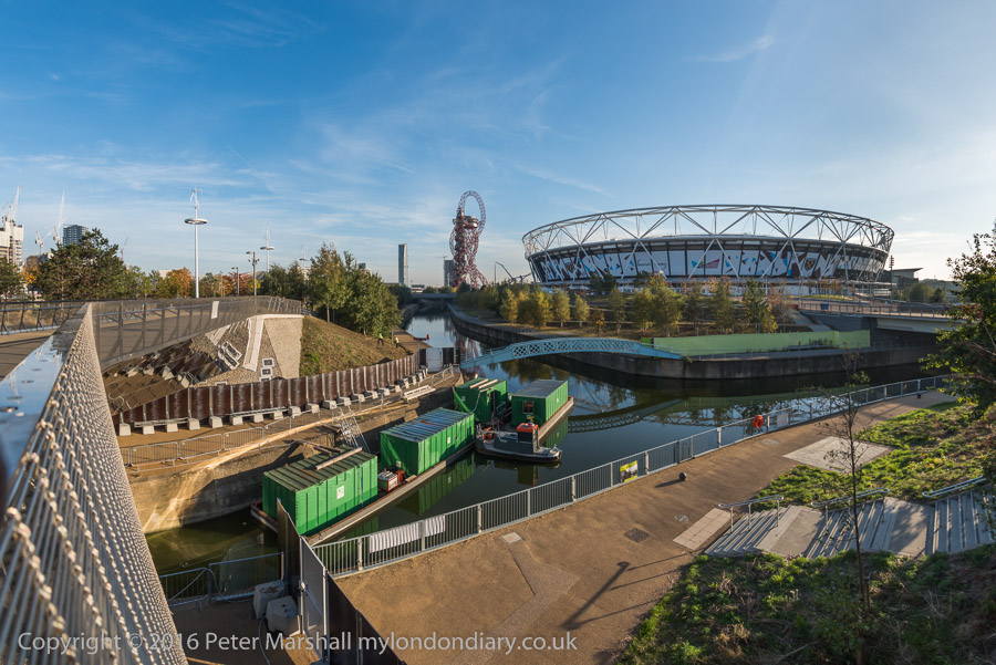
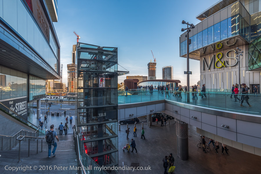
I had several hours between the protest outside the Czech Embassy and a protest in Stratford High Street and decided it was a good occasion to take another walk in the park at Stratford which had been the site of the 2012 London olympic games and to make some more panoramic images.
It was a year since I had been there, and four years since the Olympics and I had hoped to see the park in much better condition than I found it. Considerable progress had been made in the buildings which are shooting up around it and many of the ways into the park are still closed.
I walked around much of the southern area of the park and found it still “largely an arid and alienating space composed mainly of wide empty walkways rather than a park.”
I took rather a lot of pictures, both panoramic and more normal views before it was time to make my way back through the Westfield shopping centre into the centre of Stratford.
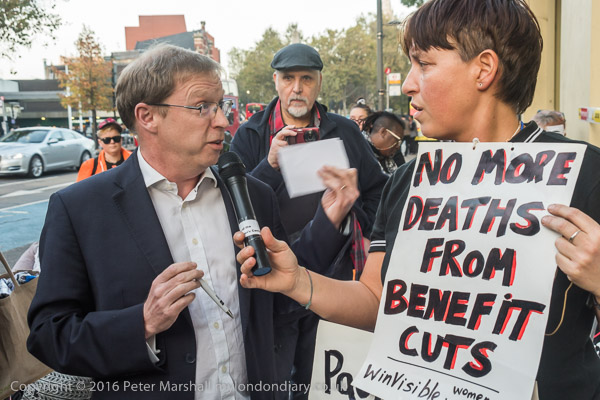
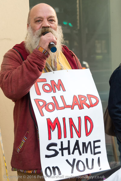
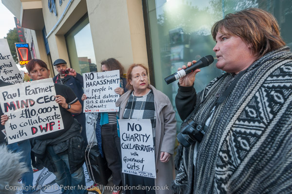
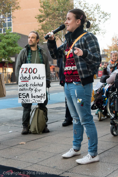
Paul Farmer, Mind’s chief executive came out and spoke to the protesters
The Mental Health Resistance Network (MHRN) and Disabled People Against Cuts (DPAC) came for a Halloween Demo at the national office of mental health charity Mind in Stratford.
They complain that Mind failed to mention the effects of welfare reform, sanctions, or benefit-related deaths in its latest five-year strategy and has dropped its support for the long-running court case aimed at forcing the government to make WCA safer for people with mental health conditions.
Mind’s policy and campaigns manager Tom Pollard had been seconded to work as a senior policy adviser to the DWP and was to start the following day and they demanded the resignation of Mind’s chief executive, Paul Farmer.
Farmer came out to meet the protesters on the pavement and told them that Mind was still working for people with mental health problems and not for the DWP, and that Pollard’s decision had been entirely a personal one in order to gain more insight into the workings of government rather than to assist them in the any discrimination against the disabled.
The protesters were unconvinced and after he had finished speaking several spoke about how local Mind groups were working against the interests of those with mental health problems. They claimed the local managers were often more interested in empire building than in the welfare of benefit claimants.
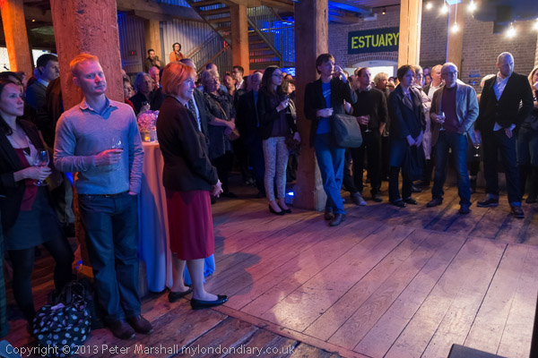
Ten years ago on Thursday 16th May 2013 I was pleased to attend the opening of the exhibition Estuary, held to mark the 10th anniversary of the Museum of London Docklands at West India Quay, a short walk from Canary Wharf. I was delighted to be one of the dozen artists in various media to be included, with ten of my panoramic images from my work on the north and south banks of the Thames.
I’d begun photographing the lower reaches of the Thames back in the 1980s, then working largely in black and white and my work concentrated on the then fast disappearing industrial sites along the river. At first I worked on the Kent bank on the south of the river, having a particular interest in the cement industry that occupied and had radically changed much of area between Dartford and Gravesend. Later I also worked along the north bank.
Cement works, Northfleet, 2000
Estuary is a term that has various definitions, and both its upstream and downstream limits have, as Wikipedia states, “been defined differently at different times and for different purposes.” For my own purposes it has been rather elastic, usually beginning at the Thames Barrier and going east as far as it was convenient to travel by public transport, on foot or by bicycle from convenient stations. In earlier years I went further along the Kent bank by car in some outings with friends including Terry King as far as Sheppey.
Cement works, Northfleet, 2000
The exhibition had come as a surprise. The ten picture in it were from around a hundred images the Museum of London had bought from various of my projects for its collection a few years earlier and I think the first I knew about it was when I received the invitation to the opening, or perhaps by an email a couple of weeks before that.
Greenhithe, 2000
These pictures all dated from the early years of this century, those from Kent in 2000 and from Essex in 2004 and all were in panoramic format. In 2000 I was working with two swing lens cameras, a Japanese Widelux F8 and a much cheaper Russian Horizon 202. Both work with rotating lens and a curved film plane, invented by give Friedrich von Martens in his Megaskop-Kamera in 1844, but instead of the daguerrotype plates he worked with use standard 35mm film, producing negatives around 56x24mm.
Chafford Hundred, 2004
The two cameras have a similar field of view horizontally around 130 degrees and have a cylindrical perspective which renders lines parallel to the film edges straight but gives an increasing curvature to horizontal lines away from the centre of the image. The image quality of the two is very similar but the cheaper camera has a rather more useful viewfinder.
Dagenham, 2004
By 2004 I had two further pieces of equipment which extended my panoramic photography. One was a new camera, the Hassleblad X-Pan, which had generally received rave reviews. I found it rather disappointing at first and it was only after I added the 30mm wideangle lens that it became useful for me. The X-Pan is a standard rectilinear camera design but gives negatives 65x24mm rather than the normal full-frame 36x24mm. The horizontal angle of view it produces with the 30mm is at the limits of rectilinear perspective, before stretching at the edges becomes too apparent, and is considerably less than the swing lens cameras at 94 degrees. The lens comes with a separate viewfinder that fits on the top of the camera, but does make operation a little less convenient.
West Thurrock, 2005
The second, and very important for working along the north bank was a Brompton folding bicycle, which enabled me to travel the greater distances needed there. Of course I also used this and the X-Pan for later pictures elsewhere.
Mucking, 2005
You can see more of these pictures in two sections of the Urban Landscapes web site, which also includes work by other photgraphers, both British and overseas. Some of the pictures I’ve chosen for today’s post were in the Estuary show, but others were not – I have a rather larger body of work to select from than the Museum, some of which appears in my book Thamesgate Panoramas.
Northfleet, 2000
The site has separate sections on the Thames Gateway in Essex and Kent, as well as from my Greenwich Meridian project in 1994-6 and a wider selection of panoramic work from around London from 1996-2005, though there is much more that I still have to put on-line. Some is also now on Flickr.
At the end of 1991 I finally bought my first panoramic camera, a Japanese Widelux F8 which I couldn’t really afford. It was a camera that took around 21 pictures on a 36 exposure film, with the film curved around a part of a cylindrical path with the lens pivoting around the centre of the cylinder.
The lens is a 26mm f2.8, though it needs to be stopped down to around f8 for most pictures as the camera is fixed focus at around 6 ft and only gets sharp at infinity when stopped down. Winding on the film winds up a clockwork motor and returns the lens to its starting position. On pressing the shutter the lens swings around through about 140 degrees, exposing the film through a slit at its back which swings across close to the film. It has 3 shutter speeds, 1/15, 1/125, and 1/250th, but even at the fastest speed it still takes rather longer to actually complete the exposure.
The design keeps lens to film distant constant – at around 26mm – right to the edge of the film across a negative 24mm x 56mm. If this was flat, the distance to the corner would be more like 40mm and so objects at the edges get stretched to around 1.5 times actual size. This camera eliminates this distortion, but at the expense of introducing its own which you can see in these pictures. This becomes particularly noticeable in the curvature of most straight non-vertical lines.
In particular, horizons become curved unless the camera is kept absolutely level. The pictures of Bow Creek were made with the camera on a sturdy tripod and with the help of a spirit level. There is one on the top plate of the camera, but I found a larger separate one more useful.
Although the angle of view is often stated as 140 degrees this is perhaps misleading and I think probably is the angle across the diagonal. Rather more useful is the horizontal angle of view, which I think is just slightly over 120 degrees. Theoretically it would be possible to create a full 360 degree view in three exposures, but practically it needed four, though I don’t think I ever succeeded on the few occasions I tried to make one.
Later I made many more panoramas here and around London, particularly with a similar Russian camera, the Horizon or Horizont which was rather more convenient to use, as well as a few with a much larger medium format version. I also used a Hassleblad X-Pan, a nice camera which was panoramic only in format, with a similar negative size, 58x24mm, but using rectilinear lenses which can’t acheive a really wide angle of view.