Archive for March, 2019

Berlin 20: Checkpoint Charlie

Sunday, March 31st, 2019

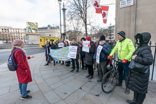
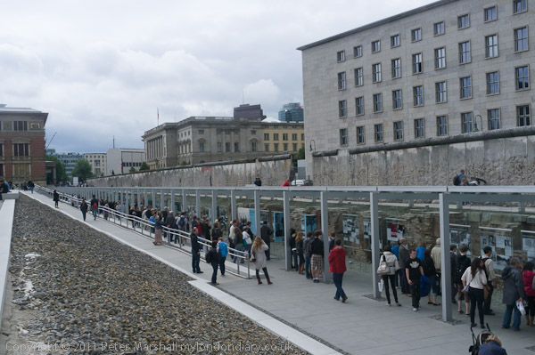
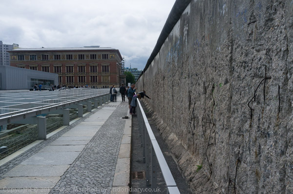
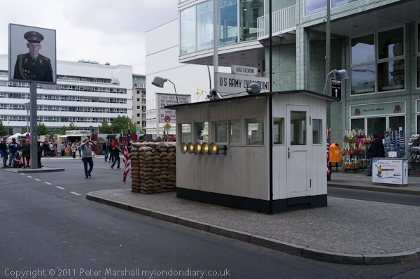
I’ve neither finished nor forgotten my series of posts from a short trip to Berlin in 2011, though I am getting close to the end.  We decided to take a look at some of the more usual tourist traps, and made our way to Checkpoint Charlie.

I declined the offer to have my picture taken with the two guards, though I did photograph a few others having their pictures taken with them

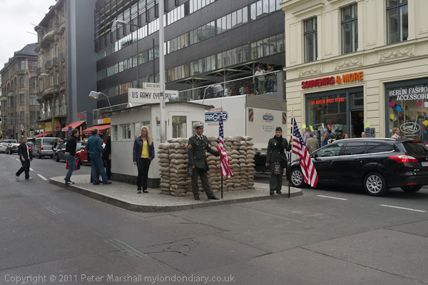
Others avoided the charge simply by standing to one side.

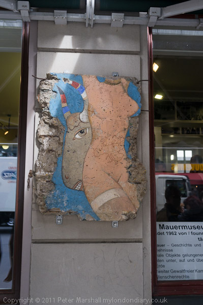
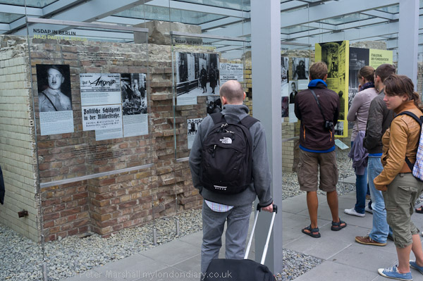
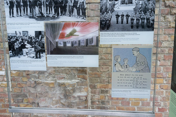
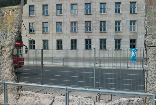
There were several small section of the wall which have been preserved and fixed on the front of buildings in the area.

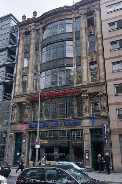
A few yards away from the checkpoint was Rudi-Dutschke-Haus at 25 Rudi-Dutschke-Strasse. Constructed as a commercial buidling in 1909 by C. Kuhn as a commercial building from 1989 it was the home of the newspaper Tageszeitung (Taz), though I think they have now moved.  Taz was founded in 1981 as an alternative to the mainstream press, aiming to be  “irreverent, commercially independent, intelligent and entertaining” and providing a progressive outlook on political and social issues and generally supporting green ideas. At first all who worked there had equal pay, but now those in more responsible posts get bonuses. Taz is a co-operative, owned by around 19,000 of its readers.

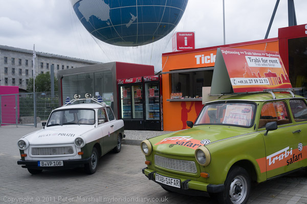
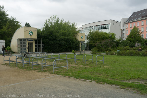
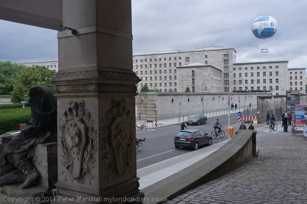
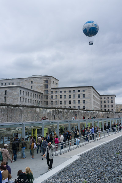
Just along the street were both the tethered balloon which gives tourists an aerial view of Berlin, and also the Trabi museum. I was tempted by the balloon, but we didn’t really have time.

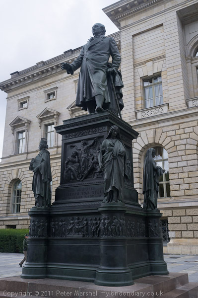
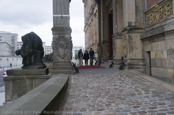
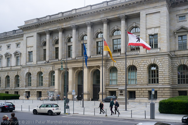
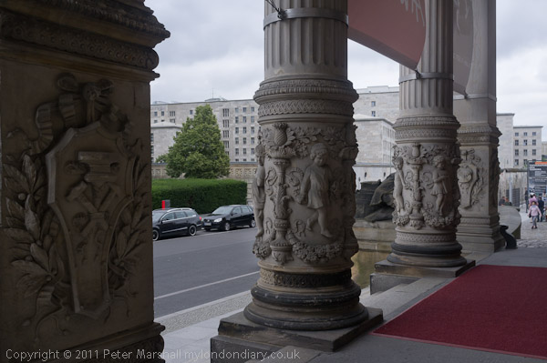
Back outside the Abgeordnetenhaus (House of Representatives), the state parliament of Berlin, is statue of Heinrich Friedrich Karl vom und zum Stein, made in 1867  by Hermann Schievelbein (1817-1867.)  It has apparently been moved several times since it was first displayed. Baron vom Stein (1757-1831) was a Prussian statesman who made important reforms including the abolition of serfdom and the creation of a modern municipal system, which enabled the later unification of Germany. He took advantage of the defeat by Napoleon in 1807 which greatly weakened the conservative establishment to make radical changes. Not only were the serfs freed, but all restrictions on the holding of land and all caste distinctions which had dominated Prussian society were removed, and he brought in local self government for all Prussian towns and villages with more than 8000 inhabitants. But Napoleon, who had urged his appointment in 1808 discovered Stein was hoping for a German national uprising and he had to flee the country. When Napoleon was finally defeated the victorious allies gave Stein the task of overseeing the administration of the liberated territories

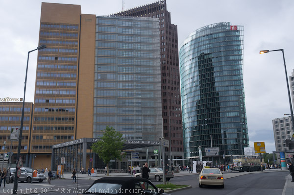
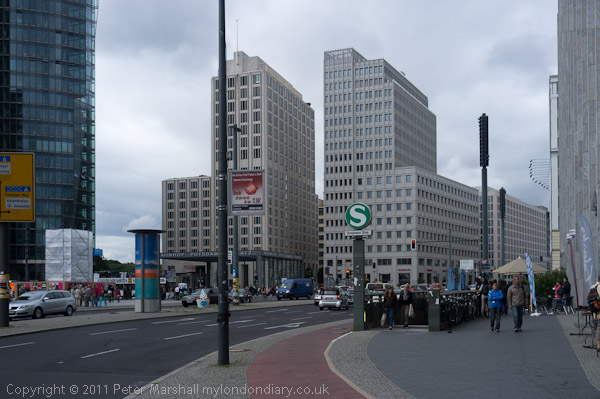
Perhaps the most disappointing part of our visit was to Potzdamer Platz.

Potsdamer Platz was almost completely destroyed by bombing and in the fight for Berlin in  World War II. and the largely empty area was at the meeting point of the Soviet, British and American sectors  and housed a thriving black market. The few buildings that had begun to be rebuilt there were largely burnt in the people’s uprising of 1953, and anything left standing was demolished and taken away after the wall was built in 1961. After the wall came down and Germany was reunified the area as sold to Daimler Benz AG and became the largest construction site in Europe for the next ten years. In 2007, it was sold to Swedish Bank SEB and then in 2015 to Canadian real estate company Brookfield.

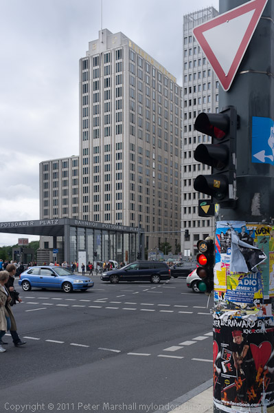
The buildings seemed rather ordinary, despite the well-known architects involved, though perhaps with longer to explore the area I might have been more interested, but nothing made me want to stay there. We left going north up Ebertstraße.

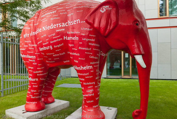
Apparently Lower Saxony is noted for its bright pink elephants.

Our walks around Berlin continue in later posts.

Previous Berlin post

______________________________________________________

There are no adverts on this site and it receives no sponsorship, and I like to keep it that way. But it does take a considerable amount of my time and thought, and if you enjoy reading it, a small donation – perhaps the cost of a beer – would be appreciated.

My London Diary : London Photos : Hull : River Lea/Lee Valley : London’s Industrial Heritage

All photographs on this and my other sites, unless otherwise stated, are taken by and copyright of Peter Marshall, and are available for reproduction or can be bought as prints.

To order prints or reproduce images

________________________________________________________

Colonial Matters

Saturday, March 30th, 2019

When I grew up our education system still proudly proclaimed the positive nature of the British Empire, even though it was more or less in its death throes, being replaced in part by the ‘Commonwealth’ (until 1949, the ‘British Commonwealth’). But we were never told about any of its less positive aspects, including often the total ignoring of the rights and laws of the people of the lands we conquered. Many of course were killed, either deliberately or by the introduction of diseases against which they had no natural resistance.

The area now in Canada around Hudson’s Bay, known as Rupert’s Land, was granted to the Hudson Bay Company by Royal Charter in 1670. The French set up ‘New France’ covering much  of what is now USA, including Canada, then the districts of Québec, Trois-Rivières and Montréal. At the peace treaty following the global Seven Years’ War in 1763, Canada became a British colony. In 1821 the Hudson’s Bay Company (HBC) took over the North-Western Territory, putting them in charge of most of the rest of modern Canada. The country came together when the UK Parliament in its Rupert’s Land Act 1868 approved the sale of all of the territory held or claimed to be held by the HBC to Canada.

Back in 1670, the charter had made it clear that so far as land rights were concerned it only recognised the land rights of “our Subjects, or … Subjects of any other Christian Prince or State.” I’m not entirely sure if the Christian in that document always included Catholics, but certainly the indigenous peoples of the area we annexed were considered to have no rights at all, and the same continued to be true in 1868.

The First Nations were clearly in possession of the land when the British and others arrived in the 17th century but they had no concept of ownership of land and any treaties they later made were for them not about ownership of land but of sharing its use. It was only in 1973 that a Canadian court acknowledged “that the aboriginal title, otherwise known as the Indian title, to their ancient tribal territory has never been lawfully extinguished“.


A passing artist, Margaret Dawn Pepper and her friend stop to show support

The Wet’suwet’en of British Columbia have never signed treaties with Canada or given up rights and title to their ancestral lands and say Canada is violating Anuk Nu’at’en (Wet’suwet’en law) as well as Canada’s own colonial laws in building the Coastal GasLink pipeline across their land to carry fracked natural gas to a processing plant. 14 of them were arrested at gunpoint on Jan 7th for obstructing the building of the pipeline, after an injunction had been obtained ordering them not to block it.

The day after this protest in London took place the Wet’suwet’en leaders came to an agreement with the RCMP to allow limited work on the pipeline to go ahead, so long as they were allowed access to their healing lodge and the back country to continue trapping.


Claire James, Campaigns Coordinator of Campaign against Climate Change

The Wet’suwet’en remain opposed to the pipeline project which they say endangers their water supplies and traditional trapping areas, and there have been continuing complaints about the pipeline workers bulldozing traps, endangering the health centre and restricting access to areas of their land.

The Wet’suwet’en have been backed locally, nationally and internationally by groups concerned with the protection of indigenous rights and by enviromentalists, worried at the huge amount of carbon dioxide that will be produced by gas exported through the pipeline and the global warming this will produce. We should be cutting our use of fossil fuels, not promoting new sources such as this.

The protest started with just a hundful of protesters but was over twice as large by the time I left. They protested at three different entrances to Canada House.

More pictures at Solidarity with Wet’suwet’en Pipeline Protesters

______________________________________________________

There are no adverts on this site and it receives no sponsorship, and I like to keep it that way. But it does take a considerable amount of my time and thought, and if you enjoy reading it, a small donation – perhaps the cost of a beer – would be appreciated.

My London Diary : London Photos : Hull : River Lea/Lee Valley : London’s Industrial Heritage

All photographs on this and my other sites, unless otherwise stated, are taken by and copyright of Peter Marshall, and are available for reproduction or can be bought as prints.

To order prints or reproduce images

________________________________________________________

The Elephant Returns

Friday, March 29th, 2019

Normal service was resumed after a long Chistmas and New Year break with a protest outside Southwark Council on January 7th. Residents want the council to press the developer to make further changes to the plans, particularly so that market traders can continue to trade in the area, and that the needs of the Latino community are met. They also demanded an increase in the number of housing properties that will be at council rents.

Tanya Murat of Southwark Defend Council Housing introduced the event and the speakers.

It wasn’t a very visual event, with only one placard, though it did have two sides, and an elelphant climbing up it. The Green Party had also brought a banner. But many of those present were intending to go into the planning committee meeting to speak or listen, and would not have been allowed to take placards in.

Soutwark have one of the worst records of any local authority for getting rid of council housing, with the demolition of the Heygate Estate and the continuing destruction of the Aylesbury Estate. Clearly they see council estates as desirable and profitable development opportunities rather than as a way of providing decent housing that local people can afford.  Many of the new properties are likely to remain empty, bought by overseas investors in the hope that their value will increase greatly, allowing them to sell on to other investors at a large profit.

We need new laws to stop this happening, Charging double council tax on empty properties would be a start, but more radical  policies are needed.

By the time a union rep for council workers was speaking there were a respectable number of protesters outside the council offices.

The area has a large Latino community and the shopping centre is an important one for them, but Southwark Council have refused to engage with them and their needs.

A leader of the market tradeers says they have been lied to by the council and developer and that promises they were made have not been kept. Southwark Council obviously want to get rid of small traders and replace them by shops from the chains that are found in high streets and shopping centres around the country, losing the vibrancy and the unique nature of the current market and centre.

More pictures at Stand Up for the Elephant.

______________________________________________________

There are no adverts on this site and it receives no sponsorship, and I like to keep it that way. But it does take a considerable amount of my time and thought, and if you enjoy reading it, a small donation – perhaps the cost of a beer – would be appreciated.

My London Diary : London Photos : Hull : River Lea/Lee Valley : London’s Industrial Heritage

All photographs on this and my other sites, unless otherwise stated, are taken by and copyright of Peter Marshall, and are available for reproduction or can be bought as prints.

To order prints or reproduce images

________________________________________________________

By Tower Bridge

Thursday, March 28th, 2019

I first photographed Shad Thames in 1980, though I’d looked down from Tower Bridge a few years earlier. It was a time when I was discovering so many new areas of London to photograph, and also when a very stressful teaching job was taking up far too much of my time – and having two young sons also took up a fair amount of my time. But in April 1980 I moved from an 2000+ comprehensive to a sixth-form and community college, considerably cutting my stress and also reducing my journey times by over an hour a day. It meant a small drop in salary as I was no longer in charge of a department, but gave me more time to spend with my family and on photography.

The area was then largely empty. The last working warehouse had closed in 1972, and some of the buildings had become artists studios, with many also moving in an sleeping there strictly against the law. Some were evicted in 1978, and others after a disastrous fire the following year, leaving the area deserted. The redevelopment only really got into gear in 1984.

It looks better now at night than during the day, when the loss of atmosphere is much more marked. I hadn’t gone to photograph the area, but had arrived early for a protest at Southwark Council offices in Tooley St, so took a walk a little further on. I’d wanted to take a look at St Saviour’s Dock just to the east, but the riverside path was fenced off for the footbridge added there in 1995 to be refurbished so that it can be opened again to allow large boats up the dock.

The footbridge which took the Thames Path across the mouth of the dock was one of the few wholly positive aspects of the redevelopment of the area, saving a diversion to Dockhead and back to the river and should be reopened in the Spring. Here’s what the dock looked like back in 1980.

The colour pictures in 2019 were made with a Nikon D750 with the Nikon 18-35mm  f/3.5-4.5G ED zoom wide open with shutter speeds from 1/15 to 1/40th s at ISO 6400. All were handheld.  Back when I was taking the black and white images I used various films, the fastest of which was Tri-X, nominally rated at ISO 400, and the slowest was Kodak Technical Pan, sometimes rated as low as IS0 5. Then I often carried a tripod, but it’s now years since I did, as most things I photograph have people moving in the frame.

More pictures from 1980 on London Photographs.

More from 2019 at Tower Bridge & Shad Thames.
______________________________________________________

There are no adverts on this site and it receives no sponsorship, and I like to keep it that way. But it does take a considerable amount of my time and thought, and if you enjoy reading it, a small donation – perhaps the cost of a beer – would be appreciated.

My London Diary : London Photos : Hull : River Lea/Lee Valley : London’s Industrial Heritage

All photographs on this and my other sites, unless otherwise stated, are taken by and copyright of Peter Marshall, and are available for reproduction or can be bought as prints.

To order prints or reproduce images

________________________________________________________

Matlock & High Tor

Wednesday, March 27th, 2019

Matlock is in the centre of some dramatic landscape, if only on a relatively small scale, and before catching the train home on Sunday I spent the morning walking around some of it.

A footpath from Snitterton Rd took me uphill to give views down on Matlock Bank on the other side of the Derwent, and then through some green fields to a path beside a wall with some views of the impressive limestone cliffs above the river.

This came down to a road beside a church which almost seemed to be built into a rock face, the rather unusual Grade II* listed Chapel of St John the Baptist, built in 1897 for Mrs Louisa Sophia Harris in a part of her garden as she didn’t care for the services at St Giles in Matlock with a Rector who refused to allow her a memorial for her dog. As well as employing the leading Arts and Craft architect Sir Guy Dawber to design her a private Anglo-Catholic Chapel, she also paid some of the leading artists of the day in its interior decoration, including stained glass by Louis Davis (1860-1941), a plasterwork ceiling with painted vines and moulded swallows, by George Bankart (1866-1929) and an altarpiece painted by John Cooke and more. The chapel was in a poor condition when taken over the the charity Friends of Friendless Churches in 2002, and they have spent £300,000 in restoring it to its previous glory, but I wasn’t unable to go inside. Apparently there is a tiny plaque
under a side window, to Vida – Mrs Harris’s dog.

There were more fine views as I walked down St John’s Road, and then took the parth across the river and under thre railway to go up to High Tor Lane, walking up along this as far as a viewing platform before turning around and walking back and then up Pic Tory, which has Matlock’s War Memorial at its top.

From there I walked back down to wait for Linda (who had been to church) in the park, and we had some lunch and another short walk in the town before catching the train to take us back to a very different landscape down south.

More at Matlock & High Tor.
______________________________________________________

There are no adverts on this site and it receives no sponsorship, and I like to keep it that way. But it does take a considerable amount of my time and thought, and if you enjoy reading it, a small donation – perhaps the cost of a beer – would be appreciated.

My London Diary : London Photos : Hull : River Lea/Lee Valley : London’s Industrial Heritage

All photographs on this and my other sites, unless otherwise stated, are taken by and copyright of Peter Marshall, and are available for reproduction or can be bought as prints.

To order prints or reproduce images

________________________________________________________

Matlock

Tuesday, March 26th, 2019

We were staying in Matlock Green, a short walk from the centre of Matlock, and from outside our hotel we could see the Parish Church on a hill in Old Matlock, as well as Riber Castle, known locally as ‘Smedley’s Folly’ on a hill top overlooking the area where it was virtually impossible to get a decent water supply. The mock-gothic castle was constructed between 1862 and 1866 as a private home for John Smedley, an industrialist who as well as running Lea Mills also built the large Smedley’s Hydro in the centre of Matlock, turning the town into a spa resort attracting visitors from around the world.

The Hydro was used as a military intelligence school in WW2 and is now the headquarters of Derbyshire County Council. Lea Mills, a few miles to the south, was founded by his father (also John Smedley) and Peter Nightingale in 1784 is the world’s oldest manufacturing factory in continuous operation, though it now makes expensive designer knitwear rather than ‘Long Johns’ and other more workaday clothing.

After visiting Lumsdale I walked up to the church, then down a steep path and into the centre of Matlock. It seems a pleasant place in winter, though probably rather crowded with tourists during the summer months, and I was pleased to find both a Gregg’s and a Wetherspoons close together as after my walk I was both a little hungry and thirsty.

I spent some time wandering around the town before the others returned from their trip to the panto, enjoyong the fading light and then phtographing some of the shops; there do seem to be rather a lot of antiques/junk shops and others with interesting window displays. Later after we met up, we had a meal in a Thai restaurant before a leisurely stroll in a rather circuitous stroll back to our hotel.

More from Matlock in Matlock & Lumsdale both before and after the Lumsdale pictures.

______________________________________________________

There are no adverts on this site and it receives no sponsorship, and I like to keep it that way. But it does take a considerable amount of my time and thought, and if you enjoy reading it, a small donation – perhaps the cost of a beer – would be appreciated.

My London Diary : London Photos : Hull : River Lea/Lee Valley : London’s Industrial Heritage

All photographs on this and my other sites, unless otherwise stated, are taken by and copyright of Peter Marshall, and are available for reproduction or can be bought as prints.

To order prints or reproduce images

________________________________________________________

Lumsdale

Monday, March 25th, 2019

Lumsdale is a remarkable site, and one which is well worth visiting as I did on Saturday morning, having decide against going to a pantomime in Chesterfield with several of my family of various ages. It was only a short walk from the pub we were staying at in Matlock Green.

It had been an industrial site certainly since Roman times, when they are thought to have had a lead assay and casting depot smelter there, from which a number of large lead ‘pigs’ have been found, though I don’t think there are any Roman remains now as over the years it has hosted various other industries. It is a narrow valley with a small stream, the Bentley Brook, cascading down and at one time providing power for a number of mills, with several mill ponds to provide a constant water flow for the machinery.

The main area is now a Scheduled Ancient Monument, cared for by the Arkwright Society, and “is one of the best water-powered industrial archaeological sites in Great Britain: it is unusual to see so extensive a use of water power in such a relatively small area.” There are the ruins of around six mills in their area of the site. This was where the industrial revolution began, before the larger mills of the Derwent Valley now in the World Heritage site.

Parts of the site were quite crowded, with only narrow places on which to stand and a camera club outing on much of them. At least I did feel that if I slipped on some of the narrower muddy paths and fell down some distance I would be noticed.

Winter is a good time to go, as there would be rather a lot of leaves to get in the way in summer. I walked up the valley, and it was a pleasant walk and not too far, but you can get a bus which passes the top of the valley, where there is also quite a lot of parking. And when I found I would have to wait 20 minutes for a bus back to Matlock I decided instead to walk back a slightly different way, which was also a good decision, as I found a few more things to make pictures of, including a larger mill converted to residential property.

More pictures from Lumsdale in Matlock & Lumsdale

______________________________________________________

There are no adverts on this site and it receives no sponsorship, and I like to keep it that way. But it does take a considerable amount of my time and thought, and if you enjoy reading it, a small donation – perhaps the cost of a beer – would be appreciated.

My London Diary : London Photos : Hull : River Lea/Lee Valley : London’s Industrial Heritage

All photographs on this and my other sites, unless otherwise stated, are taken by and copyright of Peter Marshall, and are available for reproduction or can be bought as prints.

To order prints or reproduce images

________________________________________________________

Oker Hill

Sunday, March 24th, 2019

It was good to get out into the country, though it would have been better if it had been rather less muddy as we struggled to get up the steep footpath to the sycamore at the top of Oker Hill.

The hill, above the Derbyshire village of Oaker is said to have got its name from a Romans who had a lookout post on the top of what they called the hill of Occurus, though I’m rather doubtful of this derivation. Certainly the Romans were here, and are likely to have chosen the hill as a lookout, as it has wide views all around (though a little blocked now by trees and bushes0, but why should they call it Occurus, which doesn’t appear to be a common Roman name or Latin word.

Derbyshire was important to the Romans as a source of lead, with many small mines in the area, possibly including some at Oaker, and certainly in other parts of the area around Matlock, though debates still rage about where the centre of the industry, the Roman town of Lutudarum actually was, though there is a strong case for Wirksworth. Derbyshire remained an importance source of lead until the end of the 18th century, but lead was still mined in the county well into the 20th century.

But Oker Hill became famous for another reason, a local legend of two brothers which became the subject of a sonnet written by Wordsworth in 1791 when he stayed the night in a nearby farmhouse. The sonnet tells of two – Will and Tom Shore – climbing to the top of the hill and each planting a tree, before parting to go their separate ways, never meeting again on this earth, but their trees entwining their arms.

Presumably there were still two trees in 1791, but now only one remains, and according to the local legend, the brothers quarelled and Tom left the area to seek his fortune abroad, but died in poverty. His tree too withered, while Will, who stayed at home, prospered, as did his tree.

Now the only industry on Oker Hill is farming, though probably most of those who live in Oaker drive to nearby towns such as Matlock to work. We came down the hill by a slightly different route, hoping to avoid the worst of the mud, but found ourselves having to wade through deep water-filled tractor tracks, the water just briefly overtopping my boots as I hurried across.

Close by was a reminder of how much life in this area has changed in the last hundred years or so, a small stone wall around Grace’s Well. It was a little tricky to photograph as my feet were sliding in the mud as I did so. The well was built just after 1900 for Grace, a member of the Greatorex family who still farm the area and some of whose grandchildren still live around here, and provided water for her family. Mains water only arrived here in the 1920s or 1930s. I thought about this as I washed the mud of my boots with several gallons of running water back in Matlock.

A few more pictures – and Wordsworth’s sonnet in full – on My London Diary at Matlock – Oker Hill

______________________________________________________

There are no adverts on this site and it receives no sponsorship, and I like to keep it that way. But it does take a considerable amount of my time and thought, and if you enjoy reading it, a small donation – perhaps the cost of a beer – would be appreciated.

My London Diary : London Photos : Hull : River Lea/Lee Valley : London’s Industrial Heritage

All photographs on this and my other sites, unless otherwise stated, are taken by and copyright of Peter Marshall, and are available for reproduction or can be bought as prints.

To order prints or reproduce images

________________________________________________________

Berlin 19: Museums and more

Saturday, March 23rd, 2019

This isolated facade is all that remains of Anhalter Bahnhof, once the largest railway station in the Europe. Designed by Franz Heinrich Schwechten in 1872 it was opened in 1880  by Kaiser Wilhelm I and Chancellor Otto von Bismarck. You could take a train from here to  Dresden, Prague, Vienna and to places as far away as Rome, Naples and Athens.

During World War II it was one of three stations used to deport Berlin’s Jews, taking over 9,600 in 116 trains to Theresienstadt in Nazi-occupied Czechoslovakia, from here they were transferred to concentration camps. They left Anhalter station in carriages, often attached to other trains rather than in the cattle trucks used elsewhere.

It was severely damaged in by bombing in November 1943, and mostly destroyed in February 1945. It took some time to restore rail services, and they only resumed fully in Novemebr 1947 and repairs continued until the following May. The station was in West Berlin, but the rail services to it ran through East Berlin from Soviet-controlled East Germany, and in 1952 Deutsche Reichsbahn switched them all to Ostbahnhof in the Eastern sector and the station closed. It was demolished despite public outcry in 1960 with just this fine entrance at the centre of its façade with its Ludwig Brunow  Day and Night sculptures kept. These were replaced by replicas during restoration in 2003-4.

Suburban train services continued to serve the Anhalter Bahnhof S-Bahn station which was in West Germany. Although this north-south line had first been planned in 1892, this part of the line was only built in 1939 as a part of Hitler’s public works programme to employ unemployed workers, although parts of the station had been finished in 1936.

Our walk continues to a street full of museums, with the Abgeordnetenhaus Berlin, ((House of Representatives) a grand neo-Renassiance property home to Berlin’s State Parliamenton one side

and Martin-Gropius-Bau with shows of contemporary art, photography & archaeology on the other. We went in briefly but didn’t stay long.

The helium balloon is a tethered tourist attraction which we had seen earlier from beside the memorial at the top of the Kreuzberg in Viktoria Park. It goes up 150m for you to admire all-round views of Berlin for 15 minutes. We decided it was too expensive.

Just down the street is a permanent free open-air exhibition ‘Topography of Terror’ on the site of the former Gestapo headquarters which documents in some detail the horrors of Nazism.

Above the covered exhibition is a walkway alongside a section of the Berlin Wall, the concrete barrier which divided the city in two from 1961 to 1989.

And through a hole made in the wall we could see a Berlin Bear in front of a grim office building, which I think is a part of the former Reich Air Ministry (Reichsluftfahrtministerium) whose main entrance is around the corner on Wilhelmstrasse, built on the orders of Reichsmarschall Hermann Göring between 1935 and 1936. Designed by Ernst Sagebiel (1892-1970) when built it was the largest office building in Europe with its 2,800 rooms, 7 km of corridors and over 4,000 windows. After the war it became the Soviet military headquarters, then the home of the GDR Council of Ministers.  According to rumour the many swastikas on its blocks of marble are still there, as the blocks were simply turned around to hide them. At the start of the 1953 East German Uprising it was stormed and briefly occupied by 25,000 striking workers before Soviet troops arrived. It has Soviet-era murals on the north side, but I didn’t think a great deal of them. It now houses the German Ministry of Finance.

Our walks around Berlin continue in later posts.

Previous Berlin post
______________________________________________________

There are no adverts on this site and it receives no sponsorship, and I like to keep it that way. But it does take a considerable amount of my time and thought, and if you enjoy reading it, a small donation – perhaps the cost of a beer – would be appreciated.

My London Diary : London Photos : Hull : River Lea/Lee Valley : London’s Industrial Heritage

All photographs on this and my other sites, unless otherwise stated, are taken by and copyright of Peter Marshall, and are available for reproduction or can be bought as prints.

To order prints or reproduce images

________________________________________________________

Brentford to Hammersmith

Friday, March 22nd, 2019

Our usual end of year walk came a couple of days earlier than usual as we were travelling up to Matlock for a couple of days before the New Year to where our younger son and family now live.  The trains were not back to work normally on December 27th with engineering work still taking place on some lines so we decided not to travel too far. Even so we had to change our normal route to Brentford, as there were no trains running there, but it was simple enough to take the train to Twickenham and get a bus to Brentford – and the same bus route would take us back from Hammersmith to Twickenham for the train home.

I grew up in the area and occasionally visited Brentford in my youth, more usually simply going through it on the bus on our way to Kew Bridge and Kew Gardens – back when the entrance fee was a penny. Then it was a cheap family day out, and my parents were keen gardeners, with my father growing large quantities of fruit and veg for our family and some relatives in our and their gardens and on an allotment, as well as looking after one of the best gardens in Hounslow for a few paid hours a week.

Brentford was  notable for several things as we peered out from the top of the bus. First came the canal, usually busy with boats at the lock and in front of the large goods sheds. The High Street had its interests too, not least the beehive on the Beehive pub (my father was a bee-keeper on a moderately large scale too) and then came the gas works, on both sides of the road with its powerful smells, and the River Thames as we scrambled down the stairs to get off at Kew Bridge.

Bits of the old Brentford remain, both along and off from the High St, but much has changed, particularly both by the canal and the river, with large blocks of flats replacing much of the docks and industrial sites.

One small disappointment was that a part of the Thames path was closed; at least the detour was no further than the actual route, though it did deny us seeing the boat yards still he from the path at the back of the image above.  There is so much to see along by the river on the way to Kew, and beyound at Strand on the Green it gets more picturesque with a couple of well-known pubs. Despite being December, it was warm enough in the sun to sit comfortably on a bench to eat our sandwiches.

Unfortunately the path soon leaves the river, but we were in any case on our way to Chiswick House, or rather the gardens around it, where we stopped for coffee and cakein the rather more modern cafe.

A short walk along the busy Burlington Lane took us to a footpath leading to Chiswick Church, and Hogarths tomb, and, a few yards further on, back to the river.

The sun was going down as we made our way along Chiswick Mall and then Hammersmith Mall to the bridge, turning away there to make our way to the bus station. It took us some time to find our bus stop, thanks to some rather poor signage inside the shopping centre, but soon we were on the way home after a very pleasant walk.

Many more pictures at Brentford to Hammersmith

______________________________________________________

There are no adverts on this site and it receives no sponsorship, and I like to keep it that way. But it does take a considerable amount of my time and thought, and if you enjoy reading it, a small donation – perhaps the cost of a beer – would be appreciated.

My London Diary : London Photos : Hull : River Lea/Lee Valley : London’s Industrial Heritage

All photographs on this and my other sites, unless otherwise stated, are taken by and copyright of Peter Marshall, and are available for reproduction or can be bought as prints.

To order prints or reproduce images

________________________________________________________