Deforestation in Tasmania & a Walk in Bethnal Green – 2007

Deforestation in Tasmania & a Walk in Bethnal Green : Australians were protesting outside Australia House against plans for a wood pulp mill to use wood from Tasmania’s ancient forest which had become an election issue there. I left them to go to a guided walk around Bethnal Green led by a friend and author of a new book on the area for which I had provided sixteen photographs. The walk was among the last events arranged by the much missed London Arts Café which ceased activities at the end of 2007, though the web site is still online as a record of some of its life. Here with some small alterations is my 2007 account of the day with a few of the pictures I took.


No Pulp Mill – Save Tasmania’s Wild Forests

Australian High Commission, Strand

Deforestation in Tasmania & a Walk in Bethnal Green - 2007
Tasmanian premier Lennon and Australian PM Howard at Australia House

The cutting down of ancient ‘old growth’ forests is a major political issue in Australia, and no more so than in Tasmania. With national elections announced for Australia on November 24th 2007, logging could play an important part.

Supported by liberal party (Conservative) Prime Minister John Howard and Tasmanian Premier Paul Lennon, a new pulp mill will speed the loss of the old forests, destroying valuable habitats and threatening extinction for unique species such as the Tasmanian Wedge Tailed Eagle.

Deforestation in Tasmania & a Walk in Bethnal Green - 2007

Cutting down the forest will also remove a valuable sink that removes carbon dioxide from the atmosphere (and of course produces oxygen), and pulp processing in the new plant will emit 10 million tons of CO2 a year, as well as discharging 64,000 tons of toxic effluent into the ocean each day.

Deforestation in Tasmania & a Walk in Bethnal Green - 2007

Ironically, part of the pressure for the cutting down of forests comes from the growing business of carbon offsetting. Much of the land currently occupied by the forests will, after the existing ancient forest is cleared, be replanted with trees that will be used to produce an income in carbon offset schemes.

more pictures – no pulp mill – save tasmania’s wild forests


The Romance of Bethnal Green

We had a fine day for our book-related walk around Bethnal Green and a good audience. Our meeting point was the Museum of Childhood, which features in two of my sixteen pictures in the book ‘The Romance of Bethnal Green‘ (ISBN 9781901992748), Cathy Ross, 2007). Our tour took in a number of art shows open in 2007 as well as the buildings in the area.

Deforestation in Tasmania & a Walk in Bethnal Green - 2007

One of my pictures in the book shows the sculpture which was in the space at the front of the museum for many years, and I was surprised to find it now inside, at the rear of the café area, its bronze given a white coating (perhaps so the ice-cream won’t show), and another features some of the panels on the outside of the building about agriculture.

[The museum has since been revamped as Young V&A and was the Art Fund Museum of the Year 2024.]

Deforestation in Tasmania & a Walk in Bethnal Green - 2007

Just down the road we stopped at St John’s Church, its frontage and tower still clearly the work of Sir John Soane, although the rest of the church was remodelled after a fire in the 1870s. Jane Prophet’s ‘heart’ then on show in the organ loft brought back too many memories of my own surgery for comfort, and I quickly left.

We went across the Roman Road and into the library where Foster Spragge is building a cylinder of thousands of used rail tickets. Unfortunately she was at lunch when we were there, and the cylinder was protected by a roll of corrugated paper, though this perhaps improved the photograph.

Down Roman Road we went into IAP Fine Art to look at the work of Maggi Hambling and Chris Gollon, who has been commissioned to produce Stations Of The Cross for St Johns and also a work on Henley for the 2012 Olympics.

Shops on Roman Road

Opposite the former site of Camerawork I talked a little about photography, the Half Moon Photography Workshop, and the work of Jo Spence and Paul Trevor, as well as the decline of Camerwork magazine into the quagmire of theory.

[Camerawork merged in the early 2000s with cinema workshop Four Corners a few doors down the street and after a rebuilding project reopened in 2007 and continues to hold shows continuing the social documentary and community spirit of HMPW.]

Around the corner the Usk Street Estate is a real architectural gem by Denys Lasdun from 1952, looking more modern than many recent developments thanks to a recent refurbishment. Work on the Grade II Listed Sulkin and Trevelyan tower blocks cost £2.8m. These are buildings that perhaps deserve to be better known, certainly some of the more interesting of their era, and perhaps more radical than his later Keeling house (1959) a mile or so away.

I also find Usk Street rather more interesting than the Cranbrook Estate across the road, by Skinner Bailey & Lubetkin (1965) which proves that sticking bilious green rectangles on ugly blocks still leaves them as ugly blocks. At least it provided a refuge for Elizabeth Frink’s Blind Beggar of Bethnal Green when vandalism forced his move from his intended home in the market square.

We took the bus back along Bethnal Green Road to the top of brick lane and walked up to admire Arnold Circus, before visiting Nomoregrey in Redchurch Steet to look at Jock Mcfadyen’s work there – I particularly liked his images of the wide open spaces further east – such as Dagenham, River Road and Showcase Cinema, reminding me of my visits to these areas.

Finally I went to view a projection of photographs by Paul Trevor at Rich Mix, and as I wrote found his fine images were getting rather lost by a poor display – which we later got them to improve.

I first met Paul Trevor many years ago and have long admired his work. He is living evidence to the almost total lack of interest by major British galleries and museums to most British photography. He is a truly inspired photographer who has lived and worked in the east end for years, creating a fantastic stock of images from the area.

More on My London Diary at the romance of bethnal green.


FlickrFacebookMy London DiaryHull PhotosLea ValleyParis
London’s Industrial HeritageLondon Photos

All photographs on this page are copyright © Peter Marshall.
Contact me to buy prints or licence to reproduce.


Caledonian Road, Barnsbury & Lower Holloway – 1990

Caledonian Road, Barnsbury & Lower Holloway continues my walk which began at Kings Cross on Sunday February 11th 1990 with the Kings Cross and Pentonville 1990. The previous post to this was Battlebridge, Canalside and Barnsbury – 1990.

Used furniture, Caledonian Rd, Barnsbury, Islington, 1990, 90-2c-54

From Thornhill Square I returned along Bridgeman Road to Caledonian Road, both sides of which are here lined with shops. Almost immediately on the east side of the road I saw this shop selling used furniture (I think it is now an estate agents) with the pavement in front having some of its stock – stacking tubular chairs – in front of a crude partition, at its left a phone card box and in front of that some cabinets used to support the shop’s sign.

The pavements along here are now cleared of clutter.

Sandwich Bar, Fire Escape Specialists, Caledonian Rd, Barnsbury, Islington, 1990, 90-2c-56

R Bleasdale & Co Ltd, Fire Escape Specialists had a splendid gate advertising their Victorian Metal Design. This was at 394 Caledonian Road where a similar business, The Cast Iron Shop, remained until around 2020, though the gate was long gone, together with the Sandwich Bar.

The sandwich shop also interested me with it with its striped awning and notices, incluind ‘DELICIOUS HOT SALT BEEF’ though I was unable to try it as like most shops then it was closed on Sundays.

Chinese Chef, Restaurant, Caledonian Rd, Lower Holloway, Islington, 1990, 90-2c-42

Another window I found of interest, divided into two halgs one of much had four shleves each with two spider plants and above them a net curtain. The left half mixes the reflection of the buildings opposite with the menu, a light fitting, plants and cans of soft drink under a counter inside.

Chinese Chef was on the corner with Roman Way until around 2019

Romeo Trading Co Ltd, Roman Way, Lower Holloway, Islington, 1990, 90-2c-44

I walked a few yards down Roman Way to photograph Romeo Trading Co Ltd, making several pictures both in black and white and in colour. I think this is the company founded in 1941 specialising in military surplus clothing and now operating online and in “an impressive 85,000 square foot warehouse“, Romeo House, in Tottenham.

Their former site and more of the street is now occupied by a large block of flats, Roman Court.

Mallet Porter & Dowd, Caledonian Rd, Lower Holloway, Islington, 1990, 90-2c-45

From Roman Way I photographerd Mallet Porter & Dowd on the west side of Caldedonina Road at 465 made hard-wearing fabric from horse-hair at their premises close to the Metropolitan Cattle Market, used for uniforms and textile products. This building inscribed with their name dates from 1874.

It was disgracefully converted into student housing for University College London by Mortar Developments in 2015, in a development that retained the facade a few feet in front of an unsympathetic modern development to the detriment of both. It was a worthy winner of the 2013 v awarded by Building Design for the year’s worst building. Islington Council had rejected the scheme but this was overturned on appeal.

Salvo, Caledonian Rd, Lower Holloway, Islington, 1990, 90-2c-46

Salvo C F S Ltd, Wine & Provision Importers occupied the building immediately south of Mallet Porter & Dowd until it was demolished around 2011. The company was set up by Salvatore Cumbo who owned a pizzeria in London to import Italian food and drink as wholesalers. The company moved here in 1975, and moved out in 2011 to larger premises in Hertfordshire.

The doorway between the two buildings had the number 465 and so was to the Mallet Porter & Dowd building; the free-standing ‘facade’ rather oddly retains its right hand edge of this door. It perhaps led to the offices and the building also had the wider doorway at the right of the picture.

At this point I think I decided to take a little rest and got on the tube. I’d planned to get to Finsbury Park and time was running out. The next in this series of posts will begin with tthe next frame I made which was in Finsbury Park.


FlickrFacebookMy London DiaryHull PhotosLea ValleyParis
London’s Industrial HeritageLondon Photos

All photographs on this page are copyright © Peter Marshall.
Contact me to buy prints or licence to reproduce.


Iraq Oil, Freedom, Rosary Crusade & Parliament Square – 2008

Iraq Oil, Freedom, Rosary Crusade & Parliament Square: Saturday 11 October 2008 was another varied day, beginning with protests against the US grab of Iraq’s oil and tthe increasing control over our lives by governments and corporations. I then photographed a walk of public witness by Catholics in London before going to Parliament Square were I found a number of smaller protests.


100 Days to stop Bush & Cheney’s Iraq Oil Grab!

Shell Centre

Iraq Oil, Freedom, Rosary Crusade & Parliament Square - 2008
A giant Dick Cheney looms over Iraqi Oil outside the Shell Centre

In 1972 the Iraqi government took over Iraqi oil, nationalising the Iraq Petroleum Company which was jointly owned by the world’s largest oil companies, and it provided 95% of government revenue.

Iraq Oil, Freedom, Rosary Crusade & Parliament Square - 2008

Many of us thought that the main reason behind the 2003 invasion of Iraq was to get the country to hand over most of the oil reserves to foreign companies, particularly Shell and BP.

In 2007 the US-backed Iraqi cabinet had approved a new oil law, strongly opposed by Iraqi trade unions and oil experts, but driven by expert consultants supplied by the UK and US who previously worked at a high level for companies like Shell and BP which would give the foreign oil companies control over oil production and in 2008 the Iraqi Oil Ministry began to announce contracts with former partners in the IPC, ExxonMobil, Shell, Total and BP as with Chevron and others.

Iraq Oil, Freedom, Rosary Crusade & Parliament Square - 2008

The protest came at the start of the final 100 days of President Bush’s administration in the US and was organised by ‘Hands of Iraqi Oil’, a coalition whose members include Corporate Watch, Iraq Occupation Focus, Jubilee Iraq, PLATFORM, Voices UK, and War on Want and supported by the Stop the War Coalition and others.

Iraq Oil, Freedom, Rosary Crusade & Parliament Square - 2008

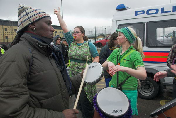
The samba band, brass band, ‘oil workers’ and others came to protest at the Shell Centre with a giant figure of US Vice-President Dick Cheney and a mock oil well as well as some with Iraqi flags.

I left them shortly after they set off to march first to protest outside BP’s headquarters in St James’s Square and then on to the US Embassy to go to New Scotland Yard.

Bush & Cheney’s Iraq Oil Grab


Freedom not Fear 2008

New Scotland Yard

Freedom not fear 2008 was an international protest in over 20 countries against excessive surveillance by governments and businesses, organised by a broad movement of campaigners and organisations.

A camera behind this person dressed in a sinister black suit and hood

The main UK event was a protest outside the Metropolitan Police headquarters, New Scotland Yard, then still in Victoria Street, Westminster. The protest was against the restriction of the right to demonstrate under SOCPA, the intimidatory use of photography by police FIT squads, the proposed introduction of ID cards, the increasing centralisation of personal data held by government, including the DNA database held by police, the incredible growth in surveillance cameras, ‘terrorist’ legislation and other measures which have affected our individual freedom and human rights.

The protest was within the area where restrictions on protests were introduced by the Serious Organised Crime and Police Act 2005 (SOCPA) which required the protesters to have given written notice to the Commissioner of the Metropolitan Police six days in advance for the event. But of course they had not as a part of the protest.

Police tried hard to give protesters SOCPA notices telling them that the protest was illegal but few took them or any interest in them. Some of the officers joked with the protesters who included People in Common and FitWatch, but sensibly they did not attempt to break up the protest or make any arrests, or at least not in the three-quarters of an hour or so I was present.

Freedom not Fear 2008


Rosary Crusade of Reparation

Westminster Cathedral

Young girls in white communion dress walked beside the statue of Our Lady of Fatima

I walked the short distance along Victoria Street to Westminster Cathedral where people were gathering for the Rosary Crusade of Reparation. This began in Austria in 1947 as a campaign by a Franciscan priest to free the country from communist control, and is said to have played a part in the Russian decision to allow Austria its independence in 1955.

THe first annual procession with the statue of Our Lady of Fatima took place in 1948 in Vienna on the feast of the Name of Mary, Sept 12th. This feast was set up by Pope Innocent XI in 1683 after Turkish invaders surrounding Vienna were defeated by Christian armies who had prayed to the Blessed Virgin.

Families at the front of the large crowd in the procession

The procession in London takes place on the nearest Saturday to the final appearance of Our Lady at Fatima in October 1917, close to the end of the First World War, when those present saw the sun dancing around in the sky, and she promised peace and an end to war if men showed contrition for their sins and changed their lives.

This was the 25 annual procession in London and had as its special theme atonement for the Human Fertilisation and Embryology Bill then passing through Parliament.

I photographed the start of the procession which was making its way slowly to Brompton Oratory.

More at Rosary Crusade of Reparation.


Parliament Square

I’d gone to Parliament Square to look for a two-man protest by the two Bens from the ‘Still Human Still Here‘ campaign dedicated to highlighting the plight of tens of thousands of refused asylum seekers who are being forced into abject poverty in an attempt to drive them out of the country. The two men had spent two weeks in a tent in the square living on the emergency rations that the Red Cross will supply to these inhumanely treated asylum seekers.

In the square I found a number of other protests taking place. Of course Brian Haw was there – as he had been for over 7 years – and I saw him being insulted by a man who smelled strongly of alcohol. There was a small group of Tamils who told me that they were part of a campaign giving out leaflets all over the centre of London about the ethnic cleansing taking place in Sri Lanka. Another small group, ‘London Against Detention’, was campaigning to close down Asylum detention centres.

In the corner close to the statue of Churchill was a man who told me he had been on hunger strike for two weeks in a protest to get his case properly investigated. He claimed to have been abused by police and social services following an incident in which as a seven year old child in Llanelli he was implicated in the death of a baby brother.

Finally I saw another group of people hurrying along the street opposite towards Whitehall carrying posters. I chased after them and found that they were Obama supporters hoping to persuade Americans they met to register and vote in the US election.

More at Parliament Square.


FlickrFacebookMy London DiaryHull PhotosLea ValleyParis
London’s Industrial HeritageLondon Photos

All photographs on this page are copyright © Peter Marshall.
Contact me to buy prints or licence to reproduce.


Uganda, Green Belt, Olympic Site – 2008

Uganda, Green Belt, Olympic Site: Thursday 9th October 2008 was Uganda Independence Day and I began work at a protest at the Ugandan Embassy in Trafalgar Square against the persecution of gays in that country. In Parliament Square I met protesters who had come from Dorset to bring a petition against a proposed new town on Green Belt land on the outskirts of Bournemouth and Poole. Then as I had a few hours before a meeting it was an opportunity to take another walk to see what I could by then of the fenced off Olympic site.


Demonstration Against Ugandan Human Rights Abuse

Ugandan Embassy, Trafalgar Square

Peter Tatchell of Outrage! and Davis Makyala of Changing Attitudes in the demo outside Uganda House

As I wrote in 2008, “October 9 is Uganda Independence Day, but for gay Ugandans in particular there is little to celebrate… “Homosexuality is illegal in Uganda and the penalty can be imprisonment for life, and gay rights campaigners have been imprisoned and subjected to torture. The Ugandan Anglican church is a leading force in anti-gay campaigns.”

The Ugandan government intimidates and tortures gay people and excludes them from healthcare. British arms exports have been used against protests there, killing at least three demonstrators by 2008.

Kizza Musinguzi who was jailed and tortured in Uganda receives the 2008 Sappho in Paradise book prize

Ugandans fleeing the country because of persecution and seeking asylum in the UK were among those forcibly sent back to the country without proper consideration of their cases under our “fast-track” process which was later declared unlawful.

Emma Ginn of https://medicaljustice.org.uk/ Medical Justice

The LGBTQ rights situation in Uganda is now even worse following the passage of ‘the Anti-Homosexuality Act, 2023, which prescribes up to twenty years in prison for “promotion of homosexuality”, life imprisonment for “homosexual acts”, and the death penalty for “aggravated homosexuality“.’

More on My London Diary at Ugandan Human Rights Abuse.


Green Belt Protest Rally

Westminster

People from villages on the outskirts of Bournemouth and Poole had come to protest against the proposed Lychett New Town on Green Belt land in Dorset.

Apparently Hazel Blears, Secretary of State, had told Dorset County Council it must build a New Town at Lytchett Minster with over 7,250 houses in the Green Belt around Poole & Bournemouth, and local residents had set up a campaign about it.

Octavia Hill had first proposed the idea of green belts in 1875 but it was the 1947 Town and Country Planning Act which allowed local authorities to set them up and they were further encouraged to do so by Tory Housing Minister Duncan Sandys in 1955. The idea was to put an end to the unplanned sprawl of ribbon development along major roads leading out from all our cities and provide areas for local food growing, forestry and outdoor leisure.

As I commented, “it has made a valuable contribution to improving the quality of life in our towns and villages and to conserving the countryside.” But as I also wrote, “Many of us feel that the whole of the current planning structure works against sensible and ecological development, but the answer to this is not to relax planning controls but to bring in improved – and in some respects tighter – controls.”

Unfortunately the changes announced by Labour in 2024 which include some Green Belt being re-classified as ‘Grey Belt’ seem largely intended to make things easier and more profitable for developers.

Consultations took place in 2025 over proposals for Lytchett Minster & Upton in the Dorset local plan which lists opportunity sites for over 5000 new homes – and a new petition was set up opposing them.

Green Belt Protest Rally


Stratford Marsh (Olympic Site) & Hackney Wick

Looking towards the main stadium in left half of picture, along what was once Marshgate Lane.

It has always been an interesting walk through Stratford marsh on top of the Northern Outfall sewer, although rather more so in the past when there were so many places one could leave it to explore further rather than coming up against the big blue fence.”

Bridge over City Mill River from the Greenway

I commented back then of my annoyance at the statements made by the Olympic authorities that after the Olympics they would be opening up the previously inaccessible area to the public. In fact they were destroying the area where it had always been interesting to wander along the various largely riverside footpaths – many of which had been cleared to make them easier to walk in the 1990s.

Work by Hackney Wick’s most prolific artist

You can see many pictures that I took in the area on my Lea Valley website And as a replacement we now have a park which seems rather arid. Perhaps by 2112 it might look better.

Foarmer Permanite Works

In 2008 most of the Olympic area was fenced off, but I enjoyed the walk along the ‘Greenway’ on top of the Northern Outfall Sewer to Hackney Wick where I dound much to interest me and “taking the train back from Hackney Wick to Stratford there were many signs of fairly frenzied activity visible.”

Wanted – Laura Norder – $5oo Reward – advertising an art fair at Decima Gallery in Hackney Wick

Many more pictures, particularly around Hackney Wick at Stratford Marsh (Olympic Site) & Hackney Wick.


FlickrFacebookMy London DiaryHull PhotosLea ValleyParis
London’s Industrial HeritageLondon Photos

All photographs on this page are copyright © Peter Marshall.
Contact me to buy prints or licence to reproduce.


Battlebridge, Canalside and Barnsbury – 1990

Battlebridge, Canalside and Barnsbury continues my walk which began at Kings Cross on Sunday February 11th 1990 with the post Kings Cross and Pentonville 1990.

Battlebridge Basin, Pentonville, Islington, 1990, 90-2b-11

Battlebridge Basin on the Regent’s Canal was opened at the same time as the Camden Town to Limehouse stretch of the canal in 1820, though the buildings around it took a couple of years longer to complete. In 1815 the landowner William Horsefall contracted with the canal company to allow them to dump the soil extracted from the Islington Tunnel a short distance away on his land, and he used this to form the basin.

It seems odd that you should need earth to form a basin, but it was needed to raise the ground level around it as part of the 480ft by 155ft basin is above the level of the streets around. Horsefall got an Act of Parliament to fill the basin with water from the canal and by 1822 it was surrounded by industrial premises, including timber yards. Among later occupants were W J Plaistowe & Co, jam, marmalade and preserve makers, here until 1926, and at Albert Wharf on the northeast corner were Cooper & Sewell (c1847-1880) and J Mowlem & Co (c1880-1922).

The best-known building on the basin was the warehouse built around 1860 by ice-cream maker Carlo Gatti to store ice brought from Norway, which since 1992 houses the London Canal Museum. In a Key Stage 2 teaching resource on their site is an excellent plan showing the uses of the different areas around the basin in the late 19th century.

Unlike other canal basins in London this was privately owned, known first of all as Horsefall Basin, then Maiden Lane Basin before taking its current name – the old name for the Kings Cross area, which had a bridge over the River Fleet. There seems to be no agreement as to which battle this was named after but few beleive the popular legend it was fought by Boudicea. In 1978 a group of boat owners came together so set up moorings here which over the years since have developed into a substantial marina.

Mercantile House, All Saints St, Pentonville, Islington, 1990, 90-2b-14

My previous post on this walk showed an overall picture of Mercantile House and gave a little of its history. In 1990 the whole site was undergoing redevelopment as you can see in pictures below. Mercantile House was retained.

All Saints St, Pentonville, Islington, 1990, 90-2b-13

I photographed Bartlett Ltd, Export Packers in 1979 from the canal towpath and wrote a little about Battlebridge Basin and Bartlett’s works then and wrote:

Although many of the canal-side buildings in the area have been replaced, a warehouse on the basin of Bartlett Export Packers survives in greatly altered form as Albert Dock. The works buildings in this picture, at the end of New Wharf Road, have been replaced by those of Ice Wharf, three blocks with 94 apartments in a highly regulated private development with 24 hour concierge service and a private, gated underground parking space where a 2 bed flat overlooking the canal could be yours for only £1,195,000.

Demolition of the buildings on All Saints Street whichg meets New Wharf Road at its west end provided me this view of part of Bartletts from here.

Regent's Canal, View West, from, Caledonian Rd, Pentonville, Islington, 90-2c-64
Regent’s Canal, View West, from, Caledonian Rd, Pentonville, Islington, 90-2c-64

From Thornhill Bridge on the Caledonian Road over the canal I could see the cleared development site and, in the distance St Pancras Hotel, the Post Office Tower and other buildings. At the left are the back of buildings on Caledonian Rd.

Regent's Canal, View West, from, Caledonian Rd, Pentonville, Islington, 1990, 90-2c-65
Regent’s Canal, View West, from, Caledonian Rd, Pentonville, Islington, 1990, 90-2c-65

A second view west from Thornhill Bridge includes Bartlett’s water tank and canalside buildings.

Thornhill Crescent, Barnsbury, Islington, 1990, 90-2c-52

I walked on north up Caledonian Road to Thornhill Crescent at the northern end of Thornhill Square, once of the well-known Barnsbury Squares, though it certainly is not square – together they are more of an oval, narrowing towards the southern end. Wikipedia calls it “an unusual large ovoid ellipse“.

Much of the land around here was owned by the Thornhill family who had come from Yorkshire and let to dairy farmers. George Thornhill began Thornhill Square in 1847, and Samuel Pocock, one of those rich farmers began Thronhill Crescent around 1849.

Lived in at first by prosperous middle class households, the area became run-down by the middle of the last century with many properties in multiple occupation and high levels of street crime. But Islington became fashionable in the 1960 and 70s and gentrification led many of those living to purchase the freeholds and the area went upmarket. Some flats now sell for over a million pounds and entire houses over two million.

More from Barnsbury in the next post in this series.


FlickrFacebookMy London DiaryHull PhotosLea ValleyParis
London’s Industrial HeritageLondon Photos

All photographs on this page are copyright © Peter Marshall.
Contact me to buy prints or licence to reproduce.


More City Panoramas – 1994

More City Panoramas: I spent several days wandering around the City of London – the “Square Mile” in July and August 1994, I think in prepaation for a group show in which I had decided this would be my contribution.

More City Panoramas - 1994
Bubbs, Restaurant Francais, Farringdon Rd, West Smithfield, City, 1994, 94-702-43

Bubb’s Le Restaurant Francais with the address Central Market, Farringdon Street is long closed, but a listing states that they served “a variety of traditional French dishes at their restaurant and can cater for private parties of up to 30 guests upon request.” There are still several French restaurants in the area.

A little further down West Smithfield was the London Central Market with on the corner a wholesale Cash and Carry and Harry’s Drinks and in the distance a covered way across the road between market buildings.

I photographed this corner on several occasions, making a similar panorama here in 1992, perhaps why I have not put this on Flickr.

More City Panoramas - 1994
River Thames, Thames Path, Vintners Hall, Paul’s Walk, City, 1994, 94-703-52

Looking west along the river to Bull Wharf, Queenhithe and beyond. Bull Wharf proudly states it was REBUILT 1980 and it looks to me exceedingly ugly, probably why I didn’t upload this picture to Flickr. My picture perhaps makes the red brickwork event more virulent – the building looks much better to me in a black and white non-panoramic image I made at the same time from more or less the same spot.

Car Park, Smithfield St, City, 1994, 94-704-51

Slightly out of focus in the distance I can just make out Lady Justice on the roof of the Old Bailey and to her right more clearly the tower of Holy Sepulchre Church at the east end of Holborn Viaduct.

I think this car park probably extended to Hosier Lane and is now filled with the shops and offices of 12 Smithfield Street, built in 2004 and now described on Buildington as “an outdated office block that has suffered from poor environmental performance, limited architectural merit, and inefficient servicing. Its ground floor lacks engagement with the surrounding public realm, and its dated façade no longer reflects the character of the conservation area” and being refurbished and extended.

St Mary Somerset Church, Upper Thames St, City , 1994, 94-704-13

A rather dark rendering of this high contrast scene with deep shadow the block of St Paul’s Vista (or 1 High Timber St, now One Millennium Bridge) straddles Upper Thames Street with the bright sky above. My picture was made from the footbridge of Fye Foot Lane carrying a section of the CIty’s Highwalk across Upper Thames Street and Castle Baynard Street and on to Queen Victoria Street.

St Mary Somerset Church was one of those destroyed in the Great Fire of London in 1666 and like 50 others rebuilt by the office of Sir Christopher Wren. The tower remains between Lambeth Hill and Castle Baynard Street but the rest of the church was demolished in 1871 when like other redundant churches the land was sold to build churches in the rapidly expanding suburbs of London. The tower was a Ladies toilet before the Second World War, Damaged by bombing, it was restored by the city in 1956 and has now been converted into a private residence.

More City Panoramas - 1994
Highwalk, Footbridge, Huggin Hill, Upper Thames St, City, 1994, 94-705-41

A fruit and vegetable stall on the pavement in Front of St Mary Aldermary (another rebuilt by Wren after the Great Fire) on busy Queen Victoria Street which you can see at extreme left. I think the extremely low stone wall on the pavement and the railings mark the former edge of its churchyard.

I liked the range of architectural age and style across the upper half of this image, and particularly admired the ornate Victorian block in the centre of the picture. As well as a bus and a coach there are 5 London taxis in the picture, an aspect of London’s traffic congestion long overdue for reform.

Highwalk, Footbridge, Queen Victoria St, City, 1994, 94-705-31
Highwalk, Footbridge, Huggin Hill, Upper Thames St, City, 1994, 94-705-31

This was taken from a now-closed section of Highwalk across Upper Thames Street and the church at left is St Mary Somerset. The alley at right is Huggin Hill with a view of the distinctive building on the block between Queen Victoria St, Bread Lane and Cannon Street, 30 Cannon St built for Crédit Lyonnais between 1974 and 1977.

Highwalk, London Wall, City, 1994, 94-706-51

So many buildings have changed around here since 1994. The building right of centre is Standard Chartered on the corner of Aldermanbury and Aldermanbury Square and was remodelled around 2010 and the building left of centre is Brewer’s Hall, now with a roof extension. I think this section of the highwalk led up at Brewers Hall Gardens

More from July 1994 in the City later.


FlickrFacebookMy London DiaryHull PhotosLea ValleyParis
London’s Industrial HeritageLondon Photos

All photographs on this page are copyright © Peter Marshall.
Contact me to buy prints or licence to reproduce.

Kings Cross and Pentonville 1990

Kings Cross and Pentonville: Although I took a few pictures in the next few weeks, mainly on my way to or from meetings, it was well into February before I was able to go on another long photographic walk. Of course the weather at that time of year often isn’t too kind and days are short, but winter is the best season for photographing much of London’s buildings, as so much is hidden once trees come into leaf.

Grays Inn Rd, Kings Cross, Camden, 1990, 90-2b-54

I can’t now recall why I decided to return to the Kings Cross area on Sunday February 11th 1990, though I liked to revisit areas periodically, and the journey to the Victoria line station was an easy one, suitable for short days to give me more hours of usable light.

I left the station by the Pentonville Road entrance and walked back towards the main station, taking a couple of pictures on my way before heading down Grays Inn Road. This picture looking back towards Kings Cross Station includes both the station clock tower – I seem to have arrived shortly before 10am – and the well-known “lighthouse” built simply as advertising for Netten’s Oyster Bar. What seems an incredibly long horizontal pole holds one of the many traffic lights in the area .

Posters, Grays Inn Rd, Kings Cross, Camden, 1990, 90-2b-55

In the centre of these fly-posted posters is an advert for ‘THE BEST SHOP IN TOWN’, SHE-AN-ME at 123 Hammersmith Road, West Kensington, London W14. It offers ‘UNUSUAL – BONED DRESSES – 6″ HEEL BOOTS – LATEX RUBBER …’ and much more, a fetish shop specialising in PVC, rubberwear and bondage equipment. Although Yelp still has a listing for the business it is long gone; after some years as ‘Simply Pleasure’ it is now ‘Quick Local Store’ selling snacks, cold drinks, tobacco, souvenirs, toiletries and household items.

Scales, Weights, 319-321, Grays Inn Rd, Kings Cross, Camden, 1990, 90-2b-56

One of London’s more photographed signs, though now a little faded and above a Nail Bar and Computer Centre on this nicely curved building. The Greek Restuarant at 325 is now a fast-food place – and is flanked by two others.

Tattoo Studio, Pentonville Rd, Pentonville, Islington, 1990, 90-2b-43
Tattoo Studio, Pentonville Rd, Pentonville, Camden, 1990, 90-2b-43

I walked back onto Pentonville Road, here the boundary between the London boroughs of Camden and Islington. Modern Jock’s Tattoo Studio on the south side was on the ground floor and Chestnuts Hair Studio for Men and Women through the same door on the first floor, illustrated by arrows for the non-literate. Born around 1920 British tattooing legend Jock Liddel started as a tattoo artist at the age of 16 in Scotland and his famous shop was at 287 Pentonville Road for many years. He died in 1995 but had moved down to Kent a few years earlier. His shop and several adjoining are now an American multinational fast food burger and fries chain.

Signs, Caledonian Rd, Pentonville, Islington, 1990, 90-2b-34

‘Kings X People Say NO’ to the Chunnel Terminal for Kings X – Chaos for London’ read the array of posters on the back of a road sign, one of four signs in this picture, along with those for the Autodrome, Peacemeal Whole Foods and Loseley Dairy Ice Cream.

I was briefly and peripherally involved with the Kings Cross Railway Lands Group and their ‘Planning for Real’ exercise with local residents which formed a basis for the comprehensive alternative plan published in their Kings Cross Railwaylands Towards a People’s Plan Full Report published in October 1991.

Of course their plans were not adopted but the opposition certainly played a part in the decision to drop the plans for a new Kings Cross and instead to develop St Pancras as the international terminal. As an article on Londonist points out, “The plans would have seen 83 homes and 58 shops demolished. The scale of destruction would have witnessed landmark listed buildings like the Scala pulled down … The entire block between Caledonian Road, York Way and Caledonia Street would have also been lost.”

Northdown St, Caledonian Rd, Pentonville, Islington, 1990, 90-2b-23

The Kings X Sauna on the corner of Northdown Street and more useful shops and offices on Caldedonian Road. The sauna at No.70 later became an estate agents.

Mercantile House, All Saints St, Pentonville, Islington, 1990, 90-2b-25

Further north on Caledonian Road I turned west into All Saints St where I photographed Mercantile House which appropriately later became home to global brand consultancy agency Wolff Olins – who have now moved to Southwark.

Work began in 2022 to transform this and other buildings on the site into Regent’s Wharf, “a ground-breaking new campus … created with the next generation of innovators in mind.”

Mercantile House was built in 1891 as the Head Office for Thorley’s Food for Cattle with their mill behind it on the bank of the Regent’s Canal. They had moved onto the site in 1857.

A family owned business for over 100 years, Joseph Thorley’s Ltd was an iconic player of the industrial age, inventing and distributing ‘spicy aromatic condiments’ that would beef up your cattle, pep up your pigs and ensure your chicken laid the best clutch in the roost.

This MiracleGro for animals was made to a secret recipe and sold around the world even in far flung outposts such as the Falkland Islands, all from the headquarters at Regent’s Wharf in King’s Cross.”

Thorley’s progressive ideas extended to their charming and playful marketing, with eye-catching advertising and branding that has become collectable today. Animal feeds went by many wonderful names such as Grula for Horses, the famous Thorley’s Cake that reared ‘Champions’, Ovum for chickens and Rabbitum.”

More from this walk later.


FlickrFacebookMy London DiaryHull PhotosLea ValleyParis
London’s Industrial HeritageLondon Photos

All photographs on this page are copyright © Peter Marshall.
Contact me to buy prints or licence to reproduce.

Sri Guru Singh Sabha Gurdwara – Southall 2005

Sri Guru Singh Sabha Gurdwara: On Saturday 1st October 2005 I enjoyed a tour of the largest Sikh Gurdwara in Europe. Building had begun in 2000 and the temple opened at the end of March 2003. The tour had been arranged by art and urban historian Mireille Galinou for the now long-defunct and much missed group ‘London Arts Café‘ – and you can still read more about on the web site I wrote for it, although the group came to an end in 2008.

Sri Guru Singh Sabha Gurdwara - Southall  2005
The use of stained galls is unusual in a Gurdwara

Here is what I wrote about the visit in 2005 and a few of the pictures I took at the Gurdwara – there are more on My London Diary.


October started with a fine day, and I went to visit the largest Sikh Temple or Gurdwara in europe (and the fourth largest in the world) which opened a couple of years ago in Southall, along with a group of friends from the London Arts Café. We were shown around the building by one of the Sikh volunteer guides and also the architect, Richard Adams of Architect Co-Partnership, which had won the open competition to design the building. He had worked fully with the Sikh community to produce a building suited to their needs, and it does so impressively: clean simple surfaces, powerful colour in the windows and light streaming into the central stairway and lobby from the large window and glass roof areas.

Sri Guru Singh Sabha Gurdwara - Southall  2005
Gold leaf covers the main dome of the Gurdwara
Sri Guru Singh Sabha Gurdwara - Southall  2005
The Wedding Room
Sri Guru Singh Sabha Gurdwara - Southall  2005

The Sri Guru Singh Sabha Gurdwara serves the community, both for workship and for other needs. As well as a vast prayer hall officially capable of seating up to 3,000 people (and actually holding rather more at major festivals) there is a fine marriage room, and various other facilities including a Langar (Dining Hall); this free community kitchen can serve over 20,000 vegetarian meals over a festival weekend.

Sri Guru Singh Sabha Gurdwara - Southall  2005
Preparing the vegetables
A team of women prepare pancakes

The Gurdwara had a powerfully religious atmosphere. On entering we followed the customary practice of removing our shoes, covering our heads with the scarves provided and washing our hands before commencing our visit.

The Prayer Hall

At various points both our guide and the architect explained how the building served the basic Sikh tenets of service, humility and equality, and also the spiritual guidance from the Sri Guru Granth Sahib, the religious writings which are were appointed as spiritual head of the Sikh religion, the Eternal Guru, by Guru Gobind Singh around three hundred years ago.

Musicians in the Prayer Hall

Although the architecture and the prayer hall in particular were impressive, what made the strongest impression on me was the kitchen, especially the team of women working together. The food was excellent, a real pleasure to eat, although my still rather painful knee made it easier for me to stand and eat at one of the tables rather than in the traditional manner seated on the floor. Although food is free, those eating may perform some service to the temple in thanks for their food, or give an donation of some kind, which we gladly did.

Southall is now Britain’s holy city, apparently with places of worship for over 50 religions or denominations. Brother Daniel Faivre’s ‘Glimpses Of A Holy City‘ published in 2001 after more than 20 years of living in Southall gives a good insight into some of this diversity.


Unfortunately Brother Daniel Faivre’s 104 page spiral bound book published in 2001 is no longer available. The Sri Guru Singh Sabha Gurdwara is, according to Wikipedia one of ten Sikh Gurdwaras in Southall, which also has two large Hindu ‘Mandir’ temples, six Mosques and “more than ten Christian churches including 5 Anglican, one Roman Catholic (St Anselm’s Church), Baptist, Methodist and several Pentecostal or Independent.” In the 2021 Census, 28.5% of the population were Sikh, 24.1% Muslim, 22.6% Christian 22.6% and 14.2% Hindu.

More pictures on My London Diary include some taken in Southall after leaving the Gurdwara.


FlickrFacebookMy London DiaryHull PhotosLea ValleyParis
London’s Industrial HeritageLondon Photos

All photographs on this page are copyright © Peter Marshall.
Contact me to buy prints or licence to reproduce.

Surbiton Festival 2006

Surbiton Festival: On Saturday 30th September 2006 I went to Surbiton to photograph the annual Surbiton Festival for the second time.

Surbiton Festival 2006
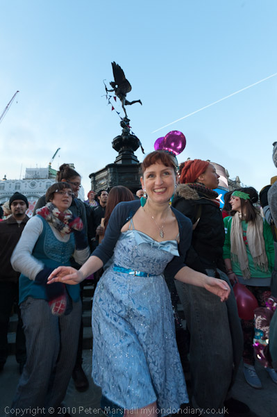
Balloons and morris dancers in Surbiton station car park

As a part of my photography of London I attended quite a few local events across London in the first decade of this century – in September 2004 I had photographed the Surbiton Festival and also the Angel Canal Festival, Walthamstow Festival, the City of London Flower Show, Lady Somerset Road Street Party, Brick Lane Festival, Thames Day, the Shoreditch Car Free Festival and Leytonstone Car-Free Festival, as well as several political protests and other events. I found it interesting how some of these reflected the different population of these areas.

Surbiton Festival 2006

But in 2006 I had another reason to go back to Surbiton, in that I was to appear with two other photographers, Mike Seaborne and Paul Baldesare in the exhibition Another London, at Kingston Museum in January 2007 and I wanted to include some pictures from the local area in my section of the show.

Surbiton Festival 2006
The band played sheltering from the heavy showers

You can still see all 26 of my pictures from that show (and those by the other two. My set included pictures from both the Surbiton Festivals I attended, as well as one from the July 2006 Kingston Regatta, two from the September 2006 Kingston Festival and one of Koreans watching the World Cup in nearby New Malden.

Surbiton Festival 2006

Surbiton is centred around Surbiton Station, a classic 1930s Southern Railway modernist structure and an important commuter station with an incredibly frequent service – around ten trains an hour to Waterloo, the faster taking around 20 minutes.

When it was first developed in the 1840s it was called ‘Kingston-upon-Railway‘, only getting its current name in 1869 – although this is a name with medieval roots, with Suth Bere-tun being Old English for an outlying farm – then part of the Royal Manor of Kingston (Norbiton was closer to the centre.)

Only one military vehicle joined this year’s parade – unless you count the model held out in the driver’s hand.

Kingston is an ancient town – it was the town where Anglo-Saxon kings were crowned – but the Surbiton Festival is a modern tradition, begun by the Rotary Club a little over 25 years ago. It seems to have grown considerably since I went in 2006. The 2025 festival was last Saturday and though I considered briefly whether to go, I decided I had other things to do. Perhaps next year…

Beavers, Cubs, scouts and guides were all present

You can see a few more of the pictures I took in 2006 on My London Diary. The short text I wrote is a little hidden, so here it is in full – though there is more information in the picture captions.


The Annual Surbiton Festival seems still to be very much a local community based affair, and takes over one of the main shopping streets, still mainly lined by small shops. This year it’s centre was the station car park, with room for a brass band, morris dancing and other activities.

The day started with driving rain, but fortunately it stopped in time for the festival to start, opened by the Mayor of Kingston. I followed her for a while as she visited the stalls along the street, taking a real interest in what was going on.

The 10 am start meant that at first the streets were rather empty, but things began to fill up later. The parade was a little thinner than in previous years, and we [Paul Baldesare and myself] were disappointed not to see more.

After the parade I went back to watch the morris dancers perform a second set, but as it came on to rain, I decided it was time to take a train elsewhere


The Greensleeves Morris men

FlickrFacebookMy London DiaryHull PhotosLea ValleyParis
London’s Industrial HeritageLondon Photos

All photographs on this page are copyright © Peter Marshall.
Contact me to buy prints or licence to reproduce.

Limehouse and the City – Panoramas 1994

Limehouse and the City – Panoramas 1994: I made one panorama at the end of my trip to Limehouse in June which is on a film processed in July which I overlooked when posting pictures to Flickr.

DLR Viaduct, Limehouse, Tower Hamlets, 1994, 94-701-51

This was taken from the top floor of John Scurr House on Ratcliffe Lane where there are open balconies leading to the flats it shows both the National Rail and DLR Limehouse stations with the DLR viaduct leading east, with the white tower of St Anne’s Limehouse just visible at extreme right before the top of the brickwork of the stairs.

You can also just see the north side of Limehouse Basin on the other side of Branch Road, and lower right of centre is a small but packed garden centre. A bus goes along Commercial Road and you can see the houses and flats of Limehouse and Bow beyond. Like all the other pictures in this post it was taken with a swing-lens panoramic camera with a horizontal angle of view of over 120 degrees.
Blackfriars Rail Bridge, Blackfriars Bridge, River Thames, Southwark, 1994, 94-701-42

Early in July I took a train to Waterloo and walked into the City from there, pausing before I crossed Blackfriars Bridge to make this panorama. This is the only place where the City comes ‘South of the River’ and where I was standing in Rennie Garden I was already in the City of London, though the wall at right and half the rail bridge past it is in Southwark.

While the City boundary for the other bridges is in the centre of the river, for some reason the Blackfriars and Southwark Bridges Act 1867 put the full length and its southern end within the city’s borders, in the parish of St Anne Blackfriars.

The garden here Rennie Garden is named after John Rennie (1761 – 1821) the engineer who built several of London’s bridges but not this one, which was by by Joseph Cubitt, also responsible for the dismantled railway bridge whose red piers remain.

This was the site of the Albion Flour Mills designed by Samuel Wyatt on this site in 1786 to house the machinery of Matthew Boulton and steam engine of James Watt – and it was this steam-powered corn mill, the first major factory in London, which is thought to be the inspiration for William Blake’s ‘dark satanic mills’.

The Albion Mill died by its own hand, burnt down in 1791 by a fire probably caused by poor maintenance when a bearing overheated, but four years earlier Robert Barker had sent his son Henry Aston Barker to sit on the roof of the building to make the sketches for his ‘London from the roof of the Albion Mills‘ which he then added detail, “greatly enlarged and painted in distemper on canvas.” He coined the name ‘panorama’ and in 1787 patented the idea. His panorama, first shown at the Albion Mill shortly before it was burnt down and then shown in various galleries in London.

Sets of aquatints were made by Frederick Birnie which toured Europe and went to the United States and while these survive in various collections the original panorama is lost.

Puddle Dock, Queen Victoria St, City, 1994, 94-701-33

Puddle Dock was a dock and also a sewer outfall and was filled in during the comprehensive reclamation and redevelopment of the area between 1962 and 1972 which created Upper Thames Street as a major road and Puddle Dock linking this to Queen Victoria Street underneath part of Baynard House, a Brutalist office block built for BT and completed in 1979.

As a part of plans to separate vehicle and pedestrian movement in the City it included a walkway leading to Blackfriars Station from which I made this panorama. The dome of St Paul’s can be seen just to the left of the tower of St Andrew by the Wardrobe.
Sculpture, Farringdon Rd, Holborn Viaduct, City, 1994, 94-702-51

Holborn Viaduct was London’s first flyover, connecting the City with Holborn over the deep valley of the River Fleet, which had be culverted here in the 18th century, in part for the building of New Bridge Street. Built in 1863-69 it links Holborn Circus with Newgate Street and was a major redevelopment ‘”the most ambitious and costly improvement scheme of the [nineteenth] century” (White 47), and it involved some outstanding feats of Victorian engineering.
Over the years I’ve made quite a few panoramas on and of the viaduct and written about it at some length – here are a few from 1994. You can read a detailed account on the Victorian Web site.

Sculpture, Farringdon Rd, Holborn Viaduct, City, 1994, 94-702-52
Sculpture, Farringdon Rd, Holborn Viaduct, City, 1994, 94-703-11

More from July 1994 in the City later.


FlickrFacebookMy London DiaryHull PhotosLea ValleyParis
London’s Industrial HeritageLondon Photos

All photographs on this page are copyright © Peter Marshall.
Contact me to buy prints or licence to reproduce.