Posts Tagged ‘lighthouse’

Kings Cross, St George’s Gardens & More

Monday, March 27th, 2023

The day after my short trip to Canning Town the weather was again looking good and so on Saturday 8th April 1989 I was out again walking and taking pictures. This time my starting point was King’s Cross St Pancras Underground Station (not then International.)

Kings Cross, Lighthouse, Pentonville Rd, Gray's Inn Rd, Islington, Camden, 1989 89-4c-41
Kings Cross, Lighthouse, Pentonville Rd, Gray’s Inn Rd, Islington, Camden, 1989 89-4c-41

Immediately on coming out of the station I crossed the Euston Road and took a photograph looking across the busy junction between Pentonville Road and Grays Inn Road. Later this was to be transformed into the death trap for cyclists it now is, after the road engineers were told to ignore cyclists in planning the junction, and I’ve photographed a number of protests there. In the past ten years at least three cyclists have been killed and 15 seriously injured here.

Back in 1989 before the redesign it was almost certainly safer, as traffic here was usually moving rather more slowly – and in my picture I think is at a complete standstill.

The building at the centre of the image is the famous “lighthouse” whose presence has invited a litany of stories, almost all empty fabrication and speculation. But it seems that it was built between 1875 and 1885 to promote Netten’s Oyster Bar then doing a roaring fast food service at street level. Later the block became home to one of London’s best known jazz record stores, Mole Jazz, which opened at 374 Gray’s Inn Road in July 1978 – and I became one of its early customers, though I had given up buying records long before it closed in 2004.

The lighthouse seems in decent condition in my picture, but more recently deteriorated and became covered in graffiti. The building has recently been refurbished as the Lighthouse King’s Cross office space, with a top floor bar and roof terrace around the lighthouse itself.

Kings Cross Station, Euston Ed, Camden, 1989 89-4c-42

I turned around and took another picture, looking back at Kings Cross Station across Euston Road. The view here remained much the same until around 2021 when the more recent buildings in front of the 1851-2 station building, designed by Lewis Cubitt, the younger brother of both Thomas Cubitt responsible for much of London’s nineteenth century housing and William Cubitt, another important developer, who gave his name to Cubitt Town on the Isle of Dogs and later served two consecutive terms as Lord Mayor of London.

The station building is Grade I listed, and the recent changes have I think greatly improved it.

St George's Gardens, Sidmouth St, Camden, 1989 89-4c-32
St George’s Gardens, Sidmouth St, Camden, 1989 89-4c-32

There are many parts of London which it is hard to assign a name to, and the one I was walking around on this Saturday was one of them. My street atlas calls it ‘St Pancras’, I think it is part of Camden’s King’s Cross Ward, and when I’ve often walked across it from Tavistock Square I’ve always thought of it as Bloomsbury. Wikipedia has a rather lengthy discussion which says in part “Bloomsbury no longer has official boundaries and is subject to varying informal definitions, based for convenience“.

St George’s Gardens began in 1713-4 as a joint burial ground for St George-the-Martyr, Holborn (in Queen’s Square, now known as St George’s Holborn) and St George’s Bloomsbury and still has a line of stones marking the division of the area between the two churches, both of which had run out of space for burial in their churchyards. It was one of the earliest London burial sites situated away from the churches it served.

St George's Gardens, Sidmouth St, Camden, 1989 89-4c-34
St George’s Gardens, Sidmouth St, Camden, 1989 89-4c-34

But people kept on dying, and where buried here, mainly in unmarked graves. By 1885 there was no more room, and it was closed for burials. As a consecrated burial ground it could not be built on and burial grounds such as this were fast becoming the only open spaces in central London. “Campaigners including Miranda Hill and the Kyrle Society and Octavia Hill fought to create ‘outdoor sitting rooms’ to ‘bring beauty home to the poor’. St George’s Gardens were opened in 1884.”

St George's Gardens, Sidmouth St, Camden, 1989 89-4c-33
St George’s Gardens, Sidmouth St, Camden, 1989 89-4c-33

I made ten pictures here, of which three are online. The Friends of St George’s Gardens say that by 1997 the gardens were very run down, though I don’t think this is apparent in my pictures which show neatly cut grass and generally well-tended areas. The Friends were formed in 1994 when they say there had been a “prolonged period of neglect” and the gardens have been restored since then, with a lottery grant in 2001 and other and continuing work by the Friends.

Houses, Frederick St, Camden, 1989 89-4c-12

Frederick Street was one of those developed by Thomas Cubitt and Numbers 48-52 date from 1815-1821, a few years earlier than some of the other Grade II listed houses on the street. Before making this picture I’d also photographed (not online) on of his terraces in Ampton Street, parallel and a few yards to the south. Both run east from Greys Inn Road, where in later years I often visited the NUJ offices on the corner with Acton Street.

Royal National Throat, Nose and Ear Hospital Swinton St, Camden, 1989 89-4c-16
Royal National Throat, Nose and Ear Hospital Swinton St, Camden, 1989

Walking north up Greys Inn Road past the NUJ offices (now at ground floor Bread&Roses @ The Chapel Bar) the next corner a few yards on is Swinton Street, and a few yards down there is this five floor frontage of the Royal National Throat, Nose and Ear Hospital towering above the fairly narrow street.

This hospital remained in use until March 2020, when it was closed a few months earlier than planned due to Covid-19. Until then it was still offering inpatients ear, nose and throat (ENT) and oral surgery, sleep diagnostics and allergy day case services.

The hospital had been set up in 1874 as the Central London Throat and Ear Hospital by two doctors who had previously worked at the first specialist throat hospital in the country, the Hospital for Diseases of the Throat in Golden Square.

The hospital’s original building was begun on the Grays Inn Road in 1875, and various other buildings and wards were later added, with the hospital eventually covering a large site between here and Wicklow St. This rather odd building on Swinton Street was the Nurses’ Home, built in the 1930s.

More about my walk in later posts.


Hull Colour – 7

Saturday, July 18th, 2020
Lighthouse, Paull 81-04-Hull-043_2400

I think that Paull was one of the places we may have walked to during one of our stays in Hull, taking a bus to somewhere outside the city to a suitable starting point. There were a couple of time I hired a car, but I think only to go for holiday weeks elsewhere in Yorkshire. The last time I hired one I managed to drive it off the road into a ploughed field at some speed somewhere near Meaux (which despite the name is on the outskirts of Hull) and decided the time had come for me to give up driving.

Strangely given that back in 1965 when I first visited Hull was a city full of bicycles it was over 35 years before I ever cycled around the city. And when I did in 2003, I visited Paull for a second time, though actually riding there from Hornsea.

Paull is a riverside village on the north bank of the Humber a few miles south-east of Hull, just beyond Hedon Haven. Neither Paull nor Hedon grew as ports because sandbanks in the Humber made them unsuitable for larger ships, while a deepwater channel led towards the mouth of the River Hull.

Navigation in and out of Hull was tricky, and in 1836 Trinity House built the lighthouse at Paull for ships leaving Hull to steer towards, before picking up other lights on the south side of the estuary. Unfortunately the channel soon moved and by around 1870 this lighthouse was obsolete and was replaced by two ‘leading lights’ a little further downstream at Thorngumbald Clough.

This extensive Grade II listed property was offered for sale in 2013 for £169,950 though it is unclear if it was sold and a rather lower bid was considered. For those of us used to London prices it seems excessively cheap.

Mouth of River Hull, RIver Humber 81-04-Hull-044_2400

This picture amused me after photographing the Humber Bridge and I think I captioned it at the time as “Not the Humber Bridge” . The view is actually of both the River Hull, coming in from the left and the Humber across the top of the image, and the spit of mud and sand is Sammy’s Point, where Hull’s major tourist attraction, ‘The Deep’ now stands, a little back from the point here.

This was a short gangway leading out to a iron-sheathed concrete dolphin at the mouth of the River Hull from the end of Nelson St. The dolphin, designed as a temporary mooring in deep water for vessels waiting for the tide to go up the River Hull (and perhaps to protect the bank from vessels off course) is still there, but the promenade has been rebuilt to stretch to the dolphin, and a footpath now leads north from it beside the Hull.

Alley in Old Town, Hull 81-04-Hull-050_2400
Alley in Old Town, Hull 1981

I can’t remember precisely where this was, but the view through it is to the wholesale fruit and vegetable traders, probably on Humber St, though possibly on Wellington St. I think this may have been an alley leading from Blanket Row, but the area has changed too much for me to now be sure.

Clearly I was attracted by both the atmosphere of the alley leading to the street and by the colour, particularly the three areas of blue against the muted yellows. Blue mixed with yellow in my paintbox to make greens and green is the only other colour in this image.

Barge R57 moored at wharf north of Ferry Lane, Hull 81-04-Hull-052_2400
Barge R57 moored at wharf north of Ferry Lane, Hull 1981

The last time I was in Hull I sat eating a lunchtime snack beside the River Hull here, though the scene had changed a little.

There was actually a barge moored a little downstream, though looking rather derelict, but I was surprised to find that there were still a couple of buildings from the earlier image remaining.

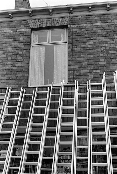
East Hull Ladder Works, Hull 81hull81003_2400
East Hull Ladder Works, Hull 1981

I don’t know the name of the dog or the name of the street where the East Hull Ladder Works then stood, but am fairly sure that it and the houses along the street either fell down or were demolished not long after I made the picture.

Probably this was a side-street off of Holderness Rd, well-placed for timber which came into Hull’s Victoria Dock. The rapid growth of Hull during the 19th century with its tremendous boom in house building will have created considerable demand for ladders.

Holderness Rd, 1977 – East Hull

And there were certainly plenty of them for sale on the Holderness Road as this picture from my web site ‘Still Occupied – A View of Hull‘ shows.

Sissons Paints, mosaic, Clough Rd, Bankside, Hull 81-04-Hull-058_2400
Sissons Paints, mosaic, Clough Rd, Bankside, Hull 81

Sisson’s Paints were another famous brand from Hull, and their advertising often used their 1910 trademark of two painters carrying cans of paint and a plank. Sisson’s won a court case against a far-eastern company that copied it, replacing the plank with a ladder, but now Sissons Paints Malaysia, one of several foreign companies that continue its name, uses it with a ladder. In the early years adverts using it had the plank carrying the text ‘Hall’s. Distemper’, a product responsible for many gloomy hallways across the world, which over the years I’ve cleaned laboriously from several walls.

Sisson’s extensive works were beside the River Hull at Bankside and had this mosaic installed in 1953 (their 150th anniversary) when they were rebuilt after wartime bombing. The company was bought by Reckitt and Colman in 1964, sold on to the Donald Macpherson Group in 1968 and taken over by  Finland’s largest paint manufacturer Tikkurila Oy in 1984, though production in Hull had I think ceased before this and the plant looked derelict when I took this picture. It was demolished in the early 1990s and the mosaic lost. All that remains is the gates.

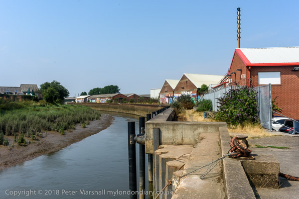
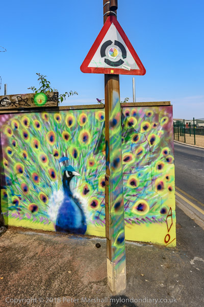
Part of the large area occupied by the factory is now more colourful than ever as a part of the Bankside Gallery which sprung up following Banksy’s addition ‘Draw The Raised Bridge’ on Scott Street bridge in January 2018.

Bankside Gallery, 2018

Hull Colour 1972-85 on Flickr.


All photographs on this and my other sites, unless otherwise stated, are taken by and copyright of Peter Marshall, and are available for reproduction or can be bought as prints.