Hull 2025 – An Evening Stroll: The second and final post of pictures I made on our first evening in Hull last week.
Part 1 of this post ended on Princes Dock Street. The pictures here are in the order I took them on Tuesday 12th August 2025 and the first image here was taken just a few yards further down the street.
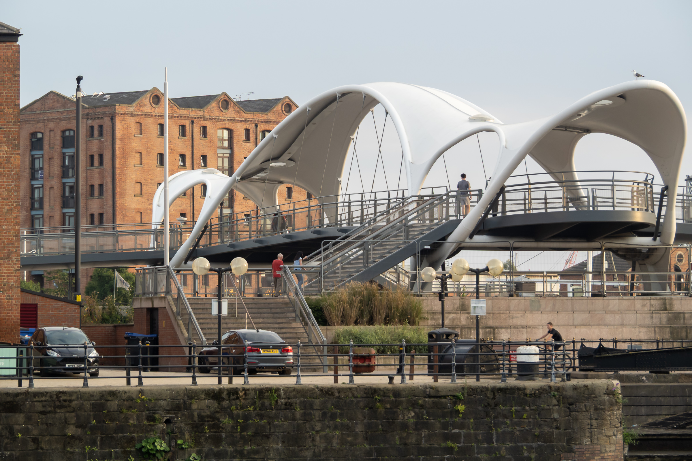
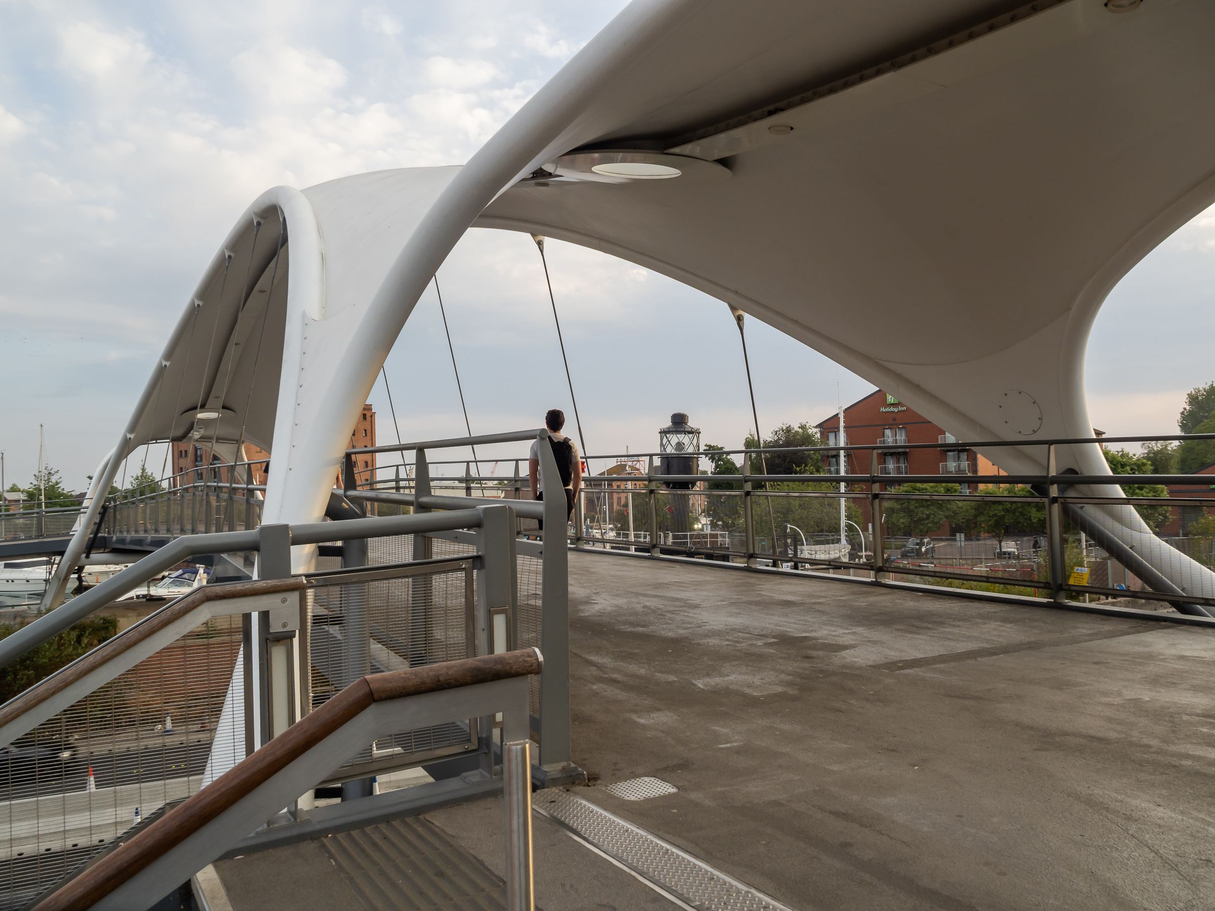
Humber Dock, now a marina, Railway Dock and the southern part of the Old Town have been brutally split from the rest of the city by the busy A63. Its hard to understand why the city council allowed this to happen with as it did, with so few places where this barrier can be crossed, and the provision of a rather odd footbridge, Murdoch’s Connection, is a rather unsatisfactory sop.
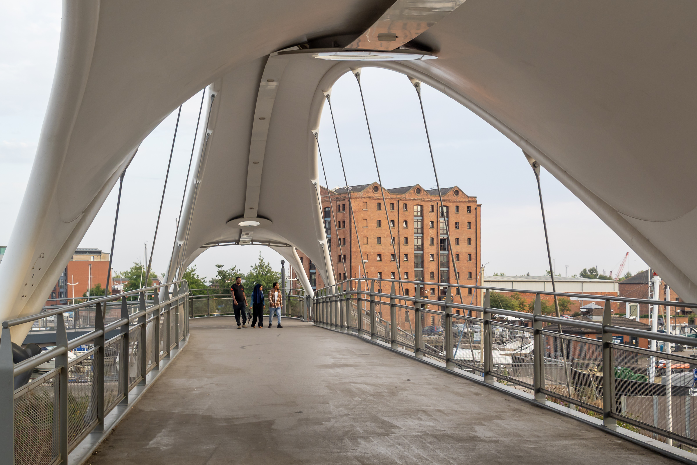
Fortunately we could manage the many steps up and down, otherwise we would have needed a fairly lengthy detour to where the road rises to cross the River Hull. This footbridge is perhaps more of a visitor attraction rather than a proper solution to access.
Murdoch’s Connection was named after Hull’s first female doctor, a house surgeon at the Victoria Hospital for Sick Children on Park Street and a suffragette, founding the Hull Women’s Suffrage Society in 1904.
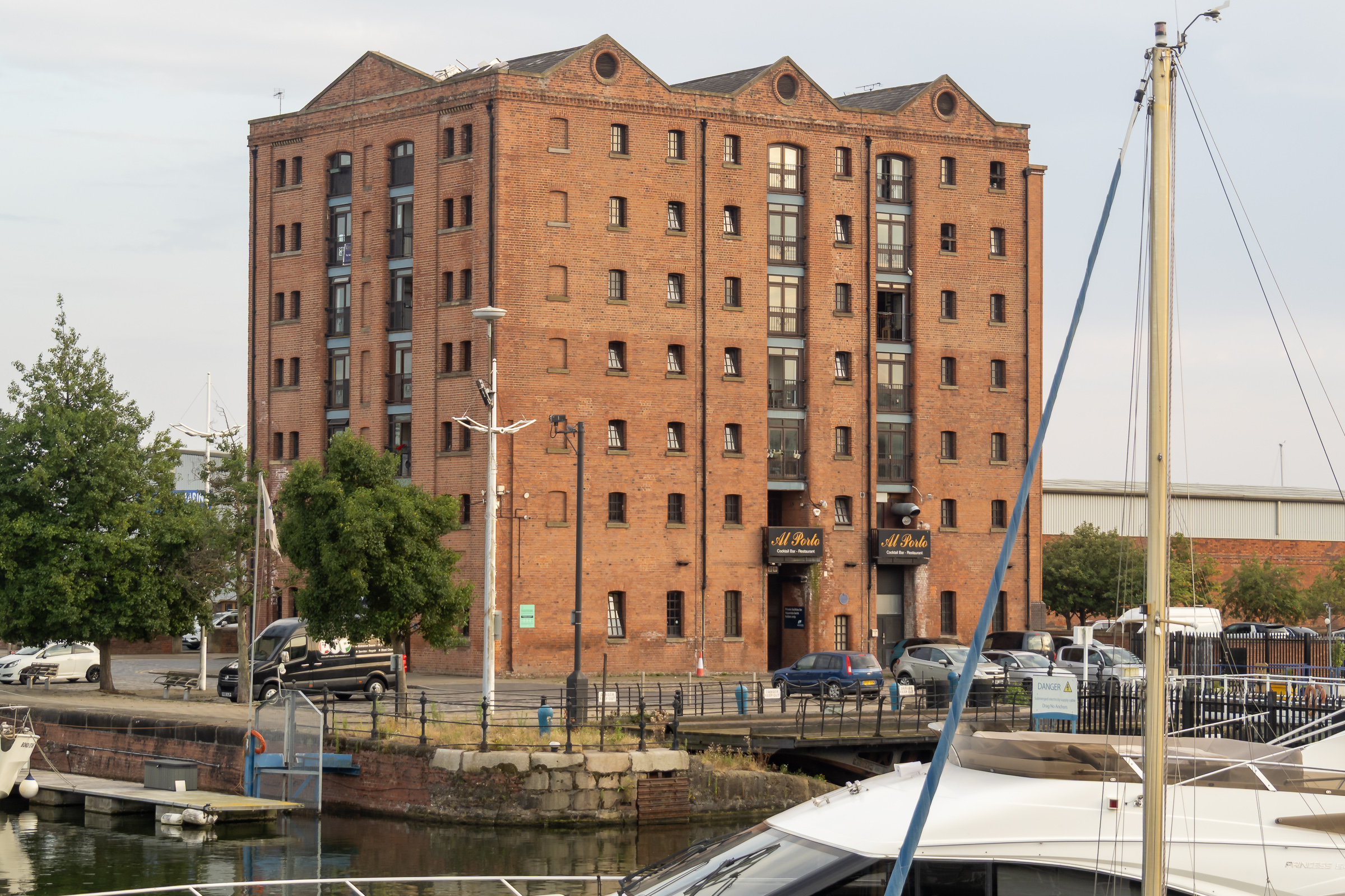
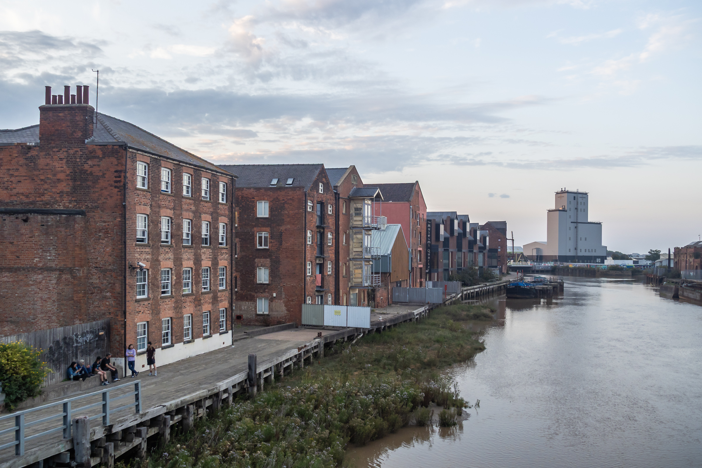
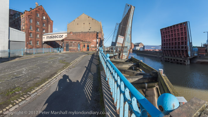
Too many of Hull’s dockside warehouses were demolished, but a few remain, including this fine block beside Railway Dock. I’d hoped to walk though Trinity Burial Ground, where I’d often sat in the past but that is now a building site.
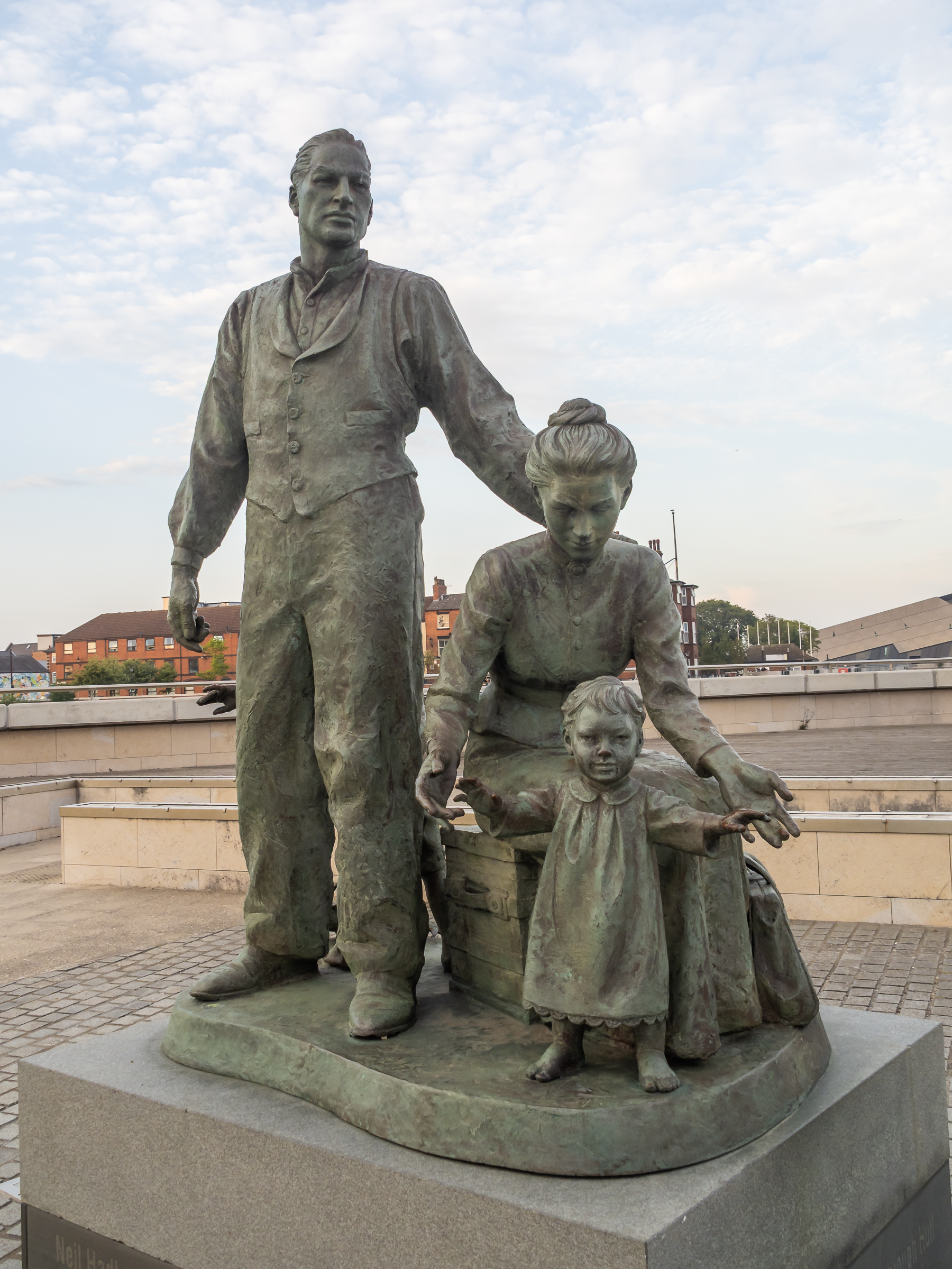
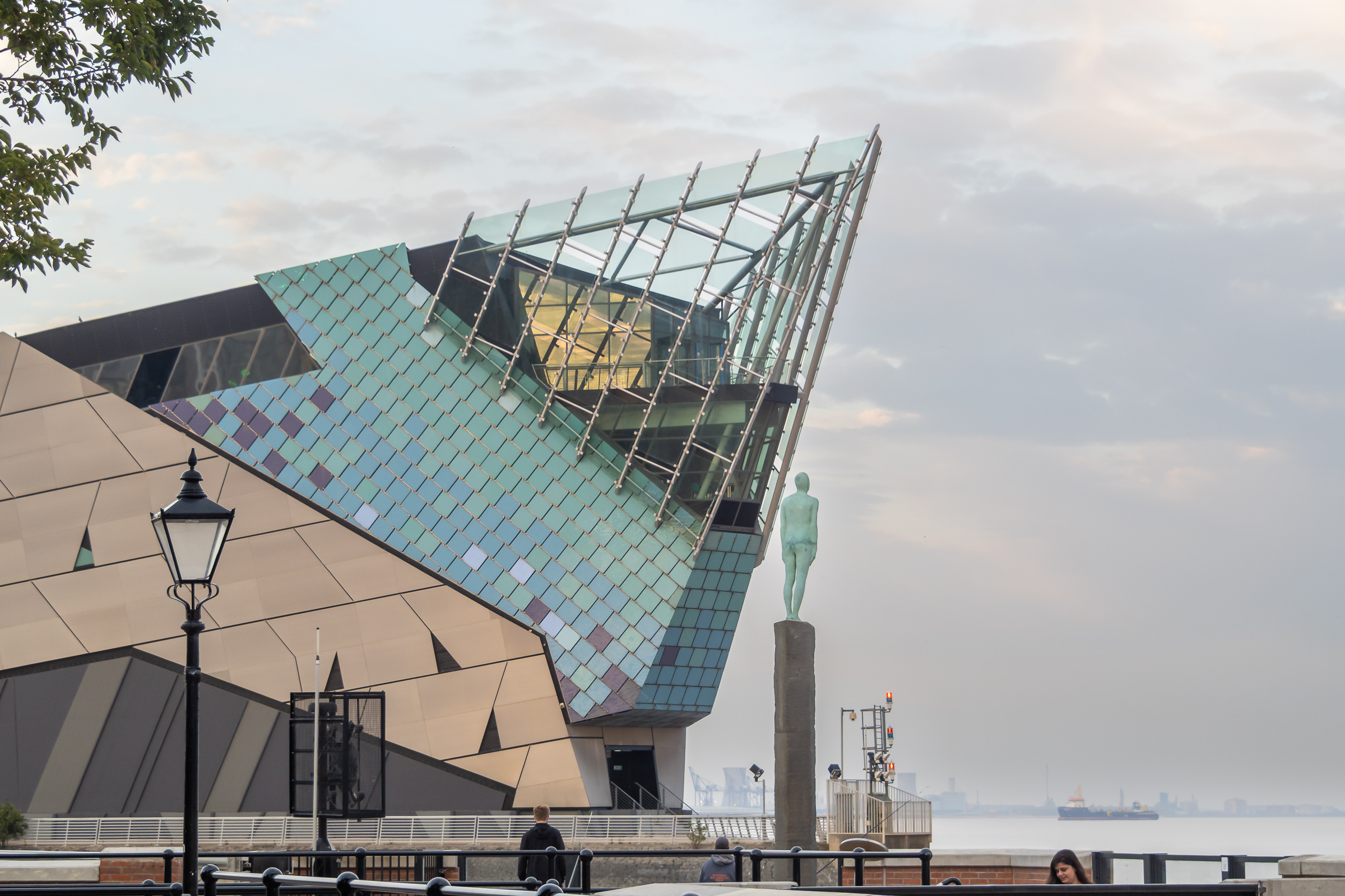
A statue by the Humber to the west of Humber Dock Basin, The Crossing, commissioned in 2001 commemorates the many migrants who came to Hull from Europe, mainly docking here to take the train to Liverpool on their way the the United States.
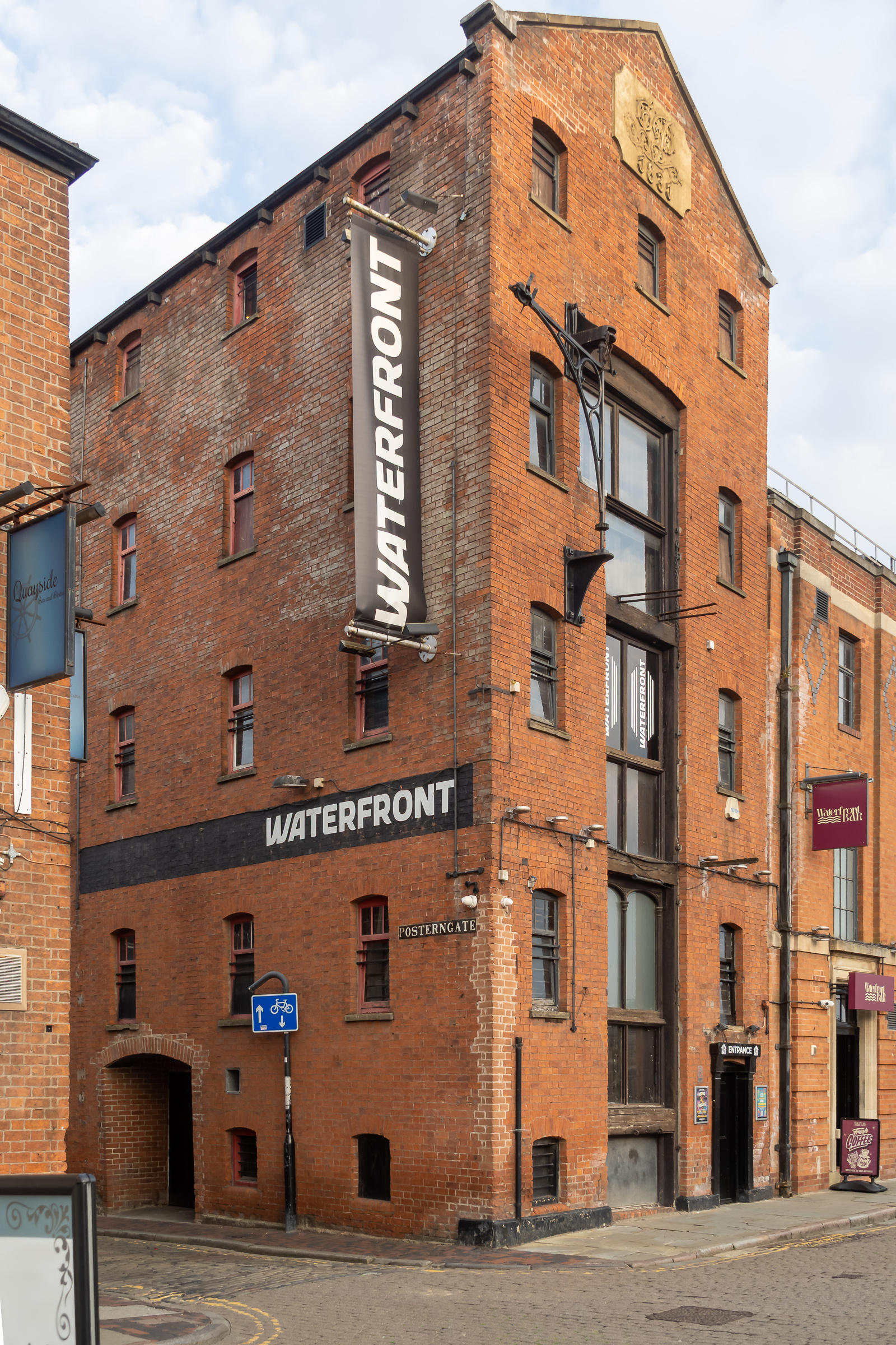
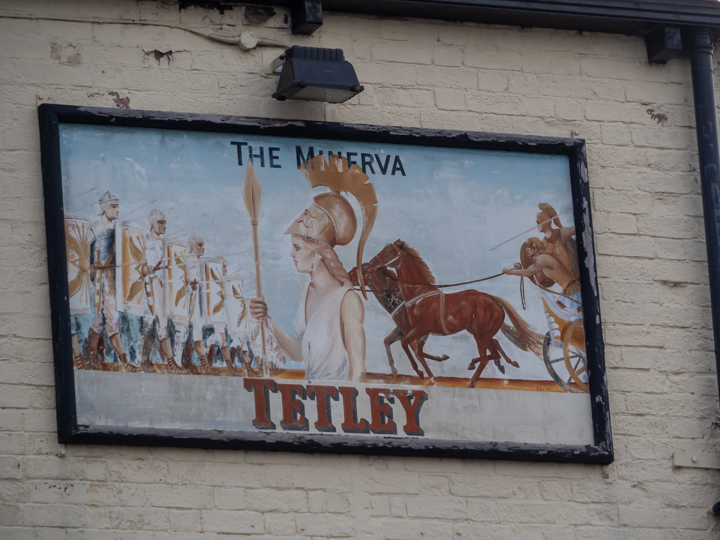
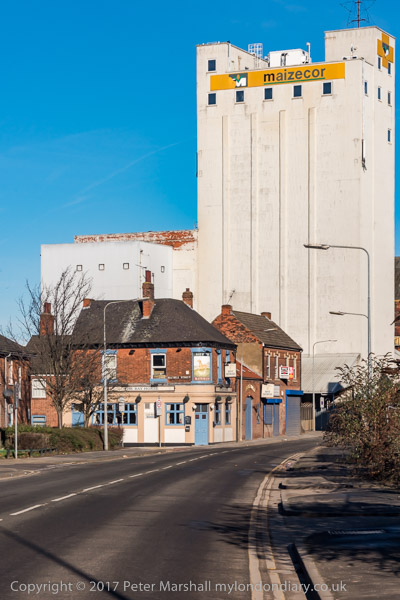
High on the wall of the Minerva pub is this sign, probably a little faded from when it was placed here. This time we didn’t go into the Minerva but continued our walk as the light was fading.
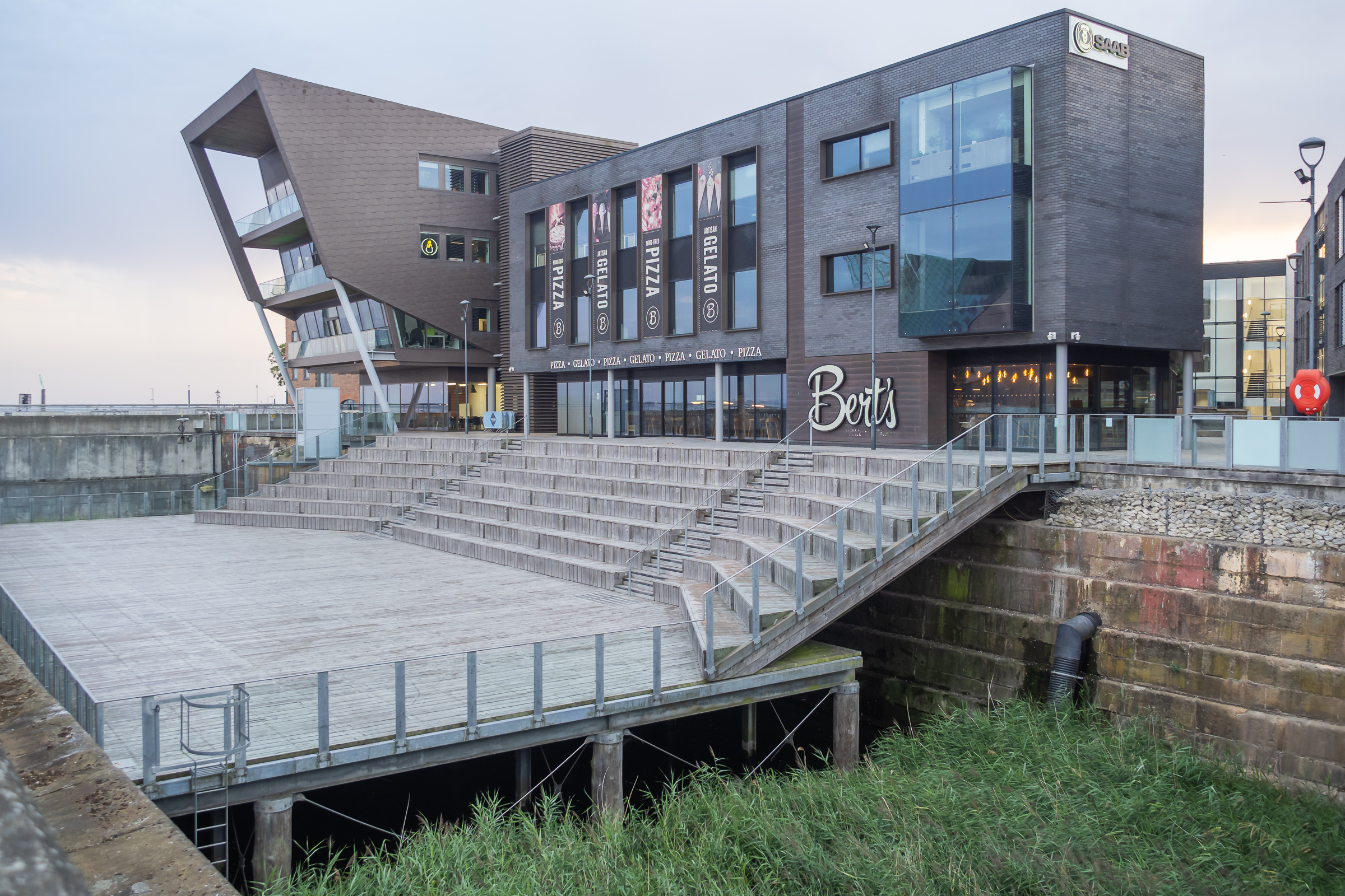
A path from Nelson Street leads along the side of the River Hull past the former Hull Central Dry Dock. In use until relatively recently this is now a performance area.
As you can see parts of the riverside walk in the ‘Old Harbour’ were closed and our plans to walk by the River Hull were cut a little short.
Instead we turned down Scale Lane and made our way back to the city centre along Silver Street and Whitefriargate.
More from our short stay in Hull later. You can see many more of my older pictures from Hull in albums on Flickr and on my Hull Photos web site – links below.
Victoria Dock & the Old Town: We arrived in Hull for a visit during the the city’s Year of Culture on Thursday 16th February 2017, 8 years ago.
We had come partly because I was hoping to have a show in the city – it would have been my first there since 1983 when ‘Still Occupied – A View of Hull‘ was in the Ferens Gallery. This one would have been on a rather less grand scale and fell through when the bailiffs evicted the group who had been squatting another city centre property.
But we had also come to celebrate Linda’s birthday in the city where she was born and grew up and for which we both have a particular affection, as well as to see some of the things that were happening for the special year.
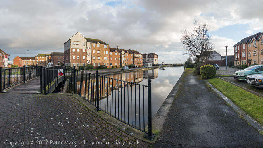
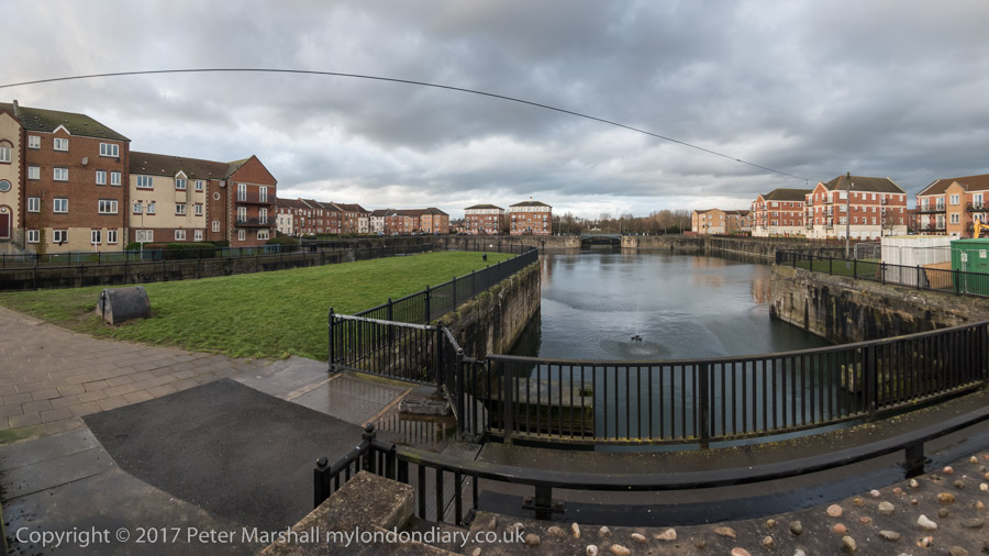
Victoria Dock Half Tide Basin. The black area in the distant dock wall was the entrance to Victoria Dock, now completly filled in.
And as always I had come to take photographs, in particular to revisit some of the many places around the city I had photographed back in the 1970s and 1980s. You can see many of those pictures on the Hull Photos web site where I posted a new photo every day throughout Hull’s year as City of Culture and beyond.
I wasn’t bent on a “re-photography” project. These often seem to me a rather lazy way for people who haven’t any real photographic ideas of their own to capitalise on those of other people – or even their own earlier work. Parasitical. Though I do have to admire a few projects that have been really well carried out.
For me photography has always been about my immediate response to the subject. If the scene has changed so too will I respond differently; and if it hasn’t why bother to photograph it again?
In particular I had moved over the years to seeing landscape and urban landscapes very much more in terms of panoramas. Forty or so years earlier had I worked almost entirely with tightly framed scenes using a 35mm shift lens. But now – with a few exceptions – I was working with the very different perspective of the wide sweeping view of a panorama. It forced me to think differently.
Victoria Dock, Hull’s timber dock had closed before I began making pictures there, although there were still a few small pockets of industry on and around the largely derelict site, as well as some remnants.
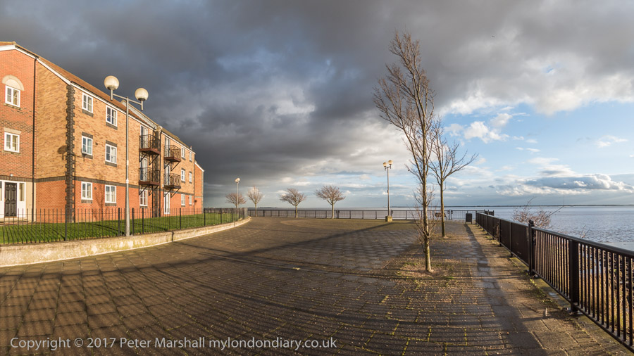
Now the dock has largely been filled in – the large timber ponds had already gone when I first visited. Much is now housing estates, leaving just the Outer Basin and Half Tide Basin and a slipway with water in them. And we were staying in a room of a house on one of the new estates. We arrived in early afternoon and after dumping our bags went out for a walk along the side of the Humber as the weather was fine for photography.
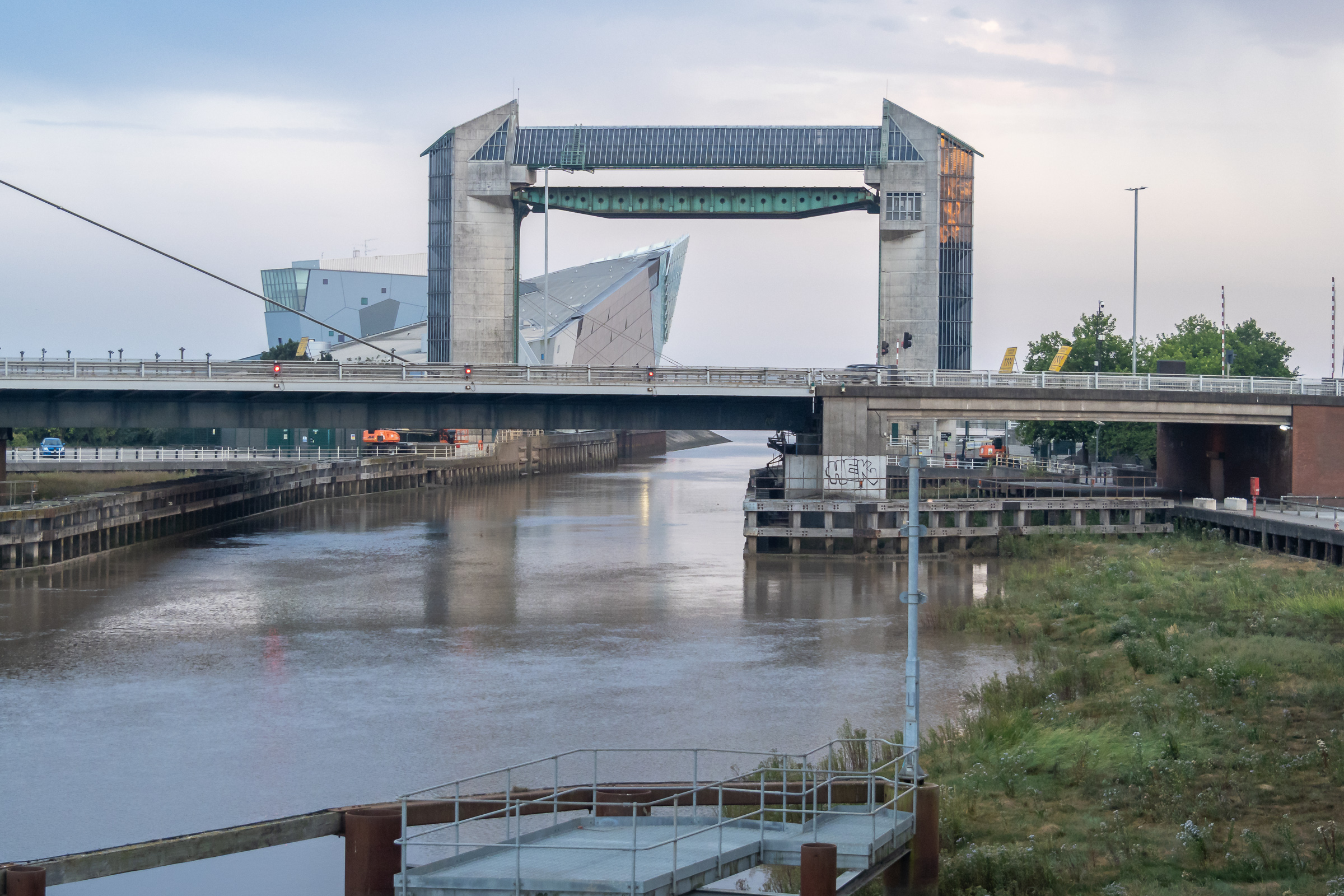
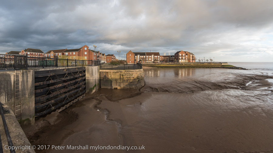
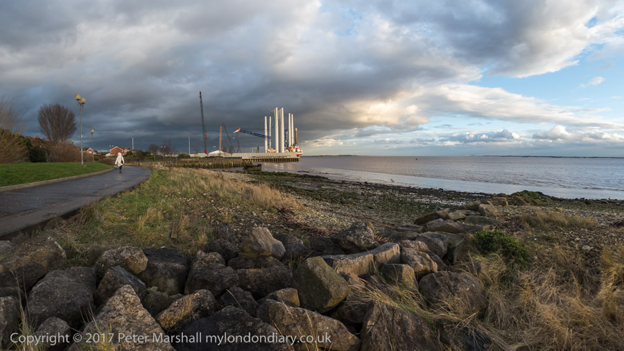
The mouth of the River Hull
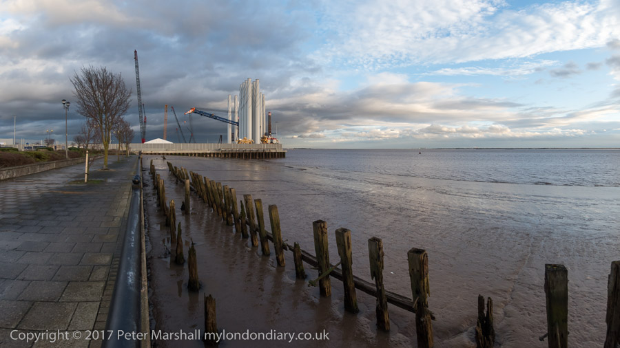
I had walked along this footpath years before, going on past the still open Alexandra and King George V Docks more or less to the city boundary. Now the path is cut off by the Siemens wind turbine site on the former Alexandra Dock.
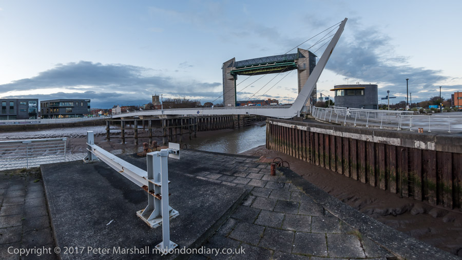
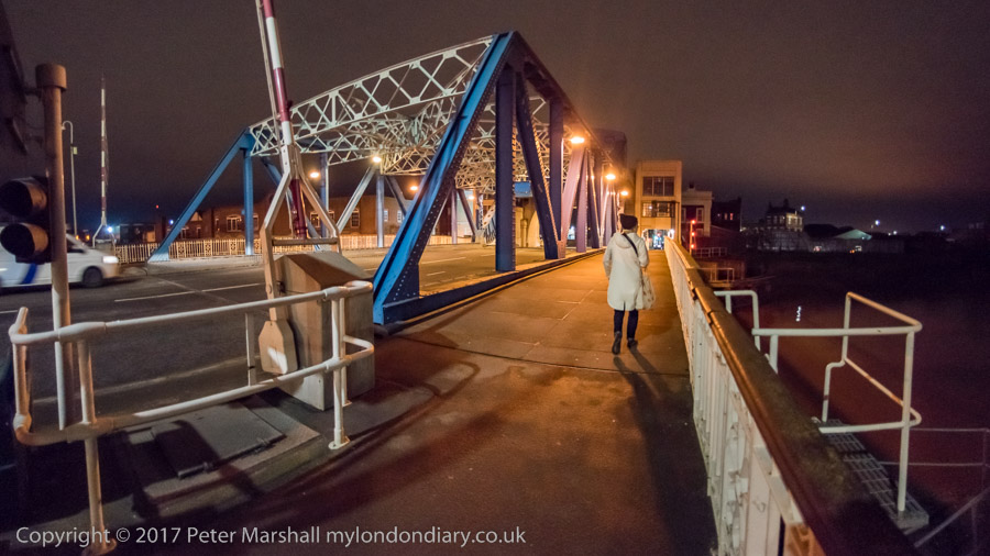
We turned around and walked back towards the Old Town where a new footbridge took us across the River Hull and on to a drink and an early dinner at the Minerva. After the dramatic skies earlier the sunset was rather disappointing.
After a long rest in the pub we decided to wander around the Old Town. In 2017 the area was still pretty empty on a Thursday night in winter, cut in half by the A63, the busy road to the docks (or rather dock), a reminder that Hull is still a significant port. But the footbridge I was then very sceptical about in my account on My London Diary was eventually built. Still something of a barrier, but far less frustrating.
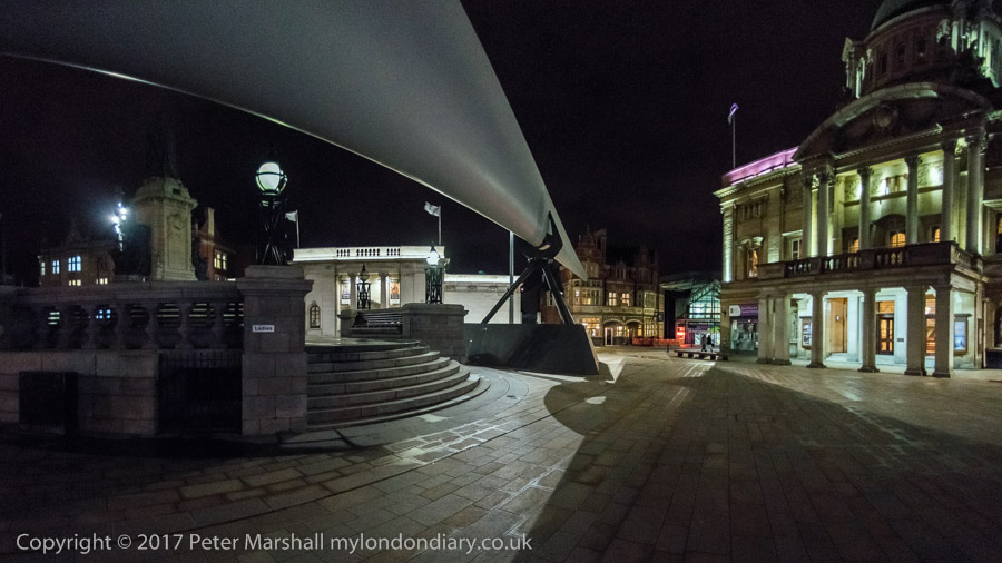
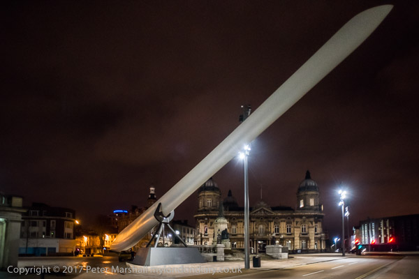
We walked as far as the city centre to admire (and photograph) the turbine blade on display there before turning round to walk back over the River Hull – this time we took the now seldom-lifting North Bridge.
We walked south beside the river along the deserted riverside path to Drypool Bridge where the path was then closed off after the needless demolition of Rank’s Mill for a hotel that didn’t arrive and through the streets – another long wait to cross the A63 – and back to the house we were staying in.
Hull – More Than The Deep: I haven’t often posted about Hull on here, but it was the city where I first carried out a serious photographic project which was shown at the city’s art gallery in 1983, and one I have continued to photograph over the years, though rather less regularly since 2000.
I didn’t really choose to photograph Hull, but I did chose to marry a woman who had grown up in the city and whose family home was still there, and it was a place where I found myself with time on my hands when visiting her parents usually for a couple of weeks most summers and often for shorter periods at Christmas or Easter.
We still have a few friends in the city, although most have now died, and our visits are less frequent. Back in 2017 Hull was enjoying its year as UK City of Culture and we were visiting partly to enjoy some of that but also to meet a few friends. I was also trying to generate some interest in my pictures of the city from the 1970s and 1980s, but plans for a show fell through.
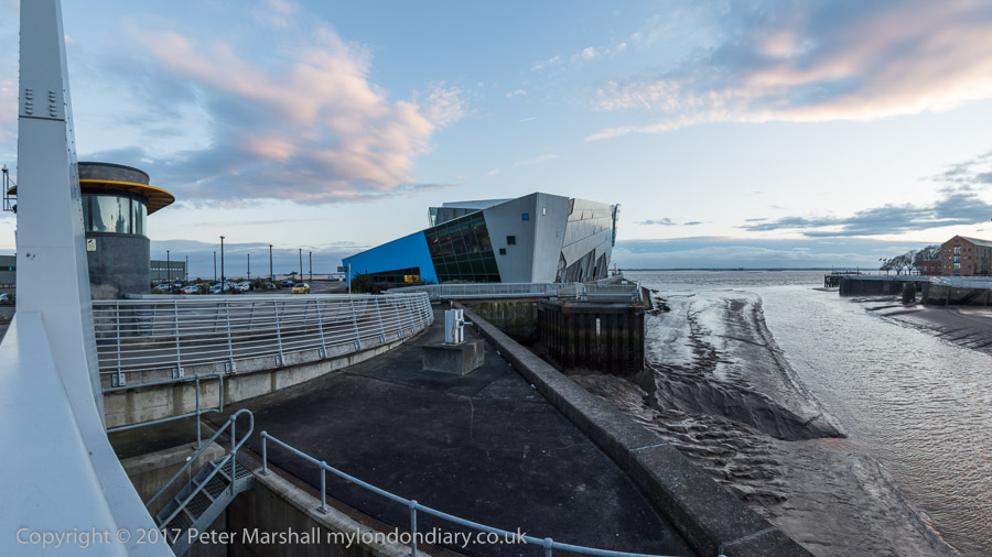
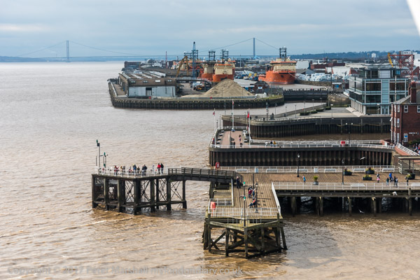
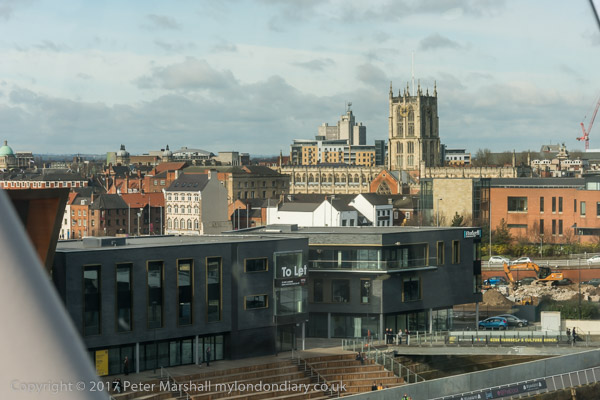
Sunday 19th February 2017 was also a day when we met with some of our family who had come to Hull both to meet us and to visit Hull’s major tourist attraction, The Deep and we met them for lunch there and I took a few pictures from its viewing platform.
I’d gone out immediately after breakfast for a long walk around some of my favourite areas of the city which I had photographed in earlier years. Then I had been working mainly with black and white film, interested in the changes taking place in the city and surprised at the way it seemed to be disregarding much of its heritage, and recording aspects that seemed unlikely to survive. I’d also taken some colour pictures and had included some in my show there, but they perhaps more reflected my interest in colour than my interest in the city.
But in 2017 I was working only on digital, so everything was colour and I was also making some panoramic colour images – again digital.
It was late afternoon by the time we said goodbye to our family, and Linda decided she would like to go for a walk around Beverley, a town seven miles away. The bus service to there is slow and infrequent, but as I wrote “it has the advantage of setting you down at the bus station immediately next door to Nellie’s.”
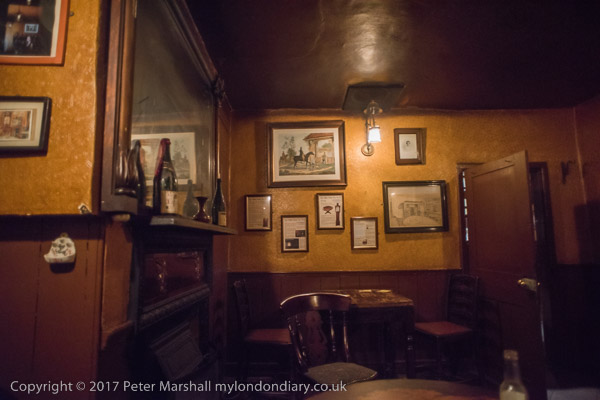
Beverley is an old market town, well known for its Minster and full of old buildings. It was too late for us to visit the Minster, but not for a visit to one of its Grade II* listed buildings, The White Horse Inn, generally known as Nellies, taken over by Samuel Smith’s brewery in 1976. And although they have modernised the pub in some ways, much remains as it was – and my pictures were taken using its rather dim gas lighting. It’s a place people come from around the world to see, though fortunately not in such large numbers to swamp it.
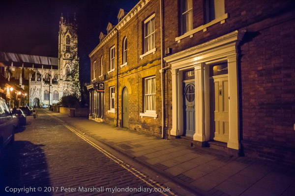
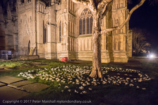
Afterwards we still had some time before the last bus back to Hull left and went for a walk around the town including Beverley Bar, the Minster and the Monk’s Walk and I made a few pictures, all hand-held.
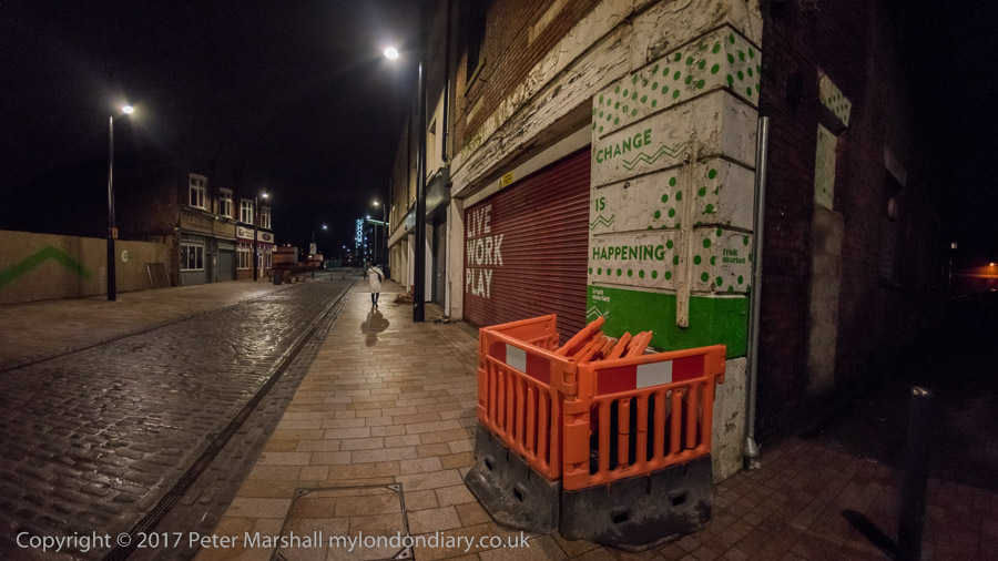
Back in Hull we had a walk through the town, mainly deserted at night to the house where we were staying in Victoria Dock Village, and there was time for a few more pictures.
I think that Paull was one of the places we may have walked to during one of our stays in Hull, taking a bus to somewhere outside the city to a suitable starting point. There were a couple of time I hired a car, but I think only to go for holiday weeks elsewhere in Yorkshire. The last time I hired one I managed to drive it off the road into a ploughed field at some speed somewhere near Meaux (which despite the name is on the outskirts of Hull) and decided the time had come for me to give up driving.
Strangely given that back in 1965 when I first visited Hull was a city full of bicycles it was over 35 years before I ever cycled around the city. And when I did in 2003, I visited Paull for a second time, though actually riding there from Hornsea.
Paull is a riverside village on the north bank of the Humber a few miles south-east of Hull, just beyond Hedon Haven. Neither Paull nor Hedon grew as ports because sandbanks in the Humber made them unsuitable for larger ships, while a deepwater channel led towards the mouth of the River Hull.
Navigation in and out of Hull was tricky, and in 1836 Trinity House built the lighthouse at Paull for ships leaving Hull to steer towards, before picking up other lights on the south side of the estuary. Unfortunately the channel soon moved and by around 1870 this lighthouse was obsolete and was replaced by two ‘leading lights’ a little further downstream at Thorngumbald Clough.
This extensive Grade II listed property was offered for sale in 2013 for £169,950 though it is unclear if it was sold and a rather lower bid was considered. For those of us used to London prices it seems excessively cheap.
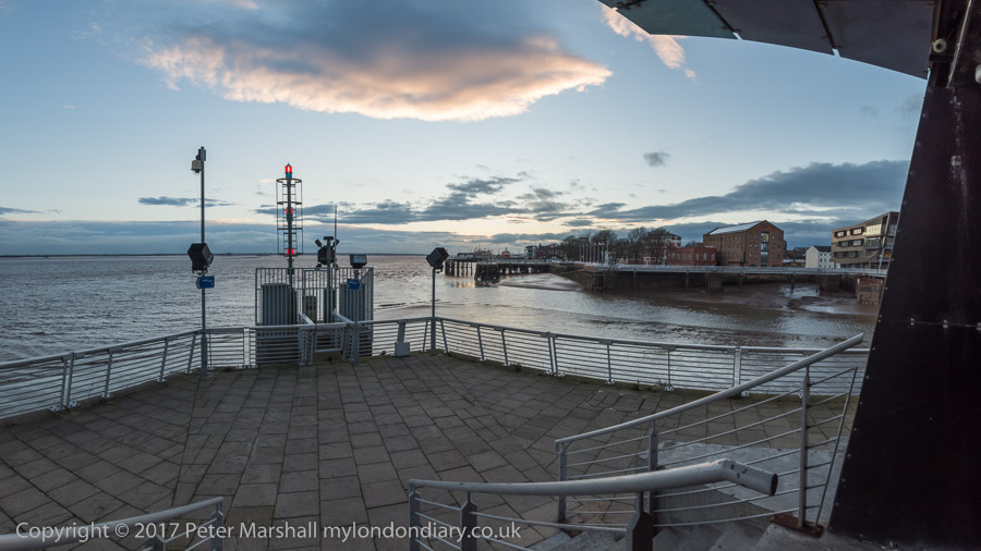
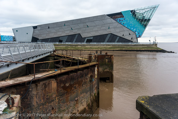
This picture amused me after photographing the Humber Bridge and I think I captioned it at the time as “Not the Humber Bridge” . The view is actually of both the River Hull, coming in from the left and the Humber across the top of the image, and the spit of mud and sand is Sammy’s Point, where Hull’s major tourist attraction, ‘The Deep’ now stands, a little back from the point here.
This was a short gangway leading out to a iron-sheathed concrete dolphin at the mouth of the River Hull from the end of Nelson St. The dolphin, designed as a temporary mooring in deep water for vessels waiting for the tide to go up the River Hull (and perhaps to protect the bank from vessels off course) is still there, but the promenade has been rebuilt to stretch to the dolphin, and a footpath now leads north from it beside the Hull.
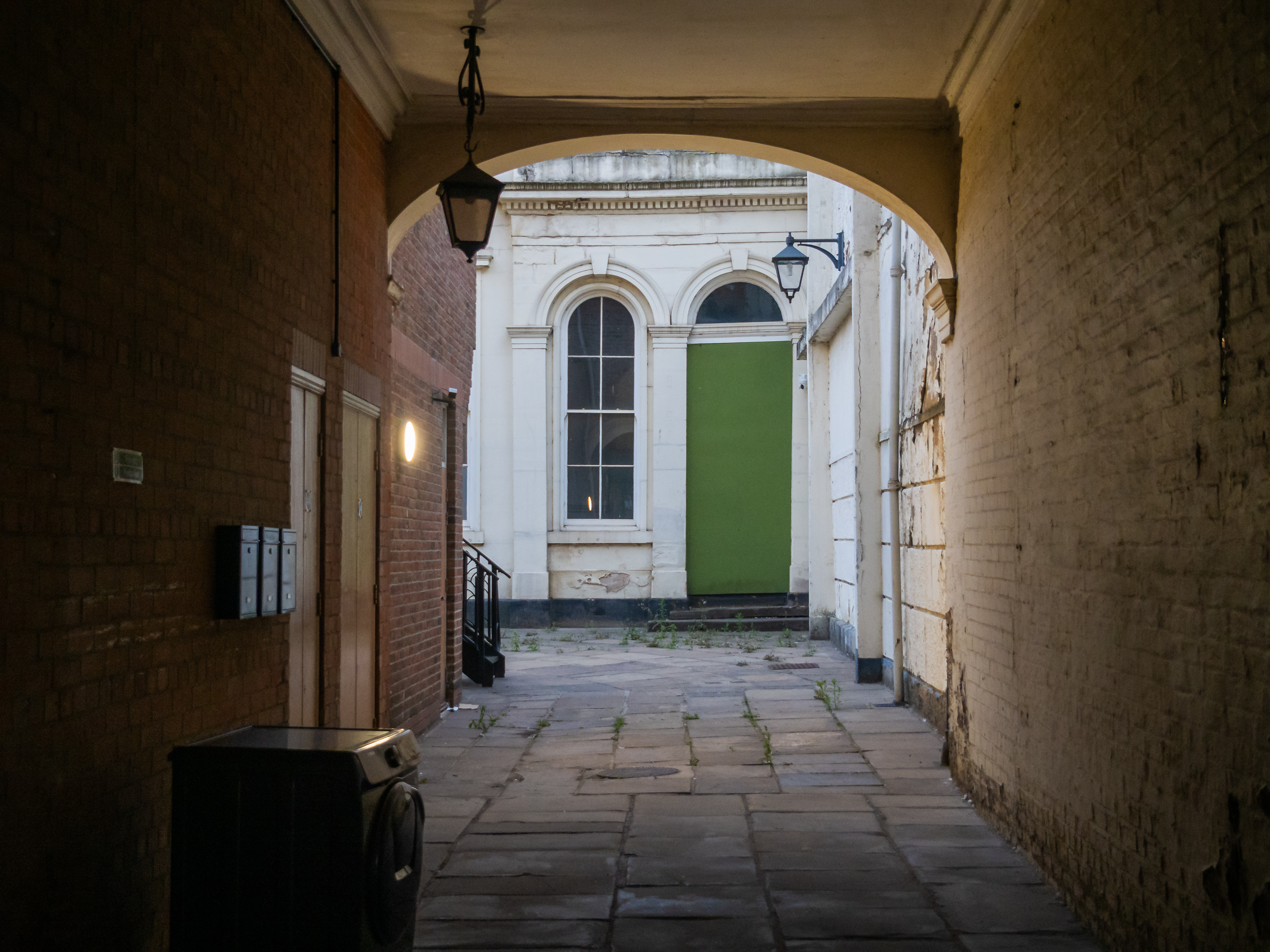
Alley in Old Town, Hull 1981
I can’t remember precisely where this was, but the view through it is to the wholesale fruit and vegetable traders, probably on Humber St, though possibly on Wellington St. I think this may have been an alley leading from Blanket Row, but the area has changed too much for me to now be sure.
Clearly I was attracted by both the atmosphere of the alley leading to the street and by the colour, particularly the three areas of blue against the muted yellows. Blue mixed with yellow in my paintbox to make greens and green is the only other colour in this image.
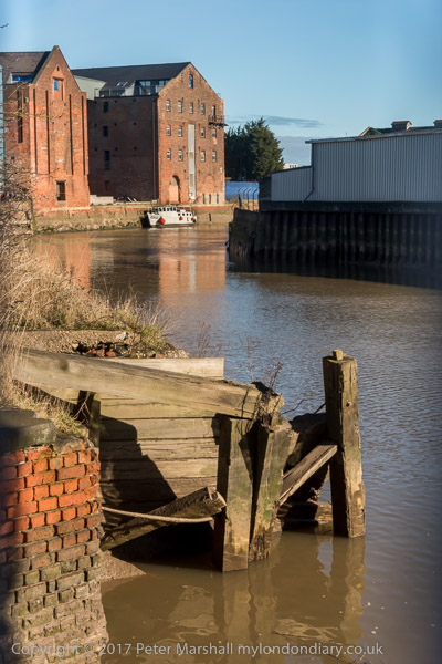
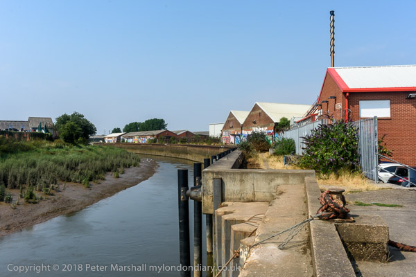
Barge R57 moored at wharf north of Ferry Lane, Hull 1981
The last time I was in Hull I sat eating a lunchtime snack beside the River Hull here, though the scene had changed a little.
There was actually a barge moored a little downstream, though looking rather derelict, but I was surprised to find that there were still a couple of buildings from the earlier image remaining.
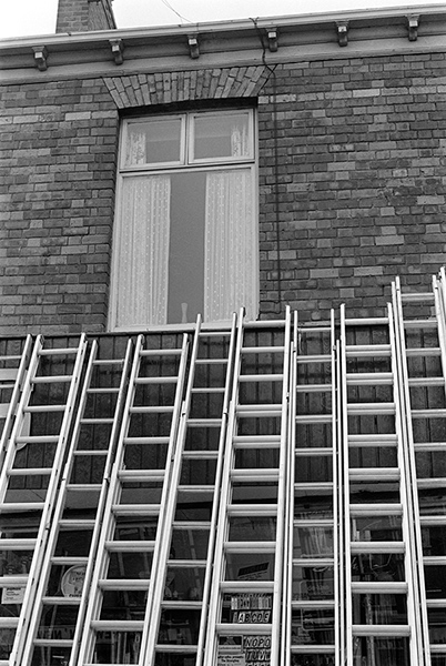
East Hull Ladder Works, Hull 1981
I don’t know the name of the dog or the name of the street where the East Hull Ladder Works then stood, but am fairly sure that it and the houses along the street either fell down or were demolished not long after I made the picture.
Probably this was a side-street off of Holderness Rd, well-placed for timber which came into Hull’s Victoria Dock. The rapid growth of Hull during the 19th century with its tremendous boom in house building will have created considerable demand for ladders.
Holderness Rd, 1977 – East Hull
And there were certainly plenty of them for sale on the Holderness Road as this picture from my web site ‘Still Occupied – A View of Hull‘ shows.
Sisson’s Paints were another famous brand from Hull, and their advertising often used their 1910 trademark of two painters carrying cans of paint and a plank. Sisson’s won a court case against a far-eastern company that copied it, replacing the plank with a ladder, but now Sissons Paints Malaysia, one of several foreign companies that continue its name, uses it with a ladder. In the early years adverts using it had the plank carrying the text ‘Hall’s. Distemper’, a product responsible for many gloomy hallways across the world, which over the years I’ve cleaned laboriously from several walls.
Sisson’s extensive works were beside the River Hull at Bankside and had this mosaic installed in 1953 (their 150th anniversary) when they were rebuilt after wartime bombing. The company was bought by Reckitt and Colman in 1964, sold on to the Donald Macpherson Group in 1968 and taken over by Finland’s largest paint manufacturer Tikkurila Oy in 1984, though production in Hull had I think ceased before this and the plant looked derelict when I took this picture. It was demolished in the early 1990s and the mosaic lost. All that remains is the gates.
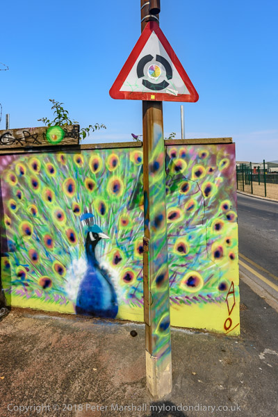
Part of the large area occupied by the factory is now more colourful than ever as a part of the Bankside Gallery which sprung up following Banksy’s addition ‘Draw The Raised Bridge’ on Scott Street bridge in January 2018.
All photographs on this and my other sites, unless otherwise stated, are taken by and copyright of Peter Marshall, and are available for reproduction or can be bought as prints.
I’m not sure from exactly where I took this view of the Humber Bridge under construction, but I was fortunate enough to go on a tour of the construction organised for a group of science teachers, and it could have been made during that visit, though I don’t remember taking any colour pictures then. The bridge took around 9 years to build and was completed and opened in 1981.
The mill visible on Hessle foreshore was built around 1810 to grind the chalk that was being quarried here into whiting, finely powdered chalk used as a filler in paint and, together with linseed oil to make putty, in whitewash, gesso and ceramic glazes etc. The windmill went out of use about a hundred years ago, losing its cap and sails and the quarry closed in 1970. The area is now a country park.
Humber Bridge, Hull ca.1980
After the cables were spun the box-girder sections of bridge decking were added, beginning in November 1979 and this picture must have been made shortly after this. Wikipedia states “the Humber Bridge was the longest single-span suspension bridge in the world for 17 years.”
When our family was travelling to Hull by train in the 1980s we would look out for the Humber Bridge in the distance to know we were getting close to our destination. I always offered a small cash prize for the first of our party to spot it through the train window, but think I never had to pay it out as I always saw it before the others.
River Humber, Hull 1980
The Humber has always seemed more mud in motion than a river, always a dirty brown colour, and it is only the small waves that differentiate between the river and the shore in this view. The mud and sandbanks in the estuary are always moving, and for many years ships travelling up the river to Hull or Goole needed the services of the Trinity House pilots, who started offering their services in 1512 and in 1581 were granted a charter authorising them to examine and licence pilots and take charge of ships. Various Acts of Parliament followed to endorse and regulate their activities, but the 1984 Pilotage Act transferred responsibility to the ports. In 2002 Associated British Ports terminated the authorisations of all Humber Pilots and employed their own pilots directly.
You can now walk along an esplanade along what had been the river frontage of Victoria Dock and various ship-building and other related businesses but only as far as what was the Alexandra Dock and is now ‘Green Port Hull’, a a wind energy manufacturing plant and riverside quay. I think this picture was probably taken just a little further downriver than the path now takes you.
Humber Dock Side, Hull 1980
There were some blue sheds on the dock side of Humber Dock that were demolished when the dock was dredged and converted into Hull Marina, and these had painted steel columns and wooden sides. The marine air had over the years produced this incredible rusting, lifting up the thick painted layers.
The buildings at the right of the picture are still there, though considerably altered on Humber Place at its junction with Wellington St, and are now Francis House, the offices of an accountancy firm, though the Wellington St building at extreme right has been demolished.
Railway Dock, Hull 1980
Although Hull lost some of its most impressive warehouses to a road scheme which split the Old Town from the city centre to take the heavy traffic for the King George Dock to the east of the city, some of those beside Railway Dock were retained, with the three gables shown here still visible, though the mass at the extreme right has been demolished.
Railway warning, Hull 1980
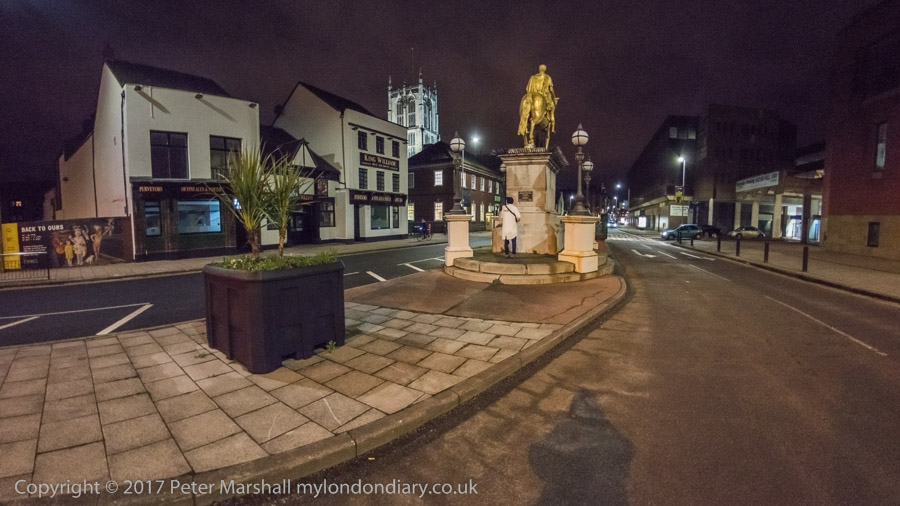
King Billy, King William III or William of Orange, successfully invaded Britain in 1688 in what is sometimes called the ‘Glorious Revolution’. James II was unpopular, largely because he was a Catholic and was seen to be changing Britain to a Catholic country, suspending anti-Catholic measures by decree when Parliament refused to do so and prosecuting Anglican bishops for seditious libel. His actions prompted anti-Catholic riots and many leading political figures of the day invited William to come and take over the country. But there were also leading Catholic members of the aristocracy who defended James and the ‘divine right of kings’ to overule all others, including Parliament. One of them was the governor of Hull, Lord Langdale, who took the military to occupy the city of Hull, fearing that William of Orange might try and land there. But instead of coming across the North Sea, William’s fleet went down the Channel and landed at Brixham on Novermber 5th, marching from there to London. The army deserted James and he fled to France on December 11th.
Hull had remained under Catholic control until December 3rd, when Protestant officers, hearing of a plot to imprison them, got together and arrested Langdale and his Catholic supporters. The day was celebrated in Hull for many years as ‘Town Taking Day’ when many wore orange sashes and celebrated with a procession, church service and fireworks in the Market Square – and around the statue of King Billy after it had been erected there in 1734.
Market Place is very much a backwater in the Old Town now, on the edge of the busy A63 and with one side occupied by some of the city’s most tedious buildings, as well as the rear end of Holy Trinity. Since the listed public toilets under King Billy closed there are few reasons to go there.
Re-used Railway warning notice, Hull. 1980
A dockside building with a doorway closed with boards from a notice that was once beside one of the swing bridges, probably that taking Wellington St across the Humber Dock lock, warning people it is an offence to pass the warning lights onto the bridge or be on it while it is moving.
A public footpath crosses the swing bridge into Albert Dock, and some time in the early 1980s while I was out walking with my family I notice that my wife and younger son in a push-chair were no longer following me. I turned around an looked for them, eventually spotting them on the bridge which was turning around to admit a ship to the dock. They had walked past the warning lights before they had been activated and the bridge operator, do doubt thinking only of the lorries which went across, had failed to spot a young woman already on the bridge with a baby buggy. She got a free ride and profuse apologies rather than a fine.
One of Hull’s minor tourist attractions, perhaps inspired by notices such as these, is now a footbridge across the River Hull on which people are allowed to ride. Unfortunately ship movements up the Hull are now extremely rare and the bridge almost never operates in anger, but there are scheduled tests most if not all weekends on which I’ve taken a couple of rides.
All photographs on this and my other sites, unless otherwise stated, are taken by and copyright of Peter Marshall, and are available for reproduction or can be bought as prints.