Hull 2025 – An Evening Stroll – 2

Hull 2025 – An Evening Stroll: The second and final post of pictures I made on our first evening in Hull last week.

Hull 2025 - An Evening Stroll - 2

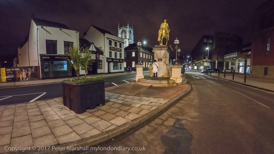
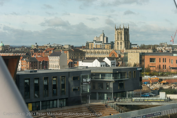
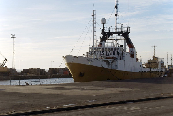
Part 1 of this post ended on Princes Dock Street. The pictures here are in the order I took them on Tuesday 12th August 2025 and the first image here was taken just a few yards further down the street.

Hull 2025 - An Evening Stroll - 2

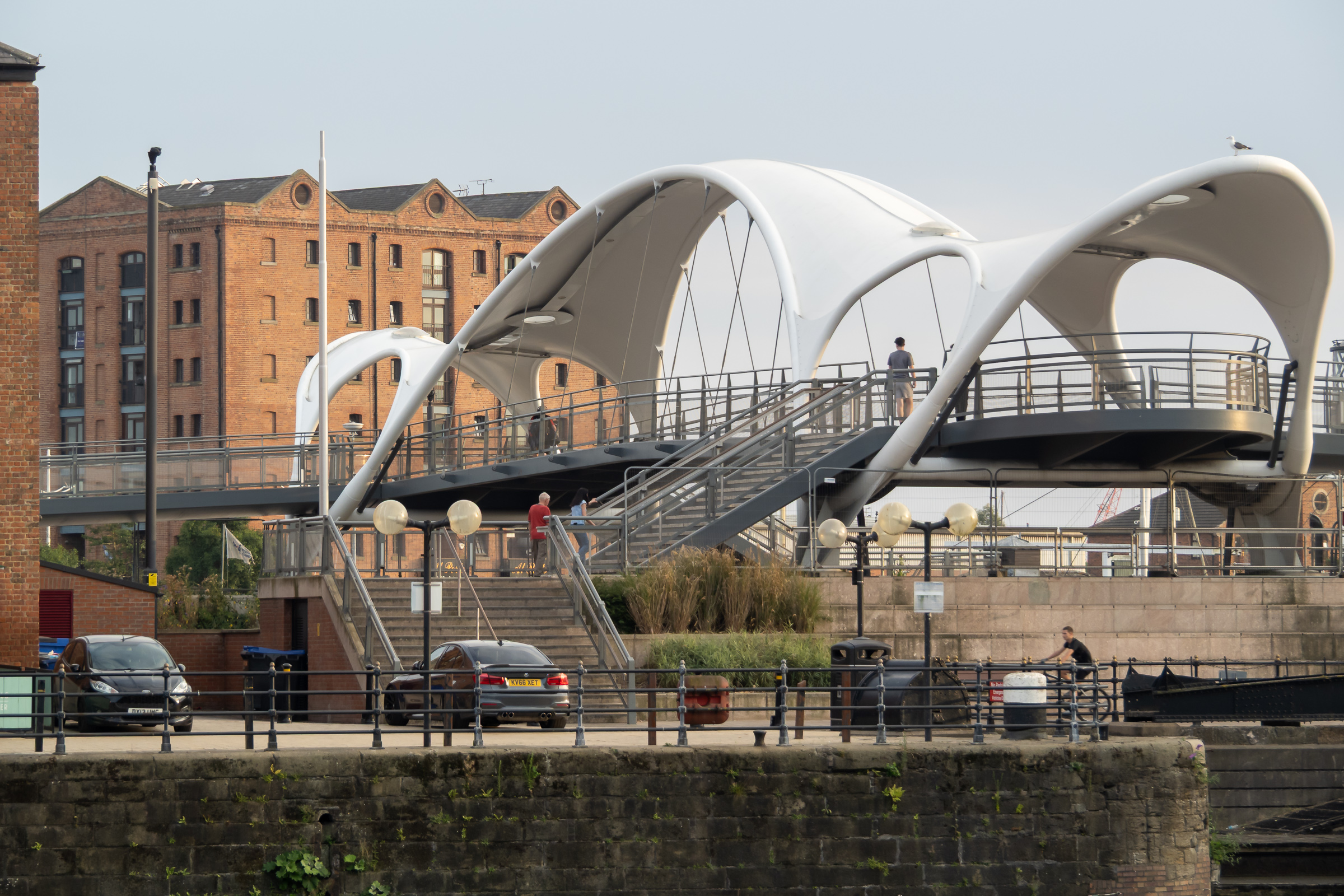
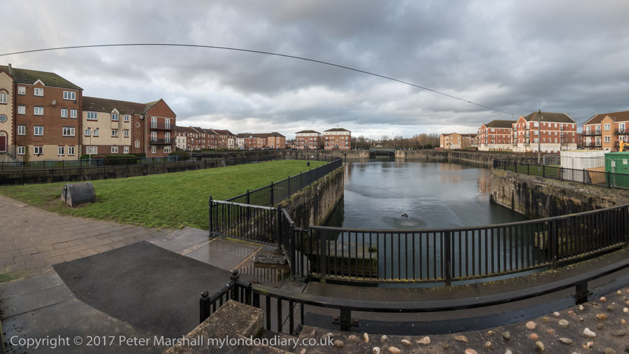
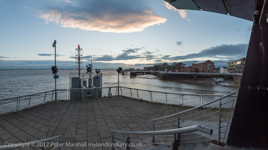
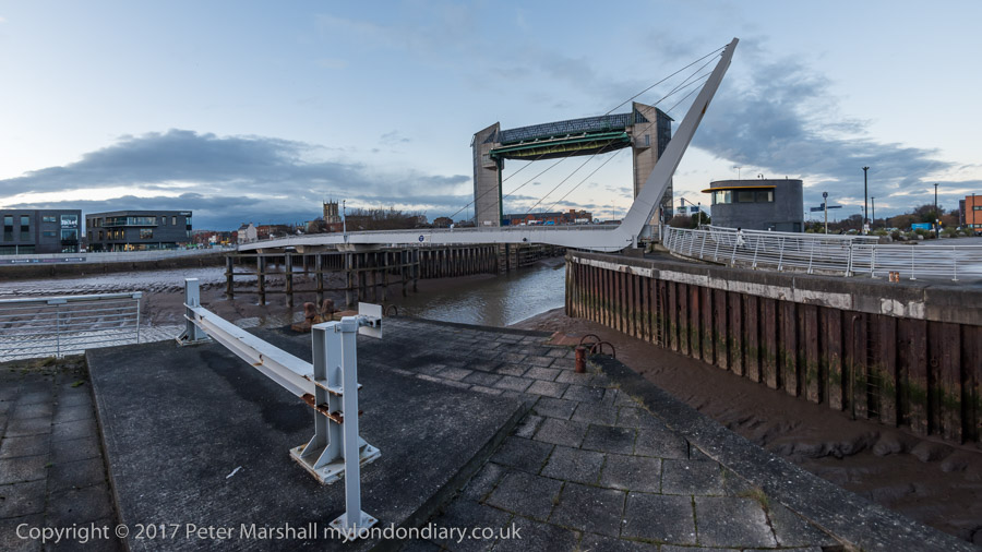
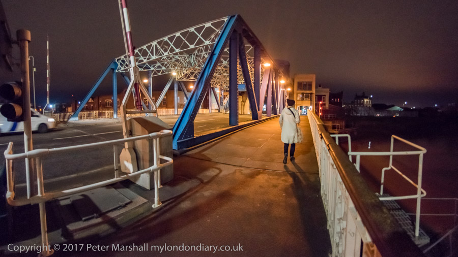
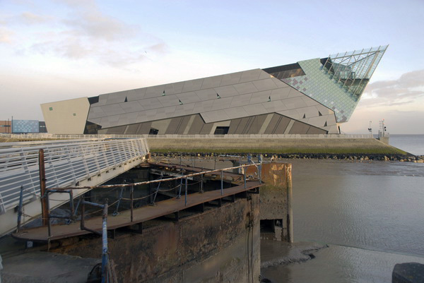
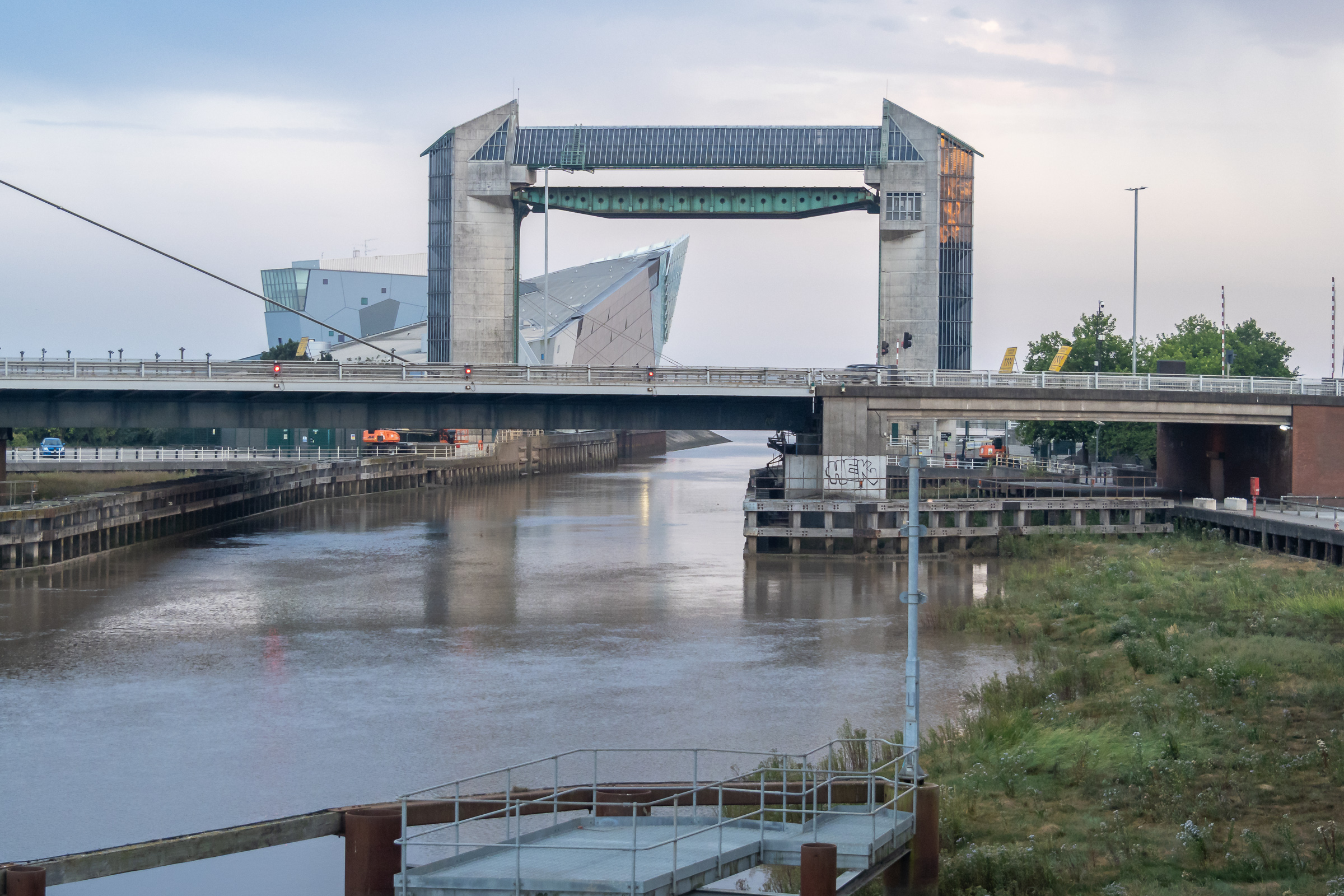
Humber Dock, now a marina, Railway Dock and the southern part of the Old Town have been brutally split from the rest of the city by the busy A63. Its hard to understand why the city council allowed this to happen with as it did, with so few places where this barrier can be crossed, and the provision of a rather odd footbridge, Murdoch’s Connection, is a rather unsatisfactory sop.

Hull 2025 - An Evening Stroll - 2

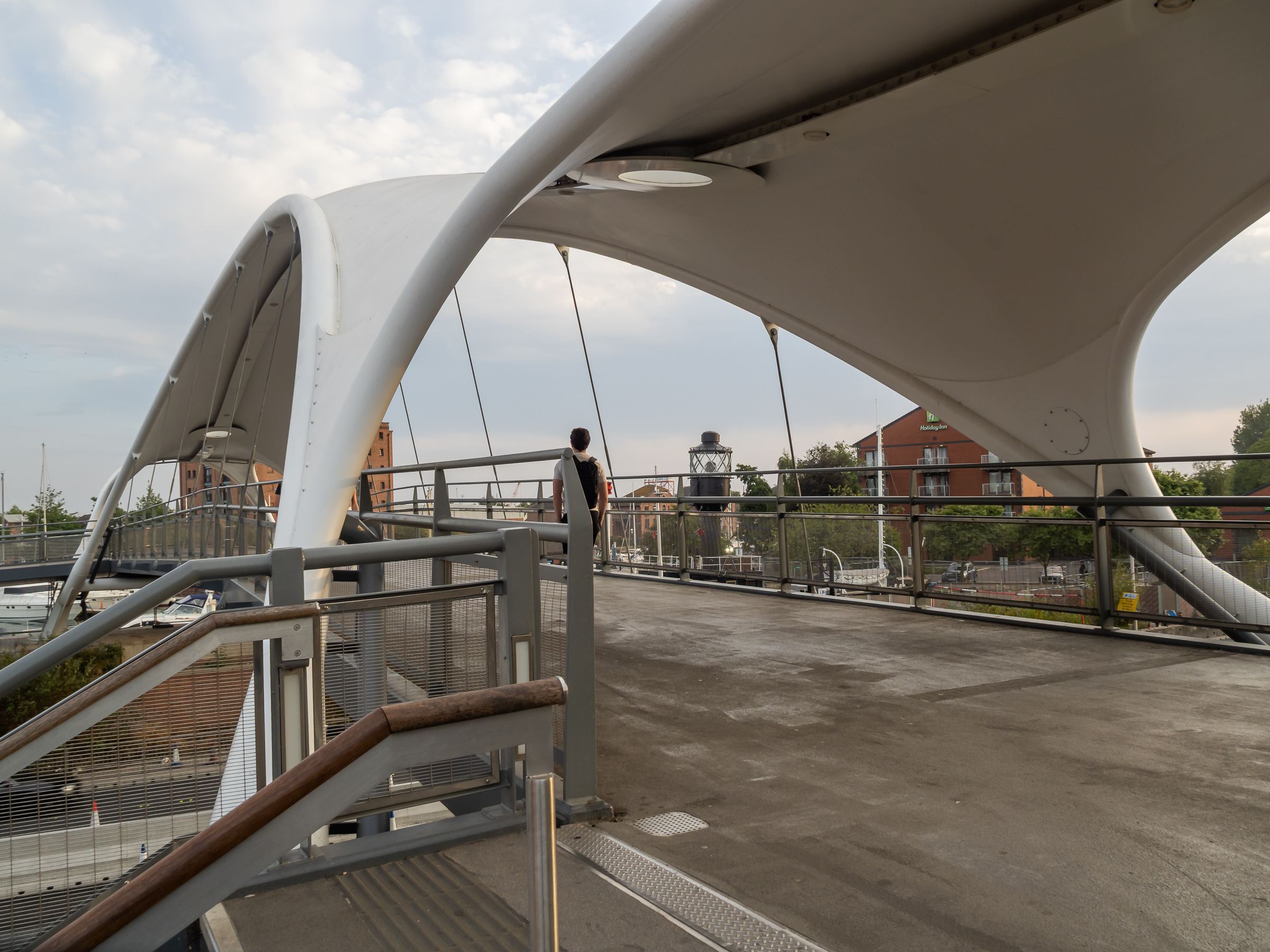
Fortunately we could manage the many steps up and down, otherwise we would have needed a fairly lengthy detour to where the road rises to cross the River Hull. This footbridge is perhaps more of a visitor attraction rather than a proper solution to access.

Hull 2025 - An Evening Stroll - 2

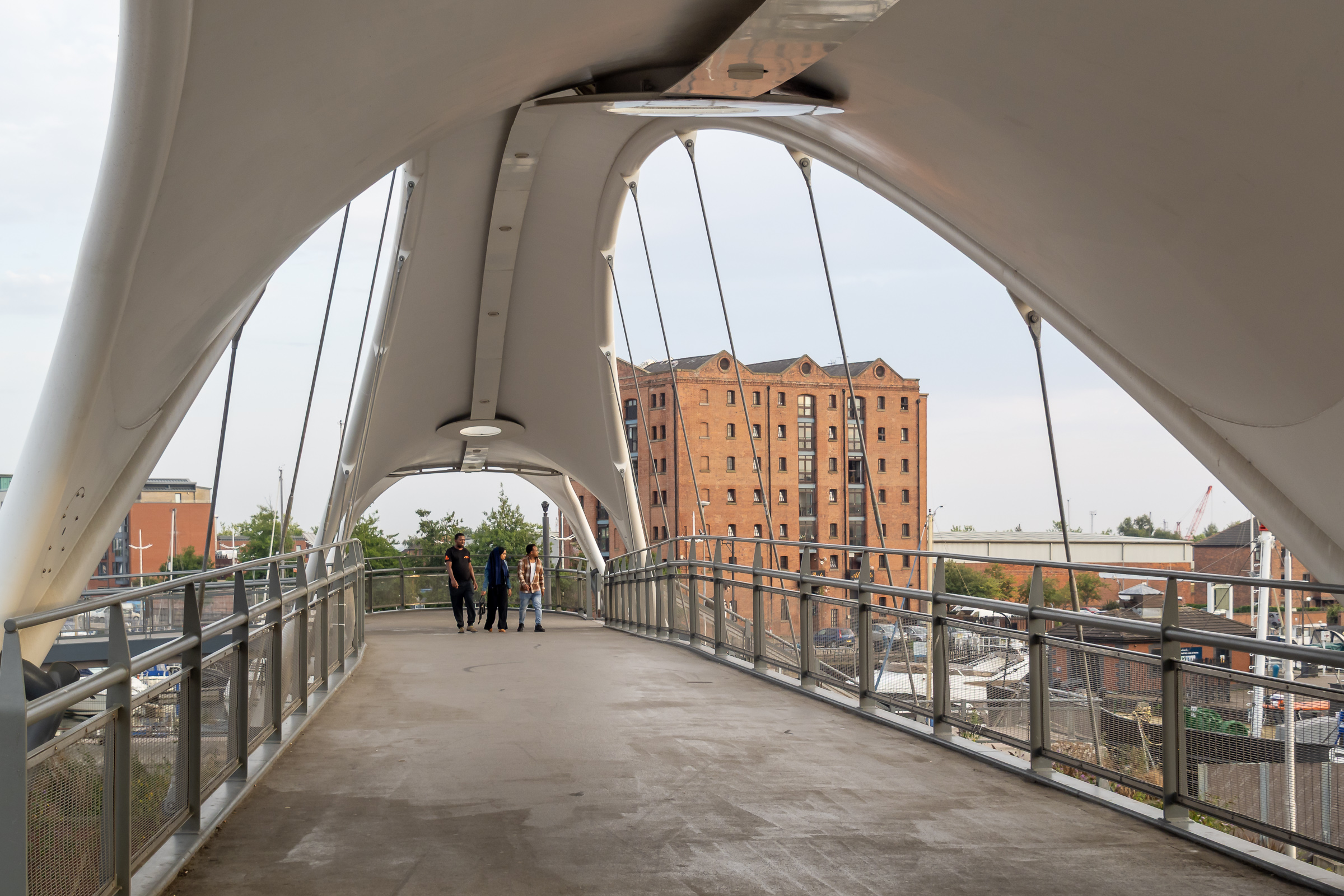
Murdoch’s Connection was named after Hull’s first female doctor, a house surgeon at the Victoria Hospital for Sick Children on Park Street and a suffragette, founding the Hull Women’s Suffrage Society in 1904.

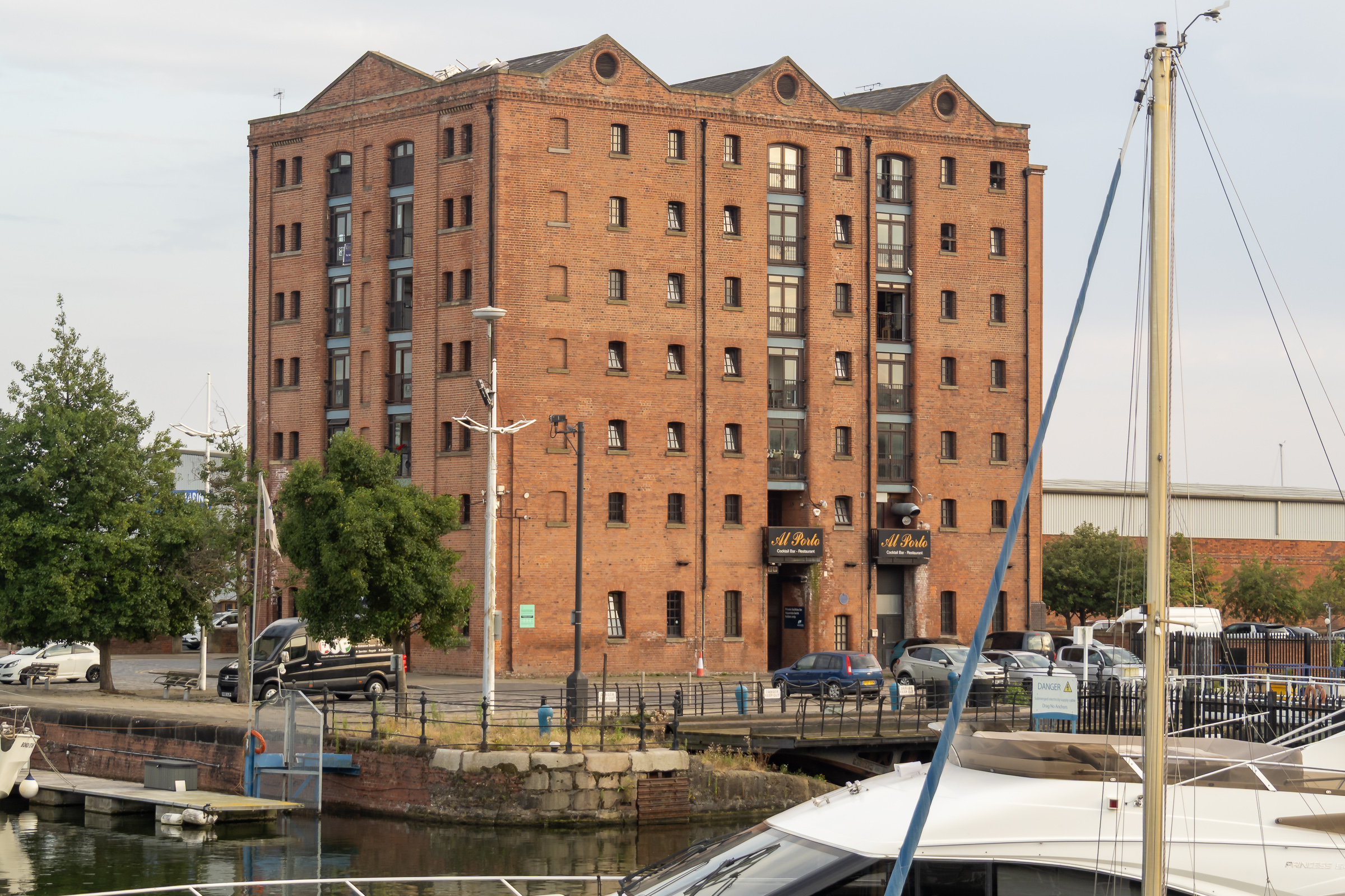
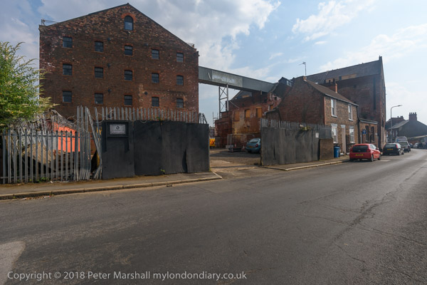
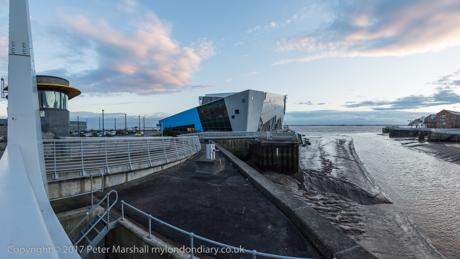
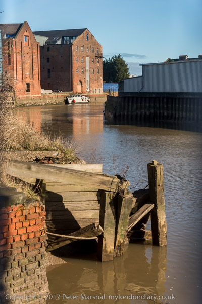
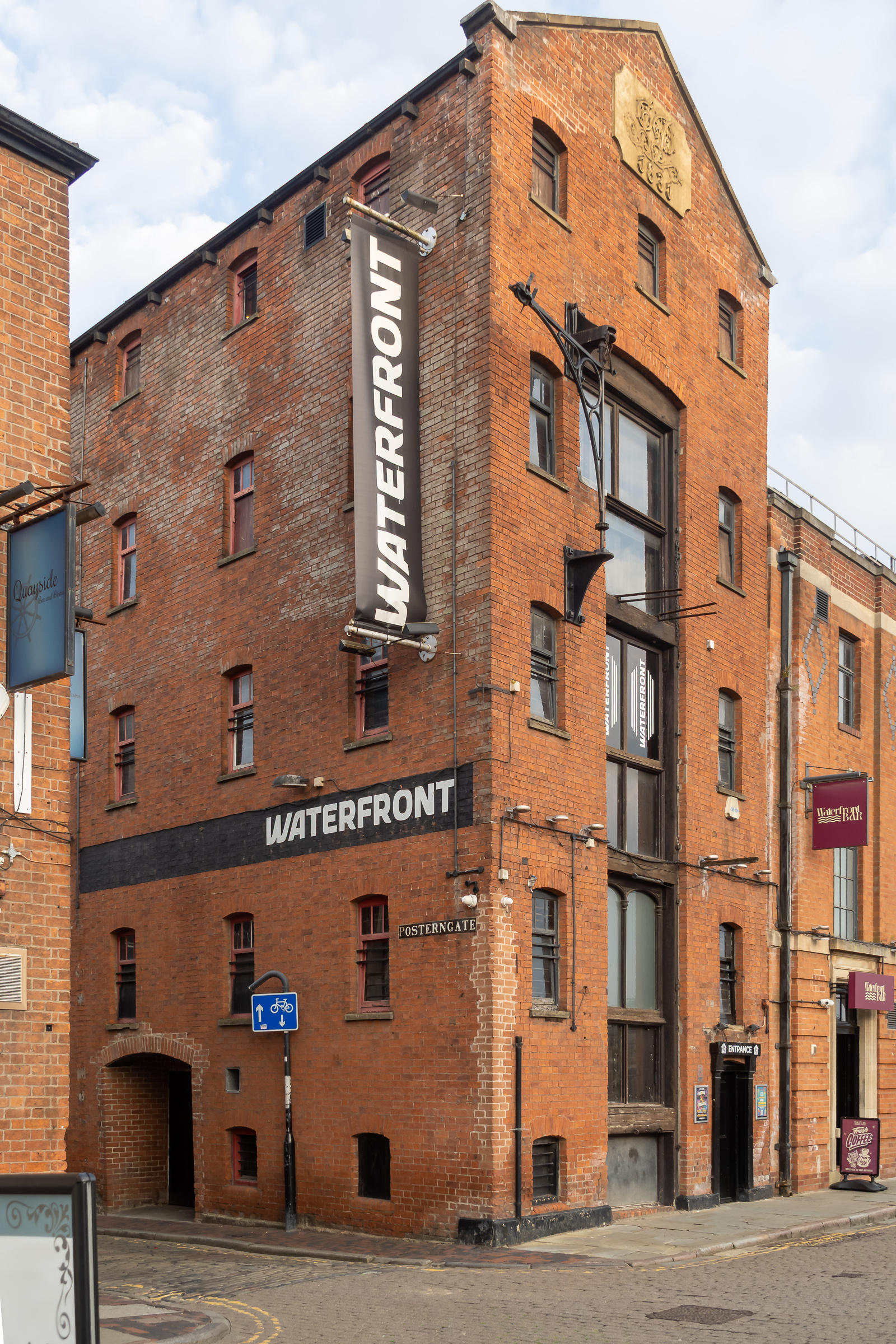
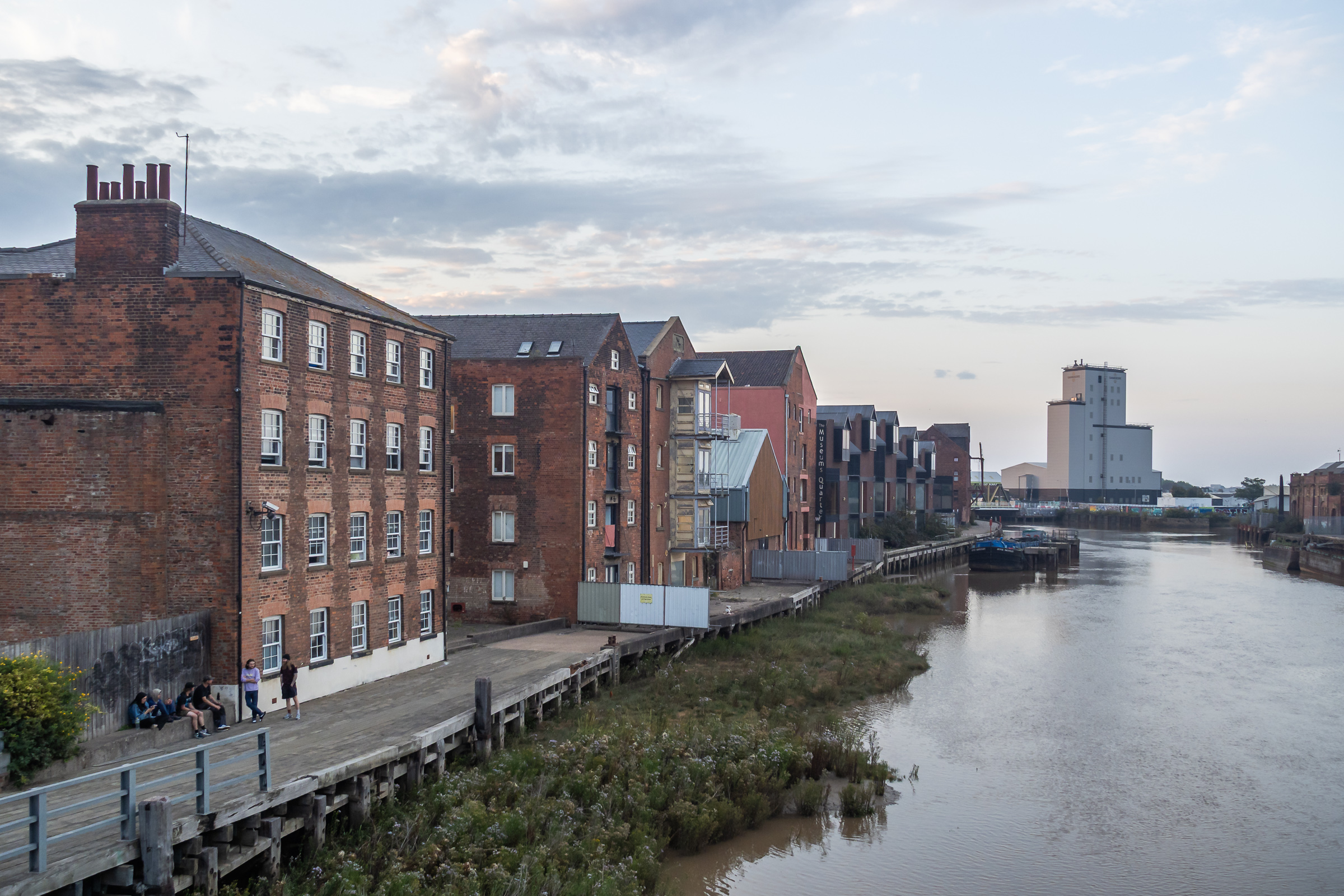
Too many of Hull’s dockside warehouses were demolished, but a few remain, including this fine block beside Railway Dock. I’d hoped to walk though Trinity Burial Ground, where I’d often sat in the past but that is now a building site.

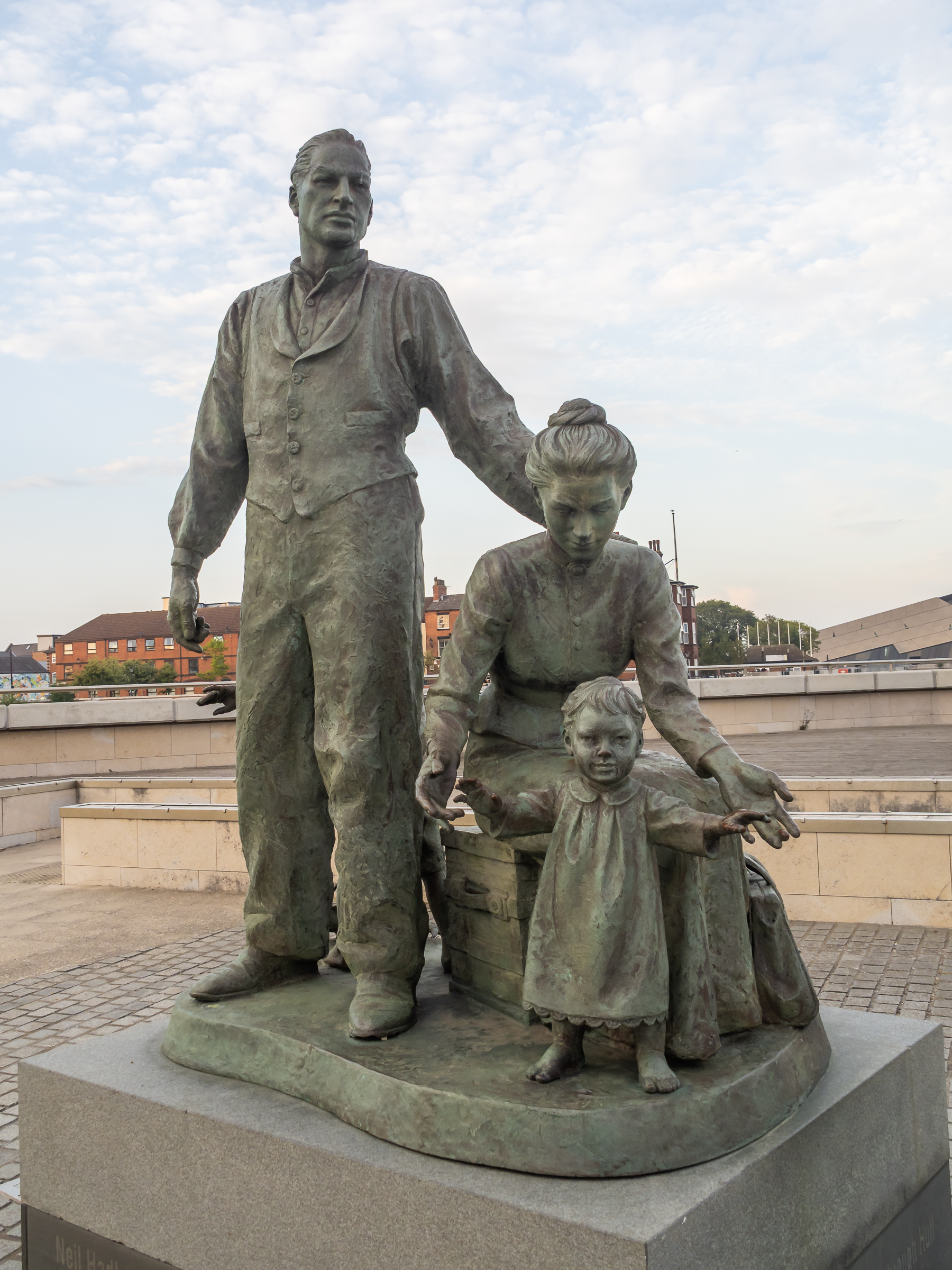
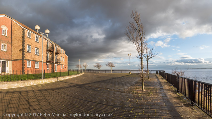
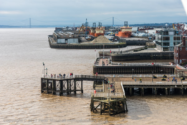
A statue by the Humber to the west of Humber Dock Basin, The Crossing, commissioned in 2001 commemorates the many migrants who came to Hull from Europe, mainly docking here to take the train to Liverpool on their way the the United States.

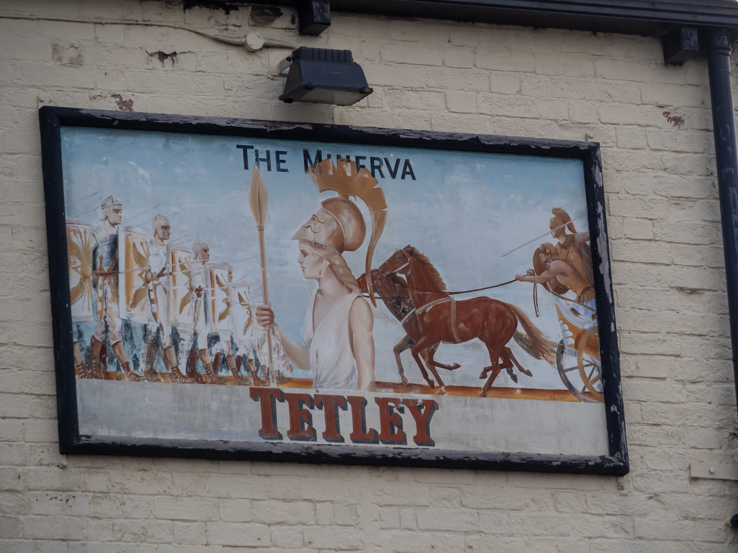
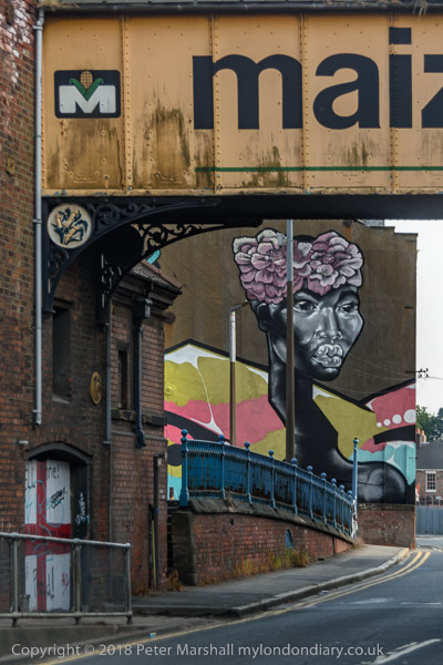
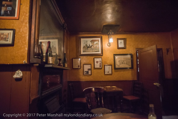
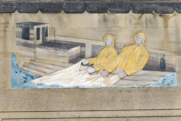
High on the wall of the Minerva pub is this sign, probably a little faded from when it was placed here. This time we didn’t go into the Minerva but continued our walk as the light was fading.

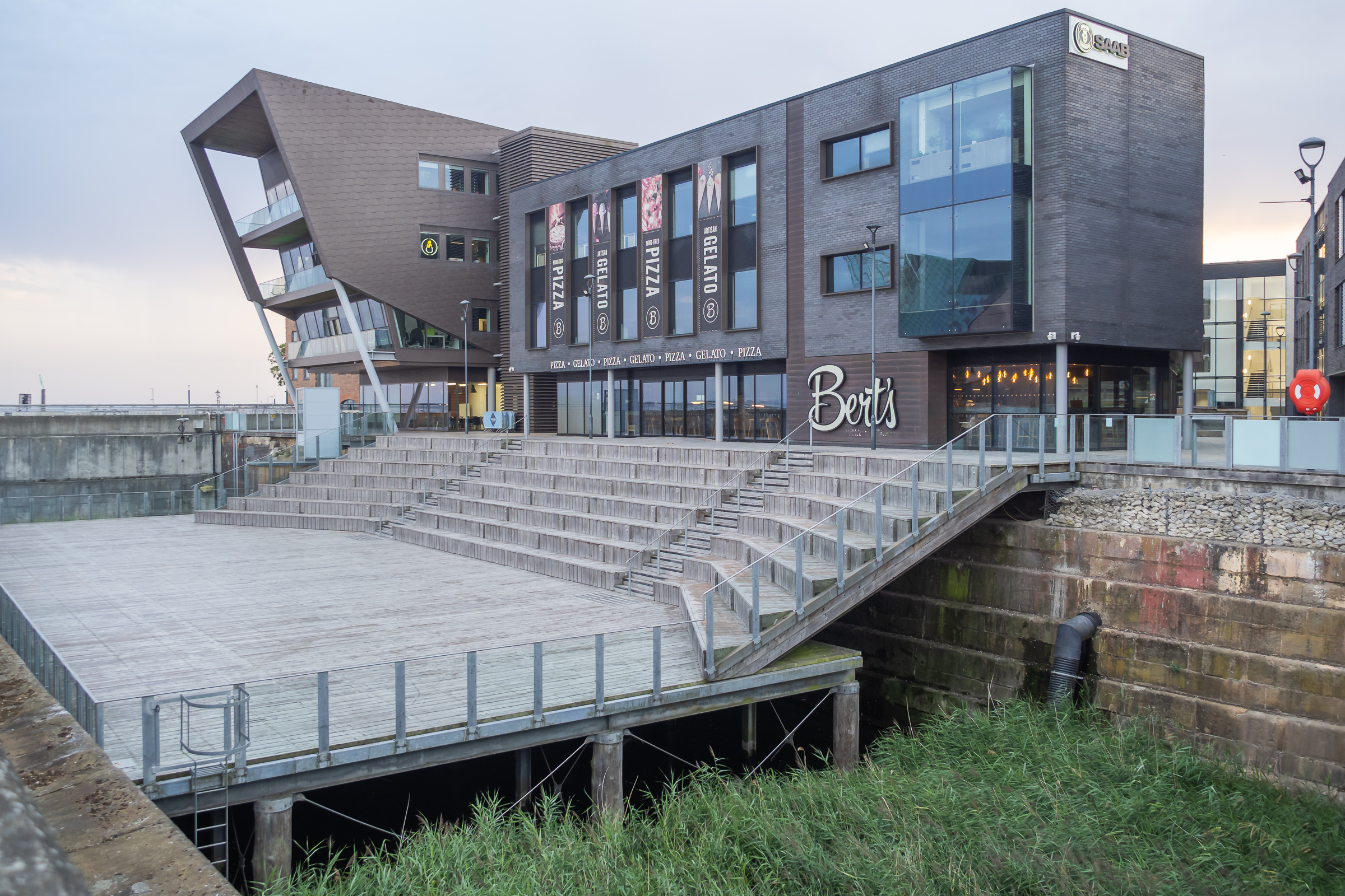
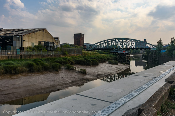
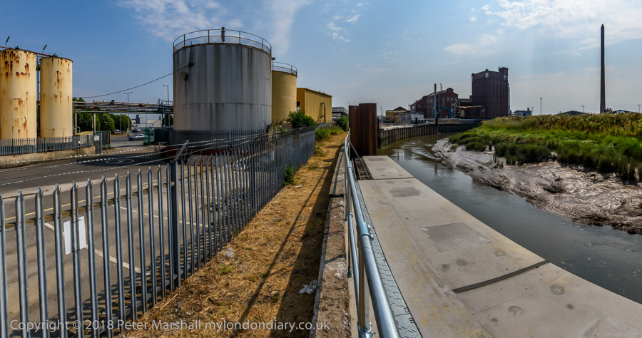
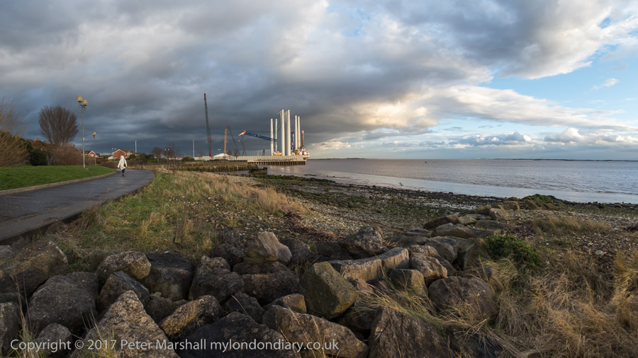
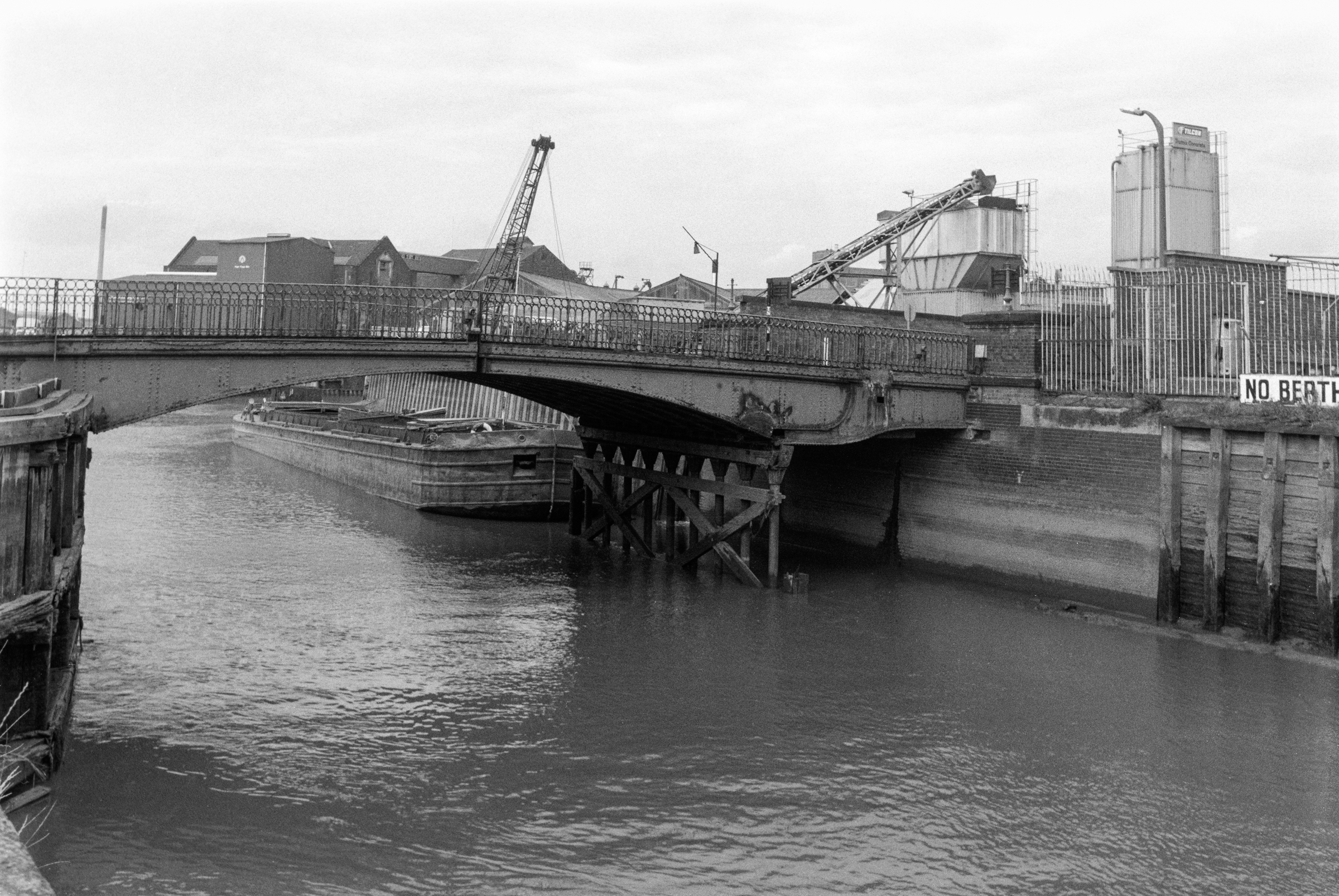
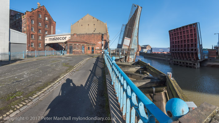
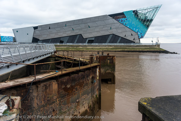
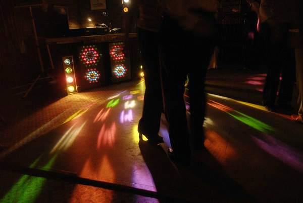
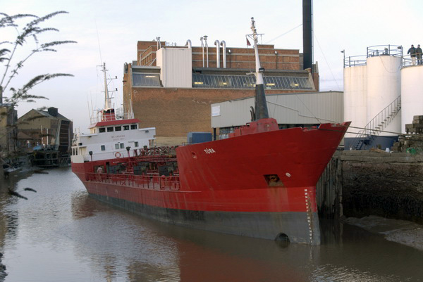
A path from Nelson Street leads along the side of the River Hull past the former Hull Central Dry Dock. In use until relatively recently this is now a performance area.

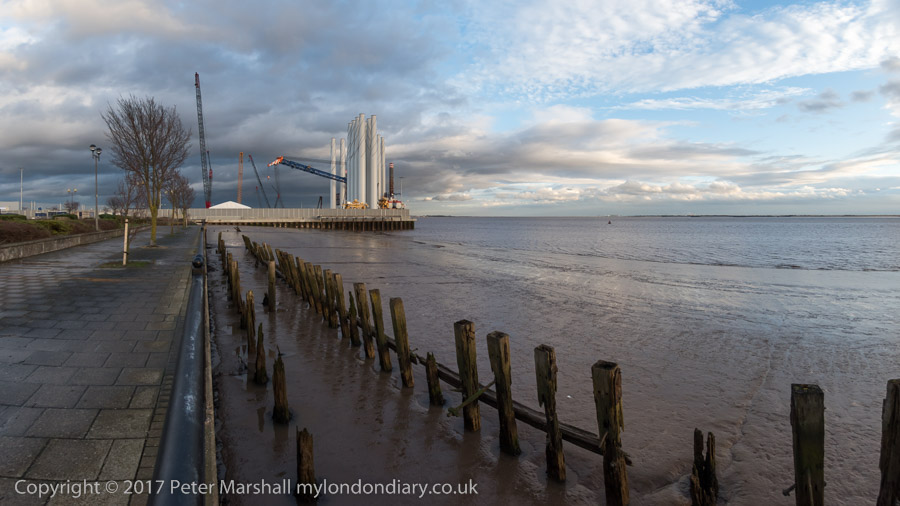
As you can see parts of the riverside walk in the ‘Old Harbour’ were closed and our plans to walk by the River Hull were cut a little short.

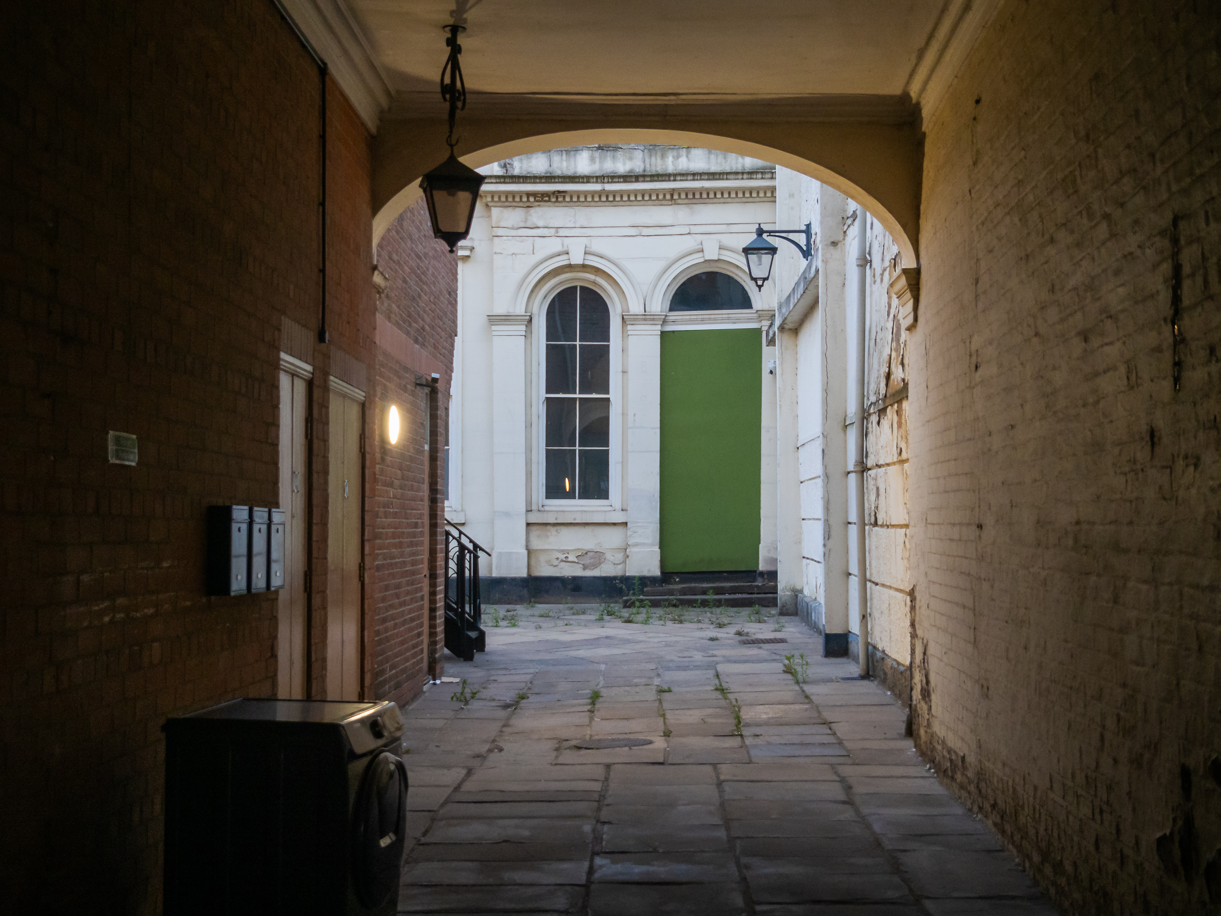
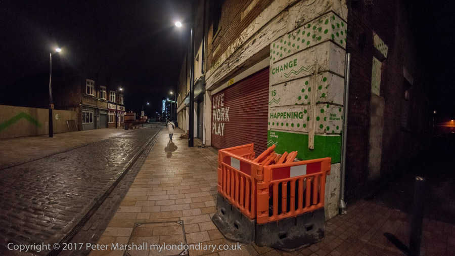
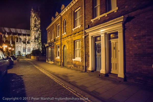
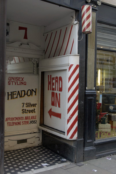
Instead we turned down Scale Lane and made our way back to the city centre along Silver Street and Whitefriargate.

More from our short stay in Hull later. You can see many more of my older pictures from Hull in albums on Flickr and on my Hull Photos web site – links below.


FlickrFacebookMy London DiaryHull PhotosLea ValleyParis
London’s Industrial HeritageLondon Photos

All photographs on this page are copyright © Peter Marshall.
Contact me to buy prints or licence to reproduce.


A Long Day Around Hull – 2018

A Long Day Around Hull: We were staying in Hull for a few days to celebrate our wedding anniversary and on Friday 27 July 2018 we visited some old friends in Cottingham before walking to Oppy Wood in the morning. A bus took us back to the city centre where we bought sandwiches for lunch to a bus to Stoneferry where we sat on the bank of the River Hull to eat them before walking back towards the Wilmington Bridge and crossing here to view the extensive Bankside Gallery before going to the Whalebone pub to refresh ourselves before making our way back to the city centre for dinner and spending some time with family members at the Royal Hotel.

It had been a long and rather tiring day and I had taken a great many photographs, a few of which are included in this post, but rather more are on My London Diary – links in the separate sections below. In particular I had decided to make many panoramic images on our walk.


Hull, Cottingham & Oppy Wood – 2018

Hull, Cottingham & Oppy Wood - 2018

We set off early from our hotel in the city centre and took a roundabout route to Hull Interchange photographing a few of the interesting buildings on our way. I made a few pictures from the upper deck of the bus on the way to Cottingham and on the short walk to have morning coffee with old friends in their bungalow.

Hull, Cottingham & Oppy Wood - 2018

From there it was another walk to Oppy Wood, created by the Woodland Trust around 2004, after they had planted 18,000 trees as a living memorial for the 200 local men from the Hull Pals battalions who died in the Battle of Oppy Wood, near Arras, France on May 3rd, 1917. There is a permanent Kingston Upon Hull Memorial at Oppy unveiled there in 1927.

Hull, Cottingham & Oppy Wood - 2018

Unfortunately extensive work was going on in the area in a flood prevention scheme for the city and access to the site – usually open to the public – was much more limited than normal.

More at Hull, Cottingham.


Stoneferry, Wincolmlee & City Centre

Hull, Cottingham & Oppy Wood - 2018
Cargill’s Oil Mill, built as Isis Mill for Wray, Sanderson & Co in 1912 and still crushing oil seeds

Again I took a number of pictures from the bus as we travelled from the city centre to Anne Watson Street where we walked to a quiet spot by the River Hull to sit in the sun and eat our sandwich lunch, before making our way back towards the city centre.

Hull, Cottingham & Oppy Wood - 2018

Unfortunately there is only a short part of the walk beside the river and much of the time we were walking along a busy hot dusty road until we got to the footpath leading to Wilmington Bridge which used to take the railway lines to Hornsea and Withernsea across the river – but now only has cycle and footpaths.

We crossed the river mainly to photograph the ‘Bankside Gallery’ – pictures in a separate section – but there is also now a little more access to the river than before here. Hull Railway bridge was still taking goods to and from the docks.

We walked north to the end of the gallery, then made our way back down Air Street to Wincolmlee, still with many small businesses some in the old buildings in poor condition but now few making any use of the river.

High Flags, WIncolmlee

We had got very hot and stopped for a drink at the Whalebone before making our way back to the city centre. There was still time to take a few more pictures there before going to meet family for a meal at the Royal Hotel at Paragon Station.

Much more at Stoneferry, Wincolmlee & City Centre.


Bankside Gallery

Hull has Banksy to thank for the Bankside Gallery. His ‘Draw The Raised Bridge‘ which appeared on Scott Street bridge on 26 January 2018 brought crowds to the area and inspired many to create murals on the many walls in the area, creating the extensive gallery.

The Grade II listed lifting bridge which has was closed to road traffic, its bascules permanently raised since 1995 was demolished in 2019-20. It had long been neglected by the city council both before and after closure.

Here I’ll post just three of the many images I took – there are many more at Bankside Gallery.


Hull Panoramas

On my visit to Hull in 2017 when it was UK City of Culture I had begun making a series of panoramic images in Hull, including many of the areas that I first photographed in black and white in the 1970s and 1980s for the work which became a show, ‘Still Occupied’ at the Ferens Art Gallery in Hull in 1983, and later a self-published book of the same name and more recently in a couple of Café Royal zines.

Scott Street Bridge

Here are two of them – and there are another 16 on My London Diary that I made during this walk – at Hull Panoramas.


FlickrFacebookMy London DiaryHull PhotosLea ValleyParis
London’s Industrial HeritageLondon Photos

All photographs on this page are copyright © Peter Marshall.
Contact me to buy prints or licence to reproduce.


Victoria Dock & the Old Town – Hull 2017

Victoria Dock & the Old Town: We arrived in Hull for a visit during the the city’s Year of Culture on Thursday 16th February 2017, 8 years ago.

Victoria Dock & the Old Town - Hull 2017

We had come partly because I was hoping to have a show in the city – it would have been my first there since 1983 when ‘Still Occupied – A View of Hull‘ was in the Ferens Gallery. This one would have been on a rather less grand scale and fell through when the bailiffs evicted the group who had been squatting another city centre property.

Victoria Dock & the Old Town - Hull 2017

But we had also come to celebrate Linda’s birthday in the city where she was born and grew up and for which we both have a particular affection, as well as to see some of the things that were happening for the special year.

Victoria Dock & the Old Town - Hull 2017
Victoria Dock Half Tide Basin. The black area in the distant dock wall was the entrance to Victoria Dock, now completly filled in.

And as always I had come to take photographs, in particular to revisit some of the many places around the city I had photographed back in the 1970s and 1980s. You can see many of those pictures on the Hull Photos web site where I posted a new photo every day throughout Hull’s year as City of Culture and beyond.

Victoria Dock & the Old Town - Hull 2017

I wasn’t bent on a “re-photography” project. These often seem to me a rather lazy way for people who haven’t any real photographic ideas of their own to capitalise on those of other people – or even their own earlier work. Parasitical. Though I do have to admire a few projects that have been really well carried out.

Victoria Dock & the Old Town - Hull 2017

For me photography has always been about my immediate response to the subject. If the scene has changed so too will I respond differently; and if it hasn’t why bother to photograph it again?

In particular I had moved over the years to seeing landscape and urban landscapes very much more in terms of panoramas. Forty or so years earlier had I worked almost entirely with tightly framed scenes using a 35mm shift lens. But now – with a few exceptions – I was working with the very different perspective of the wide sweeping view of a panorama. It forced me to think differently.

Victoria Dock, Hull’s timber dock had closed before I began making pictures there, although there were still a few small pockets of industry on and around the largely derelict site, as well as some remnants.

Now the dock has largely been filled in – the large timber ponds had already gone when I first visited. Much is now housing estates, leaving just the Outer Basin and Half Tide Basin and a slipway with water in them. And we were staying in a room of a house on one of the new estates. We arrived in early afternoon and after dumping our bags went out for a walk along the side of the Humber as the weather was fine for photography.

The mouth of the River Hull

I had walked along this footpath years before, going on past the still open Alexandra and King George V Docks more or less to the city boundary. Now the path is cut off by the Siemens wind turbine site on the former Alexandra Dock.

We turned around and walked back towards the Old Town where a new footbridge took us across the River Hull and on to a drink and an early dinner at the Minerva. After the dramatic skies earlier the sunset was rather disappointing.

After a long rest in the pub we decided to wander around the Old Town. In 2017 the area was still pretty empty on a Thursday night in winter, cut in half by the A63, the busy road to the docks (or rather dock), a reminder that Hull is still a significant port. But the footbridge I was then very sceptical about in my account on My London Diary was eventually built. Still something of a barrier, but far less frustrating.

We walked as far as the city centre to admire (and photograph) the turbine blade on display there before turning round to walk back over the River Hull – this time we took the now seldom-lifting North Bridge.

We walked south beside the river along the deserted riverside path to Drypool Bridge where the path was then closed off after the needless demolition of Rank’s Mill for a hotel that didn’t arrive and through the streets – another long wait to cross the A63 – and back to the house we were staying in.

You can read more details of the walk and see more of the panoramas I made on My London Diary.
Victoria Dock Promenade
Night in the Old Town


FlickrFacebookMy London DiaryHull PhotosLea ValleyParis
London’s Industrial HeritageLondon Photos

All photographs on this page are copyright © Peter Marshall.
Contact me to buy prints or licence to reproduce.


More from East Hull 1989

More from East Hull: The final episode of my walk around East Hull in October 1989.

The Fish House, Holderness Rd, Hull, 1989 89-8p-65

The Fish House I think sold decorative tropical fish to swim in your aquarium but I was mildly amused by the small house on the pavement in front of their sign. Certainly it was unsuitable for fish, but I couldn’t decide what it was for, perhaps a kennel for a Chihuahua. And further up on the house is a picture of dog of some sort.

Putting “the fish house holderness road hull” into Google brings up, apart from this picture, a large number of fish and chip shops and restaurants mainly around Hull. But I think the fish here would have generally been rather insubstantial as well as expensive to eat.

Bush, Opticians, 337 Holderness Road, Hull, 1989 89-8p-66
Bush, Opticians, 337, Holderness Road, Hull, 1989 89-8p-66

Bush are still there on the corner of Durham Street, though its frontage now looks rather different with a front extension across the whole of it. Though I’m sure this gives a better working space it has lost the character of the ground floor with its fort as the left, angular bay windows and glasses sign.

Bush, Opticians, 337 Holderness Road, Hull, 1989 89-8p-52

Another view of Bush Opticians. The Bush family have been prominent opticians in Hull for many years, with Herman Bush being one of Hull’s first opticians in the mid-19th century.

The sign jutting out from the shop has the date 1865, and there have been branches run by members of the family around Hull and in surrounding areas where five generations of the Bush family have been testing eyes and making spectacles in Hull. Though one of the Bush opticians websites states that, it seems now to be at least six generations, as the obituary of the most controversial of the fifth generation, the late Sydney Bush, includes a quote by his son who worked with him for over 30 years.

Country Butcher, Clip Joint, Newbridge Trophy Centre, 142-6, New Bridge Rd, Hull, 1989 89-8p-51

Hairdressers seem often to have punning titles like The Clip Joint, though the scissors taking the lower part of the T was a nice touch. The years have been tough for small shops, particularly those a little off the main streets, and The Country Butcher with its curiously altered bay windows is now residential.

The hairdresser went though several name changes and has now become a shop selling “Eco-friendly, Handmade Products” and the Newbridge Trophy Centre at 142 has become a pizza place.

Mo's Cafe, Great Union St, East Hull, 1989 89-8p-54
Mo’s Cafe, Great Union St, East Hull, 1989 89-8p-54

Mo’s Cafe in this picture was at the north end of Great Union St, at the rear of the Waterloo Hotel on the corner of Clarence Street. The buildings behind and at left were a part of the Rank Hovis mill site at Drypool Bridge and were demolished with the mill in 2015 for a hotel that was never built.

The sign on the window says Mo’s Cafe has moved to 18 Hedon Road, 2 minutes walk away.

River Hull, Drypool Bridge, Hull, 1989 89-8p-56

My walk in East Hull was at an end and I took a final picture before going to the Old Town as a walked across Drypool Bridge. The wharf at left is part of the Rank Hovis Mill. There were still a few vessels moored in the River Hull in what was Hull’s first harbour, with some fine warehouses on the right bank converted to flats.

The next post from Hull will be the last of my pictures there in October 1989 – and after that I will return to posting more pictures of London.


FlickrFacebookMy London DiaryHull PhotosLea ValleyParis
London’s Industrial HeritageLondon Photos

All photographs on this page are copyright © Peter Marshall.
Contact me to buy prints or licence to reproduce.


Around Holderness Road Hull – 1989

Around Holderness Road Hull: At the end of my walk on Monday 21st August 1989 (More from Hedon Road) I took a few pictures as I walked back into the centre of town to catch my bus back to North Hull. But I came back to East Hull the following day to walk along Holderness Road and some of the streets off it.

New Bridge Rd, Rosmead St, Hull, 1989 89-8o-35

New Bridge Road runs through the centre of an area of late Victorian working class housing and this corner is in some ways typical. It seems only a little changed today. It isn’t quite a crossroads, as the corner of Sherburn Street is just a few yards to the north of that with Rosmead Street and the two are at an angle. But in my picture it seemed a fairly busy corner with a car turning into Rosmead Street, two women walking and a bicycle with a trailer and ladders parked at the right.

Back in the 1980s there were still many workmen – painters, decorators, handymen of all trades in areas like this who still relied on bicycles and even handcarts to carry to tools of their trade while most in more prosperous areas had turned to vans. There is also another bicycle – or at least a wheel at the left edge of the picture.

Those typically Hull lamp posts have now gone, replaces by a rather less elegant design and the taller post then I think simply more powerful lighting for the busier road has been replaced by one carrying a CCTV camera and there is a pedestrian crossing here.

Bandbox, Dansom Lane, Holderness Rd, Hull, 1989 89-8o-36

This rounded building is still on the corner of Dansom Lane South and Holderness Road but became a shop selling kitchens, bathrooms and bedrooms as is now shared by a café and barbers.

Dansom Lane got its name from the farmer who was there in the 19th century. The rounded house at 2-6 Dansom Lane South & 1 Holderness Road dates from around 1850.

River Hull, North Bridge, Hull, 1989  89-8o-21
River Hull, North Bridge, Hull, 1989 89-8o-21

The view upstream from North Bridge with both sides of the river line with wharves and factories and a number of boats moored, resting on the mud at low tide. The silo of R & W Paul and some of the more distant buildings remain but the left hand bank is now empty.

Malton St School, Malton St, Hull, 1989 89-8o-23

Blenkin Street & Malton Street Board School was built by the Kingston upon Hull School Board in 1899 and closed shortly before World War Two. It later became an annex to the Art College and closed in 1997 and was sold off the following year. It has since been converted to residential use as Old School House.

Ron Hedges Emporium, Holderness Rd, Hull, 1989 89-8o-26

Ron Hedges Emporium “Incorporating House Clearance Unlimited” sold a wide range of secondhand goods some of which including furniture, cookers and bicycles were on display on the pavement in front of the shop.

Abbey Industries, Williamson Street School, Hull, 1989 89-8o-11

Williamson Street School was one of the first schools built by the Kingston upon Hull School Board established under the Education Act 1870 and constituted in 1871. This building has ‘1874 BOARD SCHOOL’ and the three crowns of the Hull coat of arms on its bell tower.

When I made this picture it was occupied by Abbey Industries. It has since been demolished.

Cravens, 35-37, Holderness Rd, Hull, 1989 89-8o-12

This fine building was built in the late 1880s for the Public Benefit Boot Company, founded in Hull by William Henry Franklin (1848-1907) in 1875. From a small shop in Hull the business grew rapidly to own 200 boot stores, several repair shops and four modern factories, providing boots cheaply for working people and advertising them widely including by touring a giant boot on a horse-drawn cart around towns and villages in Yorkshire. The building is still there and is now occupied by an IT Consultancy.

Cravens Mini Market was another shop selling secondhand household appliances, furniture and other items.


FlickrFacebookMy London DiaryHull PhotosLea ValleyParis
London’s Industrial HeritageLondon Photos

All photographs on this page are copyright © Peter Marshall.
Contact me to buy prints or licence to reproduce.


Kenfig, Hedon Sand & River Hull – 1989

Kenfig, Hedon Sand & River Hull – these pictures I made on Monday 21st August 1989 on a short section of the River Hull. I had hoped to walk along the footpath beside the river between Drypool Bridge and North Bridge.

Boats, River Hull, downstream, Drypool Bridge, Hull, 1989 89-8n-35

The small tug Felix-Tow has got around a bit since it was built in the Netherlands in 1955. After working in Rotterdam the Ijssel came to Felixtowe in 1967 where it was renamed FELIX-TOW. I think it was fairly new to Hull where it was owned by Dean’s Tugs Ltd – and was still in service in 2008 – perhaps still now.

Boats, River Hull, upstream, Drypool Bridge, Hull, 1989 89-8n-36

The vessel in the foreground is a coastal tanker belonging to the Hull based petroleum company RIX which still operates a fleet of coastal oil tankers, estuarial barges and crew transfer vehicles. Rix have oil storage tanks around a mile further up the river.

The company, as their web site relates, began in 1873 when Robert Rix, a sea Captain and Merchant Adventurer working in Hull set up in business building small coastal craft on the south bank of the River Tees in Stockton. In the 1900s the company bought steam ships and began operating them. The move into petroleum products came in 1927 when they began importing tractor vaporising oil and Lamp oil, packed in oak casks on their ships from Russia to the Humber.

The company expanded rapidly after the end of World War Two, supplying agricultural and commercial diesel across Yorkshire and opening petrol filling stations around Hull. The company has continued to grow and expand into new areas.

Boats, River Hull, upstream, Drypool Bridge, Hull, 1989 89-8n-21
Vessels, River Hull, upstream, Drypool Bridge, Hull, 1989 89-8n-21

Barges like these in the middle of the picture were once very common, and were often moored three or four abreast in the Old Harbour downstream of Drypool Bridge, but by 1989 were becoming much less common, though some are still in use. Others have been converted to houseboats.

Barges like this might carry as much as 24 large lorries and could transfer goods from the docks to river wharves at much lower costs than road transport, with much lower pollution and carbon footprint. But of course they could only take goods to sites on navigable rivers and canals and so are much less flexible than road transport.

Hedon Sand, River Hull, upstream, Drypool Bridge, Hull, 1989 89-8n-22

Hedon Sand, IMO 5185875 was a Grab Hopper Dredger built in 1954 close to Hull at Richard Dunston’s Hessle Yard. The ship had gross tonnage 677 tons, deadweight 813 tons and was around 50 metres long with a breadth of 10 meters. An 8 cylinder four-stroke msrine Ruston & Hornsby engine give it a top speed of 9 knots.

Hedon Sand, River Hull, upstream, Drypool Bridge, Hull, 1989 89-8n-23

Known for most of its active life as Kenfig, it had been built for the British Transport Commission and was transfered to the British Transport Docks Board in Cardiff in 1963. It returned to the Humber and was used in dredging the Humber Dock Basin when Humber Dock was being converted to the Marina.

Mud is always a problem in the Humber and in the River Hull and I think dredging was always needed when the River Hull was still a commercial river. In recent years there seems to be far more mud in the river close to the mouth than I remember.

Hedon Sand, River Hull, upstream, Drypool Bridge, Hull, 1989 89-8n-24

Kenfig was sold to Jones & Bailey Contractors Ltd, Hull in 1983 – they also owned another dredger, Grassendale and they renamed it Hedon Sand. In 1989 when I took these pictures the vessel was sold to be broken up in Hull.

River Hull, upstream, Drypool Bridge, Hull, 1989 89-8n-25

I think some at least of these massive wooden beams had probably once supported parts of the riverside path I had hoped to walk.

Kenfig, River Hull, upstream, Drypool Bridge, Hull, 1989 89-8n-26

Ahead of me I could see North Bridge but with extensive work taking place on the riverbank there was no way I could continue to walk along it and I had to retrace my steps to Drypool Bridge

Hedon Sand, River Hull, upstream, Drypool Bridge, Hull, 1989 89-8n-12

On my way I took another picture of Hedon Sand before walking up to the road and going on into East Hull – where I took more pictures. More later.


FlickrFacebookMy London DiaryHull PhotosLea ValleyParis
London’s Industrial HeritageLondon Photos

All photographs on this page are copyright © Peter Marshall.
Contact me to buy prints or licence to reproduce.


More River Hull, Lime St and Wincolmlee 1989

More River Hull, Lime St and Wincolmlee – pictures made in August 1989

Clarence Mill, Drypool Bridge, Dry Dock, River Hull, Hull, 1989 89-8f-61

Looking across the River Hull from the riverside path through the scrap metal you can see the Drypool Bridge and the converted warehouses on Clarence Street between High St and the River. Further to the right are the gates of a dry dock and I think the chimneys of Blaydes House, now the University of Hull Maritime History Institute at I High St.

Dry Dock, River Hull, Hull, 1989 89-8f-62

Swinging around a little brings a second set of dock gates into view, and this was the entrance to Hull’s first inland dock, needed as the Old Harbour on the river bank was getting far too congested. The Hull Dock company, founded in 1783 and the first of its kind, built the dock and opened it in 1788 simply as the Dock. It was built close to the site of Hull’s medieval walls and the street just to the south of the former dock is still called North Walls. The dock was renamed Queen’s Dock when Victoria visited in 1854 and all but the short section between the river and Dock Office Row was filled in in the 1930s and reopened as Queens Gardens in 1935.

Dry Docks, Hull College, River Hull, Hull, 1989 89-8f-63

The Yorkshire Dry Dock Co Ltd, Ship Builders Ship Repairers were incorporated in 1917, but there had been dry docks here much earlier as a detailed study in Paul Gibson’s Hull and East Yorkshire History relates. Hull’s Arctic Corsair, currently being restored, is expected to open to visitors at North End Shipyard in early 2025.

Works, Lime St, Hull, 1989 89-8f-54

Lime street runs parallel with the River Hull on its east side from North Bridge to Scott Street Bridge, and then on to the busy industrial Cleveland Street, always in the 1980s one of Hull’s dustiest streets. Between Lime Street and the river were a number of wharves and many were still in use in 1989, and some businesses here still had some maritime connection.

This picture is looking south down Lime Street from its junction with Jenning Street. I turned into Jenning Street. There are some bulk storage tanks and timber storing sheds in the middle distance and three large of cranes suggesting some large redevelopment.

Scott St Bridge, Hull, 1989

Back in 1989 I was still able to cross the river on Scott Street Bridge. I think Hull Council had long wanted to close this Grade II listed hydraulic double leaf bascule bridge and had deliberately failed to maintain it, allowing salt water to corrode its mechanism. Finally in 1994 they pronounced it unsafe.

It hit the national headlines in January 2018, when Banksy came to to Hull and drew a figure of a young boy brandishing a pencil for a sword called “Draw the Raised Bridge”. The council removed the Banksy in October 2019 and then demolished the bridge completely. Some noises were made by the council about replacing it with a replica, but don’t hold your breath.

Pauls Agriculture Ltd, Wincolmlee, Hull, 1989 89-8f-42

A man cycles down the Scott Street Bridge approach with its warning lights for bridge openind. On the other side of the long railing is Wincolmlee, the street which follows the River Hull on its west side.Two Buildings belonging to Pauls Agriculture Ltd are linked across the street by a bridge.

Pauls Agriculture was founded in Ipswich in the early 19th century initially as traders in malt and barley, but by the twentieth century there main business as in maize, which they crushed to produce vegetable oils for soap and other industrial uses with the remaining oil cake being used to produce animal feeds. In 1992 they merged with BOCM.

Much of the maize was imported, from the USA and elsewhere, so a riverside site made sense. But when transport by road took over it made more sense to site crushing mills in agricultural areas.

More to follow from Hull in August 1989 – and there are more pictures on Flickr in both black and white and colour.


FlickrFacebookMy London DiaryHull PhotosLea ValleyParis
London’s Industrial HeritageLondon Photos

All photographs on this page are copyright © Peter Marshall.
Contact me to buy prints or licence to reproduce.


River Hull 1989

River Hull 1989: I always enjoy a walk by the River Hull and back in the 1970s-90s there was always plenty to photograph, though it is rather less interesting now. My problem then was always to drag myself away and move to a different location. If you click on any of these pictures it will take you to a larger image on Flickr and you can then move forward or backward through the whole set I’ve put on-line.

Drypool Bridge, River Hull, Hull, 1989 89-8e-52

Looking upstream from Drypool Bridge you can see an industrial landscape, most of which has now disappeared, as well as several vessels on the river.

River Hull, downstream, Drypool Bridge, Hull, 1989,  89-8e-53
River Hull, downstream, Drypool Bridge, Hull, 1989, 89-8e-53

Turning around and looking out towards the Humber this was the view, one that I’d taken many times in earlier years when the river had been far more crowded. At left is the disused entrance to Victoria Dock and further down the Northern Divers building, sand and gravel works, warehouses and the Myton Swing Bridge built in 1979 to take the A63 leading to Hull Docks. Before then the traffic had gone various Hull ring roads and and the decision to put it through here, splitting off the city centre from the old town was something of a disaster for the city.

Burdale H, Ranks, Clarence Mill, River Hull, Hull, 1989 89-8e-56
Burdalen, Ranks, Clarence Mill, River Hull, Hull, 1989 89-8e-43

Rank’s Clarence Mill on the east bank of the river just downstream of Drypool Bridge had introduced improved methods of bulk handling, sucking up grain from barges moored at the jetty on which I was standing to make this picture.

Although the Victoria Docks had closed in 1979, the entrance to them here remained in use as the only place the River Hull was wide enough to swing vessels like this Rix coastal tanker around. It will have gone up forward to the Rix depot a little over a mile away on Wincolmlee, and then come backwards downriver on the tide until here, where it could turn and then proceed forwards to the Humber. I took a whole series of the Burdalen turning and you can see a few more on Flickr.

Drypool Bridge, Clarence Mill, River Hull, Hull, 1989 89-8e-44

Drypool Bridge and North Bridge are both Scherzer Rolling Bascule Bridges with a large counterweight at the left-hand end in my picture and a curved track below that which rolls on rails at ground level. Because of the counterweight relatively little force is needed to raise the bridge to allow river traffic to pass through. River traffic was heavily dependent on the tides, and the bridge always seemed to block road traffic at the most inconvenient times.

When the mill was in use the pipes at the top of the image could be lowered into the holds of the barges moored below.

Clarence Mill, Drypool Bridge, Dry Dock, River Hull, Hull, 1989 89-8e-45

A riverside walk led north along the east side of the River Hull, though in 1989 it was largely covered by large amounts of scrap iron at the end of the Union Dry Dock on Great Union St, Hull. The Drypool Engineering and Dry Dock Company Limited of Hull had a number of sites around the city and in Selby by went bust in 1976.

Clarence Mill, Joseph Rank’s great flour mill in Hull was rebuilt after wartime damage and was only finally closed in 2005. With the City Council’s usual disregard for Hull’s heritage it was demolished in 2015 to make way for a hotel which was never built. The site was still undeveloped in 2022.

Pipes, Dry Dock, River Hull, Hull, 1989 89-8e-33

More of the scrap metal which partly blocked the riverside path, including a anchor.

Pipes, Dry Dock, Clarence Mill, Hull, 1989 89-8e-22

And another view of the mills over the pipes at the Union Dry Dock. The closer building is the Shotwell Mill, still standing. Gamebore Cartridges makes shotgun catridges here, and should not be confused with the Hull Cartridge Company Limited who also make cartridges and sporting goods in Bontoft Ave, Hull. I’ve never owned a shotgun and certainly can’t comment on the relative merits.

As well as finding more pictures on Flickr in both black and white and colour you can also buy my 36 page Cafe Royal zine, Peter Marshall — The River Hull 1977–85, which has some of the best of my earlier images.


FlickrFacebookMy London DiaryHull PhotosLea ValleyParis
London’s Industrial HeritageLondon Photos

All photographs on this page are copyright © Peter Marshall.
Contact me to buy prints or licence to reproduce.


Hull – More Than The Deep: 2017

Hull – More Than The Deep: I haven’t often posted about Hull on here, but it was the city where I first carried out a serious photographic project which was shown at the city’s art gallery in 1983, and one I have continued to photograph over the years, though rather less regularly since 2000.

Hull - More Than The Deep

I didn’t really choose to photograph Hull, but I did chose to marry a woman who had grown up in the city and whose family home was still there, and it was a place where I found myself with time on my hands when visiting her parents usually for a couple of weeks most summers and often for shorter periods at Christmas or Easter.

Hull - More Than The Deep

We still have a few friends in the city, although most have now died, and our visits are less frequent. Back in 2017 Hull was enjoying its year as UK City of Culture and we were visiting partly to enjoy some of that but also to meet a few friends. I was also trying to generate some interest in my pictures of the city from the 1970s and 1980s, but plans for a show fell through.

Hull - More Than The Deep

Sunday 19th February 2017 was also a day when we met with some of our family who had come to Hull both to meet us and to visit Hull’s major tourist attraction, The Deep and we met them for lunch there and I took a few pictures from its viewing platform.

Hull - More Than The Deep

I’d gone out immediately after breakfast for a long walk around some of my favourite areas of the city which I had photographed in earlier years. Then I had been working mainly with black and white film, interested in the changes taking place in the city and surprised at the way it seemed to be disregarding much of its heritage, and recording aspects that seemed unlikely to survive. I’d also taken some colour pictures and had included some in my show there, but they perhaps more reflected my interest in colour than my interest in the city.

But in 2017 I was working only on digital, so everything was colour and I was also making some panoramic colour images – again digital.

It was late afternoon by the time we said goodbye to our family, and Linda decided she would like to go for a walk around Beverley, a town seven miles away. The bus service to there is slow and infrequent, but as I wrote “it has the advantage of setting you down at the bus station immediately next door to Nellie’s.”

Beverley is an old market town, well known for its Minster and full of old buildings. It was too late for us to visit the Minster, but not for a visit to one of its Grade II* listed buildings, The White Horse Inn, generally known as Nellies, taken over by Samuel Smith’s brewery in 1976. And although they have modernised the pub in some ways, much remains as it was – and my pictures were taken using its rather dim gas lighting. It’s a place people come from around the world to see, though fortunately not in such large numbers to swamp it.

Afterwards we still had some time before the last bus back to Hull left and went for a walk around the town including Beverley Bar, the Minster and the Monk’s Walk and I made a few pictures, all hand-held.

Back in Hull we had a walk through the town, mainly deserted at night to the house where we were staying in Victoria Dock Village, and there was time for a few more pictures.

There are many more pictures from the day on My London Diary, and many have captions too:
Beverley and Nellie’s
Around the Town
The Deep
More Hull Panoramic
Wincolmlee and Lime St


FlickrFacebookMy London DiaryHull PhotosLea ValleyParis
London’s Industrial HeritageLondon Photos

All photographs on this page are copyright © Peter Marshall.
Contact me to buy prints or licence to reproduce.


Hull Revisited December 2005

Hull Revisited December 2005: Usually I sit down to write these posts and tell some kind of story about the events or places that I photographed on a particular day or walk or project. And the pictures in this article were all taken on 17-19th December during a short visit to Hull.

Hull Revisited December 2005

But when I looked at them they didn’t look as you see them now, and my first thought was about the colour and quality of the 49 images that I’d posted to the web back in 2005, and rather than writing about them I decided to try and improve them a little. Going back to the original RAW images taken on a Nikon D200 would have been the best way to do this, but would have been very time-consuming and instead I simply worked on the 600×400 pixel jpeg images that I’d put on-line.

Hull Revisited December 2005

Back in 2005 the RAW conversion software available was pretty much in its infancy and often required considerable judgement to get anything like the most from the images. Using the current version of Lightroom would have enabled me to improve the images considerably.

Hull Revisited December 2005

But time was short, and instead I spent perhaps 30 seconds on each image, bringing them into Photoshop in batches and then using its auto-color and and auto curve correction on each. On a few I had to modify the auto settings, fading the correction or tweaking the curve a little, but most were done fully automatically, and the improvements in some cases were dramatic.

We’d gone to Hull mainly to celebrate the 60th birthday of an old friend, and stayed at the large and architecturally interesting home of another friend, as well as to visit my mother-in-law in her nursing home. But I found some time to get out and photograph parts of the city I’d first photographed in the 1970s and 1980s as well as find some new scenes to photograph. Here I’ll post a few of them, but you can see more on My London Diary.

More on My London Diary


FlickrFacebookMy London DiaryHull PhotosLea ValleyParis
London’s Industrial HeritageLondon Photos

All photographs on this page are copyright © Peter Marshall.
Contact me to buy prints or licence to reproduce.