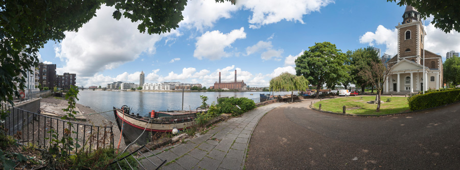
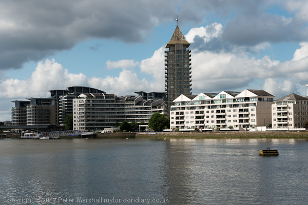
Battersea Riverside. The short walk from Battersea Bridge to Wandsworth is one I’ve done quite a few times over the years. For most of the walk you can now keep to the riverside, with views across the Thames, though a few short detours are needed. It’s on of my favourite walks in London and only a couple of miles, though if you want a longer walk it is now part of the Thames Path so you can continue for many miles either upstream or down.
Lots Rd
When I first made this walk in the 1970s the riverside was lined with industry and I could only access the river at a few locations. By 2012 the industry had almost all gone and there were blocks of private flats along most of this length. But ‘planning gain’ meant a riverside path even if it was lined behind by planning loss.
Thames at BatterseaSt Mary’s BatterseaOld Swan Wharf
People have to live somewhere and London needed extra housing, though almost all of these new developments were the wrong kind of housing and not the social housing desperately needed by Londoners. Back in the early post-war years we saw social housing being built to provide mixed communities and promote social cohesion, but Thatcher changed all that, and social housing became something only for the poor and that stigmatised residents as failures.
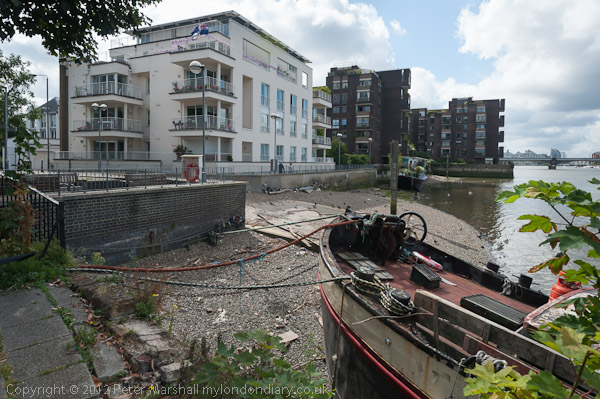
Overground train on its way to Clapham JunctionDemolition at Fulham WharfNew Flats and Wandsworth Bridge
The loss of industry also meant the loss of jobs in the area, and took place at a time of increasing gentrification in Battersea, with people moving in who worked in wealthier parts of the city.
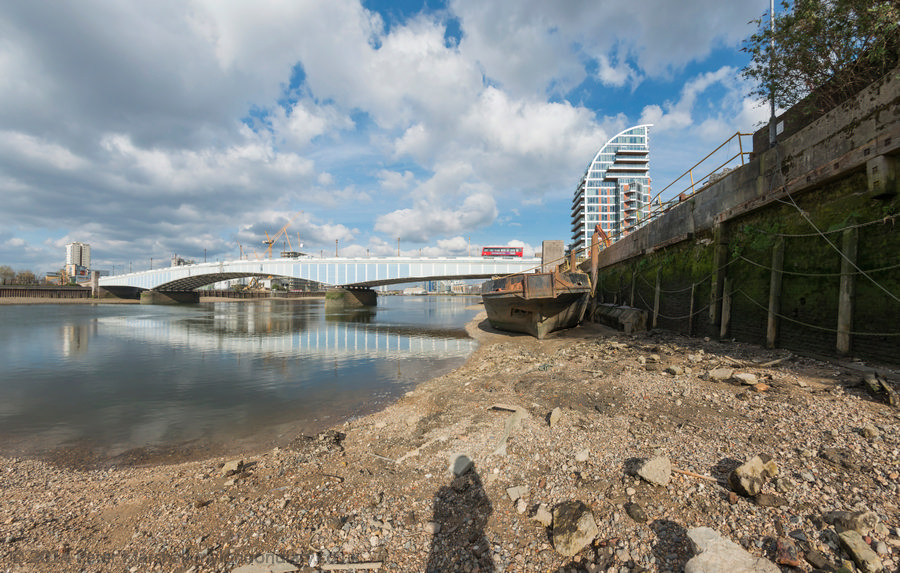
Looking upstream from Wandsworth Bridge
As I wrote in 2012, “Every time I walk it a little more has gone with a new block of flats or hotel or other luxury development. But a few things remain.”
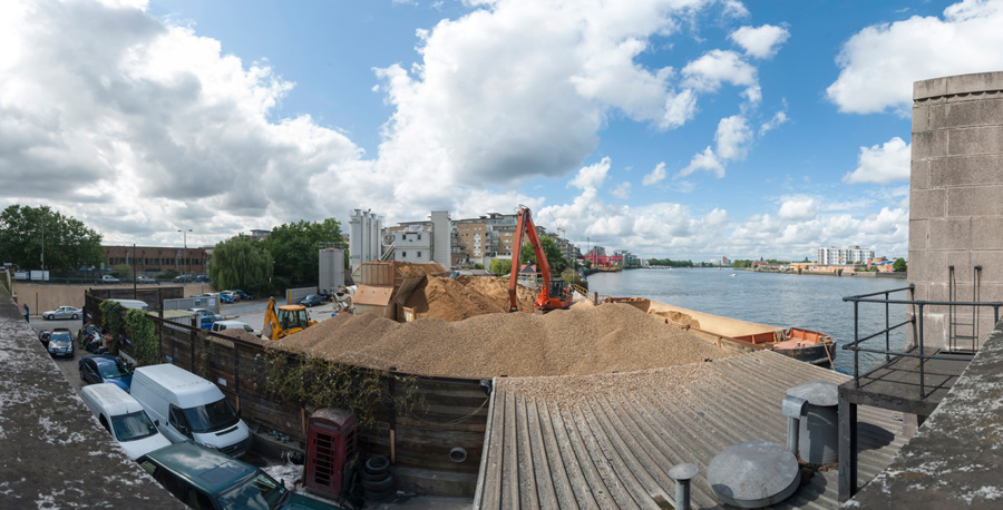
Waste transfer station, Wandsworth
You can see the panoramic images larger by right clicking on them and choosing Open Image in New Tab’ More pictures on My London Diary at Battersea Riverside.
Greenwich, Bikefest and the 1940s: Twenty years ago on Sunday 13th June 2004 I had a day out in London, beginning with a walk beside the Thames at Greenwich, then coming to Westminster for a bike festival in Trafalgar Square and then a rather peaceful ‘War in the West End’ in Leicester Square. You can find what I wrote then about all these a little way down the June 2004 page of My London Diary.
Greenwich to North Greenwich Walk
I’d decided to get up early on Sunday and take a walk by the River Thames in Greenwich. Unfortunately engineering work meant no trains were running there so I had rather a long bus journey from Waterloo to get there. At least there was little traffic to hold the bus up.
I began with a walk around the grounds of the former Royal Naval College, now Greenwich University before taking the path past the power station and along Ballast Quay an on.
The path was open to North Greenwich and I made my way along it. Some of the pictures I made are now difficult to locate as this whole riverside is getting replaced by blocks of flats.
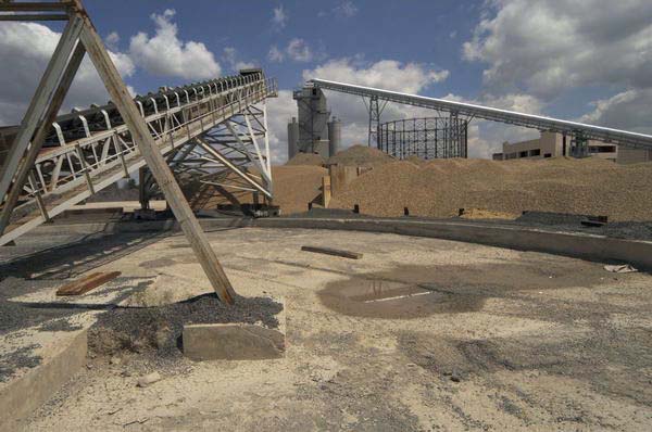
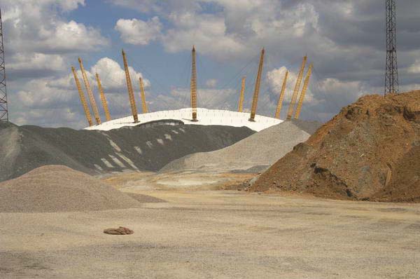
I didn’t put many images on line in 2004, as most viewers were still on slow internet connections. Further on towards North Greenwich there is still – at least the last time I walked along here a couple of years ago – an aggregate wharf with huge piles of sand and gravel on the landward side.
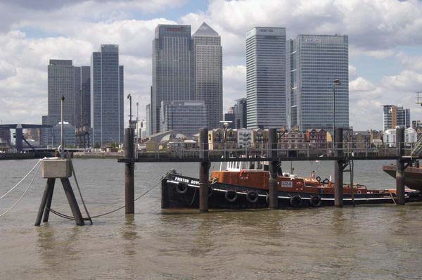
One of the huge gasholders at Greenwich was still standing in 2004, since demolished, and across the river Canary Wharf tower for long the only tower on the site was now almost hidden by others sprouting around it.
Eventually I could see the Millennium Dome looming above the sand and gravel which I felt “perhaps looks more at home in this almost lunar landscape” and I knew I was not far from North Greenwich station where I could catch the tube to Westminster.
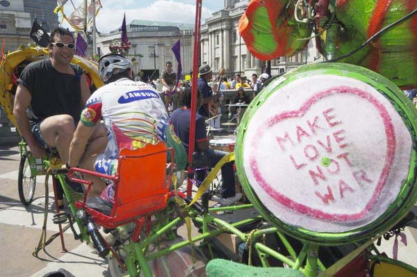
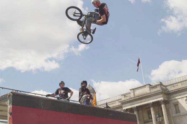
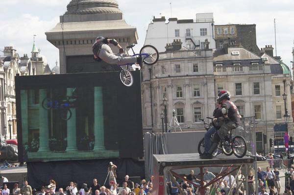
Bikefest was the first bicycle festival in Trafalgar Square, but I was surprised to find that bicycles were not allowed on the square. Though perhaps they would have got in the way, but it would have been nice at least to have had some temporary secure bike parking.
Except of course those taking part officially in the event including Team Extreme performing on the half-pipe and some great cycle powered musical systems such as Rinky-Dink.
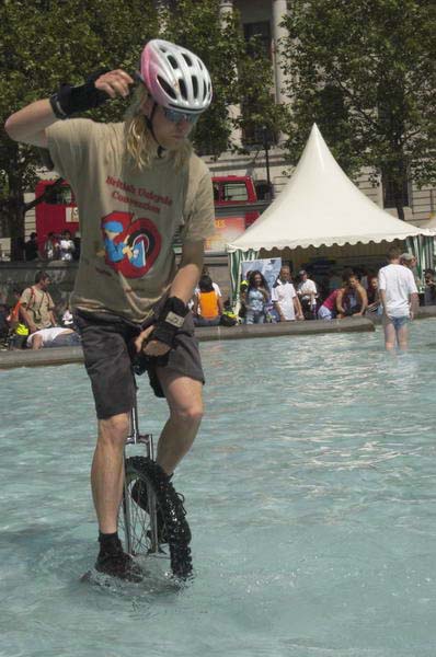
But I had agreed to meet one of my sons there and he managed to smuggle his unicycle in to the event. But by the time I found him he had already been hassled by the heritage wardens (who I described as ‘Ken’s SS’) but he still decided to have a go at riding in the fountains where he could not possibly be endangering the public.
But he had hardly got going when he was ordered out and made to leave the area, though he did so riding the unicycle after a few quick bounces to shake off the water.
I went back to watching Team Extreme and taking a few more pictures, although I found it hard to convey quite how extreme they were, before leaving to join the Second World War in Leicester Square.
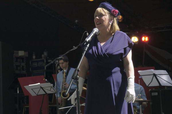
Westminster Council had organised a festival turning Leicester Square into 1940’s London for the weekend, going back 60 years to 1944.
Although 60 years ago bombs were still falling on Westminster and rationing made life difficult (though for the wealthy – and there were plenty in Westminster – the black market was flourishing) the West End was full of servicemen on leave and many servicewomen determined to have fun, “letting their hair down” in cinemas, on dance floors, in clubs, pubs and hotels.
I found the scene in the square rather sad, although obviously a lot of effort had been put into the displays and performances and there were a few 1940s dressed re-enactors among the crowds in modern dress.
60 Years earlier Allied troops had landed in France on D-Day to fight to reclaim Europe, but the previous Thursday we had seen a large vote here in the European Parliament election rejecting it with both Conservative and Labour votes well down and the Lib-Dems coming in 4th place behind the UK Independence Party.
Things of course got worse in 2016, when the leave vote gained a small majority over those wishing to remain. Although the vote was not binding, stupidly Tory Prime Minister David Cameron had promised to abide by it – rather than more sensibly pointing out that a major constitutional change such as this should require a substantial majority rather than a momentary electoral whim – as would surely have been the case if we had a written constitution. And for once a politician kept his promise.
The latest opinion poll (May 1st 2024) has 55% saying we were wrong to leave against 31% thinking we were right with 13% of Don’t Knows.
River Hull 1989: I always enjoy a walk by the River Hull and back in the 1970s-90s there was always plenty to photograph, though it is rather less interesting now. My problem then was always to drag myself away and move to a different location. If you click on any of these pictures it will take you to a larger image on Flickr and you can then move forward or backward through the whole set I’ve put on-line.
Drypool Bridge, River Hull, Hull, 1989 89-8e-52
Looking upstream from Drypool Bridge you can see an industrial landscape, most of which has now disappeared, as well as several vessels on the river.
River Hull, downstream, Drypool Bridge, Hull, 1989, 89-8e-53
Turning around and looking out towards the Humber this was the view, one that I’d taken many times in earlier years when the river had been far more crowded. At left is the disused entrance to Victoria Dock and further down the Northern Divers building, sand and gravel works, warehouses and the Myton Swing Bridge built in 1979 to take the A63 leading to Hull Docks. Before then the traffic had gone various Hull ring roads and and the decision to put it through here, splitting off the city centre from the old town was something of a disaster for the city.
Burdalen, Ranks, Clarence Mill, River Hull, Hull, 1989 89-8e-43
Rank’s Clarence Mill on the east bank of the river just downstream of Drypool Bridge had introduced improved methods of bulk handling, sucking up grain from barges moored at the jetty on which I was standing to make this picture.
Although the Victoria Docks had closed in 1979, the entrance to them here remained in use as the only place the River Hull was wide enough to swing vessels like this Rix coastal tanker around. It will have gone up forward to the Rix depot a little over a mile away on Wincolmlee, and then come backwards downriver on the tide until here, where it could turn and then proceed forwards to the Humber. I took a whole series of the Burdalen turning and you can see a few more on Flickr.
Drypool Bridge, Clarence Mill, River Hull, Hull, 1989 89-8e-44
Drypool Bridge and North Bridge are both Scherzer Rolling Bascule Bridges with a large counterweight at the left-hand end in my picture and a curved track below that which rolls on rails at ground level. Because of the counterweight relatively little force is needed to raise the bridge to allow river traffic to pass through. River traffic was heavily dependent on the tides, and the bridge always seemed to block road traffic at the most inconvenient times.
When the mill was in use the pipes at the top of the image could be lowered into the holds of the barges moored below.
A riverside walk led north along the east side of the River Hull, though in 1989 it was largely covered by large amounts of scrap iron at the end of the Union Dry Dock on Great Union St, Hull. The Drypool Engineering and Dry Dock Company Limited of Hull had a number of sites around the city and in Selby by went bust in 1976.
Clarence Mill, Joseph Rank’s great flour mill in Hull was rebuilt after wartime damage and was only finally closed in 2005. With the City Council’s usual disregard for Hull’s heritage it was demolished in 2015 to make way for a hotel which was never built. The site was still undeveloped in 2022.
Pipes, Dry Dock, River Hull, Hull, 1989 89-8e-33
More of the scrap metal which partly blocked the riverside path, including a anchor.
And another view of the mills over the pipes at the Union Dry Dock. The closer building is the Shotwell Mill, still standing. Gamebore Cartridges makes shotgun catridges here, and should not be confused with the Hull Cartridge Company Limited who also make cartridges and sporting goods in Bontoft Ave, Hull. I’ve never owned a shotgun and certainly can’t comment on the relative merits.
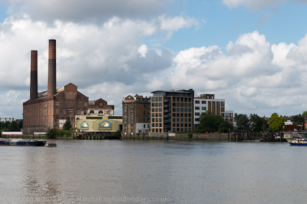
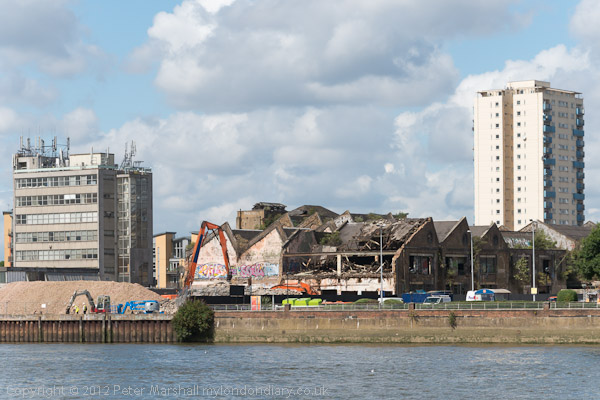
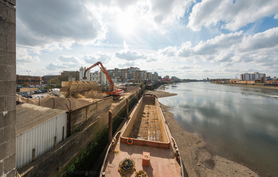
River Thames – Battersea Riverside: Tuesday 14th August 2012 was a nice day with blue sky and some interesting clouds in the sky and I had an hour or two to spare.
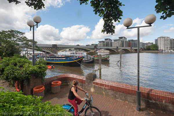
So I took a walk from Battersea Bridge to Wandsworth along the Thames Path.
Battersea Bridge crosses the river to Chelsea and I photographed the views over the river towards Lots Road Power Station and Chelsea Harbour.
This is a stretch of the river I’ve walked quite a few times over the years. It’s an easy journey for me to get there but it is also one of the more interesting and varied to walk.
When I first walked this way in the 1970s this was an industrial area, with factories and wharves and limited access to the river. Now the Thames Path takes you along the riverside with just some short diversions.
Most of the riverside is now lined with blocks of expensive flats rather than the flour mills, oil depots and a power station at Fulham I photographed back then.
Silver Belle Flour, mill, Battersea, 1991
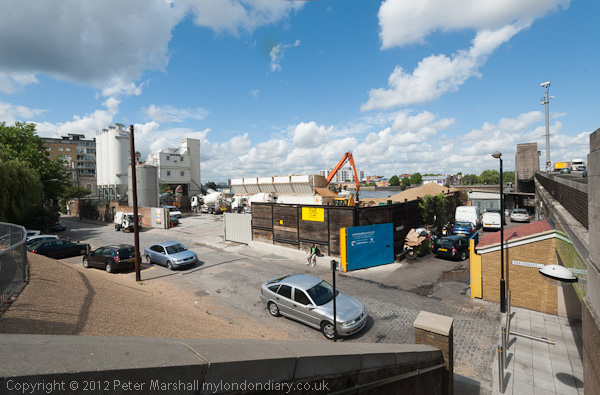
There are still a few traces of that industrial past, though some were being demolished on both sides of the river back in 2012.
Demolition at Fulham Wharf
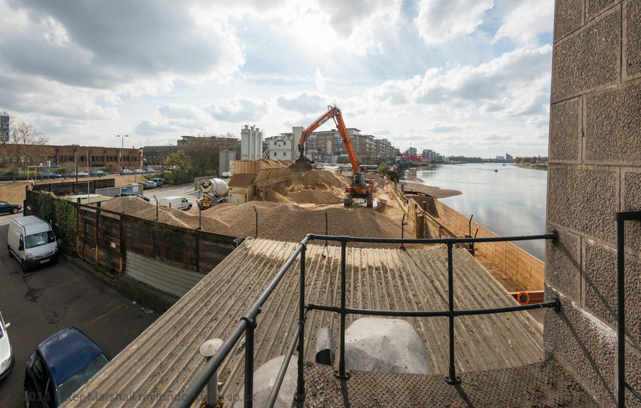
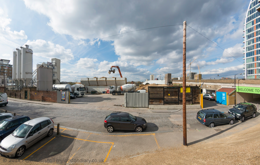
The sand and gravel works immediated upstream from Wandsworth Bridge was still there and still working when I last visited the area a few months ago, although I expect before long it will also be another luxury block of flats.
I think the best images I made that day before catching a train at Wandsworth Town were probably some panoramic images I’ve not included in this post as they don’t fit well in its format. You can see these and others from the walk on My London Diary at Battersea Riverside.
As a photographer I’ve long been interested in the difference between how we experience the world around us and how the camera records it. Some of those differences are obvious but others less so, and some we are seldom aware of.
The camera records an image produced by its lens which follows strict optical rules which I learnt about long ago in my physics lessons, though real lenses deviate slightly from those ideal and perfect specimens in those science texts.
The camera holds a film or sensor to record that image – and again does so following strict physical (and chemical for film) processes which may fail to record significant features and distort others to produce an essentially flat two-dimensional image. It may not even record colours but if it does they always to some extent arbitrary, as too are the tones.
Those of us who grew up on film are perhaps more aware of this than the digital generations. We had to be aware of the differences in recording of, for example Ilford’s Pan F and Kodak’s Tri-X, and how these were affected by processing and printing, and of the rather unreal but different colour renditions of Kodachrome, Kodacolor, Ektachrome, Agfa, Ferraniacolor and the other colour film films, each with its own qualities. Though perhaps if we ever used Orwo film quality was not the right word for its purplish nature.
Of course there are differences in the way digital cameras record colour, but these are rather smaller, and we can make use of software to make them match more closely or exaggerate the difference. Lightroom and Photoshop can make my Fuji files look very similar in terms of colour rendition to those from Nikon.
But our experience of a scene is very different, combining inputs from all of our senses, and it would be impossible to over-emphasise the subjective aspects. But even just visually it is still very different. While the lens cuts out all but a small rectangle in front of us, our eyes send information to the brain from a much wider field, much of it except from a small central section lacking in sharpness. Most of us have binocular vision, gathering this data from two eyes a short but significant distance apart, enabling us to see in depth. And our view is always dynamic, our eyes moving around, and as we swing our head around or up and down we have the sensation of moving through a static universe. Doing the same with a camera has a very different effect.
A standard lens – around 40 to 50mm on a full frame digital or 35mm film camera gives a similar idea of depth in its flat images to that we normally experience. With longer lens the effect of depth is reduced and by the time we get to really long lenses the images become flat patterns rather than appearing to represent a three dimensional scene. But what interested me more was what happened when the camera tried to represent a much wider angle of view than the standard, when the rectilinear rendering of normal lenses becomes impossible.
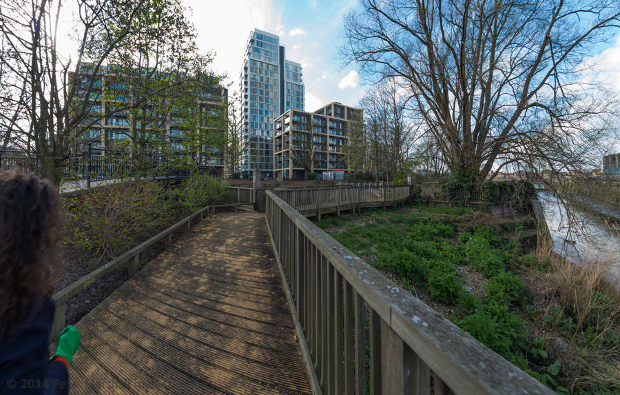
On Monday 14th of March I went for a walk with a painter friend who had brought her sketch book to introduce her to an area I thought she might find interesting. And I wanted to further explore some of the different ways of rendering very wide angles of view with digital cameras. I’d brought two Nikons with me, one fitted with a conventional wide-angle zoom which I used mainly at 16mm, close to the limit for such lenses (and I do have a wider lens which demonstrates this) and the other with a 16mm full-frame fisheye which fills the frame with an image which is 180 degrees across the diagonal.
While my friend stopped to make sketches I had time to make a series of images from similar locations. I kept warmer as I was moving around, but she fairly soon got cold, which was a good excuse to visit the pub which appears in some of these pictures, after which I took her back to the station where we had met and went back to take some more pictures on my own.
Back home I uploaded the images. Those from the conventional wide-angle zoom I’ve use as they were taken, with just the normal adjustments in Lightroom. But the fish-eye images I worked on with my panorama stitching software, PtGui, not to join images but to take the raw image data and process it it various different ways to produce cylindrical projections. If the camera was upright when the picture was taken, this will produce straight vertical lines for all upright elements. There are many different approaches to this which produce visually different results, some of which are common in mapping, such as Mercator.
Those I’ve found most useful are the equirectangular, Vedutismo and Transverse Vedutismo projections used in these examples.
Caesars American Restaurant, Waterloo Rd, Lambeth, 1988 88-10e-55
I had spent several days wandering around Hackney in the previous months and decided it was time to go back south of the river and picked on Deptford for my next walk. I’d decided to get a train from Waterloo East to Greenwich as my starting point, but arrived in to Waterloo with some time to spare and walked briefly along Waterloo Road. You won’t find Caesars there now, its place taken by a vape shop and Tesco Express.
Norman Rd, Greenwich, 1988 88-10e-56
I took the train to Greenwich Station and came out onto Norman Road which is on the east side of Deptford Creek. There are still some industrial sites here but the area to the north shown in my photograph now has tall blocks of flats both on the creek side (to the left of my picture) and on the right. There was no access to the Creek here.
Posters, Norman Rd, Greenwich, 1988 88-10e-41
The area around Deptford Creek now has many artists studios, but back in 1988 I wasn’t expecting to see this kind of display in the area, and it wasn’t at all clear whether this was a result of fly-posting followed by vandalism or art, though I inclined to the latter. It certainly had become art by the time I photographed it.
Deptford Creek, Creek Rd, Deptford, Greenwich, 1988 88-10e-44
Finally on Creek Road I was able to see the creek itself, looking across to Deptford from the Greenwich end of the bridge. In the distance is the spire of St Paul’s Deptford. Tall blocks built around 2017 on Copperas Street now block that view.
Deptford Creek, Creek Rd, Deptford, Greenwich, 1988 88-10e-45
Walking across the bridge gave me this view of the Deptford side. Creek Road Bridge is a lifting bridge and in 1988 often caused severe traffic delays in the area when lifted at high tides to allow vessels to pass. I think bridge lifts are now rare, though at least until recent years they were still occasionally needed to allow vessels carrying aggregate to berth at Brewery Wharf just below the bridge on the Greenwich side.
In the distance you can see the Deptford Creek Railway Bridge which was also a lifting bridge, though of very different design. I understand this is now welded in place and incapable of lifting.
Deptford Creek, Creek Rd, Deptford, Greenwich, 1988 88-10e-46
Although Deptford Creek forms the boundary between Deptford (in the London Borough of Lewisham) and Greenwich for much of its length, the area around its mouth from a little south of Creek Road as far west as Watergate Street in Deptford is in the London Borough of Greenwich, including the whole now former site of Deptford Power Station. Both sides of the Creek were industrial in 1988, though the last of the three power stations had ceased operation in 1983, and it was spectacularly demolished in 1992. The first station, designed by Sebastian de Ferranti and opened in 1889 was the world’s first ‘central’ power station, operating at high voltage and on an unprecedented scale and closed in the 1960s.
Deptford Creek, Creek Rd, Deptford, Greenwich, 1988 88-10e-32
Much of the Deptford side of the Creek north of Creek Road was occupied by scrap metal dealers and in 1988 this brick building at Crown Wharf was the offices of London Iron & Steel Limited.
Deptford Creek, Creek Rd, Deptford, Greenwich, 1988 88-10e-33
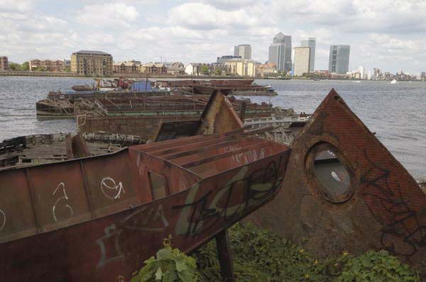
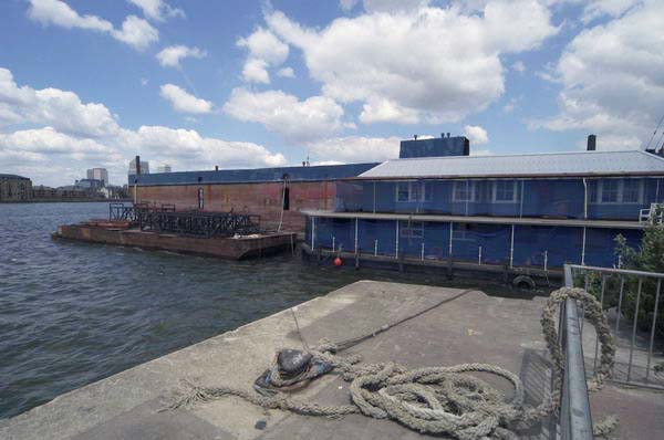
The Creek turns west after going under Creek Road, then around to the north to enter the RIver Thames. There is a large pile of scrap on the wharf in front of the disused power station and Turbulence, a general cargo vessel, 1426 tons gross built in Selby, Yorkshire in 1983 is moored there. Large heaps of sand and gravel are at an aggregate works on the Greenwich bank, though previously there had been a gas works here.
Today the scene is entirely different, with large residential developments on both sides of the Creek, at Millennium Quay on the west and New Capital Quay on the east. A new footbridge joining the two across the mouth of the Creek was opened in 2015. This is a swing bridge which also occasionally has to be opened to let vessels pass at high tide.