More From the Riverside – 1994

More From the Riverside: More pictures from my walk by the River Thames at Erith and Belvedere on Monday 1st August 1994 to its end in Plumstead.

My previous post from this walk, Thames Riverside – Erith 1994 ended as I approached the Erith Oil Works jetty. The path here climbs up to go over the roadway from the jetty into the works which provided some good views of the jetty,

Jetty, River Thames, Erith Oil Works, Erith, Bexley, 1994, 94-802-52
Riverside Path, River Thames, Erith Oil Works, Erith, Bexley, 1994, 94-804-23
Riverside Path, River Thames, Erith Oil Works, Erith, Bexley, 1994, 94-802-42

Looking upstream from the bridge over the roadway from the jetty to Erith Oil Works – the tanks at left are part of the oil works site.

Jetty, River Thames, Erith Oil Works, Erith, Bexley, 1994, 94-804-21

I continued along the path, looking back to take another view of the jetty

Bulk Carrier Tecumseh, Jetty, River Thames, Erith Oil Works, Erith, Bexley, 1994, 94-804-32
Bulk Carrier Tecumseh, Jetty, River Thames, Erith Oil Works, Erith, Bexley, 1994, 94-804-53

This whole shoreline was once lined by industrial sites with their own jetties, by 1994 mainly like this now derelict and shortened.

Riverside Path, River Thames, Belvedere, Bexley, 1994, 94-805-45
Riverside Path, River Thames, Belvedere, Bexley, 1994, 94-805-32

Looking inshore there will still industrial sites, but much no longer relying on the river, though there were still some like the aggregate works that still had working jetties.

Jetty, Riverside Path, River Thames, Erith, Bexley, 1994, 94-802-43

Another disused jetty a short distance upstream from the Oil Works.

Wharf, Mulberry Way, Riverside Path, River Thames, Belvedere, Bexley, 1994, 94-805-31

Sheds and neat stacks of orange and green boxes at a wharf – now serviced by road – at Mulberry Way. This gets its name from the temporary portable floating harbours some of which were constructed here in 1944 by Nuttall Brothers and towed to the French coast after D-Day to land supplies for the Allied invasion. Two temporary harbours were constructed on the Normandy coast; one only lasted a few days before being destroyed by a storm but that at Arromanches remained in use for 10 months.

Wharf, Mulberry Way, Riverside Path, River Thames, Belvedere, Bexley, 1994, 94-802-33

A panoraamic view from the same viewpoint as the previous image. I had climbed up on the wide concrete flood defence wall here to make the picture. The sky was filled with clouds, perfect weather for panoramic landscapes.

Remains of wharf, Riverside Path, River Thames, Belvedere, Bexley, 1994, 94-802-21

I kept walking along the riverside path, coming to these timbers which would once have supported a long landing stage on a wharf with a short jetty into deep water. Across the river you can see Tilbury Docks at the left of the picture, with the blue hull of a ship there and some cranes, and further towards the centre the chimney and turbine hall of East Tilbury Power Station.

The horizon, dead centre in the picture is straight but as you move further down in the picture the curvature produced by the cylindrical perspective become more and more apparent. The path at left is straight and it remained straight to where I was standing to take the picture and beyond. Usually I tried to compose photographs so that this curvature was less apparent, but here I rather liked the effect.

I was working with two swing lens panoramic cameras (and two ‘normal’ SLR cameras.) Normal wide-angle lenses use rectilinear perspective become unusable with a horizontal angle of view of around 90 degrees as the distance from the centre of the lens to the film increases as light travels to the edges of the frame, increasing the size of image objects. The curved film plane in a swing lens camera keeps the lens centre to film distance constant so objects are recorded at the same scale across the image. Of course the wooden posts get smaller in the image the further away they are from the camera.

Riverside Path, River Thames, Belvedere, Bexley, 1994, 94-802-23

The curvature is much less apparent in this image taken a few minutes later and a few yards further upstream. But the shadow at bottom left as actually the shadow of the same straight flood wall as the larger shadow at the right.

Both of the panoramic cameras I had gave images with a horizontal angle of view of somewhere around 130 degrees.

I’ll post more pictures from this walk later. More pictures also in my Flickr album 1994 London colour – and you can see these images larger there by clicking on them in this post.


FlickrFacebookMy London DiaryHull PhotosLea ValleyParis
London’s Industrial HeritageLondon Photos

All photographs on this page are copyright © Peter Marshall.
Contact me to buy prints or licence to reproduce.

Battersea Riverside 2012

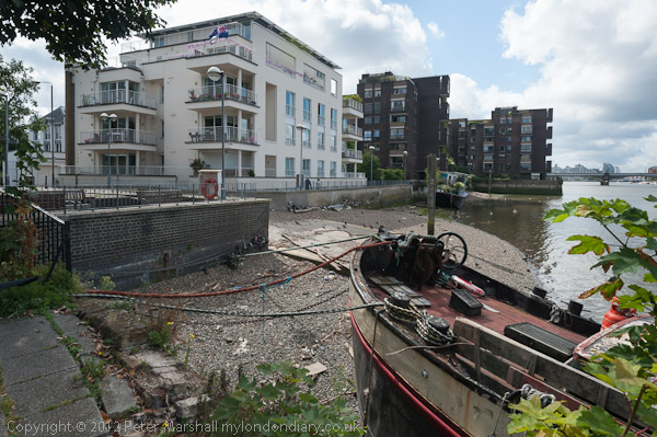
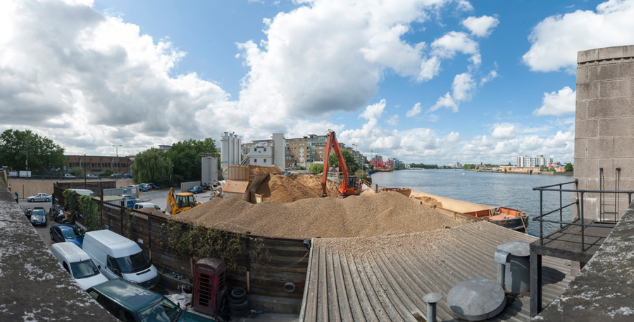
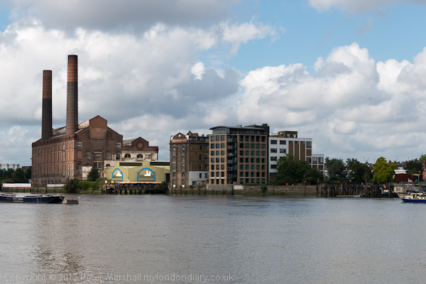
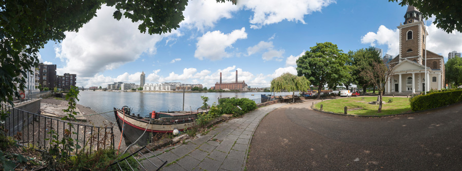
Battersea Riverside. The short walk from Battersea Bridge to Wandsworth is one I’ve done quite a few times over the years. For most of the walk you can now keep to the riverside, with views across the Thames, though a few short detours are needed. It’s on of my favourite walks in London and only a couple of miles, though if you want a longer walk it is now part of the Thames Path so you can continue for many miles either upstream or down.

Battersea Riverside 2012
Lots Rd

When I first made this walk in the 1970s the riverside was lined with industry and I could only access the river at a few locations. By 2012 the industry had almost all gone and there were blocks of private flats along most of this length. But ‘planning gain’ meant a riverside path even if it was lined behind by planning loss.

Battersea Riverside 2012
Thames at Battersea
Battersea Riverside 2012
St Mary’s Battersea
Battersea Riverside 2012
Old Swan Wharf

People have to live somewhere and London needed extra housing, though almost all of these new developments were the wrong kind of housing and not the social housing desperately needed by Londoners. Back in the early post-war years we saw social housing being built to provide mixed communities and promote social cohesion, but Thatcher changed all that, and social housing became something only for the poor and that stigmatised residents as failures.

Overground train on its way to Clapham Junction
Demolition at Fulham Wharf
New Flats and Wandsworth Bridge

The loss of industry also meant the loss of jobs in the area, and took place at a time of increasing gentrification in Battersea, with people moving in who worked in wealthier parts of the city.

Looking upstream from Wandsworth Bridge

As I wrote in 2012, “Every time I walk it a little more has gone with a new block of flats or hotel or other luxury development. But a few things remain.”

Waste transfer station, Wandsworth

You can see the panoramic images larger by right clicking on them and choosing Open Image in New Tab’ More pictures on My London Diary at Battersea Riverside.


FlickrFacebookMy London DiaryHull PhotosLea ValleyParis
London’s Industrial HeritageLondon Photos

All photographs on this page are copyright © Peter Marshall.
Contact me to buy prints or licence to reproduce.