Belvedere Riverside & Plumstead – 1994

Belvedere Riverside & Plumstead: Some more pictures including some panoramas from my Thames riverside walk on Monday 1st August 1994, and a few from Plumstead a few days later.

Ford Ferry, Pier, River Thames, Belvedere, Bexley, 1994, 94-805-22

Ford at Dagenham was just on the opposite bank of the Thames, with a Ford ship moored in front of it and some ominous black smoke rising.

But although the Ford was only around 600 metres away, the fastest route for workers driving from here to the factory was around 15 miles. Taking the Woolwich ferry would take a couple of miles off this, but be slower.

Ford Ferry, Pier, River Thames, Belvedere, Bexley, 1994, 94-802-11

Many of Ford’s workers did live south of the river, either in Thamesmead or further away, and Ford provided a large suppposedly secure car park here from which they could walk down the pier to the Ford Ferry to take them across the river.

Ford had come to Dagenham in 1929 and opened the factory in 1931. They set up the private ferry for workers living in Kent in 1933. In its heyday it made 50 crossings a day taking as many as 1,500 workers to and from the plant, but after vehicle production ended with the plant turning to making engines it was only taking around 240 across and Ford discontinued it in 2003. Eventually they were forced to pay around half a million in compensation and to provide a bus service instead.

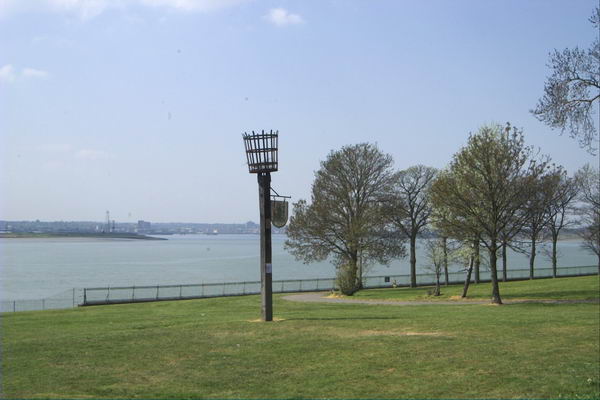
Much earlier there had been a Pilgrims ferry from Rainham to Erith, for pilgrims on their way to Canterbury, said to have begun in 1199 and to have continued in use until the mid 1950s.

Riverside Path, River Thames, Belvedere, Bexley, 1994, 94-802-12

Around here I turned back towards Erith, taking some more pictures on my way (some of which were included in my previous post.)

Riverside Path, River Thames, Belvedere, Bexley, 1994, 94-802-13

I can’t now remember exactly where on the path this was, but I think I walked all the way back to Erith and to the station there.

Penny's Cafe, Motor Auctions, Erith, Bexley, 1994, 94-803-32
Penny’s Cafe, Motor Auctions, Manor Road, Erith, Bexley, 1994, 94-803-32

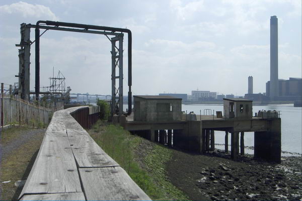
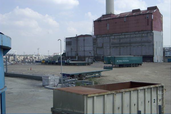
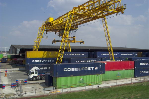
Finally from that day in Erith, one I took earlier around the start of my walk but failed to post previously. Manor Road leads out east from Erith and was then an industrial area.

This Café (and Motor Auctions) had also clearly once been a factory and still catered for workers in nearby factories. Facebook posts say it had been an engineering factory called Ivor & Jettage, that the café was full of boxing photos and that its yard, used for motor auctions and later car boot sales on Sundays, was in 2024 a scaffolding yard. But I have been unable to confirm this.

Nathan Way, Plumstead, Greenwich, 1994, 94-806-52

A few days after my Erith walk I was back not far away in Plumstead, and made just a handful of colour images including these three.

This picture was made from The Ridgeway a foot and cycle path on top of the Southern Outfall Sewer from Plumstead to Crossness. Nathan Way runs for around 600 metres just to the north of this and most industrial sites along here were demolished by 2015 and are being replaced by a huge estate of blocks of flats, Lombard Square, with 1,913 new homes. The first were finished in 2025.

Nathan Way, Plumstead, Greenwich, 1994, 94-805-24

Another image from The Greenway not far from where I made the panorama above. From 1888-90 here or close by Royal Arsenal football team played here at what became the Manor Ground. They moved next to Woolwich, becoming Woolwich Arsenal but soon found the rent there too high and moved back. They played their last game here in 1913 before moving to Highbury in North London – and of course losing the Woolwich.

Some industry remains at the east end of this stretch of Nathan Way but I’m not sure this includes any in my picture.

Panoramic, Double Glazing, Nathan Way, Plumstead, Greenwich, 1994, 94-806-31

Nathan Way is a long road leading from Plumsteaad to Thamesmead and I think this may have been on the corner with Kellner Road.. But the name repeated on the lorry and the large modern shed behind as well as on what was perhas a small shed in the foreground was unmissable. I just had to make a Panorama.

Tony's Snack Bar, Nathan Way,  Plumstead, Greenwich, 1994, 94-805-26
Tony’s Snack Bar, Nathan Way, Plumstead, Greenwich, 1994, 94-805-26

I think the building at left it 115 Nathan Way, now occupied by Hydraquip Hose & Hydraulics, while behind are the roofs of Belmarsh Prison. But the picture is about the mobile snack bar here and the neat empty row of six white chairs for its then non-existent customers.

My walk continued on into Thamesmead but although I took quite a few black and white pictures I can’t at the moment find any more colour – and perhaps I took none.


FlickrFacebookMy London DiaryHull PhotosLea ValleyParis
London’s Industrial HeritageLondon Photos

All photographs on this page are copyright © Peter Marshall.
Contact me to buy prints or licence to reproduce.


More From the Riverside – 1994

More From the Riverside: More pictures from my walk by the River Thames at Erith and Belvedere on Monday 1st August 1994 to its end in Plumstead.

My previous post from this walk, Thames Riverside – Erith 1994 ended as I approached the Erith Oil Works jetty. The path here climbs up to go over the roadway from the jetty into the works which provided some good views of the jetty,

Jetty, River Thames, Erith Oil Works, Erith, Bexley, 1994, 94-802-52
Riverside Path, River Thames, Erith Oil Works, Erith, Bexley, 1994, 94-804-23
Riverside Path, River Thames, Erith Oil Works, Erith, Bexley, 1994, 94-802-42

Looking upstream from the bridge over the roadway from the jetty to Erith Oil Works – the tanks at left are part of the oil works site.

Jetty, River Thames, Erith Oil Works, Erith, Bexley, 1994, 94-804-21

I continued along the path, looking back to take another view of the jetty

Bulk Carrier Tecumseh, Jetty, River Thames, Erith Oil Works, Erith, Bexley, 1994, 94-804-32
Bulk Carrier Tecumseh, Jetty, River Thames, Erith Oil Works, Erith, Bexley, 1994, 94-804-53

This whole shoreline was once lined by industrial sites with their own jetties, by 1994 mainly like this now derelict and shortened.

Riverside Path, River Thames, Belvedere, Bexley, 1994, 94-805-45
Riverside Path, River Thames, Belvedere, Bexley, 1994, 94-805-32

Looking inshore there will still industrial sites, but much no longer relying on the river, though there were still some like the aggregate works that still had working jetties.

Jetty, Riverside Path, River Thames, Erith, Bexley, 1994, 94-802-43

Another disused jetty a short distance upstream from the Oil Works.

Wharf, Mulberry Way, Riverside Path, River Thames, Belvedere, Bexley, 1994, 94-805-31

Sheds and neat stacks of orange and green boxes at a wharf – now serviced by road – at Mulberry Way. This gets its name from the temporary portable floating harbours some of which were constructed here in 1944 by Nuttall Brothers and towed to the French coast after D-Day to land supplies for the Allied invasion. Two temporary harbours were constructed on the Normandy coast; one only lasted a few days before being destroyed by a storm but that at Arromanches remained in use for 10 months.

Wharf, Mulberry Way, Riverside Path, River Thames, Belvedere, Bexley, 1994, 94-802-33

A panoraamic view from the same viewpoint as the previous image. I had climbed up on the wide concrete flood defence wall here to make the picture. The sky was filled with clouds, perfect weather for panoramic landscapes.

Remains of wharf, Riverside Path, River Thames, Belvedere, Bexley, 1994, 94-802-21

I kept walking along the riverside path, coming to these timbers which would once have supported a long landing stage on a wharf with a short jetty into deep water. Across the river you can see Tilbury Docks at the left of the picture, with the blue hull of a ship there and some cranes, and further towards the centre the chimney and turbine hall of East Tilbury Power Station.

The horizon, dead centre in the picture is straight but as you move further down in the picture the curvature produced by the cylindrical perspective become more and more apparent. The path at left is straight and it remained straight to where I was standing to take the picture and beyond. Usually I tried to compose photographs so that this curvature was less apparent, but here I rather liked the effect.

I was working with two swing lens panoramic cameras (and two ‘normal’ SLR cameras.) Normal wide-angle lenses use rectilinear perspective become unusable with a horizontal angle of view of around 90 degrees as the distance from the centre of the lens to the film increases as light travels to the edges of the frame, increasing the size of image objects. The curved film plane in a swing lens camera keeps the lens centre to film distance constant so objects are recorded at the same scale across the image. Of course the wooden posts get smaller in the image the further away they are from the camera.

Riverside Path, River Thames, Belvedere, Bexley, 1994, 94-802-23

The curvature is much less apparent in this image taken a few minutes later and a few yards further upstream. But the shadow at bottom left as actually the shadow of the same straight flood wall as the larger shadow at the right.

Both of the panoramic cameras I had gave images with a horizontal angle of view of somewhere around 130 degrees.

I’ll post more pictures from this walk later. More pictures also in my Flickr album 1994 London colour – and you can see these images larger there by clicking on them in this post.


FlickrFacebookMy London DiaryHull PhotosLea ValleyParis
London’s Industrial HeritageLondon Photos

All photographs on this page are copyright © Peter Marshall.
Contact me to buy prints or licence to reproduce.


Thames Riverside – Erith 1994

Thames Riverside – Erith: The Thames Path National Trail was only inaugurated on 24 July 1996 and then stopped at the Thames Barrier, but years before I had often walked along much of it in or near Greater London as well as much further east towards the Estuary.

It had taken a long time since 1947 when the towpath along the Thames was identified by the Hobhouse Committee on National Parks as one of six long distance and coastal recreational walking routes. Work began seriously in 1973 but there were many problems to be overcome, particularly in the upstream areas where much of the towpath had deteriorated, ferries closed and more.

The Thames Path still ends at Woolwich but it now joins the England Coast Path, but long before that it was possible to simply keep on walking beside the river – and I did along the south bank as far as Cliffe. Further on it became difficult to access using public transport.

Sheds, Crescent Rd, Erith, Bexley, 1994, 94-801-52

These pictures come from Monday 1st August 1994 when I took a train to Erith as my starting point. I began by taking black and white pictures of buildings in the town centre, then walked east out of the town as far as the saltings and Erith Yacht Club. The town has changed considerably since my visit. The first industry developed on this side of town, but I think there is now a large supermarket with huge car park in the almost all the former industrial area. In the 1930s the area in my picture above, on Crescent Road or ManorRoad was a part of the British Fibrocement Works.

Erith Yacht Club, Erith, Bexley, 1994, 94-801-53

I turned around and came back through Erith to the Riverside Gardens close to the centre of Erith and then walked upstream beside the river to Belvedere before turning around and coming back to take a few more black and white pictures on the west side of Erith before taking the train home.

Crane, Riverside walk, Erith, Bexley, 1994, 94-801-32

In the distance you can see the housing around Chandlers Drive, one of the first residential devolopmens on the river here, which had previously been highly industrial.

Riverside Path, River Thames, Erith, Bexley, 1994, 94-803-33
River Thames, Flats, Chandlers Drive, Erith, Bexley, 1994, 94-801-22
Jetty, River Thames, Erith, Bexley, 1994, 94-805-53

One of a number of jetties here, this more colourful than most, but I think no longer in use. On the opposite bank I think the hills are where rubbish has been brought out from London and tipped to build up what was previously marsh.

Jetty, River Thames, Erith Oil Works, Thames Path, Erith, Bexley, 1994, 94-801-13
Jetty, River Thames, Erith Oil Works, Erith, Bexley, 1994, 94-801-13

The jetty of the Erith Oil Works, still in business. It was set up on Church Manorway in 1908 and is the the largest vegetable oil mill in the UK. My next post in this series will have more pictures of the Oil Works and other industry on the riverside, again mainly panoramas made with a swing lens camera.

All pictures here and more from this and other walks in 1994 are in my Flickr album 1994 London colour and you can view them larger by clicking on them in this post.


FlickrFacebookMy London DiaryHull PhotosLea ValleyParis
London’s Industrial HeritageLondon Photos

All photographs on this page are copyright © Peter Marshall.
Contact me to buy prints or licence to reproduce.


Battersea Riverside 2012

Battersea Riverside. The short walk from Battersea Bridge to Wandsworth is one I’ve done quite a few times over the years. For most of the walk you can now keep to the riverside, with views across the Thames, though a few short detours are needed. It’s on of my favourite walks in London and only a couple of miles, though if you want a longer walk it is now part of the Thames Path so you can continue for many miles either upstream or down.

Battersea Riverside 2012
Lots Rd

When I first made this walk in the 1970s the riverside was lined with industry and I could only access the river at a few locations. By 2012 the industry had almost all gone and there were blocks of private flats along most of this length. But ‘planning gain’ meant a riverside path even if it was lined behind by planning loss.

Battersea Riverside 2012
Thames at Battersea
Battersea Riverside 2012
St Mary’s Battersea
Battersea Riverside 2012
Old Swan Wharf

People have to live somewhere and London needed extra housing, though almost all of these new developments were the wrong kind of housing and not the social housing desperately needed by Londoners. Back in the early post-war years we saw social housing being built to provide mixed communities and promote social cohesion, but Thatcher changed all that, and social housing became something only for the poor and that stigmatised residents as failures.

Overground train on its way to Clapham Junction
Demolition at Fulham Wharf
New Flats and Wandsworth Bridge

The loss of industry also meant the loss of jobs in the area, and took place at a time of increasing gentrification in Battersea, with people moving in who worked in wealthier parts of the city.

Looking upstream from Wandsworth Bridge

As I wrote in 2012, “Every time I walk it a little more has gone with a new block of flats or hotel or other luxury development. But a few things remain.”

Waste transfer station, Wandsworth

You can see the panoramic images larger by right clicking on them and choosing Open Image in New Tab’ More pictures on My London Diary at Battersea Riverside.


FlickrFacebookMy London DiaryHull PhotosLea ValleyParis
London’s Industrial HeritageLondon Photos

All photographs on this page are copyright © Peter Marshall.
Contact me to buy prints or licence to reproduce.


Rainham, Purfleet, Thurrock & Ponders End – 1993

Rainham, Purfleet, Thurrock & Ponders End: On Saturday 11th December 1993 I took a train from Fenchurch Street to Rainham and then walked along by the river to Coldharbour Point. There the path stopped and I returned to Rainham and took the train to Purfleet where I could pick up the riverside path again and walk on to Grays. Probably I walked about 9 miles in all and by the time I finished it I think the light would have been fading, with sunset at around 4pm.

Tilda Rice, Purfleet, Thurrock, 1993, 94-01-1-64
Tilda Rice, Rainham, Thurrock, 1993, 94-01-1-64

On this walk I made a little over 200 black and white images, a selection of which you can find on Flickr in my 1993 London album beginning here.

Purfleet, Thurrock, 1993, 94-01-1-65
Waste Paper, Purfleet, Thurrock, 1993, 94-01-1-51

There are more colour images from this walk, including a number of panoramas, mixed with pictures from other occasions starting here on the final two pages of my Flickr album of colour pictures from 1993.

Notices on Fence, Purfleet, Thurrock, 1993, 94-01-1-53

But today I found some more pictures from that walk at the start of my album 1994 London Colour and I’ll share these in this post. They will have come from a cassette of film which I took in 1993 but only developed a month or so later in 1994.

Waste Paper, Purfleet, Thurrock, 1993, 94-01-1-56
Works, Purfleet, Thurrock, 1993, 94-01-1-46
QEII Bridge, Dartford Bridge, Pipeline, River Thames, West Thurrock, Thurrock, 1993, 94-01-1-11

The final image in today’s post is something completely different on the same film, a shop window in Ponders End which I found it strangely weird. As it is on the same film as the others I think it was probably also taken in December 1993 although my caption stated 1994.

Shop Window, Ponders End, Enfield, 1994, 94-01-1-14

FlickrFacebookMy London DiaryHull PhotosLea ValleyParis
London’s Industrial HeritageLondon Photos

All photographs on this page are copyright © Peter Marshall.
Contact me to buy prints or licence to reproduce.


Purfleet & West Thurrock – 2003

Purfleet & West Thurrock: Pictures taken on a ride along the Essex bank of the Thames on Tuesday 22 April 2003, the day following the Easter Bank Holiday.

Purfleet & West Thurrock - 2003
Silver Jubilee Beacon at Purfleet and upstream view of the River Thames

I only put these pictures onto My London Diary around a year after I made them and wrote nothing about them when I did so.

Purfleet & West Thurrock - 2003

But these are more pictures that I took on a ride mainly along a footpath beside the River Thames where I rode on my Brompton folding bike.

Purfleet & West Thurrock - 2003

My ride started not at Purfleet which is just on the outside edge of Greater London, but at Rainham, which was the last station coming out from London where a Travelcard was still valid.

Purfleet & West Thurrock - 2003

Part of my reason for coming to this area was the building that was taking place of the Channel Tunnel rail link, which tunnelled under the river at Swanscombe in Kent to West Thurrock in Essex. I had previously photographed on the Kent side, You can see some of the work on this high speed rail line in these pictures of this, particularly some from my return journey to Rainham where I followed its route as closely as I could.

The pictures were made with my first digital SLR, the Nikon D100 and a 24-85mm Nikon lens.

As well as riverside industry, including a detergent works at West Thurrock which overshadow an ancient church, there are also images of the QEII Dartford Bridge, container parks, oil storage depots and the CTRL viaducts as well as fairly desolate riverside and a giant pylon.

St Clement’s Church, West Thurrock was one of the four churches featured in the 1994 film ‘Four Weddings and a Funeral’
Channel Tunnel Rail Link, QEII bridge and a giant pylon

You can see more pictures from the ride on My London Diary at Purfleet & West Thurrock.


FlickrFacebookMy London DiaryHull PhotosLea ValleyParis
London’s Industrial HeritageLondon Photos

All photographs on this page are copyright © Peter Marshall.
Contact me to buy prints or licence to reproduce.


Dartford 1995 Again – Panoramas

Dartford 1995 Again – Panoramas: Part 9 of my occasional series on colour pictures I made in 1995.

Victoria Industrial Park, Victoria Rd, Dartford, 1995, 95p5-252

I enjoyed another walk in Dartford on Sunday May 7th 1995, beginning by taking black and white pictures of buildings around the centre before walking out to the northwest along Victoria Road.

Philips Norman, Cash & Carry, Victoria Rd, Dartford, 1995, 95p5-251

I went on to photographing in the industrial areas between Burnham Road and the Dartford Creek – the tidal River Darent.

Burnham Trading Estate, Lawson Rd, Dartford, 1995, 95p5-263

Here I was able to make my way down to the west bank of the river and make more pictures.

River Darent, Riverside Wharf, Dartford, 1995, 95p5-121

At this wharf there had once been a fairly small dock which had been filled in but its gates were still there. I think it had perhaps been a dry dock used for ship repairs,

Dartford, 1995, 95p5-133

I think this is a site cleared for the development of a large housing estate, now on Lawson Road and Eleanor Close.

Dartford, 1995, 95p5-153

This long, empty road was University Way, a northern by-pass for Dartford, named in hope of a university that never arrived. Bob Dunn had been a Tory junior education minister who had campaigned for this development. MP for Dartford from 1979 to 1997 when he lost his seat to Labour, he died in 2003, only 56, and the road was renamed in his honour.

The bridge that takes Bob Dunn Way across the Darent was not built with navigation in mind, and makes it difficult for boats of any size to proceed up to Dartford. There has been for some years work being carried out to encourage navigation here, but boats have to look carefully at the tide tables to pass under the bridge. The Dartford and Crayford Creek Trust was founded in April 2016 to work to improve the navigation.

Roundabout, Hythe St, Victoria Rd, Dartford, 1995, 95p5-363

I walked back much the same way to this roundabout and went up Hythe Street in the centre of this picture.

River Darent, Nelsons Row, Dartford, 1995, 95p5-243

Hythe Street tok me to Nelson’s Row where I was able to cross the River Darent. There is also a public slipway here, cleared in recent years by volunteers.

Pipe Bridge, Riverside Path, River Darent, Dartford, 1995, 95p5-232

A few houses on the opposite bank are in Kenwyn Road. Past them you can see the derelict half lock which keeps some water in upstream when the tide flows out. Volunteer have put in considerable work to improve this lock in recent years and to revive navigation on Dartford Creek. In the distance is the Dartford Paper Mills site – closed in 2009 the site has been redeveloped.

Half Lock,  Riverside Path, River Darent, Dartford, 1995, 95p5-223
Half Lock, Riverside Path, River Darent, Dartford, 1995, 95p5-223

Boats can navigate through the lock when the tide is high enough for them to get over the cill of the lock which holds back sufficient water for the river to be navigable upstream to the centre of Dartford.

Dartford Fresh Marshes, Dartford, 1995, 95p5-361

I turned around here and walked back to Dartford and the station. I’d made an early start to the day on the first train into London and there was still time to stop off on the way home and take a few pictures in Woolwich where I intended to return the following week.


FlickrFacebookMy London DiaryHull PhotosLea ValleyParis
London’s Industrial HeritageLondon Photos

All photographs on this page are copyright © Peter Marshall.
Contact me to buy prints or licence to reproduce.


More Around the Meridian – 1995 Colour – Part 3

More around the Meridian – It’s seldom possible to actually walk for more than a few yards actually on the Greenwich Meridian in London and while planning my Meridian Walk I often wandered around considerably, having to make detours and also looking for the more interesting routes. So not all these images are exactly on the Meridian, but most were taken within a short distance from it.

Greenway, Abbey Lane, Abbey Rd, Stratford, Newham, 1995, 95p4-1151

When I began this project the Meridian was not marked on the Ordnance Survey or Street maps, and one of may first tasks was to get a ruler and pencil it on to them. In 1999 it was added to the OS maps of the area, but does not seem to be on the latest versions. In 1995 there were no smart phones with online maps and GPS which would have made things so much easier.

Greenway, Abbey Lane, Abbey Rd, Stratford, Newham, 1995, 95p4-1152

The Greenway was the recently rebranded path above the Northern Outfall Sewer which rans across East London from Hackney Wick to the sewage treatment plant at Beckton, going under the road here close the the bridge over Abbey Creek on the Channelsea River, where Abbey Lane becomes Abbey Road. You can see the bridge at the left of the picture.

Greenway, Channelsea River,  Stratford, Newham, 1995, 95p4-1153
Greenway, Channelsea River, Stratford, Newham, 1995, 95p4-1153

The Greenway is a great traffic-free cycle route for pedestrians and cyclists, running straight and level and this picture gives some evidence of that.

Channelsea River, Long Wall, Stratford, Newham, 1995, 95p4-1111

I’m not sure what this pipe was for, perhaps for taking gas across the river. Not far away on the other side of this tidal creek was one of the largest gas works in London – and you can still see its listed gasholders, though the view is likely to change soon with the site being redeveloped.

But behind me when I made this picture was the Abbey Mills sewage pumping station and on the edge of the creek below were the storm outfalls where sewage would be released after heavy rains. With the changing tides it would flow downstream a little and then could be taken miles upriver along the Prescott channel and the River Lea.

Gasholders, Leven Rd, Poplar, Tower Hamlets, 1995, 95p4-1332
Flats, East India Dock Rd, South Bromley, Tower Hamlets, 1995, 95p4-1321

I think the Meridian went through the centre of the taller gas holder at Poplar Gas works.

Flats, East India Dock Rd, South Bromley, Tower Hamlets, 1995, 95p4-1321

Another view with the gasholders in the background.

Clove Crescent, East India, DLR, South Bromley, Tower Hamlets, 1995, 95p4-1273

My pencilled line for the Meridian shows it going through both the water in the dock and the brick building at left which was the former Blackwall Power Station in both of these pictures.

Clove Crescent, East India DLR, South Bromley, Tower Hamlets, 1995, 95p4-1263

South of the East India Docks the line crosses the River Thames above and between the two bores of the Blackwall Tunnel, closer to the original western tunnel now used by northbound traffic. I couldn’t take photographs in the tunnel – though it was possible for those on foot to take a bus across, but these would have been rather boring in any case.

Blackwall Tunnel Entrance, Greenwich, 1995, 95p4-1672

This picture shows the southern entrance to the tunnel with its 1897 Grade II listed gatehouse by the London County Council’s Superintending Architect Thomas Blashill. In front of it a less ornate red and white striped arch with heigh and weight restriction signs and hangers to hit any overtall vehicles and hopefully prevent damage to the gatehouse.

Dorringtons, Blackwall Tunnel Southern Approach, Greenwich, 1995, 95p4-1551

One picture not I think actually on the Meridian but not far from it, taken from the long footbridge over the Blackwall Tunnel Southern Approach.

Riverside Path, Greenwich, 1995, 95p4-1762

My path continued south along the riverside path, with the Meridian going into the River Thames on the extreme left of this picture.

Riverside Path, Greenwich, 1995, 95p4-1742

I kept to the land continuing along a path I’ve walked many times and making a few more pictures.

Riverside Path, Greenwich, 1995, 95p4-1743

Like much of London’s riverside almost all of the industry has now gone, but some relics remain, though most of this part of my route is now lined by rather boring flats.

I rejoined the Meridian where it made landfall in Greenwich – where I made some of the pictures at the end of my earlier post.

More colour work from 1995 including some more panoramas in a later post.


FlickrFacebookMy London DiaryHull PhotosLea ValleyParis
London’s Industrial HeritageLondon Photos

All photographs on this page are copyright © Peter Marshall.
Contact me to buy prints or licence to reproduce.


Greenwich Walk – 2018

Greenwich Walk: On Thursday 18th October 2018 I walked with two or three other photographers from North Greenwich Station to the centre of Greenwich and made the pictures in this post. You can see many more of them in a post on My London Diary, Greenwich Walk.

Greenwich Walk

Recently on >Re:PHOTO I’ve published a series of posts about my walks in London back in the 1980s, along with some of the pictures I took then which are now in my albums on Flickr. The most recent walk I’ve featured has been in Brixton and Stockwell and began with Stockwell Park, Bus Garage, Tower and Mason, and I’ve still to finish the posts on this, and will do so shortly.

Greenwich Walk

But I’ve continued to walk around London, if less frequently than before in recent years. My walks now are rather shorter in length and duration and are mostly together with a few friends, other photographers who sometimes lure me into pubs on the way (I’m easily tempted.) And we almost always end up with a meal together in one.

Greenwich Walk

Photographically things are rather different too. I don’t even always take any photographs and am no longer working on the kind of extended projects which I had back in those earlier days, recording the fabric of the city and in particular those areas undergoing substantial change – such as the whole of London’s docklands.

Greenwich Walk

Back in the 80s and 90s I always worked with at least two cameras, one with black and white film and the other with colour. So far I’ve included very little of the colour work in those posts here, in part because I was working on a different project with the colour. You can see more of the colour work in the online project initially put together as a dummy for an as yet unpublished book in the early 1990s, ‘Café Ideal, Cool Blondes & Paradise‘.

More recently several web sites have published features using mainly these colour pictures from my Flickr albums sometimes along with some of the black and white. The most recent of these is on Flashbak, ‘34 Photos From A Walk Around Tooting, South London In 1990‘. It puts together images from several visits to the area and includes a few black and white images of people on the streets, In the introduction Paul Sorene comments “What we love about Peter’s pictures is that he shows us the everyday things we saw but didn’t much notice. Now that we get to look again, things looks strangely familiar.” I think this is about the 12th set of my pictures on that site.

But now I only take one camera on my walks, and always work in colour as the camera is digital. I could easily switch the images to black and white, but have only done so extremely rarely.

The other large change for me is the ease with which I can now make panoramic views, no longer needing to carry a separate camera for these, just the right lens. Many of the images from my walk on Thursday 18th October 2018 are panoramic with a horizontal angle of view of around 145 degrees even though they have a ‘normal’ aspect ratio of 3:2 as they also have a large vertical angle of view. Just a few are cropped to a more panoramic format.

Finally, here is the paragraph I wrote about the area in 2018:

I first walked along here back in 1980, and have done so a number of times since, though in recent years much of the riverside path has been closed as the old wharves are being replaced by luxury flats. It is still an interesting walk, though it has lost virtually all of the industrial interest it once had. A River Thames that is rapidly becoming lined by new and largely characterless buildings is at times a sad state, but there still remain some liminal landscapes and surprising vistas.

Greenwich Walk on My London Diary