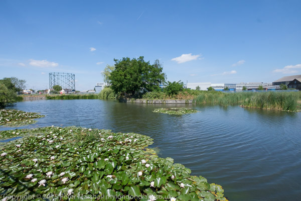
Rainham,Purfleet, Thurrock & Ponders End: On Saturday 11th December 1993 I took a train from Fenchurch Street to Rainham and then walked along by the river to Coldharbour Point. There the path stopped and I returned to Rainham and took the train to Purfleet where I could pick up the riverside path again and walk on to Grays. Probably I walked about 9 miles in all and by the time I finished it I think the light would have been fading, with sunset at around 4pm.
Tilda Rice, Rainham, Thurrock, 1993, 94-01-1-64
On this walk I made a little over 200 black and white images, a selection of which you can find on Flickr in my 1993 London album beginning here.
Purfleet, Thurrock, 1993, 94-01-1-65
Waste Paper, Purfleet, Thurrock, 1993, 94-01-1-51
There are more colour images from this walk, including a number of panoramas, mixed with pictures from other occasions starting here on the final two pages of my Flickr album of colour pictures from 1993.
Notices on Fence, Purfleet, Thurrock, 1993, 94-01-1-53
But today I found some more pictures from that walk at the start of my album 1994 London Colour and I’ll share these in this post. They will have come from a cassette of film which I took in 1993 but only developed a month or so later in 1994.
Waste Paper, Purfleet, Thurrock, 1993, 94-01-1-56
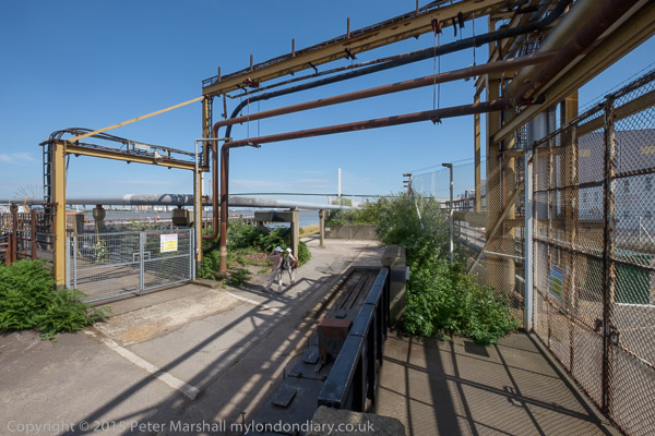
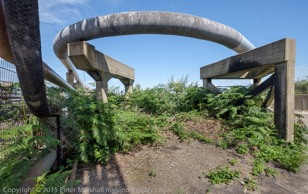
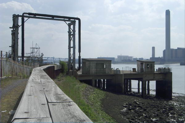
Works, Purfleet, Thurrock, 1993, 94-01-1-46
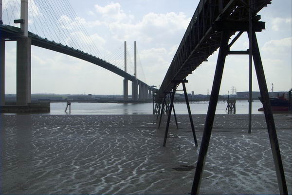
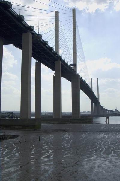
QEII Bridge, Dartford Bridge, Pipeline, River Thames, West Thurrock, Thurrock, 1993, 94-01-1-11
The final image in today’s post is something completely different on the same film, a shop window in Ponders End which I found it strangely weird. As it is on the same film as the others I think it was probably also taken in December 1993 although my caption stated 1994.
Darent Valley Path & Thames: The route we took on Saturday 4th July 2015 was new to my wife and son, but one I’d taken quite a few times before, both on foot and on my Brompton, but this time I left the bike behind and walked with them.
From Mill Pond Road, Dartford
Or rather more or less with them, as I often stopped or walked a few yards to one side or other to take pictures, and then had to scurry after them to catch up. Walking with a camera is very different from walking. My son does have a camera (one of the Fuji fixed lens X100 series) but takes far fewer pictures than me – and did much less running about.) But his captions are often rather more droll than mine, and seldom constrained by the 5W’s – Who What Where When Why.
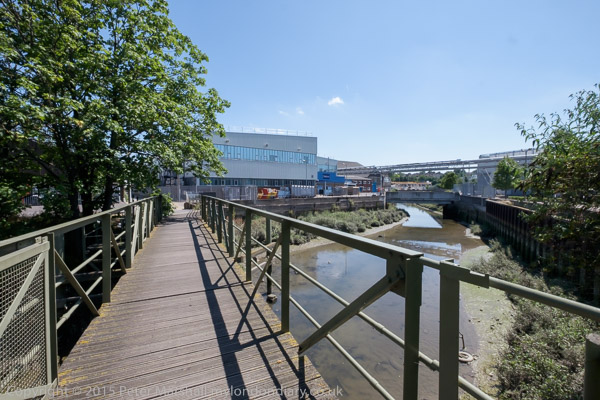
Footbridge across the Darent
It was a bad day for this walk, hot and sunny with virtually no shelter between Dartford and Greenhithe along the banks of the Darent and Thames. But I’d heard that there would be a boat sailing up Dartford Creek, a rare occasion at the time and decided it would be good to photograph it.
This route is now one end of the Darent Valley Path, a 19 mile path which ends at Sevenoaks, most of which I’ve walked or cycled on other occasions, and the part beside the Thames is on the England Coast Path.
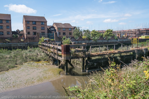
Dartford Half-Lock
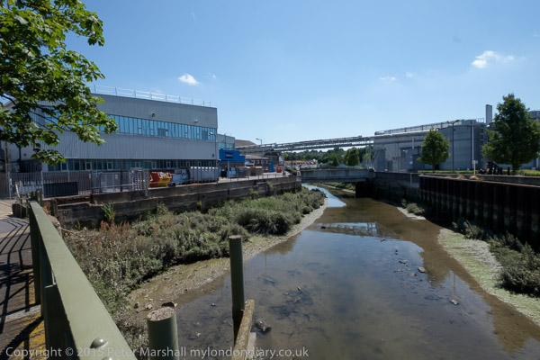
The Darent used to be navigable at least up as far as Dartford, where barges brought in and took out cargoes. Close to Dartford is a half-lock which holds back water above it when the tide goes out, long out of use but now slowly being restored to bring the waterway back into regular use.
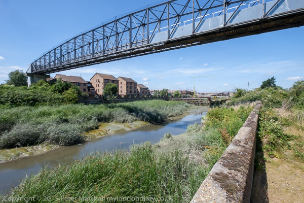
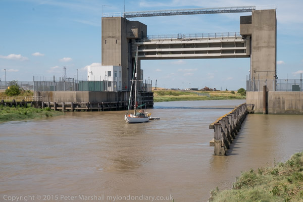
A fixed low bridge impedes navigation. This bypass was built as University Way, but the University never came so they renamed it Bob Dunn Way
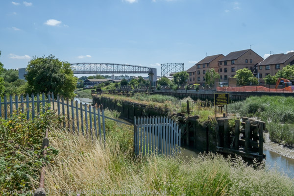
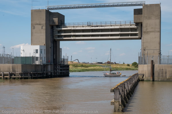
There used to be a lock which craft could go through when then the tide was high enough downstream, but that was replaced by a fixed barrier. Boats can still go through in either direction close to high tide when their is enough water for them to clear the sill.
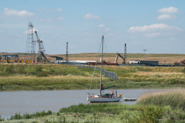
The yacht arrived later than expected and I had to run back to photograph it coming under the flood barrier. It was too late to get under the bridge on the same tide.
As well as the Darent, barges also went up the River Cray which joins the Darent downstream from the half-lock. This too is being brought back into leisure use.
Where the Darent meets the Thames
By the river in the centre of Dartford was the industrial estate dominated by the pharmaceutical manufacturing plant of Burroughs Wellcome who took over a former paper works here in 1889. In 1995 this became Glaxo Wellcome, the largest pharmaceutical company in the world. The works was wound down from 2008 by the then owners GlaxoSmithKline with manufacturing ending in 2013. Much of the site was empty by 2015 and now has large blocks of flats.
On the west side of Dartford Creek had been paper mills, but the last of these, owned by Wiggins Teape closed in 2009 and there was by 2015 housing on the site.
QEII bridge and Littlebrook Power station, River Thames, Dartford
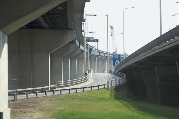
When the third Dartford Bypass was built around 1988 barges were no longer bringing esparto grass and other raw materials for the paper works up the river and no thought was given to navigation. Boats that can lower masts or without them can creep under the road for a short time on a rising or falling tide when there is enough water to allow them to float but not high enough for the bridge to block their transit.
Riverside path at Littlebrook
Much of the land to the east of the creek was marshes, which made it a suitable location for the Wells fireworks factory, long closed. But I think it or an adjoining site was now in use for clay-pigeon shooting, and for much of this section of the walk we sounded under gunfire.
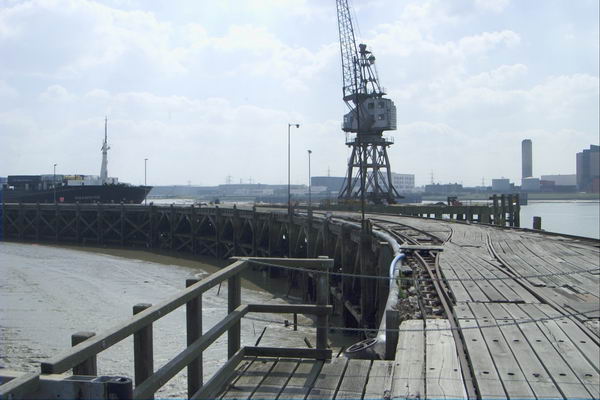
At the Littlebrook jetty
There had once been a pub, Longreach Terrace, and a ferry to Purfleet on the Thames close to the the mouth of Dartford creek, but both were long gone. It was here too that smallpox victims were brough ashore to the islolation wards of Orchard Hospital, demolished around 1975, part of the Joyce Green Hospital which was demolished around 2000.
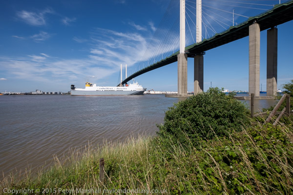
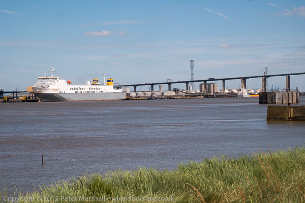
The Purfleet to Zeebruge ferry goes under the QEII bridge
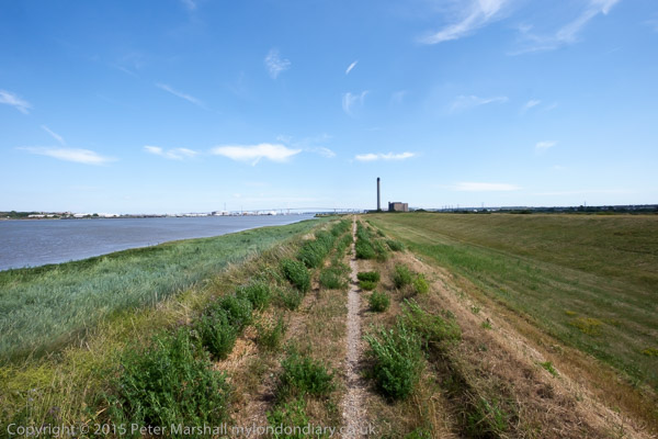
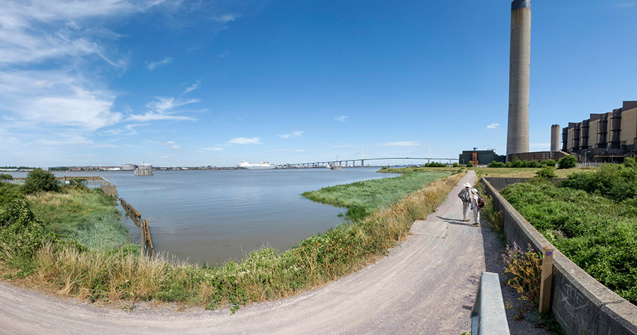
Further downstream on the banks of the Thames we passed Littlebrook power station – the final plant there, Littlebrook D, had ceased operation only four months earlier – before going under the Dartford QEII bridge and past Crossways Business Park. I had meant to climb up the hill to Stone Church, but missed the footpath and ended our walk in Greenhithe. But I was too tired anyway – and had stopped taking pictures on this last part of our walk.
Purfleet & West Thurrock: Pictures taken on a ride along the Essex bank of the Thames on Tuesday 22 April 2003, the day following the Easter Bank Holiday.
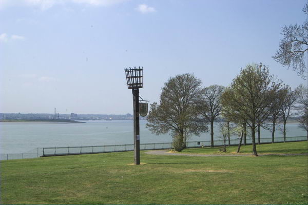
Silver Jubilee Beacon at Purfleet and upstream view of the River Thames
I only put these pictures onto My London Diary around a year after I made them and wrote nothing about them when I did so.
But these are more pictures that I took on a ride mainly along a footpath beside the River Thames where I rode on my Brompton folding bike.
My ride started not at Purfleet which is just on the outside edge of Greater London, but at Rainham, which was the last station coming out from London where a Travelcard was still valid.
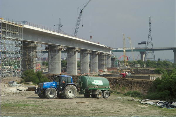
Part of my reason for coming to this area was the building that was taking place of the Channel Tunnel rail link, which tunnelled under the river at Swanscombe in Kent to West Thurrock in Essex. I had previously photographed on the Kent side, You can see some of the work on this high speed rail line in these pictures of this, particularly some from my return journey to Rainham where I followed its route as closely as I could.
The pictures were made with my first digital SLR, the Nikon D100 and a 24-85mm Nikon lens.
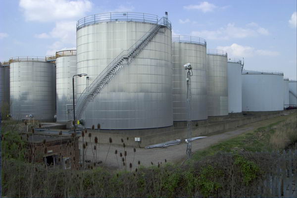
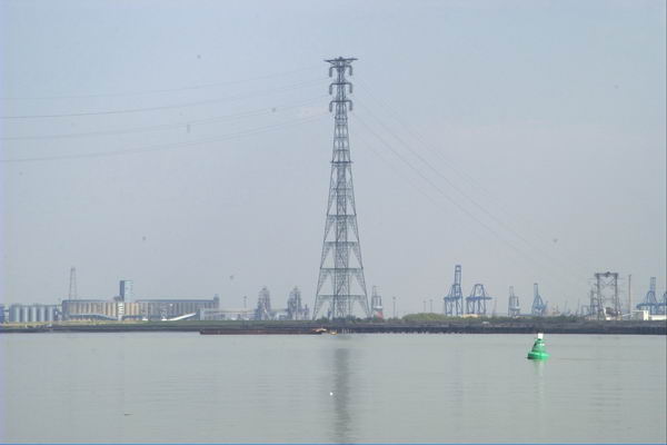
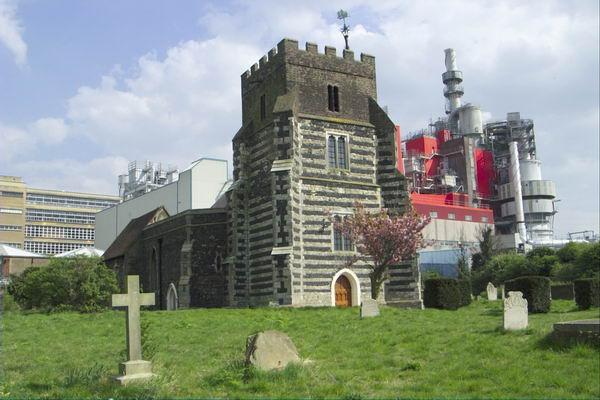
As well as riverside industry, including a detergent works at West Thurrock which overshadow an ancient church, there are also images of the QEII Dartford Bridge, container parks, oil storage depots and the CTRL viaducts as well as fairly desolate riverside and a giant pylon.
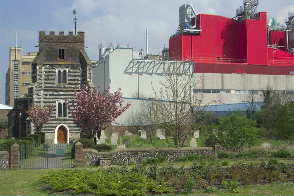
St Clement’s Church, West Thurrock was one of the four churches featured in the 1994 film ‘Four Weddings and a Funeral’Channel Tunnel Rail Link, QEII bridge and a giant pylon
1995 Colour Part 4 – Around Dartford: More of my panoramic images. These were taken in and around Dartford in Kent in March 1995 on a walk which took me from the centre of the town and along by the River Thames to an area close to the QEII Dartford Bridge. All these were taken on Sunday 19th March 1995. Dartford is a part of the Thames Gateway area around the Thames Estuary.
Dartford
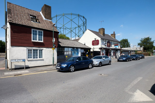
Gasholder, Hythe St, Victoria Rd, Dartford, 1995, 95p03-531
I walked up Hythe Street and then turned right to a path that led me to a bridge across Dartford Creek.
Bridge, Dartford Creek, Nelsons Row, Dartford, 1995, 95p03-533
Dartford Creek is the tidal creek of the River Darent and was once important navigable creek to wharves in the centre of Dartford. Work has now been going on for years to restore the half-lock and make the creek navigable again. I made more panoramic images along the footpath beside the creek later in the year, but on my first visit was keen to get to the River Thames and left the Creek to walk up Joyce Green Lane and Marsh Street to the River Thames.
Littlebrook
Littlebrook Power Station, Dartford Bridge, QEII Bridge, River Thames, Dartford, 1995, 95p03-612
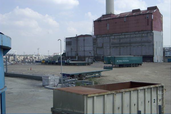
The first power station at Littlebrook was coal fired and opened in 1939 and was joined by a second in 1949 and a third in the 1950s with the final station Littlebrook D shown here opening in the 1980s. The earlier stations had been converted to burn oil by 1958 and were all decommisioned by 1981 when the final station began to be put into use. This continued to produce power until 2015 and was finally demolished in 2019. You can read much more detail on Wikipedia.
River Thames, Dartford Bridge, QEII Bridge, Dartford, 1995, 95p03-631
Google’s map now shows Littlebrook Beach as a ‘tourist attraction’ but I’m fairly sure I was the only person there on the day I made this picture.
Jetty, Littlebrook Power Station, Dartford Bridge, QEII Bridge, River Thames, Dartford, 1995, 95p03-643
National Power, River Thames, Dartford, 1995, 95p03-663
Crossways
As I walked along the path beside the river taking these and rather more black and white images I kept looking for a gate or gap in the fence betweent the riverside path and Crossways I could go through, but there was none. It was only when I got to Stone Marshes that I was able to leave the river and then walk along St Mary’s Road and into Crossways Business Park.
Warehouse, Crossways Business Park, Crossways, Dartford, 1995, 95p03-873
The area has been considerably expanded now, with a new major road to Greenhithe as well as new housing and commercial development.
Lake, Crossways Business Park, Crossways, Dartford, 1995, 95p03-733
The lake now has much new development around it, including a pub, The Wharf on Galleon Boulevard, close to where I made these pictures
Lake, Crossways Business Park, Crossways, Dartford, 1995, 95p03-721
Lake, Crossways Business Park, Crossways, Dartford, 1995, 95p03-723
Darent Valley Path & Thames, Dartford, Kent. On Saturday 4th July 2015 I went by train with my wife and elder son to Dartford for a day’s walking mainly beside the River Darent and River Thames.
It was a hot summer day and the sky was blue with just a few small patches of white cloud. It probably wasn’t the best day to have chosen, as this was a walk with relatively little shade, but as usual there was a little breeze by the rivers to cool us slightly.
I’d walked (and cycled) along the paths we took several times before, first in the 1980s, but they were new to my companions. After taking a short look at the Darent in Dartford we made our way to Hythe Street. Its name means a landing place or small port, and the Darent was once an important navigation at least as far as the mills in the centre of Dartford. The has been a pub here since 1764 and the Hufflers Arms gets its name from the men who guided and pulled the barges up the river to here.
A footbridge takes the path across the Darent here, and past the backs of some industrial sites on towards the half-lock which stopped the river above it drying out at low tide, long derelict. It was something of a surprise to see a narrow boat moored close to it.
There has been a huge change here since 2015, with volunteers working on and around the lock and the river. You can read more about the work of the Dartford and Crayford Creek Restoration Trust on the Facebook page of the Friends of Dartford and Crayford Creek, and see some of the changes in the pictures there.
Later in the day I photographed a yacht making its way through the flood barrier from the Thames and going upriver. I heard afterwards that it had reached the recent bridge under the Bob Dunn Way bypass when the tide was just a fraction too high for it to creep underneath with its mast lowered.
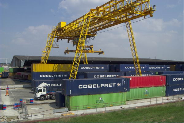
The Thames is pretty wide here and the channel deep enough to take fairly large ships, with the ferries including the ship in the picture operating regular contianer services to Rotterdam and Zeebrugge.
I made a few panoramic images, but the sky was a little empty and blue for it really to be a good day for that. This one which shows my two companions walking on ahead is interesting to me as I have managed to make use of the curvature inherent in these very wide angle views. The path on which I was standing to make the image was more or less straight, though in the picture it seems to bend at roughly a right angle.
The Littlebrook Power Station had only recently ceased operation, and we walked past some interesting structures there before making our way under the Dartford Bridge.
I was pleased that the ferry was leaving and I was able to take a series of photographs of it going under the bridge and sailing on downriver. Some of the pictures give a better impression of the relative heights of ship and bridge with an enormous amount of headroom for the passage.
By now I was getting tired, mainly from the heat and the lack of any shade, and I took few pictures on the rest of the walk to the station at Greenhithe. We didn’t see any sign of the path marked on the map which would have taken us up to the church at Stone as I had planned, but I think I was releived not to have had to climb up the hill, and perhaps didn’t look too hard. After all I’d been there and taken pictures on various occasions before. And if you are walking this way it’s worth the detour.
Purfleet & West Thurrock: 20 years ago, on 22nd April 2003 I was still recovering from a heart attack and a little minor surgery. Delays and cancellations in the NHS are not new, and I’d spent several weeks in hospital waiting for the op, with three or four cancellations as emergencies bumped me off the list at short notice – one time I was even on a trolley on may way to theatre. Back then the major shortage, and one that seldom made the news, was of doctors and it still is, with the government still committed to doing little or nothing about it, even refusing to discuss the junior doctors claims.
My actual operation, when finally it happened, went well, but 24 hours later I was an emergency too, collapsing the the ward toilet as my blood pressure dropped spectacularly thanks to a large dose of a exotic drug through a cannula incorrectly inserted by a junior doctor (the nurses were extremely scornful) and I was still far too weak when they released me home to join the million or more (including my son and wife) the protesting against the Iraq war the following day. I think I was more upset about that than my heart attack.
My GP signed me off work for a few weeks (though most of my work was freelance and from home, and I was able to continue this) and prescribed aspirin and exercise along with a few other drugs to deal with my blood pressure, which I’ve been taking daily ever since, along with insulin for my diabetes, also diagnosed when I went into hospital. And thanks to the NHS, all this has cost me absolutely nothing. And after I was signed off as fit for work in March, though I was still very weak, I managed to go and photograph a couple of protests.
Walking was still for the first month or two just a little taxing, but after a couple of weeks I was fine on my Brompton, where I could take it easy later I went on some longish rides. And as it was a folding bike I could put it on trains and the underground to take me away for more distant starting points. And in April 2003 I went on rides from Dartford, Rainham and, on 22nd April 2003, to Purfleet, where I cycled along beside the Thames to West Thurrock and back.
When I posted pictures of this and other rides on My London Diary, I noted “I didn’t get around to adding these other pictures from April 2003 until very much later, and haven’t got around to giving them captions.” And I wrote nothing about the ride at the time. All were taken on a Nikon D100 with a Nikon 24-85mm lens.
I travelled up to London on a Travelcard which covered a journey to any station in Zones 1-6, which meant the closest I could get to Purfleet was actually the station before, Rainham. Then it wasn’t possible to follow the riverside path from Rainham to Purfleet, which then ended at Coldharbour, so I had to cycle along the road to Purfleet through Wennington. The map now shows a riverside cycle path.
This part of the ride had little interest, other than passing some of the works for the Channel Tunnel Rail Link, where I took a few pictures before going down Tank Hill Rd to reach the riverside close to the Purfleet Armada Beacon.
Navigation from there to West Thurrock (and on to Grays and the edge of Tilbury Docks on other occasions) was simply a matter of following the riverside path. But it was then an extremely interesting path, past various industrial sites and under the Dartford Bridge (and less noticeably over the Dartford Tunnel.
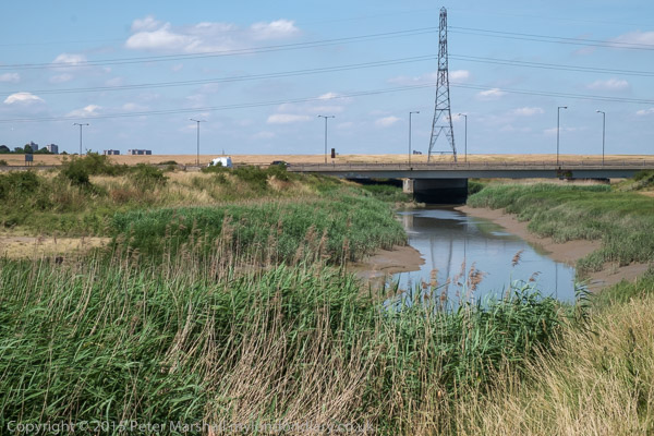
This is a wide and interesting stretch of the river, also crossed by a 400kV high voltage power line from Swanscombe, with the two 623ft pylons on each side being the tallest in Britain. The distance between the two towers is apparently 4,501 feet, around 0.85 miles or 1.37 km.
Pilgrims en route to Canterbury crossed the river from close by St Clement’s Church, taking to boat across to Swanscombe where the path up from the river is still the Pilgrims Road. But there was no boat available to me, so I turned inland into West Thurrock.
St Clement’s Church was Grade I listed in 1960 and parts at least are 13th century. It was used by a a youth unemployment scheme after regular services closed in 1977 and the interior was gutted, and after the project closed it was badly vandalised.
Dominating the church is the Procter & Gamble detergent factory begun here in 1940 and in 1987 when they were celebrating the company’s 150 years in business they took over the upkeep of the church which took 3 years to restore. The church, which was the location of the funeral in ‘Four Weddings and a Funeral’ is now open to the public once a month from April to September.
I can’t recall my route back along various roads to Rainham station, but there are a few pictures I took, mainly of the A13 and the Channel Tunnel Rail Link on My London Diary.