Greenhithe, Swanscombe & Broadness – 2006

Greenhithe, Swanscombe & Broadness: On 25th August 2006 I travelled by train with my Brompton for a day riding and photographing this area on the River Thames in North Kent. A few days later I posted the following account on My London Diary, along with quite a few pictures from the ride.


Greenhithe, Swanscome & Broadness - 2006
Broadness moorings – in 2025 now under threat – see the bottom of this post

My London is a pretty flexible area, and takes in all of the Greater London area and everywhere else within the M25, as well as obvious extensions including the area covered by the Thames Gateway plans for a mega-city covering a much wider area than the present boundaries. One of the growth axes is the high speed rail link from France, with stations at Stratford and Swanscombe (as well as Ashford, Kent close to the tunnel mouth.)

Greenhithe, Swanscome & Broadness - 2006
Greenhithe, across the Thames to West Thurrock

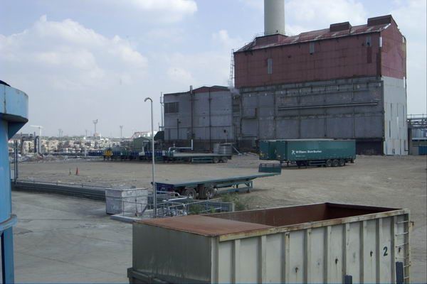
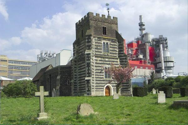
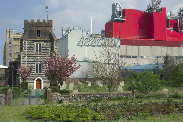
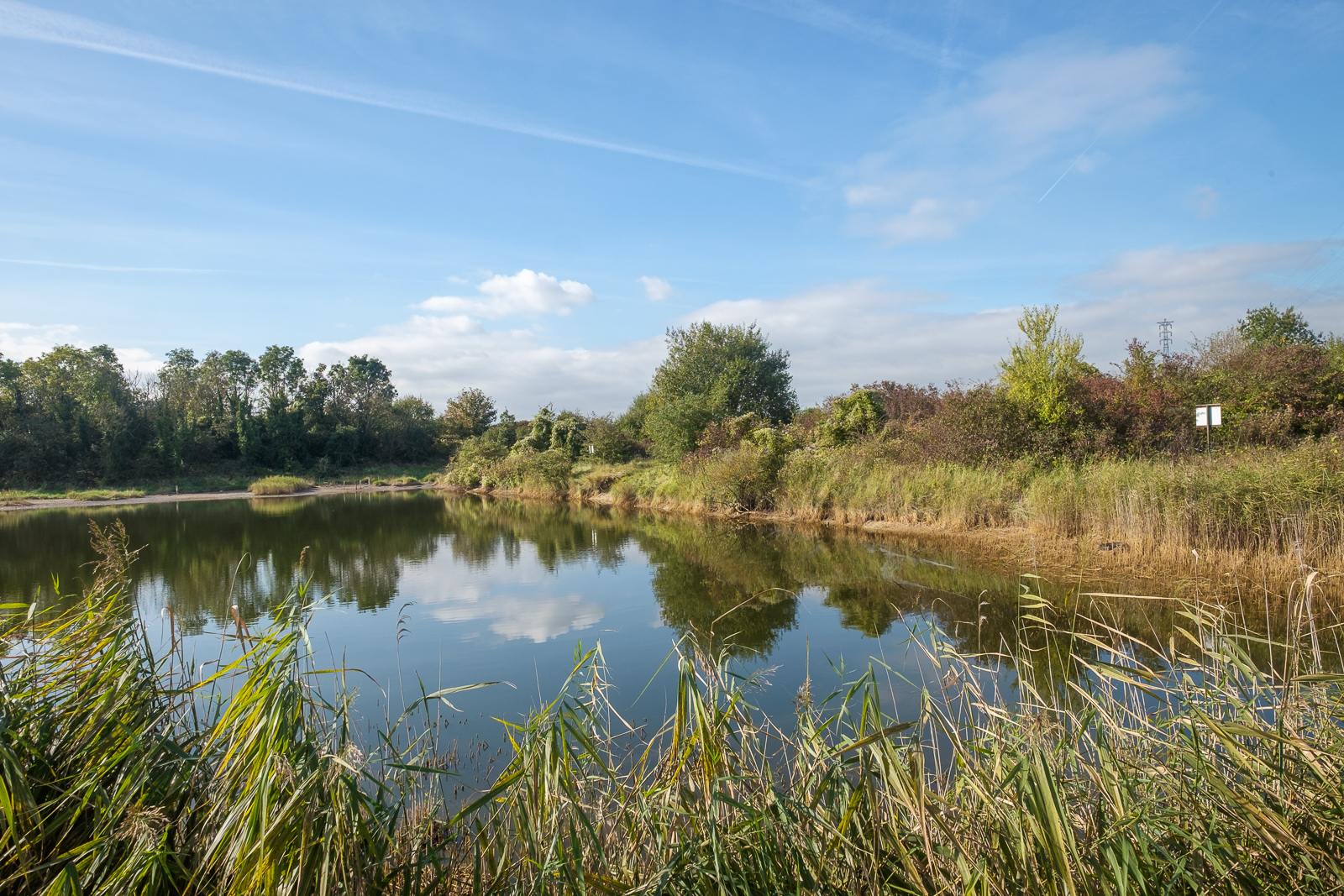
The areas around Stratford and Swanscombe are both places I’ve photographed at intervals since the early 1980s, and I made a couple of visits to them again close to the end of August 2006. Swanscombe, best known for the early human remains – Swanscombe Man – found there, is in the centre of what was a major cement industry (a little of which still remains) with some dramatic landscape formed by quarrying.

Greenhithe, Swanscome & Broadness - 2006
River Thames: Landing stage at Greenhithe with Dartford bridge and passing ship

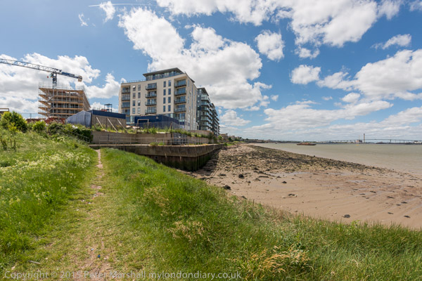
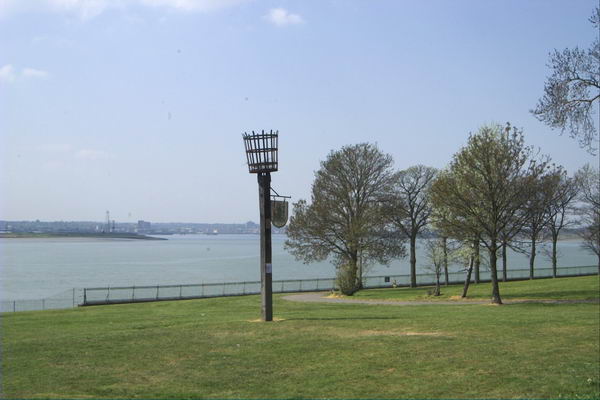
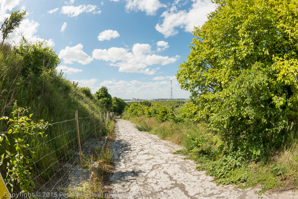
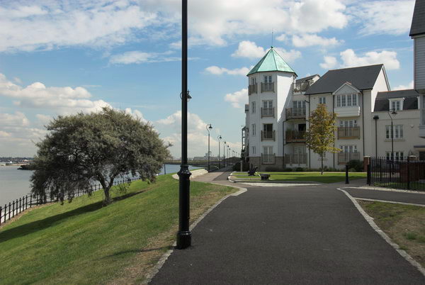
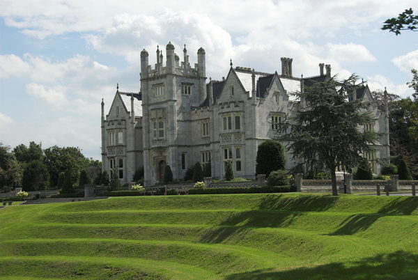
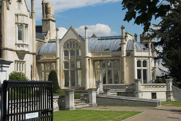
I started my visit there at Greenhithe, still a Thames-side village at its centre, but now dwarfed by new housing developments and the huge shopping centre in a former quarry at Bluewater. This time I gave that a miss and took a look at the housing development on the riverfront. This is a prestige scheme that has retained ‘Ingres Abbey’ and the core of its fine grounds, where there is now a heritage walk.

Greenhithe, Swanscome & Broadness - 2006
New riverside housing on Ingress Abbey estate, Greenhithe

The grounds, in a an old chalk quarry with high cliffs, were provided with follies and landscaped in the 18th century by Sir William Chambers and later by Lancelot ‘Capability’ Brown, but the 17th century house at their centre was demolished in 1815 when the navy had plans for a huge riverside dockyard. After these plans were dropped, it was sold to a London alderman and barrister, James Harman who built a large ‘gothic revival’ private house there in 1833.

Greenhithe, Swanscome & Broadness - 2006
Ingress Abbey, Greenhithe, now restored and used by a high-tech company

Harman had hoped to attract other wealthy Londoners to develop parts of the extensive grounds for their own villas in this scenic area, hoping it would rival riverside developments as those in Chiswick and Richmond, but failed to attract any takers.

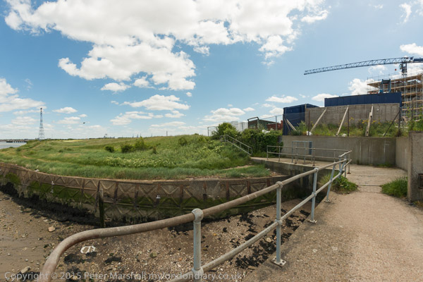
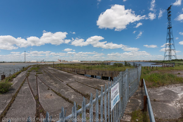
Part of the site to the east was later sold for the building of the Empire Paper Mills, and the Navy again took an interest in the area, mooring the training ship HMS Worcester in front of the abbey in 1871, and also acquiring some of the estate. The Thames nautical training college continued in use until 1989, and had some large concrete buildings from the 1970s.

Harman’s dream has been partly completed now by the developers, who have won awards for their handling of this ‘brownfield’ site. The house and the various follies were listed buildings and have been retained (fortunately for the developers, neither the paper mill nor the training college gained listing.)

Moorings on Broadness Salt Marsh

Although the architecture of the new housing is perhaps pedestrian (although not suburban), the abbey and its surroundings immediate have been restored (although most of brown’s parkland is now under housing.) The development is high density, but there are quality touches in the street furniture. The spacious lawn in front of the house (offices for a high-tech company) has its impressive steps, but the housing is terraced town houses with balconies rather than gardens.

About all that remains of the cement works at Swanscombe

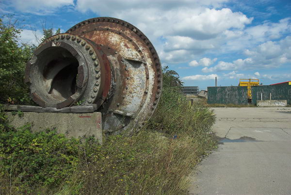
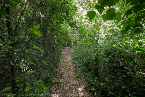
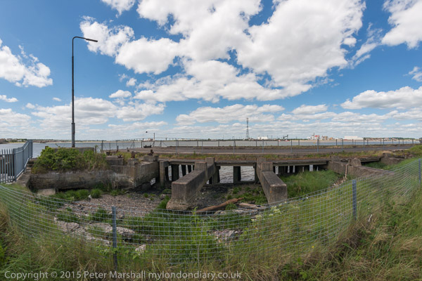
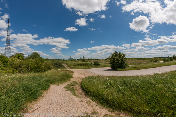
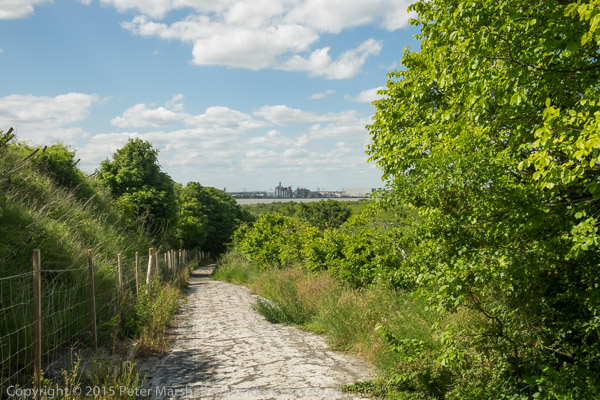
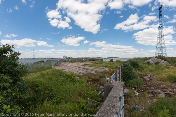
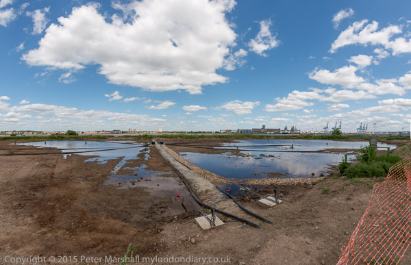
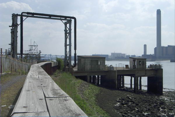
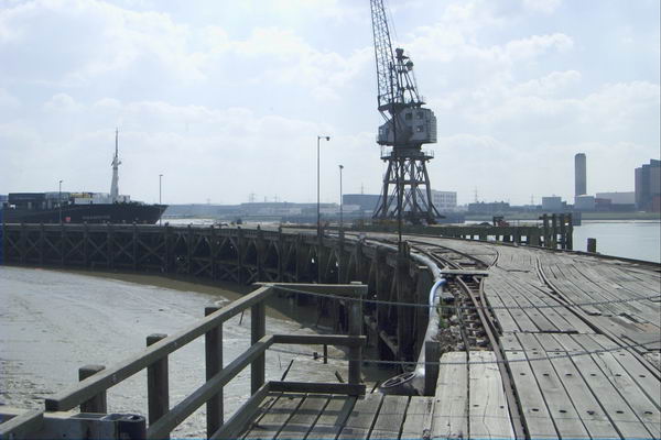
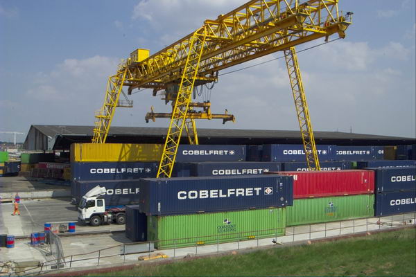
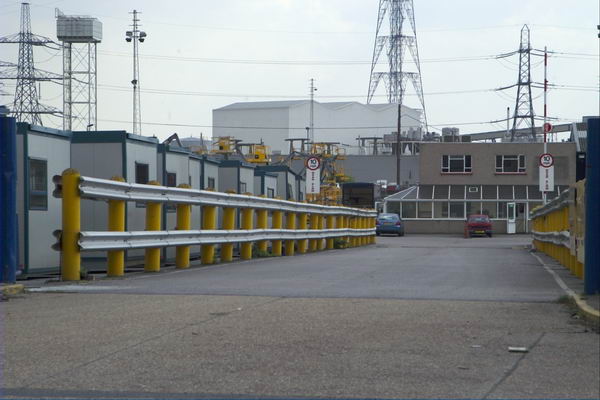
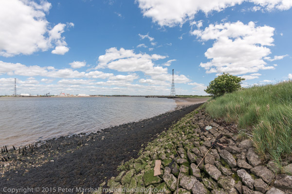
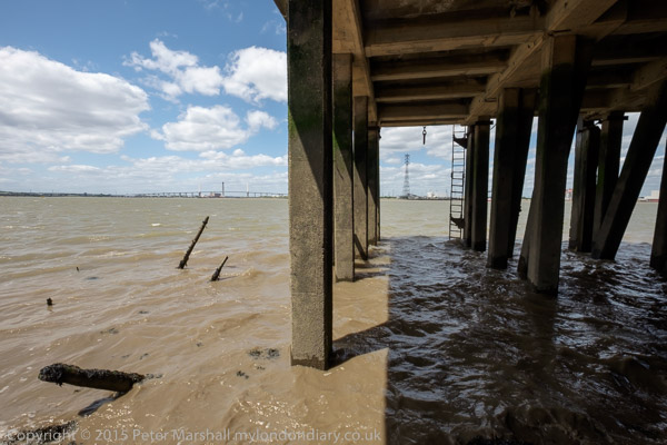
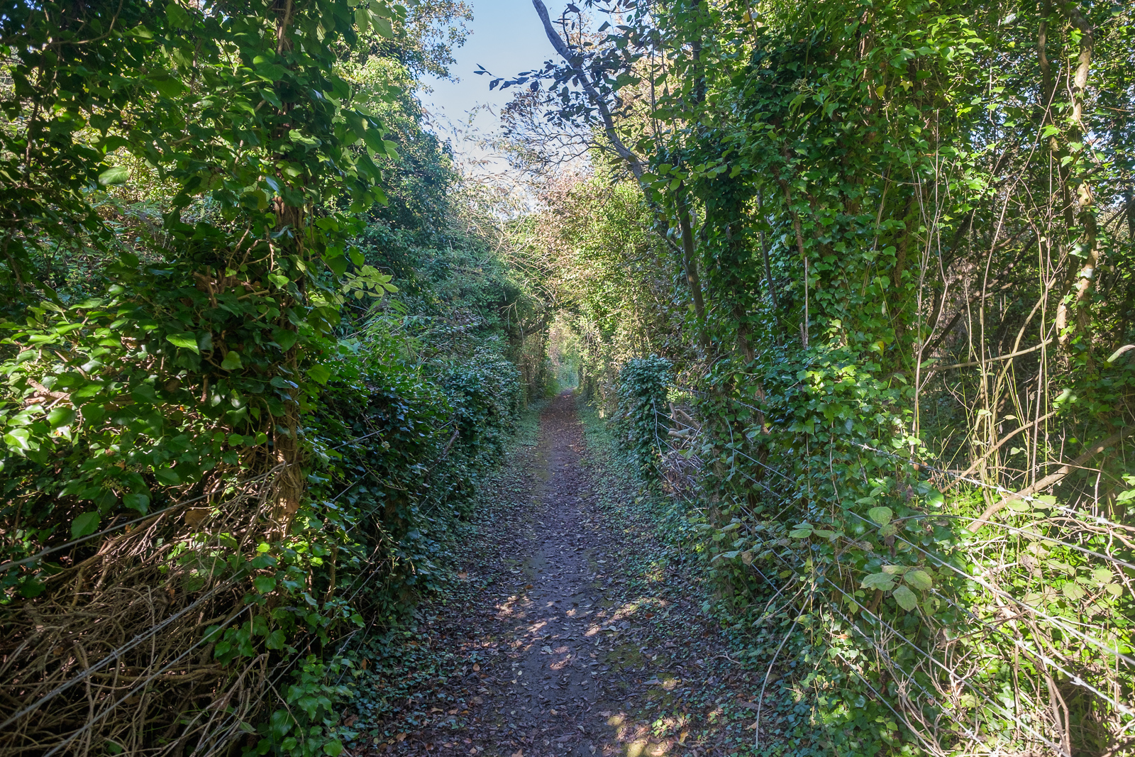
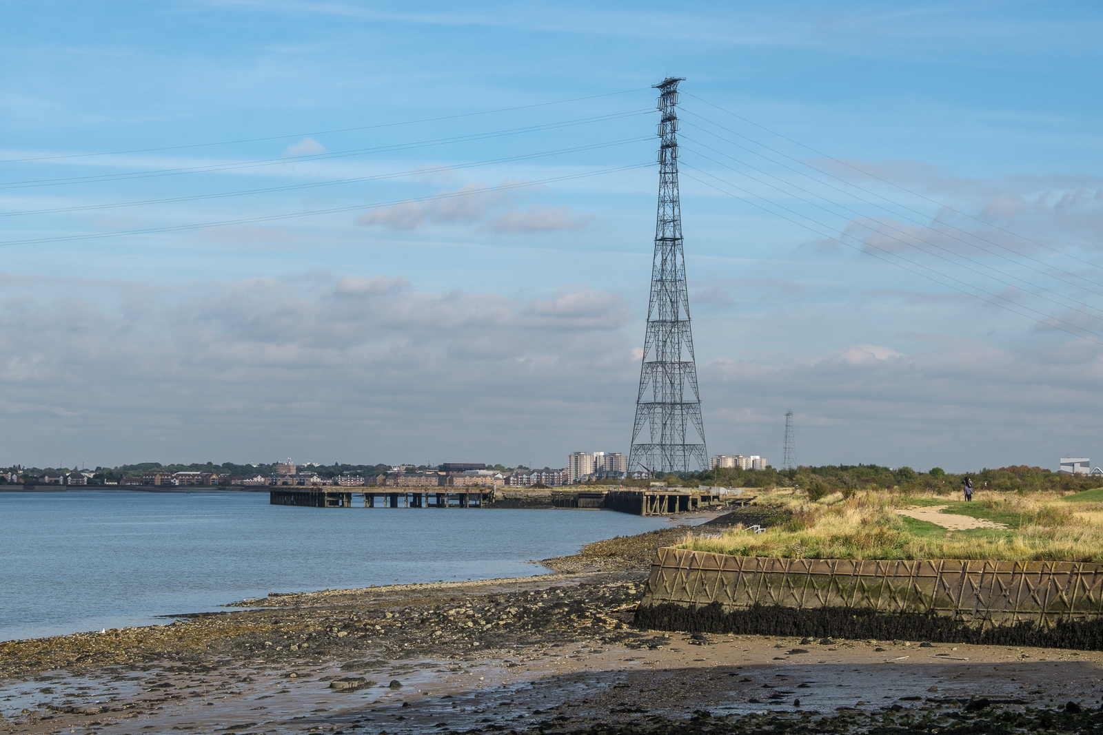
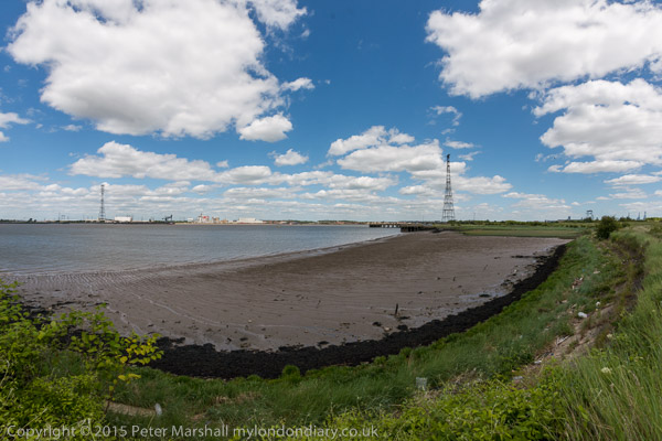
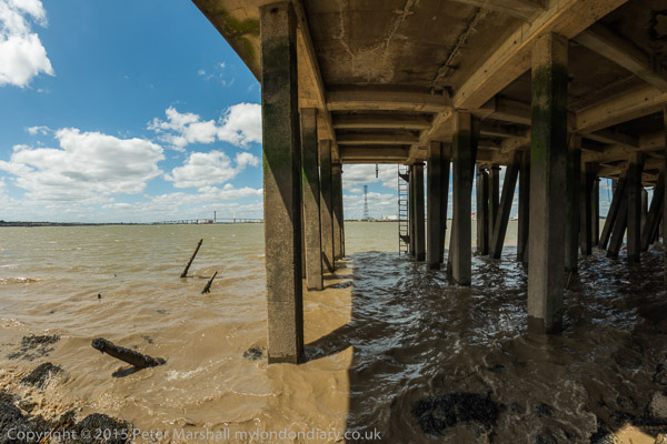
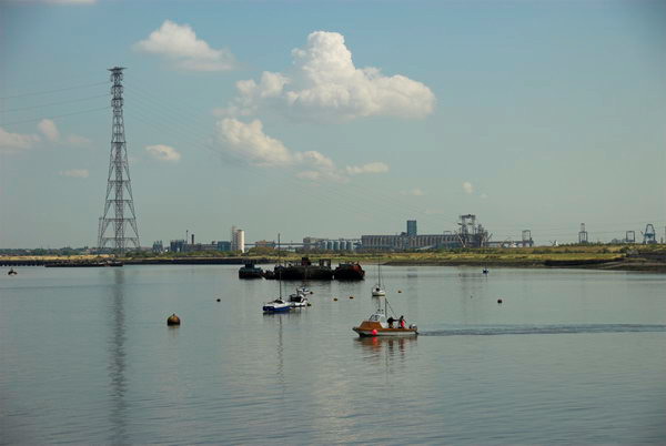
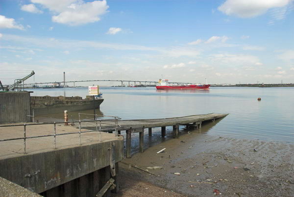
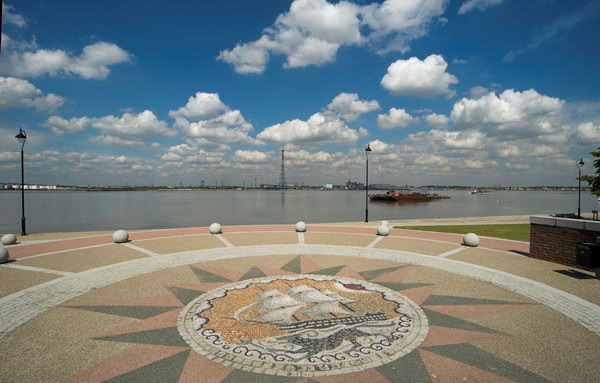
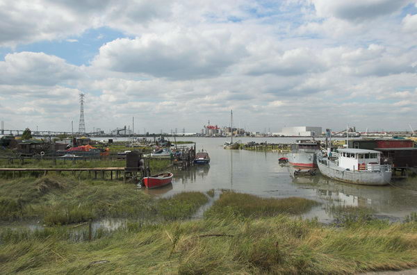
From here I cycled on to the open emptiness of Swanscombe marsh. In the distance were the heaps of spoil from the Channel Tunnel Rail Link which burrows under the Thames here. The piers for the former cement works are now derelict and closed off, used only by a few fishermen. The Pilgrims Road no longer leads up to the village, cut off by the work on the link.

Greenhithe, Swanscome & Broadness - 2006

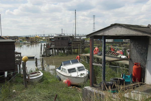
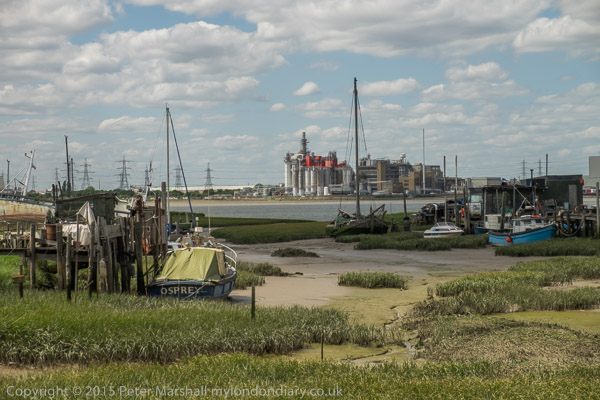
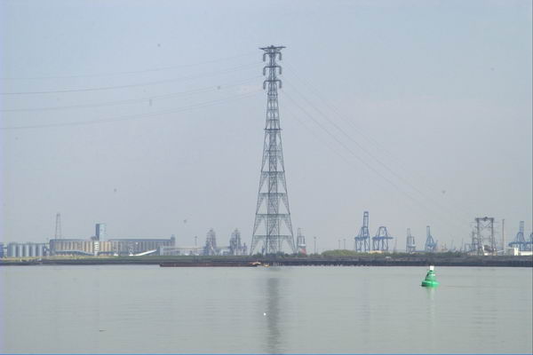
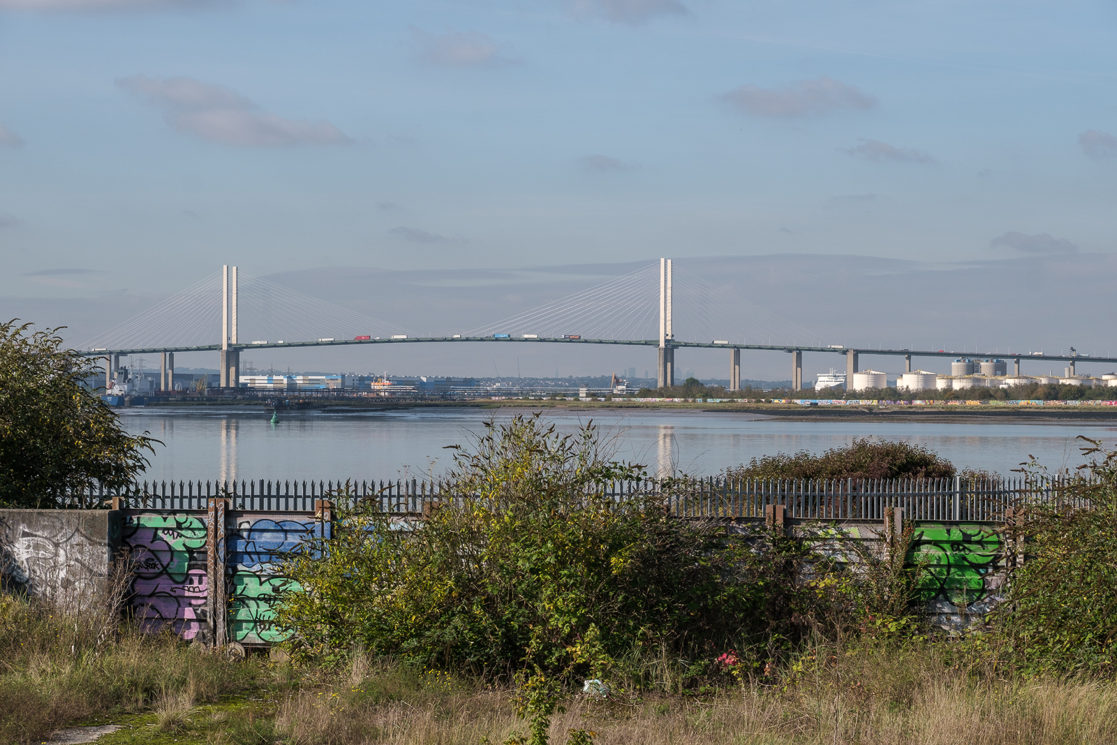
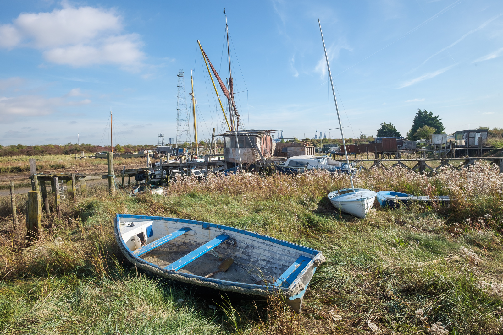
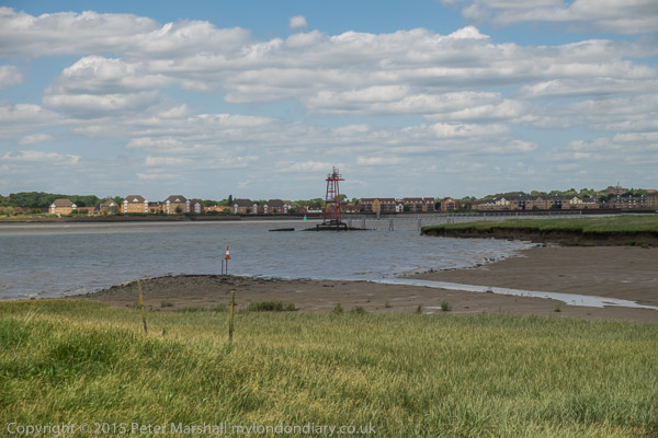
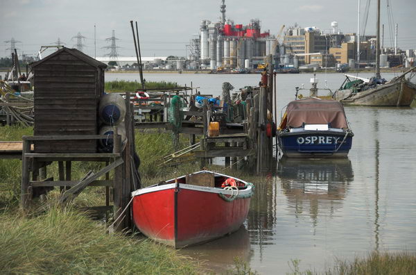
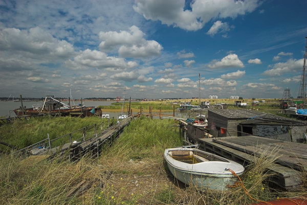
Past the giant pylons carrying the grid across the Thames, I came to the saltings on Broadness Marshes and was rather surprised to see these still in use as moorings. The tide was high as I walked down beside them, and a boat made its way out. Another was being worked on near the landward end, but otherwise the place seemed deserted.

More pictures on My London Diary beginning here.


Save Swanscombe Peninsula SSSI

Recently the Broadness Cruising Club in the saltings have discovered that the owners of the Swanscombe Peninsula have “registered the land our boats are moored on and our jetties and boat sheds are built on as their own” and are trying to get rid of them from the site, restricting their access. The club has been there for over 50 years and is now fighting for the right to stay with a fundraiser for legal costs.


FlickrFacebookMy London DiaryHull PhotosLea ValleyParis
London’s Industrial HeritageLondon Photos

All photographs on this page are copyright © Peter Marshall.
Contact me to buy prints or licence to reproduce.


Swanscombe Peninsula Kent 2015

Swanscombe Peninsula Kent: I visited and photographed the Swanscombe peninsula in the 1980s as a part of an extensive project along the south bank of the River Thames east of London, returning occasionally over the years, particularly in the 2000s when I documented the building of the Channel Tunnel Rail Link which crosses under the river here.

Swanscombe Peninsula Kent

Back in the 1980s there was still a large cement industry here. But it was here that Portland Cement became the centre of the UK cement industry, with huge quarries digging out the chalk, often 100ft thick here, leaving huge gaps in the landscape. But most of these quarries were now worked out and the industry was fast declining and has now all gone.

Swanscombe Peninsula Kent

On my 2015 post Swanscombe on My London Diary you can read more about the industry. The Swanscombe cement plant was the l argest in the UK from 1840 until 1930, but was largely derelict when I took pictures in the ’80s though it only finally closed in 1990. That at neighbouring Northfleet, was only fully developed in 1970, although cement production had begun there in 1796. That site, the last working cement plant in the area, closed in 2008 was cleared and its landmark chimneys demolished in 2009-10.

Swanscombe Peninsula Kent

Chalk had been quarried to within a few feet of the main A226 London Road and in some places on both sides of the road, leaving it running on a narrow spine of chalk.

Swanscombe Peninsula Kent

From the road the Pilgrims Road leads down steeply to Swanscombe marshes, with some industrial developments in the former chalk pits on both sides.

Swanscombe Peninsula Kent

Kent Wildlife Trust describe the marshes as “Home to a remarkable mosaic of grasslands, coastal habitats, brownfield features, scrub and wetland” and I certainly found it a remarkable area both in the 1980s and in later visits – the last a year or so ago. My pictures more reflect an interest in industrial archaeology rathe than nature.

In 2012 plans were announced to turn 216 hectares of this site into a theme park, at first with the support of Paramount Pictures who withdrew their support for Paramount Park in 2017 with the proposed park being renamed London Resort. Paramount are also taking London Resort to the High Court over a financial deal after the London Resort was in danger of going bust, although they still apparently have an interest in providing content based on their block-buster films.

In 2015 it looked likely that Paramount Park would go ahead in the relatively near future, prompting me to get on my bike and revisit the area. In the post on My London Diary I give some details about my route. I think all of the site is privately owned but back then much was still open to the public to wander around. Since then there have been more fences and notices restricting public access but there is also a new section of the England Coast Path opened at the start of 2022 through here.

The English Resort plans are still in limbo and the planning permission has lapsed, although the company still believe they will go ahead at some time, others feel the project is dead. Development of the site became more complicated when it was declared as an SSSI on account of its jumping spiders in 2021, and its financial prospects are threatened by Universal Studios consideration to build a rival resort in the former brickworks near Bedford. And its unclear if there would be the money to go ahead.

Dartford Council has withdrawn its support for the project, as has the local MP, but it remains to be seen what attitude a new government will take towards the plans. Campiagners against it, including the council have called for it to lose its Nationally Significant Infrastructure Project status which would almost certainly be its death knell.

Of course this doesn’t mean that this remarkable piece of nature is safe from development, and if London Resort is ended parts of the area are likely to be developed for housing as prime riverside sites, though hopefully much will remain.

More at Swanscombe.


FlickrFacebookMy London DiaryHull PhotosLea ValleyParis
London’s Industrial HeritageLondon Photos

All photographs on this page are copyright © Peter Marshall.
Contact me to buy prints or licence to reproduce.


Purfleet & West Thurrock – 2003

Purfleet & West Thurrock: 20 years ago, on 22nd April 2003 I was still recovering from a heart attack and a little minor surgery. Delays and cancellations in the NHS are not new, and I’d spent several weeks in hospital waiting for the op, with three or four cancellations as emergencies bumped me off the list at short notice – one time I was even on a trolley on may way to theatre. Back then the major shortage, and one that seldom made the news, was of doctors and it still is, with the government still committed to doing little or nothing about it, even refusing to discuss the junior doctors claims.

Purfleet & West Thurrock

My actual operation, when finally it happened, went well, but 24 hours later I was an emergency too, collapsing the the ward toilet as my blood pressure dropped spectacularly thanks to a large dose of a exotic drug through a cannula incorrectly inserted by a junior doctor (the nurses were extremely scornful) and I was still far too weak when they released me home to join the million or more (including my son and wife) the protesting against the Iraq war the following day. I think I was more upset about that than my heart attack.

Purfleet & West Thurrock

My GP signed me off work for a few weeks (though most of my work was freelance and from home, and I was able to continue this) and prescribed aspirin and exercise along with a few other drugs to deal with my blood pressure, which I’ve been taking daily ever since, along with insulin for my diabetes, also diagnosed when I went into hospital. And thanks to the NHS, all this has cost me absolutely nothing. And after I was signed off as fit for work in March, though I was still very weak, I managed to go and photograph a couple of protests.

Purfleet & West Thurrock

Walking was still for the first month or two just a little taxing, but after a couple of weeks I was fine on my Brompton, where I could take it easy later I went on some longish rides. And as it was a folding bike I could put it on trains and the underground to take me away for more distant starting points. And in April 2003 I went on rides from Dartford, Rainham and, on 22nd April 2003, to Purfleet, where I cycled along beside the Thames to West Thurrock and back.

Purfleet & West Thurrock

When I posted pictures of this and other rides on My London Diary, I noted “I didn’t get around to adding these other pictures from April 2003 until very much later, and haven’t got around to giving them captions.” And I wrote nothing about the ride at the time. All were taken on a Nikon D100 with a Nikon 24-85mm lens.

I travelled up to London on a Travelcard which covered a journey to any station in Zones 1-6, which meant the closest I could get to Purfleet was actually the station before, Rainham. Then it wasn’t possible to follow the riverside path from Rainham to Purfleet, which then ended at Coldharbour, so I had to cycle along the road to Purfleet through Wennington. The map now shows a riverside cycle path.

This part of the ride had little interest, other than passing some of the works for the Channel Tunnel Rail Link, where I took a few pictures before going down Tank Hill Rd to reach the riverside close to the Purfleet Armada Beacon.

Navigation from there to West Thurrock (and on to Grays and the edge of Tilbury Docks on other occasions) was simply a matter of following the riverside path. But it was then an extremely interesting path, past various industrial sites and under the Dartford Bridge (and less noticeably over the Dartford Tunnel.

This is a wide and interesting stretch of the river, also crossed by a 400kV high voltage power line from Swanscombe, with the two 623ft pylons on each side being the tallest in Britain. The distance between the two towers is apparently 4,501 feet, around 0.85 miles or 1.37 km.

Pilgrims en route to Canterbury crossed the river from close by St Clement’s Church, taking to boat across to Swanscombe where the path up from the river is still the Pilgrims Road. But there was no boat available to me, so I turned inland into West Thurrock.

St Clement’s Church was Grade I listed in 1960 and parts at least are 13th century. It was used by a a youth unemployment scheme after regular services closed in 1977 and the interior was gutted, and after the project closed it was badly vandalised.

Dominating the church is the Procter & Gamble detergent factory begun here in 1940 and in 1987 when they were celebrating the company’s 150 years in business they took over the upkeep of the church which took 3 years to restore. The church, which was the location of the funeral in ‘Four Weddings and a Funeral’ is now open to the public once a month from April to September.

I can’t recall my route back along various roads to Rainham station, but there are a few pictures I took, mainly of the A13 and the Channel Tunnel Rail Link on My London Diary.

Brompton around Swanscombe 2015

Brompton around Swanscombe 2015 – Late in 2002 I bought a Brompton folding bicycle, something I’d been considering for years, but the cost had put me off. I can’t remember exactly what it cost me then, but with a few essential bits and pieces it was around £700 – allowing for inflation now equivalent to around £1200. Bromptons (hereafter just B’s) now start at £850, even better value. In an interview a year or two later with a photographic magazine I was asked “What is your favourite photographic accessory?” and my answer, “My B” wasn’t what was expected.

I wasn’t new to cycling – I’d got my first two-wheeler back in 1951 and had owned and used bikes since then, but this was my first folding bike and was bought as a photographic accessory to enable me to explore areas in outer London and the outskirts where public transport was often in scarce supply.

I’d hoped also it would be a convenient way to get around when photographing various events in the centre of London, but soon gave up on that idea as finding safe places to leave it appeared impossible. Bs are idea for bike thieves. Relatively high value and much in demand, they can be stowed away in a car boot in seconds. And even the sturdiest bike lock can only hold up the well-equipped criminal for less than a minute.

Locking and leaving isn’t really an option unless you can keep it in sight or in a secure place. Office workers can keep them in cloakrooms or under their desks, but when your place of work is the street you have a problem.

For cycling close to home I still had the full-size Cinelli that my eldest brother had given me as a birthday present back in 1958, and despite being dirty, dilapidated and having suffered much downgraded with more robust and heavier wheels and tyres still rolling well. But the huge advantage of the B was that it could be folded and taken on trains, underground and even buses at any time, enabling me to make rides from places which were too far away for me to cycle to.

I made my first such journey back in January 2003, taking the train to Erith, a little over 30 miles away, and then spent a few hours cycling “around the town and along the Thames, Darent and Cray before braving the Dartford bypass and striking off along Joyce Green Lane before returning to catch the train home from Slade Green.” Much of that cycling was along footpaths and other poor surfaces and tiring enough – and at one point I almost collapsed trying to lift the B over a stile. I couldn’t understand why, as even with my photographic gear in the front bag it was probably less than 15kg. A week or two later I found out the reason, having a relatively mild heart attack at home which required some minor surgery to put a stent into a blocked artery.

As soon as I could walk, my doctor told me I had to exercise, and soon I was taking a series of rides from home on the B over much of the nearby country. It was much easier to mount and dismount than a normal men’s bike, having no crossbar. Scattered through My London Diary are pictures from a number of bike rides, mainly made on the B. On a bike you can stop almost anywhere and don’t need a place to park, and the ease of getting on and off makes a B ideal. At times I’ve also used it, parked against a wall to stand on, one foot on the saddle and the other on the handlebars, but it can roll away and leave you unsupported.

My trip around Swanscombe on Saturday 6th June was one such ride, taken while the area was under threat from development as the Paramount London theme park (and it still is though this now seems less likely.) It was an area I’d photographed on a number of occasions since the 1980s and knew reasonably well. In the 1970s, together with neighbouring Stone, Greenhithe, Swanscombe and Northfleet was the largest cement producing area in Europe, mainly run by Blue Circle. But by the time I first visited that production was centred at Northfleet, and the works at the other sites had largely disappeared or were very run down, and the Swanscombe works had ceased production although the site only finally closed in 1990. Northfleet continued for some years into this century, but nothing now remains – except of course the huge quarry areas with their chalk cliffs.

The post Swanscombe on My London Diary gives more of the history of the area, and also includes a fairly complete description of the route I took on Saturday 6th June 2015, so I won’t repeat that information here. The B isn’t a great off-road bike – and impossible in muddy conditions – but is fine on reasonable footpaths but I might had had to get off an push in some places. One of the paths I mention, Lovers Lane, is now a wide road beside a new housing estate but otherwise the area is much the same as it was in 2015 except there are now notices that some of the areas are private property.

The area is also well described in the many pictures, many of which were made with a very wide horizontal and vertical angle of view. Although not panoramic in format they are panoramic in their scope.

Swanscombe

Swanscombe Peninsula 2021

Pilgrims Rd (DS31)

A couple of days ago I walked around the Swanscombe peninsula together with two photographer friends and took some more pictures of the area.

Footpath (DS12)

I first went to Swanscombe back in 1985 as a part of my project on lower Thameside and in particular the area close to the river between Dartford and Cliffe. The area between the main road and the Thames had been one of a chalk hill leading to marshes, and the chalk had largely been quarried years ago after the invention of Portland Cement, with major factories producing it in Stone, Swanscombe and Northfleet.

By 1985, only the Northfleet factory was still in production, with just a few largely ruined buildings of the Swanscombe factory still standing. The ancient pathway of Pilgrims Road, by then just a footpath, ran down from the main road to the marsh on a narrow section of chalk which remained., and the floor of the former quarry to the east of this was occupied by various industrial sites.

Then you could wander fairly freely across the marsh where there were still the clear traces of its its former industrial use, with relics from the overhead cable and conveyor belt which took materials from the jetty to the works, and various heaps of waste materials. There are still a few sections of the railway lines that lead to the jetty, but much more of the land is now either fenced off or has recent notices prohibiting access.

There are several public footpaths through the area, and we took a route along most of them, although a part of one near the jetty appears to have been blocked and needed a slight detour. A new route going east beside the jetty and then alongside the river to the saltings had been approved as a part of the England Coast Path “from Autumn 2021” and we walked along this section of it, although I’m not sure if it is as yet officially open.

Although we took care not to go past any of the notices marking areas a private, we did find at one point as we walked past a notice that it claimed the track we had just been walking on was private. But by then it was too late, although of course we were doing no harm by walking along this unfenced path. One of the public footpaths (DS12) has a short section that is now totally overgrown, and we had to push our way through a few yards of rather boggy reeds to keep within its fenced route. We ended out walk at Greenhithe, which had two pubs but virtually no beer or food and caught the train to Darford for a meal.

Since 2021 the area has been under threat of a planned development as London Resort, 535 acres of a “world class, sustainable, next generation entertainment resort on the bank of the River Thames” and a kind of London equivalent to Disneyland, with a theme park, hotels with 3,500 beds, jetties on both the north and south bank of the river and a new road connection from the A2.

Although this would provide new jobs, there has been considerable opposition to the scheme, particularly as it would threaten the huge diversity – the area is home to many plant species and bees, butterflies, beetles, cuckoos and marsh lizards, more than any other brownfield site in the UK, and is one of only two places where the critically dendangered Distinguished jumping spider (Attulus distinguendus) is found. Following a request by the Save Swanscombe Marshes campaign the area was declared a site of special scientific intrest (SSSI) by Natural England who describled it as “one of the richest known sites in England for invertebrates”.

Many new housing estates have been developed in the surrounding areas since 1985 and others are likely to be built on various quarry areas in the region. It would be a great shame to lose this important area of green riverside space to the proposed development. Leisure doesn’t need theme parks.

More pictures on Facebook at Swanscombe October 2021.


Swanscombe

Swanscombe, Kent. Sat 6 Jun 2015

I first visited Swanscombe back in 1985, when I was photographing along the south bank of the River Thames and Lower Thameside. Until the 1840s this area of North Kent had been relatively remove and rural, with riverside marshes largely untouched and valuable agricultural land on the higher areas growing food for the capital.

Portland Cement was patented by by Joseph Aspdin in 1824 and the later developed by his sone William, but the modern version of it was developed at Swanscombe by Isaac Charles Johnson, then manager of John Bazeley White’s cement plant. Johnson soon after left J B Whites to set up his own cement plants, including those nearby at Geenhithe and Cliffe, and Frindsbury on the Medway. In 1911 C Johnson & Co became a part of the Blue Circle Group.

The building of London’s sewers led both to a large demand for cement and also led the Metropolitan Board of Works to provide a specification for their needs which became the standard for Portland Cement. Portland Cement is the cement used in almost all concrete, mortar, stucco and grouting.

From around 1900 virtually all cement has been made in large rotary kilns, with flames heating limestone or chalk with clay-containing minerals at around 1500-1600 degrees Celsius. Water and carbon dioxide are driven off as the minerals combine to give silicates (mainly (tricalcium silicate, dicalcium silicate, tricalcium aluminate and tetracalcium aluminoferrite). Around 10% of world CO2 production which fuels climate change is due to cement manufacture, and smaller amounts of other polluting materials are also released in the process – hence the high chimneys of cement works. The small lumps of ‘cement clinker’ that emerge at the lower end of the kiln are then ground to a fine powder, often with added gypsum (calcium sulphate) or limestone to give cement.

Cement can cause burns and it readily absorbs water, hardening to form solid hydrated material and firmly embedding the sand or aggregate it is mixed with for most uses. Over many thousands of years the River Thames in this area had cut its course up to the chalk of the North Downs, and since the 1840s much of that chalk has been quarried, leaving deep pits with often fairly narrow strips left for roads through the area and housing. One of those deep pits now holds the Bluewater shopping centre at Greenhithe and others are filled with various industrial properties or housing. The industry over around 150 years completely transformed the landscape. But by the time I first came to photograph it, this post-industrial landscape was rapidly being reclaimed by nature.

Down the centre of the Swanscombe peninsula is the footpath, Pilgrims Road, leading down towards where a ferry once brought pilgrims on their way to Canterbury from a ferry across the River Thames from close by St Clement’s Church, still there beside the detergent works at South Stifford. Later clay was brought across the river from Essex to wharves for making cement, as well as coal, probably coming by coaster from the north-east to fuel the kilns. Ropeways or conveyor belts will have linked the wharves to the cement plant.

In 2012 I heard of the plans to transform part at least of the area yet again, into the Paramount London theme park, a leisure attraction along the lines of Thorpe Park, which would destroy the area as I knew it. Although I decided to come and photograph the area again before that happened it took me three years to return and do it, cycling around the area on a Brompton, (though occasionally I had to leave it a explore on foot.) Five years on, the plans are still plans and I hope to go back again next month.

With a few exceptions, the pictures here are wide-angle panoramics, with a horizontal angle of view of around 145 degrees and a vertical angle of view of roughly 90 degrees which results in a ‘normal’ aspect ratio of 1.5 : 1 – I usually took these intending to crop to a 1.9:1 ration but have left them uncropped. A few are taken with more normal wide-angle lenses.

On My London Diary you can see more of these pictures, and also read more about the area and my day there in 2015. The images display a little larger on that site.


All photographs on this and my other sites, unless otherwise stated, are taken by and copyright of Peter Marshall, and are available for reproduction or can be bought as prints.


South of the River 1985

Container ship, biker, Shornemead Fort, Shorne, Gravesend, Gravesham 85-6c-43_2400

In 1984, I more or less came to an end of my work on the River Lea (though I returned to it later) and the major focus of my photography shifted to London’s Docklands, and I’d photographed the West India and Millwall Docks as well as the Royal Docks, pictures from which I’m currently posting daily on Facebook. And later in that year I also went to the Surrey Docks, where work by the London Docklands Development Corporation was well advanced.

I was very aware of the political dimensions of the redevelopment, with the LDDC taking over from the elected local authorities and imposing its own largely business-led priorities which although accelerating the development distorted it away from the needs of the local area, and particularly away from the still pressing need for more social housing and for better employment opportunities for local people.

Northfleet, Gravesham 85-8e-35_2400

In those years I read every book in my local library on the history and geography of London, and began to build up my own collection of older works bought from secondhand bookshops and by post. Before the days of on-line listings I used to receive a monthly duplicated list of books on offer from a dealer I think in Brighton, and found many topographic and photographic items of interest, often very cheaply, and would look forward to receiving heavy parcels wrapped in several layers of newspaper. Yes, there was mail order before Amazon, and it was rather more exciting.

Cement Works, Northfleet, Gravesham 85-8e-53_2400

It was reading one of the books, Donald Maxwells ‘A pilgrimage of The Thames’, published in 1932 with his imaginative text and evocative drawings (some originally printed in the Church Times) that prompted me to walk in 1985 as he did from Gravesend west through Northfleet and Greenhithe exploring what he christened ‘the Switzerland of England’. As a rather more down-to-earth guide I also had the more academic ‘Lower Thameside’ picked up for pennies in a secondhand bookshop, which included a chapter on its 1971 cement industry by geographers Roy Millward and Adrian Robinson.

Crossness Marshes, Belvedere Power Station, Belvedere, Erith 85-9j-53_2400

My series of walks traversed what was an incredible industrial and post-industrial landscape, altered on a huge scale by quarrying and industry, continuing past Gravesend along the riverside path past Erith and Woolwich to Greenwich and Deptford (areas also covered in my 1985 London Pictures), as well as walking further east to Cliffe and Cooling.

Cement Works, Manor Way, Swanscombe, Dartford 85-9g-36_2400

It was a project that I returned to for several years – and I went back to the area more recently when the Channel Tunnel Rail Link was being built as will as the occasional walk or bike ride over the years.

You can see 280 of my pictures from 1984 now on Flickr in the album
1985: South of the River: Deptford to Cliffe


All photographs on this and my other sites, unless otherwise stated, are taken by and copyright of Peter Marshall, and are available for reproduction or can be bought as prints.

There are no adverts on this site and it receives no sponsorship, and I like to keep it that way. But it does take a considerable amount of my time and thought, and if you enjoy reading it, please share on social media.
And small donations via Paypal – perhaps the cost of a beer – would be appreciated.