Thames Riverside – Erith 1994

Thames Riverside – Erith: The Thames Path National Trail was only inaugurated on 24 July 1996 and then stopped at the Thames Barrier, but years before I had often walked along much of it in or near Greater London as well as much further east towards the Estuary.

It had taken a long time since 1947 when the towpath along the Thames was identified by the Hobhouse Committee on National Parks as one of six long distance and coastal recreational walking routes. Work began seriously in 1973 but there were many problems to be overcome, particularly in the upstream areas where much of the towpath had deteriorated, ferries closed and more.

The Thames Path still ends at Woolwich but it now joins the England Coast Path, but long before that it was possible to simply keep on walking beside the river – and I did along the south bank as far as Cliffe. Further on it became difficult to access using public transport.

Sheds, Crescent Rd, Erith, Bexley, 1994, 94-801-52

These pictures come from Monday 1st August 1994 when I took a train to Erith as my starting point. I began by taking black and white pictures of buildings in the town centre, then walked east out of the town as far as the saltings and Erith Yacht Club. The town has changed considerably since my visit. The first industry developed on this side of town, but I think there is now a large supermarket with huge car park in the almost all the former industrial area. In the 1930s the area in my picture above, on Crescent Road or ManorRoad was a part of the British Fibrocement Works.

Erith Yacht Club, Erith, Bexley, 1994, 94-801-53

I turned around and came back through Erith to the Riverside Gardens close to the centre of Erith and then walked upstream beside the river to Belvedere before turning around and coming back to take a few more black and white pictures on the west side of Erith before taking the train home.

Crane, Riverside walk, Erith, Bexley, 1994, 94-801-32

In the distance you can see the housing around Chandlers Drive, one of the first residential devolopmens on the river here, which had previously been highly industrial.

Riverside Path, River Thames, Erith, Bexley, 1994, 94-803-33
River Thames, Flats, Chandlers Drive, Erith, Bexley, 1994, 94-801-22
Jetty, River Thames, Erith, Bexley, 1994, 94-805-53

One of a number of jetties here, this more colourful than most, but I think no longer in use. On the opposite bank I think the hills are where rubbish has been brought out from London and tipped to build up what was previously marsh.

Jetty, River Thames, Erith Oil Works, Thames Path, Erith, Bexley, 1994, 94-801-13
Jetty, River Thames, Erith Oil Works, Erith, Bexley, 1994, 94-801-13

The jetty of the Erith Oil Works, still in business. It was set up on Church Manorway in 1908 and is the the largest vegetable oil mill in the UK. My next post in this series will have more pictures of the Oil Works and other industry on the riverside, again mainly panoramas made with a swing lens camera.

All pictures here and more from this and other walks in 1994 are in my Flickr album 1994 London colour and you can view them larger by clicking on them in this post.


FlickrFacebookMy London DiaryHull PhotosLea ValleyParis
London’s Industrial HeritageLondon Photos

All photographs on this page are copyright © Peter Marshall.
Contact me to buy prints or licence to reproduce.


Return to Hull – 2017

Return to Hull: Monday 20th February 2017 was the last day of a short visit to Hull, the city where my wife was born and grew up, and where I made my first sustained photographic project.

Return to Hull - 2017
Scott St Bridge and the River Hull

As I wrote in 2017, “I was trying to visit as many of the locations where I had photographed back in the 1970s and 80s for the show and the book ‘Still Occupied – A View of Hull’ and which I’m currently putting on the ‘Hull Photos’ web site, a day at a time throughout Hull’s year as UK City of Culture.

You can still see those photographs on my Hull Photos site, though there are now larger versions and more pictures in my Flickr albums – links at the end of this post.

In 2017 didn’t want to do a straightforward “then and now“. My earlier pictures were not simple topography but a more personal view of the city, and both it and I had changed in the 45 or more years and I was determined to look at things differently – and with different photographic parameters.

While I had then photographed mainly in black and white and with only a moderately wide 35mm shift lens, in 2017 all of my pictures were in colour and my main interest was in the much wider scope of a roughly 140 degree panorama rendered with a cylindrical perspective which I had been using for some years in my personal urban landscape projects.

I’ll post here under the various headings in my 2017 posts for the day on My London Diary. Here I’ll just post pictures but you can read much more on the links to that site I give for each section.

Gipsyville

Return to Hull - 2017
Dorset St and the former Cawoods site – they and the fish moved to Grimsby
Return to Hull - 2017

Text and more pictures at Gipsyville.

Hessle Rd

Return to Hull - 2017
Haunted Factory, West Dock Ave

Although I took quite a few pictures I didn’t stop to make any panoramic images in this area.

Text and more pictures at Hessle Rd.

St Andrew’s Dock

Return to Hull - 2017
The footpath – now the Transpennine Way – used to cross the dock gates but there was now a fence on the other side

Text and more pictures at St Andrew’s Dock.

Ropery St & St Mark’s Square

St James St / St Marks Square
English St

Text and more pictures at Ropery St & St Mark’s Square.

City Centre & Beverley Rd

Holy Trinity Burial Ground
Ferensway
Baker St

Text and more pictures at  City Centre & Beverley Rd.

Sculcoates & River Hull

Scott Street Bridge and River Hull
Caroline St/Cannon St

Text and more pictures at Sculcoates & River Hull.

We went on to visit some exhibitions and it was soon time for dinner, but our day had not ended and afterwards we walked into the Old Town and to the Humber Street Gallery where I took this picture looking over the rooftops to Holy Trinity.

Many of my older pictures from Hull are now in two of my albums on Flickr:

Hull Black and white
Hull Colour 1972-2000


FlickrFacebookMy London DiaryHull PhotosLea ValleyParis
London’s Industrial HeritageLondon Photos

All photographs on this page are copyright © Peter Marshall.
Contact me to buy prints or licence to reproduce.


DLR – Bow Creek and Poplar Panoramas 1994

Bow Creek and Poplar Panoramas: It was before Christmas that I posted the previous set of panoramic images I made in July 1994 along the DLR between Poplar and Beckton, DLR – Connaught Rd & Bow Creek 1994. Here is the final set I made then.

Bow Creek, Wharfside Rd, Canning Town, Tower Hamlets, Newham, 1994, 94-720-11

Another picture taken from the East India Dock Road, looking down at Wharfside Road and the sawmills with their address on Barking Road. The road layouts here have changed with the building of Newham Way flyover and I think Barking Road which earlier began at the ‘Iron Bridge’ over Bow Creek now only starts at the roundabout about 250 yards or so to the east.

As the noticeboard states the entrance to the site is from Wharfside Road on the opposite side of the road, and any driver unfortunate to read the sign would be faced with a long detour to reach it.

M&J Reuben Ltd was founded in 1895 and seems to have moved from the area in 2004 when the then managing director David Reuben retired. London Sawmills Ltd also had timber sheds at Hercules Wharf in Orchard Place closer to the mouth of Bow Creek.

Bow Creek appears on both sides of this roughly 130 degree view, upstream at right, flowing under the bridges and in a long loop and coming up at the left past Pura Foods where London City Island now is, before turning round the other side of Pura foods to flow down to the Thames.

Bow Creek, East India Dock Rd, Canning Town, Tower Hamlets, Newham, 1994, 94-720-12

Moving a few yards to the west along East India Dock Road I made this picture standing on the bridge. The Iron Bridge, built in 1810, was the first road bridge to use cast-iron columns and made a new lower route across Bow Creek. It has now been replaced and the current bridge is concrete.

On the left of the river is Essex Wharf, with the sawmills out of picture to the left. The first bridge on the river, a pipe bridge for a large gas pipe, was demolished soon after, but its brick piers remain. The second bridge is now the ‘Blue Bridge’ though in my picture it is grey. A third, a disused single track rail bridge, is hidden by those in front.

Construction work, South Bromley, Tower Hamlets, 1994, 94-721-62

A little further on but I think still on or close to the East India Dock Road I made this picture looking across a construction site, the DLR, Bow Creek and Pura Foods. I think that the tunnel which connects East India Dock Road to Aspen Way is under the site here.

Aspen Way, East India DLR, South Bromley, Tower Hamlets, 1994, 94-720-51

East India Dock Station on Aspen Way, looking west. At left is the Telehouse South and the Blackwall Tunnel ventilation shafts. Then along the horizon some 1930s council flats and buildings aroudn Canary Wharf including the tower. On the other side of the DLR viaduct is the Grade II listed former hydraulic pumping station in Naval Row and over the dock wall the ugly 1990s buildings on the former East India Dock.

DLR, Poplar, Tower Hamlets, 1994, 94-721-11

Finally a view through the rear window of a DLR train on its way from Poplar to Canary Wharf. Poplar Station can just be seen under the long footbridge across the DLR and the Wes India Dock Road. At left is the DLR line towards Tower Gateway.

The next post in this series of my colour pictures will feature pictures made in July 1994 here and elsewhere using a normal camera.


FlickrFacebookMy London DiaryHull PhotosLea ValleyParis
London’s Industrial HeritageLondon Photos

All photographs on this page are copyright © Peter Marshall.
Contact me to buy prints or licence to reproduce.


Czech Photography & Goldin

Czech Photography & Goldin: Earlier this week I visited two exhibitions in London which I think are worth seeing if you can. The first was one part of a three part show organised by the Czech Embassy, Pixels and Poetics: Sudek, Funke, and the Influence of New Technologies on the Development of Photography, and featured some classic works by Josef Sudek and Jaromír Funke.

[I’ve decided not to include photographs in this post – the links will provide plenty and there are far more on line. But the best way to see most photographs is not on-line but in books which are now readily available for the photographers I mention.]

I think I first really came across Josef Sudek (1896-1976) when Creative Camera magazine published a few of his pictures in 1973 and 1975 and it was from their Doughty Street bookshop that I bought the first monograph published outside his native country in 1978, Sudek by Sonja Bullaty, a substantial volume and finely printed in gravure. Some years later, Sonja Bullaty, the most prestigious of photography magazines, devoted two of its quarterly issues to him and I also managed to buy a fine book of his work published in Czechoslovakia – one of around 16 published in his lifetime.

Czechoslavakia only became an independent country at the end of the First World War in 1918, and from 1948-89 was under communist control. Sudek’s photographs during that time had to be smuggled out of the country by his friends, and some were shown in the USA in the late 1960s, with a retrospective at George Eastman House in 1974.

Conscripted into the Austro-Hungarian Army in 1915, he was wounded and his right arm amputated. He studied photography in Prague with Karel Novák from 1922 to 1924, and his army pension and a small inheritance helped him build a career in photography. He always worked with large format cameras, sometimes with an assistant – Sonja Bullaty before she left for New York in 1947. These large cameras and his disability meant he had to work slowly and methodically which suited his style of work.

Most of his photographs were made in the city of Prague, but many inside his own studio, and he was a master of the still-life, using familiar household items – a glass of water, a loaf of bread, and egg… and controlled natural lighting.

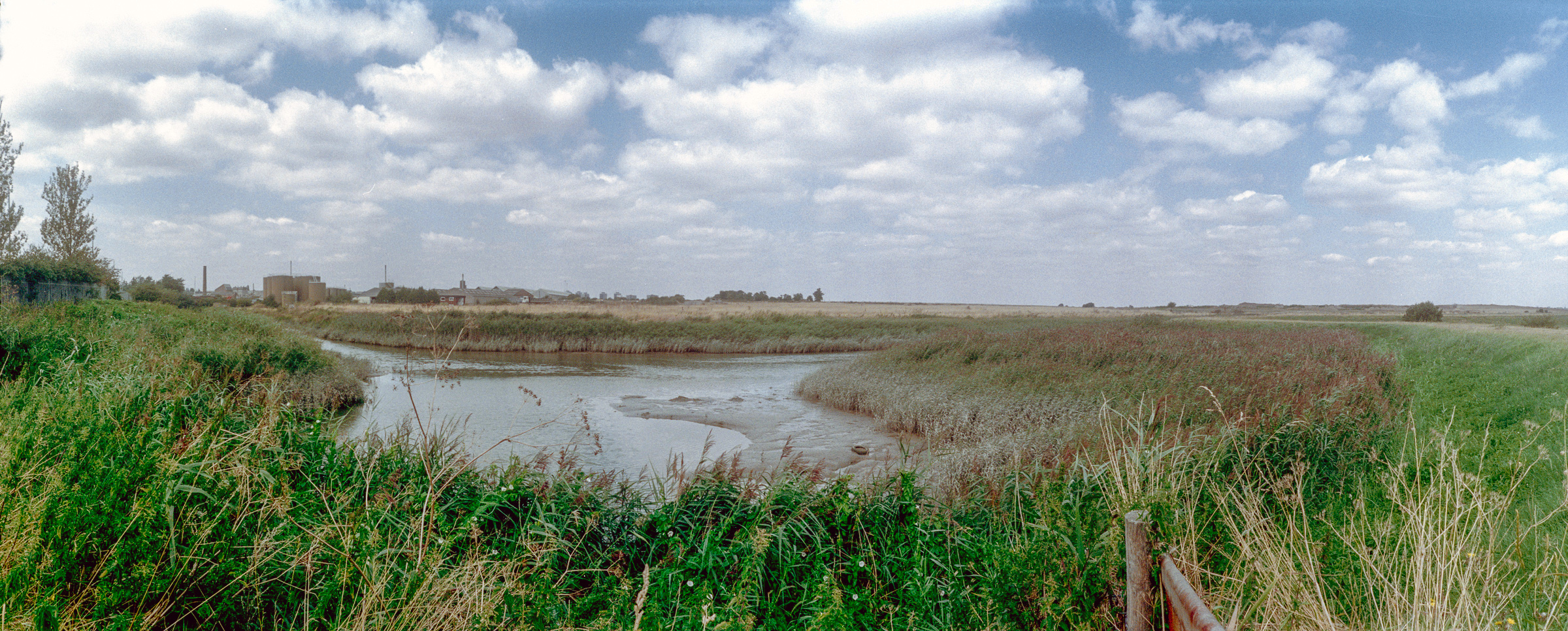
His work is very different to mine, but I found Sudek’s panoramic images of particular interest. As Tim Parkin states in a detailed account of his life in On Landscape magazine, it was “in 1948 that a major piece slotted into place for Sudek. Two friends gave him a panoramic camera, more specifically a Kodak No. 4 Panoram. This camera took 3:1 ratio film at 12” by 4” and used a sweep lens that covered almost 120 degrees.” It was for Sudek a new way of seeing the world, and it was one that appealed to me, and led to me spending more than I could really afford – around a month’s salary – on a rather smaller Japanese swing-lens camera which had a similar angle of view, though was rather easier to use and worked with much cheaper 35mm film, though giving a much wider vertical view.

Jaromír Funke (1986 – 1945) was a very different photographer, but the two of them became friends as members of a camera club when Sudek first came into photography. They both for different reasons had strong disagreements with the more established club members over photography and were thrown out so founded their own club. This too had some resonance with me and my own experiences when with Terry King, Derek Ridgers and some other friends we formed Framework – and which I wrote about here ten years ago in the post Punk London 1977.

Funke was ten years older than Sudek but a modernist, part of a movement that was exploring new ways with photographic images across much of Europe, with photographers including Man Ray in Paris, László Moholy-Nagy at the Bauhaus, Christian Schad, Alexander Rodchenko in Russia and others – often working without cameras. Geometry played an important part in their work, both in using unusual angles of view and in choosing subject matter, while Sudek’s work was more lyrical.

The show in the Bouda Gallery, at the Czech Centre London is a small one, but with fine works by both photographers. Sudek’s images in high quality pigment inkjet prints are superb, with great separation of the darker tones, truly luxurious, while Funke’s are more workmanlike, more concerned with ideas than the quality of their expression. It is part of a larger show, with some works on the street outside the embassy which didn’t particularly speak to me and others in the Vitrínka Gallery in Kensington Palace Gardens which I didn’t visit. But I did walk the length of Kensington Palace Gardens, a private street lined with embassies and other fine buildings, but unfortunately a street where photography is banned.

I won’t write much about the second show I visited. Nan Goldin’s The Ballad of Sexual Dependency is at Gagosian in Davies Street until March 21 and has already been widely covered. It is described as “an exhibition of all 126 photographs from Nan Goldin’s genre-defining photobook The Ballad of Sexual Dependency” and there are actually more than those 126 pictures on show. The ‘Ballad’ has had a number of different manifestations over its life, beginning as slide presentations with playlists in New York clubs and has also been made into a film. I wrote about it around 20 years ago in an article no longer on-line which perhaps I’ll one day search out and republish.

Having seen the Ballad in several formulations I found this perhaps the least interesting and impressive. Presented in 4 horizontal rows it was hard to see any real sequence and there are no captions. Of course the slide shows had no captions, but did have accompanying music – and contained many more images, I think over 700 in some cases.

But both in the slide shows and the book, the images come at you one – or two as slides fade into each other – at a time, and with captions in the book.) Perhaps this show would have pleased me more it it were laid out in a single line along a very long corridor or around the walls of a larger space. That top line was too high and that bottom line too low and made it impossible to get close enough to the work to concentrate on a single image. I went home and pulled that 1986 book (republished many times later) off my shelf, sat in a comfortable chair and enjoyed it much more.


FlickrFacebookMy London DiaryHull PhotosLea ValleyParis
London’s Industrial HeritageLondon Photos

All photographs on this page are copyright © Peter Marshall.
Contact me to buy prints or licence to reproduce.


Panoramas Around Albert & Victoria Docks – 1994

Panoramas Around Albert & Victoria Docks: More panoramas I made in July 1994 on and around the Beckton Extension of the DLR, getting off the train at each stop, taking a walk around and making a few pictures before boarding the train again

DLR, Roundabout, Royal Albert Way, West Beckton, Newham, 1994, 94-718-33

One of the few pictures I made with a deliberate tilt of the camera in order to get the whole circle of the roundabout in the image. As you can see this results in a curved horizon.

DLR, Albert Dock, West Beckton, Newham, 1994, 94-719-11

The DLR stations on the elevated line often provided a useful viewpoint. Along the horizon here at left you can see the church at Silvertown, then the Silvertown Flyover. Around the centre are the mills on Royal Victoria Dock, then the more distant Canary Wharf and past that the Grade II listed 1881 Connaught Tavern. At right is the Compressor House, built in 1914 as a cold store for the dock.

DLR, Albert Dock, West Beckton, Newham, 1994, 94-721-22

A view through the front window of a DLR train which shows the Compressor House next to the Royal Albert Dock Station and the long stretch of the Royal Albert Dock. At the left are the houses of West Beckton. At right is London City Airport with a couple of planes.

DLR, Connaught Crossing,  Custom House, Newham, 1994, 94-721-42
DLR, Connaught Crossing, Custom House, Newham, 1994, 94-721-42

A view from the side of the train as it goes across Connaught Road looking over the recently built cable stayed swing bridge with reinforced concrete approach viaducts, opened around 1990. It replaced an earlier swing bridge built in 1904 to carry both the road and the North Woolwich Railway across the Connaught Passage between the Royal Victoria and Royal Albert Docks. The small octagonal building to the left of the bridge pumps water from the Connaught Tunnel, originally by hydraulic pumps but now by electric pumps. This was replaced by a larger circular structure when the tunnel was rebuilt for the Crossrail.

DLR, Victoria Dock Rd, Canning Town, Newham, 1994, 94-718-53

The DLR line runs beside Victoria Dock Road and this picture was made from Custom House Station and shows the junction with Freemasons Rd. Further along Victoria Dock Road you can see The Missions to Seaman Institute, Flying Angel House, built in red-brick Art Deco style in 1936. It closed in 1973 and after being used for some time as a college was converted into flats.

Royal Victoria Dock, Canning Town, Newham, 1994, 94-718-41

The western end of Royal Victoria Dock which closed in 1981. This picture was taken roughlky from where the cable car ride now has its northern terminal. The dockside sheds have been replaced by tall waterside blocks – around 17 storeys. There are still some of the old cranes on the quayside.

More panoramas from 1994 to follow.


FlickrFacebookMy London DiaryHull PhotosLea ValleyParis
London’s Industrial HeritageLondon Photos

All photographs on this page are copyright © Peter Marshall.
Contact me to buy prints or licence to reproduce.


More From Beckton, Cyprus and Silvertown – 1994

I spent a long day in July 1994 travelling up and down the recently opened Beckton Extension, taking some pictures from the trains but also getting off at every station and explouring the area around the stations, sometimes at some length. The previous set of pictures, DLR – Beckton Extension – 1994, began from around the end of the line at Beckton, and these images start with those from a walk from the next station along, Gallions Reach.

In the 2000s there was a plan to extend the DLR from here to Dagenham Dock, but these were cancelled in 2008; now plans have been approved for an extension to a Beckton Riverside station and on under the Thames to Thamesmead.

DLR, Roundabout, Woolwich Manor Way, Cyprus, Newham, 1994, 94-716-13
DLR, Gallions Roundabout, Woolwich Manor Way, Cyprus, Newham, 1994, 94-716-13

From the Gallions roundabout you can go north and south along Woolwich Manor Way or take the more recent roads, Royal Albert Way, Royal Docks Road and Atlantis Avenue. My picture was made from Woolwich Manor Way looking roughly north. In the centre of the roundabout is a pumping station, which I think is a 16-sided building, though I always lose count. On top in its centre is a small 8 sided pimple. Locally listed, it was built for Thames Water in 1974.

Ruins, Beckton Gas Works, Beckton, Newham, 1994, 94-717-61

Beckton Gas Works were built on the East Ham Levels from 1868-1870 by the Gas Light and Coke Company which had been founded in 1812 by Frederick Albert Winsor and was not only the UK’s first gas company but the first public gas company in the world. It was for some years the largest gas works in Europe and until 1969 produced gas for industry and homes across much of East London.

The site was named Beckton after then company chairman Simon Adams Beck and covered a huge of 550 acres. As well as giving room for the huge works, its site on the Thames well to the east of London meant that larger colliers could bring coal to it than to the gas works closer to the city.

As well as town gas, the site also contained the Beckton Product Works which became the largest UK manufacture of tar and ammonia by-products. Beckton was a huge local employer, providing jobs for as many as 10,000 men.

For many years after it closure the site remained derelict and was used in a number of films, most notably Stanley Kubrick’s Vietnam War film ‘Full Metal Jacket’. Back in 1994 there was little left on the site which is now largely a retail park.

I’d taken a few pictures in the area in black and white and colour ten years earlier when more of the works where still there – such as this one:

Beckton Gas Works, Beckton, Newham, 1984 81-NorthWoolwich-008
Beckton Gas Works, Beckton, Newham, 1984

[If you open the image you can browse a few more on Flickr.]

Royal Docks Rd, Galions Reach, Newham, 1994, 94-717-52
Atlantis Avenue, Gallions Reach, Newham, 1994, 94-717-52

A view made from underneath Gallions Reach Station looking roughly north-east towards the former gas works site.

DLR, Approaching Woolwich Manor Way, Cyprus, Newham, 1994, 94-717-43
View from Gallions Reach DLR, Station, Atlantis Avenue, Gallions Reach, Newham, 1994, 94-717-43

I went up to the station platform and made this picture as I waited for a train to arrive. At right you can see the Thames Water pumping station in the middle of the Gallions roundabout. On the left others waiting on the platform can be seen in a mirror. Beyond that is the Royal Albert Dock and in the distance the hills on the other side of the Thames. In the sky is a plane shortly after take-off from London City Airport.

DLR Station, Beckton Park, Beckton, Newham, 1994, 94-717-31
Beckton Park Station, DLR, Beckton, Newham, 1994, 94-717-31

I can’t remember if I got off the train first at Cyprus station or continued directly to the next stop, Beckton Park. The two stations are fairly similar and both are in the centre of roundabouts in the Royal Albert Way, built for the LDDC and opened in 1990.

DLR, Royal Albert Dock, West Beckton, Newham, 1994, 94-717-11

I got back on a train to go to the next stop on the line, Royal Albert, where I took a walk around the area beside Royal Albert Dock dock, making this picture from its west end looking east down the dock. In the distance is a DLR train approaching and to the left is the road leading the the Connaught Bridge. I think the brick structure at left of picture is a ventilator for the railway tunnel below.

Connaught Bridge, Royal Albert Dock, West Beckton, Newham, 1994, 94-717-12
Connaught Bridge, Royal Albert Dock, Silvertown, Newham, 1994, 94-717-12

I made this from a temporary footpath across the channel between the Royal Victoria and Royal Albert Docks a few yards to the west of the Connaught Bridge. Under the bridge is the full 1.75 miles of the Royal Albert Dock, built in 1875-80 and opened by the Duke of Connaught. The dock finally closed to commercial traffic in 1981.

In 1984 I got permission to go onto the site and photograph the remaining buildings – virtually all now demolished. They had no great architectural value but were an important part of London’s history. You can see some of the black and white pictures I took in the book The Deserted Royals – there is a good preview with over 40 pictures on the website and the PDF version is reasonably priced – and rather more, including colour work on Flickr – in the two albums 1984 London Photographs and 1984 Docklands Colour.

More Docklands colour from 1994 in my next post in this series.


FlickrFacebookMy London DiaryHull PhotosLea ValleyParis
London’s Industrial HeritageLondon Photos

All photographs on this page are copyright © Peter Marshall.
Contact me to buy prints or licence to reproduce.


DLR – Beckton Extension – 1994

DLR – Beckton Extension: One of the earliest projects I had used a panoramic camera on was the building of the Docklands Light Railway Beckton extension which had been a part of a transport show at the Museum of London in 1992. I had made these pictures on black and white film – you can view these along with many other pictures in my Flickr album ‘1992 London Photos

DLR, Train, Station, Beckton, Newham, 1994, 94-715-11

So when the Beckton branch from Poplar opened at the end of March 1994 I made a note to myself to return there and make more panoramas along the completed route, but this time working in colour. But I was busy with other things and it was only in July 1994 that I finally managed to go and take some new pictures.

Station Entrance, DLR, Beckton, Newham, 1994, 94-715-13

I began by taking a DLR train to the end of the line, Beckton Station, and then walked out to make a few pictures in the area surrounding the station.

Horses, sculpture, Brian Yale, Beckton Bus Station, Woolwich Manor Way, Beckton, Newham, 1994, 94-716-62

I’d first visited Beckton in 1981, and had gone back briefly when I was working on the DLR construction in 1982, but by 1994 things were very different to my first visit. Then Beckton was still a largely uninhabited area, noted for its gas works – then mainly in ruins and for being at the end oof London’s Northern Outfall sewer.

Station Entrance, DLR, Beckton, Newham, 1994, 94-716-51

There had also been a large postwar prefab estate, but that had been swept away and plans to build large council estates to help solve Newham’s huge housing problems were swept away with the advent of the London Docklands Development Corporation, who sold off most of the land for private housing. The LDDC also commissioned the Horses sculpture by Brian Yale, who had worked for many years as an artist and environmental designer for the architecture department of the Greater London Council, creating “designing murals, sculptures, public art works and play spaces for GLC housing estates and schools“. He was also commisioned by them to produce the long 50 panel The Docklands Frieze at Prince Regent Station.

Robert, Steam Engine, Winsor Terrace, Beckton, Newham, 1994, 94-716-32

Robert, a 0-6-0 tank engine was built in 1933 for the Staveley Coal and Iron works and worked in their sidings until 1969. It then went to various preserved railway sites, at one of which it gained its name. Kew Bridge Steam Museum in 1993 restored it to look like a Beckton Gas Works engine (presumably for the LDDC) and it was placed here. After some vandalism Newham Council took Robert over and moved it close to Stratford Station. The engine was again moved during building works assocatied with the 2012 Olympics and finally came back to a different location outside Stratford Station in 2011. It was still there when I last went to Stratford a few weeks ago.

Beckton, Newham, 1994, 94-716-43

I took a long walk around Beckton, and made quite a few normal format images in black and white, but relatively few colour panoramas, mainly close to the station, then walked rather futher around the area making more panoramas, only relatively few of them on-line at Flickr – two of those in this post are online for the first time including ‘Link Road, Beckton’ below.

Link Road, Beckton, Newham, 1994, 94-716-11

I this was part of one of the ring road schemes around London that was never built, Ringway 2, which was planned go under the River Thames at Gallions Reach in a new tunnel between Beckton and Thamesmead. When I made this picture it simply came to a dead end not far on.

More panoramic pictures from around the DLR Beckton branch in a later post.


FlickrFacebookMy London DiaryHull PhotosLea ValleyParis
London’s Industrial HeritageLondon Photos

All photographs on this page are copyright © Peter Marshall.
Contact me to buy prints or licence to reproduce.


More City of London Panoramas – 1994

More City of London Panoramas: This is the final set of picturesI’ll post from those I made while working on a personal project on the City of London in July 1994. Of course I took many which I’ve not digitised, spending several days walking the City and making over 300 exposures. The camera I used makes negatives on standard 35mm film which are wider than normal and a ’36 exposure’ film only gets around 20 or 21 panoramic frames. Film loading is also trickier as the film has to go around a curve.

Each exposure took a few minutes to select a viewpoint, set up my tripod, level the camera, use a handheld lightmeter to check exposure and finally press the cable release. Most of those not uploaded are similar to those I have posted with just minor changes to the view.

London Bridge Walk, Tooley St, Borough High St, Southwark, 1994, 94-711-52

Not quite in the City, but made as I made my way from London Bridge Station to London Bridge along London Bridge Walk. The road in the background is Borough High Street which leads on to London Bridge and the City boundary is in the middle of the river. You can just see the pinnacles on the top of the tower of Southwark Cathedral.

After the operation of the Waterloo & City underground line from Network South East to London Underground in April 1994 I could no longer use my ‘London Terminals’ ticket on this route, and my cheapest journey became to go to London Bridge on this and walk across to the City.

This is one of a few pictures I had digitised but missed when I was uploading these images to Flickr.

High Walk, Wood St, City, 1994, 94-713-42

Another exposure from the highwalk at Wood Street, leading south along the east side of the street away from London Wall. In the centre of the picture is the City of London Police Headquarters, with two white police vans at bottom right. Steps lead down from the walkway to Wood Street but the highwalk also continued straight on at extreme left – though with more steps.

In the centre of Wood Street at right is the tower of St Alban Wood Street. The medieval church was destroyed in the Great Fire and rebuilt by Sir Christopher Wren. The church was largely destroyed in the Blitz in 1940. The tower remained and was Grade II* listed in 1950 and is now a private house; the remains of the rest of the church were demolished in 1965.

Lower Thames St, King William St, City, 1994, 94-711-12

Again on my way from London Bridge Station to the centre of the City, this is made from where London Bridge joins to King William Street and goes across Lower Thames Street. You can see a highwalk bridge going across Lower Thames street a couple of hundred yards to the east, still there in 2025.

Until around 1970 Thames Street was a fairly narrow street, just wide enough to allow a single lane of traffic in both directions. It was then turned into a major road and divided at London Bridge into Lower and Upper Thames Street. At the left you can clearly see where older buildings were cut through to widen the road.

Bank Junction, City, 1994, 94-712-33

The heart of the City. I made the picture close to the corner of Mansion House Street and Princes Street with the Underground entrance on the corner. At left is a corner of the Bank of England and the main modern building towering above it is the Stock Exchange Tower, home to the Stock Exchange until 2004.

Towards the centre is the Royal Exchange, I think then still home to the International Financial Futures Exchange rather than just an upmarket shopping mall. Two buildings full of banks and insurance companies book-end Hawksmoor’s St Mary Woolnuth and at the extreme right is the edge of the Mansion House with a gilded lamp on its steps.

Milton Court, Silk Street, City, 1994, 94-713-21

Another section of highwalks ran from close to Moorgate Station to the Barbican Estate and these last four pictures show sections of this, which could also be accessed from Ropemaker Street. This northern section has now been lost.

Milton Court was designed by Chamberlin, Powell & Bon and built as a part of the Barbican development in 1959 for various City services – “a fire station, Coroner’s Court, mortuary, office of weights and measures and a civil defence school.”

It was arguably London’s most outstanding single post-war building and English Heritage wanted to list it in 2001, but the government’s Department of Culture, Media and Sport objected and in 2007 Secretary of State James Purnell granted it immunity from listing. In a sad act of cultural vandalism this remarkable building was demolished in 2008.

Milton Court, Silk Street, City, 1994, 94-713-12

The building which replaced Milton Court was also given the same name but is a much more bland modern structure. The bridge which linked to the northern section of highwalk disappeared.

The new 115m tall Milton Court is described on its builders Sir Robert McAlpine web site: “Climbing to 36 storeys, Milton Court redefines luxury living in the Square Mile. In addition to a graceful residential tower, the development is home to a spectacular new annexe to the Guildhall School of Music & Drama.” But to me it looks like just another tall city office block.

Highwalk, Ropemaker St, City, 1994, 94-715-52

This enclosed section of highwalk ran from Ropemaker Street to the bridge across Silk Street to the Speed Highwalk still there along the north side of Speed House.

Ropemaker St, Islington, City, 1994, 94-715-32

Remarkably I think none of the buildings in this picture looking east along Ropemaker Street has ssurvived. Even the building at left, Ropemaker Place, a 60m high block which I photographed while it was being built in 1986 and was completed in 1987 and which I thought was one of the more attractive modern buildings in (or rather a few feet outside) didn’t last long and was demolished only 18 years later in 2005.

More colour from 1994 in later posts.


FlickrFacebookMy London DiaryHull PhotosLea ValleyParis
London’s Industrial HeritageLondon Photos

All photographs on this page are copyright © Peter Marshall.
Contact me to buy prints or licence to reproduce.


Around the Highwalks – Wood Street 1994

Around the Highwalks – Wood Street: London’s ambitious series of ‘highwalks’, aimed at separating movement on foot from traffic began after World War 2 when the City began to rebuild after extensive war damage – a process that really sprung into action on a large scale in the 1950s.

Highwalk, Wood St, City, 1994, 94-708-21

As Wikipedia states, “In 1947 architect Charles Holden and planner William Holford” had put forward a blueprint for “a network of first-floor walkways that would connect buildings across the City.”

Wood St, Escalator, London Wall, City, 1994, 94-709-12, 1994, 94-709-31
Wood St, Escalator, London Wall, City, 1994, 94-709-31

The City of London Pedway Scheme was later adopted by the City of London Corporation and to get planning permission by the 1960s all new developments were required to include first floor access to walkways. It worked where there had large areas destroyed by bombing – such as the Barbican, but elsewhere these walkways were often dead ends leading nowhere.

Wood St, Escalator, London Wall, City, 1994, 94-709-12

Although London had suffered greatly from the bombing, much survived – and many damaged buildings had been restored in the immediate aftermath of the war. Although some of the city’s older buildings were demolished there was an increasing recognition of the value of many of them. The 1944 Town and Country Planning Act had given the government power to create a statutory list of buildings of special architectural interest – and those powers were increased in the 1947 Act.

Green Cuisine, Highwalk, Wood St, London Wall Citry, 1994, 94-709-21

Listing of buildings began seriously after this, and many buildings in the City gained some protection from demolition – and a resurvey in 1968 began to add more to the lists. It became increasingly clear that the Pedway scheme would never be able to produce a really coherent scheme over most of the City and by the mid-1980s it was effectively discontinued.

Highwalk, St Alphage Highwalk, London Wall, City, 1994, 94-710-22

Since then some parts of the walkway system have been lost, while some areas still remain. Around London Wall while some parts of it were closed. The part of the St Alphage Highwalk in these pictures had been demolished but it was partly replaced by a new section during redevelopment around 2017.

Highwalk, St Alphage Highwalk, London Wall, City, 1994, 94-710-12

Another problems with the Pedway is that London’s transport systems – buses and Underground largely leave passengers at street level. Getting to the highwalks generally requires going up steps and most people would prefer to simply continue to their destination at street level.

Highwalk, St Alphage Highwalk, London Wall, City, 1994
Highwalk, St Alphage Highwalk, London Wall, City, 1994, 94-710-11

For those with disabilities which make steps difficult or impossible this is a real barrier. There were very few places where escalators were provided to ease the problems as these were expensive.

More panoramic images from the City Highwalks in a later post.


FlickrFacebookMy London DiaryHull PhotosLea ValleyParis
London’s Industrial HeritageLondon Photos

All photographs on this page are copyright © Peter Marshall.
Contact me to buy prints or licence to reproduce.


More City Panoramas – 1994

More City Panoramas: I spent several days wandering around the City of London – the “Square Mile” in July and August 1994, I think in prepaation for a group show in which I had decided this would be my contribution.

More City Panoramas - 1994
Bubbs, Restaurant Francais, Farringdon Rd, West Smithfield, City, 1994, 94-702-43

Bubb’s Le Restaurant Francais with the address Central Market, Farringdon Street is long closed, but a listing states that they served “a variety of traditional French dishes at their restaurant and can cater for private parties of up to 30 guests upon request.” There are still several French restaurants in the area.

A little further down West Smithfield was the London Central Market with on the corner a wholesale Cash and Carry and Harry’s Drinks and in the distance a covered way across the road between market buildings.

I photographed this corner on several occasions, making a similar panorama here in 1992, perhaps why I have not put this on Flickr.

More City Panoramas - 1994
River Thames, Thames Path, Vintners Hall, Paul’s Walk, City, 1994, 94-703-52

Looking west along the river to Bull Wharf, Queenhithe and beyond. Bull Wharf proudly states it was REBUILT 1980 and it looks to me exceedingly ugly, probably why I didn’t upload this picture to Flickr. My picture perhaps makes the red brickwork event more virulent – the building looks much better to me in a black and white non-panoramic image I made at the same time from more or less the same spot.

Car Park, Smithfield St, City, 1994, 94-704-51

Slightly out of focus in the distance I can just make out Lady Justice on the roof of the Old Bailey and to her right more clearly the tower of Holy Sepulchre Church at the east end of Holborn Viaduct.

I think this car park probably extended to Hosier Lane and is now filled with the shops and offices of 12 Smithfield Street, built in 2004 and now described on Buildington as “an outdated office block that has suffered from poor environmental performance, limited architectural merit, and inefficient servicing. Its ground floor lacks engagement with the surrounding public realm, and its dated façade no longer reflects the character of the conservation area” and being refurbished and extended.

St Mary Somerset Church, Upper Thames St, City , 1994, 94-704-13

A rather dark rendering of this high contrast scene with deep shadow the block of St Paul’s Vista (or 1 High Timber St, now One Millennium Bridge) straddles Upper Thames Street with the bright sky above. My picture was made from the footbridge of Fye Foot Lane carrying a section of the CIty’s Highwalk across Upper Thames Street and Castle Baynard Street and on to Queen Victoria Street.

St Mary Somerset Church was one of those destroyed in the Great Fire of London in 1666 and like 50 others rebuilt by the office of Sir Christopher Wren. The tower remains between Lambeth Hill and Castle Baynard Street but the rest of the church was demolished in 1871 when like other redundant churches the land was sold to build churches in the rapidly expanding suburbs of London. The tower was a Ladies toilet before the Second World War, Damaged by bombing, it was restored by the city in 1956 and has now been converted into a private residence.

More City Panoramas - 1994
Highwalk, Footbridge, Huggin Hill, Upper Thames St, City, 1994, 94-705-41

A fruit and vegetable stall on the pavement in Front of St Mary Aldermary (another rebuilt by Wren after the Great Fire) on busy Queen Victoria Street which you can see at extreme left. I think the extremely low stone wall on the pavement and the railings mark the former edge of its churchyard.

I liked the range of architectural age and style across the upper half of this image, and particularly admired the ornate Victorian block in the centre of the picture. As well as a bus and a coach there are 5 London taxis in the picture, an aspect of London’s traffic congestion long overdue for reform.

Highwalk, Footbridge, Queen Victoria St, City, 1994, 94-705-31
Highwalk, Footbridge, Huggin Hill, Upper Thames St, City, 1994, 94-705-31

This was taken from a now-closed section of Highwalk across Upper Thames Street and the church at left is St Mary Somerset. The alley at right is Huggin Hill with a view of the distinctive building on the block between Queen Victoria St, Bread Lane and Cannon Street, 30 Cannon St built for Crédit Lyonnais between 1974 and 1977.

Highwalk, London Wall, City, 1994, 94-706-51

So many buildings have changed around here since 1994. The building right of centre is Standard Chartered on the corner of Aldermanbury and Aldermanbury Square and was remodelled around 2010 and the building left of centre is Brewer’s Hall, now with a roof extension. I think this section of the highwalk led up at Brewers Hall Gardens

More from July 1994 in the City later.


FlickrFacebookMy London DiaryHull PhotosLea ValleyParis
London’s Industrial HeritageLondon Photos

All photographs on this page are copyright © Peter Marshall.
Contact me to buy prints or licence to reproduce.