Posts Tagged ‘industry’

Harlesden, Willesden, Mary Seacole & a Wassail

Friday, February 2nd, 2024

Harlesden, Willesden, Mary Seacole & a Wassail: Sunday 2nd February 2014, ten years ago today was a pleasant winter day, not too cold and with some sunshine and light clouds, perfect for panoramas, so I went early to have a walk around the area before going on to photograph the wassail in Willesden Green.


Harlesden, Willesden & Mary Seacole

Harlesden, Willesden, Mary Seacole & a Wassail

It was long ago on one of the dirtiest trains imaginable, windows think with dust so I could hardly see outside that I first came to Willesden Junction Station from Richmond on the North London Line which ran to the City and Broad Street Station. Upgraded to run to North Woolwich in the 80s with new rolling stock the line became a key way for me to travel to photograph around north London. Nowadays the line is part of London’s Overground, since 2016 run by Arriva Rail London, a part of Deutsche Bahn and rather cleaner, with trains running to Stratford.

Harlesden, Willesden, Mary Seacole & a Wassail

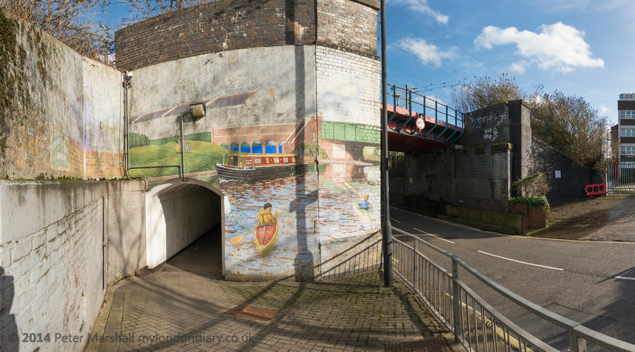
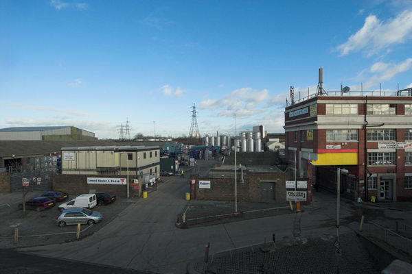
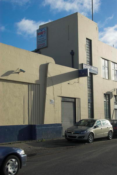
Willesden Junction, which links with the Bakerloo line and another Overground service from Euston to Watford Junction is not in Willesden but in Harlesden and has platforms at two levels, and also has mainline trains rushing past without stopping. Apparently, according to Wikipedia, in earlier years it was was nicknamed “Bewildering Junction” or “The Wilderness” because it contained such a maze of entrances, passages and platforms and it is still rather like that.

Harlesden, Willesden, Mary Seacole & a Wassail

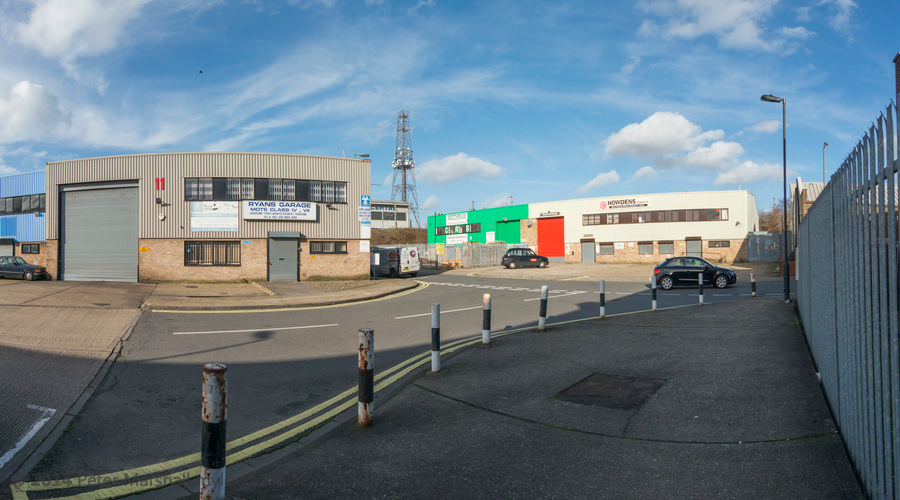
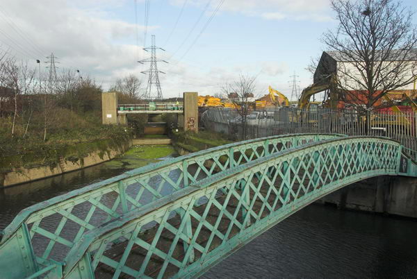
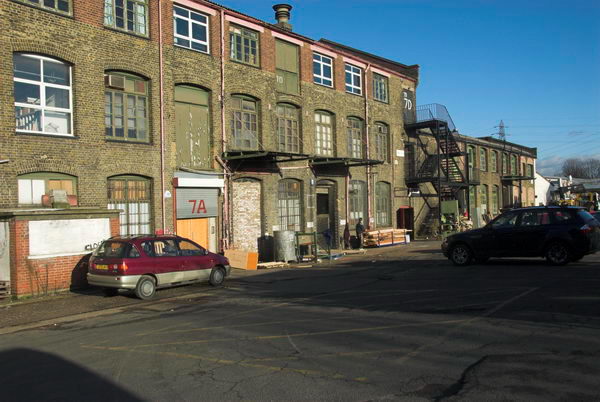
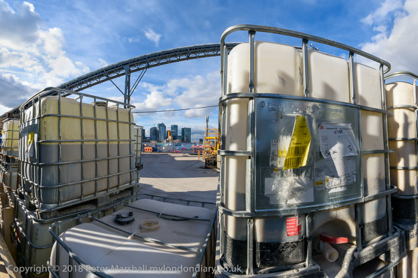
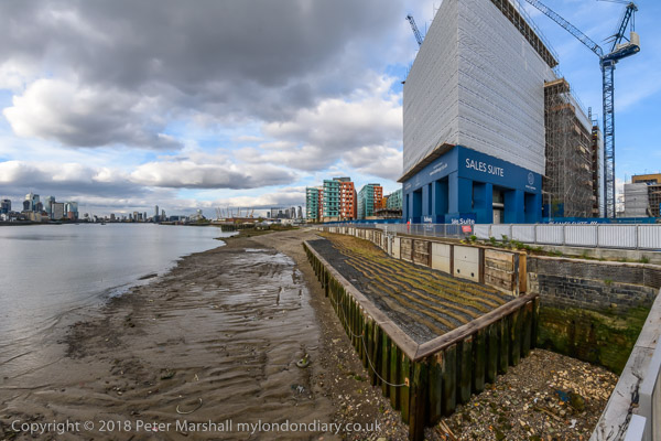
If you can find it, a footpath leads over the mainline tracks next to the line from Richmond and Clapham Junction through an industrial wasteland and eventually to Hythe Road. Google Maps even dignifies it with a name, Salter Street Alleyway. Turning left at into Hythe Road takes you to Scrubs Lane, but going right can take you to the Grand Union Canal, with a bridge leading across to the tow path. I did both.

Harlesden, Willesden, Mary Seacole & a Wassail

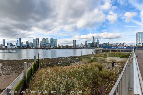
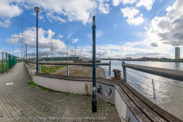
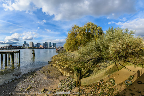
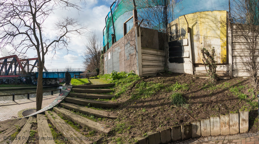
The blue sky with clouds was perfect weather for panoramas, and I took a number going back and forth a little in the area, across the Scrubs Lane bridge and back. At the corner of this bridge is a memorial garden to Mary Seacole (1805-81) who nursed many British soldiers in the Crimean War as well as working in her native Jamaica and Panama and Cuba, funding her medical work from the proceeds of her general store and boarding house in Jamaica. The garden, on the canal bank next to Mitre bridge, on Scrubs Lane, not far from where she was buried in St Mary’s Catholic cemetery, Kensal Green, was begun in 2003, shortly before the 2005 bi-centenary celebration of her birth.

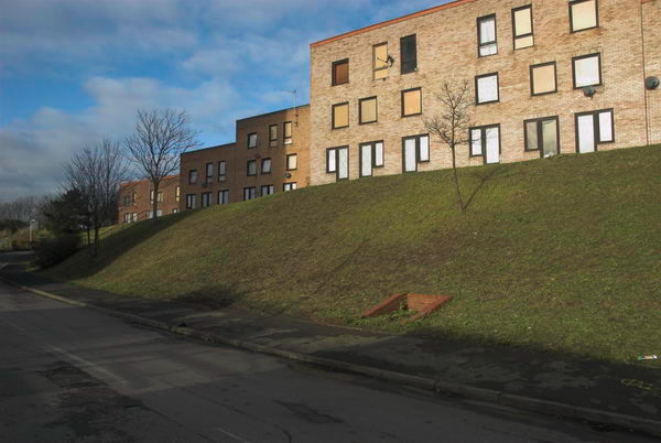
The garden, now rather overshadowed by a new development, was a pleasant place to sit in the sun and eat my sandwiches before making my way to Willesden Green for the Wassail. Pictures from the walk start here on My London Diary and include more panoramas as well as other pictures.


Willesden Wassail – Willesden Green

This was the fifth Urban Wassail in Willesden High Street organised by Rachel Rose Reid to celebrate local shopkeepers who give Willesden Green its character and help to create a vibrant community.

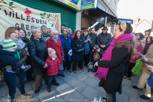
The wassail is described as a “small free festival run by and for people from Willesden Green” and also celebrates the work of all who live there and create the neighbourhood and brought together artists and volunteers from the area including James Mcdonald, Berakah Multi Faith Choir, Poetcurious, Errol Mcglashan and several others, with more performing later after the wassail.

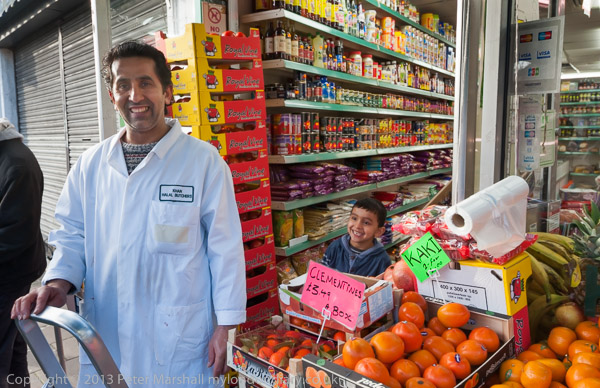
The group met at Willesden Green Station, though unfortunately this was closed for engineering works on the day. Here there was a performance from ParkLife singers, a local community choir run as a not-for-profit co-operatvie and led by Charlotte Eaton, before Rachel Rose Reid introduced us to the first shopkeeper who told us a little abor her shop, Daisychain Florist, with all of the 70 or so people present repeating her words in Occupy ‘mike-check’ style.

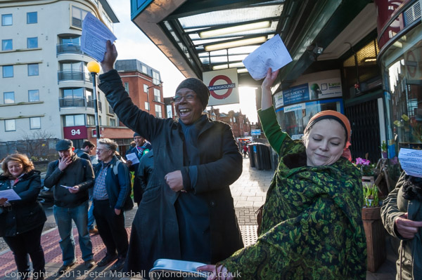
Then everyone sang a Wassail Song, borrowed from the Carhampton Wassail, with the shop name in place of its “Old Apple Tree”. You can read this on My London Diary.

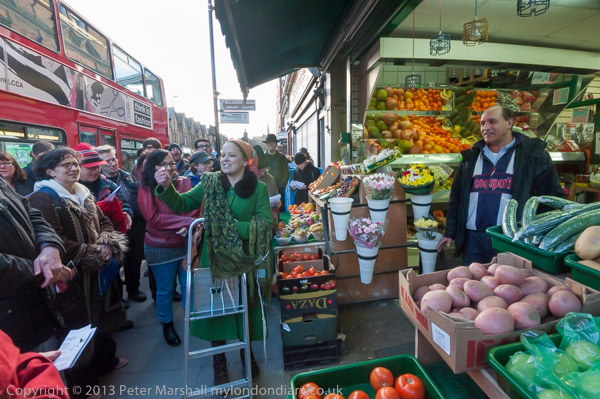
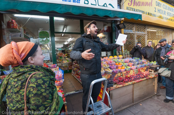
The same pattern was repeated at a number of shops along the High Stret including Hamada supermarket, Khan Halal Butchers, Pound.com, Corner Barber Shop, Red Pig, Fornetti, Mezzoroma and Buy Wise.

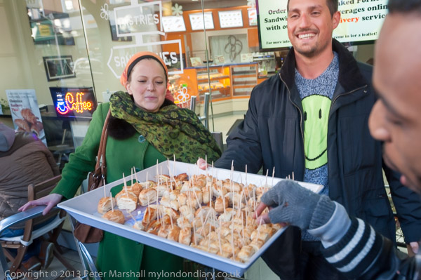
There were other stops on the route for poetry and songs, including one in the yard at the front of Sainsbury’s, one of relatively few chains in the area.

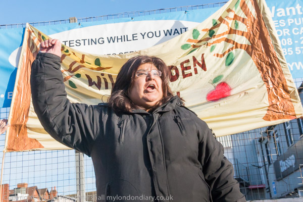
Here we were also told about the campaign to save the Queensbury Pub on Walm Lane from demolition, with a petition of over 4,000 signatures to Brent Council against the demolition of this ‘Asset of Community Value’ and its replacement by a 10 storey block of flats. The pub had been open since 1895 but was bought by developer Fairview New Homes (North London) Ltd in 2012. Brent turned down the development, but the developer, now called Redbourne (Queensbury) Ltd put forward new plans in 2018. Again these were refused by the council but the developer’s appeal succeeded. The pub vlosed in 2022-3 and was demolished in October 2023 to build 48 flats. The development is supposed to include a new pub.

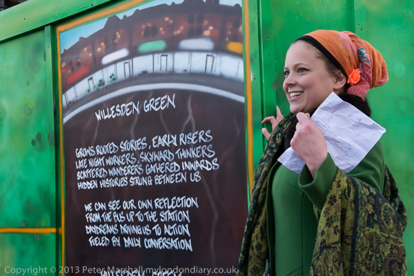
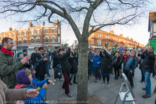
The Wassail ended with a number of poetry performances opposite the Willesden Green Library building site, after which we moved to the neighbouring cherry tree for a final wassail after which everyone let off the party poppers and decorated the tree with ribbons. It was slightly less noisy version of the traditional banging pans and firing guns in order to wake up the apple trees.

The wassailers then moved to the Bar Gallery in Queens Parade on the corner of Walm Lane, where refreshments were available and there were to be more performances. I went along but then realised it was time for me to start my journey home and left.

More pictures on My London Diary at Willesden Wassail.


FlickrFacebookMy London DiaryHull PhotosLea ValleyParis
London’s Industrial HeritageLondon Photos

All photographs on this page are copyright © Peter Marshall.
Contact me to buy prints or licence to reproduce.


An Olympic Bike Ride

Tuesday, January 4th, 2022

Businesses later demolished at the heart of the site for London’s 2012 Olympics

An Olympic Bike Ride: At the end of 2002 I finally bought a Brompton, a rather expensive folding bicycle which then cost me around £600. Perhaps not a lot for a new bike then and certainly not now, but rather more than the £13-7s6d or so the other bike I was still riding had cost in 1958.

Clays Lane Housing Co-operative – demolished for the Olympics

I’d been thinking about it for years, and it would certainly have been very useful for the work that I’d been doing around outer London in the previous decade, but I’ve only used it infrequently for my photography.

Eastway Cycle Circuit – lost to the Olympics

Though it’s a great way to get to places, taking it by train or underground and riding from a convenient station, Bromptons are a powerful magnet for bike thieves, so easy to put in a car boot or van, and selling at a relatively high price. It isn’t safe to lock them anywhere in public view when even the best cycle lock can only detain the well-equipped thief for around 30 seconds.

Bully Fen Wood – Community Woodland lost to the Olympics

So rather than using it for my general photography – mainly of protests and other events – I’ve used it for cycle rides on which I’ve taken photographs, both around where I live – it’s easier to jump on and off than my full-size bike – and in and around London.

Factory on Waterden Road – demolished for the Olympics

Thursday 4th January 2007 was a nice winter’s day, not too cold and blue skies with just a few clouds, and I went with the Brompton to Waterloo and then on the Jubilee Line to Stratford. Preparations had begun for the 2012 London Olympics and I wanted to see and photograph what I could of the changes that were taking place.

The footbridge has been kept in the new Olympic Park

My account of the day on My London Diary begins with my tongue-in-cheek suggestion that it would have been much preferable on environmental ground to shut down Heathrow and use that as the Olympic site, but goes on to describe a conversation I had with one of the residents at Clays Lane, then about to be demolished (spelling etc corrected.)

‘he talked of living in a fascist state, with lack of consultation and individual powerlessness, and of the games as having always had a militaristic overtone. hardly surprising there is little support for the games here, as initial promises that people from the Clays Lane Housing Co-operative would be rehoused in conditions “as good as, if not better than” their present estate were soon changed to “at least as good as in so far as is reasonably practicable.”‘

My London Diary

Work on the site seen from the Greenway

From Clays Lane I moved to the Eastway Cycle Track, already closed and fenced off – I decided against going through a gap in the fence to ride around it. The Community Woodland at Bully Fen Wood was also already closed. and I cycled on around the roads at the north of the site to Hackney Wick.

Pudding Mill River and Marshgate Lane – all now gone

Along Waterden Road I photographed some of the other industrial sites that were to be lost to the games, then turned along Carpenters Road and into Marshgate Lane, all soon to be fenced off and everthing on them destroyed. After taking pictures around Marshgate Lane I went back and into Hackney Wick, photographing the Kings Yard workshops on Carpenters Road soon to be demolished on my way.

Kings Yard – demolished for the Olympics

Hackney Wick to the west of the Lea Navigation is largely outside the Olympic compulsory purchase area, but some large areas of industry were scheduled for demolition and I took more pictures. I found the towpath here beside the navigation still open and rode down it to Stratford High Street, where more industry to the north of the road is also going.

Canary Wharf from Stratford Marsh

I spent some time going up the roads and paths here going from the High Street into Stratford Marsh which were still open, then went east along the top of the outfall sewer past areas also covered by the Olympic CPO.

St Thomas Creek, Bow Back Rivers – factories at left and right to be demolished

There was still a little light and I came down from the ‘Greenway’ and cycled down to Bow Creek from West Ham, going down the path on the west side of the creek to the Lower Lea Crossing. I wanted a picture showing the Pura Foods site then being demolished, but also made a number of other twilight pictures from this elevated viewpoint, and also some from the Silvertown Way viaduct as I made my way to Canning Town Station for the train home.

Pura Foods being demolished for London City Island development

Many more pictures from this ride on My London Diary, starting a little way down the January 2007 page.


Marshgate Lane

Friday, January 15th, 2021

Marshgate Lane, Stratford Marsh, Stratford, Newham, 1990 90-9h-53_2400-2
Marshgate Lane from Northern Outfall Sewer, 1990

Marshgate Lane runs through the centre of Stratford Mash and what became the London 2012 Olympic site. It’s southern end was a short distance north of the bridge over St Thomas’s Creek on Pudding Mill Lane, and it ran parallel and a few yards to the east of Pudding Mill Lane, which rejoined it just south of the Northern Outfall Sewer. Marshgate Lane then continued in its northerly route past Knobs Hill to run beside the Old River Lee and across both the City Mill River and the Waterworks River to Carpenters Road.

City Mill River, Marshgate Lane, from Greenway, Northern Outfall Sewer, Stratford Marsh, Newham, 1983 33x-32_2400
Industry between Marshgate Lane and the City Mill River, 1983

It’s southern area still follows the same route, though it now starts at Stratford High St, which was previously Pudding Mill Lane, and north of the sewage outfall its route is completely different. But what was back in the 1980s a street lined for much of its route with industrial premises is now a wasteland with some athletic facilities, parts of which will shortly be covered with tall blocks.

Marshgate Lane, Stratford Marsh, Stratford, Newham, 199090-9g22_2400
Maryland Plastics, St Thomas’s Creek, Pudding Mill Lane, 1983

As well as the Olympic devastation, Crossrail has also played havoc with the southern area. An earlier addition with little disruption was the Docklands Light Railway, extended to Stratford for the Olympics and opened to the public in 2011 with a station on Pudding Mill Lane, which gives considerably more convenient access to the area.

Marshgate Lane, Stratford Marsh, Stratford, Newham, 1990 90-9g24_2400
Marshgate Lane, 1990

It isn’t always easy to decide now exactly where I took some of these pictures as I wandered freely around the area, both on the streets, on the Greenway and other footpaths and through some small areas of waste land. So some pictures captioned as Marshgate Lane may actually be on Pudding Mill Lane or even Barbers Rd or Cooks Road.

Marshgate Lane, Stratford Marsh, Stratford, Newham, 1990 90-9g26_2400
Marshgate Lane, 1990

There was considerable opposition from some of the businesses in the area to the redevelopment for the Olympics, and for some it was the end of their business, while a few did well out of their relocation. I continued to photograph in the area during the redevelopment, though access to much of it was closed, the area surrounded by a blue fence and security guards. Now there is little to attract me back to Stratford Marsh, and my few visits before Covid have been sadly disappointing.

Marshgate Lane, Stratford Marsh, Stratford, Newham, 1990 90-9h52_2400
Marshagate Lane, 1990

More pictures from the 1980s on Flickr.


All photographs on this and my other sites, unless otherwise stated, are taken by and copyright of Peter Marshall, and are available for reproduction or can be bought as prints.


Greenwich Riverside Walk

Monday, October 19th, 2020

One of my favourite London walks has for many years been beside the River Thames on the path downstream from Greenwich. I first walked it in the 1970s and went back occasionally over the years, both on foot and later taking my Brompton bicycle to it on the train. When I was on foot I often went as far as Woolwich, not a great distance but I was always a photographer rather than a walker. Other riverside walks began from Woowlich or railway stations further east including Erith, Dartford and Gravesend.

On October 18th 2018 my walk was rather shorter as I was with three other photographers, and we began at North Greenwich. Parts of the riverside walk had recently reopened after closure for the continuing process of ruining the Thames by lining it with tall blocks of expensive flats and I was keen to walk it again after some years away.

There were other reasons for the walk too. One was a visit to the Pelton Arms, arguably Greenwich’s finest pub. Its in a homely area, developed like the pub around 1844, though the Grade II listed street of granite setts from around 1870 stops a few yards short. It’s just a short walk from Granite Wharf, which got its name as it was here than Mowlem landed its granite from Guernsey that once paved much of the streets of London. But the real attraction is its fine range of real ales and comfortable atmosphere – and, although quiet when we visited is one of South London’s leading music venues.

We were also on our way to an evening event across the river in North Greenwich, and after a meal in the centre of the town hopped on the DLR at Cutty Sark for the single stop to Island Gardens and a short walk to where another of our photographer friends, Mike Seaborne was having the launch of his book on the Isle of Dogs. It was getting a little late when we had finished our meal otherwise I would have suggested going across the river on foot, not walking on the water but under it in the Greenwich foot tunnel.

There are many more pictures from the walk on My London Diary. Most but not all are ultra-wide views with a horizontal angle of view of over 140 degrees. Often I crop these to a more panoramic format, but here I decided to leave them covering the full frame to fit better with the few less wide-angle images. All except one in this post are ultra-wide and they are presented in the order of the walk.


All photographs on this and my other sites, unless otherwise stated, are taken by and copyright of Peter Marshall, and are available for reproduction or can be bought as prints.


Hull Colour – 9

Wednesday, July 22nd, 2020

Time for the last post on my series of colour pictures from Hull in my Flickr album which covers the period up to 1985. I didn’t stop photographing Hull then, but I did stop using slide film around the middle of that year, and some of the pictures in the album from 1985 were made using colour negative film. Although this made it easier to get good prints and allowed me to work with a wider range of subjects, it does make the images harder to digitise. I’ll write more about this at a later date. The first few images here are from slides and later ones from negatives.

Barge moored in River Hull, Hull 83-Hull-1-2-Edit_2400
Barge moored in River Hull, Hull 1983

As well as the colour I was attracted by the seemingly random numbers on the building and the ordered line of them on the prow of the barge, indicating the draught – the distance from the waterline to the lowest part of the hull. This barge, R38, is more or less empty and I think floating, its draught below the lowest mark of 4 (I think in feet), but when fully loaded would be at 9 or a little above. The slide mount crops the image rather more than I intended when making this picture.

83-Hull-8-Edit_2400
Factory, River Hull, 1983

There are new industries on land adjoining the River Hull, particularly on the northern outskirts of the city, around Stockholm Rd, Malmo Rd and Bergen Way, names reflecting the traditional trade, still continuing across the North Sea into the port of Hull. I think this picture was probably made just to the north of Sutton Road bridge.

For me the bank of reeds expressed that these new industries have turned their backs to the river, while traditionally Hull’s industries had been on wharves and dependent on the River Hull for the transport in of raw materials – whale oil, agricultural products and later petroleum products and sometimes the export of bulk products such as edible oils. Now everything moves by lorry.

Lee Shore, River Hull, Hull 83hull159_2400

It is just possible still to recognise this as the view looking upstream from Chapman St Bridge, as the low sheds at left are still standing (or at least were in 2019) but I think most of the rest of the buildings in this view have disappeared and ships such as the Lee Shore and the other vessel upstream on the left bank no longer moor here.

The cocoa works on the right bank was razed to the ground around 10 years ago, and is now Energy Works, a renewable energy site built with the aid of a grant of almost £20 million from the European Regional Development Fund which will power 43,000 homes from waste and develop innovative technologies together with the University of Hull.

S Low, Laundry, Spring Bank, Hull 85-10c1-43_2400

S Low’s laundry had long amused me as I regularly travelled along Spring Bank either on foot or more often on the top deck of a Hull Corporation Bus, and I photographed it a number of times. This was the first I had taken on colour negative film and I’m not sure that the colour is as accurate as on the two different versions on slide film you can also see in the album.

This building is still there on Spring Bank, now painted very drably grey and no longer a shop.

Blanket Row, Hull 85-10c3-61_2400
Humber Dock Side/Blanket Row, Hull 1985

I apologise for the green cast in this image which I should really correct, but it is perhaps appropriate given that this location, now the Humber Dock Bar and Grill overlooking the marina, describes itself as “Formerly the Green Bricks”.

The picture shows that before becoming a pub and restaurant the area was home to Charles Batte and the Kingston Fruit Co and along the street a number of other businesses, and the green glazed bricks of the pub, opened in 1806 as the New Dock Tavern and around 1838 renamed as the Humber Dock Tavern, taller than the rest of the row, are only just visible above the parked blue van. The green bricks by the Leeds Fireclay Co. Ltd probably date from 1907 and the pub was locally listed in 2006.

This was the final picture from Hull in the album Hull Colour 1972-85 (though I may add more later) which ends with some pictures from Goole.


All photographs on this and my other sites, unless otherwise stated, are taken by and copyright of Peter Marshall, and are available for reproduction or can be bought as prints.