Return to Hull: Monday 20th February 2017 was the last day of a short visit to Hull, the city where my wife was born and grew up, and where I made my first sustained photographic project.
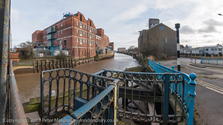
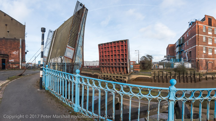
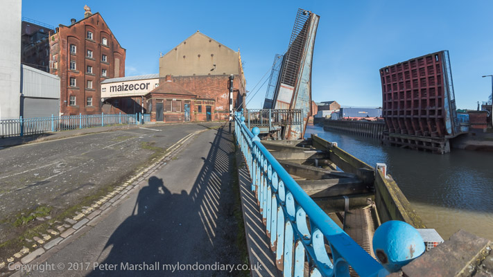
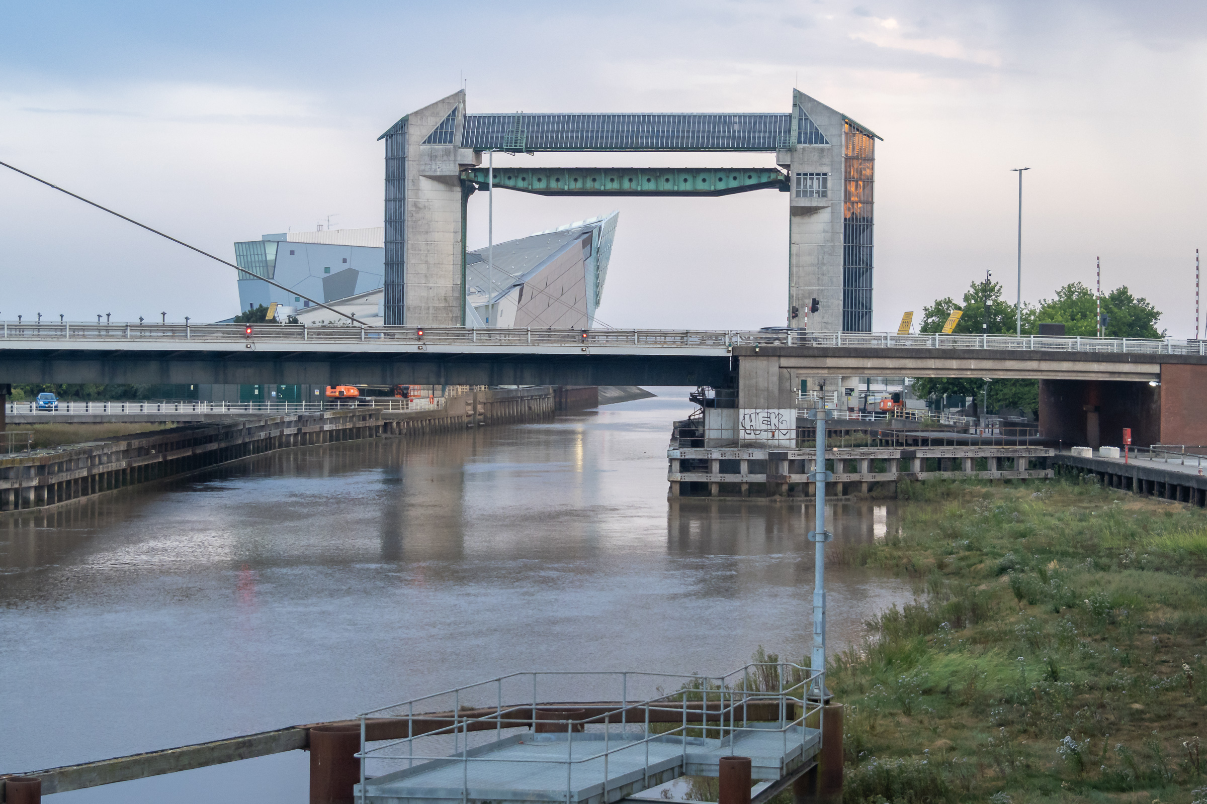
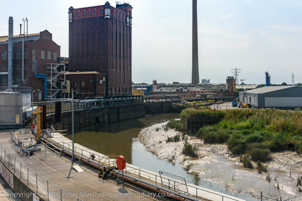
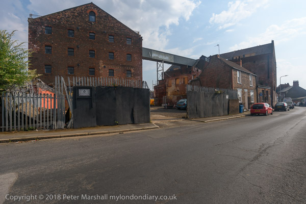
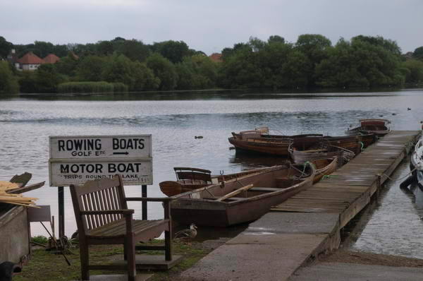
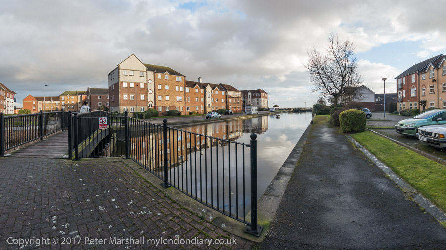
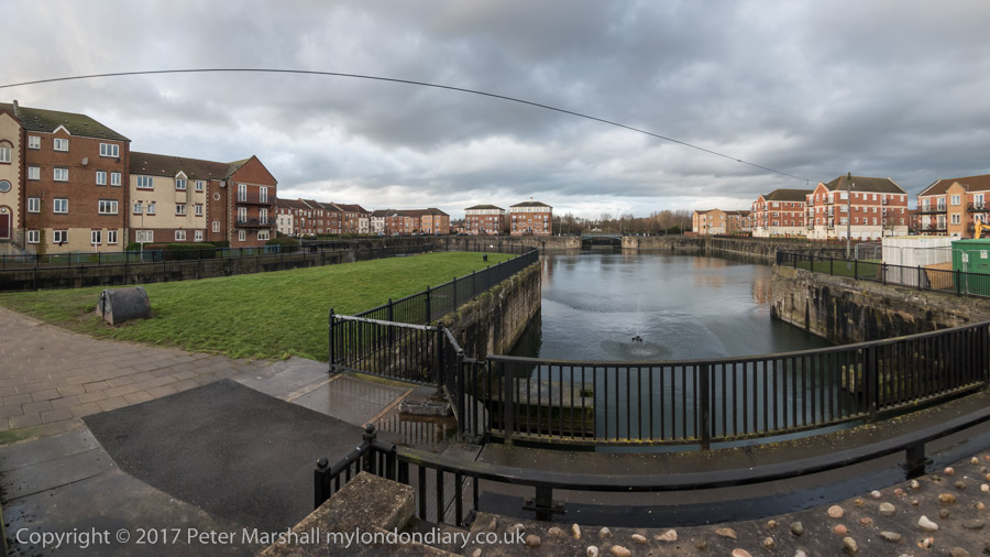
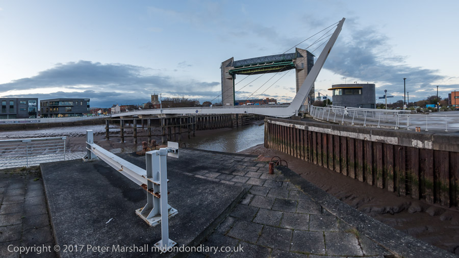
Scott St Bridge and the River Hull
As I wrote in 2017, “I was trying to visit as many of the locations where I had photographed back in the 1970s and 80s for the show and the book ‘Still Occupied – A View of Hull’ and which I’m currently putting on the ‘Hull Photos’ web site, a day at a time throughout Hull’s year as UK City of Culture.“
You can still see those photographs on my Hull Photos site, though there are now larger versions and more pictures in my Flickr albums – links at the end of this post.
In 2017 didn’t want to do a straightforward “then and now“. My earlier pictures were not simple topography but a more personal view of the city, and both it and I had changed in the 45 or more years and I was determined to look at things differently – and with different photographic parameters.
While I had then photographed mainly in black and white and with only a moderately wide 35mm shift lens, in 2017 all of my pictures were in colour and my main interest was in the much wider scope of a roughly 140 degree panorama rendered with a cylindrical perspective which I had been using for some years in my personal urban landscape projects.
I’ll post here under the various headings in my 2017 posts for the day on My London Diary. Here I’ll just post pictures but you can read much more on the links to that site I give for each section.
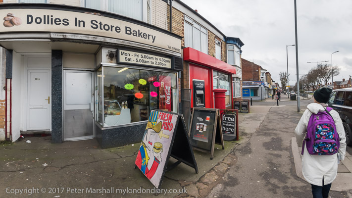
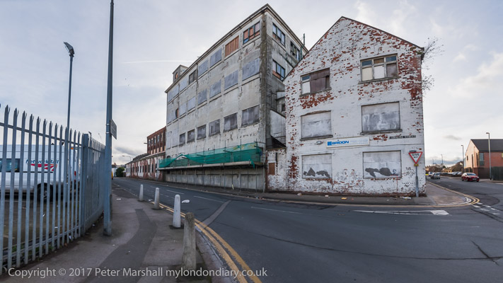
Gipsyville
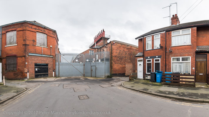
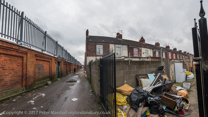
Dorset St and the former Cawoods site – they and the fish moved to Grimsby
We went on to visit some exhibitions and it was soon time for dinner, but our day had not ended and afterwards we walked into the Old Town and to the Humber Street Gallery where I took this picture looking over the rooftops to Holy Trinity.
Many of my older pictures from Hull are now in two of my albums on Flickr:
Hull’s River Bridges: Rich & Lou Duffy Howard began their ‘A River Full of Stories‘ project when they produced ‘Open Bridges’ as one of the most interesting events of Hull’s 2017 year as UK City of Culture.
Unlike most of the events in that year, this was one that was truly based on Hull and produced by people from Hull rather than put on by a team who largely came up from London to organise the year. Although that team received around 200 proposals from local artists for the year, virtually all these were turned down in favour of imported ‘culture’.
We are familiar with ‘taking coals to Newcastle’ but after what happened in 2017, we could replace this idiom by ‘taking culture to Hull’.
As I learnt when I met Rich and Lou for the first time in August this year, the support for including ‘Open Bridges’ was more than somewhat grudging and it required a considerable effort to get it included in the official programme, with some ingenious overcoming of problems raised.
I wrote about Open Bridges here in 2019 when as a follow up to it Rich & Lou – with the help of the Heritage Lottery Fund – produced “a film, exhibition, website and a book which will be given to each library and museum in Hull and the East Riding.” And those outside the area can see the book using our inter-library loan system. It would be good to see it published more widely – and perhaps one day there might be a paperback edition on sale, though its sheer size makes this difficult.
On their Open Bridges 2017 web site they write “Open Bridges made history when for the first, and only time, all the bridges over the River Hull were raised, swung or closed simultaneously splitting the city in two at 20:17 hours on the autumn equinox, 22nd September 2017.”
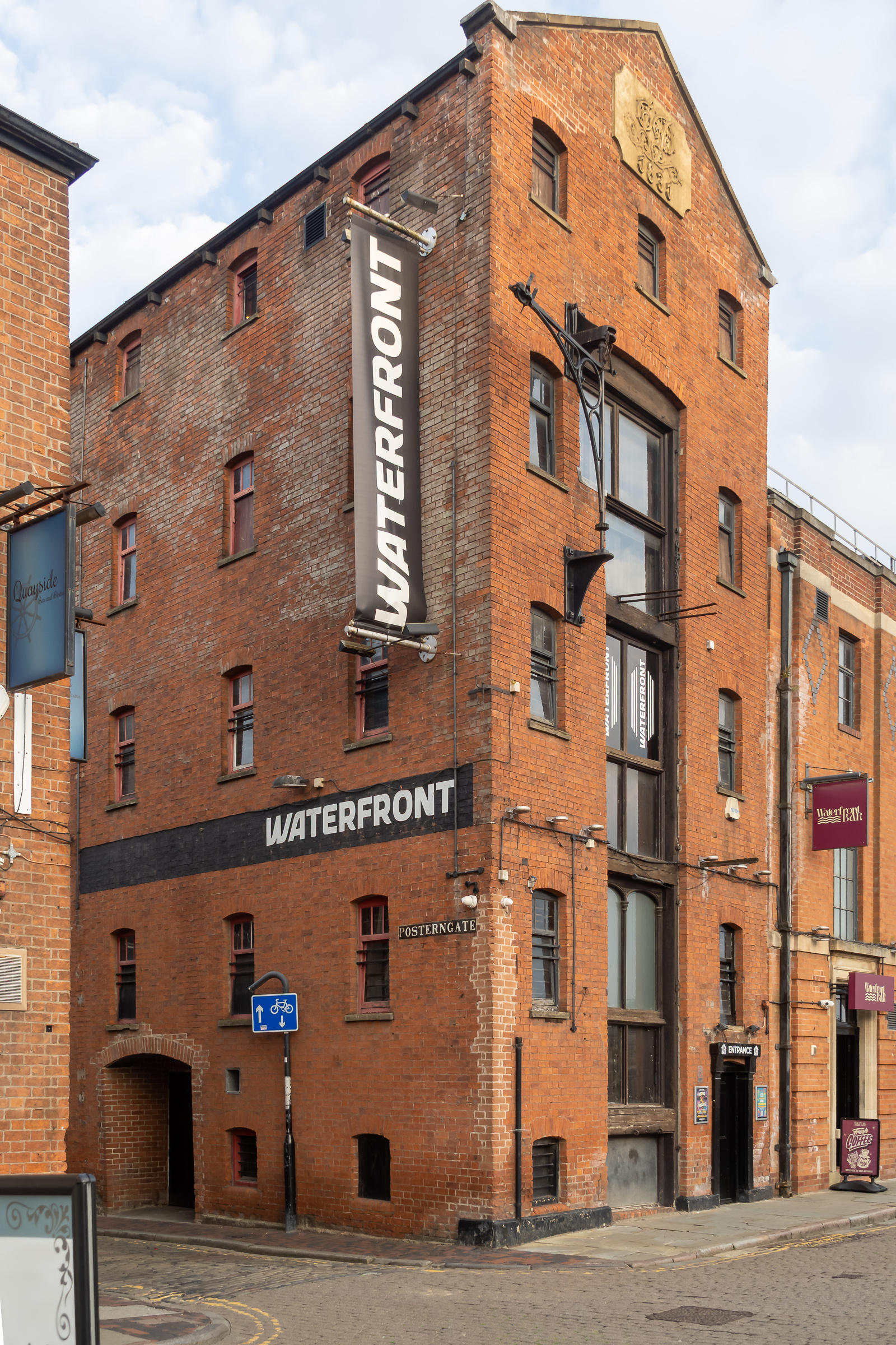
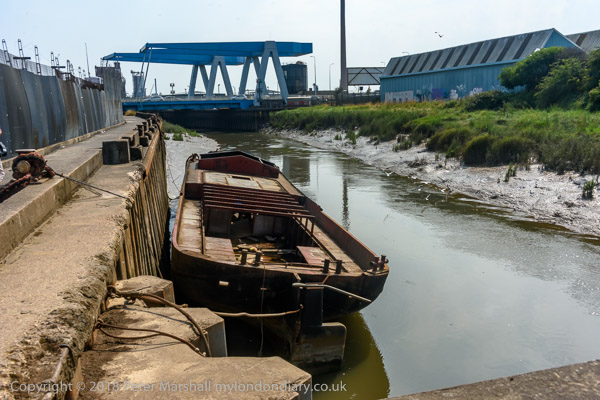
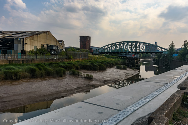
The River Hull splits the city of Kingston upon Hull in two, with 13 bridges inside the city limits, all of which can be lifted or swung to allow navigation.
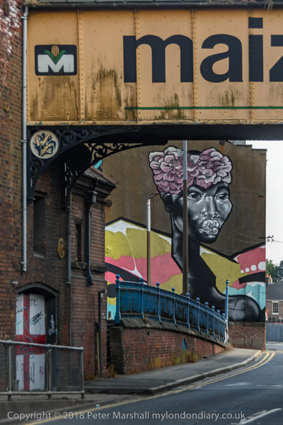
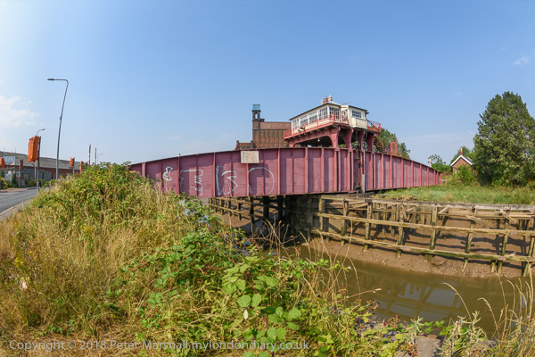
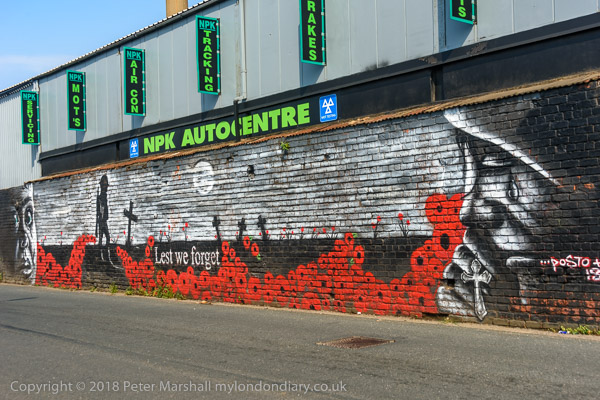
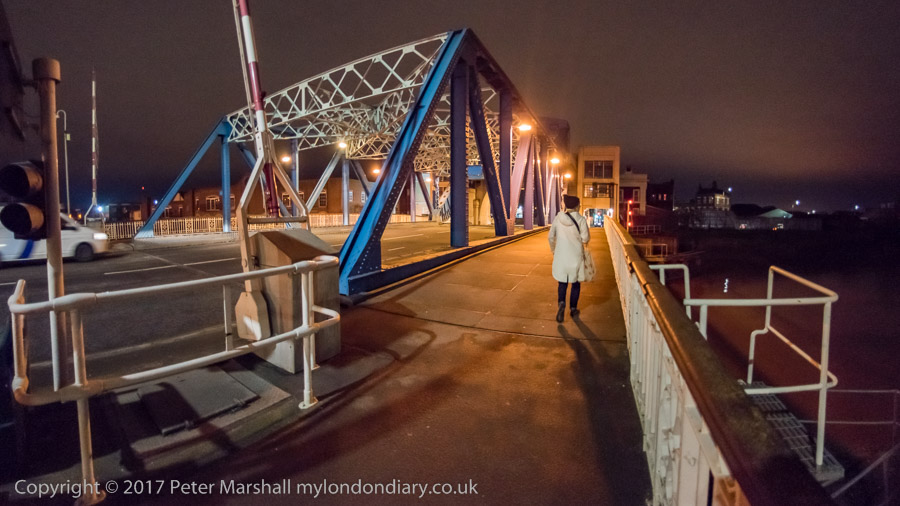
Shamefully despite its Grade II listing the City gave itself permission to demolish one of the, the Scott Street bridge (most of the pictures in this post are of it or from it.). It had been permanently raised since 1994, allowed to rot by the city authorities – which was brought to national attention by Banksy in early 2018 with his “Draw The Raised Bridge!” which may have been inspired by Open Bridges.
As well as drawing attention to the scandal of the bridge and continuing a debate about freedom of movement which ‘Open Bridges’ had also drawn attention to, Banksy’s intervention also sparked an incredible display of activity by Hull’s own fine muralists in what became the Bankside Gallery.
Anyway, at last I’ll get to the point. Here is a Facebook post by Lou Duffy-Howard on Friday 12th September:
“‘Hull’s River Bridges’ is an online tour of all the bridges over the River Hull, past & present, inside & out. It explores the history of the bridges with previously unpublished original architectural plans and photographs, contemporary art and personal memories & stories.” “There are contributions from many people. If you have a browse, we hope you enjoy it. And if you’d like to share it or pass on the link to anyone who might be interested we’d be grateful.”
——————
I’m proud to have some of my pictures again used in this project, particularly one of that scandalously lost Scott Street bridge. As well as photographs the site also has, maps and engineering drawings and a great deal more information about the bridges across the river and some of the people involved – including a portofolio of some of my work including my writing about the pictures featured.
In this post I’ve deliberately pictures which are not on the new web site – so do click on the links above to see more there – and of course not just my work.
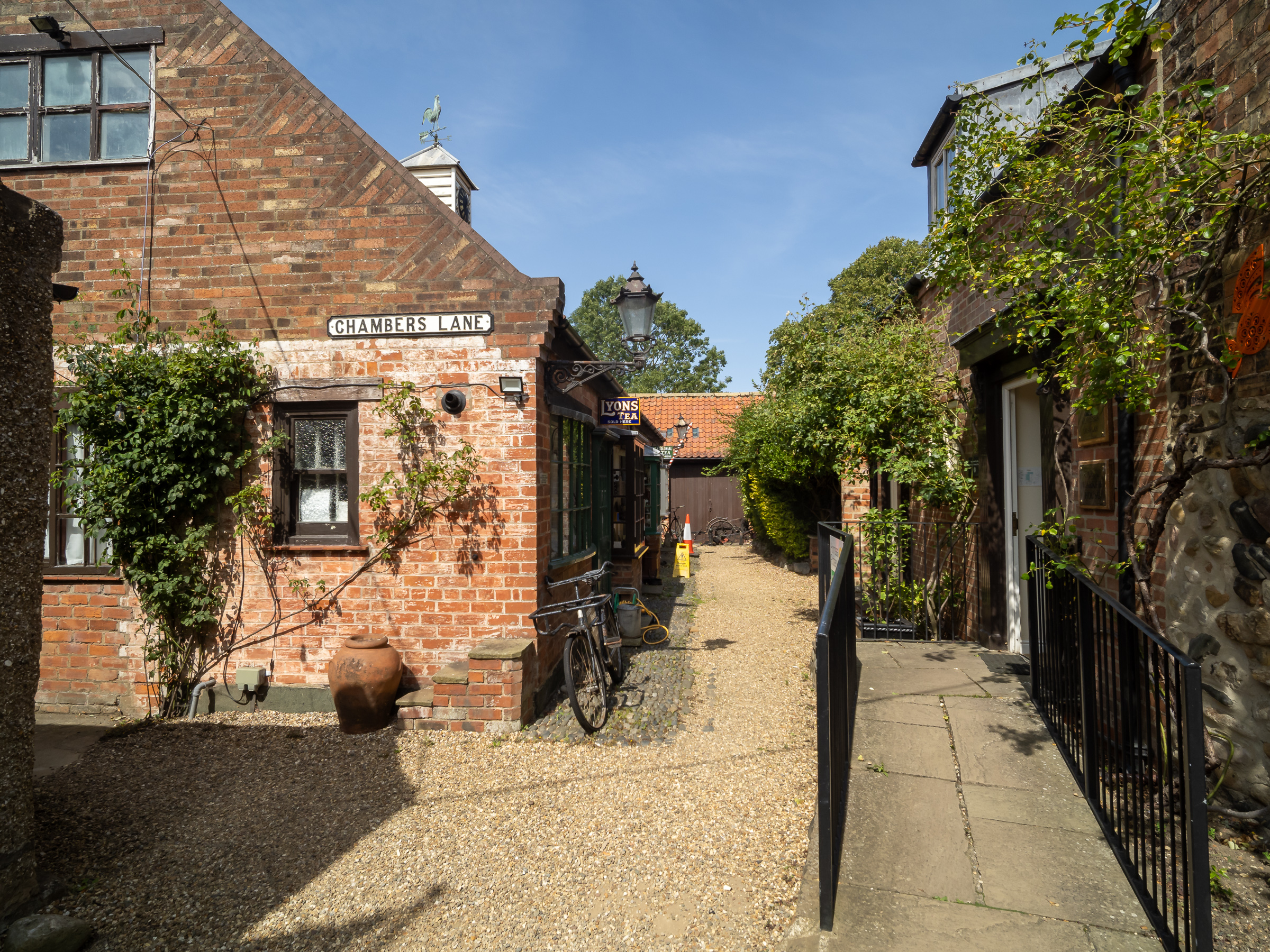
Hornsea, East Yorkshire is a small seaside town on the Holderness coast to the north-east of Hull, and is where my wife spent most of her holidays in her early years.
Her Aunt Florrie (I think a great-aunt) lived in a small corner shop close to Stepney Station in Hull and had bought a condemned cottage on the town’s main street for £25, expecting it to be demolished within a few years, but it survived for many more. The accomodation was primitive, with an outside toilet, but back in the 1950s money was tight and most people couldn’t afford much. There is now just a small garden area with a few seats where it stood on the corner with Willows Drive.
Seventy years or so ago, Aunt Florrie could close her shop and board a train at 5.57pm and be in Hornsea 40 minutes later, and the last train would leave to take her home at 10.10pm, arriving at 10.49. People from Hull did often go to Hornsea for an evening, and commuters could catch the 7.12am from Hornsea and arrive in Hull for work by 7.52.
The railway completed in 1864 brought an enormous change, with many new buildings, and as well as bringing in large numbers of visitors the population doubled in the next 30 years. But Beeching put an end to that, the line closed in 1964/5 and is now a popular footpath and cycle trail. Of course by that time most of the visitors were arriving by road.
As we did, taking advantage of our free bus passes and catching the 10.10 from Hull Paragon Interchange. To our surprise, given it was a hot day at the peak of the holiday season East Yorkshire buses had only provided a single-decker, and by the time it got to the bridge across the River Hull into East Hull it was full, with people standing.
More people crowded on as it slowly made its way along Holderness Road, and at some stops people looked at the bus and turned away, though a few people got off. We raced past at least one stop leaving people standing – and it was an hour before the next bus.
Progress through Hull was slow due to traffic, but once we were in the country the bus could move faster – until we got close to Hornsea. The last half-mile took almost 20 minutes in a slow moving queue towards the Market Place roundabout – we should have got out and walked but it was too late by the time we thought of it. Our journey had taken over twice as long as the trains used to.
The delay was I think largely because too many motorists block roundabouts rather than allow others to move on to them rather than the volume of traffic. Traffic lights would probably keep things moving better here, but I suppose for most of the year it isn’t a great problem.
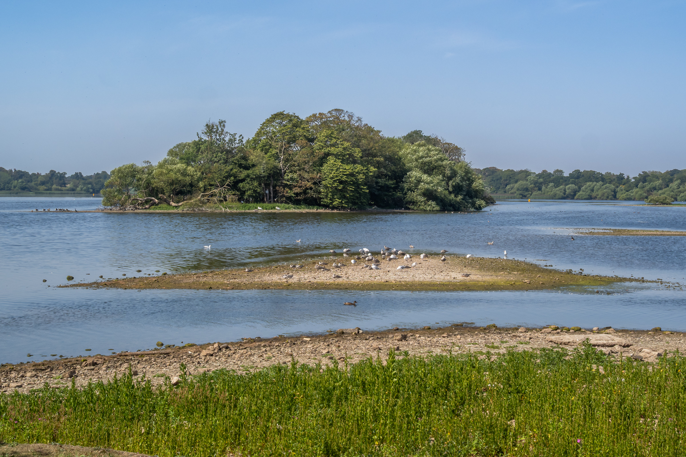
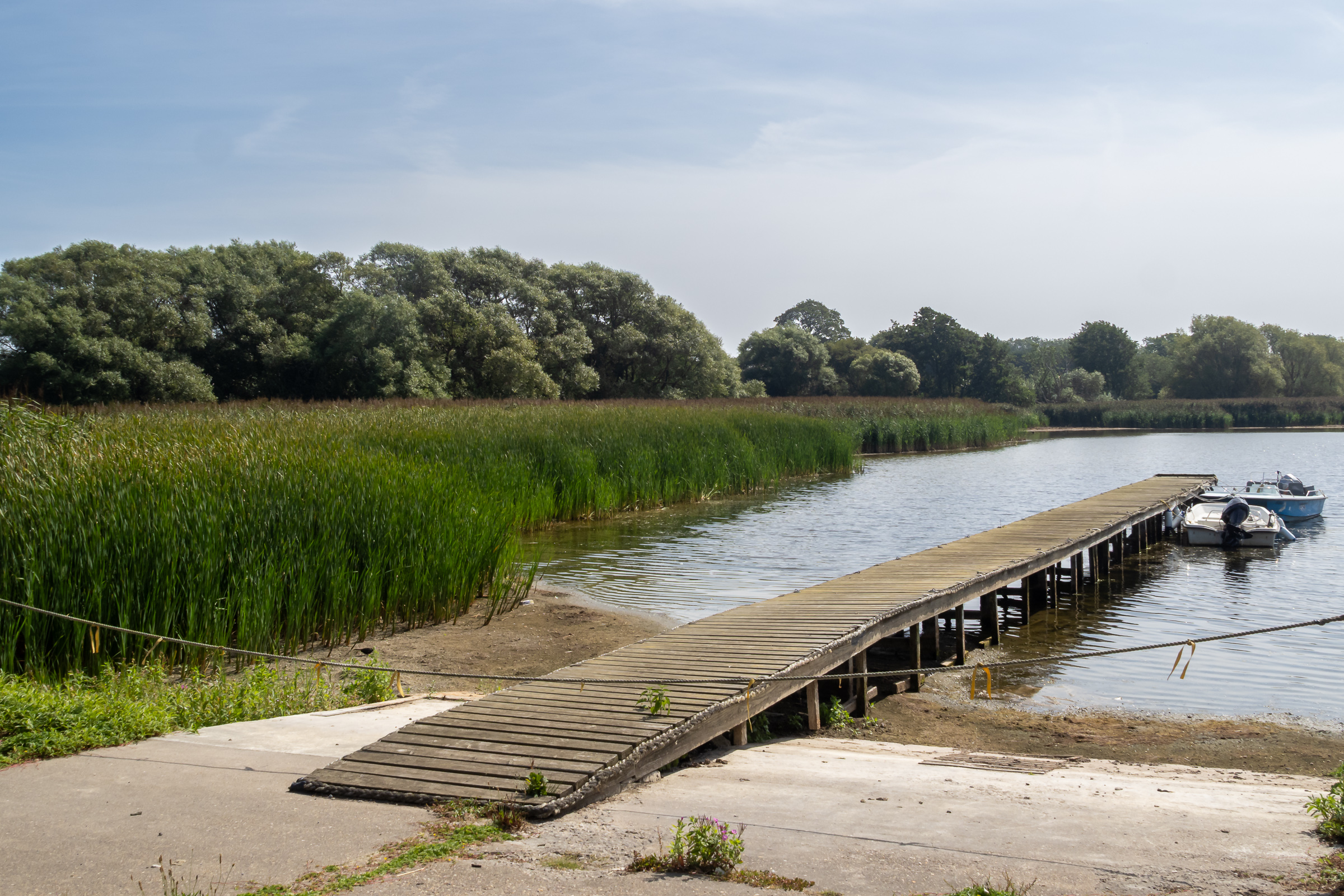
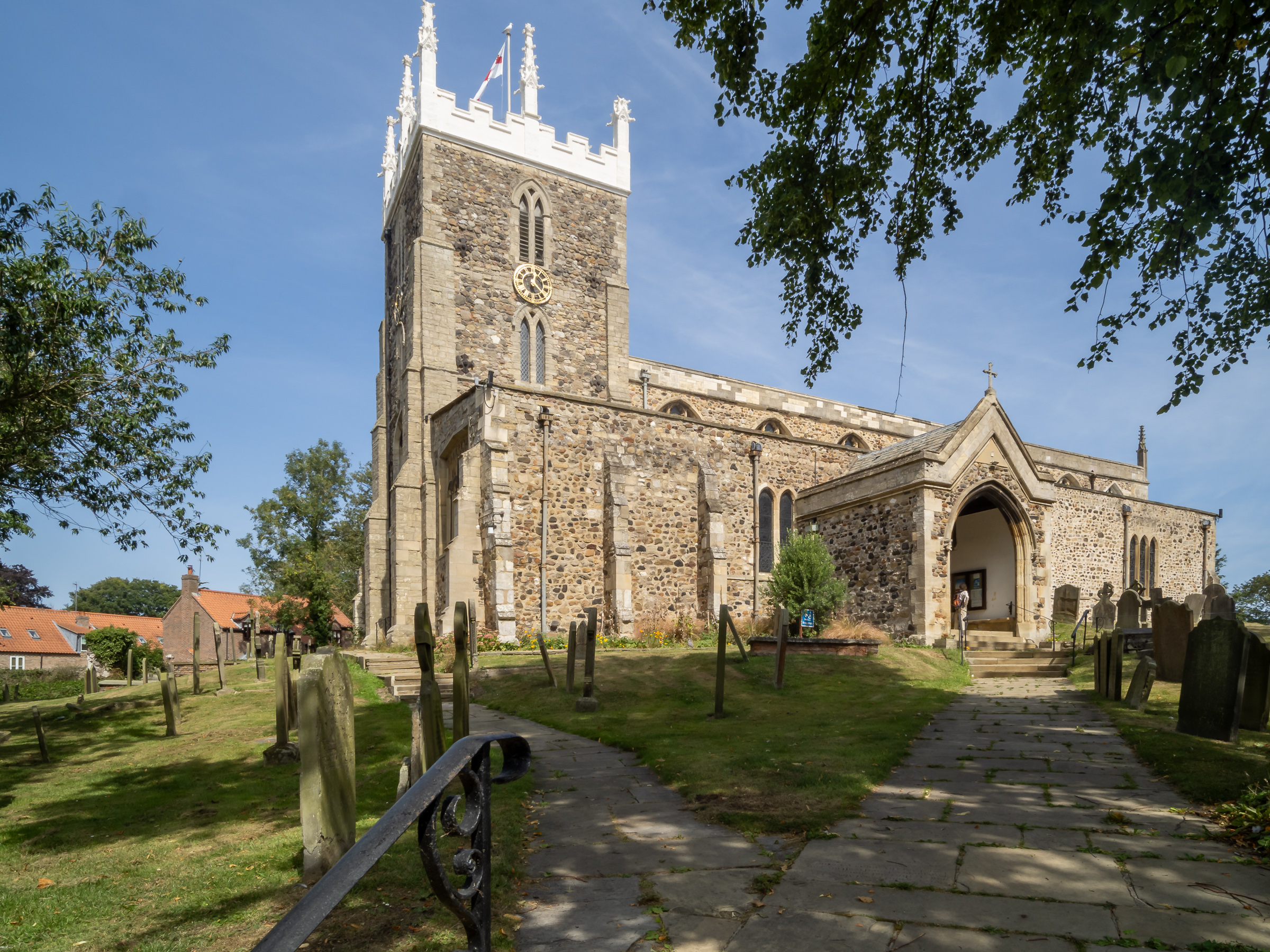
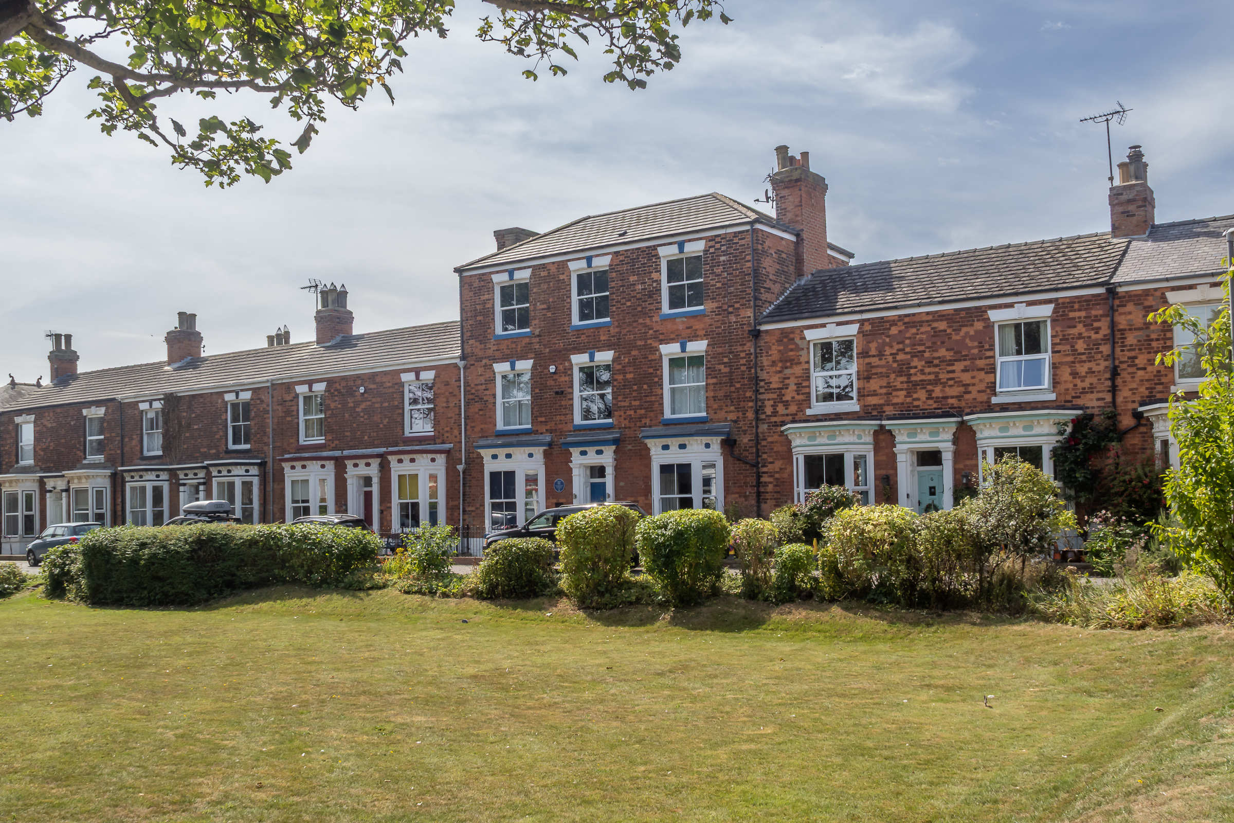
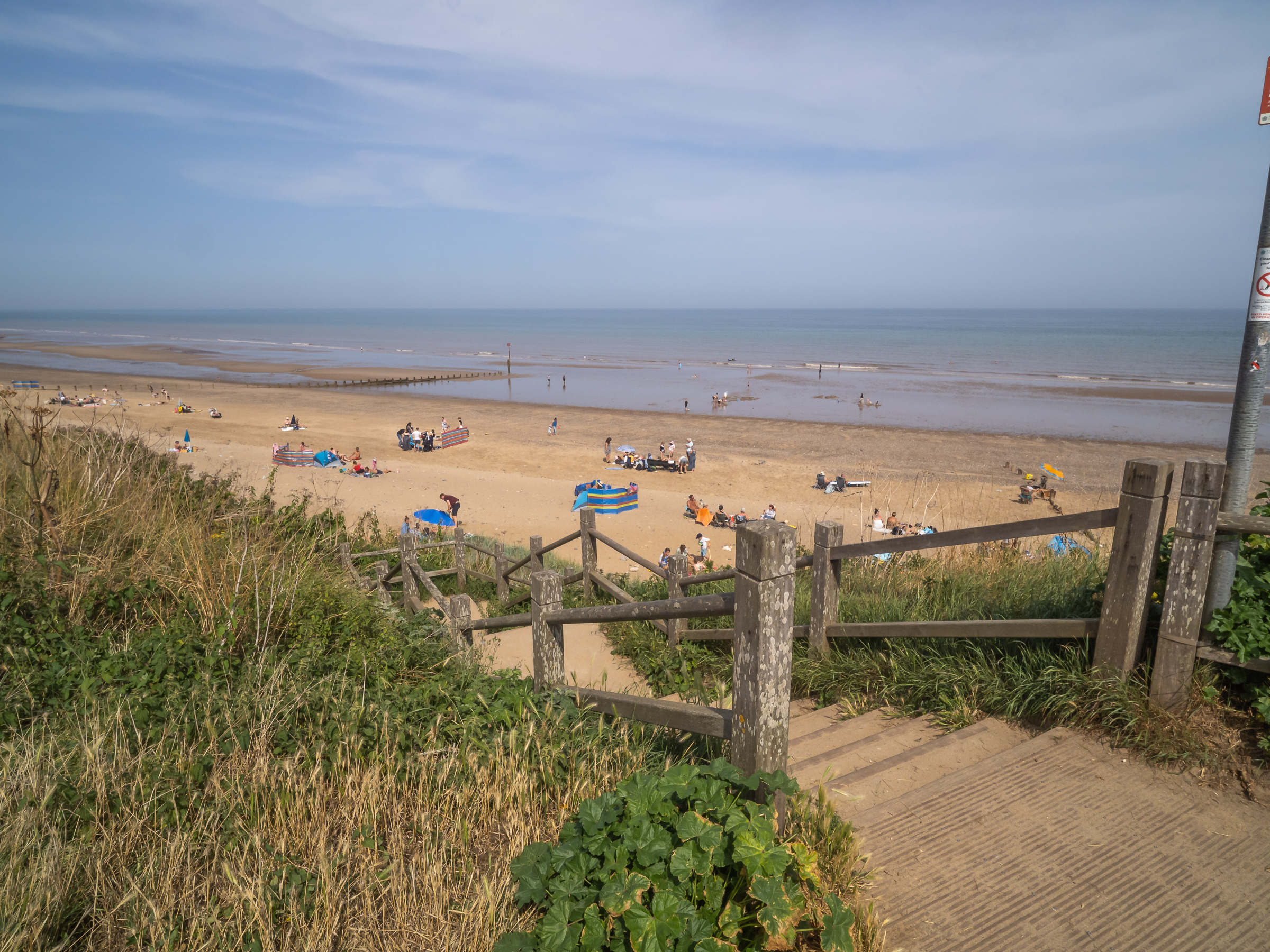
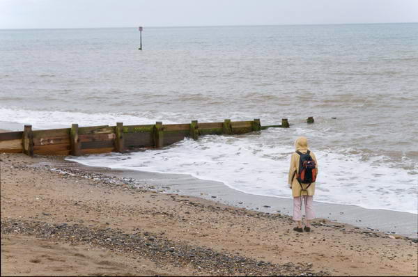
We walked down to Hornsea Mere, a large freshwater lake, said to be Yorkshire’s largest, then along Newbigin, the main street, where we went into the church hall for lunch – and an opportunity to talk to some local residents – and make a donation to local charities. I would have preferred a pub, but this was very much my wife’s day.
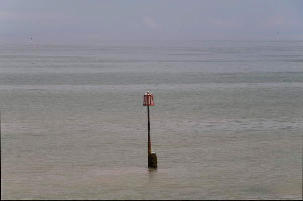
We walked on towards the seafront, tuning off to visit Wilton Crescent and the station before making our way along the promenade. Parts of the beach were almost crowded. The North Sea looked a little warmer than it often is, the tide was out and we walked across a large expanse of sand to the water’s edge, where small waves rippled around my trainers, but I couldn’t be bothered to take them off and paddle.
We walked further north along the prom. It was hot and there was a little haze and we could neither see Flamborough Head nor the record-breaking Hornsea Windfarms – Hornsea 1 became the largest offshore wind farm in the world when it became commercially operational in 2020, only to be beaten by Hornsea 2 which came on-line in 2022 – and has 165 turbines with a total output of 1.32GW, enough to power over 1.4 million homes. And they are building the even larger Hornsea 3 and Hornsea 4.
These windfarms are a long way out to sea, but when we stayed at a seafront hotel here in 2017 and 2018 we could see the closest in the distance from our first floor bedroom and from the cliff top at the north of the promenade.
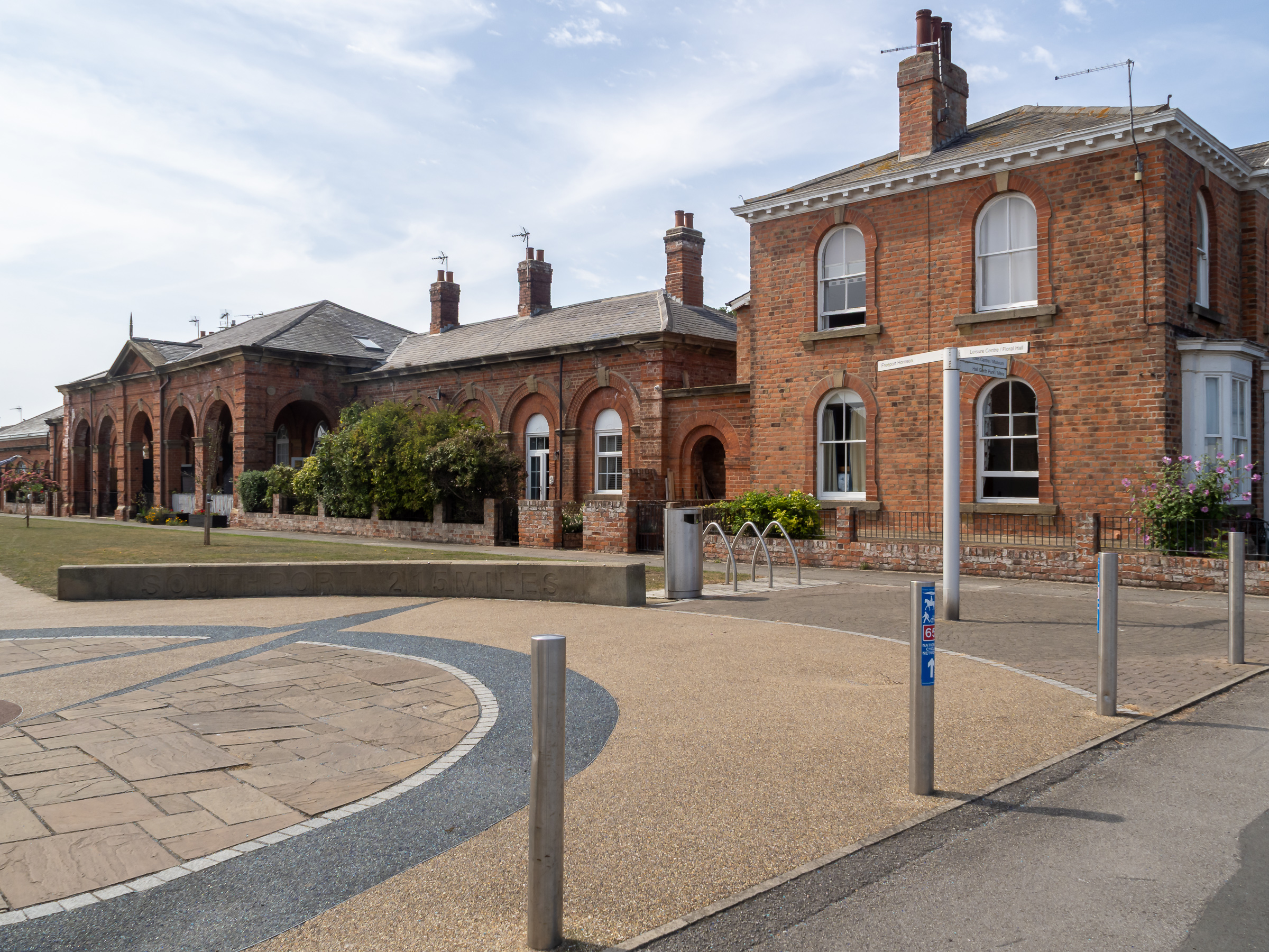
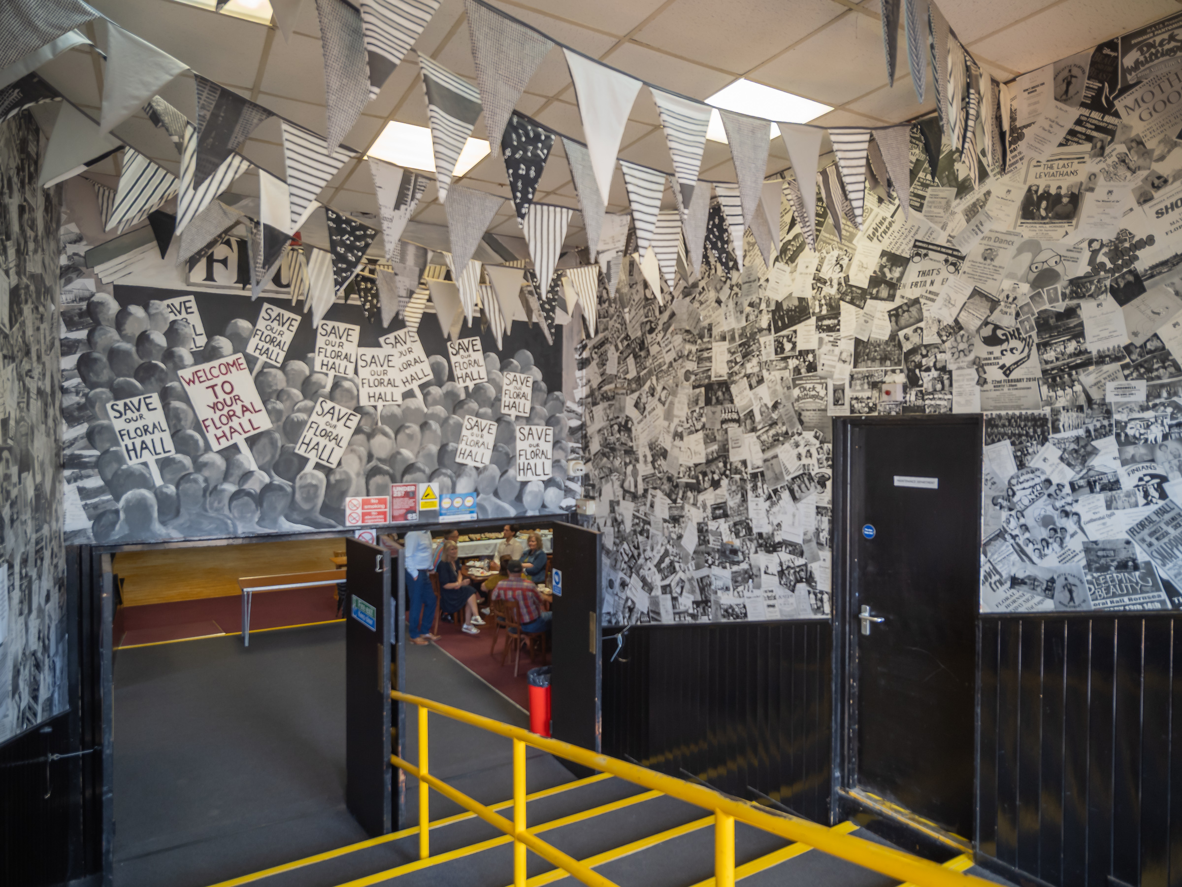
After a short visit to the Floral Hall – now a large café – and a walk to the end of the seafront path we walked to the Cliff Road bus stop for a mid-afternoon bus back to Hull. This time it was a double-decker and there was seating for everyone and arrived on time for us to take another walk around Hull before meeting people in the evening.
The pictures here are in the order they were taken. More from our days in and around Hull in a later post.
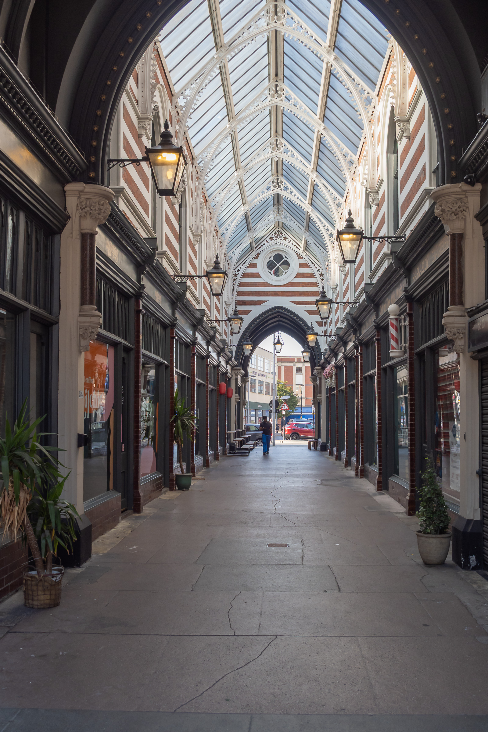
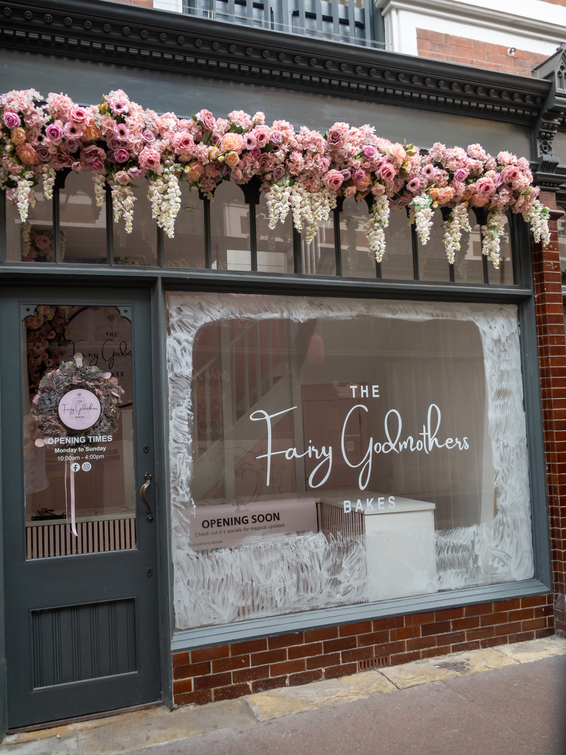
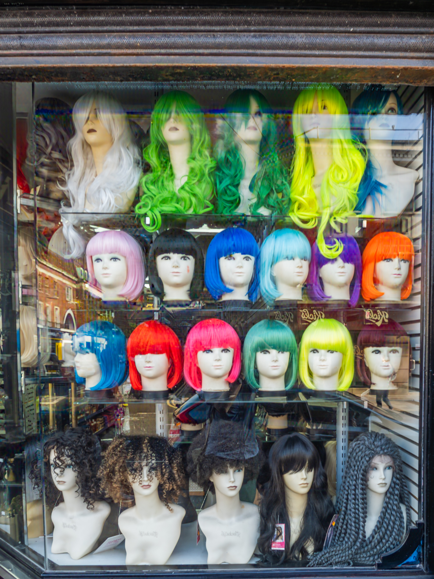
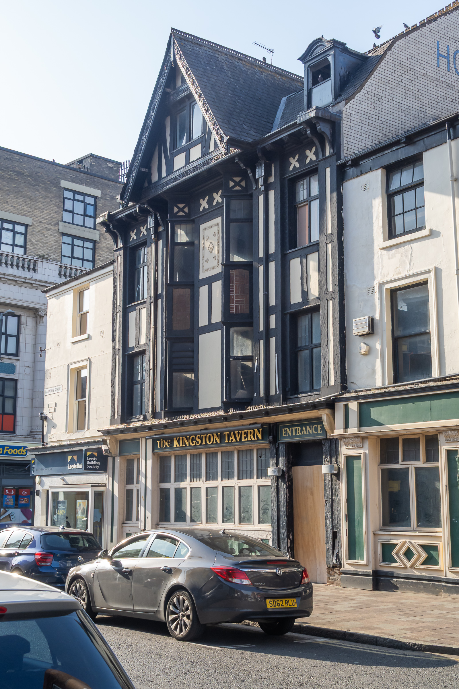
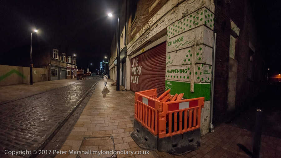
Hull 2025 – An Evening Stroll: The second and final post of pictures I made on our first evening in Hull last week.
Part 1 of this post ended on Princes Dock Street. The pictures here are in the order I took them on Tuesday 12th August 2025 and the first image here was taken just a few yards further down the street.
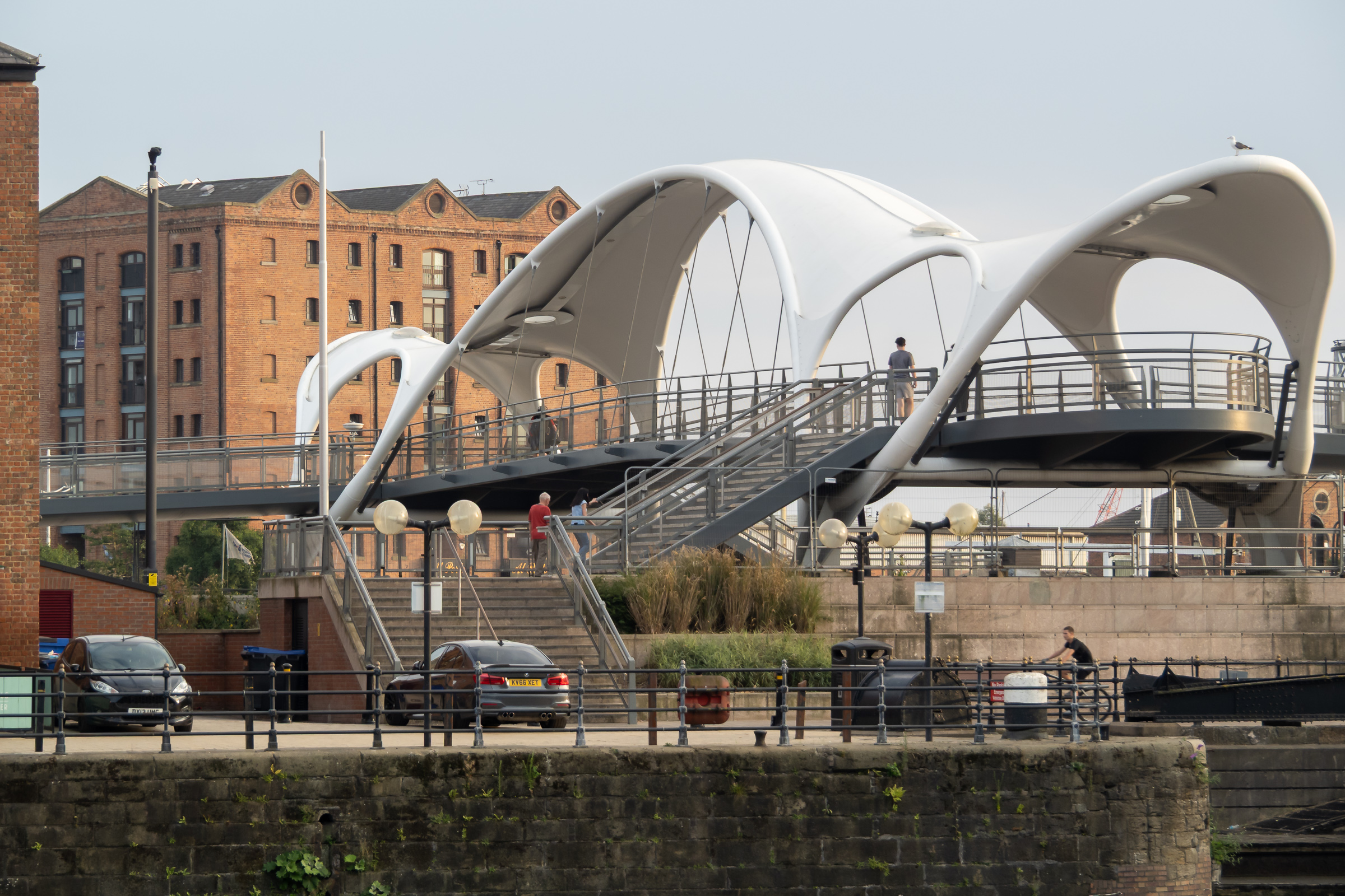
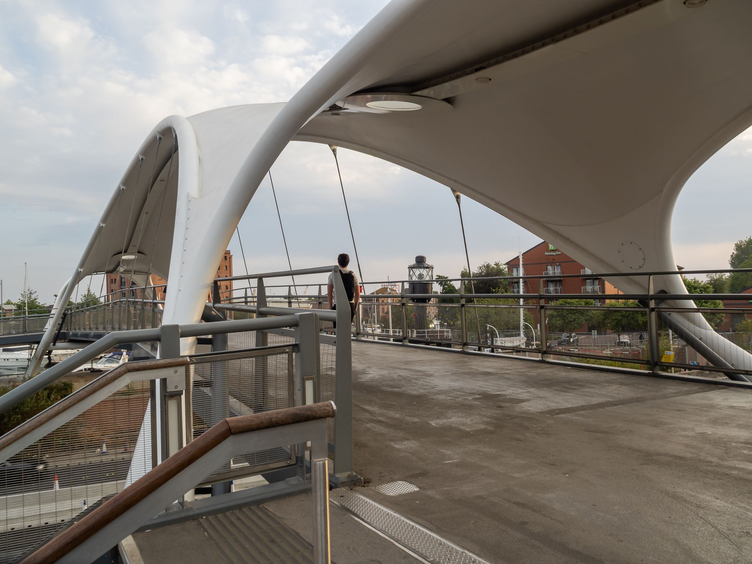
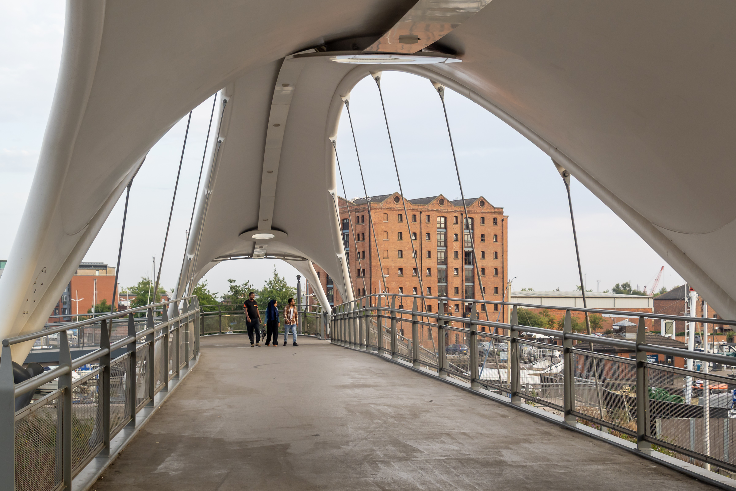
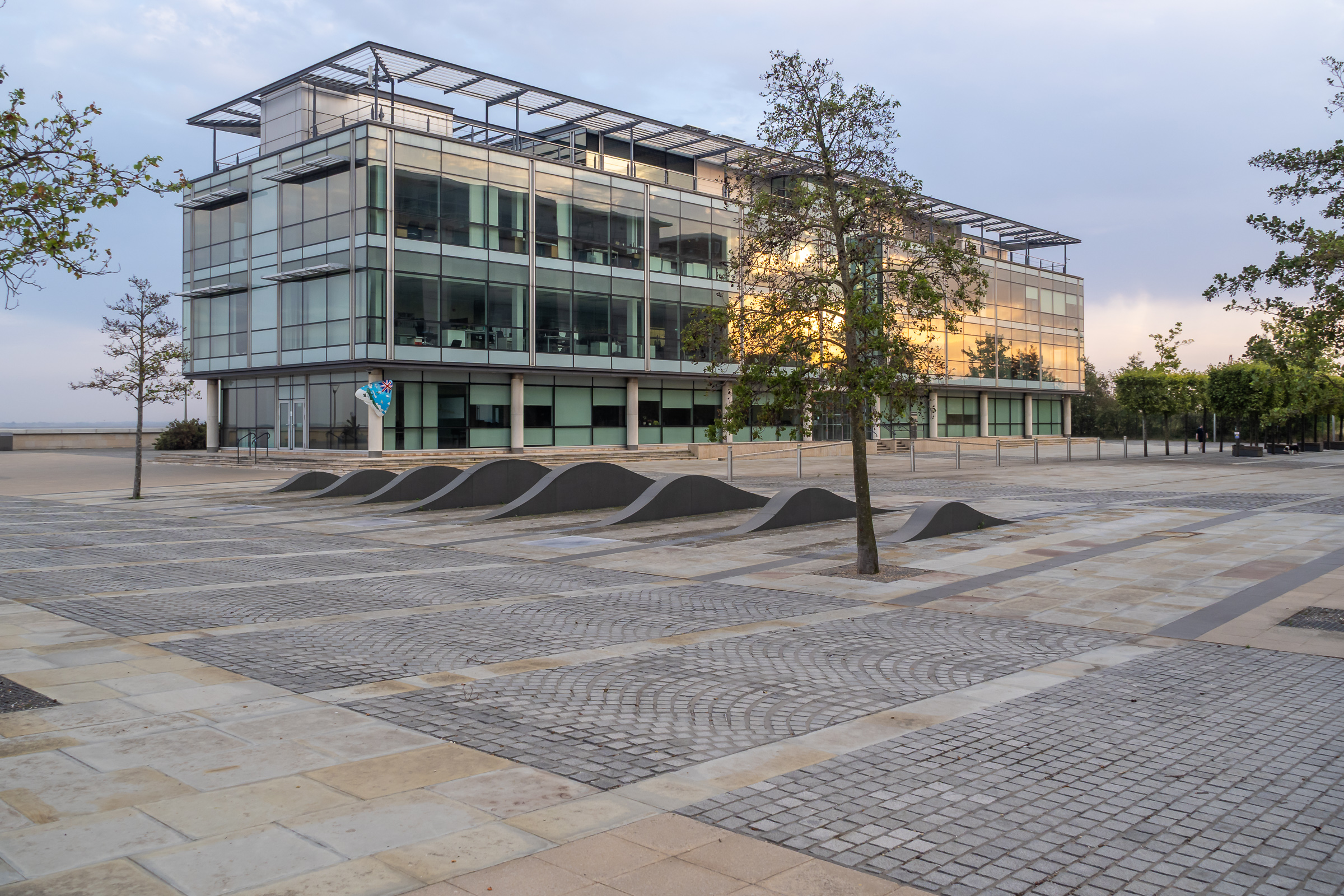
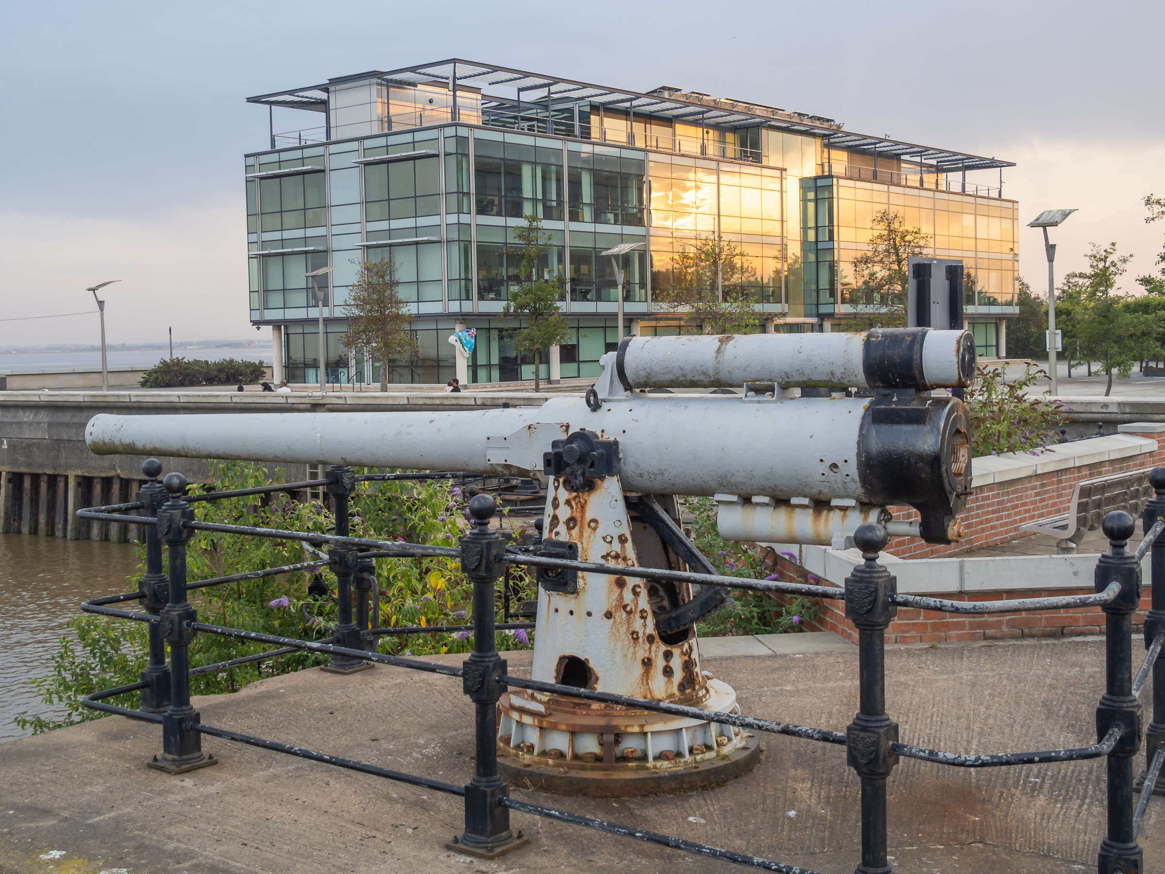
Humber Dock, now a marina, Railway Dock and the southern part of the Old Town have been brutally split from the rest of the city by the busy A63. Its hard to understand why the city council allowed this to happen with as it did, with so few places where this barrier can be crossed, and the provision of a rather odd footbridge, Murdoch’s Connection, is a rather unsatisfactory sop.
Fortunately we could manage the many steps up and down, otherwise we would have needed a fairly lengthy detour to where the road rises to cross the River Hull. This footbridge is perhaps more of a visitor attraction rather than a proper solution to access.
Murdoch’s Connection was named after Hull’s first female doctor, a house surgeon at the Victoria Hospital for Sick Children on Park Street and a suffragette, founding the Hull Women’s Suffrage Society in 1904.
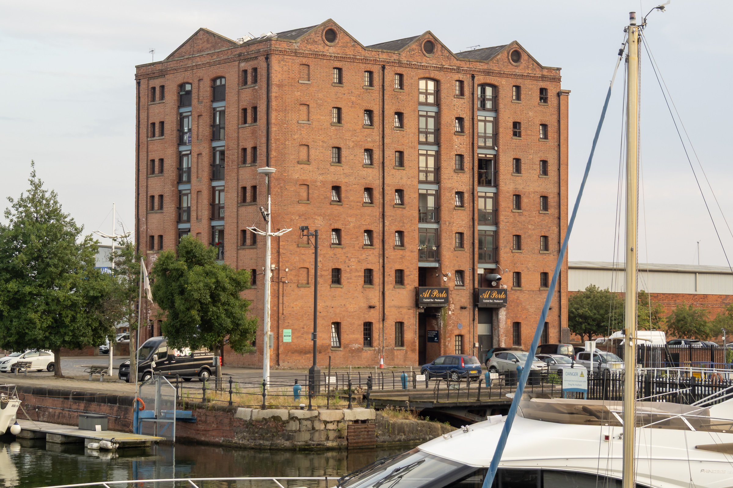
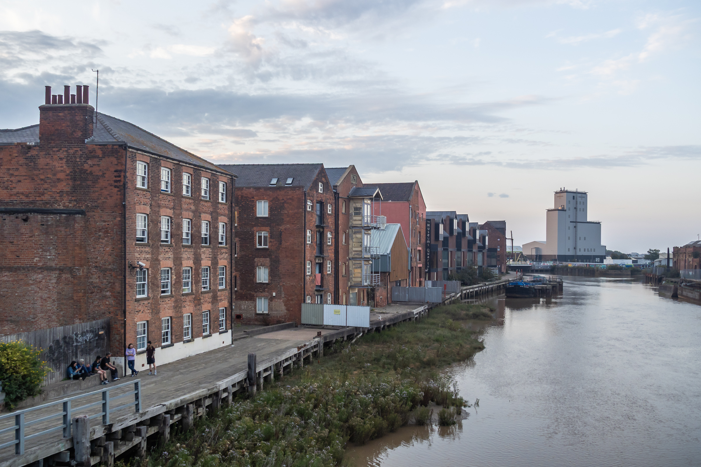
Too many of Hull’s dockside warehouses were demolished, but a few remain, including this fine block beside Railway Dock. I’d hoped to walk though Trinity Burial Ground, where I’d often sat in the past but that is now a building site.
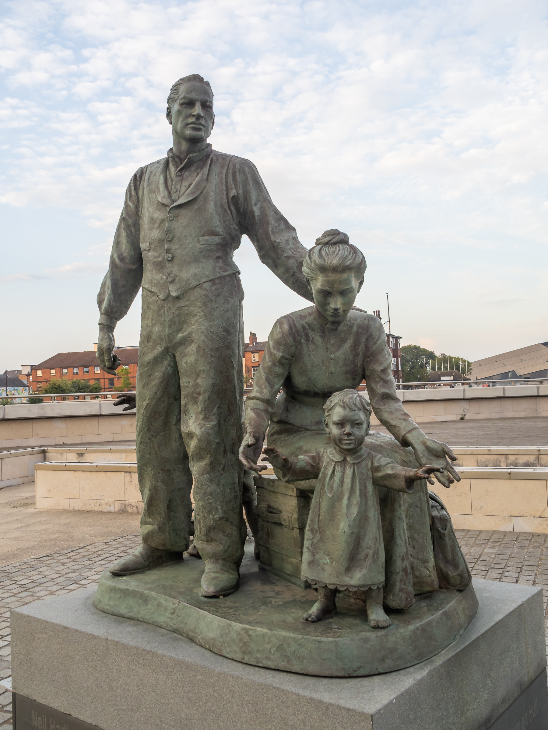
A statue by the Humber to the west of Humber Dock Basin, The Crossing, commissioned in 2001 commemorates the many migrants who came to Hull from Europe, mainly docking here to take the train to Liverpool on their way the the United States.
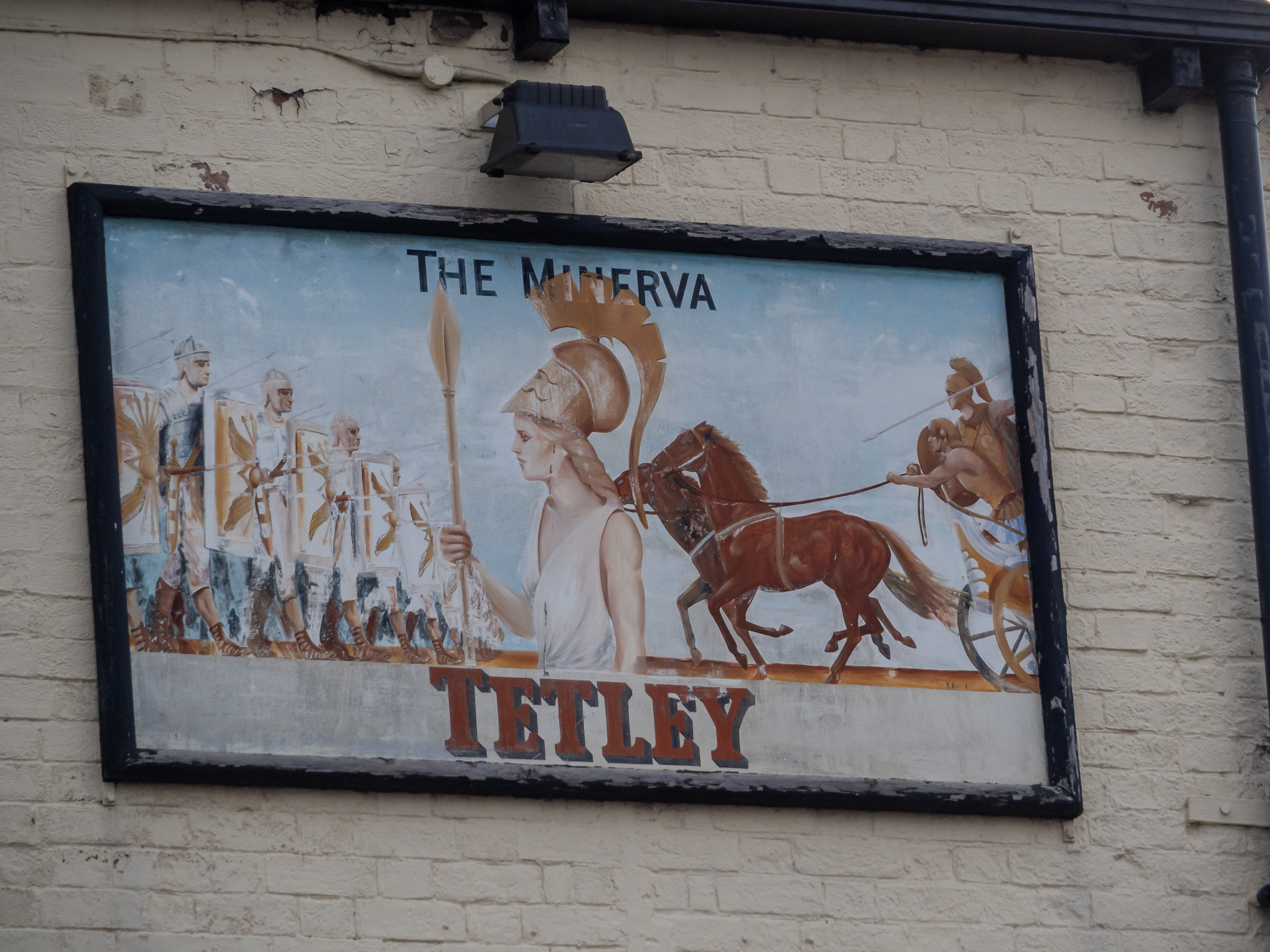
High on the wall of the Minerva pub is this sign, probably a little faded from when it was placed here. This time we didn’t go into the Minerva but continued our walk as the light was fading.
A path from Nelson Street leads along the side of the River Hull past the former Hull Central Dry Dock. In use until relatively recently this is now a performance area.
As you can see parts of the riverside walk in the ‘Old Harbour’ were closed and our plans to walk by the River Hull were cut a little short.
Instead we turned down Scale Lane and made our way back to the city centre along Silver Street and Whitefriargate.
More from our short stay in Hull later. You can see many more of my older pictures from Hull in albums on Flickr and on my Hull Photos web site – links below.
Hull 2025 – An Evening Stroll: Last month I realised it was seven years since I had last visited Hull. Too long for a city that played an important part in my life and in my growth as a photographer. So I booked train tickets and a hotel room for a short visit with my Hull-born wife earlier this month.
I first visited Hull around 1965, going in some trepidation to meet and stay with my future parents-in-law who lived in a small street of terraced houses around a mile and a half from the city centre.
I don’t remember much from that trip, though I think I will have been taken shopping to the city centre and also in to the old town, but it was the first of many visits.
Back in 1965 I was a penniless student and although I had long had an interest in photography and owned a rather basic camera I couldn’t afford to take pictures. It was only a few years later that I learnt how to save costs by developing and printing myself and began actually earning money that I was able to get a cheap camera that worked and began as a photographer.
And some of the first real photographs I took were in Hull in the early 1970s. During that decade I was teaching at a large comprehensive with a very heavy workload and had relatively little time to take pictures, except during the school holidays, and we spent quite a lot of those in Hull.
My work in Hull began to take shape as a project concerned with Hull’s heritage and its loss as large areas of the city were redeveloped and much of its traditional industries being lost, including of course the fishing after the final Cod War in 1976.
And my first one-person show took place in Hull in 1983 – and much later I produced the book ‘Still Occupied – A View of Hull‘ using the same work and more, one of my first self-published books.
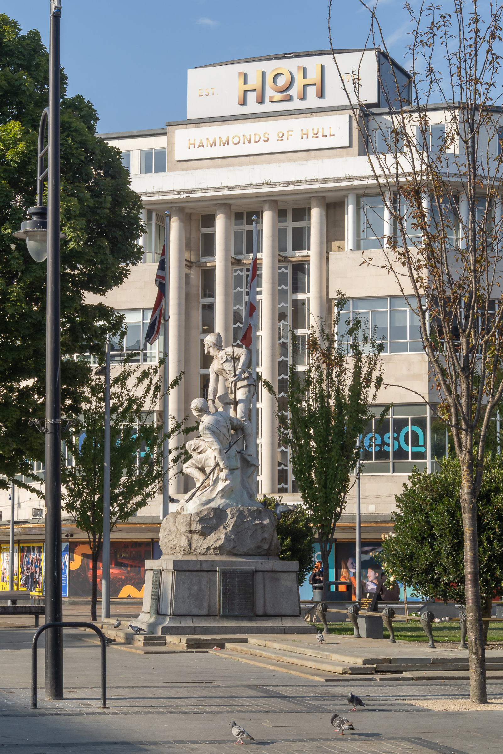
Hull was always a city of culture, with an unusual collection of museums, theatres, artists, poets and music of all types. Its relative isolation from other cities and large towns made it very culturally self-reliant.
Shamefully when it became the UK City of Culture the huge majority of Hull’s own artists were sidelined, with the event being run by a team who came from London and dominated by events and people with no real link to the city. But some locals responded by doing their own thing as a part of the year – and I set up my Hull Photos web site where I uploaded a new picture of Hull every day throughout the year (and for some time afterwards.)
In this short series of posts I’ll share some of my pictures from my visit this month, starting with a couple of posts from our first evening. I haven’t captioned these images – but if you know Hull many will be well-known to you.
The next post will finish our walk on the evening we arrived. Later posts will include more from Hull as well as our trips to Hornsea and Beverley.
A Long Day Around Hull: We were staying in Hull for a few days to celebrate our wedding anniversary and on Friday 27 July 2018 we visited some old friends in Cottingham before walking to Oppy Wood in the morning. A bus took us back to the city centre where we bought sandwiches for lunch to a bus to Stoneferry where we sat on the bank of the River Hull to eat them before walking back towards the Wilmington Bridge and crossing here to view the extensive Bankside Gallery before going to the Whalebone pub to refresh ourselves before making our way back to the city centre for dinner and spending some time with family members at the Royal Hotel.
It had been a long and rather tiring day and I had taken a great many photographs, a few of which are included in this post, but rather more are on My London Diary – links in the separate sections below. In particular I had decided to make many panoramic images on our walk.
Hull, Cottingham & Oppy Wood – 2018
We set off early from our hotel in the city centre and took a roundabout route to Hull Interchange photographing a few of the interesting buildings on our way. I made a few pictures from the upper deck of the bus on the way to Cottingham and on the short walk to have morning coffee with old friends in their bungalow.
From there it was another walk to Oppy Wood, created by the Woodland Trust around 2004, after they had planted 18,000 trees as a living memorial for the 200 local men from the Hull Pals battalions who died in the Battle of Oppy Wood, near Arras, France on May 3rd, 1917. There is a permanent Kingston Upon Hull Memorial at Oppy unveiled there in 1927.
Unfortunately extensive work was going on in the area in a flood prevention scheme for the city and access to the site – usually open to the public – was much more limited than normal.
Cargill’s Oil Mill, built as Isis Mill for Wray, Sanderson & Co in 1912 and still crushing oil seeds
Again I took a number of pictures from the bus as we travelled from the city centre to Anne Watson Street where we walked to a quiet spot by the River Hull to sit in the sun and eat our sandwich lunch, before making our way back towards the city centre.
Unfortunately there is only a short part of the walk beside the river and much of the time we were walking along a busy hot dusty road until we got to the footpath leading to Wilmington Bridge which used to take the railway lines to Hornsea and Withernsea across the river – but now only has cycle and footpaths.
We crossed the river mainly to photograph the ‘Bankside Gallery’ – pictures in a separate section – but there is also now a little more access to the river than before here. Hull Railway bridge was still taking goods to and from the docks.
We walked north to the end of the gallery, then made our way back down Air Street to Wincolmlee, still with many small businesses some in the old buildings in poor condition but now few making any use of the river.
High Flags, WIncolmlee
We had got very hot and stopped for a drink at the Whalebone before making our way back to the city centre. There was still time to take a few more pictures there before going to meet family for a meal at the Royal Hotel at Paragon Station.
Hull has Banksy to thank for the Bankside Gallery. His ‘Draw The Raised Bridge‘ which appeared on Scott Street bridge on 26 January 2018 brought crowds to the area and inspired many to create murals on the many walls in the area, creating the extensive gallery.
The Grade II listed lifting bridge which has was closed to road traffic, its bascules permanently raised since 1995 was demolished in 2019-20. It had long been neglected by the city council both before and after closure.
Here I’ll post just three of the many images I took – there are many more at Bankside Gallery.
Hull Panoramas
On my visit to Hull in 2017 when it was UK City of Culture I had begun making a series of panoramic images in Hull, including many of the areas that I first photographed in black and white in the 1970s and 1980s for the work which became a show, ‘Still Occupied’ at the Ferens Art Gallery in Hull in 1983, and later a self-published book of the same name and more recently in a couple of Café Royal zines.
Scott Street Bridge
Here are two of them – and there are another 16 on My London Diary that I made during this walk – at Hull Panoramas.
Yorkshire Interlude – Hornsea: On Saturday 12th July 2008 when we were staying for a few days in Hull with an old friend we took a bus to the Yorkshire coast at Hornsea for the day.
I’d first visited Hornsea, a small coastal resort, back in 1965 when I made my first visit to the Hull home of my future parents-in-law, but my wife’s memories of it go back further.
Until Beeching swung his axe there were trains from Hull to two seaside towns, Hornsea and Withernsea which stopped at her local station, Botanic Gardens, a quarter of an hour’s walk from her home. People would often go to them for an outing, for a day or even an evening, and many who lived in these towns would commute to work in Hull.
My wife’s family took their annual holiday most years with a week in Hornsea, staying in a cottage that one of her great-aunts had bought for £25 after it had been condemned for demolition in the near future. I think it was more than 25 years later that it actually came down – and the site is now just a small garden on the main street, a few minutes walk from the seafront.
Most times when we go to Hull now – not as often as we used to as most of those we knew there are now dead or have moved away – we take a bus to Hornsea. What used to be around 40 minutes on the train now takes around twice as long on the buses, though at least it is now free for those of us with bus passes. And the old railway line is now part of a long-distance footpath. Perhaps we will visit again this summer.
We’ve also stayed there, in a holiday cottage in the town centre and a couple of times for a few days at a hotel on the seafront there, where we’ve enjoyed some remarkable sunrises over the wide expanse of the North Sea – as well as some battering storms.
But in 2008 we were staying in one of the finest houses in Hull, West Garth, (more here) then owned by an old friend – an ‘Arts & Crafts’ house which gets a short mention in the guide to Hull’s architecture. It had been one of our friend’s childhood homes and after some years of retirement he bought the property. Various ‘improvements’ had been made which meant it had been denied listing and he spent considerable time and money in restoring it to its original state but sadly died before he completed the job.
The weather wasn’t too good, with some heavy showers, but this did mean that we had the town almost to ourselves, as most of those who would normally have come for a day out at the seaside in July stayed home.
We visited Hornsea Mere, a large freshwater lake at the centre of the town, and a shower gave us a good reason to go into its café before we walked down to the seafront. The sea looked cold and uninviting and for once Linda didn’t paddle.
Then along to another café at the Floral Hall where the sun came out briefly after we had taken shelter there and on the the large park, Hall Garth before it was time to get the bus back into Hull.
This time we took the slower route back via Beverley, getting off in Hull on Beverley Road where I took a picture of Bethnal Green, here just a short terrace of houses, before returning to our friends house to cook dinner.
Despite the weather we had enjoyed a good day.
But it wasn’t a good day to have afternoon tea on the south-facing loggia. You can see many more pictures and some captions from our day at Hornsea on My London Diary.
Abolition of the Slave Trade Act: Bicentenary: On Sunday 25th March 2007 I was in Brixton and Clapham where commemorations were taking place on the 200th anniversary of the bill to abolish the Atlantic slave trade being given royal assent by King George III on 25 March 1807. It was a great step forward but despite this bill, slavery “remained legal in most of the British Empire until the passing of the Slavery Abolition Act 1833.”
The previous day I had photographed the “Anglican Church’s walk of witness to mark the abolition. The Church Of England has much to repent, with many of those who profited greatly from the ships that transported some 12 million African people over the years being pillars of the church and supporting it financially.“
As I continued on My London Dairy:
“When Christopher Codrington died in 1710 he left his Barbados plantations to its missionary society, who at least at first continued his regime of forced hard labour, punishment with the lash, iron collar and straight-jacket, and, at least for some years to brand its enslaved Africans across their chest with the word “society”. Even though the church claimed to have made various improvements in conditions, 4 of every 10 Africans bought by the society still died in their first 3 years there in 1740. Despite the efforts of abolitionists, slavery continued until made illegal by the 1833 act, which provided the church with a very large financial reward in compensation.”
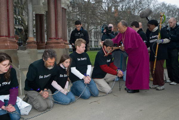
This procession had been accompanied from its opening service in Whitehall Place by a small group who had walked from Hull, the birthplace of William Wilberforce who had led the fight for the abolition in Parliament. They had taken turns to march in a yoke and chains and ended their walk in Victoria Gardens at the Buxton Memorial Fountain erected in 1865 to mark the ending of slavery in the British Empire in 1834.
Drexel Gomez, the Archbishop of the West Indies, symbolically removes the yoke
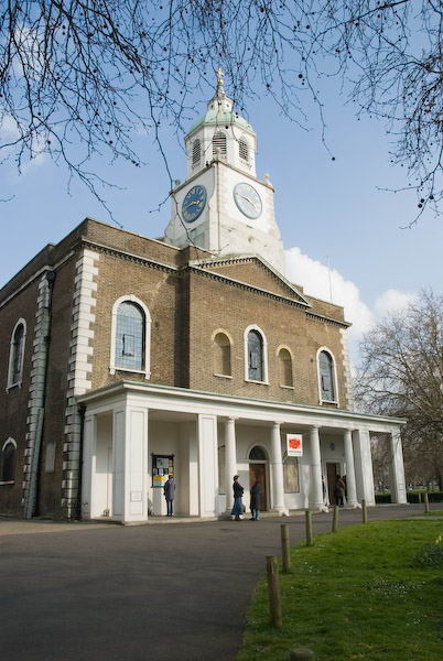
After photographing a ceremony on Lambeth Bridge acknowledging the 2704 ships that left the port of London to carry enslaved Africans the march then continued in a silent remembrance of those who died in the ocean crossings to Kennington Park. I left them to photograph a second march coming to join them from Holy Trinity, Clapham.
The walk from Holy Trinity Clapham was just coming into Stockwell when I joined it.
On Sunday 25th I began at Windrush Square in Brixton where another commemorative event was taking place, organised by the Brixton Society. After drumming, gospel music and speeches about the abolition people planted bulbs in the grass and there were prayers, The event then moved on to celebrating the contribution of those of black Afro-Caribbean origin to life and culture in Britain now with a number of speeches and then more gospel singing.
Planting bulbs
After a lunchtime walk by the Thames I went to Clapham, the spiritual and physical home of the abolition movement, where the London Borough of Lambeth had organised a commemorative walk.
Holy Trinity, Clapham, the home of the Clapham Sect which was the centre of the abolition movement.
This started at Holy Trinity Church, where the Clapham Sect at the centre of the movement, including William Wilberforce, Granville Sharp, John and Henry Thornton, John Venn, Zachary Macaulay and others had worshipped. But as tour guide Steve Martin pointed out Clapham was also home to many who had made fortunes from the trade and opposed the abolition, with both sides worshipping in the same parish church.
One of the three groups of walkers at the probable site of the African Academy
You can read much more about these events on My London Diary, and I won’t copy it all here, but here are my two opening paragraphs:
There is no escaping that all of us who live in Britain – whatever the colour of our skin or our personal history – are now benefiting from the proceeds of the trafficking of African people and their forced labour in our colonies over around four centuries. Fortunes made from slavery helped to build many of the institutions from which we still benefit, including many of our great galleries and museums. Slavery founded many of our banks and breweries and other great industries, and made Britain a wealthy nation.
But it is also true that the same wealthy elite that treated Africans so callously exploited the poor in Britain. My ancestors were thrown off their land and probably some were imprisoned for their religious beliefs by these same elites. Almost certainly some of my forebears were a part of the movement that campaigned against slavery and called for and end to the trade in human beings, although equally certainly they had little or no political power at the time, and probably no vote.
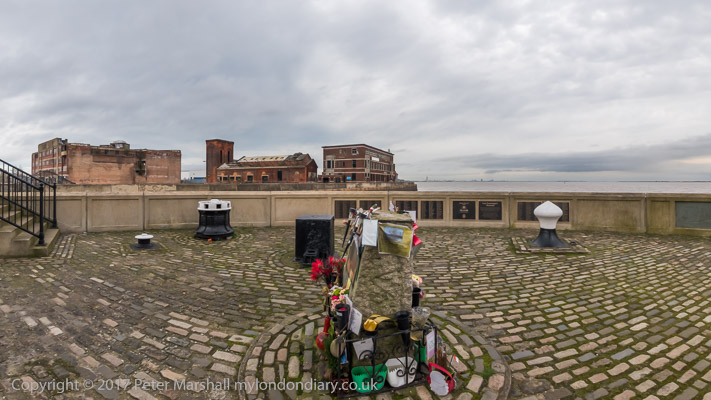
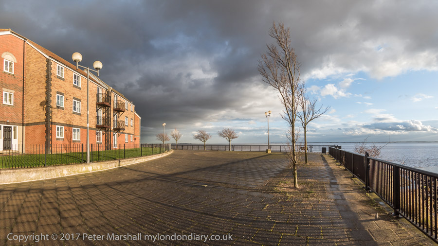
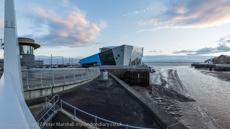
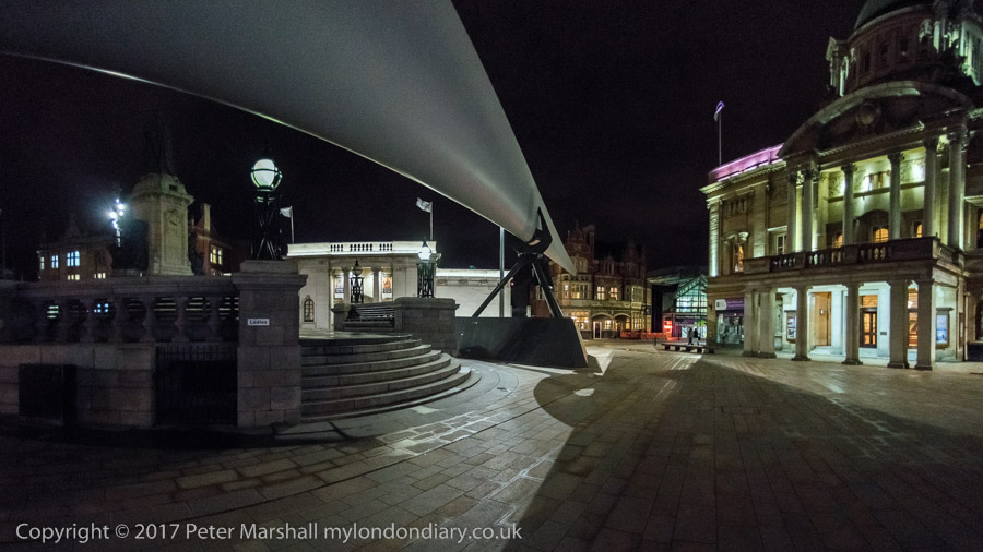
Victoria Dock & the Old Town: We arrived in Hull for a visit during the the city’s Year of Culture on Thursday 16th February 2017, 8 years ago.
We had come partly because I was hoping to have a show in the city – it would have been my first there since 1983 when ‘Still Occupied – A View of Hull‘ was in the Ferens Gallery. This one would have been on a rather less grand scale and fell through when the bailiffs evicted the group who had been squatting another city centre property.
But we had also come to celebrate Linda’s birthday in the city where she was born and grew up and for which we both have a particular affection, as well as to see some of the things that were happening for the special year.
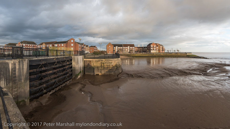
Victoria Dock Half Tide Basin. The black area in the distant dock wall was the entrance to Victoria Dock, now completly filled in.
And as always I had come to take photographs, in particular to revisit some of the many places around the city I had photographed back in the 1970s and 1980s. You can see many of those pictures on the Hull Photos web site where I posted a new photo every day throughout Hull’s year as City of Culture and beyond.
I wasn’t bent on a “re-photography” project. These often seem to me a rather lazy way for people who haven’t any real photographic ideas of their own to capitalise on those of other people – or even their own earlier work. Parasitical. Though I do have to admire a few projects that have been really well carried out.
For me photography has always been about my immediate response to the subject. If the scene has changed so too will I respond differently; and if it hasn’t why bother to photograph it again?
In particular I had moved over the years to seeing landscape and urban landscapes very much more in terms of panoramas. Forty or so years earlier had I worked almost entirely with tightly framed scenes using a 35mm shift lens. But now – with a few exceptions – I was working with the very different perspective of the wide sweeping view of a panorama. It forced me to think differently.
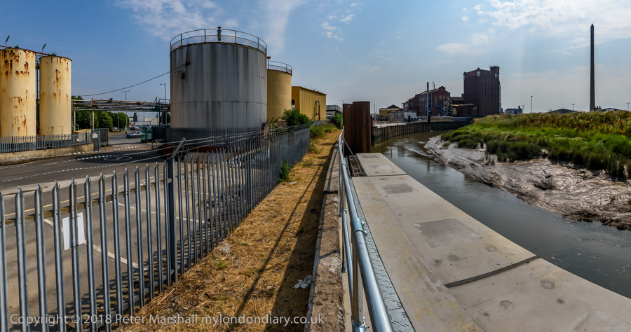
Victoria Dock, Hull’s timber dock had closed before I began making pictures there, although there were still a few small pockets of industry on and around the largely derelict site, as well as some remnants.
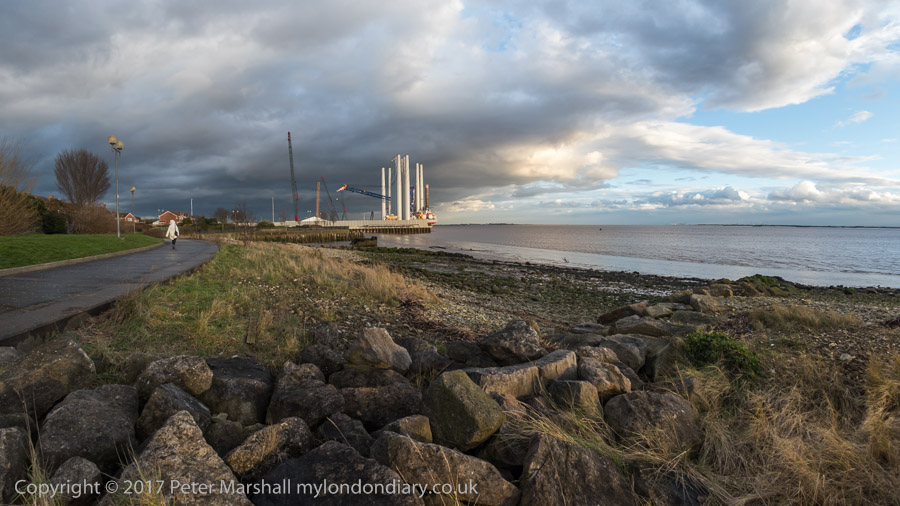
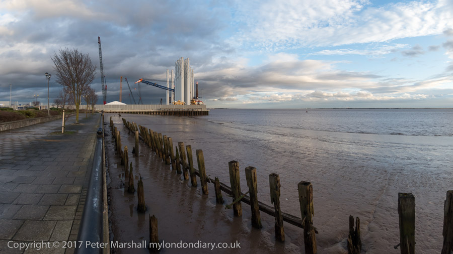
Now the dock has largely been filled in – the large timber ponds had already gone when I first visited. Much is now housing estates, leaving just the Outer Basin and Half Tide Basin and a slipway with water in them. And we were staying in a room of a house on one of the new estates. We arrived in early afternoon and after dumping our bags went out for a walk along the side of the Humber as the weather was fine for photography.
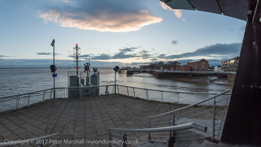
The mouth of the River Hull
I had walked along this footpath years before, going on past the still open Alexandra and King George V Docks more or less to the city boundary. Now the path is cut off by the Siemens wind turbine site on the former Alexandra Dock.
We turned around and walked back towards the Old Town where a new footbridge took us across the River Hull and on to a drink and an early dinner at the Minerva. After the dramatic skies earlier the sunset was rather disappointing.
After a long rest in the pub we decided to wander around the Old Town. In 2017 the area was still pretty empty on a Thursday night in winter, cut in half by the A63, the busy road to the docks (or rather dock), a reminder that Hull is still a significant port. But the footbridge I was then very sceptical about in my account on My London Diary was eventually built. Still something of a barrier, but far less frustrating.
We walked as far as the city centre to admire (and photograph) the turbine blade on display there before turning round to walk back over the River Hull – this time we took the now seldom-lifting North Bridge.
We walked south beside the river along the deserted riverside path to Drypool Bridge where the path was then closed off after the needless demolition of Rank’s Mill for a hotel that didn’t arrive and through the streets – another long wait to cross the A63 – and back to the house we were staying in.
A Damp Sunday in Hull: My poston My London Diary for Sunday 29th July 2018 begins with the question “What do you do on a wet Sunday morning in Hull?” and goes on to answer it, and a second post shows how we spent a slightly less damp afternoon in the city. The pictures here with one exception are from that day.
Hull, thanks to the remarkable generosity of Thomas Robinson Ferens, (1847 – 1930), a Methodist, “industrialist and philanthropist, for whom ‘Reckitt’s Blue made Ferens’ gold'”. He lived simply and gave this wealth almost entirely “to worthy causes. In 1920 he was earning £50,000 a year and giving away £47,000 of that, and still teaching Sunday School every week.” Thanks to him Hull has a university with the motto “Lampada Ferens” (carrying the light of learning) and more to the point for wet Sunday mornings, one of the finest municipal galleries in the country, though I had plenty of time for breakfast before it opened at 11 am.
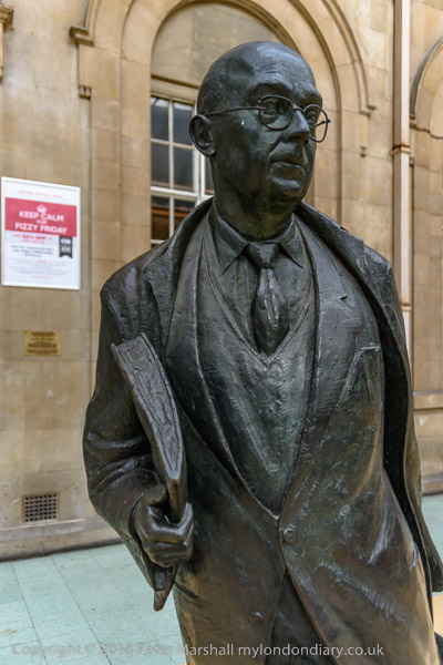
I didn’t photograph the fine exhibition then showing in the gallery of the work of Käthe Kollwitz or any of the other work on display, but went on to meet my wife in Hull Minster where there was an exhibition by the Mission to Seamen and the statue shown above of Lil Bilocca made from issues of the Hull Daily Mail by Gail Hurst. Bilocca was the leader of Hull’s Headscarf Revolutionaries, the Hessle Road Women’s Committee who took direct actioin after three Hull trawlers, St Romanus, Kingston Peridot and Ross Cleveland, sank with the loss of 58 lives in freezing North Atlantic seas around Iceland in January and February 1968.
They fought the trawler owners – and at times the fishermens’ union – to get better safety measures and went to Downing St and persuaded Harold Wilson and his Labour government to review the industry and bring in safety measures which saved thousands of lives. For which she was blacklisted and subjected to a campaign of abuse and hate until her early death in 1988, but is now widely recognised as a hero for her campaign.
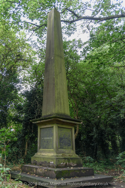
The rain had eased off after lunch as we walked along Spring Bank and through Hull General Cemetery on Spring Bank West to Chants on a combined nostalgia trip and on the Larkin trail.
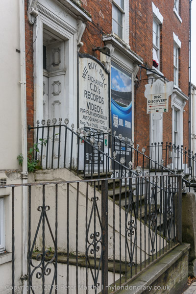
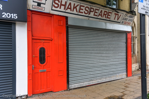
One of the surprises on Spring Bank was the return of Shakespeare, a TV repair shop which I had photographed in the 1980s but more recently had become a Portuguese grocers and, more recently a multicultural food shop. Though it was only the former shop sign and was soon to be covered by a new once for the food store.
And in the cemetery which has been cleared a little – it now has friends, whearas before the council were more its enemies – I was pleased to again find the Monument to Cholera Victims. The 1849 outbreak in Hull killed 1,860 – one in 43 of the city’s inhabitants.
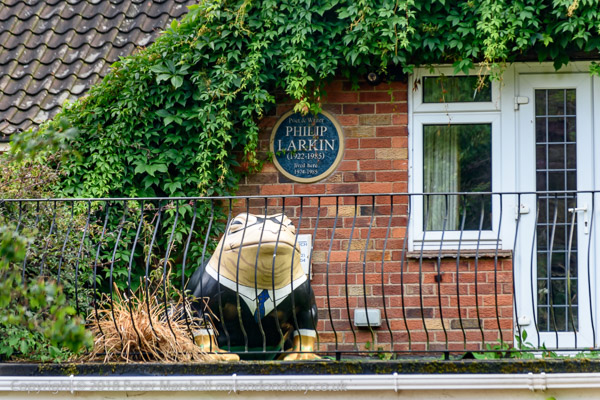
A short detour took us past Linda’s former home and through the Northern Cemetery to visit her family grave and then it was on to Newland Park, a wandering street in which Philip Larking lived in two houses. The entrance to the street has a plaque on the Larkin trail, and the second house he owned there has a plaque and a large toad.
Newland Park is Hull’s most expensive roads, close to the University, and as well as Larkin was also home as another plaque records for 9 years of De Eva Crane in whose house her the International Bee Research Association was formed.
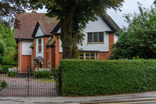
Architecturally of more interest is West Garth, a large ‘Arts & Crafts’ house designed by John Malcolm Dossor (1872-1940) who later became Lord Mayor of Hull. It has a ‘butterfly’ design, with wings at 45 degrees leading off from the central panelled entrance hall. The ground floor room closest to camera was the billiard room, with a full-size table and a bar.
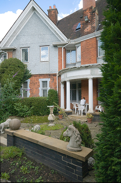
Taken while staying at West Garth in 2008
At the rear the wings enclosed a loggia, which was south-facing and acted as a sun trap, where we took afternoon tea when staying there – my wife was for some years a frequent visitor and I sometimes accompanied her. The building also had a fine library, and five large bedrooms. When sold for £620,000 on September 1, 2017 it was Hull’s most expensive house sale for the year, considerably more than the second most expensive (also in Newland Park,) which sold for £450,000.
West Garth had been the childhood home of one of our friends and he moved back to Hull in later life, first buying Larkin’s first home in Newland Park (and where I think his lawnmower killed a hedgehog) and later moving back into West Garth, spending his last years trying to restore it to its original state aiming to get it listed, but sadly he died before the work was completed.
Our day ended at another of the locations on the Larkin trail, with dinner at the Royal Station Hotel. Originally built together with the station in an Italian Renaissance style, it opened as the Station Hotel in 1849, gaining the ‘Royal’ after Queen Victoria visited in 1853. We had stayed there on a previous visit to Hull, but on this occasion were at a more modern and cheaper venue a few minutes walk away.