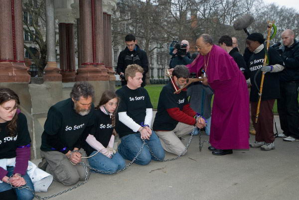
Abolition of the Slave Trade Act: Bicentenary. Events on Sunday 25th March 2007 commemorated the 200th anniversary of the passing of an Act of Parliament to end the slave trade. The previous day I had photographed a Church of England walk of witness to mark the abolition, but on Sunday I covered events in Brixton and Clapham. Sunday was the actual anniversary of the Act which marked a change from Britain being a major partner in the slave trade to opposing slavery worldwide, though it was not until 26 years later in 1833 that slavery was abolished throughout the British Empire. The text below is basically what I wrote in 2007 accompanied by a few of the pictures I made.
Abolition of the Slave Trade Act: Bicentenary
There is no escaping that all of us who live in Britain – whatever the colour of our skin or our personal history – are now benefiting from the proceeds of the trafficking of African people and their forced labour in our colonies over around four centuries. Fortunes made from slavery helped to build many of the institutions from which we still benefit, including our many of our great galleries and museums. Slavery founded many of our banks and breweries and other great industries, and made Britain a wealthy nation.
But it is also true that the same wealthy elite that treated Africans so callously exploited the poor in Britain. My ancestors were thrown off their land and probably some were imprisoned for their religious beliefs by these same elites. Almost certainly my forebears were a part of the movement that campaigned against slavery and called for an end to the trade in human beings, although equally certainly they had little or no political power at the time, and probably no vote.
Of course that in no way diminishes the horror of the trade, but it does colour my personal attitude to the celebrations of the 200th anniversary of the abolition. The abolition movement was an important turning point in the history of our empire and the world leading to the act banning the trade in people and later in 1833 the abolition of slavery throughout the British Empire. The abolition movement changed Britain from being a country that enslaved millions in its own colonies to one that opposed slavery worldwide.
Slavery of course still exists, even in Britain, and we still need to oppose it in all its forms. Much of present day slavery here only flourishes because of our current immigration policies and their implementation, which makes many immigrants illegal, and impoverishes them, denying them human rights or making them afraid to claim them.
Clapham Commemoration Walk
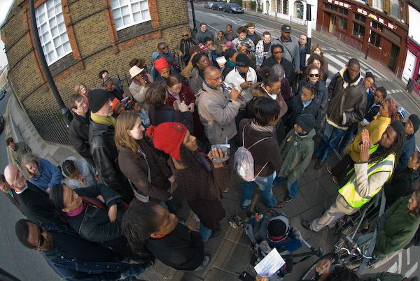
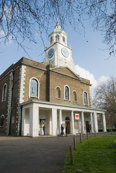
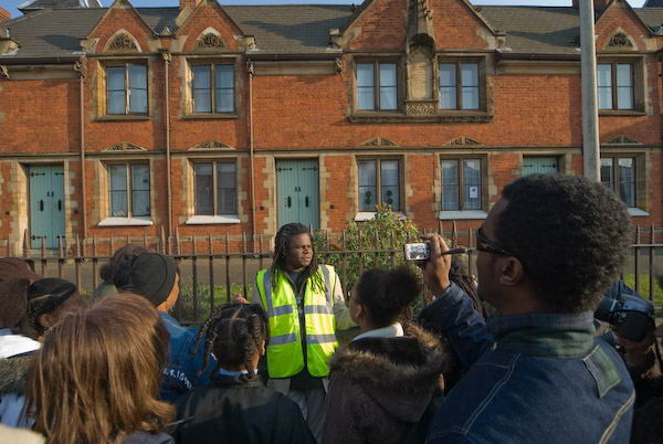
For the 200th anniversary of the passing of the Slave Trade Act on 25 March 2007, I went to Clapham, the spiritual and physical home of the abolition movement, where the London Borough of Lambeth had organised a commemoration walk. This started at Holy Trinity Church, where the Clapham Sect at the centre of the movement, including William Wilberforce, Granville Sharp, John and Henry Thornton, John Venn, Zachary Macaulay and others had worshipped.
Steve Martin, our guide for the walk emphasised that Clapham was also home to many who had made fortunes from the trade and opposed the abolition, with both sides worshipping in the same parish church.
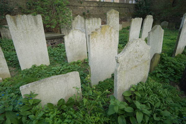
Zachary was a former plantation manager in Jamaica and governor of Sierra Leone who had become an abolitionist. As a part of a project to return freed Africans to Sierra Leone he brought 21 boys and 4 girls back from Sierra Leone and set up an African Academy in Clapham to educate them to return to run their country. The walk took us to two possible sites for this school, as well as to a nearby church cemetery, as unfortunately many of them died of measles and were buried there.
Down Matrimony Place we came to Wandsworth Road, and turned along it to a former brewery and the pub next door. One local family that had made considerable fortune from plantations worked by slave labour were the Barclays (later they became abolitionists and freed their slaves much to the anger of other plantation owners.) When they sold their plantations, the money went into businesses including breweries and banks.
One of those most prominent in the campaign against abolition was George Hibbert, chairman of the West India Dock Company which profited hugely as the slaving ships brought back the produce of the plantations to London. The Hibbert Almshouses on Wandsworth Road were built to house elderly poor residents of Clapham by his two daughters.
As we turned back up towards Clapham Common, Steve informed us that the street along which we walked had been built on what were once the back gardens of the houses of these wealthy traders in human beings who lived in the extensive houses facing the common on Clapham Northside. The tour ended outside no 29, once the home of George Hibbert (Robert Barclay lived next door at 31), a couple of hundred yards from Holy Trinity, where our walk had started.
Across the middle of the Clapham Common is of course a dividing line – between the London boroughs of Lambeth and Wandsworth. It would have prolonged our walk to take in the plaque to Wilberforce in Broomwood Road (Broomfield where he lived was demolished in 1904) or to Battersea Rise, the ‘home’ of the Clapham Sect where he lived earlier with his friend and fellow MP Henry Thornton (the house there was demolished in 1908 despite a campaign and public appeal to save it because of its connection with the abolition movement.)
I could find no mention of the bicentenary on the London Borough of Wandsworth site, although the mayor was to attend a church service at All Saints organised by the local churches on 31 march. One of the bas-reliefs on Wandsworth Town Hall shows Wilberforce with the act in his hand, next to Macaulay. Rather to my surprise I found Wandsworth Museum, instead of celebrating its contribution to abolition, was currently showing a Museum Of London travelling show, ‘Queer Is Here’ which in their words included “Peter Marshall’s dynamic black and white photographs capturing a decade of the annual London gay pride event” – which you can still see on line on My London Diary.
Brixton Commemoration – Windrush Square

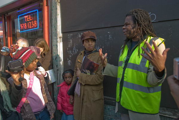
Earlier in the day I’d been at another Lambeth event, in the centre of Brixton, outside the Tate Library.
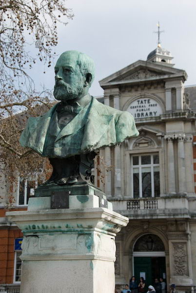
At the end of the Clapham walk there had been a fairly intense argument about whether Tate’s sugar fortunes had come, at least in part, from slave labour on Brazilian plantations after the abolition in the British Empire.

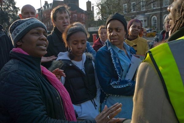
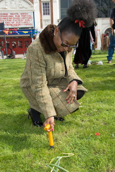
Organised by the Brixton Society, the commemoration of the abolition took place next to Windrush Square and the site of the proposed Black Cultural History Centre in Raleigh Hall. It was opened by an African drummer and singers from the Sozo House Of Praise gospel choir. There were then some speeches mainly concerned with commemorating the abolition of slavery from the Mayor of Lambeth, Cllr Liz Atkinson, local MP Keith Hill, and Superintendent Paul Wilson for Metropolitan Police in Lambeth.

Those present were then invited to plant bulbs in the grass as a permanent memorial, after which Rev Stephen Sichel of St Matthew’s with St Judes across the road led prayers.
Norma Williamson, the treasurer of the Brixton Society introduced a the next section celebrating the contribution of those of Black Afro-Caribbean origin to life and culture in Britain now. Floella Benjamin, OBE gave a very powerful address particularly stressing the need for black kids to get educated to empower themselves. It was a hard act for Derrick Anderson, CBE, Lambeth’s chief executive, and Devon Thomas, the chair of Brixton Business Forum to follow.
Linda Bellos, former leader of the Labour group on Lambeth council, but rejected by the party as a candidate for a local parliamentary seat gave another powerful performance, putting the issue strongly into its political perspective. Power isn’t just about race, it’s also about class, and gender. The event closed with more fine gospel singing from the Sozo House Of Praise choir.
Flickr – Facebook – My London Diary – Hull Photos – Lea Valley – Paris
London’s Industrial Heritage – London Photos
All photographs on this page are copyright © Peter Marshall.
Contact me to buy prints or licence to reproduce.