I was interested to read about the latest RPS project, Bleeding London, which calls itself ” the most ambitious photo project that the capital has ever seen – to photograph every street in London” because it is more or less what I set out to do all on my own in the 1980s.
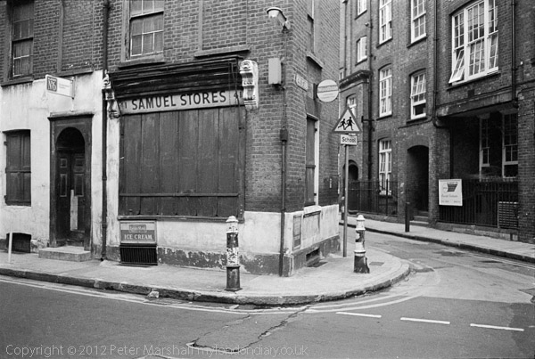
Samuel Stores, Artillery Lane, Spitalfields 1978 from London Dérives
Of course they aim to enrol a large army of volunteers and to do the job in six months, while I spent approaching 20 years, and didn’t quite finish it (and I started out knowing I wouldn’t literally do so.) They also restrict themselves to the ‘standard A to Z‘ while I made use of the rather wider Greater London version. Whatever the results, I think my project can claim to have been considerably (if not foolishly) more ‘ambitious’, and ended up with over 100,000 images.
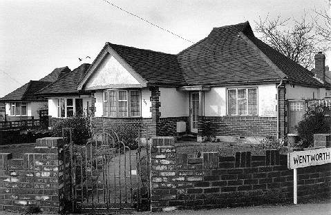
Bungalows on edge of London, Hamsey Green, Tandridge, from London Buildings
Their inspiration – and title – comes from Geoff Nicholson‘s 1997 novel Bleeding London rather than directly from the A-Z London Atlas first published in 1938 by Phyllis Pearsall, who founded the Geographers’ Map Company to produce up-to-date street mapping of London in 1936. It is said that it was only in legend that “Working for up to eighteen hours a day, she walked a total of 3,000 miles while mapping London’s 23,000 streets” though probably a great deal of legwork was involved in checking details.
It is however completely untrue that the 1919 Ordnance Survey was the “most recently published London street map she could find” unless it means she simply did not look very hard. There were other street atlases existing. Perhaps she used that 1919 map because it was the only overall source of mapping she could use as a basis for her own for copyright reasons?
As Bruce Hunt states in his History of London Street Maps, the first London street atlas appears to have been published in 1720, pre-dating the A-Z by around 215 years, containing both a general map and “thirty-six maps of the Wards, Parishes and Liberties“. Bacon‘s pocket series began in 1896, Bartholomew‘s in 1988, Philip‘s in 1902 and Geographia around 1922. All were readily available when Pearsall started work.
Her A-Z was successful because it was better organised than existing street atlases, as well as cheaper and lighter than most. I have a suspicion that she got the idea for the name from the ‘Philips A.B.C. Pocket Atlas Guide to London and its Outer Districts’ which was in to its 17th edition at the time (and which had rather clearer maps, in colour rather than the black and white of the early A-Z.) Her title was snappier, and A-Z appears rather more inclusive. The A-Z also gave some indication of street numbering on the major streets which could be extremely useful.
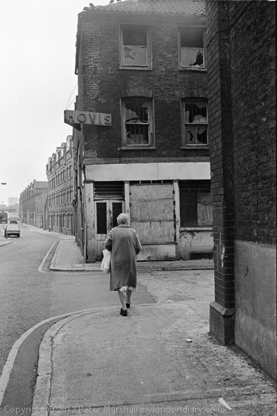
Shoreditch, 1978 From London Derives
My own work was inspired more by the work of photographers, notably Eugene Atget, than by novelists, and although I intended to look down every street in those areas I covered, I wanted only to photograph those aspects that interested me as either being typical or in some respect exceptional.
In particular I set out to show the whole range of London buildings, both the exceptional and the typical, including industrial, commercial, domestic and other types of buildings, but on those same long perambulations I also worked on other projects such as Café Ideal, Cool Blondes, and Paradise.
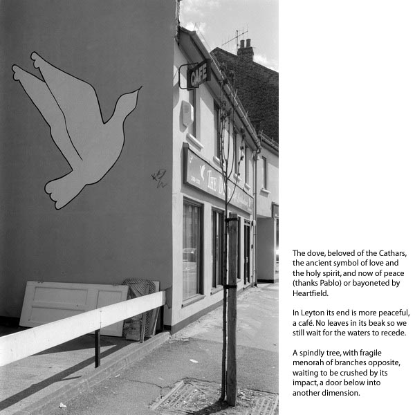
From the website and book ‘1989’
There may have been a literary inspiration too. In my book 1989 which is a kind of fictionalised account of a little of my work in that year my introduction (written in 2006) starts with a section that mentions two books, one the A-Z but also has oblique references to other written works:
“It was in 1989 that I met Upton Trent in Stratford and embarked on series of rambling walks through the streets of northeast London and that writer’s mind. Research for a novel that somehow never quite materialised and now that he is dead, never will, unless I write it myself. All that I have are the notes that I took on our excursions, as we headed up unlikely streets and alleys in a deliberate avoidance of any actual route or end, or jumped on buses that came to rest at lights or crossings as we passed (wherever possible he avoided both bus stops and full stops.)
We carried two books as guides on our journeys. One of course was Aragon’s ‘Paris Paysan’, and the other that we consulted only when lost and exhausted, his London ‘A-Z’. Half the pages of this were missing – probably removed for emergency duties – so it was often of little help. Occasionally he’d pull out a crumpled magazine feature, book page or newspaper article from his pocket, liberated during his visits to dentist’s waiting rooms and libraries, but we could seldom make out more than a few incomplete sentences. I never bothered to take notes from these; after all I could always repeat the process myself, as his pickings seemed entirely random. I think it was how he wrote most of his novels.”
You can also see my comments on ‘1989’ in two posts on this site, ‘1989‘ and A Book At Last: 1989 and there is an earlier version of the work on the web.
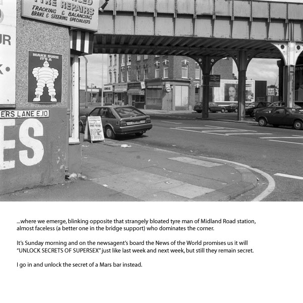
Coopers Lane/High Road Leyton from ‘1989’
You can learn more about the ‘Bleeding London’ project by reading through FAQs, and it is a project open to anyone who wants to take part using almost any way of taking photographs. The newsletter says that there are 300 people already signed up, and they need at least 1,000.
My last paper edition of the ‘standard’ A-Z is dated 1990, and has 140 pages of street names from Abbess Clo. to Zoffany St., each with 4 columns of around 85 lines. Most street entries take a single line, but some occupy two, but at a rough estimate, this makes for around 45,000 streets, and a few more have been added in the last 25 years. So with a thousand members that makes around 45 each. The number isn’t a great problem, but the organisation certainly is.
I did think briefly about taking part when I heard about it a couple of weeks ago, but not for long. It’s an idea which I think is past its time. Because almost every street in London is now available at the click of a mouse thanks to Google Street View.
Continue reading Bleeding London – re-Inventing Streetview?
