Posts Tagged ‘June’

Girls, Houses and St John

Wednesday, September 20th, 2023

Girls, Houses and St John: The second and final set of missing pictures from my walk on June 4th June 1989 – continuing from Stockwell- Chapel, Church, Jazz & Housing

Two girls, Stockwell, Lambeth, 1989 89-6b-23

These two feisty young girls demanded to know what I was doing taking pictures in their manor, outside Cassell House close to the corner of Stockwell Rd and insisted that I take their picture. I think that probably they were sisters although they are dressed rather differently. The older of the two is wearing earrings. They are now 34 years older and if they see their picture I hope they like it.

Across the road you can make out Joseph Yates Timber Merchants at 17-19 Stockwell Road, whose shop was still there though boarded up in 2008. Together with the house behind it was replace by a new block shortly after, the shop becoming EZ Homeware and around 2018 a vape shop, Ez Cloudz.

House, 349, Clapham Rd, Clapham, Lambeth, 1989 89-6b-25

I turned left around the corner into Clapham Road, walking down towards Clapham, crossing Mayflower Road to a group of impressive Queen Anne style red-brick houses – I think this was number 349.

As you can see these houses have quite long front gardens which were then rather overgrown. I think the house had long been divided into flats. There is a broken window on the ground floor which looks as if it is boarded up. These buildings are locally listed

House, 357, Clapham Rd, Clapham, 1989 89-6b-11

This is a bay extension on 355 Clapham Road, which I found more interesting than the Grade II listed house at the left of the picture, the listing text of which begins “Substantial early C19 house, one of a pair of which the other is so much altered as not to be of special interest.” According to the Survey of London the house was first occupied in 1792.

House, 357, Clapham Rd, Clapham, Lambeth, 1989 89-6b-12

Another view of 357 makes it clear that the two storey bay above a basement garage in the previous picture is indeed a part of this house.

I think its doorway with the two front doors is probably also a later addition, though again I found it of interest, though its listed neighbour retains its original and perhaps more common if still fine entrance. I think my taste in buildings allows rather more for eccentricity while those who make the listings are more concerned with age and consistency of style.

House, 369, Clapham Rd, Clapham, Lambeth, 1989 89-6b-13

Listed as The Garden House with location ‘Union Mews, Lambeth, London SW9’ in 1981, this is an unusual house at 369 Clapham Road with no front door, though it does have a fairly plain Doric entrance around the side on the left. It was first occupied in 1815, and was built on land acquired by the Duke of Bedford in the early 18th century and let by him to Robert Robson. There is a fairly lengthy description of the house in the Survey of London volume orginally published by the LCC in 1956 which ends with “The premises are now occupied by Messrs. Ashton Brothers and a garden with seats extends from the pavement edge back to the house.”

My picture shows Ashton Funerals at the site in 1989 with ‘PRIVATE CHAPELS FUNERALS CREMATIONS’ and their name in large signage on rails on the frontage, and a well-kept garden, though I couldn’t resist including the Ad Hoc Wine Warehouse signs as well. The house is now flats and the Ashton signage has gone, and the wine warehouse having become car hire has now been demolished as a part of a new block of flats including and existing property at 363.

St. John the Evangelist, Clapham Rd, Clapham, Lambeth, 1989 89-6b-14
St John the Evangelist, Clapham Rd, Clapham, Lambeth, 1989 89-6b-14

Built 1840-42, architect Thomas Marsh Nelson the church is Grade II listed. A confined site led to an unusual orientation. It was truncated in 1986 and the Diocese of Southwark website comments “In short, this building has suffered due to a lack of clarity from its earliest day. First of all when the east-west axis was reversed and latterly the internal alterations described above. These changes plus the ravages of dry rot have left the interior merely as a jumble of ill-defined spaces without any overall cohesion.”

However the simple classical exterior is impressive, and rather unusual for the date of construction.

Various events and visits took me out of London for the next few weekends and it was July before I could return for my next walk around part of the city.


Stockwell – Chapel, Church, Jazz & Housing

Monday, September 18th, 2023

Stockwell – Chapel, Church, Jazz & Housing: I thought I had completed the pictures from my walk on 4th June 1989, but find there is a chunk I had left out. As those who have followed my various walks know I often wandered in circles. I think these pictures were taken following those in the post More Stockwell Green & Mary Seacole.

Khatme Nubuwwat Centre, 35 Stockwell Green, Stockwell, Lambeth, 1989 89-6b-46

The Khatme Nubuwwat Centre was previously known as Aalami Majlise Tahaffuze Khatme Nubuwwat and is also known as Stockwell Green Mosque. It was the subject of an investigation by the Charity Commission in 2016 over its links with Pakistani groups advocating the killing of Ahmadi Muslims. Its name means that Muhammad is the last of the prophets, while Ahmadis are a minority Muslim sect who believe the Prophet Mohammad is not the last and final messenger.

Khatme Nubuwwat Centre, 35 Stockwell Green, Stockwell, Lambeth, 1989 89-6b-31

Another picture of Stockwell Green Mosque with the number 35 and its name in 1989, Aalami Majlise Tahaffuze Khatme Nubuwwat, at the side of the door.

Confusingly this building still appears to be Grade II listed as Stockwell Green United Reformed Church, although it was sold to the mosque in 1988, when that church moved to smaller premises. It also gives the address as Union Mews. The listing text says it is a classical chapel dating from around 1830. It was known as Stockwell New Chapel and was where William Booth and Catherine Mumford the founders of The Salvation Army were married on 17th June 1855.

I’m surprised that when it was listed in 1981 a more exact date could not be given as most chapels have foundation stones with names and dates. It was built in 1798, but was extended and given this facade by architect Hames Wilson in 1850.

St Andrew's, Church, CofE, Landor Rd, Stockwell, Lambeth, 1989 89-6b-33
St Andrew’s, Church, CofE, Landor Rd, Stockwell, Lambeth, 1989 89-6b-33

I went back to Landor Road and made another picture of the Anglican St Andrew’s Church seen from the corner of Stockwell Green, showing the oversize circular window at its east end, doubtless part of H E Roe’s Romanesque rebuilding in 1867.

The house at the left, 22 Stockwell Green is early 19th century and Grade II listed.

Live Music, Stockwell Green, Stockwell, Lambeth, 1989 89-6b-34

I think this may have been an entrance to the Plough pub, on the corner of Stockwell Green and with the address 90 Stockwell Road, though nothing there resembles this now.

The Plough had been on this site since brewery records began in 1666, but was rebuilt in the 1930s as a Truman pub designed by A E Sewell. It was a well-known jazz venue in the 1960s and 70s with performances by some of Britain’s best jazz musicians and some live recordings were made in the bar.

By the 1990s the audience for live jazz had declined and two letters of its name had fallen from the sign and it was relaunched as a garish bar, the Plug. But this was unsuccessful and closed in 2001. The upper floors are now residential but the ground floor seems to still be empty 22 years later.

King George's House, 40 Stockwell Rd, Stockwell, Lambeth, 1989 89-6b-35
King George’s House, 40 Stockwell Rd, Stockwell, Lambeth, 1989 89-6b-35

Built as Ingram House, architect Arthur T Bolton, it opened in 1905 as a residential club for young men and later was taken over the the YWCA for young ladies. In 1937 it became King George’s House, a home for working boys aged 14-18 run by the John Benn Boys’ Hostel Association. It is now run by Evolve Housing as “an 87 bed service for single homeless young people from 16 years of age with a range of support needs.

The rather tall gates were firmly locked when I made this picture from the street.

Cassell House, Stockwell Gardens Estate, Stockwell, Lambeth, 1989 89-6b-21

Cassell House is in Stockwell Gardens West and has flat numbers 1-81. The estate was built by the London County Council from around 1930 on. Cassell House is a large complex with this curved block behind a group of buildings including the Swan pub on the corner of Clapham Road and Stockwell Road more or less opposite the Stockwell Underground Station.

Stockwell’s most famous gardens, the botanical gardens of John Tradescant lay a little to the north.

A few more of the ‘missing’ pictures in a later post.


Coldharbour, Atlantic & Brixton Rd – 1989

Sunday, September 10th, 2023

Coldharbour, Atlantic & Brixton Rd: My walk which began in Clapham on Sunday 4th June 1989 continues in Brixton. It began with Light & Life, Pinter and Stockwell Breweries and the previous post was Bon Marche, Police, Acre Lane and Tate.

Shops, Coldharbour Lane, Brixton, Lambeth, 1989 89-6a-45

After taking a near-identical image of Electric Avenue to that I posted earlier I moved on to Coldharbour Lane. Rather to my surprise this row of shops is still there, close to the corner with Electric Lane on the south side of the road.

Clifton Mansions, Coldharbour Lane, Brixton, Lambeth, 1989 89-6a-46

Clifton Mansions, 22 flats at 429 Coldharbour Lane were built set back from the road in 1896 to house workers at the nearby Brixton Theatre, now the Ritzy Cinema and are still reached by a archway between shops at 427 and 431.

They attracted a wide range of squatters in the 1990s, including the Pogues and Jeremy Dellar. The flats were refurbished in 2012. Flats there can now be rented for around £2,500 a month.

Matlock House, Rushcroft Rd, Brixton, Lambeth, 1989 89-6a-32

Matlock House looks in rather better condition now and the blocked doorway covered with fly-posting has now been restored. I think the date on the tile above that doorway is 1892. These properties were refurbished in 2015-6 after some 75 squatters living in Rushcroft Road were forcefully evicted in July 2013. You can read about the eviction and see photographs on Brixton Buzz.

Lambeth Council had owned the flats since around 1975 when they had bought them for the constuction of the Innner London Motorway Box, plans for which fortunately were abandoned, as it would have been disastrous for Brixton. Like Clifton Mansions these flats had been built to house artists and technicians from Brixton’s theatre and music halls. The council abandoned the flats and left them to rot, with squatters moving in.

One resident was able to claim “ownership in the House of Lords under the so-called ‘twelve year rule.’ Five Law Lords threw up their hands in exasperation, took a flat away from Lambeth Council and gave it to him, gratis, after more than a decade of Council mismanagement, incompetence, irresponsibility and neglect.”

The squatters formed a neighbourhood association to defend the flats against sale by the council to property developers in 2002. But slowly, despite great public support for the residents the council pressed ahead, destroying a successful community and hugely accelerating the gentrification of Brixton. Flats here are now for sale at around £750,000.

Continental Foods, Coldharbout Lane, Brixton, Lambeth, 1989 89-6a-33
Continental Foods, Coldharbour Lane, Brixton, Lambeth, 1989 89-6a-33

Home in 1989 by Continental Foods, this Grade II listed building at 411-417 Coldharbour Lane, was built around 1914 to the designs of of T R Somerford as one of the chain of Temperance Billiard Halls. The company targeted south London in particular because many new pubs were built here around the end of the 19th century.

Since I made the photograph, there have been some changes with the ground floor now divided into a number of shops, including a community police station. Lambeth Council granted planning permission for it to be turned into a hotel in the 1990s, and the rest of the building around 2005 became a hostel with the name London Hotel, but has since been refurbished as flats named Billiard Lodge.

Shops, Atlantic Rd, Brixton, Lambeth, 1989 89-6a-34

This row of shops with housing above is between Kellett Road and Saltoun Road on Atlantic Road and includes the Frontline Off Licence. The area around the north end of Railton Road which continues Atlantic Road south of here gained that name after the 1981 clashes with police which became known as the Brixton Uprising or Brixton Riots started here.

Vote Rudy Naryan, Shop Window, Brixton Rd, Brixton, Lambeth, 1989 89-6a-36

Rudra (Rudy) Narayan (1938 – 28 1998) was a barrister and civil rights activist who migrated to Britain in the 1953 from Guyana, spending seven years in the British Army before studying at Lincoln’s Inn to become a barrister.

A blue plaque now marks the building at 413 Brixton Road where he had a law practice from 1987-94. Erected by the Nubian Jak Community Trust and the Society of Black Lawyers it remembers him as ‘BARRISTER, CIVIL RIGHTS ACTION, COMMUNITY CHAMPION AND “VOICE FOR THE VOICELESS’. A heavy drinker who was thrown out of chambers for assaulting his head of chambers, he died of cirrhosis of the liver in Kings College Hospital in 1998 following a lengthy battle with alcoholism.

In 1989 Narayan who had been a Labour councillor and once been selected as Labour candidate for Birmingham Handsworth, but then deselected for allegedly anti-Semitic remarks in his books stood as a candidate in the Vauxhall by-election arguing that a largely black area should have a black MP. His campaign failed to attract much support and Labour’s Kate Hoey was elected.

The plaque is above the San Marino coffee shop on the corner with Brixton Station Road. From there I returned to the area around Ferndale Road where a further post will continue this walk.

Bon Marche, Police, Acre Lane and Tate

Wednesday, September 6th, 2023

Bon Marche, Police, Acre Lane and Tate: My walk which began in Clapham on Sunday 4th June 1989 continues in Stockwell. It began with Light & Life, Pinter and Stockwell Breweries and the previous post was More Stockwell Green & Mary Seacole.

240-250 Ferndale Rd, Brixton, Lambeth, 1989 89-6a-61

Possibly before going to Stockwell Green, perhaps even at some point on my previous walk I made some more pictures around the centre of Brixton. Unfortunately film doesn’t come with meta-data and my memory is not as reliable as EXIF data, but these pictures were certainly made around the end of May or beginning of June 1989 and so I’ll share them here.

240-250 Ferndale Rd on the corner with Stockwell Ave, just a few yards back from Brixton Road was built in 1905-6 as an annexe of Bon Marche department store, later becoming Post Office with council offices on the upper floor. You can see a post office sign at the left of my picture. A photograph in the Lambeth Archives taken around 1975 show it as offices for Christian Aid and it was later home to the Refugee Council. The ground floor more recently became Canova Hall, a restaurant and the building was revived as The Department Store, “to create a series of collaborative workspaces supported by an evolving hub of creative, retail and community uses“.

Edmundsbury Estate, Ferndale Rd, Brixton, Lambeth, 1989 89-6a-64

This estate was complete in 1929 for the London County Council as Ferndale Court to house police officers in the City of London Police, but converted into council flats managed by Lambeth Council in 1979 when one of the blocks was demolished to leave a public open space. They were designed by Sidney Perks, who was surveyor to the City of London from 1908 before being appointed as its architect in 1928.

Adjoining the site to the east was the City of London Police Sports Club ground, now the Ferndale Community Sports Centre.

Acre Lane Mouldings Ltd, Acre Lane, Brixton, Lambeth, 1989 89-6a-52

A board illustrates the range of skirting architraves and cornices the company could supply, ‘Quality Mouldings for That Finishing Touch!‘.

Acrelane Timber Ltd is still at this site in Brixton and can perhaps still supply some similar items. A previous frame, not yet digitised shows a little of the frontage offering heating and plumbing supplies.

In my father’s workshop, a very large shed with store rooms and work benches at the back of his family house in Hounslow, long sold off and demolished, I was intrigued as a child by many of the old tools used around the start of the 20th century which included a range of moulding planes used to produce shaped mouldings such as this, used in his father’s cart building business. Back when my elderly aunts moved out around 1970 there was little interest in things like this and I imagine they ended up in landfill, though I’ve since viewed far less impressive ranges in museums.

Lambeth Town Hall, Acre Lane, Brixton Hill, Brixton, Lambeth, 1989 89-6a-54

I turned back along Acre Lane to the junction with Brixton Road where I photographed the grandiose Lambeth Town Hall, complete with a banner advertising an event about child benefit taking place on June 2nd, as well as a sign about going to Lambeth Debtline for debt advice.

Grade II listed Lambeth Town Hall was built in 1905-8, designed by Septimus Warwick and H Austen Hall in what is described as a modified Baroque style, and was further raised and extended 1935-8. I think the clock tower looks like some strange parody, an ornament which doesn’t really belong but has somehow thrust itself up through the ceiling of the main building and flowered extravagantly, reminding me of an amaryllis.

Tate Bust, Tate Library, Brixton Oval, Brixton, Lambeth, 1989 89-6a-55

This area was a pleasant garden before being destroyed by Lambeth Council to produce a windswept waste to discourage local people gathering here. It hasn’t really worked, just become less comfortable with oddly placed fixed chairs and the wind certainly rushes through the renamed Windrush Square. I think I might have come here in 1989 to sit and eat my sandwich lunch.

Henry Tate was born in 1819 in Lancashire, the son of a Unitarian minister, and set up a successful grocery business with six shops in the Liverpool area before going into partnership with sugar refiner John Wright there in 1859. When this partnership came to an end he founded Henry Tate & Sons with his sons Alfred and Edwin.

Tate introduced new more efficient refining techniques for the production of white sugar, and his business expanded and in 1878 he opened a large refinery at Silvertown still producing sugar now.

Fountain, Tate Library, Brixton Oval, Brixton, Lambeth, 1989 89-6a-56

Tate was an employer who took care of his workers and supported many educational projects including free libraries in Streatham, Balham, South Lambeth and Brixton as well as hospitals. After he had built and opened a gallery on Millbank and presented his art collection to the nation he was told Queen Victoria would be offended if yet again he refused a title, and he became a baronet in 1898, a year before his death.

The business was merged with that of Abram Lyle & Sons in 1921, probably causing Tate to turn in his grave, as he had despised Lyle, not least for the way he treated his workers.

Reliance Arcade, Electric Avenue, Brixton, Lambeth, 1989 89-6a-41
Reliance Arcade, Electric Lane, Brixton, Lambeth, 1989 89-6a-41

The Art Deco Reliance arcade was built into an exiting Georgian house and other buildings between Brixton Road and Electric Lane in 1923-5, its Egyptian style terracotta inspired by the 1922 discovery of Tutankhamun’s tomb.

Home to around 30 businesses it was since 2014 this Grade II listed arcade was on English Heritage’s at risk list but was renovated in 2019-20. There are some good pictures from this time by Mike Urban on Brixton Buzz from before and close to the end of the renovation.

My account of this walk will continue in a later post.


More Stockwell Green & Mary Seacole

Friday, August 25th, 2023

My walk which began in Clapham on Sunday 4th June 1989 continues in Stockwell. The first and previous part was Light & Life, Pinter and Stockwell Breweries.

Combermere Rd, Stockwell, Lambeth, 1989 89-6b-51

The decorations at right are on the fine frontage of The Marquess of Lorne pub. The Grade II listing for this mentions is fine terracotta window surrounds and these panels in green, gold and brown glazed tiles. The pub has the address 51 Dalyell Rd, but this side is in Combermere Rd. The Marquis of Lorne is a title given to the eldest son and heir of the Duke of Argyll (in full Marquis of Kintyre and Lorne.) The decoration on the building includes the name of the Licensee in 1881 although a licence for the pub was refused ten years earlier. CAMRA note that as well as the fine Victorian exterior decoration much of the inter-war interior refitting remains.

Probably the pub name dates from 1878 when John George Edward Henry Douglas Sutherland Campbell, later 9th Duke of Argyll but then Marquess of Lorne was made Governor General of Canada. He was married to Princess Louise, fourth daughter of Queen Victoria, who has a rather fine pub named after her in Holborn.

The decoration on 20 Combermere Road at left has also survived. This is a Laundromat and dry cleaners.

Hargwyne St, Stockwell, Lambeth, 1989 89-6b-52

A street of solidly built late Victorian houses. Their plain elegance is relieved by leaf decoration on three sides of the the first floor windows and dentillation above the ground floor bays. A boy plays with a ball outside in this quiet street. I can’t find any explanation of the street name.

Shops, Brixton Station Rd, Brixton Rd, Brixton, Lambeth, 1989 89-6b-53

I made a detour into the centre of Brixton, probably to use the public toilets in Brixton Market, taking a picture of the block of shops on its north side between Brixton Road and Beehive Place, before returning to Combermere Road. I made more pictures in Brixton the same day on another camera, either on this detour or later in my wanderings on the day but I can’t now remember which – I’ll include these in one of the later posts on this walk.

Stockwell Depot, Combermere Rd, Stockwell, Lambeth, 1989 89-6b-42

Another view of the former Waltham’s Brewery in Combermere Road which was for many years a Lambeth Council Depot and has since been replaced by housing. Although I wasn’t able to view the interior, this seemed to me to be a good example of a relatively early industrial building, few of which have survived.

New Queens Head, pub, Stockwell Rd, Stockwell, Lambeth, 1989 89-6b-43

The pub is still there on Stockwell Road, a short distance east of the corner of Combermere Road, and still looks similar though it has lost the ‘New’ and is now longer a Courage pub. The name board between the two first floor windows is gone, now just dull brown empty paintwork and the ground floor paint is all over, no longer emphasising the panels and door and window frames. It used to look rather smarter. Perhaps the beer is better.

Perhaps surprisingly this building is Grade II listed, described as a “Building of Regency appearance with alterations.” The listing states it is included for group value and my picture shows some of that group.

Mary Seacole Mural, Stockwell Green, Stockwell Rd, Stockwell, Lambeth, 1989 89-6b-44

I moved a few feet west to include a better view of the Mary Seacole mural on the west corner of Combermere Road. Not only has the mural now gone, so has the building on which it was painted.

Mary Seacole (1805 – 1881) was born in Jamaica, her father a Scots soldier and mother a free Creole. She became a nurse and a doctor using natural herbs, learning her skills from her mother who ran a house looking after injured soldiers. In 1854 she applied to the War Office to go as a nurse to the Crimean War (1853-6) but was rejected as she had no formal training. So she made her own way there.

In the Crimea she met Florence Nightingale who refused to let her work in the hospital there, so she set up her own British Hotel near Balaclava to look after sick and recovering officers, also going to nurse wounded soldiers on the battlefield, sometimes under fire.

In the Crimea, ‘Mother Seacole’ gained a reputation among the soldiers rivalling that of Florence Nightingale. She returned to England after the war in poor health and destitute, but thousands who knew what she had done for our soldiers set up a festival and collection for her in 1857. At the time William Russell who had been in Crimea as War correspondent for The Times wrote “I trust that England will not forget one who nursed her sick, who sought out her wounded to aid and succour them, and who performed the last offices for some of her illustrious dead.”

But somehow, probably because of her colour, Mary Seacole more or less disappeared from our history books, and this mural and a memorial garden close to where she was buried in St Mary’s Cemetery in Kensal Green were part of a campaign to revive the memory and reputation of this “Black lady of compassion” and Black history in general.

In 2016 a memorial statue to her was erected in the grounds of St Thomas’s Hospital, the first in the UK to a named black woman. There was opposition to the erection of a statue to her, led by the the Nightingale Society.

More pictures from my walk on 4th June 1989 in a later post.


Abbey Rd, South & West Hampstead – 1988

Sunday, November 28th, 2021
Rowley Way, South Hampstead, Camden, 1988 88-6d-54-positive_2400
Rowley Way, South Hampstead, Camden, 1988 88-6d-54

Camden council bought the Alexandra Road estate, part of the Eyre estate in North London and their architect Neave Browne designed this ziggurat style terrace in 1968, but construction only began in 1972. Browne saw the design, with vehicles restricted to the basement level as a better solution than tower blocks, which had been discredited by the Ronan point collapse and other problems. Family flats with small gardens opened onto the walkway at ground level, with smaller flats stepped back above them, so all got good light and air. The height of the 8 storey block at left gave some protection to the rest of the estate from the noise of the main West Coast railway line from Euston.

I had wrongly titled this Langtry Walk, which runs at the south of this estate a few yards away with a single lower row of flats by Browne built on similar principles. The name Langtry walk refers to royal mistress Lily Langtree, nicknamed “The Jersey Lily”, who, as local historians Dick Weindling and Marianne Colloms have shown had no connection with the area but was co-opted by a resident whose house in Alexandra Road was to be demolished for the new estate.

The estate was Grade II* listed in 1993, remarkably early in its life and the first post-Second World War council estate and one of very few public housing schemes to acheive this status.

Snowman House, Casterbridge, Abbey Rd, Camden, 1988 88-6d-55-positive_2400
Snowman House, Casterbridge, Abbey Rd, Camden, 1988 88-6d-55

This photograph was made from Abbey Road, with the back of Rowley Way at the right of the picture. Snowman House at left is on Abbey Road and Casterbridge at the corner of this and Belsize Rd and both are in Camden Council’s Abbey Estate. Both were approved in 1965 and building completed in 1967. They have 20 storeys above ground and are 59.4m tall – about 195 feet.

Snowman House, Casterbridge, Abbey Rd, Camden, 1988 88-6d-42-positive_2400

A bridge across Abbey Road connects the Casterbridge tower with another Abbey estate building, Emminster, which has a parade of shops at ground level. Both the 8 storey Emminster and another block, Hinstock, are scheduled for demolition to make way for new affordable homes to be built, and improvements to the road layout. This bridge was still there in April 2021, but will presumably soon be gone.

Finchley Rd, Camden, 1988 88-6d-35-positive_2400
Finchley Rd, Camden, 1988 88-6d-35

I walked back towards Kilburn Grange Park and then to West End Lane, and then across to FInchley Road. On my contact sheet this row of heraldic figures on the front garden wall of a house is labelled ‘Finchley Rod’, but it may have been a few yards down a side turning.

The Alcove Cafe, Finchley Rd, Camden, 1988 88-6d-36-positive_2400
The Alcove Cafe, Finchley Rd, Camden, 1988 88-6d-36

The Alcove Cafe was in a part of the former station entrance for the Finchley Road (Midland) station which first opened as Finchley Rd & St John’s Wood in 1868. Around 1905 a row of seven shops and offices named Midland Crescent was added to the entrance on the west side of FInchley Road. The station closed in 1927 but the shops remained, being demolished in the early 1990s for the building of the O2 Centre here. Various planning, finanacial and other problems held up the new building which finally opened in 1998.

Neasden Electronics, Tandoori Cottage, Finchley Rd, Camden, 1988 88-6d-21-positive_2400
Neasden Electronics, Tandoori Cottage, Finchley Rd, Camden, 1988 88-6d-21

Neasden Electronics was roughly opposite the former station, and these buildings have now been replaced by a hotel.

Broadhurst Gardens, South Hampstead, Camden, 1988 88-6d-22-positive_2400
Broadhurst Gardens, South Hampstead, Camden, 1988 88-6d-22

I walked down towards Swiss Cottage turning briefly into Broadhurst Gardens to make a picture of the rear of the St John’s Court flats on FInchley Rd, built in 1937-8, architect T P Bennett, with the lower three floors for the department store John Barnes, with five floors above housing 96 flats. In 1940 the store became part of the John Lewis Partnership. It closed as a department store in 1981 and the ground floor are now occupied by Waitrose.

Swiss Cottage, South Hampstead, Camden, 1988 88-6d-24-positive_2400
Swiss Cottage, South Hampstead, Camden, 1988 88-6d-24

I made a couple of photographs of new office buildings at Swiss Cottage.

Swiss Cottage, South Hampstead, Camden, 1988 88-6d-25-positive_2400

Swiss Cottage, South Hampstead, Camden, 1988 88-6d-25-positive_2400
Swiss Cottage, South Hampstead, Camden, 1988 88-6d-25

And then went on the photograph Ye Olde Swiss Cottage, a Grade II listed Samuel Smiths pub originally built as an alpine-style chalet and called The Swiss Tavern.

Ye Olde Swiss Cottage, Finchley Rd, Camden, 1988 88-6d-26-positive_2400
Ye Olde Swiss Cottage, Finchley Rd, Camden, 1988 88-6d-26

Various dates for the building of the chalet can be found on the web, including both 1804 and 1840. Possibly CAMRA may be more reliable given the nature of the building, which they state “was built in 1830 by T Redmond and it stood next to a toll gate; travellers would stop at the tavern while waiting to pay their fees. There had been a gabled building on the site called Lausanne Cottage said to have been used by Charles II as a hunting lodge and their may have been an earlier pub called the Swiss Tavern.”

I didn’t pop in for a pint of ‘Old Brewery Bitter’ (and probably it wasn’t then on tap) but continued my walk – and will do so in a later post.


Click on any of the pictures to go to a larger version on the album 1988 London Photos from where you can browse the whole album. Pictures there are usually in file name order which differs from the order in which they were taken.


Swanscombe

Sunday, June 6th, 2021

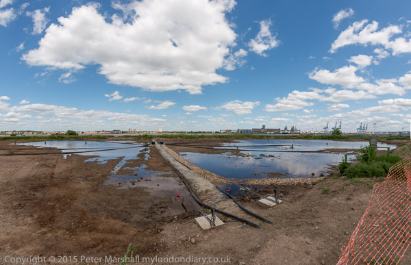
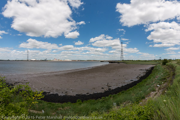
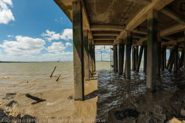
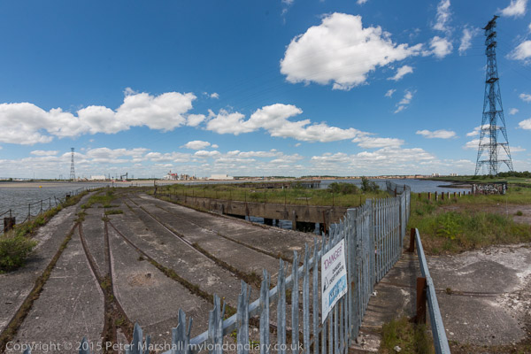
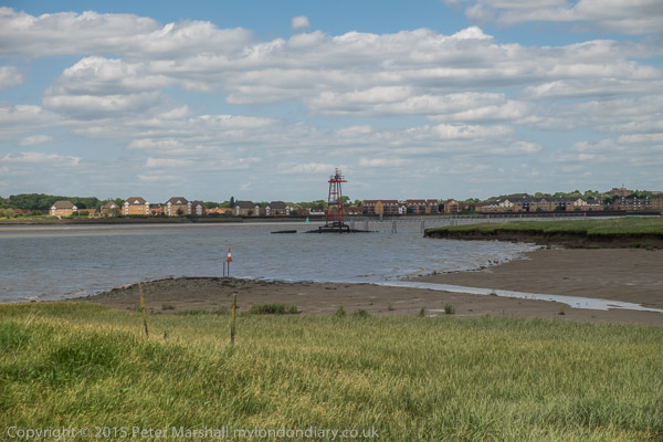
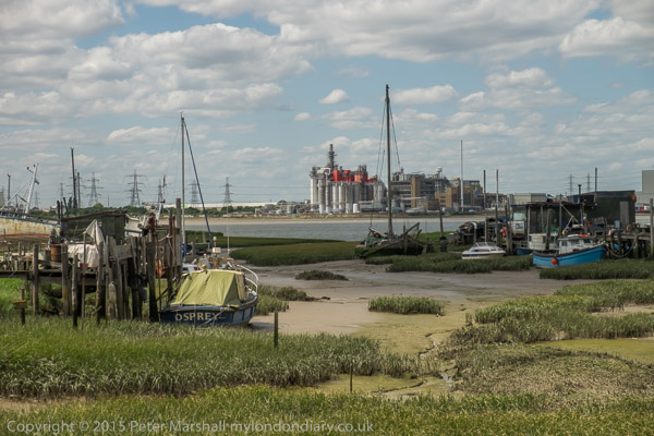
Swanscombe, Kent. Sat 6 Jun 2015

I first visited Swanscombe back in 1985, when I was photographing along the south bank of the River Thames and Lower Thameside. Until the 1840s this area of North Kent had been relatively remove and rural, with riverside marshes largely untouched and valuable agricultural land on the higher areas growing food for the capital.

Portland Cement was patented by by Joseph Aspdin in 1824 and the later developed by his sone William, but the modern version of it was developed at Swanscombe by Isaac Charles Johnson, then manager of John Bazeley White’s cement plant. Johnson soon after left J B Whites to set up his own cement plants, including those nearby at Geenhithe and Cliffe, and Frindsbury on the Medway. In 1911 C Johnson & Co became a part of the Blue Circle Group.

The building of London’s sewers led both to a large demand for cement and also led the Metropolitan Board of Works to provide a specification for their needs which became the standard for Portland Cement. Portland Cement is the cement used in almost all concrete, mortar, stucco and grouting.

From around 1900 virtually all cement has been made in large rotary kilns, with flames heating limestone or chalk with clay-containing minerals at around 1500-1600 degrees Celsius. Water and carbon dioxide are driven off as the minerals combine to give silicates (mainly (tricalcium silicate, dicalcium silicate, tricalcium aluminate and tetracalcium aluminoferrite). Around 10% of world CO2 production which fuels climate change is due to cement manufacture, and smaller amounts of other polluting materials are also released in the process – hence the high chimneys of cement works. The small lumps of ‘cement clinker’ that emerge at the lower end of the kiln are then ground to a fine powder, often with added gypsum (calcium sulphate) or limestone to give cement.

Cement can cause burns and it readily absorbs water, hardening to form solid hydrated material and firmly embedding the sand or aggregate it is mixed with for most uses. Over many thousands of years the River Thames in this area had cut its course up to the chalk of the North Downs, and since the 1840s much of that chalk has been quarried, leaving deep pits with often fairly narrow strips left for roads through the area and housing. One of those deep pits now holds the Bluewater shopping centre at Greenhithe and others are filled with various industrial properties or housing. The industry over around 150 years completely transformed the landscape. But by the time I first came to photograph it, this post-industrial landscape was rapidly being reclaimed by nature.

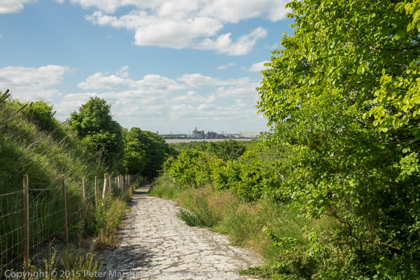
Down the centre of the Swanscombe peninsula is the footpath, Pilgrims Road, leading down towards where a ferry once brought pilgrims on their way to Canterbury from a ferry across the River Thames from close by St Clement’s Church, still there beside the detergent works at South Stifford. Later clay was brought across the river from Essex to wharves for making cement, as well as coal, probably coming by coaster from the north-east to fuel the kilns. Ropeways or conveyor belts will have linked the wharves to the cement plant.

In 2012 I heard of the plans to transform part at least of the area yet again, into the Paramount London theme park, a leisure attraction along the lines of Thorpe Park, which would destroy the area as I knew it. Although I decided to come and photograph the area again before that happened it took me three years to return and do it, cycling around the area on a Brompton, (though occasionally I had to leave it a explore on foot.) Five years on, the plans are still plans and I hope to go back again next month.

With a few exceptions, the pictures here are wide-angle panoramics, with a horizontal angle of view of around 145 degrees and a vertical angle of view of roughly 90 degrees which results in a ‘normal’ aspect ratio of 1.5 : 1 – I usually took these intending to crop to a 1.9:1 ration but have left them uncropped. A few are taken with more normal wide-angle lenses.

On My London Diary you can see more of these pictures, and also read more about the area and my day there in 2015. The images display a little larger on that site.


All photographs on this and my other sites, unless otherwise stated, are taken by and copyright of Peter Marshall, and are available for reproduction or can be bought as prints.