Posts Tagged ‘moderne’

Ghost Sign, Cooltan and a Cinema

Wednesday, July 19th, 2023

The final episode in in the series of posts on my walk in south London on Sunday 6th May 1989. The walk began with Hanover, Belgrave, Chapel, Shops, Taxis. The previous post was Railton Road, Herne Hill.

Ghost Sign, S.Errington, Dulwich Road, Brixton, Lambeth, 1989 89-5f-41
Ghost Sign, S.Errington, Dulwich Road, Herne Hill, Lambeth, 1989 89-5f-41

I turned into Dulwich Road and walked up it towards Brixton, stopping to make very few pictures, perhaps keen to get to the end of the walk. Just before reaching Water Lane on the side of what was then Ellis Newsagents at 1a Dulwich Road I couldn’t resist the finely painted sign ‘
S Cooltan
ERRINGTON
DEALER IN
ANTIQUE
&
MODERN

FURNITURE

FURNITURE
BOUGHT
SOLD OR

in drop capitals, decorated with some fine curly bits. Clearly something at the bottom following the ‘OR’ had been painted over, but I couldn’t decide what it might have been. Perhaps ‘EXCHANGED’ or ‘HIRED’?

The property now looks to be residential, but on Google Maps it still appears as:
S Errington Dealer In Antique & Modern Furniture
Home Furniture Shop
Temporarily closed

and that sign is still there, rather more faded and with the lettering now looking very much plainer. Unfortunately although I will have had a camera body with colour film in my bag I did’t photograph this in colour. Some days I only thought in black and white.

CoolTan Suntan Lotion factory, Effra Rd, Brixton, Lambeth, 1989  89-5f-44
CoolTan, Suntan Lotion factory, Effra Rd, Brixton, Lambeth, 1989 89-5f-44

I walked along Brixton Water Lane, taking a couple of pictures (not digitised) on my way to Effra Road. The the names suggest I was following the route of the River Effra, underground since the early nineteenth century, but in fact I had been doing so all the way down from Herne Hill and was now walking away from it. Effra Road got its name from Effra Farm which was on the bank of the river.

CoolTan Suntan Lotion factory, Effra Rd, Brixton, Lambeth, 1989  89-5f-33
CoolTan Suntan Lotion factory, Effra Rd, Brixton, Lambeth, 1989 89-5f-33

The former Suntan lotion factory was squatted and in June 1991 became the CoolTan Arts Centre. They were evicted in February 1992, and the centre moved first to offices above Brixton Cycles before squatting the former Unemployment Benefit Offices in Coldharbour Lane. There it became a thriving art space, with a cafe, live music and offices for various campaign groups including Reclaim the Streets, Earth First! and the Green Party until 1995, when the building was taken over by The Voice newspaper – who boarded it up and left it empty and rotting. The Effra Road factory was demolished shortly after their eviction and remained as empty unused ground for over ten years.

CoolTan Suntan Lotion factory, Effra Rd, Brixton, Lambeth, 1989  89-5f-34
CoolTan Suntan Lotion factory, Effra Rd, Brixton, Lambeth, 1989 89-5f-34

But Cooltan Arts continued. From 1993-2016 Michelle Baharier was, as she writes in her statement on the South London Women Artists site, “Founder, Artistic Director and CEO of CoolTan Arts, London. In twenty-five years, I grew CoolTan Arts from an old suntan lotion factory squatted social centre in Brixton to a user-led disabled people’s arts and mental health charity. CoolTan Arts worked with over three thousand people face-to-face per year with its participatory art programme. The charity improved the lives of individuals with mental distress through creativity, self-advocacy, and volunteer opportunities within the arts. During my tenure at CoolTan I developed psycho-geography walks and other collaborative events with different communities.”

CoolTan Suntan Lotion factory, Effra Rd, Brixton, Lambeth, 1989  89-5f-35
CoolTan Suntan Lotion factory, Effra Rd, Brixton, Lambeth, 1989 89-5f-35

Clearly I was intrigued by this empty 1930s moderne factory and by its gates and their shadows. Unfortunately the gates were locked and although the fence was fairly low the location seemed a little public for me to climb over and explore the site further though it was more decorative than a real barrier. Eventually I managed to tear myself away and continue my walk, taking a few pictures not online as I walked past St Matthews Church and on to Brixton Hill.

Former Cinema, 101-3 Brixton Hill, Brixton, Lambeth, 1989 89-5f-24

The Tarpaulin & Ten Mfg Co, T&T was for many years in the former cinema, which was converted from shops and opened on 10th March 1911 as Brixton Hill Cinematograph Theatre, and was 13th of Montagu A. Pyke’s chain of Cinematograph Theatres. Pyke went out of business when he was jailed after his projectionist in his cinema died in a fire in 1914, and the cinema was taken over by others. It changed its name then and several other times over the years, operating under names including ‘New Royalty’, ‘New Royalty Kinema’ and finally the Clifton.

It showed its last film in 1957 and deteriorated badly before becoming the T&T shop. I think this kept going into this century and the building was up for sale in 2004 and became the Dalxiis Somalian restaurant. By 2008 the auditorium had been demolished and the front of the cinema had become the South Beach Bar, which lost its licence in 2012. In 2015-6 it was ‘Believers Home Chapel’ , in 2018 the S.G.H Events Hall and in 2019 the TAMI Gospel Centre of The Anointed Ministry International, though still with the South Beach Bar sign on that metal structure, empty in my picture at roof level that had once carried the The New Royalty Kinema and Camping Centre signs.

Post Office Building, Blenheim  Gardens, Brixton, Lambeth, 1989 89-5f-11
Post Office Building, Blenheim Gardens, Brixton, Lambeth, 1989 89-5f-11

I went down Blenheim Gardens, photographing this building, dating from 1891 and still in use by the Royal Mail as Brixton Delivery Office, and the windmill, before walking through the back streets between Brixton Hill and Tulse Hill on a roundabout way to Brixton Water Lane to catch a bus on my way home at the end of my long walk.


Sudbury to Brentford – 31st December 2016

Saturday, December 31st, 2022

Sudbury to Brentford

Six years ago on New Year’s Eve we walked with a couple of family members from Sudbury to Brentford. This year because of rail and health problems none of our family are staying with us and “South Western Railway services between 18 December and 8 January are subject to change and may not operate”, so if the weather is fine we will probably do a rather shorter walk from home.

Sudbury to Brentford

The trip in 2016 to Sudbury Hill station was reasonably fast; a short train journey then a bus and a couple of short hops on the Piccadilly line got us there in a little under an hour and a half, and within a few minutes we were walking along suburban streets to Horsenden Wood, where we walked to the top of the hill.

Sudbury to Brentford

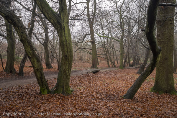
Unfortunately it was a dull and damp day, and we could only see the extensive views this part of the walk would have given us had the air been clear dully through the murk, but the path up through the wood was enhanced by the slight mist. We walked down the hill to cross the Grand Union Canal.

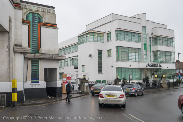
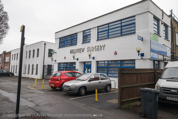
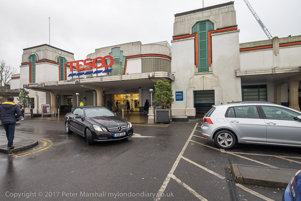
Soon we reached the highpoint of the walk for some of us, the 1930s trading estate leading to the Art Deco Tesco on Western Avenue, designed by Wallis, Gilbert and Partners and built in 1933 for Hoover, along with the 1930s moderne canteen, now an Asian restaurant. We chose the Tesco both for a tiny bit of shopping and the toilets, then walked west to the footbridge to cross the busy road.

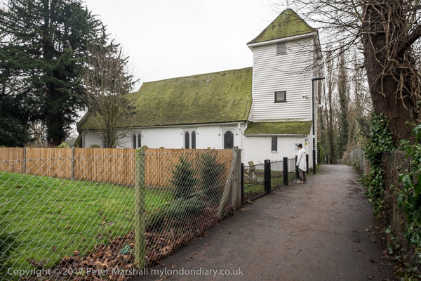
Almost immediately on the path the other side of Western Avenue we came to St Mary the Virgin Perivale, now used for concerts, with just an occasional service.

This Grade I listed redundant church dates in part from the 13th century and was the smallest church in Middlesex (outside London.) We explored its graveyard and sat down on a rather damp seat there to eat our sandwiches in what was either heavy drizzle or light rain.

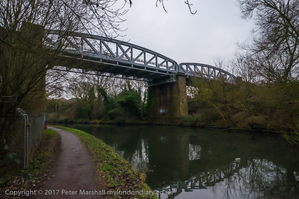
The next section of the walk took us beside the River Brent, another of London’s minor rivers and like the rest of our walk going to Brentford, though we had to make some deviations to follow roads and footpaths. This was a relatively quiet and sometimes boring section of the walk, though its always good to walk beside the river, and there was a rather dumpy viaduct for a doomed railway, a council estate and a long foot path to a Cuckoo Lane where no cuckoos were to be heard except for our ludicrous imitations.

Things got more interesting again when we reached Hanworth Church, and early work of George Gilbert Scott who later called it ‘a mass of horrors’ and Brent Lodge Park, where I ignored the pleas of some of my cfo-walkers and led us firmly away from a tea-room – we were already and hour or so behind schedule if we were to finish the walk during daylight.

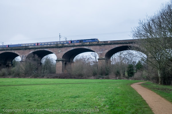
Brunel really knew how to build a viaduct, and here was the first major engineering work on the new Great Western Railway in 1836-7, with 8 semi-elliptical arches each of 70 ft span and rising 19 ft supported on hollow brick piers – the first time these were used in a railway viaduct. 886 ft long, the height to the parapet is 81 ft, and when built it was 30 ft wide to carry two broad gauge lines. Later it was widened to 55ft with a third pier added to each existing pair, and it could then take four standard gauge tracks, which were laid in 1892. We walked under this impressive structure beside the River Brent to the south side which is the earlier part and carries the arms of Lord Wharncliffe, chair of the committee that gave permission for the GWR.

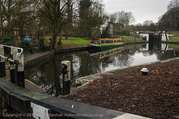
We continued by the Brent to join the Grand Union Canal, another earlier great engineering acheivement along with the rest of the canal system, at the Hanwell flight of locks. Our route now ran along the towpath, so navigation was simple, all the way to the Great West Road.

There was still just enough light to take a few photographs, but my companions were flagging and our walk was getting slower and slower.

By the time we reached the road for the short walk to Brentford Station it was truly dark and they had slowed to a snails pace, and despite my urging them to catch the next train we arrived there to see it just departing, for once dead on time, though we were an hour and a minute later then planned. It had been a good walk but would have been better without the 29 minutes wait there for the next train.

You can see many more pictures from the walk on My London Diary at New Years Eve Walk.


Back to Poplar in 1988

Wednesday, February 23rd, 2022

My previous post, Around Devons Road, Bow 1988, ended outside Spratt’s Patent Limited on Morris Road on the south bank of the Limehouse Cut. My walk continued south down Chrisp St to the East India Dock Road, then turning east for around 350 yards and then back up the next main route north, St Leonards Road.

Plaque, George Lansbury, Poplar Councillors, East India Dock Rd, Poplar, Tower Hamlets, 1988  88-7t-66-positive_2400
Plaque, George Lansbury, Poplar Councillors, East India Dock Rd, Poplar, Tower Hamlets, 1988 88-7t-66-positive_2400

This ‘blue plaque’ is actually and appropriately a red one, placed here by Tower Hamlets Environment Trust with the text ‘Near this place on July 29th 1921 George Lansbury led the people and councillors of Poplar on their march to the high court for the equalisation of rates to poor boroughs.’

According to a long article in Wikipedia, as a youth Lansbury was a supporter of the Liberal Party and particularly Gladstone, but while campaigning for the party he became greatly influenced by leading socialists including William Morris, Eleanor Marx, John Burns and Henry Hyndman, and resigned in 1892, joining the Social Democratic Federation. He worked for a short period as the SDF paid national organiser, leaving that job to return to Bow to take over the running of the sawmill owned by his wife’s family.

Lansbury was first elected to Poplar Borough council in 1903 and in 1910 became MP for Bow and Bromley. He resigned in 1912 in order to fight a by-election in the constituency standing as the ‘Women’s Suffrage and Socialist’ candidate, and although neither Labour nor Liberal parties put up candidates to oppose him he lost to a Conservative candidate with the name of Blair. Reginald Blair had campaigned under the slogan “No Petticoat Government”.

Earlier in 1912 Lansbury had campaigned with others to found a daily socialist newspaper, the Daily Herald, and became editor in 1914. Under his editorship the paper opposed the 1914-18 Great War with Germany and supported the 2017 Russian Revolution.

Lansbury and 29 fellow Poplar councillors were jailed in 1921 for refusing to pay unfair sums from the rates to fund the London County Council, Metropolitan police and other London-wide bodies, instead using the money to support the local poor. Their imprisonment led to public outcry and they were released after six weeks, with a law hastily passed to make richer London boroughs pay their fair share. The campaign made Lansbury a popular hero, and the following year he was elected as local MP with a large majority, holding the seat until his death in 1940.

From 1932 to 1935 Lansbury was the Leader of the Labour Party, but was forced to resign because his Christian pacifist principles became increasingly unacceptable as war with Germany and Italy looked increasingly inevitable. Ernest Bevin put in the final knife, pointing out at conference that his beliefs contradicted the party policy to oppose fascist aggression. Lansbury resigned a few days later, his deputy Clement Atlee becoming leader.

The Falcon, pub, East India Dock Rd, Poplar, Tower Hamlets, 1988  88-7t-51-positive_2400
The Falcon, pub, East India Dock Rd, Poplar, Tower Hamlets, 1988 88-7t-51

The Falcon was at 202a East India Dock from 1869 until it closed in 1985. In my picture you can see some of the windows are boarded up inside and one in Bullivant Street is broken. The first building here was around 1819 and was owned by a Poplar wine merchant, so it may have been a pub earlier. The Truman, Hanbury & Buxton building in the picture dates from 1911 and was demolished shortly after I took this picture.

The A13 here has been widened and nothing on the south side of the road here remains. There are flats on the corner of Bullivant St, a few yards further south than the front of the former pub.

Chinese, East India Dock Rd, Poplar, Tower Hamlets, 1988  88-7t-52-positive_2400
Chinese, East India Dock Rd, Poplar, Tower Hamlets, 1988 88-7t-52

I think this heavily metal shuttered frontage was a Chinese restaurant on the north side of East India Dock Road, probably in the block opposite Bullivant St. Unfortunately I can’t read the two Chinese characters but was intrigued by them and the hanging curtain behind them in this small aperture at the bottom of the doorway.

Tunnel Furnishers Ltd, East India Dock Rd, Poplar, Tower Hamlets, 1988  88-7t-53-positive_2400
Tunnel Furnishers Ltd, East India Dock Rd, Poplar, Tower Hamlets, 1988 88-7t-53

Tunnel Furnishers, a furniture warehouse, was as few doors along East India Dock Road east from The Falcon pub on the corner of Bullivant St. A rather fine 1930s building, this was also lost in the widening of the road not long after I photographed it.

It looks rather like a cinema, but was built in 1938 for the Borough of Poplar as Electricity Showrooms and Offices, replacing an earlier showroom on the site. Closed in 1972, the upper floors continued to be used for training by the London Electricity Board until 1975, after which it was sold for commercial use. Like the rest of the block it was demolished in 1991.

Lodore St, Poplar, Tower Hamlets, 1988  88-7t-55-positive_2400
Lodore St, Poplar, Tower Hamlets, 1988 88-7t-55-positive_2400

My walk took me into what is now the St Frideswide’s Mission House Conservation Area, where a couple of days earlier I had photographed the Follett St Seamen’s Mission, and I took another, very similar picture of that building, before going further along the street and turning into Lodore St.

The view above is I think from Follett St, and shows the rear of one of the buildings of St Frideswide’s on Lodore St, but I think the archway, probably part of the chapel, has been demolished.

Christ Church, Oxford was originally the church of St. Frideswide’s priory, and St Frideswide’s Mission was set up by members of Christ Church College led by the father of Alice in Wonderland, Dean Liddell. A church was built here around 1892, with the Mission house opened in 1893, devoted to a girl’s and mother’s group.

St Frideswide's, Mission House, Lodore St, Poplar, Tower Hamlets, 1988  88-7t-41-positive_2400
St Frideswide’s, Mission House, Lodore St, Poplar, Tower Hamlets, 1988 88-7t-41

The building was paid for by Miss Catherine Phillimore (1847-1929) , who I think was then well-known as an author as well as a translator of Italian books on artists, a wealthy spinster living at Shiplake House in Henley-on-Thames. A number of her books have been reprinted in recent years and are still available.

St Agnes House, Follett Street Poplar, Tower Hamlets, 1988 88-7t-43-positive_2400
St Agnes House, 18, Follett Street Poplar, Tower Hamlets, 1988 88-7t-43

This was built to allow the work of the mission to expand in 1899, and also paid for by Catherine Phillimore. In 1900 it became the Hostel of the Poplar Association for Befriending Girls. The washing on the balcony shows it was still in use in 1988.

St Frideswide’s was the inspiration for the TV series ‘Call the Midwife’ and there is a good article on the Poplar London web site which praises the accuracy of the series and its depiction of the Religious Sisters of Saint John the Divine and their midwives, though complaining that it unfairly makes the residents of Poplar look dirty.


My walk will continue in a later post. You can see larger versions of the pictures by clicking on any of them, which will take you to the album where you can browse more.


Abbey Rd, South & West Hampstead – 1988

Sunday, November 28th, 2021
Rowley Way, South Hampstead, Camden, 1988 88-6d-54-positive_2400
Rowley Way, South Hampstead, Camden, 1988 88-6d-54

Camden council bought the Alexandra Road estate, part of the Eyre estate in North London and their architect Neave Browne designed this ziggurat style terrace in 1968, but construction only began in 1972. Browne saw the design, with vehicles restricted to the basement level as a better solution than tower blocks, which had been discredited by the Ronan point collapse and other problems. Family flats with small gardens opened onto the walkway at ground level, with smaller flats stepped back above them, so all got good light and air. The height of the 8 storey block at left gave some protection to the rest of the estate from the noise of the main West Coast railway line from Euston.

I had wrongly titled this Langtry Walk, which runs at the south of this estate a few yards away with a single lower row of flats by Browne built on similar principles. The name Langtry walk refers to royal mistress Lily Langtree, nicknamed “The Jersey Lily”, who, as local historians Dick Weindling and Marianne Colloms have shown had no connection with the area but was co-opted by a resident whose house in Alexandra Road was to be demolished for the new estate.

The estate was Grade II* listed in 1993, remarkably early in its life and the first post-Second World War council estate and one of very few public housing schemes to acheive this status.

Snowman House, Casterbridge, Abbey Rd, Camden, 1988 88-6d-55-positive_2400
Snowman House, Casterbridge, Abbey Rd, Camden, 1988 88-6d-55

This photograph was made from Abbey Road, with the back of Rowley Way at the right of the picture. Snowman House at left is on Abbey Road and Casterbridge at the corner of this and Belsize Rd and both are in Camden Council’s Abbey Estate. Both were approved in 1965 and building completed in 1967. They have 20 storeys above ground and are 59.4m tall – about 195 feet.

Snowman House, Casterbridge, Abbey Rd, Camden, 1988 88-6d-42-positive_2400

A bridge across Abbey Road connects the Casterbridge tower with another Abbey estate building, Emminster, which has a parade of shops at ground level. Both the 8 storey Emminster and another block, Hinstock, are scheduled for demolition to make way for new affordable homes to be built, and improvements to the road layout. This bridge was still there in April 2021, but will presumably soon be gone.

Finchley Rd, Camden, 1988 88-6d-35-positive_2400
Finchley Rd, Camden, 1988 88-6d-35

I walked back towards Kilburn Grange Park and then to West End Lane, and then across to FInchley Road. On my contact sheet this row of heraldic figures on the front garden wall of a house is labelled ‘Finchley Rod’, but it may have been a few yards down a side turning.

The Alcove Cafe, Finchley Rd, Camden, 1988 88-6d-36-positive_2400
The Alcove Cafe, Finchley Rd, Camden, 1988 88-6d-36

The Alcove Cafe was in a part of the former station entrance for the Finchley Road (Midland) station which first opened as Finchley Rd & St John’s Wood in 1868. Around 1905 a row of seven shops and offices named Midland Crescent was added to the entrance on the west side of FInchley Road. The station closed in 1927 but the shops remained, being demolished in the early 1990s for the building of the O2 Centre here. Various planning, finanacial and other problems held up the new building which finally opened in 1998.

Neasden Electronics, Tandoori Cottage, Finchley Rd, Camden, 1988 88-6d-21-positive_2400
Neasden Electronics, Tandoori Cottage, Finchley Rd, Camden, 1988 88-6d-21

Neasden Electronics was roughly opposite the former station, and these buildings have now been replaced by a hotel.

Broadhurst Gardens, South Hampstead, Camden, 1988 88-6d-22-positive_2400
Broadhurst Gardens, South Hampstead, Camden, 1988 88-6d-22

I walked down towards Swiss Cottage turning briefly into Broadhurst Gardens to make a picture of the rear of the St John’s Court flats on FInchley Rd, built in 1937-8, architect T P Bennett, with the lower three floors for the department store John Barnes, with five floors above housing 96 flats. In 1940 the store became part of the John Lewis Partnership. It closed as a department store in 1981 and the ground floor are now occupied by Waitrose.

Swiss Cottage, South Hampstead, Camden, 1988 88-6d-24-positive_2400
Swiss Cottage, South Hampstead, Camden, 1988 88-6d-24

I made a couple of photographs of new office buildings at Swiss Cottage.

Swiss Cottage, South Hampstead, Camden, 1988 88-6d-25-positive_2400

Swiss Cottage, South Hampstead, Camden, 1988 88-6d-25-positive_2400
Swiss Cottage, South Hampstead, Camden, 1988 88-6d-25

And then went on the photograph Ye Olde Swiss Cottage, a Grade II listed Samuel Smiths pub originally built as an alpine-style chalet and called The Swiss Tavern.

Ye Olde Swiss Cottage, Finchley Rd, Camden, 1988 88-6d-26-positive_2400
Ye Olde Swiss Cottage, Finchley Rd, Camden, 1988 88-6d-26

Various dates for the building of the chalet can be found on the web, including both 1804 and 1840. Possibly CAMRA may be more reliable given the nature of the building, which they state “was built in 1830 by T Redmond and it stood next to a toll gate; travellers would stop at the tavern while waiting to pay their fees. There had been a gabled building on the site called Lausanne Cottage said to have been used by Charles II as a hunting lodge and their may have been an earlier pub called the Swiss Tavern.”

I didn’t pop in for a pint of ‘Old Brewery Bitter’ (and probably it wasn’t then on tap) but continued my walk – and will do so in a later post.


Click on any of the pictures to go to a larger version on the album 1988 London Photos from where you can browse the whole album. Pictures there are usually in file name order which differs from the order in which they were taken.