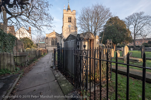
Brian, Bears, Morris and May Queens: On Saturday 13th May 2006 I went to Parliament Square where I photographed resident peace protester Brian Haw and Morris Dancers, going on to more dancers performing in Trafalgar Square as a part of a Westminster Day of Dance. From there the Underground took me out to Hanger Lane from where I walked to Brentham to photograph the 100th anniversary of the first Brentham May Queen crowning.
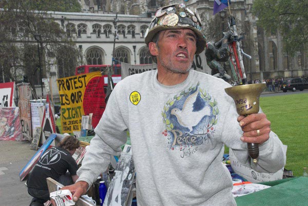
Brian Haw at Parliament Square
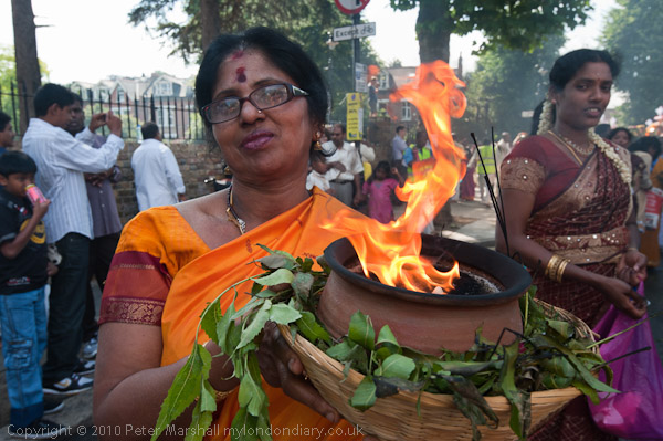
Brian and the Bears
Brian Haw lost the appeal by the government over his protest in Parliament Square, the court deciding that the Serious Organised Crimes And Police Act did apply to his protest after all, despite it having started around 4 years before the act came into force. It seems to be a decision that reflects more on the ability of the government to apply pressure rather than one that suggests an independent judiciary.
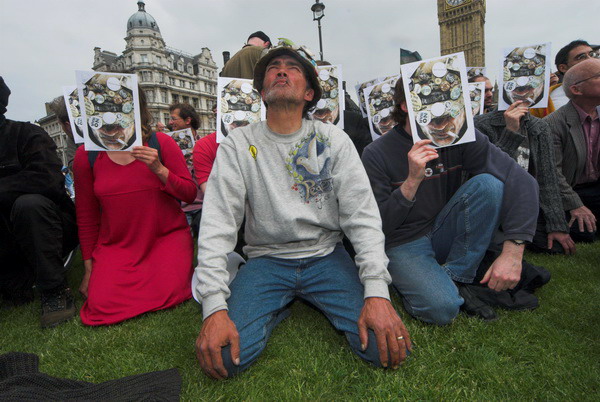
At the moment, Brian is still there, his protest now regulated by the police, but it seems rather likely that at some moment the feel convenient they will decide to terminate it. On Saturday morning I went to have a short word with him and take some more pictures, particularly of some of the bears who are with him.
His protest from the start has been about the killing of children, at first by the effects of sanctions, then by the war, and the teddy bear symbolises this (I think of one of the most poignant images from the Second World War, by Cecil Beaton, of a child in a hospital bed with a teddy bear.) I hope to be back to see Brian tomorrow, with a few friends, if he is still there. [He was, and depite constant harassment remained there until ill-health forced him to leave in 2011, dying in a German hospital six mohnths later.]
Westminster Morris Dance Day
St Margarets & Trafalgar Square
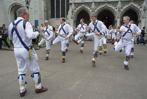
For several years there has been a dance festival in Westminster in May, with teams of Morris Dancers from around the country. I caught up with them briefly dancing in front of St Margaret’s Church next to Westminster Abbey, then a little later in Trafalgar Square.
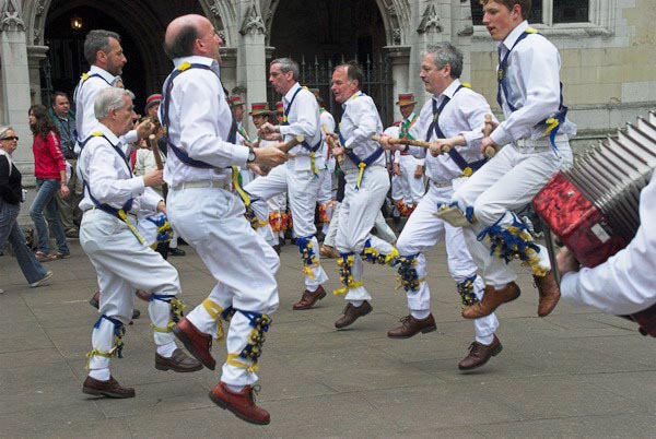
Although i’ve never had a great desire to take up Morris myself, it certainly is one of our English traditions, going back at least 500 years – the first written record of it is in 1448.
It was still alive in many villages in the nineteenth century and a revival started in the early twentieth century particularly through the work of Cecil Sharp, who collected over 170 different dances around the country and started the English Folk Dance Society in 1911. Sharp and Mary Neal published books of dances, and in the 1920s and 30s, country dancing became a part of most young school children’s week. How I hated it in the 1950s!
It is perhaps that enforced participation that led to Morris Dancing being thought of as something false and lacking in credibility. In a curious anomaly, our Arts Councils refuse to support English ethnic dances while (quite rightly) giving aid to foster dance and related activities among minority ethnic groups. Despite this, Morris Dancing has continued to grow both in the UK and now increasingly abroad, particularly in Canada and the USA.
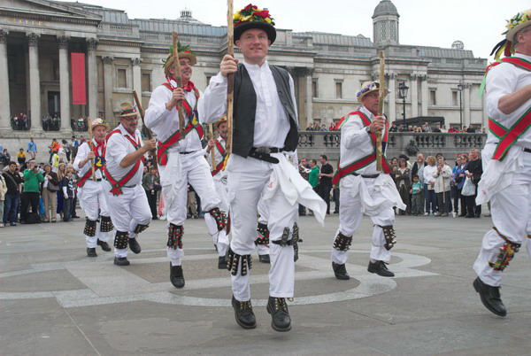
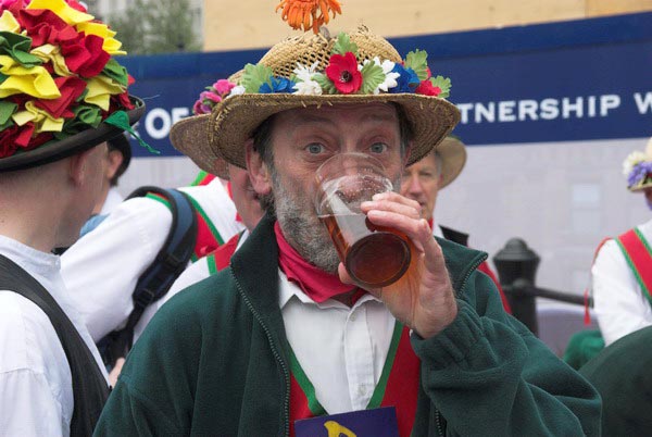
All the teams in Trafalgar Square were men, although there are also many women dancers. One of the things that comes out in my pictures is that the dance is at times a very athletic event. Many of the traditional dances use swords or staves and have a link to martial arts. Morris also has a strong link to another English tradition, the ale house.
Brentham Centenary May Day Festivities
Brentham Estate, Ealing
May continued for me with another May Queen. Last year (2005) I had photographed the oldest continuing May Queen event at least in the London area, the Merrie England and London May Queen Fayre at Hayes, Kent, held continuously since 1913. This year I went instead to Brentham, where a May Fayre with maypole dancing was held in 1906, and its centenary was held this year.
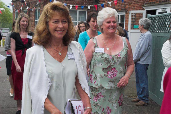
For this event, the organisers had managed to find and invite along many former May Queens, including some from the 1950s. Some had come long distances to be there, including one now living in America.
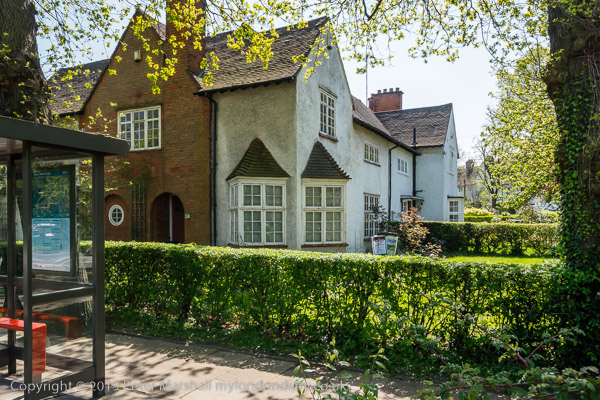
Brentham was one of the earliest “garden village” estates, built by ‘Ealing Tenants’ a co-partnership housing scheme started in 1901 and largely completed by 1915. The road layout was designed by Raymond Unwin and Barry Parker, and it was in many ways a model for other and better known garden villages.
The Brentham May Queen is less formalised that the south London events, with little or no long speeches and ceremonies (unlike Hayes it was not set up by a Dulwich schoolmaster.)
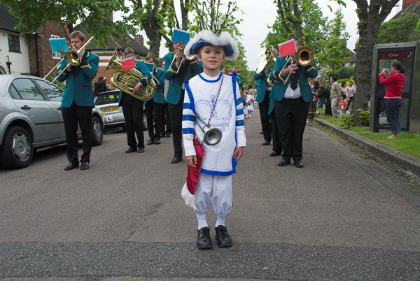
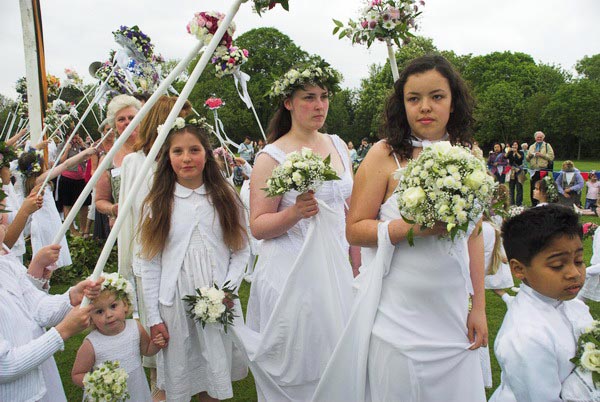
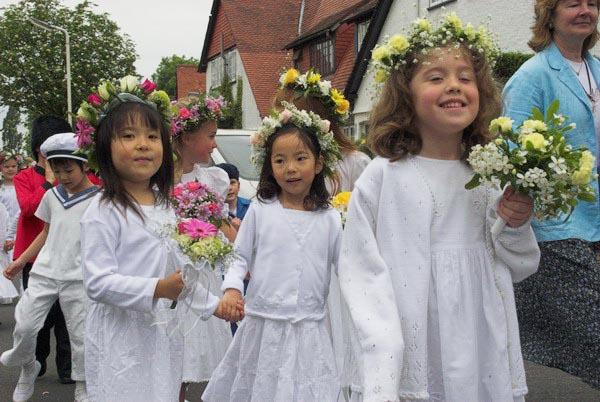
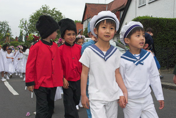
As well as the May Queen Elect and previous May Queens, each with a small group of attendants, there is also a herald who leads the parade (aided today by a brass band) Brittania, Sailor and Soldier, and, leading the large group of around 150 young girls dressed in white with flowers, a Jack In The Green, covered with leaves, with just bare legs and sandals visible.
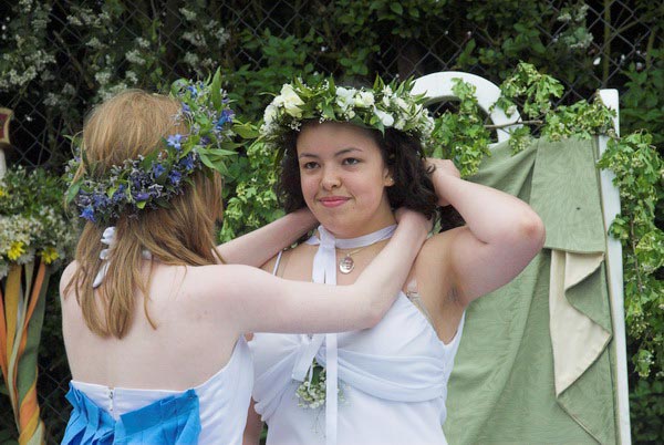
After the parade around the area, there was a short ceremony in one of the fields by the River Brent in which last year’s May Queen crowned the new queen, and a very short speech. Following this were country dances and dancing round the maypole, but I left before this began.
Many more pictures begin here.
Flickr – Facebook – My London Diary – Hull Photos – Lea Valley – Paris
London’s Industrial Heritage – London Photos
All photographs on this page are copyright © Peter Marshall.
Contact me to buy prints or licence to reproduce.