Chiswick Cottage and Lionel Road Brentford: The previous post from my walk on Sunday 7th January 1990 was BHS, Rolls-Royce, Pubs & Funerals, Hammersmith – 1990

I can’t now remember how I got to Duke Road from Hammersmith – either by walking through some of the back streets or by taking a bus to Hogarth Lane where a footpath, Devonshire Passage, leads to Duke Road by the side of St Alban’s Cottage, a detached house dating from 1871.
This is on the Glebe Estate, formerly an open filed providing an income to the vicar of St Nicholas Church, Chiswick and owned by the Ecclesiastical Commissioners and St Paul’s Cathedral who let it for building in 1869. As Gillian Clegg remarks, “That charming little enclave of Victorian cottages between Duke Road and Devonshire Road, Glebe Street and Fraser Street has become one of the most desirable, not to say expensive, places in which to live, which is somewhat ironic since the houses were built as homes for Chiswick’s less affluent.” And this is probably the most charming of the cottages in the area.

I went up Duke Road to the Chiswick High Road in Turnham Green and I think probably jumped on another bus to Kew Bridge.
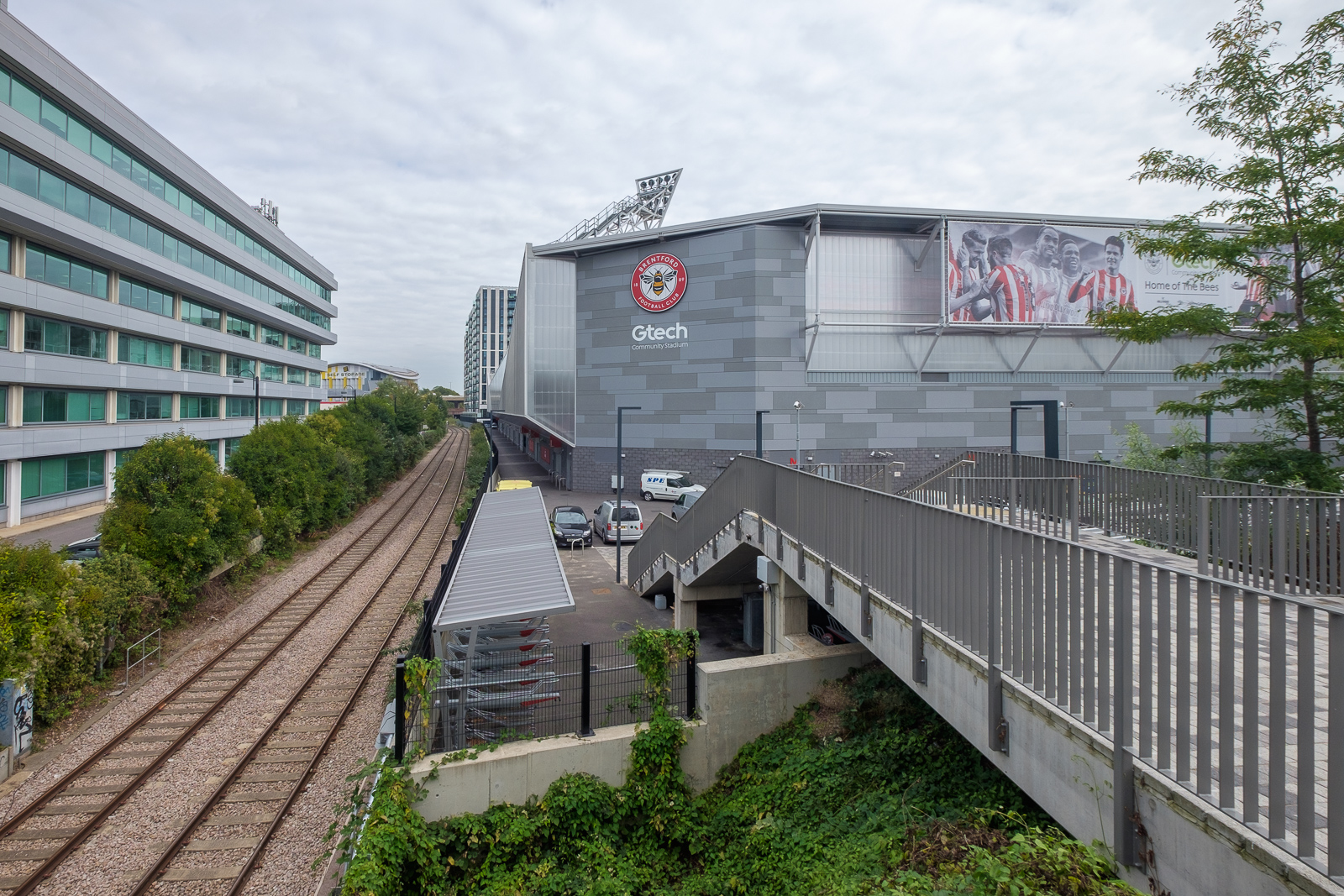
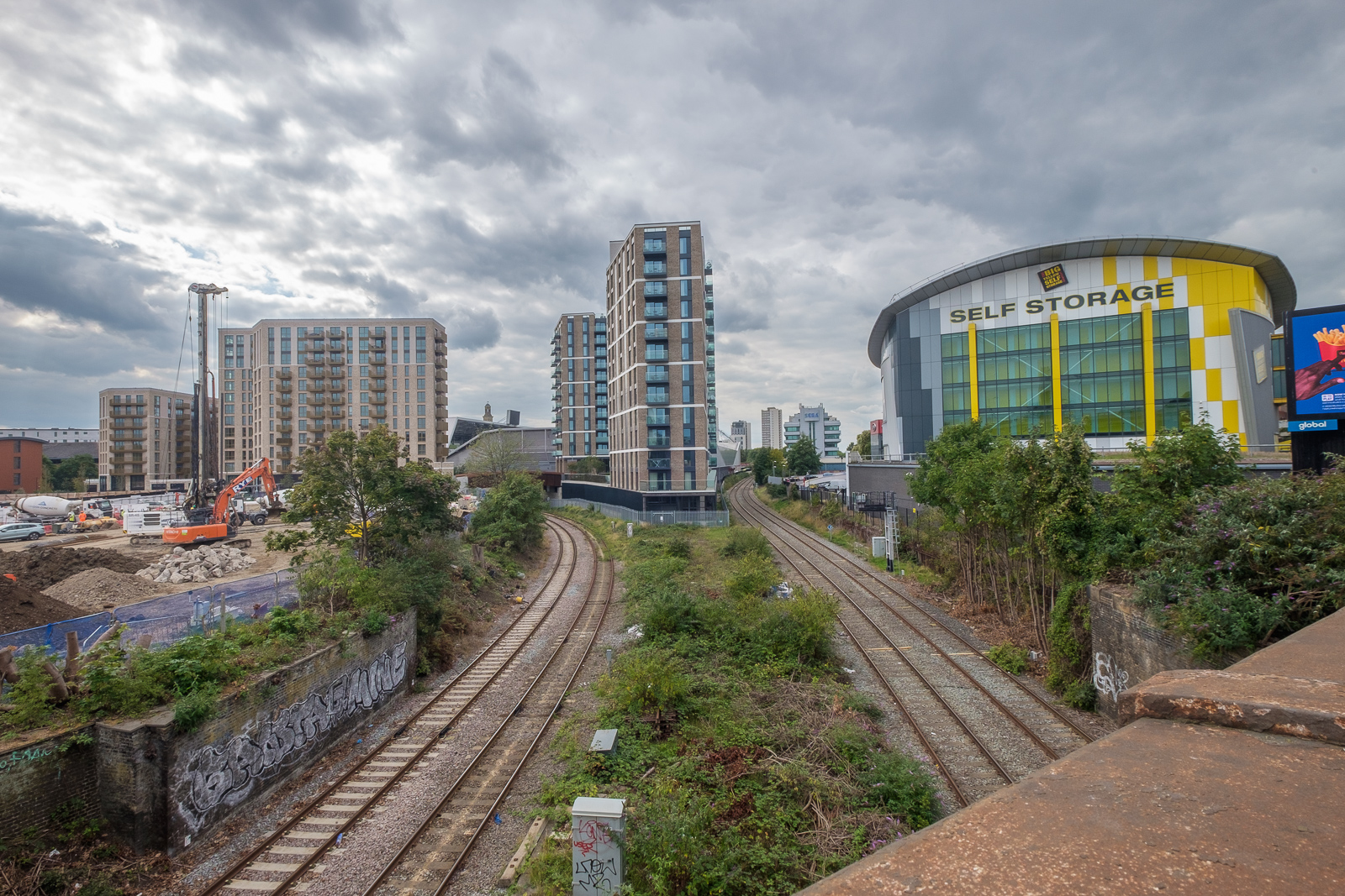
Lionel Road South runs from beside Kew Bridge Station to the Great West Road and is now dominated by Brentford Football Club’s Gtech Community Stadium. RSR Fasterners in Station House was close to the corner with Kew Bridge Road. All of the land in this area had been railway land and was important for bringing passengers and coal from the north of England in the 1850s. In 1990 this building was still on the edge of the station’s freight yard as the sign directing deliveries indicates. The company RSR Fasteners was founded in 1948 and moved here the following year. The business is now based in Hayes.

At the back of the signs here for Tunnel Cement, Brentford Commercials and others is a sign for the British Rail Freight Yard, although some sources say the goods yard closed in 1967. In the background you can see Kearney’s large shed and beyond it the Agfa building on the Great West Road.

The Agfa building was extensively refurbished and became 27 West but the rest was swept away with the development of the new Brentford stadium. There are now further plans for the development of the area.
I’m not sure that the rather rusted vehicle here was a good advert for the servicing provided by the Tony Western Garage.

Another view of Rydal Engineering and to the right of the Volvo lorry is Kearneys, with the Agfa building again in the background.
Agfa were one of the pioneers of colour negative film, introducing Agfacolor in 1932 and I’d occasionally used Agfa film, but they had failed to keep up with others and almost all of the colour I have put online was taken on Fujicolor – and when I made prints in the darkroom they were all on Fuji paper – except for the project ‘German Indications’ which I printed from transparencies on outdated Agfa reversal paper.

Looking across Lionel Road was a parking yard protected by a tall fence, The railway line is lower down and out of sight beyond this, and the four tall blocks of flats are on Green Dragon Lane. Here is what I wrote about when they appeared in a picture from an earlier walk:
Six 23 storey blocks were built here as the Brentford Towers Estate in 1968 to 1972 by the London Borough of Hounslow.
Green Dragon Lane apparently got its name from a 17th century pub but there appears to be no record of where this was, though there are or were around 40 other pubs of that name elsewhere in the country. The name is usually thought either to have come from the Livery Badge worn by servants of the Herbert family, the Earl of Pembroke, which showed a bloody arm being eaten by a dragon or a reference to King Charles II’s Portuguese Catholic queen, Catherine of Braganza whose family badge was the Green Wyvern.
More from Brentford later.
Flickr – Facebook – My London Diary – Hull Photos – Lea Valley – Paris
London’s Industrial Heritage – London Photos
All photographs on this page are copyright © Peter Marshall.
Contact me to buy prints or licence to reproduce.