More from the Golden Mile continues from where my previous post on my walk on Sunday 7th January 1990, Curry’s, Firestone, A Fountain & Kluwer – 1990, ended. This is my final post on this walk.
Adini, 891, Great West Rd, Isleworth, Hounslow, 1990, 90-1g-12
Just to the west of Syon Lane on the Great West Road in Isleworth is this 1933 Art Deco factory by Wallis, Gilbert and Partners built for William Burnett Chemicals. This was the furthest west of the 1930s commercial buildings on the new road and past it are residential properties in the north of Isleworth and Osterley.
Adini, 891, Great West Rd, Isleworth, Hounslow, 1990, 90-1g-12
The building is I think still in use by fashion clothing firm Adini. In 2023 Hounslow Council turned down a planning application to develop the site retaining and restoring this locally listed Art Deco building but with two six storey blocks containing 51 flats on the site. The developers appealed and I am not sure of the current state of the proposal.
Softsel, 941, Great West Road, Brentford, Hounslow, 1990, 90-1h-65
I hadn’t finished with the ‘Golden Mile’ and turned around and walked east back into Brentford along the Great West Road. 941, the occupied by Softsel was another building by Wallis, Gilbert & Partners for cosmetics company Coty.
This building is now the private Syon Clinic.
Steps, 971, Great West Road, Brentford, Hounslow, 1990, 90-1h-66
Another grand set of steps led up to the factory of Leonard Williams Ltd, who made Packard cars here from 1929. Queensway in 1990 it now leads to DFS Brentford Sofa & Furniture Store, but only these steps remain of the previous building.
Pyrene Building, Westlink House, 981, Great West Road, Brentford, Hounslow, 1990, 90-1h-51
Built 1929-1930 by Wallis, Gilbert & Partners for Pyrene, makers of fire extinguishers it is Grade II listed. The main windows here had already been altered by 1990.
Pyrene Building, Westlink House, Great West Road, Brentford, Hounslow, 1990, 90-1h-44
This grand entrance and the gate posts are perhaps the most interesting feature of the building. The building now provides tailor-made office space for companies of all sizes.
Pyrene Building, Westlink House, Great West Road, Brentford, Hounslow, 1990, 90-1h-44
I still hadn’t quite finished with the Golden Mile, but my final pictures were a set of five pictures of the remarkable former Curry’s HQ at 991 Great West Road which featured in an earlier post – you can see them starting here on Flickr.
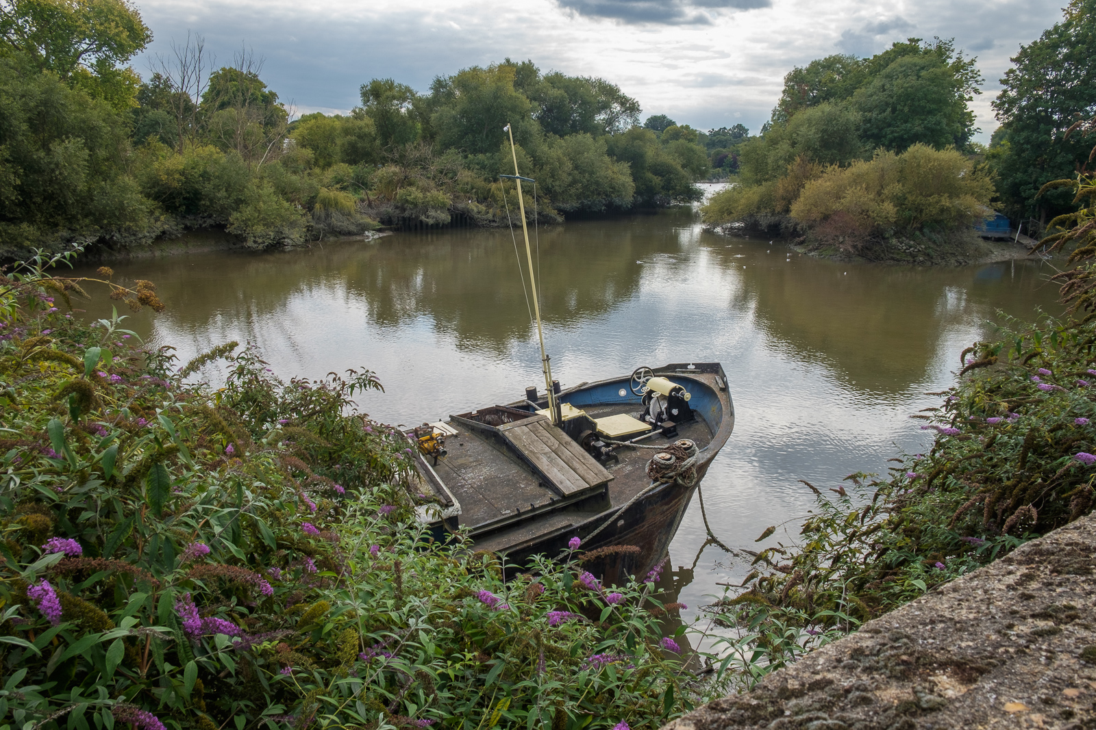
Grand Union Canal, Great West Rd, Brentford, Hounslow, 1990, 90-1h-34
I ended my walk by with a final picture looking south from the bridge which takes the Great West Road over the here combined River Brent and the Grand Union Canal before getting away from the noise and dust of the road and walking along the canal towpath to Brentford High Street where I could catch a bus to start my journey home.
Macleans Toothpaste, Great West Rd, Brentford, Hounslow, 1990, 90-1g-03
Toothpaste in my youth came as dentifrice, a usually pink powder or block in small tins, around 7 or 8 cm diameter and 2 cm tall, and Macleans had a patent aluminium tin. In my home we only changed to toothpaste in tubes at some time in the 1950s, but we could have been behind the times. And we used Gibbs Dentifrice, not Macleans.
Macleans was begun by a New Zealand born businessman, Alex C. Maclean in 1919, and moved into this splendid new factory on the Great West Road in 1932. The company was bought by Beechams in 1938 and later was swallowed up as a part of GlaxoSmithKline or GSK. You can still apparently get Macleans toothpaste though it bears little relationship to the orginal product and is now produced by Haleon
Macleans, Great West Rd, Brentford, Hounslow, 1990, 90-1g-04
The centenary of the Great West Road is celebrated in the book The Great West Road: A Centenary History by James Marshall, so far as I know not a relative of mine. “For two miles, from its junction with the North Circular Road and Chiswick High Road to Gillette Corner, a corridor of inter-war factory buildings emerged, a stylish celebration of art deco architecture.”
Macleans, Great West Rd, Brentford, Hounslow, 1990, 90-1g-61
Unfortunately many of the buildings have now gone, Trico and Macleans among them, although a few of the grander survive. I think I knew when I took these pictures two years before the business moved that these would shortly be demolished.
Trico, 980, Great West Rd, Brentford, Hounslow, 1990, 90-1g-51
The Trico Products Windscreen Wiper factory, No. 980, Great West Road, Brentford opened in 1928, three years after the new road was opened by George V in 2025 as the Brentford by-pass. Trico relocated to Pontypool, South Wales in 1992 and the building was demolished.
Certainly I took more pictures of these buildings than the others along this stretch of road, about three times as many as are in this post, though most of the rest are fairly similar to these.
Trico, 980, Great West Rd, Brentford, Hounslow, 1990, 90-1g-52
In the 1980s there was still little general appreciation of Art Deco or moderne buildings from the 1920s and 1930s and few had been give the protection afforded by listing. The most celebrated case of demolition was the Firestone Tyre Factory which had closed and been sold to Trafalgar House, a company run by Lord Victor Matthews and Nigel Broakes on 22nd August 1980.
A Department of the Environment inspector had the same week decided the building should be listed, but as it was the Bank Holiday weekend no civil servant was available to sign the emergency listing document. “On Saturday 23 August Lord Matthews ordered demolition men to destroy the main features of the facade – the ceramic tiles around the entrance, the white pillars, the pediment above and the bronze lamp standards.” And so one of the finest buildings on the stretch was destroyed.
Trico, 980, Great West Rd, Brentford, Hounslow, 1990, 90-1g-54
Victor Matthews, who as well as being Chairman of Trafalgar House was the proprietor of the Daily Express, had been made a Life Peer as Baron Matthews of Southgate a month before this despicable act of cultural vandalism.
Grand Union Canal, Trico, Great West Rd, Brentford, Hounslow, 1990, 90-1g-56
The canal which had been so important in earlier Brentford history was irrelevant to the companies which now set up along the new road. They were entirely based around road transport and very much used their impressive frontages as advertisements for their businesses to those driving along the new highway.
Grand Union Canal, Trico, Great West Rd, Brentford, Hounslow, 1990, 90-1g-41
More from other buildings along the Great West Road in the next instalment.
Jubilee Chapel, Primitive Methodist, New Rd, Brentford, Hounslow, 1990, 90-1f-26
Built in 1897, the year of Queen Victoria’s Diamond Jubilee, the church closed in 1964 when a new church opened in Clifden Rd. The Primitives had joined with the Wesleyans and United Methodists in 1932. The building is a rather curious design laid out along the road with a tower like this at each end and five bays between, the central one with what looks as it should be an entrance with taller brickwork and a triangular pediment above a large oval-topped window. You can see a little of the interesting brickwork in my photograph. The windows now have some delicate metal protection in front of them and the building is still in use, I think by an Electrical contactor. It is locally listed for its architectural and social significance.
House, Hamilton Rd, Brentford, Hounslow, 1990, 90-1f-11
This Gothick style house at 17 Hamilton Road stands head and shoulders above its neighbours with a basement, steps up to a grand doorway and the fine decoration below its distinctive oriel window. It is capped on one side with an attic gable, making it three and a half storeys. Locally listed.
Performance Cars Ltd, Windmill Rd, Great West Rd, Brentford, Hounslow, 1990, 90-1f-13
Although it might gain no stars for its uncompromising 1930s architecture this building for Performance Cars had a blunt and striking appearance and I was sad to see it was about to be demolished, one of many losses of buildings along the Great West Road. It’s a shame it was not saved, although the adjoining workshops were no great loss. Most of its site is now empty or parking for another motor dealer. I took this picture from underneath the elevated M4.
The Globe, Boston Park Rd, 104, Windmill Rd, Brentford, Hounslow, 1990, 90-1f-15
The Globe pub on the corner of Boston Park Road and Windmill Road is still open and is a popular traditional pub which still has some original features.Though it is no longer run by Fullers you may still be able to get a pint of London Pride. My picture just shows a little of the large globe let into the parapet above the corner of the building.
The pub was built in the 1880s and acquired by Fuller Smith & Turner in 1908. It is named in an impressive series of reviews of Brentford’s pubs written by ‘Wandering Tom’ and published in the County of Middlesex Indepent in 1996 but he tells us nothing mopre than its name. Unearthed by Vic Rosewarne as part of extensive research into Brentford’s pubs, these notes have been re-published as part of the Brentford High Street project.
Macleans Toothpaste, Great West Rd, Brentford, Hounslow, 1990, 90-1f-16
Finally two pictures – more to follow later – of another and more important loss of the 1920’s factories that lined the Brentford section of the new Great West Road. This was Maclean’s Toothpaste factory, opened in 1932 and together with the neighbouring Trico was demolished in 1992.
Trico Products Windscreen Wiper factory, No. 980 Great West Road, opened in 1928. The Trico business relocated to Pontypool, South Wales in 1992 and the building was demolished.
Macleans, Boston Manor Rd, Brentford, Hounslow, 1990, 90-1g-01
Initially the Macleans site, along with the adjoining former Trico factory next to the Grand Union Canal was to be a UK headquarters for Samsung, but plans fell through with an Asian financial crisis and instead building a new headquarters of GlaxoSmithKline was begun in 1998 and completed in 2001. Designed by Hillier with RHWL and Swanke Hayden Connell it was the biggest single commercial development of the time, and one of the few more interesting new buildings on the Great West Road.
GSK announced they were selling it in 2021 and the last of their staff left the building in 2014. There are now plans being made for what will probably be the largest ever development in Brentford.
Vantage London, Great West Rd, M4, Brentford, Hounslow, 1990, 90-1f-45
Built around 1970 as the 12 storey headquarters of Beecham Pharmaceuticals it was no longer needed after they became part of Glaxo Smith Kline and was refurbished as as Vantage London with offices let to a number of companies. The building was again refurbished in 2016 and in 2019 was sold to a Luxembourg based company for £30 million.
In 2024 a planning application was made by Resolution Property for its conversion into 178 flats. It was approved following some modifications in April 2025.
The elevated section of the M4 runs on top of the Great West Road in front of the building. The strucvture in the foreground is I think a gritting bin.
Great West Rd, M4, Brentford, Hounslow, 1990, 90-1f-35
Taken under the elevated M4 where slip roads link the A4 Great West Road with the motorway. One project I was working on at the time was inspired by J G Ballard’s 1973 novel ‘Crash’, key scenes of which were set in this area – although the 1996 film of the book by Cronenberg was made in Canada. Ballard who lived not far away in Shepperton obviously knew the area well.
Crash centres around a car crash victim who finds himself aroused by car accidents but my project was more simply about the domination of our culture by the car and I felt threatened by the powerfully enclosed architecture here which is perhaps a modern equivalent of the Roman coliseums, and was rather choked by the fumes.
On previous occasions I had photographed the iconic moderne 1930s buildings along the Great West Road, and this at right shows Beechams, which had this side entrance a few yards down Clayponds Lane. The factory building continues in a more utilitarian fashion but with a tall window, probably lighting a staircase which reflects the style.
Flats, Carville Hall, Carville Hall Park, Brentford, Hounslow, 1990,90-1f-22
The Carville Hall Estate was bought by Middlesex County Council in 1919 for the construction of the Great West Rd, and they sold the parts on both sides of the new road to Brentford UDC as a park, which opened in 1923. The house, orginally known as Clayponds, is now called Simmonds House. Originally built in the late 18th century, the front was re-modelled in the 19th century. It is locally listed.
The park is off Clayponds Lane and parts of it were once dug for clay, leaving ponds, marked as ‘Fishponds’ on the 1871 OS Map.
Lion, flats, Carville Hall Park, Brentford, Hounslow, 1990, 90-1f-23
Beyond the lion and the park are the tall blocks of the Brentford Towers Estate built for Hounslow Council in 1968-72.
The house here had extensive grounds and there is now a park on both sides of the A4/M4. The park to the north of the roads is larger than this but of little interest.
The house is thought to have been built for the “wealthy distiller and brewer David Roberts (c1733-97)” and was later home to “coal and horse racing magnate William Lancalot Redhead (c1853-1909) and his daughter“. It was later converted into flats.
Lion, Carville Hall, Carville Hall Park, Brentford, Hounslow, 1990, 90-1f-24
The fate of the lion appears to be a mystery. I was surprised on a later visit to find it no longer there and I’ve not been able to find what happened to it. The most I’ve come across is a suggestion that it was stolen.
I thought that it was probably a Victorian garden ornament made from artificial stone – Coade or Portland Stone etc – and would have been fairly heavy, so the thief would have needed a lorry with appropriate lifting gear.
St Peter’s Church, Black Lion Lane, Hammersmith, Hammersmith & Fulham, 1989, 89-12c-35
St Peter’s Church is at the south-east corner of St Peter’s Square on Black Lion Lane and is now uncomfortably close to the Great West Road, this section built well over a hundred years later in the late 1950s. In 1829 the church would have been surrounded by trees, meadows and market gardens with a pleasant walk to the nearby Thames. Now you need to seach for the subway to get across one of the busiest roads out of London.
The architect was locally born Edward Lapidge, whose father was an assistant to Capability Brown as a landscape gardener at Hampton Court. As well as a wider practice he also built other local churches at Hampton Wick and Putney. The Classical church building is Grade II* listed and William Morris who lived nearby had a hand in redecorating its interior in 1887.
Leaning Woman, Karel Vogel, North Verbena Gardens, Hammersmith, Hammersmith & Fulham, 1989, 89-12c-36
This 1959 concrete sculpture by Karel Vogel, (1897-1961) a Jewish Czech-born artist who fled here from the Nazis in 1938, was Grade II listed in 2016. It was commissioned by the London County Council’s Patronage of the Arts scheme when the Great West Road was being built through St Peter’s churchyard in 1959 “provide visual amenity in compensation for” this major road scheme. The sculpture, cast concrete over a metal framework, took Vogel over a year to complete and was extremely controversial in the local area.
By 2016 the sculpture had seriously deteriorated and Radio Prague reported in 2023 on its planned renovation at a cost of over £50,000. The restored statue now looking in grand shape was unveiled in July 2024.
Metropolitan Water Board, Hammersmith old pumping station, Great West Rd, Hammersmith, Hammersmith & Fulham, 1989, 89-12c-21
This 1909 building (described by some estate agents as Victorian) has now been converted into ‘exclusive’ flats.
Upper Mall, The Dove, Hammersmith, Hammersmith & Fulham, 1989, 89-12c-11
You can see the sign for The Dove pub which has its entrance on the footpath here at 19 Upper Mall. This Grade II listed public house is well worth a visit. It has probably been serving beer since the 1730s and was bought by Chiswick Brewery in 1796. Although a charming enough place its listing probably more reflects its stories and associations rather than any particular architectural merit. Of course as the very detailed The Dove, Hammersmith – a tiny mystery on Zythophile states its popularity has resulted in “most of the “facts” printed about it being demonstrably wrong.”
Also worth a visit is the William MorrisSociety Museum, just behind me as I made this picture in the lower floor of the house he lived in for the last 18 years of his life, renaming it as Kelmscott House. Doubtless he enjoyed the facilities of The Dove (then called The Doves, apparently by an error of the sign-maker) including the marbles game of bumblepuppy.
This pier is on the corner of Furnivall Gardens. Previously this had been mouth of Hammersmith Creek which ran north as far as King Street. The fishermen here were replaced by noxious industries in the nineteenth century, with brewery malthouses to its west and a lead mill on the east. The creek was filled in by Hammersmith council in 1936 and they built a new town hall across it which opened in 1939 – still there facing the Great West Road.
Wartime bombing removed the Phoenix Lead Mills and the Friends Meeting House with its burial ground and the area was opened as a public park, Furnivall Gardens, named for Frederick James Furnivall, one of the founders of the Oxford English Dictionary as well as Working Men’s College and the Hammersmith Rowing Club (now renamed after him) as well as the probable inspiration for ‘Ratty’ in the Wind in the Willows.
The pier here was opened at the same time as Furnival Gardens in 1951 for the Festival of Britain to enable people from the area to board steamers to take them to the Festival. After the end of the Festival there was little use for it. Eventually the PLA sold it to the owner of the Dove pub, and it was extended to provide more moorings.
My walk a few days ago in September 2022 began at Kew Bridge Station. I’d come half an hour before I was due to meet my two companions to take a short walk around one of the newer parts of the area before meeting them for a longer walk to Isleworth.
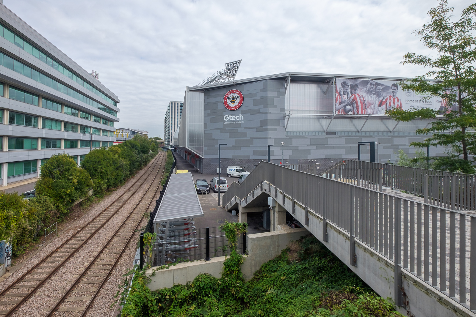
Lionel Road runs north of the railway up to meet the Great West Road. It used to be a rather run down area with railway sidings on one side and a few old commercial buildings and works to the north. The last time I’d walked down here on my way to Gunnersbury Park in 2018 the whole area had been a building site, but now is home to Brentford FC, currently doing pretty well in the Premier League.
Brentford was my local team when I was a kid, and several members of the award-winning under-11 team I played for at left back on went on to play for them at their old ground (and at Chelsea.) One of the other patrol leaders from my scout group stayed there until he retired, though I never met him after I hung up my woggle, but read his obit in the local rag.
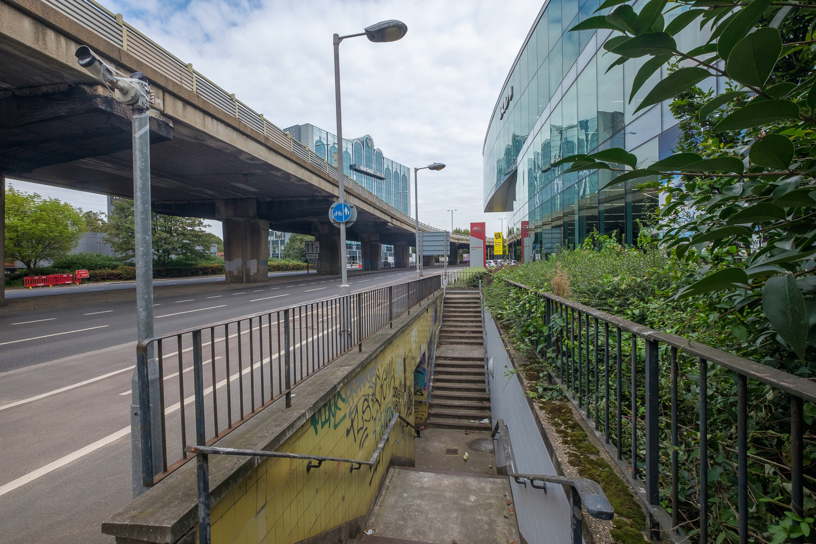
Past there I came to the Great West Road, a 1930s dual carriageway with cycle tracks I sometimes used further west on my way home from school. In the 1980s or 90s I photographed most of the remaining Art Deco factories along it, though the bulldozers got to some first. Now it reminds me of J G Ballard’s novels, particularly ‘Crash’, set around the area we both lived in, with the elevated M4 above the older modern road.
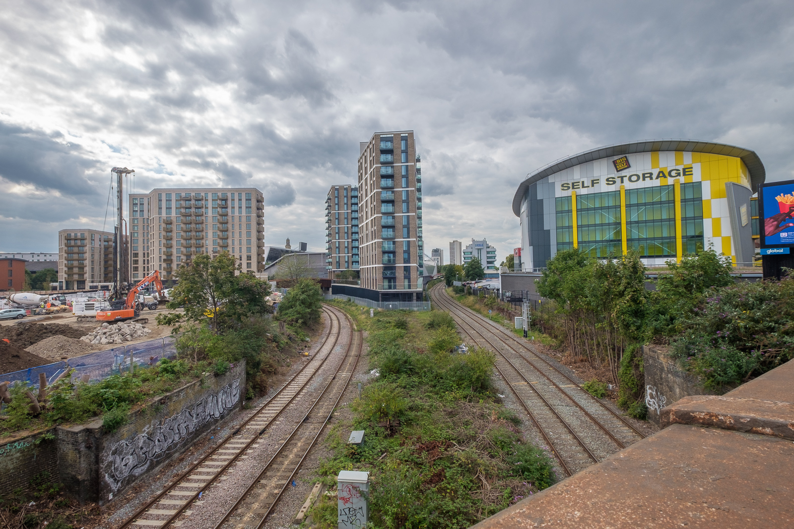
A new Brentford of tall blocks has sprouted here, though more land remains to be built on. A little-used rail line goes through it, the Kew Curve, with Brentford’s stadium replacing the sidings and cattle pens to its west, with new building on the east in what was Brentford Market. It moved to this site in 1893 after the Brentford Local Board had bought the 2 acre site from the Rothschild estate because market trading in the area around the Express Tavern immediately south of the station which had developed informally away from Brentford’s traditional market in Market Place had become a public nuisance. The site was extended in 1905 and then covered land now part of the Chiswick Roundabout. The market moved to the edge of Southall in 1974 as the new Western International Market and the Fountains Leisure Centre was built on part of the site, with the rest staying derelict for years.
My maternal grandfather, then a market gardener in Feltham, would drive his cart with produce to Brentford Market in the early years of the last century, past the house in Hounslow where my father, then a young boy, used to see him driving past. Around twenty years later when he became engaged to my mother he found out who he was.
I met my two colleagues and we walked together down by the west side of Kew Bridge to the Thames. To our right was where the Kew Bridge Ecovillage had squatted from June 2009 until May 2010, now occupied by 164 flats, a business centre, gym and pub.
The Hollows runs west between riverside moorings and recent blocks of luxury flats, eventually returning us to Brentford High St, and a park beside the river now called Watermans Park. This was the site of Brentford Gas Works which straddled the High Street here and was a great attraction when we took the bus through it in my childhood, usually on our way to Kew Gardens. Entrance then was only an old penny, and it was a cheap outing for families in the area. My father would have his scissors in his pocket and perhaps take the odd small cutting to grow in our garden. Rather cheaper than garden centres.
But if you were lucky as the bus drove slowly down the usually congested street, one of its Intermittent Vertical Retort would open sending a wall of red hot coke to the ground, quite an amazing site as we peered from the top deck. It almost made up for the smell.
A gas works had been set up here and began production in 1821, first supplying has for lighting the turnpike to Kensington, but later serving large areas around. Later other gas works were set up in Southall and then elsewhere as demand continued to rise. in 1926 the Brentford gas company became a part of the Gas Light and Coke Co which later became British Gas plc. Brentford Gas Woks closed in 1963 and the riverside buildings were demolished in 1965 though the large gasholder remained until 1988.
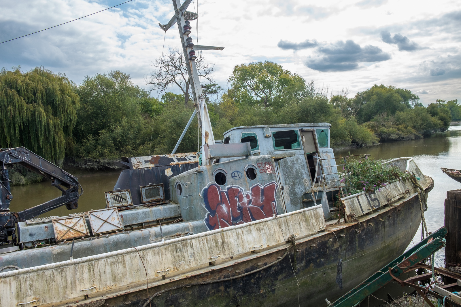
All than now remains of the gas works are some of the substantial posts of the gas works jetty, where colliers once brought in coal. There has been a long battle over the rights to moorings here between boat owners and Hounslow Council with boat owners claiming that the foreshore here belongs neither to the council nor to the PLA but to the Bishop of London, and refusing to abide by various eviction notices. Most have now moved but some derelict boats remain.
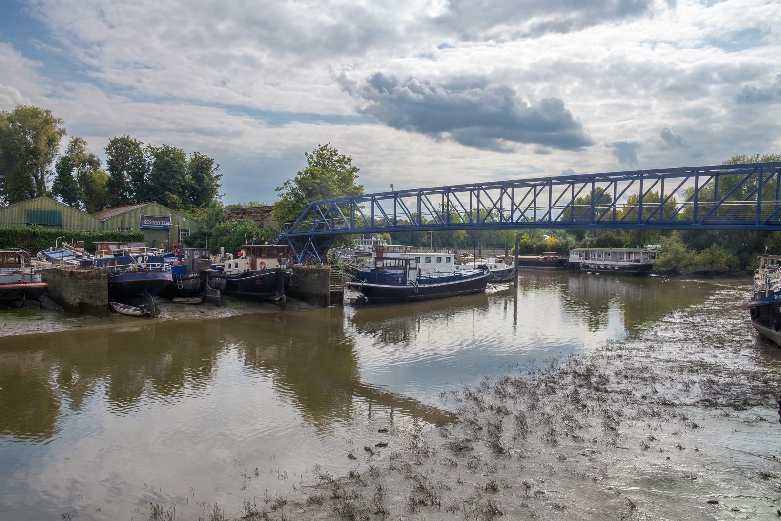
Brentford Ait runs along the centre of the river here. It was bought in the late 19th century by the Crown who planted trees on it to hide the gas works from visitors to Kew Gardens on the opposite bank. A few yard upstream is Lot’s Ait, where the Thames Steam Tug and Lighterage Company Ltd set up a boatyard in 1920 – most of the Thames lighters were built there. The boatyard closed in the 1970s, but was reopened in 2012 when a new footbridge was constructed to it.
As well as the park, the Watermans Arts Centre was also built on the gasworks site. We walked between it and the river, and continued on the riverside path, past the bridge to Lots Ait and recent blocks of flats. There are new moorings around here too.
A small spit of land leads from the bottom of Ferry Lane (more new flats) to an artwork by the riverside. I’m not quite sure what to make either of Liquidity or another similarly decorated column not far away, but it could provide a useful windbreak in bad weather. This was where once a ferry ran across to Kew Gardens.
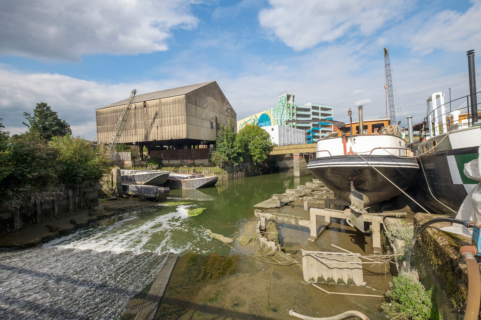
We followed the Thames Path around a small dock, on what was the site of the Thames Soap Works and then continued along the side of the River Brent which flows into the Thames here, continuing along this beside the winding river past another boatyard to Brentford High Street.
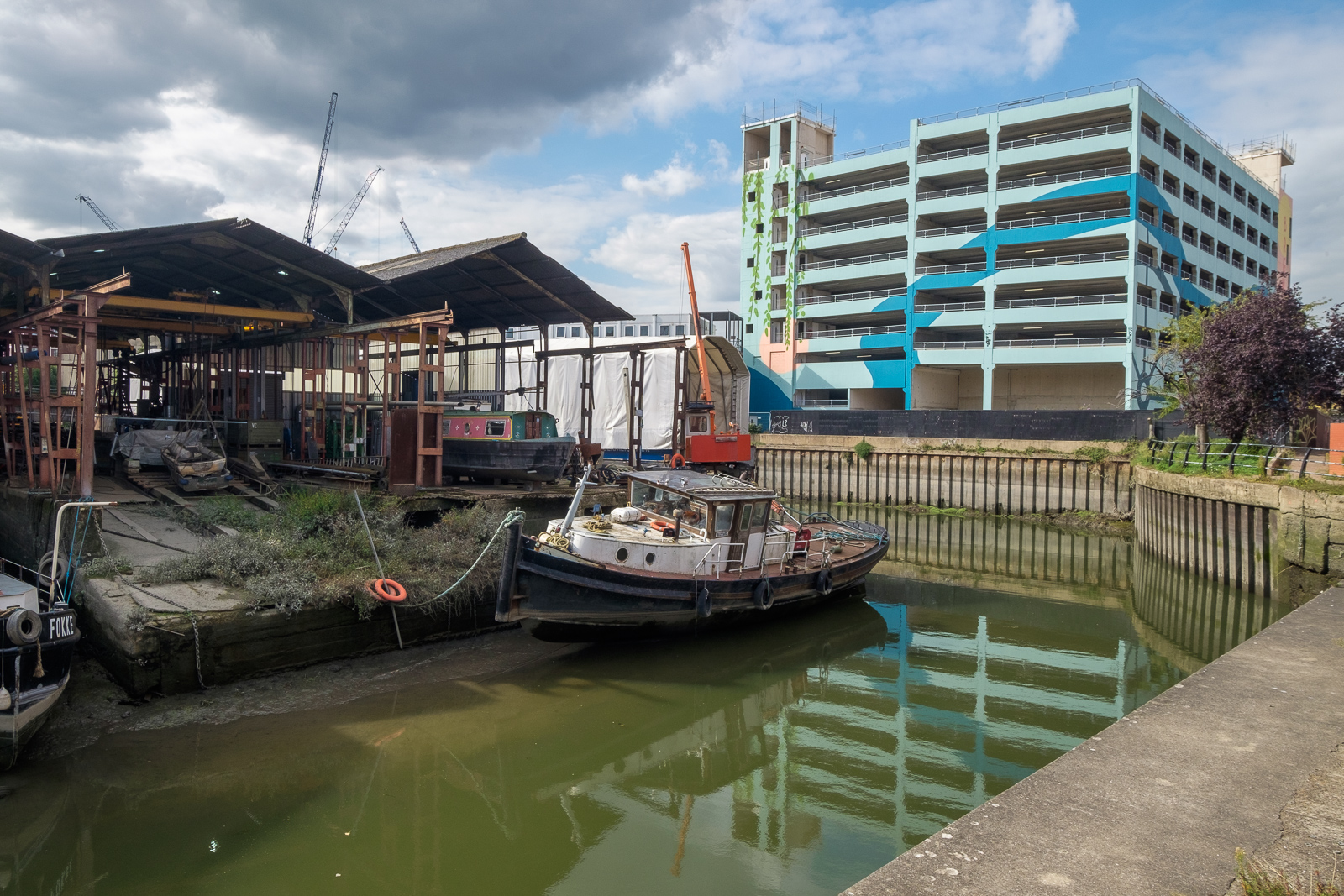
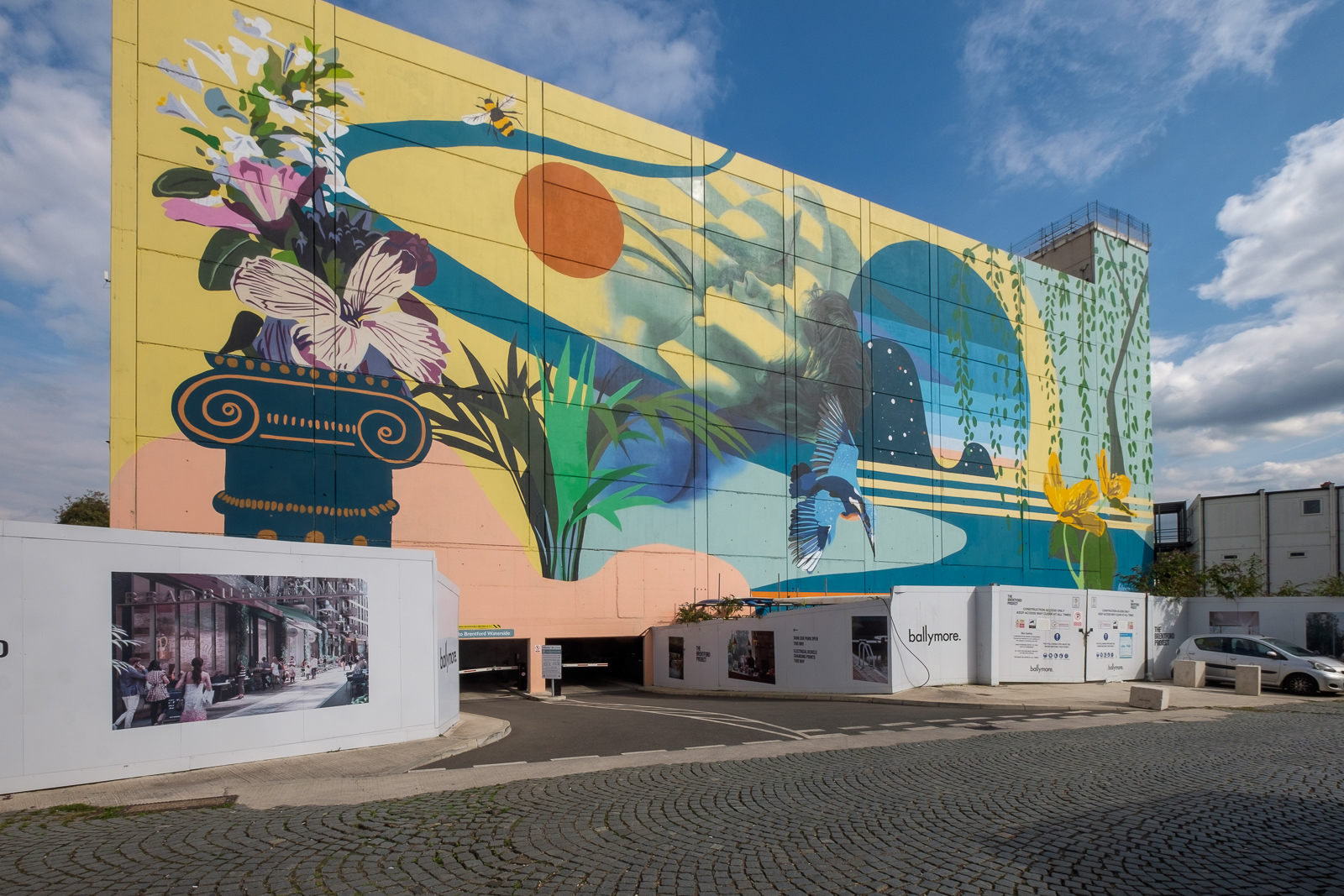
A few yards along we turned left down Dock Road to Thames Lock, past a huge mural and the other end of the boatyard, to Thames Lock, the southern end of the Grand Union Canal. Here we took the path beside the north side of the canal, leading across a bridge over the Brent to Johnson’s Island and Catherine Wheel Road.
The mural, on the side of a multi-story car park had included a giant kingfisher, and I’d joked saying this was the only kingfisher we’d see in Brentford. But as we walked across the bridge over the River Brent and stopped to take pictures, perched on the top of a post there was one, still only for a second before flying out of sight. By the time I’d raised my camera to my eye it was gone, though since I had and extreme wideangle lens it would hardly have been visible, just a few more colourful pixels.
I’d planned to walk along Brent Way and rejoin the canal towpath, but the whole of this area is now a huge building site, and instead we walk along the High Street to the canal bridge. I couldn’t bring myself to walk down to the Gauging Lock preserved there, though I’ve done so several times before, but the changes to the area, now with a marina, flats and hotel made me feel too sad; we simply stood on the bridge and looked for a while before moving on.
Part 2 will continue the walk from here to its end in Isleworth. You can see more pictures from the walk in a Facebook album.