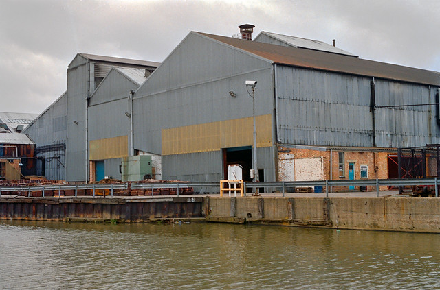
Posts Tagged ‘factory’

Ghost Sign, Cooltan and a Cinema

Wednesday, July 19th, 2023

The final episode in in the series of posts on my walk in south London on Sunday 6th May 1989. The walk began with Hanover, Belgrave, Chapel, Shops, Taxis. The previous post was Railton Road, Herne Hill.

Ghost Sign, S.Errington, Dulwich Road, Brixton, Lambeth, 1989 89-5f-41
Ghost Sign, S.Errington, Dulwich Road, Herne Hill, Lambeth, 1989 89-5f-41

I turned into Dulwich Road and walked up it towards Brixton, stopping to make very few pictures, perhaps keen to get to the end of the walk. Just before reaching Water Lane on the side of what was then Ellis Newsagents at 1a Dulwich Road I couldn’t resist the finely painted sign ‘
S Cooltan
ERRINGTON
DEALER IN
ANTIQUE
&
MODERN

FURNITURE

FURNITURE
BOUGHT
SOLD OR

in drop capitals, decorated with some fine curly bits. Clearly something at the bottom following the ‘OR’ had been painted over, but I couldn’t decide what it might have been. Perhaps ‘EXCHANGED’ or ‘HIRED’?

The property now looks to be residential, but on Google Maps it still appears as:
S Errington Dealer In Antique & Modern Furniture
Home Furniture Shop
Temporarily closed

and that sign is still there, rather more faded and with the lettering now looking very much plainer. Unfortunately although I will have had a camera body with colour film in my bag I did’t photograph this in colour. Some days I only thought in black and white.

CoolTan Suntan Lotion factory, Effra Rd, Brixton, Lambeth, 1989  89-5f-44
CoolTan, Suntan Lotion factory, Effra Rd, Brixton, Lambeth, 1989 89-5f-44

I walked along Brixton Water Lane, taking a couple of pictures (not digitised) on my way to Effra Road. The the names suggest I was following the route of the River Effra, underground since the early nineteenth century, but in fact I had been doing so all the way down from Herne Hill and was now walking away from it. Effra Road got its name from Effra Farm which was on the bank of the river.

CoolTan Suntan Lotion factory, Effra Rd, Brixton, Lambeth, 1989  89-5f-33
CoolTan Suntan Lotion factory, Effra Rd, Brixton, Lambeth, 1989 89-5f-33

The former Suntan lotion factory was squatted and in June 1991 became the CoolTan Arts Centre. They were evicted in February 1992, and the centre moved first to offices above Brixton Cycles before squatting the former Unemployment Benefit Offices in Coldharbour Lane. There it became a thriving art space, with a cafe, live music and offices for various campaign groups including Reclaim the Streets, Earth First! and the Green Party until 1995, when the building was taken over by The Voice newspaper – who boarded it up and left it empty and rotting. The Effra Road factory was demolished shortly after their eviction and remained as empty unused ground for over ten years.

CoolTan Suntan Lotion factory, Effra Rd, Brixton, Lambeth, 1989  89-5f-34
CoolTan Suntan Lotion factory, Effra Rd, Brixton, Lambeth, 1989 89-5f-34

But Cooltan Arts continued. From 1993-2016 Michelle Baharier was, as she writes in her statement on the South London Women Artists site, “Founder, Artistic Director and CEO of CoolTan Arts, London. In twenty-five years, I grew CoolTan Arts from an old suntan lotion factory squatted social centre in Brixton to a user-led disabled people’s arts and mental health charity. CoolTan Arts worked with over three thousand people face-to-face per year with its participatory art programme. The charity improved the lives of individuals with mental distress through creativity, self-advocacy, and volunteer opportunities within the arts. During my tenure at CoolTan I developed psycho-geography walks and other collaborative events with different communities.”

CoolTan Suntan Lotion factory, Effra Rd, Brixton, Lambeth, 1989  89-5f-35
CoolTan Suntan Lotion factory, Effra Rd, Brixton, Lambeth, 1989 89-5f-35

Clearly I was intrigued by this empty 1930s moderne factory and by its gates and their shadows. Unfortunately the gates were locked and although the fence was fairly low the location seemed a little public for me to climb over and explore the site further though it was more decorative than a real barrier. Eventually I managed to tear myself away and continue my walk, taking a few pictures not online as I walked past St Matthews Church and on to Brixton Hill.

Former Cinema, 101-3 Brixton Hill, Brixton, Lambeth, 1989 89-5f-24

The Tarpaulin & Ten Mfg Co, T&T was for many years in the former cinema, which was converted from shops and opened on 10th March 1911 as Brixton Hill Cinematograph Theatre, and was 13th of Montagu A. Pyke’s chain of Cinematograph Theatres. Pyke went out of business when he was jailed after his projectionist in his cinema died in a fire in 1914, and the cinema was taken over by others. It changed its name then and several other times over the years, operating under names including ‘New Royalty’, ‘New Royalty Kinema’ and finally the Clifton.

It showed its last film in 1957 and deteriorated badly before becoming the T&T shop. I think this kept going into this century and the building was up for sale in 2004 and became the Dalxiis Somalian restaurant. By 2008 the auditorium had been demolished and the front of the cinema had become the South Beach Bar, which lost its licence in 2012. In 2015-6 it was ‘Believers Home Chapel’ , in 2018 the S.G.H Events Hall and in 2019 the TAMI Gospel Centre of The Anointed Ministry International, though still with the South Beach Bar sign on that metal structure, empty in my picture at roof level that had once carried the The New Royalty Kinema and Camping Centre signs.

Post Office Building, Blenheim  Gardens, Brixton, Lambeth, 1989 89-5f-11
Post Office Building, Blenheim Gardens, Brixton, Lambeth, 1989 89-5f-11

I went down Blenheim Gardens, photographing this building, dating from 1891 and still in use by the Royal Mail as Brixton Delivery Office, and the windmill, before walking through the back streets between Brixton Hill and Tulse Hill on a roundabout way to Brixton Water Lane to catch a bus on my way home at the end of my long walk.


Flats, A Square, Bread & Funerals – Walworth

Thursday, August 18th, 2022

This post about my walk on Sunday 13th November continues from Gardens, Neckinger, Silver Sea, Special Girls & Deaf Boys.

Congreve St area, Walworth, Southwark, 1988 88-11c-42-Edit_2400
Congreve St area, Walworth, Southwark, 1988 88-11c-42

Flats, A Square, Bread & Funerals – Walworth 1988
My walk continued on the other side of the Old Kent Road, in Walworth, where late Victorian housing was partly replaced by modern council estates in the 1930s and 1960s. I wandered through the Congreve/Barlow estate getting rather lost, as I often did in such places, where street maps like the miniature A-Z I always carried in a pocket were seldom of much use. The older houses here are in Tatum St, with those at the right further back in Halpin Place.

The passageway in which I was standing is between Ellery House on my right and the longer block of Povey House on my left, both dating from around 1964 and part of Southwark Council’s Barlow Estate.

Congreve St, Walworth, Southwark, 1988 88-11c-43-Edit_2400
Congreve St, Walworth, Southwark, 1988 88-11c-43

Thelow wall at the left in front of Comus House was obviously designed for children to walk on top, and I found a small group doing so. The building on the right at 5 Congreve St is also still there, and has been in use by the Redeemed Christian Church Of God (RCCG) since 1997. I am not sure whether it was still in use as a factory when I made this picture, or what was made there.

I think this was the rear of a site entered from a yard on the Old Kent Road, possibly Preston Close, the front part of which was redeveloped in around 2005. Excavations on that part of the site by the The Museum of London Archaeology Service after it was cleared suggested it might have been the site of a Roman mausoleum.

At the end of the street you can see Townsend Primary School, still very much in use.

Comus House, Congreve St, Walworth, Southwark, 1988 88-11c-44-Edit_2400
Comus House, Congreve St, Walworth, Southwark, 1988 88-11c-44

The block is a part of the Barlow/Congreve Estate and was built in 1957 for Southwark Council. The picture is from the corner of Congreve St and Comus Place.

Surrey Square, Walworth, Southwark, 1988 88-11c-35-Edit_2400
Surrey Square, Walworth, Southwark, 1988 88-11c-35

The blue plaque on 42 Surrey Squareclose to the centre of the picture records that artist Samuel Palmer (1805 – 1881) was born here, just a few years after this street was developed in 1793-4 by architect Michael Searles. His plan included houses around the other three sides of a square but these were never built.

My Surrey Square Park describes this as “the only remaining group of 18th century domestic buildings in Walworth with any pretension to architectural quality“.

A church, All Saints was built in 1864-65 to the designs of R. Parris and S. Field, but damaged by bombing in WW2 and replaced by a rather plain church designed by N F Cachemaille-Day in 1959. This became redundant when parished were merged in 1977 and is now in use as The Church of the Lord (Aladura) and is their Europe Diocese HQ.

I was standing in front of the church with it out of picture to my right as I made this picture which shows the church hall, an Arts and Crafts style building dating from around 1900. It was used for a variety of purposes after the church closed and is since 2019 the Walworth Living Room, a community space.

Dalwoods, Bakers, Bagshot St, Smyrk's Way, Walworth, Southwark, 1988 88-11c-22-Edit_2400
Dalwoods, Bakers, Bagshot St, Smyrk’s Way, Walworth, Southwark, 1988 88-11c-22

Dalwoods Quality Bakers and Quality Confectioners on the corner of Bagshot St and Smyrk’s Way was closed when I made this picture on a Sunday morning but still in business.

Dalwoods, Bakers, Bagshot St, Smyrk's Way, Walworth, Southwark, 1988 88-11c-25-Edit_2400
Dalwoods, Bakers, Bagshot St, Smyrk’s Way, Walworth, Southwark, 1988 88-11c-25

I was rather attracted to the display font used for DALWOODS and BAKERS although I couldn’t put a name to it, perhaps a 1930s Deco touch? Something very similar came free with the first Desk Top Publishing package I taught, and it was one of several of which students would make highly inappropriate use. It rather contrasted to the sold block serifs of ‘HOME MADE BREAD’ above the window, best seen in the previous image.

The shop has changed hands since then and now offers the rather less tasty selection of ‘Hair, Nails, Cosmetics & Fashion Wears’ (sic) as a unisex hair salon and boutique. The shopfront has also been redesigned with smaller windows and canopies over the windows.

Funeral Services, Albany Rd, Walworth, Southwark, 1988 88-11c-26-Edit_2400
Funeral Services, 96 Albany Rd, Walworth, Southwark, 1988 88-11c-26

Another business shopfront, for J W Simpson’s Funeral Service, with the word CREMATIONS over the coach entrance at left, suggesting to me an on-site service for anyone misguided enough to drive into it. The clock had suffered some damaged, with a blank black area above the face where one of the two texts partly visible below had once fitted.

I disliked the fussy little bricks that had been imposed on the front extension of the shop, but they perhaps look less annoying now as the concrete walls around the front garden have gone to make room for a parking space in front of what is still a funeral director. It’s one business that never runs out of clients.

My walk will continue ….


Kilburn Park 1988

Sunday, October 17th, 2021

Carlton Vale, Kilburn, Brent 1988 88-5k-26-positive_2400
Carlton Vale, Kilburn, Brent 1988 88-5k-26

My next walk at the end of May 1988 took me to Kilburn Park and Kilburn, and again in this post I have put the pictures in the order of my walk rather than the somewhat random order they have in the Flickr album 1988 London Photos. The church in the picture of Carlton Vale is St Augustine, Kilburn, and the large block of flats on the corner of Carlton Vale and Kilburn Park Rd was demolished in 2018-9, though I think the overhead walkway went many years earlier.

Kilburn, Brent 1988 88-5k-15-positive_2400
Kilburn, Brent 1988 88-5k-15

These lower blocks of flats were a part of the same South Kilburn estate and I think close to the corner of Carlton Vale and Cambridge Rd. The estate of high-density housing in low-rise flats and 11 tower blocks was begun in 1959 and further developed in the 1960s and 70s. Brent embarked on a comprehensive redevelopment in 2014, which is resulting in a considerable loss of social housing.

Oxford Rd, Kilburn, Brent, 1988 88-5l-61-positive_2400
Oxford Rd, Kilburn, Brent, 1988 88-5l-61

Unsurprisingly Oxford Road runs parallel with Cambridge Ave up to the Kilburn High Rd. These streets were two of those developed by local builder James Bailey in the 1860s, developing the area he called Kilburn Park. The name was given to the first underground station in Kilburn which opened in 1915 in Cambridge Ave.

Oxford Rd, Kilburn, Brent, 1988 88-5l-64-positive_2400
Oxford Rd, Kilburn, Brent, 1988 88-5l-64

These are typical houses of the era and were probably built from published designs in architectural pattern books. My grandather, who built a few houses on a much less grand scale had owned at least one of these and as children we were sometimes allowed to look at this beautifully illustrated volume.

Cambridge Avenue, Kilburn, Brent, 1988 88-5l-66-positive_2400
Cambridge Avenue, Kilburn, Brent, 1988 88-5l-66

At its southern end Cambridge Avenue leads to both Cambridge Road and the rather posher Cambridge Gardens.

Central Motors, Canterbury House, Canterbury Rd, Kilburn, Brent 1988 88-5l-52-positive_2400

Central Motors, Canterbury House, Canterbury Rd, Kilburn, Brent 1988 88-5l-52-positive_2400

Central Motors in Canterbury Rd still looks much the same, but Canterbury House, although retaining the facade had two extra storeys added in 2015-6 with luxury flats and penthouses. It as built in 1862 when this was still a part of Kilburn Lane as a railway signal factory for Saxby & Farmer who became one of the largest employers in the area but moved out around 1906.

South Kilburn Estate, Crone Court, Rupert Road, Brent, 1988 88-5l-53-positive_2400
Crone Court, South Kilburn Estate, Rupert Road, Brent, 1988 88-5l-53

Crone Court is on the corner of Rupert Rd and Denmark Rd on the South Kilburn Estate and is due for redevelopment in the next few years. The 12 storey block, 32m tall, was completed in 1964.

Joe's Used Ballbearing Emporium, Malvern Rd, West Kilburn, Westminster, 198888-5l-55-positive_2400
Joe’s Used Ballbearing Emporium, Malvern Rd, West Kilburn, Westminster, 1988 88-5l-55

Joe’s Used Ballbearing Emporium & Cycleworks was definitely in Malvern Rd, West Kilburn as it had a street sign higher up on the building. It had a remarkable window display and I took far too many pictures – a few of them here.

Joe's Used Ballbearing Emporium, Malvern Rd, West Kilburn, Westminster, 1988 88-5l-56-positive_2400
Joe’s Used Ballbearing Emporium, Malvern Rd, West Kilburn, Westminster, 1988 88-5l-56

Joe's Used Ballbearing Emporium, Malvern Rd, West Kilburn, Westminster, 1988 88-5l-41-positive_2400
Joe’s Used Ballbearing Emporium, Malvern Rd, West Kilburn, Westminster, 1988 88-5l-41

Joe's Used Ballbearing Emporium, Malvern Rd, West Kilburn, Westminster, 1988 88-5l-45-positive_2400
Joe’s Used Ballbearing Emporium, Malvern Rd, West Kilburn, Westminster, 1988 88-5l-45

Joe's Used Ballbearing Emporium, Malvern Rd, West Kilburn, Westminster, 198888-5l-31-positive_2400
Joe’s Used Ballbearing Emporium, Malvern Rd, West Kilburn, Westminster, 1988 88-5l-31

Click on any of the images to go to a larger version in my album 1988 London Photos from where you can browse the rest of the album.


Hammersmith to Holland Park

Saturday, May 22nd, 2021

Brook Green, Hammersmith, Hammersmith & Fulham, 1988 88-1a-56-positive_2400
Brook Green, Hammersmith, Hammersmith & Fulham, 1988

Helpfully a street sign and a number inform me that this is 180 Shepherds Bush Rd, at the western edge of Brook Green. The road at one time used to wander around here but long ago traffic was routed straight through the grassy space, with both new and old road remaining as Shepherds Bush Road. There are no properties on the new section of the road, just a bus stop, traffic signs and traffic lights.

Without the information on the photo it would be hard to place this picture, as nothing visible remains of this part of the factory which housed Express Lifts and was I think part of the large Osram works which had began making carbon lamps here in 1881. It went on to produce many other types of lamps until around 1955, continuing only to produce argon and electronic valves until 1988 and was demolished the same year, with only its tower with the famous Osram Dome elsewhere on the site being saved, incorporated into the Tesco Superstore that took its place

Sinclair Rd, Hammersmith, Hammersmith & Fulham, 1988 88-1a-43-positive_2400
Sinclair Rd, Hammersmith, Hammersmith & Fulham, 1988

You can still find this pair of houses on Sinclair Rd, part of one of many conservation areas in Hammersmith & Fulham. There are a number of houses with impressive paired porches on the street, substantial four storey houses dating from around 1880. This pair is one of relatively few to have retained the stucco urns under the porticos, and this is a particularly impressive example with slender columns and capitals, but I think the real attraction for me was the incredibly morose bearded and moustached crowned head at the base of a finial.

Springvale Terrace, Hammersmith, Hammersmith & Fulham, 1988 88-1a-32-positive_2400
Springvale Terrace, Hammersmith, Hammersmith & Fulham, 1988

In the same conservation area as Sinclair Rd is a small section of very different housing. This small block which contained around 24 late Victorian terraced houses with a small Radiator Factory at its north end had been replaced by these modern buildings by 1988. The picture is taken from the road at the south side of this small estate.

St John the Baptist, Church, Holland Rd, Holland Park, Kensington & Chelsea, 1988 88-1a-26-positive_2400
St John the Baptist, Church, Holland Rd, Holland Park, Kensington & Chelsea, 1988

Crossing the railway at the bridge on Addison Gardens took me from Hammersmith & Fulham into the Holland Park area of Kensington & Chelsea and St John the Baptist Church in Holland Rd, a remarkably exuberant Grade I listed building by the distinguished Victorian church architect James Brook, “cathedral-like in scale and ambition, combining Brooks’s devotion to severe early Gothic models with a degree of material opulence not seen in his better-known East End churches”. Begun in 1872 it was completed in stages when the parish had the money and only finished after Brook’s death with finishing touches (perhaps unfortunate) by his successor John Standen Adkins in 1910.

The well-illustrated feature on the history of the church on the church web site states “St John’s is a distinguished and integrated time-capsule of the Anglo-Catholic movement. It is regularly in use for that traditional form of worship today.”

Holland Park Gardens Holland Park, Kensington & Chelsea, 1988 88-1a-15-positive_2400
15 Holland Park Gardens, Holland Park, Kensington & Chelsea, 1988

The London School of English is still in this imposing building in Holland Park Gardens. Perhaps surprising I avoided the wide sweep of steps leading up to its door, probably in order to emphasise the nest of balloons tied to its railings.

Addisland Court, Holland Villas Road, Holland Park, Kensington & Chelsea, 1988 88-1a-11

Addisland Court is a prestigious block of flats that screams 1930s Art Deco and its site design also very much reflects the golden age of motoring (when it was only for the rich.) A three bedroom flat here has an estimated value of around £2million. It was apparently used as a location in a couple of episodes of a TV series of Agatha Christie’s Poirot. It was built in 1936, designed by William Bryce Binnie whose other works include the East Stand at Arsenal’s old Highbury ground and who after distinguished war service had been assistant architect at the Imperial War Graves Commission for which he designed a number of memorials in France and Belgium.


All photographs on this and my other sites, unless otherwise stated, are taken by and copyright of Peter Marshall, and are available for reproduction or can be bought as prints.


Saw Mills & Flood Barrier

Tuesday, February 16th, 2021

M & J Reuben, London Sawmills, Wharfside Rd, Newham, 1983 35t-25_2400

Standing more or less on the bank of Bow Creek beside the saw mill in 1983 I could see the elevated East India Dock Rd from which quite a few of my pictures were taken, and beyond it the box-like West Ham Power Station with its two pencil-like chimneys and cooling towers. Sawing timber creates a great deal of dust and a large extractor removes this, probably more for its commercial value than an anti-pollution measure.

Bow Creek, Flood Barrier, Saw Mill, Wharfside Rd, Newham, 1983 36v-25_2400

Looking down from East India Dock Rd onto the circular car park where Wharfedale Rd emerged from the tunnel under the road. There were few if any traces of the old railway line that used to run between the fence and the river here – where the DLR now runs. The picture gives a good impression of the densely packed industry on the peninsula beyond the creek. Taken with an extreme wide-angle lens – the 21mm on the Olympus OM1 you can see some stretching of objects closer to the edges of the frame which is a consequence of rectilinear perspective.

Bow Creek,  Flood Barrier, Wharfside Rd, Newham, 1983 35t-11_2400

Working from more or less the same position (but on a different day) with a less wide lens (probably a 35mm) gives a considerably less wide view, making distant objects seem larger, and also avoids any noticeable distortion. You can see the flood barrier on Bow Creek much more clearly.

Canning Town, Flood Barrier, Bow Creek, East India Dock Rd, Newham, 1982 36v-26_2400

Moving a little further along East India Dock Road gave a better view of the river now running south through the flood barrier. At left are the tower blocks of Canning Town. The row of buildings at right are on the far side of Victoria Road, and the railway line from Stratford to North Woolwich is in front of them, hidden by a bank of earth. Stairs led down from the road to this waste land and there were no fences to stop me walking along the river bank.

Flood Barrier, Bow Creek, Newham, Tower Hamlets, 1983 36a-32_2400

From the bank I got a good view of the flood barrier, its three gates in raised position, getting shorter from left to right to match the slope of the creek, deeper on the outside of the curve. Building the Thames Barrier at Charlton which first came into operation at more or less at the time I made this picture made this barrier, previously essential to prevent flooding along Bow Creek, redundant. It was removed shortly after I made these pictures.

Flood Barrier, Bow Creek, Newham, Tower Hamlets, 1983 36a-36_2400

Back in 1983 there were no barriers to stop me walking beside Bow Creek all the way to the River Thames, but not long afterwards this whole bank was closed off to the public. There have long been plans to open part of it as a riverside walkway, with the northern part of it built but fenced off, and in 2004 following a public competition a winning design was selected for a bridge further downstream a little below the Lower Lea Crossing across the river as a part of this foot and cycle path to Trinity Buoy Wharf. But in 2005 the Thames Gateway Delivery Unit withdrew funding and the bridge was never built. The last time I visited the area a couple of years ago the riverside walkway was open but ended around a hundred yards south of Canning Town station.

Flood Barrier, Bow Creek, Newham, Tower Hamlets, 1983 36a-23_2400

There is now a bridge across close to Canning Town station leading to the development of City Island which has replaced the edible oil factory on the peninsula which opened in 2014, though a far less interesting design than the competition winner.

The empty area to the east of Bow Creek which can be seen in some of these pictures was from 1837 to 1912 the home of the Thames Ironworks and Shipbuilding Company Ltd. More recently it was for some years given over to a construction works yard for Cross Rail and is now home to the Limmo Peninsula, a largely residential development scheme by a partnership between TfL and Grainger plc.

You can visit my Flickr album with more pictures of the area by clicking on any of the pictures above which will take you to a larger version from where you can explore the album. Future posts will look at a series of panoramic pictures I made in 1992 and continuing my walk to the Thames.


All photographs on this and my other sites, unless otherwise stated, are taken by and copyright of Peter Marshall, and are available for reproduction or can be bought as prints.


More from the Lea: Enfield

Saturday, December 5th, 2020

Enfield, 1983 34y-16_2400
Enfield, 1983

I’ve now put more photographs in my Flickr album River Lea – Lea Navigation 1981-1992 to add pictures from Broxbourne to the River Thames to my earlier uploads.

Enfield Lock, 1983 34y-35 (2)_2400
Enfield Lock

I’ve gone through the contact sheets from 1981-3 and selected and digitised a few more pictures I found of interest to add to those I’d scanned preparing for earlier shows, but I think there are pictures from some of the later years in that period I may add later.

Lea Navigation, Brimsdown, Ponders End, 1983 34n-52_2400

But for the moment this album is complete – with 418 pictures. Because I made these on a number of different visits to the area, it was difficult to put them into sensible order – and a few are still obviously in the wrong place. But I’ve tried to put them at least largely in order as the valley leads down to the River Thames at Leamouth.

Lea Navigation, Brimsdown, Ponders End, 1983 34n-41_2400

Back in 1981-3 I was not too concerned with the exact locations of the pictures, and my contact sheets seldom have little indication except for the contents of the pictures. I can no longer find the notebooks in which I wrote about the project, though a few of the vintage prints have locations on them and a couple even grid references. I’ve tried to give locations on Flickr, and already a few viewers have been able to help me on this, and correcting a few mistakes I made. Corrections and comments are always welcome, and clicking on any of the images in this post will take you to a larger version where you can post comments.

Broxbourne, 1983 37d-55_2400

So, for example, this picture I’ve captioned simply ‘Broxbourne, Herts, 1983‘ but I could be quite wrong. It could be Cheshunt or somewhere else. And I’d be happy to be told exactly where it is. It’s easier to remember pictures further south as I’m more familiar with the area, though thanks to some who have already corrected a few of my confusions such as mistaking the Clapham Park flats for the Trowbridge Estate.

Lea Navigation, Brimsdown, Ponders End, 1983 34n-42_2400

Most of the pictures in today’s post are from Enfield, Ponders End or Brimsdown, in the London Borough of Enfield, where a large industrial area is located to the west of the canal. I think most of the structures I photographed back then have since been replaced.

Lea Navigation, Brimsdown, Ponders End, 1983 34m-14_2400

In a later post I’l post more selected pictures from Ponders End and Edmonton and then further south. But you can see them already at Flickr album River Lea – Lea Navigation 1981-1992.


All photographs on this and my other sites, unless otherwise stated, are taken by and copyright of Peter Marshall, and are available for reproduction or can be bought as prints.