Posts Tagged ‘East India Dock Road’

East India Dock Road to Bow Common

Monday, February 7th, 2022

More pictures continuing my walk on 31st July 1988 – the previous post is Bow Common to West India Dock Road, so this returns to close to where that started. Like most of my walks it was more about exploring a neighbourhood than getting anywhere.

East India Dock Rd, Poplar, Tower Hamlets, 1988 88-7s-61-positive_2400
East India Dock Rd, Poplar, Tower Hamlets, 1988 88-7s-61

East India Dock Road was built as its name suggests when the East India Docks were opened in 1806 to provide a more direct and less congested route than Poplar High Street to them from the end of the Commercial Road, also then recently built in Limehouse. It is now part of the A13 and this section in Poplar has in turn been largely bypassed by the Limehouse Link and Aspen Way opened in 1993. Traffic was still very heavy along it in 1988.

The picture with rubbish on the pavement and gutters, a small rather derelict shop to let gave a picture of a run-down area which contrasted with the word Wonderful on what seems a rather faded fabric on a restaurant at right. Buddleia is growing in front of the billboard, always a sign of dereliction. Interestingly the the advert is for a low alcohol lager, hardly a thing back then when most drivers on the streets after closing time were drunk, although the breathalyser had come in back in twenty-one years earlier. But even the introduction of Kaliber in 1986 had not really galvanised the market – but low alcohol beers are now a massive growth area, and some are even drinkable.

There is still a Chinese restaurant in the building at the right of this picture, and rather surprisingly that small shack is still in place in front of Amory Place, now a minicab office.

Chun Yee Society, East India Dock Rd, Birchfield St, Poplar, Tower Hamlets, 1988 88-7s-62-positive_2400
Chun Yee Society, East India Dock Rd, Birchfield St, Poplar, Tower Hamlets, 1988 88-7s-62

There are still traces of London’s first Chinatown in Limehouse, which began in the area around 1900, but the centre of the Chinese community had moved to Soho in the 1950s, partly because of extensive bomb damage in Limehouse, but also because of dirt-cheap rents in an area with a bad reputation where few then wanted to live in central London.

Chun Yee Society, East India Dock Rd, Birchfield St, Poplar, Tower Hamlets, 1988 88-7s-63-positive_2400
Chun Yee Society, East India Dock Rd, Birchfield St, Poplar, Tower Hamlets, 1988 88-7s-63

The house on the corner of Birchfield St still has the sign for the Chun Yee Society – Chinese School on Sundays over its doorway. not along with a larger and newer version with fewer Chinese characters. Like many similar societies it began as a Tong, variously described as a criminal gang or a semi-masonic bortherhood, and organised various festivals including those commemorating the dead. Founded in 1906 it was a shelter for Chinese sailors as well as providing a Chinese Sunday school for children and is now largely an old peoples centre. Possibly some of the games of dominoes may have got a little out of hand, but the criminality was largely in the mind of Sax Rohmer, his readers and the sensationalist press.

St Mary & St Joseph, Catholic Church, Upper North St, Poplar, Tower Hamlets, 1988 88-7s-51-positive_2400
St Mary & St Joseph, Catholic Church, Upper North St, Poplar, Tower Hamlets, 1988 88-7s-51

The Roman Catholic Church of SS Mary and Joseph, Poplar impresses mainly by its scale. Built in 1951-4, its architect Adrian Gilbert Scott (1882-63) was the brother of the better-known Sir Giles Gilbert Scott, both from a distinguished family of architects. I always think of it as an ecclesiastical version of Battersea Power Station, without the chimneys but with a rather odd green pyramid on its roof, but that’s rather unfair as it is a very individual design, sometimes described as Byzantine jazz gothic.

According to the Grade II listing text this is a camel arch, and a similar arch appears at the top of the main windows, supposedly inspired by Persian buildings. The church replaced one on the site behind me as I made the picture which was destroyed by bombing – the site is now a Catholic school. I think I chose an interesting viewpoint, but one that needed a slightly wider lens and a more upright photographer.

Flats, GLC, Temporary Housing, Brabazon St, Poplar, Tower Hamlets, 1988 88-7s-53-positive_2400
Flats, GLC, Temporary Housing, Brabazon St, Poplar, Tower Hamlets, 1988 88-7s-53

The second of these LCC temporary buildings has a sign proclaiming it as ‘LANSBURY WORKS OFFICE’ and giving its address in Brabazon St. The street got its name not from the huge white elephant civil airliner that made a few flights in the 1950s before it and the project was scrapped in 1953, but from the 1882 founder of the Metropolitan Gardens Association, the 12th Earl of Meath, Lord Brabazon.

Work began on the layout of the London County Council’s Lansbury Estate in 1949 on a large area devastated by wartime bombing, and its best-known feature, Chrisp Street Market was built the following year and became an integral part of the 1951 Festival of Britain. But construction of the estate continued for many years and was only said to be completed in 1982, by which time it had been transferred first to the GLC and then Tower Hamlets. Since 1998 it has been owned by Poplar HARCA.

But as this picture shows, this part was still not completed in 1988. The large 11-storey tower block Colebrook House with 42 flats was part of the Barchester Street Scheme by the LCC Architects department and completed in 1957-8, named after a shop built at nearby Blackwall Yard. Brabazon St now has a small park to the left of my picture and a row of neat two-story houses along the right side.

Limehouse Cut, Upper North St, Poplar, Bow, Tower Hamlets, 1988 88-7s-54-positive_2400
Limehouse Cut, Upper North St, Poplar, Bow, Tower Hamlets, 1988 88-7s-54

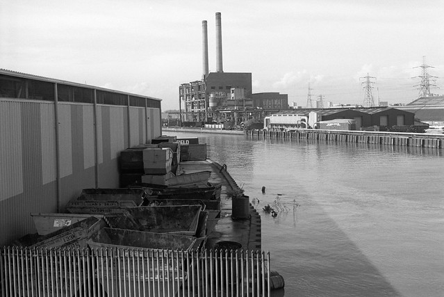
Bow Common Bridge, an iron bridge replacing the earlier bridge here in 1929, is where Upper North Street meets Bow Common Lane across the Limehouse Cut and the factory building here on the north-west side has now been replaced by a block of offices and flats built in 2008-2011, with the 13 storey Ingot Tower at one corner of the largely five storey development. This large site alongside the Limehouse Cut was formerly a chemical works between the Cut and Thomas St (now Thomas Road.)

Phoenix Business Centre, Limehouse Cut, Upper North St, Poplarm Bow, Tower Hamlets, 1988 88-7s-55-positive_2400
Phoenix Business Centre, Limehouse Cut, Upper North St, Poplarm Bow, Tower Hamlets, 1988 88-7s-55

Wikipedia recounts that this area had become popular with chemical manufacturers as they could discharge waste into the Cut, and this bridge from at least 1819 was known as Stinkhouse Bridge and the area around became a huge fire risk, culminating in a great fire in 1866. The bridge was also a popular choice for suicides, with a local coroner in 1909 noting he had held over 50 inquests on them there. As Wikipeida comments ‘ In a derisory attempt to enhance its image it was renamed Lavender Bridge.’ But the old name stuck at least until the 1950s.

The Phoenix Business Centre on the north east corner of the bridge has also been demolished and replaced by tower blocks around 2008-2010.

The Sanitas Company Ltd, Council Depot, Watts Grove, Bow, Tower Hamlets, 1988 88-7s-44-positive_2400
The Sanitas Company Ltd, Council Depot, Watts Grove, Bow, Tower Hamlets, 1988 88-7s-44

The Sanitas Company Limited proudly put their name across the top of their 1914 building in Watts Grove, and it remained written in stone (or at least render) for a hundred years until the building was demolished and replaced by a rather blander building completed in 2017, part of a large development on Watts Grove and the new Pankhurst Avenue.

Previously the site stretching down to Yeo Street annd Glaucus Street had been occupied as it was when I made this photograph as a council depot by various of Tower Hamlet’s Councils municipal services (latterly Veolia.)

The Sanitas Company Limited was a local company which specialised in disinfectant and soap-based products. So far as I’m aware they had no connection with other and now better known companies using the name Sanitas, the Latin for Health.


My walk will continue in a later post.

Clicking on any of the pictures will take you to a larger version in my album 1988 London Photos from where you can browse the album.


Saw Mills & Flood Barrier

Tuesday, February 16th, 2021

M & J Reuben, London Sawmills, Wharfside Rd, Newham, 1983 35t-25_2400

Standing more or less on the bank of Bow Creek beside the saw mill in 1983 I could see the elevated East India Dock Rd from which quite a few of my pictures were taken, and beyond it the box-like West Ham Power Station with its two pencil-like chimneys and cooling towers. Sawing timber creates a great deal of dust and a large extractor removes this, probably more for its commercial value than an anti-pollution measure.

Bow Creek, Flood Barrier, Saw Mill, Wharfside Rd, Newham, 1983 36v-25_2400

Looking down from East India Dock Rd onto the circular car park where Wharfedale Rd emerged from the tunnel under the road. There were few if any traces of the old railway line that used to run between the fence and the river here – where the DLR now runs. The picture gives a good impression of the densely packed industry on the peninsula beyond the creek. Taken with an extreme wide-angle lens – the 21mm on the Olympus OM1 you can see some stretching of objects closer to the edges of the frame which is a consequence of rectilinear perspective.

Bow Creek,  Flood Barrier, Wharfside Rd, Newham, 1983 35t-11_2400

Working from more or less the same position (but on a different day) with a less wide lens (probably a 35mm) gives a considerably less wide view, making distant objects seem larger, and also avoids any noticeable distortion. You can see the flood barrier on Bow Creek much more clearly.

Canning Town, Flood Barrier, Bow Creek, East India Dock Rd, Newham, 1982 36v-26_2400

Moving a little further along East India Dock Road gave a better view of the river now running south through the flood barrier. At left are the tower blocks of Canning Town. The row of buildings at right are on the far side of Victoria Road, and the railway line from Stratford to North Woolwich is in front of them, hidden by a bank of earth. Stairs led down from the road to this waste land and there were no fences to stop me walking along the river bank.

Flood Barrier, Bow Creek, Newham, Tower Hamlets, 1983 36a-32_2400

From the bank I got a good view of the flood barrier, its three gates in raised position, getting shorter from left to right to match the slope of the creek, deeper on the outside of the curve. Building the Thames Barrier at Charlton which first came into operation at more or less at the time I made this picture made this barrier, previously essential to prevent flooding along Bow Creek, redundant. It was removed shortly after I made these pictures.

Flood Barrier, Bow Creek, Newham, Tower Hamlets, 1983 36a-36_2400

Back in 1983 there were no barriers to stop me walking beside Bow Creek all the way to the River Thames, but not long afterwards this whole bank was closed off to the public. There have long been plans to open part of it as a riverside walkway, with the northern part of it built but fenced off, and in 2004 following a public competition a winning design was selected for a bridge further downstream a little below the Lower Lea Crossing across the river as a part of this foot and cycle path to Trinity Buoy Wharf. But in 2005 the Thames Gateway Delivery Unit withdrew funding and the bridge was never built. The last time I visited the area a couple of years ago the riverside walkway was open but ended around a hundred yards south of Canning Town station.

Flood Barrier, Bow Creek, Newham, Tower Hamlets, 1983 36a-23_2400

There is now a bridge across close to Canning Town station leading to the development of City Island which has replaced the edible oil factory on the peninsula which opened in 2014, though a far less interesting design than the competition winner.

The empty area to the east of Bow Creek which can be seen in some of these pictures was from 1837 to 1912 the home of the Thames Ironworks and Shipbuilding Company Ltd. More recently it was for some years given over to a construction works yard for Cross Rail and is now home to the Limmo Peninsula, a largely residential development scheme by a partnership between TfL and Grainger plc.

You can visit my Flickr album with more pictures of the area by clicking on any of the pictures above which will take you to a larger version from where you can explore the album. Future posts will look at a series of panoramic pictures I made in 1992 and continuing my walk to the Thames.


All photographs on this and my other sites, unless otherwise stated, are taken by and copyright of Peter Marshall, and are available for reproduction or can be bought as prints.


Bow Creek: Priors to Pura Foods

Monday, February 15th, 2021

Bow Creek, Leamouth Rd, Leamouth, Tower Hamlets, Newham, 1982 36v-23_2400

Goiong down Leamouth Road roughly south and parallel to the river there were a few places where you could look back up to the East India Dock Road and the disused railway bridge that crossed the creek a little to the south of the road. The bridge had carried a line which came from where Canning Town Station now is along the route now followed by the DLR but continuing across the river to pepper warehouses for the East India Docks opposite the docks on the eastern side of Leamouth Road, still shown on my 1939 Philip’s A B C Pocket Atlas-Guide to London and its Outer Districts.

J J Prior, Ship Repairs, Orchard Wharf, Bow Creek, Leamouth Rd, Leamouth, Tower Hamlets, 1982 36v-36 (2)_2400

Where the river swung around the Limmo Peninsula – now the Bow Creek Ecology Park – the view was wide open with the river only separated from the road by an open fence. Close to the bend to the west was Orchard Wharf, where J J Prior were still carrying out ship repairs. The flats in the background are on the other side of the East India Dock Road.

Pura Foors, Bow Creek, Tower Hamlets, 1983 36v-21_2400

Looking up the creek on the eastern side of the peninisula was the west bank of the second peninsula, occupied by a large edible oil factory, Pura Foods, the smells from which were often rather noticeable. There were local campaigns to have this factory shut down, and eventually it did move out, relocating a few miles down-river. This peninsula is now redeveloped as City Island.

Pura Foods, Orchard Place, Leamouth, Tower Hamlets, 1982 32f-33_2400

Roads in this area were disrupted when the Lower Lea Crossing was built – it opened in 1991. When I first went to photograph the area, Leamouth Road (historically called Orchard St) continued to meet Orchard Place at a T-junction, with Orchard Place going north to the Pura Food site and south, then turning east to Trinity Buoy Wharf.

Pura Foods, Bow Creek, Tower Hamlets, 1989 89-4c52_2400

Although there were still high walls along the northern section of Leamouth Rd, there was a clear view of Bow Creek looking south from the East India Dock Road only around a hundred yards east of where the river, here flowing roughly north, went under the bridge in the opposite direction.

Bow Creek, Pura Foods, Essex Wharf, Wharfside Rd, East India Dock Rd, Newham, Tower Hamlets, 1989 89-4b12_2400

Wharfside Road comes in a short tunnel under the East India Dock Road on which I was standing to take this picture, leading to Essex Wharf and the saw mills for the timber yard. The Docklands Light Railway now runs along here on the route of the the former rail line to the pepper warehouses, just in front of the line of parked cars in this picture.

There is now a footbridge across the DLR leading to a riverside path, built at around the same time as the new railway, the gates to the bridge were kept locked for most of its first twenty years but now seem to be permanently opened, and it provides a good short cut to Canning Town Station, whose riverside entrance was also locked for years after it was built, as well as to a new footbridge to City Island which replaced the factory here. You can also now walk or cycle down here to the right to visit the Bow Creek Ecology Park. Although very different it is still an interesting area in which to walk.

Clicking on any of the above images will take you to larger versions in my Flickr album on the River Lea. A further post will start at Wharfside Road and look at my pictures moving along Bow Creek towards the Thames.


All photographs on this and my other sites, unless otherwise stated, are taken by and copyright of Peter Marshall, and are available for reproduction or can be bought as prints.


Bow Creek from East India Dock Road

Tuesday, February 9th, 2021

Bow Creek, West Ham Power Station, East India Dock Rd, Tower Hamlets, Newham, 1989 89-4c55_2400
Bow Creek, West Ham Power Station, East India Dock Rd, Tower Hamlets, Newham, 1989

Bow Creek truly became magical as it passed under the East India Dock Road, and although it has now lost much of the interest on its banks, the incredible flattened S-shape as it curves before reaching the Thames remains impressive.

Bow Creek, West Ham Power Station, East India Dock Rd, Newham, 1989 89-4c56_2400
Bow Creek, West Ham Power Station, East India Dock Rd, Newham, 1989

The creek bends almost 90 degrees to flow roughly south under the road at Ironbridge Wharf (the iron bridge long replaces by more modern concrete structures) only to take a hairpin 180 degree bend to return almost back to the road before sweeping another 180 degrees down to go over the elevated Lower Lea Crossing. From there its convolutions continue with a 90 turn to the east and another to the south before entering the Thames as Leamouth, around 900 metres away as the gull flies, but 1900 by boat.

Bow Creek, East India Dock Rd, Poplar, Tower Hamlets, Newham, 198232f-24_2400
Bow Creek, East India Dock Rd, Poplar, Tower Hamlets, Newham, 1982

Its course defines two very different peninsulas; to the west on largely undeveloped and now a nature reserve, with the DLR crossing to it on a viaduct and running up it, and on the east an industrial site, then occupied by the edible oil company Pura Foods (earlier Acatos & Hutcheson) and now the site of the City Island development.

Timber yard,  Essex Wharf, Bow Creek, East India Dock Rd, Newham, Tower Hamlets, 1989 89-4c51_2400
Timber yard, Essex Wharf, Bow Creek, East India Dock Rd, Newham, Tower Hamlets, 1989

On the eastern bank of the river south of Canning Town station is another so-called peninsula, the Limmo Penisula, which became a major Crossrail works site and is now a housing development. The name was previously used for the whole area around this part of Bow Creek and the nature reserve, now the Bow Creek ecology park was first called the Limmo Peninsula ecological park. It is an area of confusing names, with the new development south of the Lower Lea Crossing taking its name, Goodluck Hope, from the area now called City Island. It was also easy to get a little confused by the area itself with the wandering of the river, and even when writing this post I had problems sorting out pictures just from the appropriate area.

Pipe Bridge, Bow Creek, Tower Hamlets, Newham, 1989 89-4c63_2400
Pipe Bridge, Bow Creek, Tower Hamlets, Newham, 1989

The pipe bridge possibly carried gas from the nearby Poplar Gas works to Canning Town; downstream was a disused railway bridge. A new ‘blue bridge’ was later erected between these two (it appears in my 1992 pictures) and the pipe bridge was taken down though its brick piers left in place – now only the eastern one remains.

Timber Yard, Bow Creek, Tower Hamlets, 1989 89-4c65_2400
Timber Yard, Bow Creek, Tower Hamlets, 1989

The pictures in this post were all taken on or close to the East India Dock Road where it crosses Bow Creek, beginning with a couple looking up river and with the rest looking towards the south. In later posts I’ll cover the area further down Bow Creek which played an important part in the industrial (and footballing) history of the nation, and return with the creek back almost to the road.

Bow Creek, Leamouth Rd, Leamouth, Tower Hamlets, Newham, 1982 32f-36_2400
Bow Creek, Leamouth Rd, Leamouth, Tower Hamlets, Newham, 1982

The pictures here are from visits to the area in 1982 and 1989, but I also took some in 1983, and returned again in 1992, mainly to make some panoramic views, which I’ll write about in a later post. You can see more of my pictures in my Flickr album – this area is on page 4 – and clicking on any of the above pictures will also take you to the larger version there.