Bow Creek truly became magical as it passed under the East India Dock Road, and although it has now lost much of the interest on its banks, the incredible flattened S-shape as it curves before reaching the Thames remains impressive.

The creek bends almost 90 degrees to flow roughly south under the road at Ironbridge Wharf (the iron bridge long replaces by more modern concrete structures) only to take a hairpin 180 degree bend to return almost back to the road before sweeping another 180 degrees down to go over the elevated Lower Lea Crossing. From there its convolutions continue with a 90 turn to the east and another to the south before entering the Thames as Leamouth, around 900 metres away as the gull flies, but 1900 by boat.

Its course defines two very different peninsulas; to the west on largely undeveloped and now a nature reserve, with the DLR crossing to it on a viaduct and running up it, and on the east an industrial site, then occupied by the edible oil company Pura Foods (earlier Acatos & Hutcheson) and now the site of the City Island development.

On the eastern bank of the river south of Canning Town station is another so-called peninsula, the Limmo Penisula, which became a major Crossrail works site and is now a housing development. The name was previously used for the whole area around this part of Bow Creek and the nature reserve, now the Bow Creek ecology park was first called the Limmo Peninsula ecological park. It is an area of confusing names, with the new development south of the Lower Lea Crossing taking its name, Goodluck Hope, from the area now called City Island. It was also easy to get a little confused by the area itself with the wandering of the river, and even when writing this post I had problems sorting out pictures just from the appropriate area.

The pipe bridge possibly carried gas from the nearby Poplar Gas works to Canning Town; downstream was a disused railway bridge. A new ‘blue bridge’ was later erected between these two (it appears in my 1992 pictures) and the pipe bridge was taken down though its brick piers left in place – now only the eastern one remains.

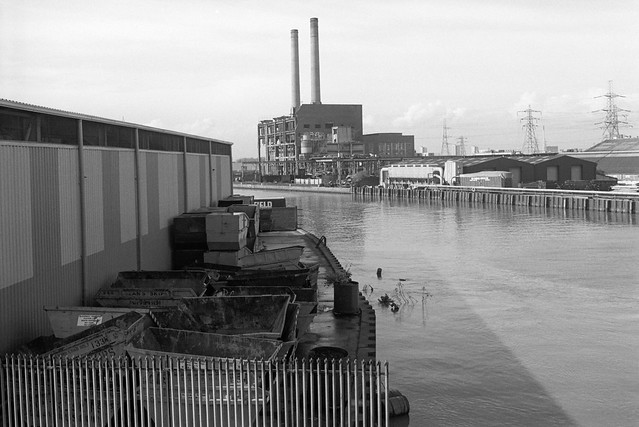
The pictures in this post were all taken on or close to the East India Dock Road where it crosses Bow Creek, beginning with a couple looking up river and with the rest looking towards the south. In later posts I’ll cover the area further down Bow Creek which played an important part in the industrial (and footballing) history of the nation, and return with the creek back almost to the road.

The pictures here are from visits to the area in 1982 and 1989, but I also took some in 1983, and returned again in 1992, mainly to make some panoramic views, which I’ll write about in a later post. You can see more of my pictures in my Flickr album – this area is on page 4 – and clicking on any of the above pictures will also take you to the larger version there.