My 2024 in Photographs – Today I set out on the impossible task of summing up the photographs I took over the year. It’s something I find very hard to do not least because I’ve taken so many pictures. But here is the first of a four-part presentation of some I’ve taken – though on any other day I might have chosen completely different pictures – with the often rather generic captions written in haste on the day they were taken. So its perhaps more a cross-section than a selection.
London, UK. 13 Jan 2024. Hundreds of thousands march in London in a global day of action for a full ceasefire in Gaza, an end to the genocide and a political solution to bring peace and justice to Palestine under international law. Israeli forces have killed over 23,000 people including more than 10,000 children, with many bodies sill under the rubble. Bombing has made humanitarian aid and medical treatment impossible and widespread deaths from disease and starvation now seem inevitable.London, UK. 22 Jan 2024. A large crowd outside Twickenham Rugby Stadium protested against the arms fair attended by companies supplying Israel with armoured vehicles and other weapons used in its devastating assault on Gaza and used to repress, terrorise, abduct and kill civilians and children in Palestine, Saudi Arabia, Egypt, Yemen and elsewhere around the world. They called on the Rugby Football Union to end hosting arms sales.London, UK. 27 Jan 2024. A march from Edmonton Green to a rally at Silver St demanded Israel ends its genocidal attack on Gaza, calling for an immediate ceasefire and an urgent programme of humanitarian aid to end famine and provide shelter, medicine and water. They praised South Africa for taking Israel to court for genocide and called for a just peace with freedom for Palestine.
Making the selection was a fairly long job. There are a little over 22,000 RAW images stored in my 2024 folder at the moment – those I thought worth saving from the rather more I actually made.
London, UK. 3 Feb 2024. Hundreds of thousands march from the BBC to Downing Street calling for a full ceasefire in Gaza where Israeli forces have now killed over 27,000, mainly women and children, and are ignoring last week’s ICJ ruling to prevent acts of genocide. Humanitarian aid and medical treatment is largely impossible and widespread deaths from disease and starvation are inevitable. They call for restoration of funding to UNRWA and a political solution to bring peace and justice to Palestine.London, UK. 3 Feb 2024. A dove with a key. Hundreds of thousands march from the BBC to Downing Street calling for a full ceasefire in Gaza where Israeli forces have now killed over 27,000, mainly women and children, and are ignoring last week’s ICJ ruling to prevent acts of genocide. Humanitarian aid and medical treatment is largely impossible and widespread deaths from disease and starvation are inevitable. They call for restoration of funding to UNRWA and a political solution.London, UK. 10 Feb 2024. A rally outside Ealing Town hall was one of many local protests around the country calling for an immediate ceasefire and an end to the genocide in Gaza which has now killed 28,000 mainly women and children and severely injured around 68,000. The entire population of Gaza is now living in desperate conditions with constant threat of bombing, shelling, famine and disease. They condemned the failure to respond to the ICJ ruling to prevent acts of genocide. London, UK. 17 Feb 2024. A huge march to the Israeli Embassy demands a full ceasefire in Gaza and an end to genocide. Israeli forces have now killed over 30,000, mainly women and children, are ignoring the ICJ ruling and launching a brutal assault on Rafah. Humanitarian aid and medical supplies are desperately needed to avoid mass deaths from disease and starvation and UNRWA funding is essential. Protesters demand a political solution to bring peace and justice to Palestine. London, UK. 17 Feb 2024. Movement for Justice. A huge march to the Israeli Embassy demands a full ceasefire in Gaza and an end to genocide. Israeli forces have now killed over 30,000, mainly women and children, are ignoring the ICJ ruling and launching a brutal assault on Rafah. Humanitarian aid and medical supplies are desperately needed to avoid mass deaths from disease and starvation and UNRWA funding is essential. Protesters demand a political solution to bring peace and justice to Palestine.London, UK. 24 Feb 2024. Women with flower head dresses leading the march. Two years after the Russian invasion thousands march from Marble Arch to a vigil in Trafalgar Square in solidarity with the Ukrainian resistance and to show opposition to Russian aggression and war crimes. Russia has occupied parts of Ukraine since 2014. The event was organised by the British-Ukrainian community in London and the wider UK.
This is too many for me to look through, so I made this selection to the roughly 2,000 that I posted on Facebook over the year. In the end I gave up trying to cut down my selection to only the dozen or so I could show in a single post here, so this is the first of four daily posts of my pictures from 2024.
London, UK. 28 Feb 2024. Poice arrested one man on the march. Extinction Rebellion protesters marched from Trinity Square to a festival outside the Lloyds insurance building, some in business attire. They demand the insurance industry refuses to provide cover for fossil fuel developments as these are risking our future. 40% of the world’s fossil fuel production is insured by Lloyds. The peaceful protest included music, speeches and dancing. London UK. 29 Feb 2024. Extinction Rebellion artivist troupe Red Rebel Brigade in front of the march to protest for climate justice and solidarity with Palestine at AXA Insurance which is insuring new oil and gas fields and investing in companies creating illegal Israeli settlements in occupied Palestine. They demanded AXA divests from Israel’s genocidal actions and end its investments in new oil and gas. The protest in heavy rain remained entirely peaceful.London, UK. 4 March 2024. Mary Ellen is surrounded by police as they clear wheelchair protesters from DPAC block of Victoria St after protest at the DWP in a National Day of Action before the budget against proposed brutal and horrific social security reforms which will cut benefits for hundreds of thousands of the disabled and give new powers to work coaches in Job Centres. A 2020 UCL report found almost 150,000 had then died as a direct result of Tory cuts and welfare reform policies.
Part 2 follows tomorrow. You can see many more pictures from these and other events in my albums on Facebook.
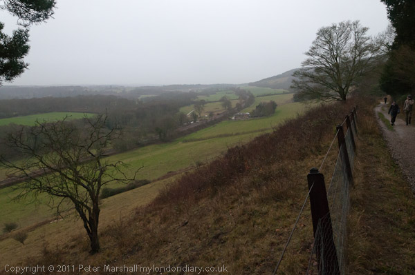
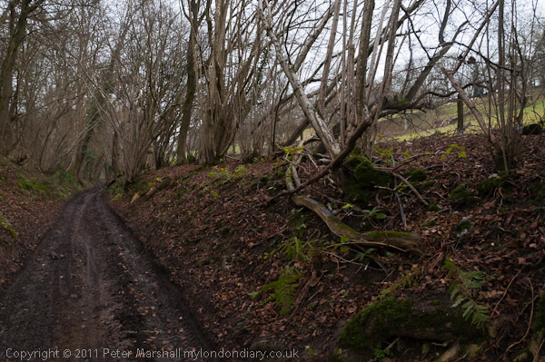
Westhumble & Ranmore Common, Surrey – 30th December 2011
The Pilgrims Way – and lower down the valley the railway from Guildford to Dorking
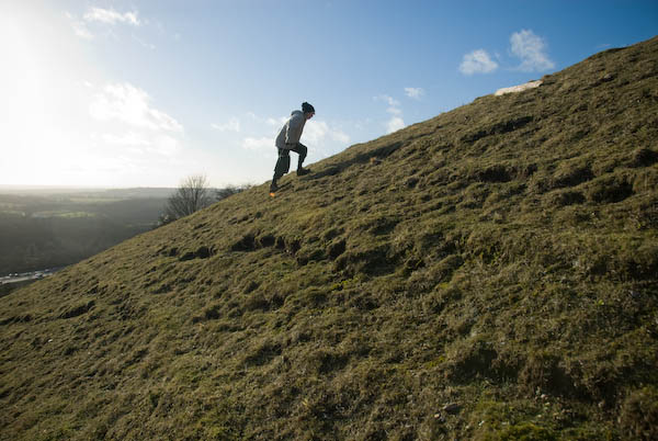
On Friday we went for another walk on the North Downs in Surrey, in a popular area for walking. In Summer it can get rather crowded with walkers but on a rather dull and damp winter’s day, even though many would have been still away from work over their Christmas break, relatively few were out walking the downs.
Leladene and blue plaque to Fanny Burney
The second picture I made on the walk was this one of Leladene with its blue plaque to Fanny Burney. Leladene, later renamed to Camilla Lacey was for some years the home of Burney (1752 – 1840) who came to live there after her marriage to one of the exiles from the French revolution who had made Mickleham their home, General Alexandre d’Arblay. As well as being one of the most notable authors of her age she was also for four years ‘keeper of the robes’ to Queen Charlotte, the wife of George III.
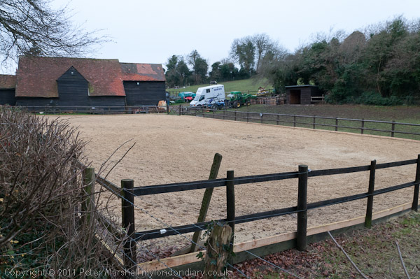
Norbury Park Saw Mill
In 2010 I wrote a brief description of the walk, although I seem to have missed out a line or so when I copied it to My London Diary so I’ve needed to do a little rewriting to make sense of one part of it. So I’ll rewrite it a little rather than simply copying here.
The weather wasn’t great and days are so short at this time of year, so we decided not to go to far for a walk, and did a roughly ten-mile circuit from Box Hill & Westhumble station.
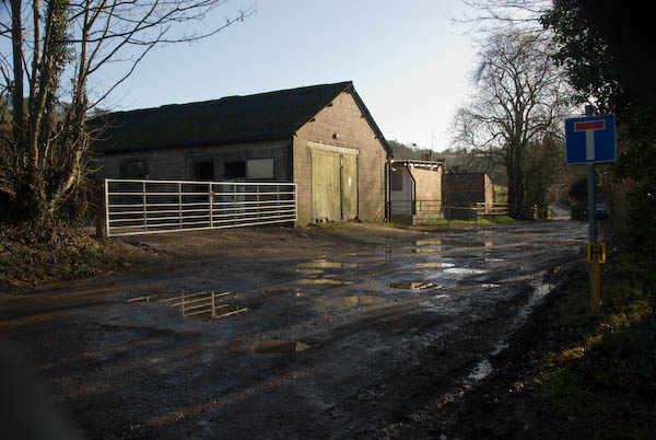
Roaringhouse Farm
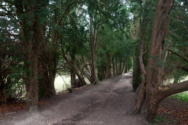
It was dry when we started, with some very muddy paths, though parts of the path were sheltered by the trees as we went along through Druids Grove.
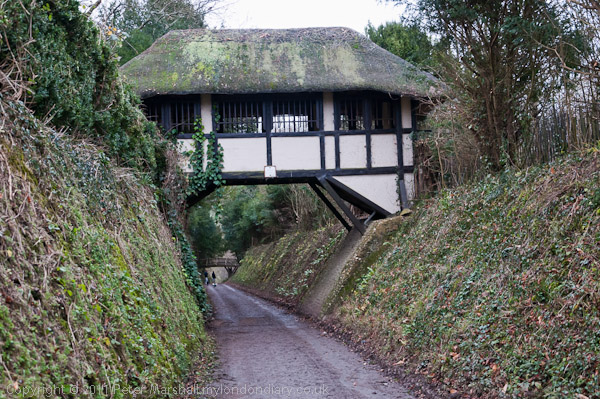
Thatched bridge at Polesden Lacy
Many of the old yews (some perhaps 2000 years old) have now been blown down in gales but there are still quite a few on each side of the path. From there we walked past the Albury Park sawmills and on through Polesden Lacy, passing under it’s thatched bridge.
The Causeway, Polesden Lacy
The steep track down from where we crossed from the North Downs Way to the Pilgrim’s Way a couple of hundred feet lower down the slope was a greasy mud slide, but we picked up some hefty sticks to help us keep upright, and from then on the way was easy going, with just a short uphill scramble to join the North Downs Way to take us back to Westhumble.
Hogden Lane
The light, never good, was fading as we walked above the Denbies vineyard and it was getting dark by the time we reached the station around 4.15pm.
I first got to know this area a little as a boy in the 1950s. I had got my first two-wheeler bike to replace an earlier tricycle on my sixth birthday and by the time I was 9 or 10 was going out for longish rides on a slightly larger replacement, sometimes with one or two friends, but for longer rides mainly on my own.
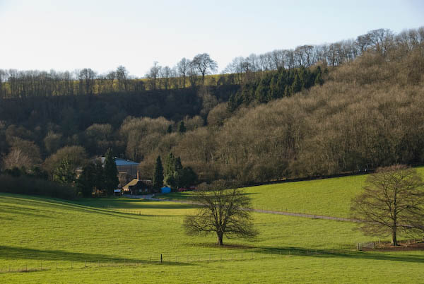
Denbies vineyard
One of those rides I made quite a few times took me across the River Thames at Hampton Court then on south through the ‘Scilly Isles’ roundabout and on to Leatherhead and the the A24 to Box Hill, around 20 miles each way.
My routes were carefully planned with the help of the “One Ihch” Ordnance Survey map. Generally I looked for the shortest way even when it meant cycling along busy major roads like the A3 though the final stretch along the A24 Mickleham bypass built in 1937-8 to Box Hill was on one of the few roads in the UK with a separate cycle path.
Box Hill and Westhumble station – and a long wait for the train with no seats in the dry on the up platform. It had been a good walk, though the views would have been better in clearer weather.
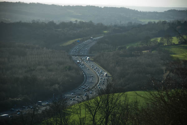
North Downs & the M25: We had our elder son staying with us over the Christmas break and by the 29th the trains in our area were almost working normally and we decided to have a walk on the North Downs.
I didn’t write a lot about it on-line, though some of the pictures have captions, but here is the complete text from My London Diary other than those.
A couple of days later we took a walk on the North Downs at Woldingham. It was pretty enough, but for much of the walk we could hear and see the M25.
Though we were walking along rather less busy roads – the sign here says ‘Public Bridleway. No Four Wheel Vehicular Access.’
Wikipedia begins its entry on the village with “Woldingham is a village and civil parish high on the North Downs between Oxted and Warlingham in Surrey, England, within the M25, 17.5 miles (28.2 km) southeast of London.”
Which isn’t a great deal of help to those of us who have only the vaguest idea of where Oxted and Warlingham are, but this is a part of what I think of as “deepest Surrey“, a few miles out past Croydon. We live in a very different part of the county with few large houses and virtually free of horses and on the other side of the Thames which doesn’t really belong in the county – and until the 1960s was Middlesex, the county which once included London and our town is still a part of it.
There is a steep escaprment on the Southern edge of the North Downs
This year today engineering work on the railway means there would be no way to get to Woldingham by train, but back in 2007 – and at normal times of the year now – it’s a relatively short journey, with a change at Clapham Junction we could be there in around an hour and a quarter. So even with the short December days there would still be plenty of time to walk around ten or twelve miles before it gets dark and be home in time for dinner.
I can’t remember the route we took, but this was a circular walk from Woldingham station Both the first and last pictures I made that day were at Church Farm, just a quarter of a mile south from the station. It’s probably not a walk I would recommend unless for some reason this section of the M25 was closed, as almost everywhere you can hear the noise of the traffic along it.
My shadow taking a picture in the churchyardof St Agatha’s Woldingham, first recorded in 1270
It’s probably not a walk I would recommend unless for some reason this section of the M25 was closed, as almost everywhere you can hear the noise of the traffic along it. There seemed to be some long traffic jams, with cars moving hardly any faster than us.
The final picture I made on the walk. More on My London Diary at North Downs & M25.
St Augustine of Canterbury, Church, Archway Rd, Highgate, Haringey, 1989 89-11g-46
This large Anglican church on Archway Road is immediately to the south of the fine parade of shops which ended the previous post. It always looks to me more like a Catholic Church than an Anglican one, probably because of the sculptural decoration on and above its doorway, and my impression seems to be correct.
The church is a product of three leading members of the Art Workers Guild, a body founded in 1994 promoting the ideas of William Morris and the Arts and Crafts movement. It was begun in 1888 by John Dando Sedding (1838 – 1891), one of the Guild’s founders in 1886-7 its second master and the west front shown here was completed in 1916 by his chief assistant Henry Wilson (1864–1934) with the Calvary added then by J Harold Gibbons (1878 – 1957.)
The church describes itself as a “friendly Anglo Catholic parish church” and has recently “due to theological convictions regarding the catholicity and sacramental integrity” of its mission asked to be removed from the care of Dame Sarah Mullally the Bishop of London and has been transferred to the See of Fulham which has a male Bishop.
Houses, Cholmeley Park area, Highgate, Haringey, 1989 89-11g-21
I walked up Archway, and photographed the Winchester Tavern (not on line) at 206 before turning west down Cholmeley Park where I think I took this picture of a 1930s suburban house with a circular window beside the door and a rounded bay with Crittal windows. I think I felt it was a rather typical building rather than anything exceptional, something I tried to include in my project.
Flats, 55, Cholmeley Park, Highgate, Haringey, 1989 89-11g-23
But these flats are clearly unusual, and the facade here was the entrance to the building set up here by the Santa Claus Society in 1890 or 1900 (sources differ) to provide 20 long-term convalescent beds for children with hip and spinal diseases.
The hospital became part of the NHS and was closed in 1954. It was converted by the London County Council in 1954 to provide hostel accommodation for 31 men suffering from tuberculosis who had “reached their maximum degree of improvement under hospital treatment but who cannot be discharged because they are homeless.”
Pineapple, Waterlow Park, Highgate, Camden, 1989 89-11h-65
Waterlow Park on a hillside below Highgate Village is one of London’s finest parks and when in the area I’ve often had a short rest in it, finding a suitable spot to eat my sandwiches.
This fine example of a pineapple is beside some steps in the park and I think is one of those produced by Eleanor Coade, who ran Coade’s Artificial Stone Manufactory, Coade and Sealy, and Coade in Lambeth, London, from 1769 until her death in 1821.This hard-wearing architectural material is virtually weatherproof. Coade Stone was produced by a secret process involving double firing of stoneware which died with her final business partner in 1833. It has been revived in recent years by Coade, a company “born due a lack of skilled craftsman capable of restoring the original Coade stone sculpture.”
Pineapples were a common architectural decoration in Georgian and Victorian times, symbolising wealth and fine taste.
I came out of Waterlow Park and crossed Highgate Hill to Highgate Presbyterian Church on the corner between Cromwell Avenue and Hornsey Lane. Designed by Potts, Sulman & Hennings, a fairly short-lived partnership from 1885 to 1891 between Arthur William Hennings, Edward Potts and Sir John Sulman (who left for Australia in 1885) in a Gothic Revival style was completed in 1887. In 1967 it became Highgate United Reformed Church and was converted into flats as Cloisters Court in 1982.
Flats, Hornsey Lane, Haringey, 1989 89-11h-42
This fine terrace is at 57-71 Hornsey lane and I think dates from around 1900, probably the late 1890s, and is joined at its west end to a slightly grander central block at 39 at extreme left of the picture, (where are 41-55?) with Linden Mansions continuing to the west to the former church on the corner of Hornsey Lane.
My walk continued down Hornsey Lane – more in a later post.
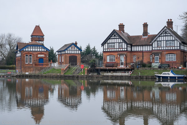
Brentford, Chiswick & Hammersmith: On Thursday 27th December 2018 we still had a lot of Christmas excess to walk off despite having made our normal Boxing Day walk the day before. But we had followed that with a second Christmas dinner.
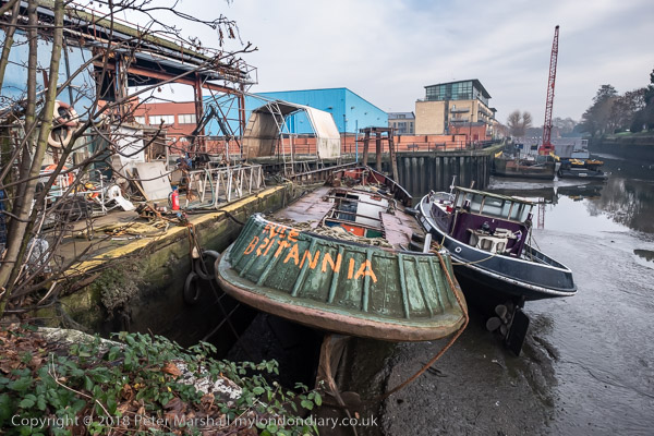
‘Rule Britannia’ on a boat moored below Thames Lock at Brentford
This is still one of my favourite walks in West London and includes various stretches I’ve often walked over the years in one direction or the other, usually during the times of year when days are short and we don’t want to spend much time in travelling. And during the time between Boxing Day and New Year, rail travel is often something of a lottery with much of the network being shut down for engineering work.
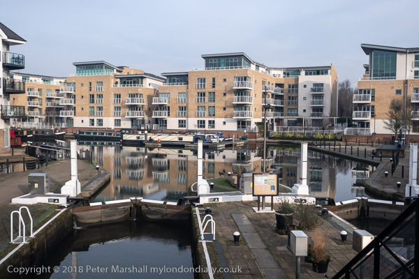
Brentford locks were gauging locks so that tolls could be charged based on the weight of goods in barges. The flats here on a site between the River Brent and the canal have replaced large dockside sheds.
Even our short journey to Brentford was affected in 2018 and the usual direct train service to Brentford – our slow route to Waterloo – was not running. But we could take a train to Twickenham and go the rest of the way on the top deck of a bus, always one of the most interesting ways to travel in London. And the bus did take us more conveniently close to where I wanted to start this walk, at the bridge which takes Brentford High Street over the Grand Union Canal.
The road over the canal used to be the main route from London to the west and southwest before the Great West Road opened in 1925, and the canal linked the Thames to Birmingham.
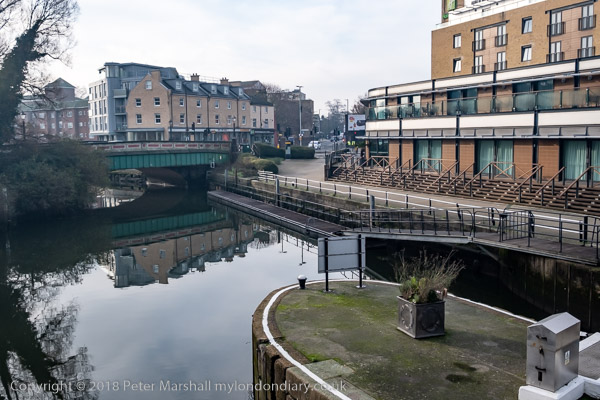
Brentford used to be a rather dirty downmarket industrial and commercial centre, with sheds and warehouses, factories, docks on the canal and where this enters the Thames, a thriving market, a large gas works and more. It has changed dramatically in the last 40 or so years with much of its river and canal sides now filled with luxury flats. Parts of the old Brentford remain but more and more is disappearing, including some things in these pictures I made in 2018. I’ve been there a few times since and it remains an interesting walk.
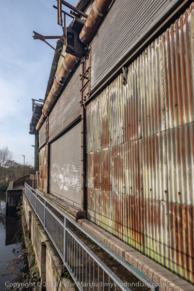
A narrow section of the towpath beside a derelict shed
More on My London Diary at Brentford to Hammersmith. Here I’ll simply post a few images with captions from some of the key places along our route apart from the picture at the top of the post they follow roughly in the order I took them, though we did quite a bit of wandering around in Brentford.
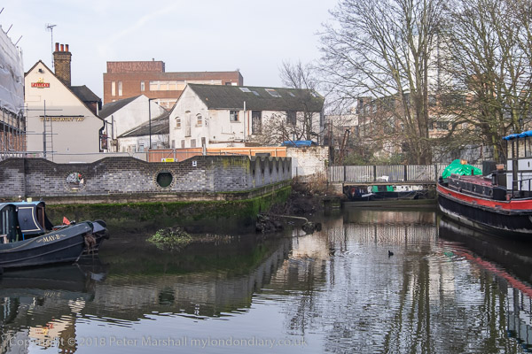
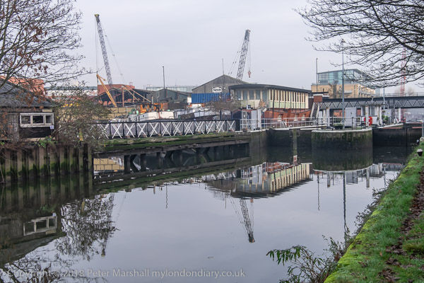
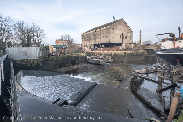
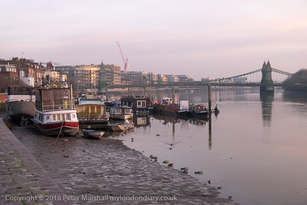
A small dock in the middle of BrentfordThe River Brent flows over the weir below the footbridge at centre left; at right, Thames Lock connects the canal to the tidal River Thames.The River Brent from the footbridge over the weir.Below Thames Lock the river comes back into the channel leading from the lock to the Thames.A working boatyard at Dock Road on the River BrentJohn’s Boat Works, Lot’s Ait with the bridge to it built in 2012Hounslow Council and boat owners fought a long battle over the moorings at the gasworks site, but these boats were simply abandoned after the council’s victory.Strand on the Green at low tide. It was warm enough to sit in the sun and eat our sandwichesWe walked through the gardens and out from the main gate to Chiswick HouseThe footpath to St Nicholas’s Church in ChiswickRiver Thames looking back to ChiswickRiver Thames and Hammersmith Bridge
In Hammersmith we took the District line to Richmond and then a train back home to tackle some of the leftovers from our Christmas lunch.
Boxing Day Walk: Most years this century we have walked from Staines to Old Windsor for a family lunch, at first at my sister’s house, but more recently at a pub in Old Windsor where we have been joined by other members of the family. We are hoping to do the same today, though perhaps we might need to take a bus, a few of which are rumoured to be running, though I think likely to be cancelled at zero notice.
The Swanmaster statue had been moved earlier in 2014 to the riverside garden in Staines
It’s not a great distance, though in earlier years we often added a few miles to the more direct five or so to develop more of an appetite, and sometimes we had too when the path beside the River Thames was flooded.
Offices on a small riverside dock on the Surrey bank in Staines
On My London Diary you can read more about some of these walks, and in particular about our walk on Friday 26th December 2014, ten years ago, when I wrote about it in rather more detail than usual. Here I’ll just post a few of the pictures from that walk with some captions, mainly those I wrote back in 2014. The pictures follow the order of our walk.
The annual Boxing Day Challenge (if river flow allows) between Staines Boat Club and Burway Rowing ClubThe more recent of the two bridges taking the M25 and A30 Staines Bypass across the riverA floating crane moored by the weir at Bell Weir Lock in water undisturbed by boatsThe 1910 water intake to the Staines aqueduct takes water to reservoirs and treatment works.Rosehearty has been moored here for years. The name is a town on the Moray Firth.Dock at Bell Weir Boats in RunnymedeHouses on The Island in Wraysbury – many here were flooded in February 2014The Thames at Runnymede, where we crazily swum in the buff when young after an evening in the Angler’s Rest Hotel. Then there was a diving board here too.R G Bargee – most boat owners seem unable to resist a pun. We were almost there.Another family at our destination.
Crackers & Paper Hats: A Happy Christmas to you all.
Perhaps this is not the most obvious of Christmas pictures, but if you’ve pulled a cracker and put on a paper hat you have enjoyed the legacy of Tom Smith, whose wife and company are remembered in this memorial.
Martha Smith Memorial Water Fountain, Finsbury Square, Finsbury, Islington, 1992, 92-10e-33
This water fountain states it was ‘Erected and presented to the Parish of St Luke by Thomas and Walter Smith (Tom Smith and Co) to commemorate the life of their mother, Martha Smith, 1826 – 1898.’
Thomas J Smith (1823-1869) invented the Christmas Cracker in 1847 and the company made enough from their sales and the paper crowns introduced into them by his son Walter to move to premises in Finsbury Square where they remained until 1953. The fountain dedicated to their mother was erected by Thomas’s sons Tom and Walter in 1898.
You can still buy Tom Smith crackers both in the UK and the USA and the company has “been the proud holder of a Royal Warrant to The Monarch since 1906” – including our current king, and you can view their catalogue online which also includes gift wrap, display units and tags, gift bags and cards. You can get some of them from various charities in boxes of six at around a pound a cracker as well as in various shops. However I suspect those they produce to be pulled around the royal Christmas dinner table are considerably more expensive.
On another site you can read a fairly detailed story of how the cracker came about – and my short summary based on this and Wikipedia.
Tom Smith began work as a small boy in a “a bakers and ornamental confectioners shop in London, selling sweets such as fondants, pralines and gum pastilles” and enjoyed making new “new, more exciting and less crude designs in his spare time.“
In his teens he set up his own shop in Goswell Road, Clerkenwell selling wedding cake ornaments and confectionery and on a trip to Paris in search of novel ideas in 1840 found the ‘bonbon‘, a sugared almond wrapper in a twist of tissue paper, and he began making and selling these in London. He had the idea of increasing sales by adding love messages in the wrappers.
Chemist Edward Charles Howard had discovered silver fulminate in 1800 and in 1802 Luigi Valentino Brugnatelli found a “a safe way of using it in amusements and for practical jokes.” I think schoolboys made use of it ever since (as I did) to put a trace on schoolmasters chalks to make a small explosion when they write on the board. I imagine whiteboard markers have made this obsolete.
Again according to Wikipedia, Smith bought the design and formula for the “snap” in his crackers from a chemist called Tom Brown who had worked for the Brocks Fireworks company. Smith added these to the now rather larger bonbons and sold them first as ‘Bangs of Expectation‘, later as “Cosaque (French for Cossack)”, but they became known popularly as ‘crackers’.
It was his son Walter, who took over the business after his father’s death in 1869 who first produced the cracker as we know it now, adding trinkets and paper hats, and these enjoyed a huge success, enabling him to move the business to much larger premises near this monument in Finsbury Square. In the 1890s it had 2000 employees and it remained there until 1953 when the company merged with Caley Crackers, then owned by toffee manufacturer John Mackintosh & Sons Ltd. The new joint company operated under the name of Tom Smith’s.
The picture to the memorial which celebrates both Walter’s mother and father is one of over 35,000 pictures, mainly of London, though also some of Paris, Hull and elsewhere. You can search the collection to find pictures of particular interest or browse the albums. As always, comments there are welcome on any of my pictures.
Wishing You A Merry Christmas: As in the past few years I’ve produced a digital Christmas Card for my many on-line friends, including all the readers of this >RE: Photo blog and my over 4,000 Facebook friends.
The picture isn’t perhaps very Christmassy, but then neither are many on the actual printed cards I’ve receeived. It’s one of a number of pictures I took on a couple of visits with friends to the West Norwood Cemetery this year when we largely followed the Discovering Britain walk created in collaboration with the Friends of West Norwood Cemetery.
It took us two visits, as on the first visit in July we got halfway round and were at the furthest point from the cemetery entrance when the heavens opened for one of the most torrential downpours. We sheltered for some minutes under a tree before walking under our umbrellas along the paths which were now small streams to the exit. By the time we reached the bus stop it had almost stopped raining but we were quite wet and had had enough for the day – and took a bus to the The Holland Tringham in Streatham where we drank a toast to the artist.
Another image of the mosaic
We returned in September, when the weather was a little kinder. It had been bright and sunny when we arrived at the Greek section of the cemetery but soon after we arrived we had to shelter under a tree for a few minutes. But I think the rain made many of the monuments look better.
I’d visited the cemetery years earlier in 1990 and made quite a few pictures there, around 40 of which are on Flickr, mainly from the Greek section, starting here.
But the picture I printed for cards for a few friends, mainly photographers was this one of a shop window taken during our Christmas walk in December last year, which began with a short walk around the City of London and a visit to Leadenhall Market and a drink in a pub there before going a short distance away for a meal.
Almshouses, Museum, Hospital & Shops – Highgate: More from my walk in Highgate on Sunday 19th November. You can read the previous part at Into Highgate Village.
Wollaston and Pauncefort, Almshouses, Southwood Lane, Highgate, Haringey, 1989 89-11f-12
The Wollaston and Pauncefort Almshouses were set up by wealthy City goldsmith Sir John Wollaston who was Lord Mayor of London in 1643 and a among many other positions was a Governor of Highgate School and briefly Lord of the manor of Hornsey. In his last years he had these almshouses built for “six men and women of honest life and conversation‘ from Hornsey and Highgate, and his will in 1658 made the governors of Highgate school trustees of the almshouse.
His endowment provided those living in the almshouses an income of 50 shillings a year and for money for the repair of the premises. The school governors selected the residents and laid down strict rules for them, including attending services in the school chapel.
However by 1722 the building was beyond repair and school governor and treasurer Edward Pauncefort had them rebuilt, doubling the number of residents to 12 and adding a charity school for girls. His endowment and other bequests also gave the residents a rise to £7 a year.
The Grade II listed almshouses were altered internally over the years and finally the year before I made this picture significantly modernised and provided with indoor bathrooms and toilets by merging pairs of the units, reducing the number of residents to the original six. Only one of each pair of doors is now in use.
My picture includes a phantom cyclist, blurred almost to extinction by the slow shutter speed I used.
Highgate School Library, Southwood Lane, Highgate, Haringey, 1989 89-11f-13
The Highgate Tabernacle at 20a Southwood Lane was built as a Baptist chapel in 1836, replacing an earlier Presbyterian chapel and was Grade II listed in 1974. In 1976 the chapel was bought by Highgate School and served as their library for almost 30 years. It now houses the archive and museum of the school, open to researchers and occasionally to the public.
Among its holdings are the “Royal Charters of Queen Elizabeth I, authorising our founder Sir Roger Cholmeley to found a school at Highgate, 29 January 1565, 6 April 1565“.
The Limes was built in 1815 and in 1921 was bought for use as an orphanage by the Furniture Trades’ Provident and Benevolent Institution who renamed it Radlett House. In 1940 they moved to larger premises and leased the property to Middlesex County Council who converted it to a small hospital. After becoming a part of the NHS it was renamed Southwood Hospital.
The hospital was still in use though on a reduced scale when I made these two pictures, but a notice beside the main entrance (part visible on my first picture) makes clear it offered no casualty or accident and emergency services. It simply housed a few beds for chronically ill patients needing nursing care.
The hospital closed in 1991 and in 2004 was was converted into a terrace of large private houses.
Archway Road was designed in 1808 as the world’s first bypass to provide a less steep route out of London than Highgate Hill for heavy waggons by building a 900ft long tunnel. Work started in 1810 but unfortunately the tunnel collapsed in 1812 when it was almost finished. Fortunately nobody was killed but it was decided to convert the tunnel into a cutting. This then needed a bridge to carry Hornsey Lane over the new road, and John Nash came up with an elegant brick design with a tall narrow arch for traffic and above that a three arch bridge carrying the road.
But the arch was too narrow as traffic increased and was replaced with the current bridge in 1900. This row of shops begin around 200 metres north of the bridge.
Steps lead up from Archway Road to Winchester Road from where I was able to make this second picture of the long row of shops. The conservation area appraisal describes this as late Victorian and “very distinctive with original balustrades above many of the shops” and notes the “top floor balconies set back under large arches with half timbering” and the “very eye-catching” roofscape though it notes only some of the stone finials have survived. These details are clearer in the previous picture.
Fire Station Cottage, North Rd, Highgate, Haringey, 1989 89-11f-45
I continued along North Road. Fire Station Cottage dates from 1906 and as the name suggests was built as a fire station. According to British History Online, “A room in North Road, Highgate, was hired in 1882 and a portable fire station was opened in 1887” with a fire engine manned by volunteers. This building was built as a replacement. It had closed as a fire station before World War Two but was reopened for use in the Blitz.
Highgate School, North Rd, Highgate, Haringey, 1989 89-11f-34
Taken from beside The Old Gate House pub at 1 North Road, a 1930s faux antique timber framed building with only its sign in my picture, I was looking across to Highgate School, founded by Roger Cholmeley in 1565, and formally ‘Sir Roger Cholmeley’s School at Highgate’. The current school fees for Years 7-13 are £8,830 per term and with VAT at 20% that comes to almost £32,000 a year. The per-student annual cost of public education in the UK in 2023-4 was £7,600.
The Grade II listed chapel was designed by Frederick Pepys Cockerell and built in 1865-6 and has an unusually long description in the official listing text.
Pond Square, Highgate, Camden, 1989 89-11f-35
Pond Square is certainly not a square, but a strangely shaped quadrilateral one side of which is South Grove. I rather liked the atmospheric nature of this image taken into the light which nicely illuminates what must surely be a gas lamp, as well as the many fallen sycamore leaves. The building on the right is 6 Pond Square and the church in the distance is St Michael’s Church, Highgate.
As well as not being a square, Pond Square does not have a pond, but rather more usefully does have public conveniences. There had been two man-made ponds here, the first apparently dug out as a hobby by a local hermit in the fourteenth century. Both were filled in by the local council in 1864 as unsanitary.
Highgate Literary & Scientific Institution, South Grove, Highgate, Camden, 1989 89-11f-22
South Grove forms the southern side of Pond Square and the Highgate Literary & Scientific Institution is at Number 11 on its junction with Swains Lane. It was founded in 1839 to enlighten the local population about the new developments in science and industry that were revolutionising the country. It still continues to do so.
It moved to this Grade II listed building in 1840 and remodelled it both then and later in that century. According to the listing it had previously been in use as a school for Jewish boys, and other sources suggest it may have been built on the cellars “of the Swan, Highgate’s first alehouse dating from the fifteenth century“.
The Angel, Pub Sign, Barclays Bank, High St, Highgate, Camden, Haringey, 1989 89-11f-25
There was a brewery and pub on this site at least by 1610, but it was given a new frontage in 1880 and then completely rebuilt in 1928-30. But though I liked the sign I was more impressed by the Barclays Bank and the adjoining building on the opposite of the street.
Barclays closed the bank at 54 High Street in 2020, selling it for £1.8 million and Highgate no longer has a bank. I think these buildings probably date from the late 1890s.