Brentford, Chiswick & Hammersmith: On Thursday 27th December 2018 we still had a lot of Christmas excess to walk off despite having made our normal Boxing Day walk the day before. But we had followed that with a second Christmas dinner.
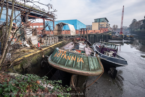
‘Rule Britannia’ on a boat moored below Thames Lock at Brentford
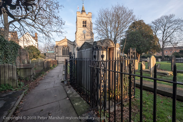
This is still one of my favourite walks in West London and includes various stretches I’ve often walked over the years in one direction or the other, usually during the times of year when days are short and we don’t want to spend much time in travelling. And during the time between Boxing Day and New Year, rail travel is often something of a lottery with much of the network being shut down for engineering work.
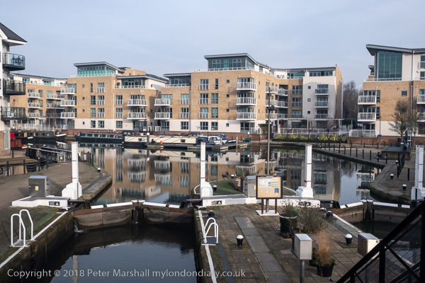
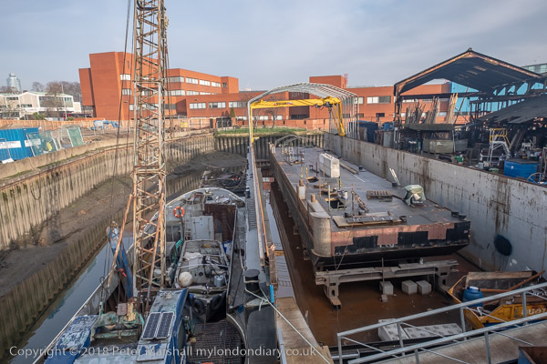
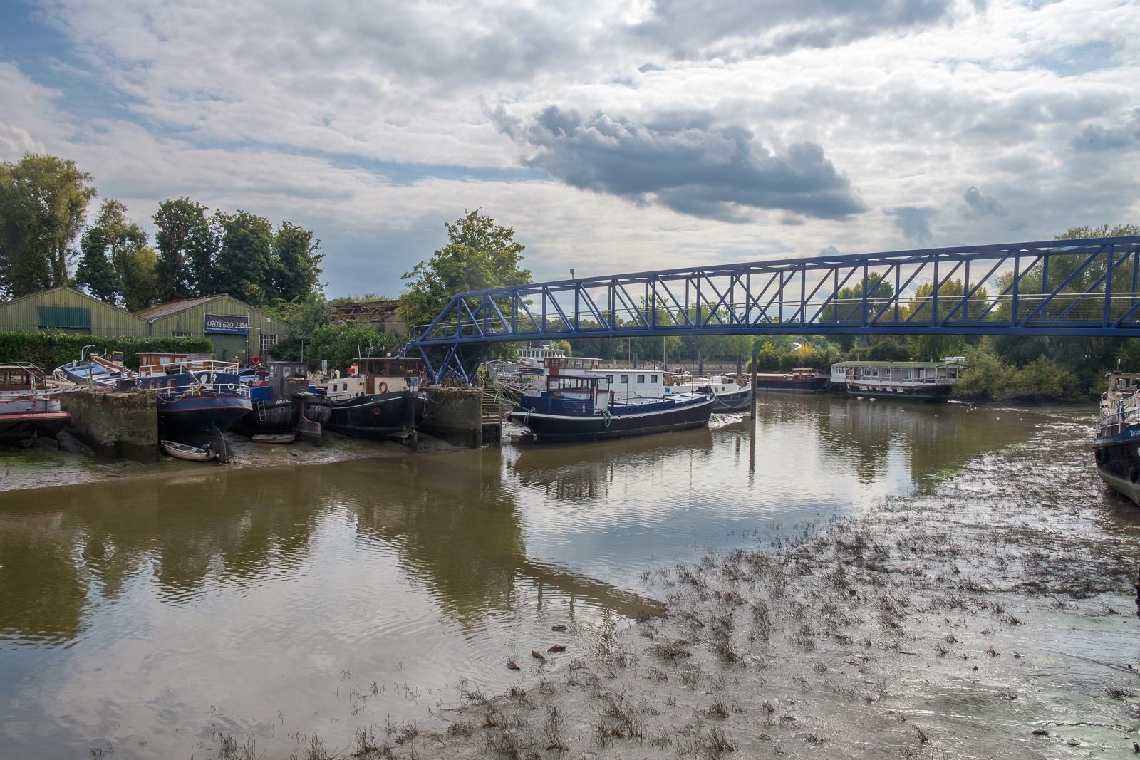
Brentford locks were gauging locks so that tolls could be charged based on the weight of goods in barges. The flats here on a site between the River Brent and the canal have replaced large dockside sheds.
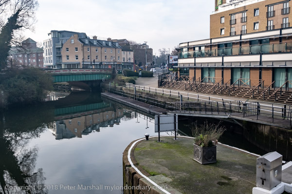
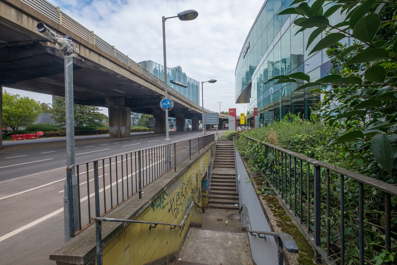
Even our short journey to Brentford was affected in 2018 and the usual direct train service to Brentford – our slow route to Waterloo – was not running. But we could take a train to Twickenham and go the rest of the way on the top deck of a bus, always one of the most interesting ways to travel in London. And the bus did take us more conveniently close to where I wanted to start this walk, at the bridge which takes Brentford High Street over the Grand Union Canal.
The road over the canal used to be the main route from London to the west and southwest before the Great West Road opened in 1925, and the canal linked the Thames to Birmingham.
Brentford used to be a rather dirty downmarket industrial and commercial centre, with sheds and warehouses, factories, docks on the canal and where this enters the Thames, a thriving market, a large gas works and more. It has changed dramatically in the last 40 or so years with much of its river and canal sides now filled with luxury flats. Parts of the old Brentford remain but more and more is disappearing, including some things in these pictures I made in 2018. I’ve been there a few times since and it remains an interesting walk.
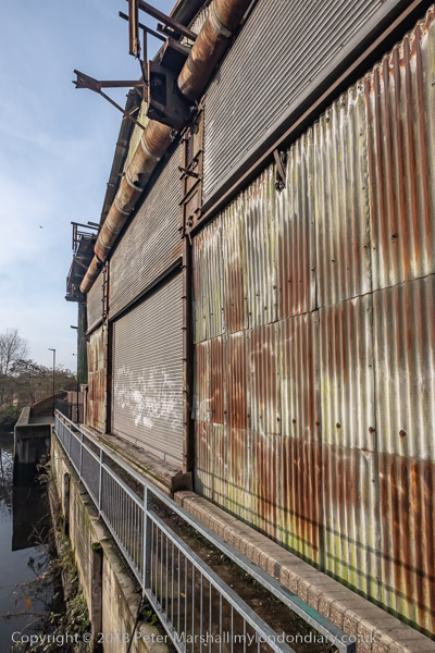
A narrow section of the towpath beside a derelict shed
More on My London Diary at Brentford to Hammersmith. Here I’ll simply post a few images with captions from some of the key places along our route apart from the picture at the top of the post they follow roughly in the order I took them, though we did quite a bit of wandering around in Brentford.
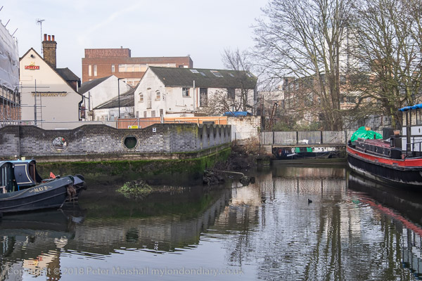
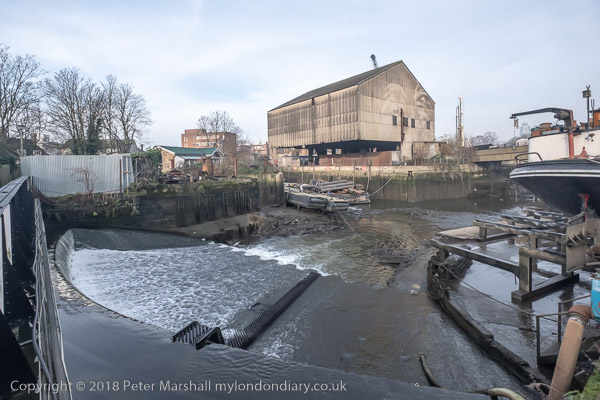
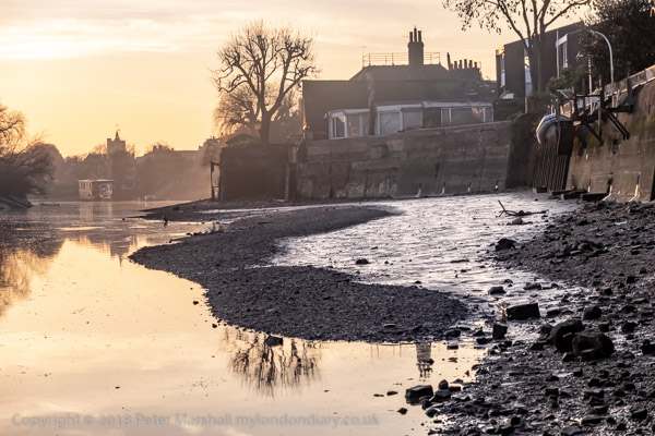
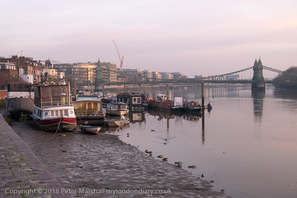
A small dock in the middle of BrentfordThe River Brent flows over the weir below the footbridge at centre left; at right, Thames Lock connects the canal to the tidal River Thames.The River Brent from the footbridge over the weir.Below Thames Lock the river comes back into the channel leading from the lock to the Thames.A working boatyard at Dock Road on the River BrentJohn’s Boat Works, Lot’s Ait with the bridge to it built in 2012Hounslow Council and boat owners fought a long battle over the moorings at the gasworks site, but these boats were simply abandoned after the council’s victory.Strand on the Green at low tide. It was warm enough to sit in the sun and eat our sandwichesWe walked through the gardens and out from the main gate to Chiswick HouseThe footpath to St Nicholas’s Church in ChiswickRiver Thames looking back to ChiswickRiver Thames and Hammersmith Bridge
In Hammersmith we took the District line to Richmond and then a train back home to tackle some of the leftovers from our Christmas lunch.
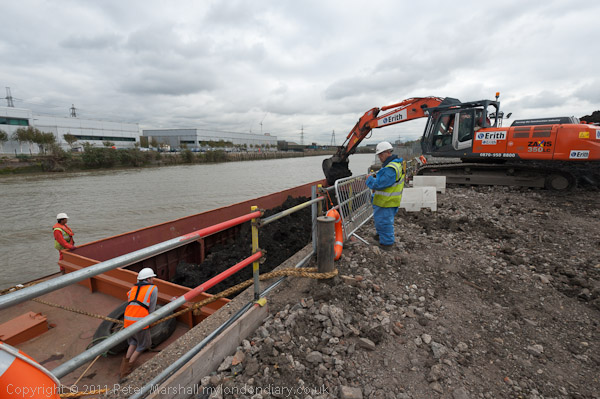
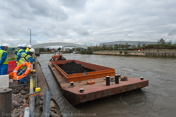
Barging on Bow Creek: On Wednesday 12 October 2011 I was pleased to get paid to go back to Bow Creek and take photographs of a working barge on Bow Creek in Poplar.
Bow Creek is the lower part of the River Lea, between Bow Locks and the River Thames. Bow Locks mark the southern end of the Lea Navigation and since London’s oldest canal, the Limehouse Cut opened in 1770, most canal traffic took advantage of this to take a more direct route to the Thames and avoid the dangerous and meandering tidal Bow Creek.
The River Lea remains tidal some miles above Bow Lock, but this tidal section is separate from the navigation, although there are various channels and locks such as City Mill Lock and Carpenters Lock on the Olympic site which link the two.
Bow Creek continued to be used for navigation, including for bring coal to West Ham Power Station and the huge Imperial Gas Light & Coke Company gas works at Bromley-by-Bow.
But the gas works closed in 1976 although its gasholders remain – they were still in use for gas storage until 2010. (I went inside the site to photograph them in 2022.) Planning permission has now been granted for 2,200 new homes on the site, retaining the seven gasholders. The gas works dock is now Cody Dock, a creative and community hub with moorings and a short walk from the DLR at Star Lane, hosting many intersting events.
West Ham Power Station ended production in 1983 and was then demolished to build a business park. In the lower sections of Bow Creek there were still a number of timber yards and a ship repair business still using the creek at least in the 1980s, but I think all all commercial traffic has now ended.
Much was made during the construction of the Olympic site of the use of barges to carry waste away from the area, and a new lock was built at great expense on the Prescott Channel at Three Mills Green, but I think barges were only used for PR photographs and the huge majority of waste was taken out by lorries.
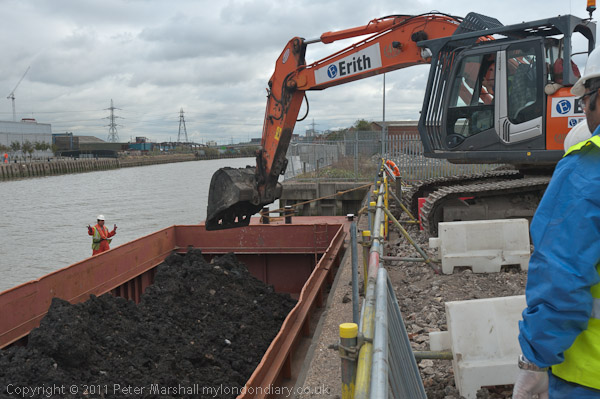
So I was pleased to hear that “the people cleaning up the gas works site at Poplar … were using barges to carry out the highly toxic soil from the site* and “… “was delighted to be given a commission to go and photograph the barging.”
This is what a rubbish recycling plant looks like
On My London Diary I write more about my relationship with the River Lea which had begun in 1981 when “I heard a story on the radio that commercial barge traffic was about to come to an end on the Lea Navigation, and decided to travel across London to record its last days.” From then I carried out a major project on the river, but was disappointed to have a funding application turned down.
I returned to the River around ten years later and again in the early 2000s, with more frequent visits after the Olympic bid was successful – although access to the main site was soon impossible. In 2010 I published Before the Olympics, ISBN: 978-1-909363-00-7 with over 200 pictures from the source to the Thames.
The My London Diary post also describes my experience on the visit – how I had to dress up to take the pictures – and that although I’d been promised I would have half an hour to take photographs it actually ended up as 11 minutes.
After taking the pictures – both for the project PR and myself – I had the rest of the day to take a walk along Bow Creek again and made my way to the Thames on the Greenwich meridian, where I found “a new marker installed in the Virginia Quay estate next to West India Docks station, built since I carried out my ‘Meridian Project‘ in the 1990s and made an unsuccessful bid to create a’Meridian Walk’ to mark the new millennium.” Now there is a sculpture trail, The Line, which in part follows Bow Creek – and includes work at Cody Dock.
All pictures in this post are from Wednesday 12 October 2011. There are many more pictures from my walk as well as the barging at Barging on Bow Creek
More from Nine Elms Riverside: My walk on Saturday 29th July continued from yesterday’s post.
Libation, River Thames, Riverside Walk, Nine Elms, Wandsworth, 1989 89-7l-66
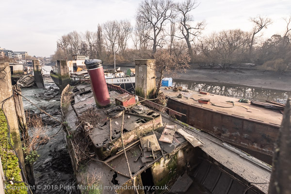
At the end of the William Henry Walk I photographed a small coastal vessel, the Libation, moored at a short pier.
Libation, River Thames, Riverside Walk, Nine Elms, Wandsworth, 1989 89-7l-51
As a took a few photographs the skipper of the vessel came up to talk with me. He told me that he and his mate brought the ship up on the tide every day with a load of gravel dredged from the estuary, where it was unloaded by the crane with a grab into the hopper at left of the picture. As soon as I ended the conversation and moved on I regretted I had not asked him if I could take his picture, but it was too late to go back.
The Battersea Barge, Bistro, River Thames, Nine Elms Lane, Nine Elms, Wandsworth, 1989 89-7l-41
The Battersea Barge is at the west end of this section of walk, immediately west of the Heathwall pumping station. And although the area around has changed completely the Battersea Barge is still there, a 1930s Dutch barge converted to a floating bar and restaurant, much in demand for private parties, though it now seems only to offer a bar to which people are welcome to bring their own food – and there are many local outlets which have now opened. And it now has a sister ship nearby, another converted Dutch barge, the Tamesis, a “walk-on neighbourhood bar, live music & events space” moored nearby.
Until around 2008 the path here was reached by an fairly narrow alley beside a warehouse, but the commercial properties along this side of Nine Elms Lane were replace from 2012 on by tall residential blocks, part of the immense development that has taken place in the Nine Elms area.
River Thames, Riverside Walk, Nine Elms Lane, Nine Elms, Wandsworth, 1989 89-7l-44
The dock here was originally Manor House Wharf and a dock ran into the gas works on the other side of Nine Elms Lane. The jetty at Imperial Wharf allowed larger ships to unload coal here.
Jetty, River Thames, Imperial Wharf, Nine Elms Lane, Nine Elms, Wandsworth, 1989 89-7l-31
The jetty for the Nine Elms Gas Works was rebuilt in 1952 to handle the flatiron coastal colliers which brought coal to the works. The gas works had begun here in 1858 and were taken over by the Gas Light and Coke Company in 1883 who ran them until nationalisation in 1949. The gas works closed in 1970 when the UK changed to natural gas.
There are now more houseboats moored here in what is now called Nine Elms Pier.
Pier, Riverside Walk, River Thames, Kirtling St, Nine Elms, Wandsworth, 1989 89-7l-34
At the west end of the Tideway Walk I used the steps up to the jetty to take this and a landscape format image from the same position – below. Both are looking upstream towards Battersea Power Station at left and its jetties and cranes, and on the other side of the river the 1875 chimney for the Western Pumping Station on Grosvenor Road.
Pier, Riverside Walk, River Thames, Kirtling St, Nine Elms, Wandsworth, 1989 89-7l-35
The Tideway Walk ends here, turning south to Kirtling Street, which leads back to the main road. The riverside here is still in industrial use as the Cringle Dock Solid Waste Transfer Station. Back in 1989 there was a long walk before you could access the river at Chelsea Bridge and Battersea Park, but now you can go down Cringle Street to the Battersea Power Station development.
My description of this walk continues in a later post towards Battersea.
My walk a few days ago in September 2022 began at Kew Bridge Station. I’d come half an hour before I was due to meet my two companions to take a short walk around one of the newer parts of the area before meeting them for a longer walk to Isleworth.
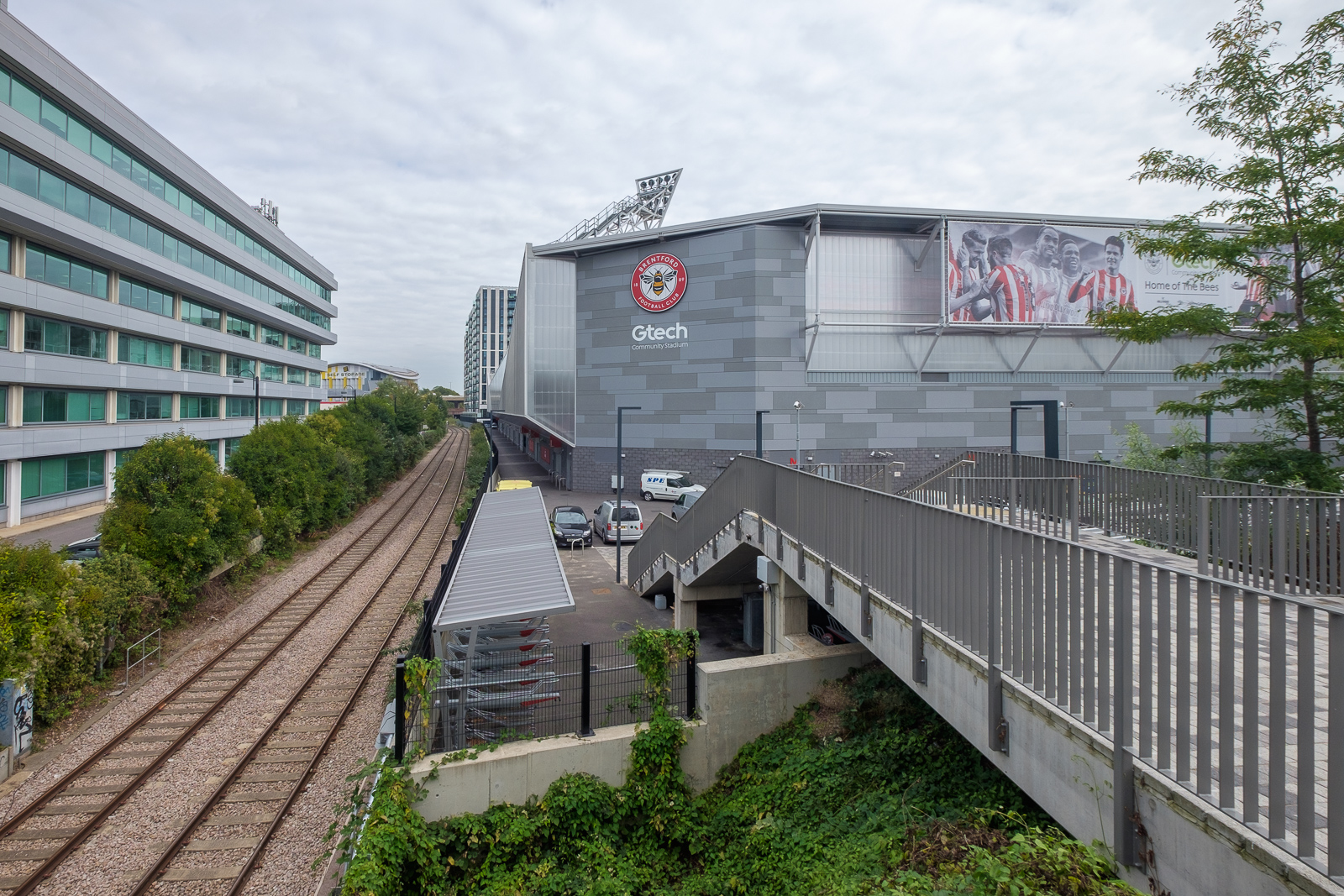
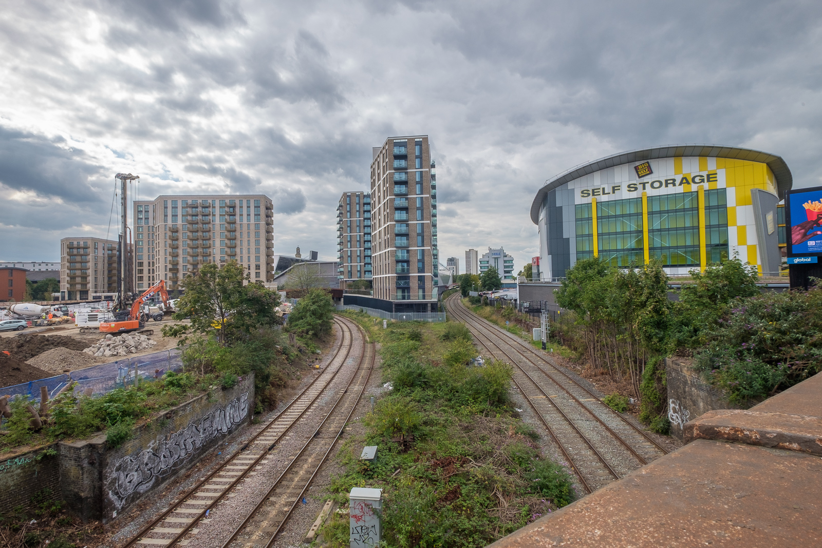
Lionel Road runs north of the railway up to meet the Great West Road. It used to be a rather run down area with railway sidings on one side and a few old commercial buildings and works to the north. The last time I’d walked down here on my way to Gunnersbury Park in 2018 the whole area had been a building site, but now is home to Brentford FC, currently doing pretty well in the Premier League.
Brentford was my local team when I was a kid, and several members of the award-winning under-11 team I played for at left back on went on to play for them at their old ground (and at Chelsea.) One of the other patrol leaders from my scout group stayed there until he retired, though I never met him after I hung up my woggle, but read his obit in the local rag.
Past there I came to the Great West Road, a 1930s dual carriageway with cycle tracks I sometimes used further west on my way home from school. In the 1980s or 90s I photographed most of the remaining Art Deco factories along it, though the bulldozers got to some first. Now it reminds me of J G Ballard’s novels, particularly ‘Crash’, set around the area we both lived in, with the elevated M4 above the older modern road.
A new Brentford of tall blocks has sprouted here, though more land remains to be built on. A little-used rail line goes through it, the Kew Curve, with Brentford’s stadium replacing the sidings and cattle pens to its west, with new building on the east in what was Brentford Market. It moved to this site in 1893 after the Brentford Local Board had bought the 2 acre site from the Rothschild estate because market trading in the area around the Express Tavern immediately south of the station which had developed informally away from Brentford’s traditional market in Market Place had become a public nuisance. The site was extended in 1905 and then covered land now part of the Chiswick Roundabout. The market moved to the edge of Southall in 1974 as the new Western International Market and the Fountains Leisure Centre was built on part of the site, with the rest staying derelict for years.
My maternal grandfather, then a market gardener in Feltham, would drive his cart with produce to Brentford Market in the early years of the last century, past the house in Hounslow where my father, then a young boy, used to see him driving past. Around twenty years later when he became engaged to my mother he found out who he was.
I met my two colleagues and we walked together down by the west side of Kew Bridge to the Thames. To our right was where the Kew Bridge Ecovillage had squatted from June 2009 until May 2010, now occupied by 164 flats, a business centre, gym and pub.
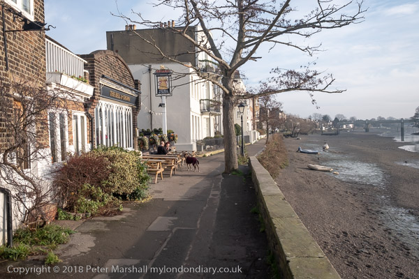
The Hollows runs west between riverside moorings and recent blocks of luxury flats, eventually returning us to Brentford High St, and a park beside the river now called Watermans Park. This was the site of Brentford Gas Works which straddled the High Street here and was a great attraction when we took the bus through it in my childhood, usually on our way to Kew Gardens. Entrance then was only an old penny, and it was a cheap outing for families in the area. My father would have his scissors in his pocket and perhaps take the odd small cutting to grow in our garden. Rather cheaper than garden centres.
But if you were lucky as the bus drove slowly down the usually congested street, one of its Intermittent Vertical Retort would open sending a wall of red hot coke to the ground, quite an amazing site as we peered from the top deck. It almost made up for the smell.
A gas works had been set up here and began production in 1821, first supplying has for lighting the turnpike to Kensington, but later serving large areas around. Later other gas works were set up in Southall and then elsewhere as demand continued to rise. in 1926 the Brentford gas company became a part of the Gas Light and Coke Co which later became British Gas plc. Brentford Gas Woks closed in 1963 and the riverside buildings were demolished in 1965 though the large gasholder remained until 1988.
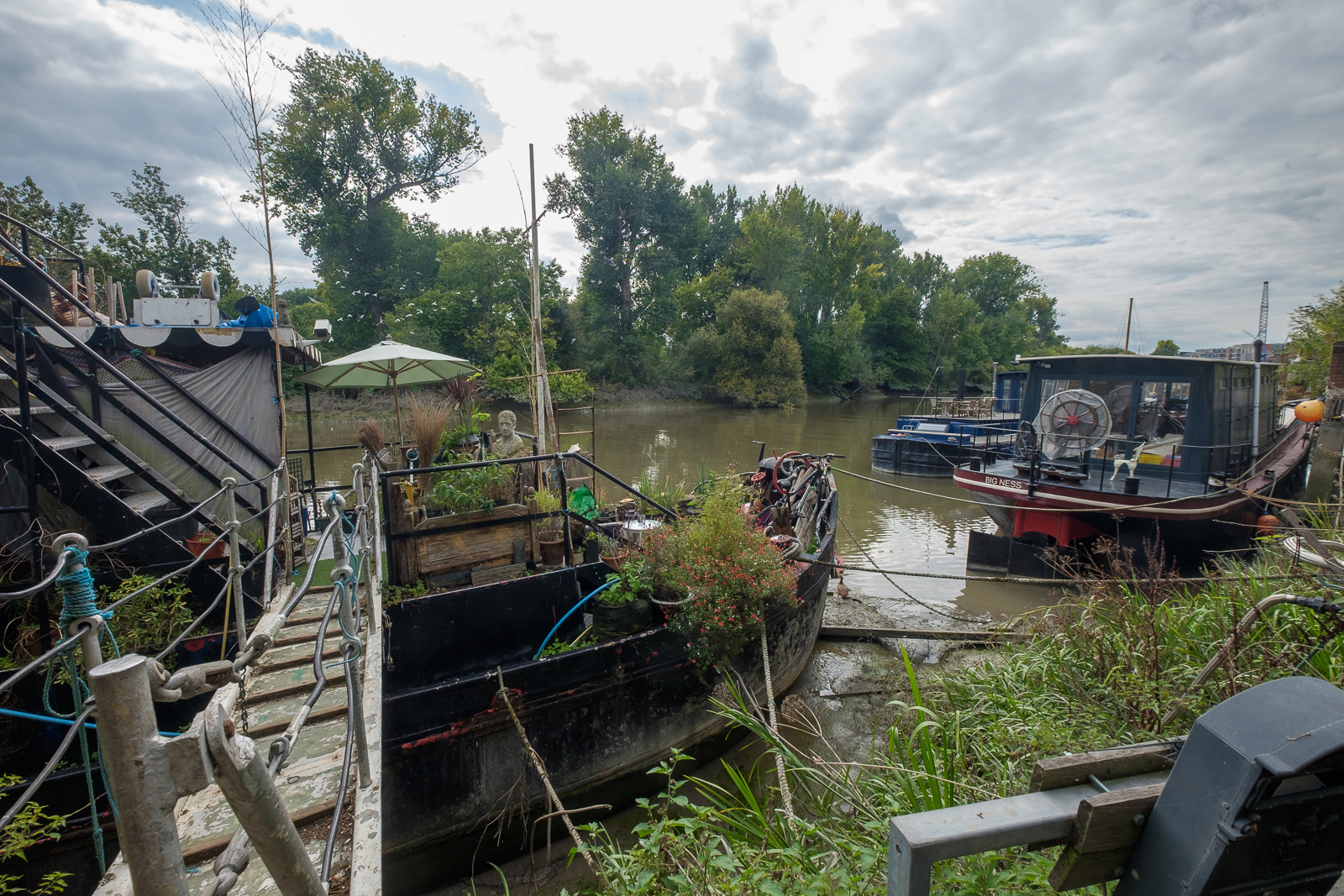
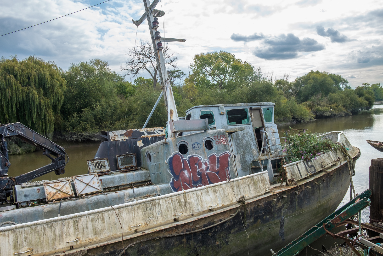
All than now remains of the gas works are some of the substantial posts of the gas works jetty, where colliers once brought in coal. There has been a long battle over the rights to moorings here between boat owners and Hounslow Council with boat owners claiming that the foreshore here belongs neither to the council nor to the PLA but to the Bishop of London, and refusing to abide by various eviction notices. Most have now moved but some derelict boats remain.
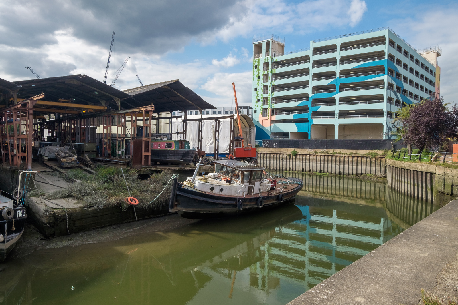
Brentford Ait runs along the centre of the river here. It was bought in the late 19th century by the Crown who planted trees on it to hide the gas works from visitors to Kew Gardens on the opposite bank. A few yard upstream is Lot’s Ait, where the Thames Steam Tug and Lighterage Company Ltd set up a boatyard in 1920 – most of the Thames lighters were built there. The boatyard closed in the 1970s, but was reopened in 2012 when a new footbridge was constructed to it.
As well as the park, the Watermans Arts Centre was also built on the gasworks site. We walked between it and the river, and continued on the riverside path, past the bridge to Lots Ait and recent blocks of flats. There are new moorings around here too.
A small spit of land leads from the bottom of Ferry Lane (more new flats) to an artwork by the riverside. I’m not quite sure what to make either of Liquidity or another similarly decorated column not far away, but it could provide a useful windbreak in bad weather. This was where once a ferry ran across to Kew Gardens.
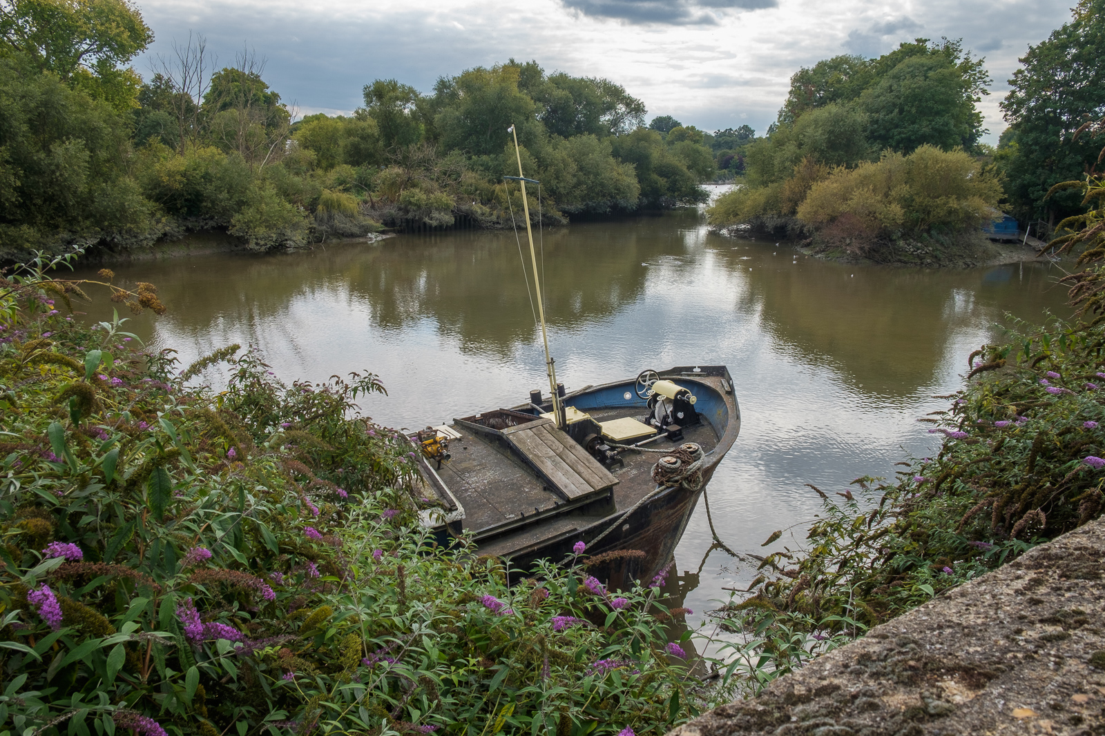
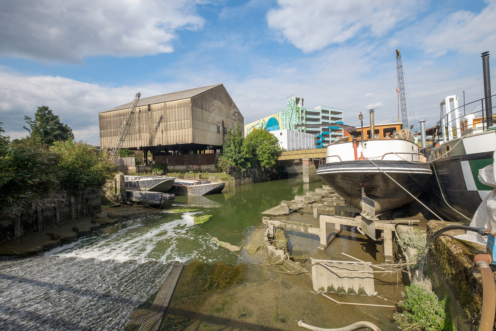
We followed the Thames Path around a small dock, on what was the site of the Thames Soap Works and then continued along the side of the River Brent which flows into the Thames here, continuing along this beside the winding river past another boatyard to Brentford High Street.
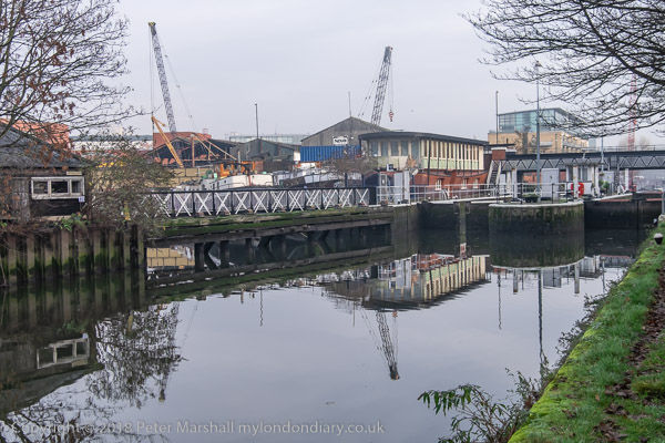
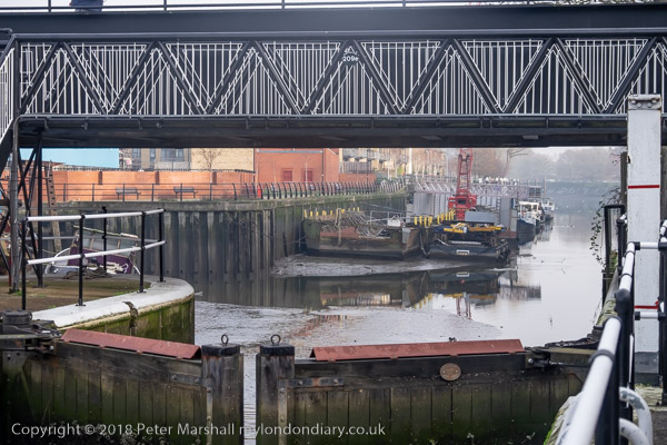
A few yards along we turned left down Dock Road to Thames Lock, past a huge mural and the other end of the boatyard, to Thames Lock, the southern end of the Grand Union Canal. Here we took the path beside the north side of the canal, leading across a bridge over the Brent to Johnson’s Island and Catherine Wheel Road.
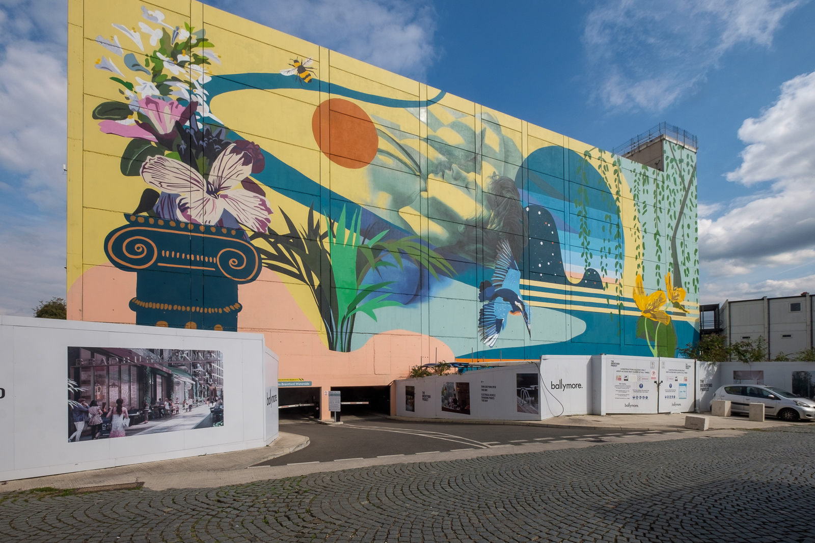
The mural, on the side of a multi-story car park had included a giant kingfisher, and I’d joked saying this was the only kingfisher we’d see in Brentford. But as we walked across the bridge over the River Brent and stopped to take pictures, perched on the top of a post there was one, still only for a second before flying out of sight. By the time I’d raised my camera to my eye it was gone, though since I had and extreme wideangle lens it would hardly have been visible, just a few more colourful pixels.
I’d planned to walk along Brent Way and rejoin the canal towpath, but the whole of this area is now a huge building site, and instead we walk along the High Street to the canal bridge. I couldn’t bring myself to walk down to the Gauging Lock preserved there, though I’ve done so several times before, but the changes to the area, now with a marina, flats and hotel made me feel too sad; we simply stood on the bridge and looked for a while before moving on.
Part 2 will continue the walk from here to its end in Isleworth. You can see more pictures from the walk in a Facebook album.
Bromley-by-Bow Gasholders: A week ago on Monday 28th March I was invited to go with a team from Cody Dock on a site visit to the gasholders which are a prominent feature of the local landscape, seen by many thousands every day from the Underground and National Rail lines as they travel in and out of London as well as local residents and walkers along the Lower Lea and Bow Creek, including those following The Line sculpture trail. We were there invited to study the heritage, history and ecology of the Bromley-by-Bow Gasworks site which has just been sold by its future developers.
The seven gas holders, all to a similar design were built between 1872 and 1882 and are all Grade II listed. Nine were built on the site but two are no longer there, the base of one now forming a large circular lake in the site. Holder No 1 was given an extra upper tier in steel in 1925-7 to more than double its capacity. All were taken out of use in the 1980s.
The real value of the site is not in the individual holders although these were some of the “most aesthetically distinguished and finely detailed gasholders ever built” (according to the listing text) but in the ensemble, thought to be “the largest group of Victorian gasholders known to remain in the world, which is testament to the scale of Britain’s pioneering gas industry and its contribution to the Industrial Revolution.” It is a heritage site not just of national importance but of world importance.
Given their importance the group, together with the adjoining memorial garden with its Grade II listed memorial lamp and statue of Sir Corbett Woodall surely deserves both Grade I listing and preservation, and the former gas works offices could form a heritage centre for the area. The offices were for some time a gas museum.
The circular pond is the base of a former gasholder
Just across the Channelsea river from the site is the Grade I listed Three Mills and a little to the south the former gas works Dock at Cody Dock, now a thriving creative and community hub, the sites linked by a riverside path which currently stops at Cody Dock but which should long ago have been opened as planned to lead to the Thames at Trinity Buoy Wharf, passing on the way the Bow Creek Ecology Park. Many sites along here played an important part in Britain and the world’s industrial history, but unfortunately little evidence remains, making it essential to preserve what does.
We were shown around the site in the morning by two of those responsible for planning the development who expressed their wish for the development to retain these elements which make the site unique and to open them up to the public, but good intentions are not enough, particularly for company accountants.
Given what has happened at other sites greater protection is required to make sure that any development in the area leaves the gasholders intact and preserves their landscape value, in particular the views of the ensemble from the railway and Underground lines, from Three Mills and the riverside footpaths by the Channelsea River and River Lea and the navigation. We do need more housing, or at least more social housing rather than luxury flats many of which remain largely unoccupied as investments, but we also need to preserve important monuments such as these which record and could celebrate our history.
Many more pictures from the day, mainly inside the holder site in my album Bromley-by-Bow Gas Holders. You can click on any of the images above to see a larger version in the album – and browse from there. Most of the images have an horizontal angle of view of approximately 145 degrees. There are more pictures of the area in various posts on My London Diary including Bow and The Fatwalk, Bromley-by-Bow to Star Lane and Gasworks Dock Revived.
My previous walk came to an end close to Westferry Station, from where I took the Docklands Light Railway to make my way home, but before the train came I made several views from the west-bound platform. The DLR runs through Limehouse on the old viaduct first planned in 1835 by the Commercial Railway Company to take the railway from the City to the West India and East India Docks. The viaduct was a cheap way to take the railway through the built-up area, and won out against a rival scheme involving cuttings. The two companies merged to build the London and Blackwall Railway in 1838-40, though it was later widened.
It was the world’s second elevated railway, opening shortly after the London and Greenwich on the other side of the Thames. The 20 ft high viaduct now gives good views of the surrounding area both from the trains and from the stations. At the left of this view you can see the rear of the West India Dock warehouses on Hertsmere Road, and at right the low structures, now replaced, of Heron Quays.
Isle of Dogs, River Thames, from Westferry Station, Limehouse, Tower Hamlets, 1988 88-7q-25
Turning a little the view from the southern platform shows Westferry Road and the River Thames, with in the distance a view of two of the Barkantine Estate towers at left, closer to the centre a side view of the Cascades Tower and towards the right two towers on the Pepys Estate in Deptford and more distant blocks.
A couple of days later I returned to the area, stopping off in central London on my way and taking a picture of the statue of Isambard Kingdom Brunel by Carlo Marochetti, (1805-1867). The statue was commissioned in 1861 by the Institute of Civil Engineers but was only installed here in 1874 on a Portland stone pedestal by Richard Norman Shaw (1831-1912). Its inscription reads ISAMBARD KINGDOM BRUNEL/ CIVIL ENGINEER/ BORN 1806 DIED 1859″.
The ICE had hoped to install this statue together with that of two other prominent engineers, Robert Stephenson and Joseph Locke who had died within a few months of Brunel, in Parliament Square, close to their offices at 1 Great George St. Permission was initially granted, but then withdrawn when the Office of Works decided only politicians should have statues in Parliament Square. Brunel’s was erected on Temple Place, Stephenson’s outside Euston Station and poor Locke’s was sent to Barnsley, where he had grown up.
Lazdan, Builders Merchants, Bow Common Lane, Bow, Tower Hamlets 88-7q-12
281 Bow Common Lane was until recently Lazan Builders Merchants but they have now moved to Sebert Road, Forest Gate. The house had a facelift in 2020.
Bow Common Lane, Bow, Tower Hamlets 88-7q-14
I think this is somewhere in the Joseph St area, but new building makes it hard to identify the exact position.
S P Brown, Builders Merchants, Lockhart St, Bow, Tower Hamlets, 1988 88-7r-01
This house, 31 Lockhart St, is still there at the corner of Lockhart St and Ropery St, but the large gate now has letter boxes for 33,35 and 37 and the lettering has gone.
Bow Common Gas works were to the west of Knapp Road, the continuation of Cantrell Road south of the railway line which runs across the center of the image. The gasworks were built here in 1850 and at one time there were seven gasholders. Most of the site was demolished in 1982 and the last two gasholders shown here in 2016-7.
The scrapyard is now the Scrapyard Meadow, part of Tower Hamlets Cemetery Park.
Railway Bridge, River Thames, Battersea Power Station, Grosvenor Rd, Pimlico, Westminster, 1988 88-5f-62
These seven pictures all come from the same film I took at the end of a fairly long day’s walk around Chelsea on Sunday 8th May 1988 which had taken me down to the Thames on Grosvenor Road. I spent some time wandering around on the road and also where it was possible to get onto the riverbank, though most was fenced off.
Railway Bridge, River Thames, Battersea Power Station, Grosvenor Rd, Pimlico, Westminster, 19888 8-5f-64
The views today are rather different, although the railway bridge carrying the main line to and from Victoria is still much the same. In the pictures you can see some work being carried on in Battersea Power Station, but now new flats hide most of the building apart from the chimneys from here, and the gas works have completely gone.
Railway Bridge, River Thames, Battersea Power Station, Grosvenor Rd, Pimlico, Westminster, 1988 88-5f-51
You may still see lighters moored in the river here, but I think this rather odd structure close to the mouth of the vestigial Grosvenor Canal here has gone. I wasn’t absolutely sure why there was this wooden platform with what looked to me like small dog-kennels on it, but perhaps as the rope shows they were simply for mooring barges waiting to use the canal. Technically I think this is a dolphin, as the picture below shows.
Chelsea Bridge, River Thames,Grosvenor Rd, Westminster, 1988 88-5f-52
The first bridge here was built in 1858 when Chelsea Embankment was being built and was a suspension bridge intended to give the large population of Pimlico access to the new Battersea Park – if they could afford the toll – though it was made free on Sundays. It was then called Victoria Bridge, named like the station after the Queen. It became even less popular after Albert Bridge was built at the other end of the park in 1873. It was bought by the Metropolitan Board of Works in 1877 and they abolished the tolls in 1979. It was a narrow bridge and found to be structurally unsound, so fearing it might embarass the Queen if it collapsed they renamed it Chelsea Bridge. It didn’t collapse and apparently took several years to demolish when they decided to replace it with the current bridge which opened in 1937.
As the picture shows, the main cables are attached to the end of the bridge rather than on solid ground on the banks, and it was the first such ‘self-anchored’ suspension bridge in Britain. The LCC couldn’t afford to fund the entire cost and the Ministry of Transport only agreed to stand 60% oof the cost on the condition that all the materials used came from the British Empire.
When Billy Strayhorn named his most famous composition ‘Chelsea Bridge’ it was not this structure that he had in mind, but something more ethereal, probably Whistler’s Nocturne: Blue and Gold – Old Battersea Bridge.
Grosvenor Canal, entrance, River Thames, Pimlico, Westminster, 1988 88-5f-53
I wrote at some length in a previous post about the Grosvenor Canal, London’s last working canal, still in use when I took this picture. You can see part of one of the barges still in use to carry Westminster’s rubbish downriver through the bridge.
Chelsea Bridge, River Thames, Battersea Power Station, Chelsea Embankment, Kensington & Chelsea, 1988 88-5f-43
The pictures here (and on Flickr) are from around 20 exposures I made on this small area of riverside, though many of the others are very similar. There were very few boats around moving on the river at the time.
Pagoda, Battersea Park, River Thames, Chelsea Embankment, Kensington & Chelsea, 1988 88-5f-34
I walked upriver along Chelsea Embankment on my way to catch a bus across Battersea Bridge to take me to Clapham Junction for the train home. On my way I took a few pictures of the impressive late-Victorian houses – which haven’t made it to my Flickr album – and four pictures across the river of the Battersea Park Peace Pagoda, this one of which has. I’m not sure about the framing and I think it would perhaps be better in a square format but I felt it had a suitably Japanese feel to it.
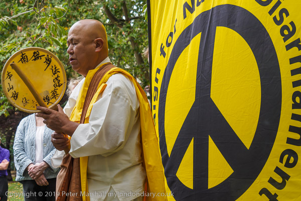
Reverend Gyoro Nagase at Hiroshima Day, Tavistock Square, 2019
After the destruction of Hiroshima and Nagasaki by US atom bombs in August 1945, Nichidatsu Fuji who had in 1917 founded the Japanese Buddhist movement, Nipponzan Myohoji, in 1947 decided they would set up Peace Pagodas around the world to promote peace and non-violence. The first opened in Japan in 1954 and the London Peace Pagoda was built by Nipponzan Myohoji monks and opened in 1985, shortly after Nichidatsu Fuji died aged 100. Since 1978 it has been looked after by Reverend Gyoro Nagase who I have met and photographed at many events calling for peace. There are also Peace Pagodas in Milton Keynes and Birmingham among over 80 around the world.
Click on any of the black and white images to go to a larger version in my album 1988 London Photos from where you can browse to other images.
All photographs on this and my other sites, unless otherwise stated, are taken by and copyright of Peter Marshall, and are available for reproduction or can be bought as prints.
Back in the 1980s it wasn’t possible to walk beside Bow Creek from Bow Locks south to the East India Dock road, as the banks were occupied by various industrial and commercial sites, including two gas works and West Ham power station. And although there have been plans by the councils for many years, even today you can only walk down on the Newham bank as far as Cody Dock, on a path opened to the public some years ago with the ridiculous name of the Fatwalk, but since renamed. There is a tantalising walkway visible continuing past the dock along the former power station bank, but this is still closed to the public.
While this was a limitation, it was also an opportunity to explore the two areas where roads ran close (or not too close) to Bow Creek to both the east in West Ham and west in Bromley and Poplar, and I was rewarded by some images I found interesting, though parts of my walks were along fume laden streets with heavy traffic.
Tweed House, a tall block of council flats on the Blackwall Tunnel Approach Road next to the Limehouse Cut enabled me to take some pictures which I more recently stitched together to create two panoramas of the area – the individual pictures are also in the Flickr album. Click to see the larger versions on Flickr.
From various places both on to the east and west of Bow Creek I found rather satisfyingly bleak views of the distant power station, including one with a young mother with a small baby in a pram.
Others were emptier still, like this
or more minimal and just occasionally rather threatening; some streets around here featured in crime films and TV dramas of the era, gangster London.
But there was also a little chance for fun, with a cafeteria with two giant cooling towers to take away the cooking fumes and the unlikely name of Oasis.
Poplar Gas Works was on a rather smaller scale to Bromley-by-Bow, but its gas holders still dominated the working class housing around it. Two young girls playing on the grass came to see what I was doing and insisted on being photographed, though I perhaps should have stepped back a foot or two to avoid cropping their feet to get the gasholder in the frame.
At East India Dock Road I was able to return to Bow Creek – and things got even more interesting (and although very different they still are) as I hope to show you in the next installment of my work from the Flick album River Lea – Lea Navigation – 1981-92 – the pictures above are all on Page 4.
Clicking on any of the images above should take you to a larger version on Flickr, and you can also go on to explore the album from there.
All photographs on this and my other sites, unless otherwise stated, are taken by and copyright of Peter Marshall, and are available for reproduction or can be bought as prints.