This is the final section of my walk on Sunday September 3rd 1989 which had begun in Stratford, from which some images appeared in my web site and self-published book ‘1989’, ISBN: 978-1-909363-01-4, still available. The pictures here are in the order I took them, and almost all of these final images are in the book so you can read my deliberately disjointed thoughts that made up the text on the book pages here. Although this was the end of this walk I returned to the area for another walk a few days later.
Dove Cafe, 390, High Road, Leyton, Waltham Forest, 1989 89-9b-54
Andy & Co, Catering Equipment, 376-80, High Rd, Leyton, Waltham Forest, 1989 89-9b-55
Good As New Clothes, High Rd, Leyton, Waltham Forest, 1989 89-9b-41
Jesus is Alive, Leyton Rd, Stratford, Newham, 1989 89-9b-43
178-80 High Rd, Leytonstone, Waltham Forest, 1989 89-9b-44
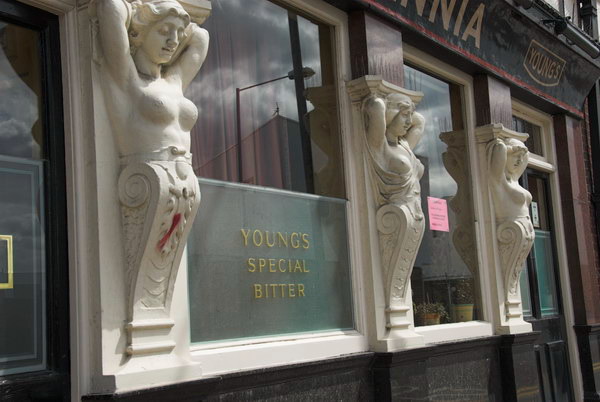
Here you can see the buildling where I took a photograph in a earlier post of Eves, a ‘STRICTLY LADIES ONLY HEALTH CLINIC’. The road on the corner at the left of the picture is Eve Rd. As you can read the building was also BeCKS Driving Lessons, BRITAINS LARGEST PRIVATELY OWNED DRIVING SCHOOL FOR CAR & H,,G,V.’.
There are some clues as to the origin of this building, including the intertwined initials J and S but I have been unable to find out more. Currently it is a bookmakers.
Noted Eel & Pie House, West St, 481, High Rd, Leytonstone, Waltham Forest, 1989 89-9b-45
Finally I photographed the Noted Eel & Pie House, still present at the start of West Street although the Potato Dealers and Farm Produce shop at left is now an off-licence. The shop sign for the Eel & Pie House has changed and now spreads across three bays and all those white tiles have been replaced by green and the shopfront also now has a large eel at right.
You can read the history of the shop, with some pictures on their web site. It began with the great grandfather of the current owners who was the skipper of an eel barge sailing out of Heeg, a fishing village in the Netherlands. Eels were exported to London from there until 1938. Around 1894 his youngest son came London at the age of nine to live with a family who owned a pie shop and learn the trade, opening a pie shop in Hoxton with a cousin just before the outbreak of The Great War. He married the daughter of another pie shop owner and in 1926 with a loan from his father-in-law set up his own shop under his father-in-law’s name, E Newton, on Bow Road.
The shop name was changed soon after the outbreak of the Second World War when the Home Office insisted his name as a “friendly alien” had to be on the shop front. It became the “Noted Eel & Pie House” with his name, “H HAK” in the smallest font permitted in the bottom right corner as he worried customers might think it German.
In 1976 when two of his sons were then running the business the shop was compulsory purchased by the council and the business opened in Leytonstone in 1978. I suspect the sign in my picture may have come with them as it doesn’t quite fit and there is a name painted over at bottom right.
This was the final frame exposed on this walk. But I was soon to return to take more pictures in the London Borough of Waltham Forest.
More from Hedon Rd, Hull – More of my photographs on Hedon Road made in August 1989. The previous post on Hull was More Around Popple Street, Hull – 1989
Works, Hedon Rd, Hull, 1989 89-8o-41
This section of Hedon Road was bypassed by the building of Roger Millward Way and most of the buildings on it have been demolished, with just a few short sections of brick walls remaining. Back in 1989 much of it was lined with buildings which appeared to be disused. This section attracted me for its large entrances, probably built for horse-drawn wagons carrying timber to the saw mills and the smaller building on the road frontage with four boared up windows that seemed to have been rather crudely inserted into the tall wall at left. Little traffic used the road in 1989 and the no parking and no loading signs were by then superfluous. Old maps show this area as occupied by an Iron Works and Saw Mill.
Abram Transport, Hedon Rd, Hull, 1989 89-8o-42
Although the company names S P S and Abram Transport were still on these buildings I think none were still in use. These buildings probably dated from around the beginning of the 20th century for previous occupiers of the sites.
Works, Hedon Rd, Hull, 1989 89-8o-44
Another view of the row of buildings in the previous image with an empty road but a lorry in the foreground packed high with sawn timber, so apparently there were still some saw mills operating in the area. In the distance you can see the dust extractor for C B North’s saw mill.
ONLY THIEVES USE THIS LINE, Hedon Rd, Hull, 1989 89-8o-45
I think this railway bridge will have carried lines into Victoria Dock across Hedon Road. No trace of it remains. There were some rail bridges roughly where the Mount Pleasant North Roundabout now is, with South Bridge Road leading into what is now Victoria Dock Village. But I think this was another rail bridge further east close to Hotham Street which led to both Victoria and Alexandra docks.
The lines had certainly become unused after both these docks closed in 1970, but presumably gave access to some commercial premises still in use after that date – hence the reward offered in this notice.
Railway Bridge, Hedon Rd, Hull, 1989 89-8o-46
Under a railway bridge and looking east away from the city centre. The parked cars show that some of buildings along the street were still in business use. I think none of the buildings in this picture are sill standing
Crowle Street runs parallel to Hedon Road a short distance to the north and this house is still standing although much altered, visible from Hedon Road down Ferries Street. There is a rather more impressive Crowle House in High Street, Hull, a grade II listed how build in 1664 for wealthy Hull merchant George Crowle and his wife Eleanor.
Newtown Square, Hull, 1989 89-8o-33
Newtown Square, just off Hedon Rd and along Southcoates Lane opposite Hull Prison was developed for council housing in 1931-2 with a dozen or so blocks of three-story flats, I think around 150 in all. The 1950 OS map calls them Newtown Square and that was still the name when I photographed them in 1989, though they are now known as Newtown Court.
Newtown Square, Hull, 1989 89-8o-34
The flats built in 1931-2 were apparently improved in the 1980s and I think my picture may show some before and some after that improvement. They have been again modified recently.
House boats, Mooring, River Thames, Chelsea Wharf, Kensington & Chelsea, Battersea Church Rd, Battersea, Wandsworth, 1989 89-8b-35
The churchyard of St Mary’s Church is on the riverside and back in 1989 was the first place I could access the river in Battersea upstream of Battersea Bridge. The churchyard was closed for public burials in 1854.
The moorings here look rather crowded. At Spring Tides the river comes into the churchyard at high tide and I think people living on the houseboats here would need wellingtons, but the tide was low when I made this picture. On the west side of the churchyard is a slipway and past that was Church Wharf, part of Battersea Wharf. Immediately on the corner of the slipway until fairly recently was the Old Swan pub. Once a solid Victorian building it had been replaced in the 1960s by a strange building with much wooden planking and large windows which had become a punk venue in the 70s before closing, being squatted, and becoming derelict and then perhaps conveniently burning down. The block of expensive riverside flats which replaced the pub is named Old Swan Wharf.
St Mary’s, Church, Battersea Church Rd, Battersea, Wandsworth, 1989 89-8b-21
St Mary’s Church is a real gem, Grade I listed, built in 1775-77, architect Joseph Discon, though the painted glass in its East Window is said to date from 1631, attributed to Bernard van Linge and transferred from the previous church building on this site. The stonework around this window is even older, dating from 1379 when the church was owned by Westminster Abbey and they sent one of their masons over for the job.
Bomb damage in the 1940s gave the then vicar the chance to smash some of the “very bad Victorian stained glass” which made the interior gloomy and there are now four modern stained glass windows. One commemorates William Blake who was married here in 1842 and another J M W Turner who was rowed across from his Chelsea house each day and sat at the vestry window to paint his riverscapes. The famous 18th century botanist William Curtis is commemorated in the third, while the fourth is for the US “archetypal traitor” General Benedict Arnold, given by an American donor.
Houses, Battersea Church Rd, Battersea, Wandsworth, 1989 89-8b-24
At the extreme right of this picture is a sign pointing to the riverside walk which began next to the slipway beside the church and in the centre is the rather ugly riverside development of Valiant House, in 1971 one of the earlier blocks of luxury riverside flats. The Survey of London quotes it being described as ‘luxurious and dismal, a high security complex which afforded views of the river as well as the rubbish tips on Chelsea Reach’. It took its name from the former concrete works on part of the site at Valiant Wharf, and perhaps the only mitigating grace of the development was that it provided a narrow riverside walkway, though a little narrow.
The houses at left, probably mainly Victorian with various alterations now look rather different but the facades along the street remain.
Houses, Battersea Church Rd, Battersea, Wandsworth, 1989 89-8b-25
A few yards along the street with an attractive curve leading to Battersea Square the view here seems little changed now. You can see the Grade II listed Raven (no longer a Pub) just to the left of the traffic light.
Lamp post, River Thames, Chelsea Wharf, Kensington & Chelsea, Vicarage Walk, Battersea, Wandsworth, 1989 89-8b-13
The view across the river to Chelsea Harbour. Planning permission was granted for this huge riverside development in 1986 and building proceeded rapidly. By 1989 from across the river it seemed complete and very different to what Sands End would have looked like when Nell Gwyn lived here or when it was a coal dock for the gas works and railways. The old coal dock, became a somewhat shorter marina. The 18 storey tower was erected at a rapid pace, with at one point gaining a new floor every 4 days, and was topped out in six months.
The 310 luxury flats in the new development were marketed with prices starting at around £2 million per property and have 24 hour security patrols and porterage.
Being towed by a tug upriver are empty containers which have carried London’s rubbish away downstream and are now returning upstream to the refuse depot at Wandsworth for refilling with the barge sitting considerably higher in the water. I think this general waste now mainly goes for incineration at Crossness.
Battersea Railway Bridge was built in 1863 and has been strengthened and refurbished in 1969 and in 1992 after I made this picture.
It provides one of relatively few links between railways south of the Thames and those to the north and is used by Overground and mainline trains running between Kensington Olympia (and points north) and Clapham Junction. It is also used by goods traffic which could use Battersea’s extensive rail network to run almost anywhere in the South.
The stretch of walkway by the river leading here through the narrow Vicarage Gardens next to Vicarage Crescent had been opened up some years earlier. But there was still little access to the river beyond the railway bridge. Since then the riverside path now continues through one of the railway arches.
There are plans for a foot and cycle bridge across the Thames next to the railway bridge, but although a start has been made on this project and planning permission was given by both Wandsworth and Hammersmith & Fulham in 2013 I think funding remains a problem; but Wikipedia states ‘The forecast opening date is 2025, taking 18 months to build and audit.’
Thes two handcarts on Ashbury Road close to the corner with Grayshott Road took me straight back to my childhood. Tradesmen commonly used such carts to carry their equipment and materials around the streets back in the 1950s, and my father continued using his until he retired in the late 1960s whenever he needed more than he could carry on his bicycle.
Ladders, bricks, tiles, sand, plaster, tools, cookers, fridges, bee hives and more would be carted around the streets of Hounslow and neighbouring areas. Dad never owned a car or a van, though in his youth he had ridden a motorcycle. Sometimes I would be recruited to pull the cart, and when younger still I sometimes got a ride on it when he had to look after me while he was working as a plumber, painter and decorator, electrician, plasterer, bricklayer etc. Though social services now would have a fit if he took me up with him to keep an eye on while he was roofing.
And as a Boy Scout in my teens I sometimes helped to pull a trek cart loaded with our camping gear for a weekend at Chalfont St Peter, setting off along busy main roads for around 15 miles to the camp site.
The doorway at left is on the corner of Grayshott Road and Eversleigh Road, where above the porch on the other side of the road is the date 1878 and the intertwined initials of the Artizans’, Labourers’, & General Dwellings Company. I’ve written in earlier posts about the company and you can also read a much more detailed account in the Survey of London’s Shaftesbury Park Estate chapter.
A closer view of the porches on some of the houses on Eversleigh Road – these are on the southern side of the street. The uniformity of the long terrace is enlivened by the occasional gable with a narrow window in the attic storey though any room there must have been only dimly lit and with steeply sloping sides. But servants were not kept in luxury.
In the distance you can just make out the octagonal turret with a steep roof, almost a spire, at the end of the terrace at No 44.
On the triangular sites on the corners of Eversleigh Road and both Ashbury Road and Kingsley Street are rather more substantial detached houses. This doorway is on Kingsley Street but the address is 18 Eversleigh Road. These ‘Gothic’ Houses were designed for the more prosperous ‘clerk’ classes and were the most expensive of four classes of housing built on the estate, deliberately creating a social mix. But even the smallest ‘Class 4’ two bedroom houses were too expensive for the many poorer working class families.
Iglesia Ni Christo, Church of Christ, Latchmere Rd, Battersea, Wandsworth, 1989 89-7o-46
I made my way west out of the Shaftesbury Park Estate onto Latchmere Road and turned north towards the railway. On the east side of the road is a short terrace of the estate, but the west side is very different, and even contains a pub, something the estate, built on temperance principles, lacked. Probably many of its residents made their away across Latchmere Road to the Fox and Hounds, although perhaps few could afford it as the estate rents were high.
A few yards further north, next to the railway lines was the Iglesia Ni Christo, Church of Christ. The church was founded in the Phillipines in 1913 and it now has 2.8 million worshippers there. Its founder Felix Y Manalo became dissatisfied with the theology of the established churches, eventually setting up his own which claims to be based on the true church established by Jesus Christ in the first century and rejects the traditional Christian belief in the Trinity for a belief in only ‘God the Father’ as the one true God.
The church now has members in “165 countries and territories in the six inhabited continents of the world” and has around 50 churches across the UK. The Latchmere Road site is now occupied by a block of flats but there is an Lglesia Ni Christo further north in Battersea.
I continued north on Latchmere Road under the long bridge taking 15 tracks out of Clapham Junction across the road, followed immediately by another bridge with two more and continued, going under yet another railway bridge a couple of hundred metres on.
Latchmere Passage is a narrow street running west from Latchmere Road and then turning south under two rather small bridges to Falcon Park and another on to Cabul Road.
My final post on this walk will pick up the story here shortly.
Beltane, Chariot Festival, Barking & Whitechapel: I had an interesting and varied day at events and places across London on Sunday 28th May 2006, taking rather a lot of photographs. Appropriately for a Sunday I covered two religious events.
Pagan Pride – Beltane Bash – Holborn
My working day began at Holborn, having caught a fairly early train into London. Now I like to relax a bit on Sundays, but for many years I often came up by the first train to take photographs. Though it wasn’t that early on Sundays, departing around 8am.
I took a bus from Waterloo to Holborn and walked the few yards to the Conway Hall at the north-east corner of Red Lion Square.
Here (with corrected capitalisation) is what I wrote about this event on My London Diary in 2006.
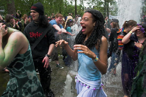
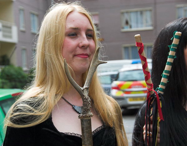
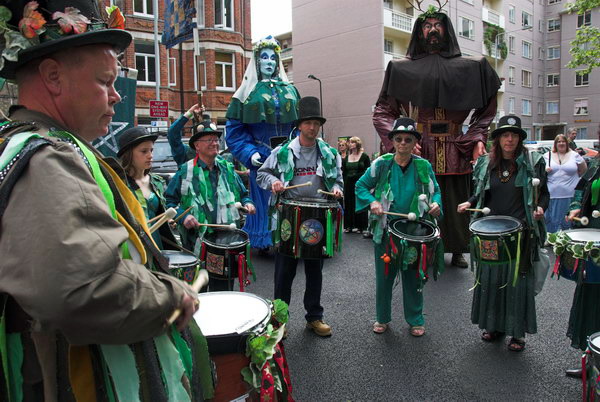
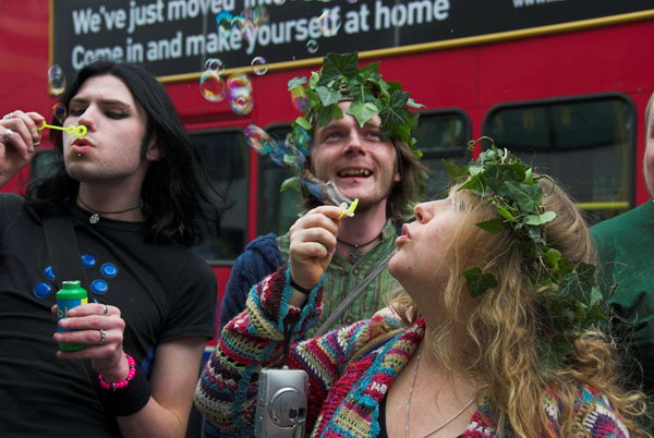
The Pagan Pride Parade in Holborn is now a regular annual event, a part of the Beltane Bash that takes place in the Conway Hall in Red Lion Square. Mostly it was the same people as last year, but I found it hard to get into the mood to take pictures.
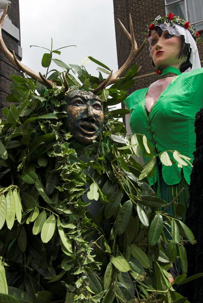
As usual the parade was led by Jack In The Green – a dancing bush – the Green Lady and the Bogies. The Giants included the Morrigan (in green and flowers to welcome summer) with Black Ravens, Old Man Thunder and Old Dame Holder, along with the rest of it.
Dancing round the fountains was energetic, but somehow for me the event didn’t really get going, and lacked any real climax, people just slowly began to fade away.
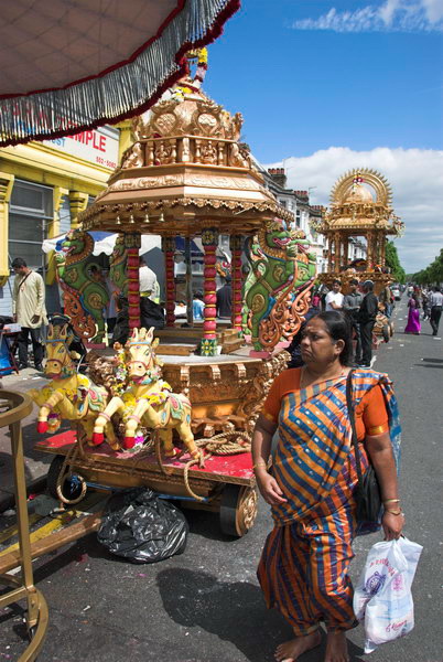
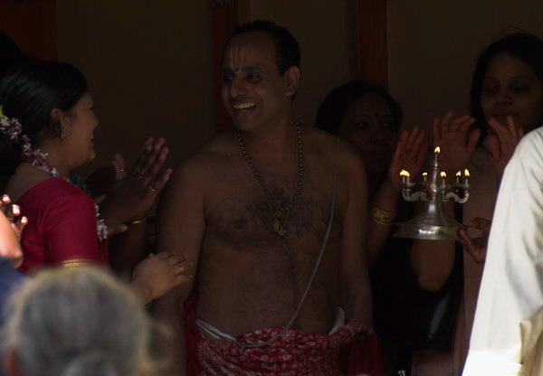
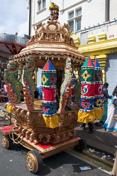
Chariot Festival, Sri Mahalakshmi Temple – East Ham
Those taking part in the Pagan Pride parade began to make their way back to Conway Hall for the rest of their day of events, but I rushed to Holborn underground station to take the Central line eastwards, changing at Mile End to get to East Ham. But I had stayed too long with the pagans.
The Sri Mahalakshmi Temple had been built in 1989 and opened and was almost opposite the station. Before that Hindus and worshipped at a converted shop on the corner of Kensington Avenue and High Street North, around 300 yards north from the station.
Unfortunately I had arrived too late and the procession on the streets had ended, though I was still able to photograph the chariots outside and a few of the people. I made a mental note to come back and cover this event another year, but although I photographed other chariot festivals including one in Manor Park, East Ham, I’ve never returned for this one.
I was in East Ham and the afternoon lay ahead; it was a fine day and I decided this was a great opportunity to take a walk a little further to the east by the River Roding. I took a few pictures of the chariots, then went to walk along by the River Roding and to photograph a new development by the railway in Barking.
The half-mile walk along unkonwln was rather uninteresting. It’s a long suburban street lined with terraces of working class housing from the early twentieth century on both sides, named for the family who once owned the estate on which it was built. As Stephen Benton points out in his London Postcode walk it has one small claim to fame, and almost every famous pop guitarist from the the 70s and 80s – including those from the Beatles, Rolling Stones, Yardbirds, The Who as well as musical failures like me will have started with Bert Weedon’s ‘Play in A Day – Guide to Modern Guitar’, first published in 1957. Weedon (1920-2012) was born here, though he had probably moved away long before he became famous.
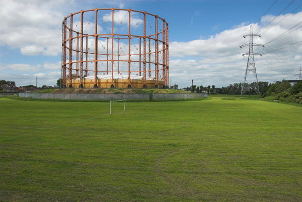
The path led on to Watson Ave, with a view of the Leigh Road gasholder in what is now the derelict Leigh Road Sports Ground. The Barking Gas Works opened here in 1836 but was purchased in 1912 by the Gas Light and Coke Company, who closed it as they had the much larger and more economical works they had opened at Beckton in 1870. But the holder remained and was I think still in use by the North Thames Gas Board possibly until the change from coal gas to natural gas. The area around it became their sports ground.
At the end of Watson Ave is a long footbridge which took me over the North Circular Road, from which I took a few pictures before going through an industrial estate.
I made quite a few pictures in the Tanner Street area, where a considerable amount of new development was taking place.
I told myself I would return here later, but I don’t think I’ve done so yet.
I think I had travelled back from Barking on a Hammersmith & City line train and needed to change soemwhere to the District Line. Having got off the train I decided I had time for a short walk around on before needing to continue my journey. I only taok a few pictures, perhaps making 20 exposures, and there are only four pictures on My London Diary.
R & G Holden, Household & Fancy Goods, Southwark Park Road, Bermondsey, Southwark, 1988 88-10j-31
‘The Blue’, the area around the market on Southwark Park Road and Blue Anchor Lane gets its name from the Blue Anchor Pub at the corner of the lane. The pub is on the site of an ancient hostelry, marked on the earliest maps of the area dating from 1695 as the Blew Anchor. The area belonged to Bermondsey Abbey and attracted many pilgrims, some on their way to Canterbury. The anchor is thought to have not been any reference to the later nautical links of the area but to the many Anchorites, many of them women who were enclosed in religious buildings having withdrawn themselves from secular society to lead a life of prayer. Pilgrims would visit them to join them in prayer and seek advice. It was a practice largely when Henry VIII broke away from the Pope.
The market was along Southwark Park Road until a separate market square was created in 1976, but shops like this still spilled out onto the pavement.
Spa Rd Station, Former Railway Station, S E & C R, Priter Rd, Bermondsey, Southwark, 1988 88-10j-22
London’s first railway station was a short walk away. The London and Greenwich Railway opened its Spa Road station in 1836 before it had completed the line into London Bridge. Although little more than a temporary halt and at first without platforms it remained open until 1838. A second Spa Road station was opened after the line was widened in 1842 and operated until 1867 when a new station was opened 200 yards to the east with its entrance in the railway arches on what is now Priter Road. This closed as a wartime economy measure in 1915. Some of the buildings of the 1867 station including this can still be seen in the railway arches and I photographed several of them as well as this one. The initials are for the South Eastern and Chatham Railway which was only formed in 1899, and until 1923 ran all the railways in Kent and to the Channel ports.
Spa Rd, Bermondsey, Southwark, 1988 88-10k-62
On my contact sheet I state that this remains of a former garage was on Spa Road and although I have no reason to doubt this the roads around here were confusing and the rail bridges all have a similar appearance. I took a number of very similar frames, obviously intrigued by both the broken boarding and the branches growing through it was well as the strange tower rising about a very tall brick wall on the other side of the road.
The tower block in the background of this picture is Lupin Point on Abbey St, a 21 floor 61 m tall bock on Southwark’s Dickens Estate. This was made at the mouth of the bridge on Rouel Road, with Frean Street going off to the right. More recently this part of Rouel Road, was renamed Marine Street which previously had only started north of Jamaica Road (now Old Jamaica Road.)
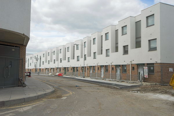
This area has been redeveloped since I made this picture and the old housing replaced by a nine storey block so you need to go a little way along the road to see Lupin Point.
Old Jamaica Rd, Bermondsey, Southwark, 1988 88-10k-42
These buildings on Old Jamaica Road are long gone. In 1988 clearly Robinsons Motorcycles Cycles Mopeds was still in business with a row of machines outside and bike parts in the shop window and curtains on the floors above, but much of the rest of the block was ready for demolition.
Enid Garage, Old Jamaica Rd, Bermondsey, Southwark, 1988 88-10k-43
Enid Garage on the south side of Old Jamaica Road was clearly a very basic concrete structure, its skeleton of beams exposed at the left. Behind are the railway arches and a long gantry across the tracks, still there. Enid Garage has gone and this is now the Old Jamaica Business Estate.
I think my walk continued to Rotherhithe New Road, where I’ll begin the next post in this series.
South Hackney Walk 1988 It was not until Sunday 18th September 1988 that I had the time for another walk with my cameras around London, taking a train and tubes to Bethnal Green Station and walking north up Cambridge Heath Road to Mare St in Hackney.
Victoria Buildings, Mare St, Hackney, 1988 88-9c-53
I stopped to take another photograph of the fine late Victorian commercial building with its row of shops at ground level and a bricked up doorway, particularly attracted by the multiple identities of No 7 as Aarons Van & Car Rental with Doris Car Service partly covering yet another. In the top left corner of the shop window it tells us ‘UNDER NEW MANAGEMENT’ while a rather drunken notice lower down states ‘YOU DRINK WE DRIVE’. Above Simply Seconds at No 9 were peeling posters and the upper floors appeared largely unoccupied.
Rich Scum out of Hackney!!, Westgate St, Hackney, 1988 88-9c-56
A little further up Mare St I wandered briefly down Westgate St, to record the graffiti on its railway bridge, which above the advert for LEATHER MERCHANTS gave the clear message ‘RICH SCUM OUT OF HACKNEY!!’. The bridge has been regularly repainted over the years, but I think later graffiti has been non-political.
King Edwards Rd, Hackney, 1988 88-9c-43
On King Edwards Road off to the west of Mare Street I came across a fine piece of architectural decoration with peeling paint and shrubs growing from it at No 6. The house next door, No 8 had a similar feature in better condition and a little more ornate which I also photographed but is not on-line.
Synagogue, Ainsworth Rd, Hackney, 1988 88-9c-31
The South Hackney Federation Synagogue or Yavneh Synagogue at 25 Ainsworth Rd was founded in 1904 and was an Ashkenazi Orthodox synagogue incorporated into Clapton Federation Synagogue in the 1990s. It was demolished and replaced by a block of flats.
Southborough Road area, Hackney, 1988 88-9c-21
I often made use of framing a view through some kind of arch – in this case of trees – which had been emphasised by the writers for Amateur Photographer when as a grubby teenager I spent hours perusing it in my local library. And while it can be a useful device it is certainly a cliché and is often used ironically in my work. I’ve also here carefully joined together a 22 storey tower block and the rather grand porch of an older house.
I think the block could be Clare House in Hawthorne Avenue, on the other side of Victoria Park where I was standing on a street corner, somewhere not far from Church Crescent where I made a previous exposure and the next on the corner of Southborough and Lauriston Roads. But I cannot find its precise location
Derby Rd, Hackney, 1988 88-9c-24
These houses were on Derby Road, awaiting demolition as well as those in the image below. There is now a modern two-story housing development on this side of the street.
J Roler, Derby Rd, Hackney, 1988 88-9c-25
J Roler was at the corner of Derby Rd though I think its address as No 6 may have been in Rutland Road. It appeared long closed when I made this picture. Perhaps someone reading this will remember visiting the shop and tell us all more in a comment to this post.
Shelter, Victoria Park, Hackney, 1988 88-9c-26
A curiously organic shelter in Victoria Park with a generous coating of graffiti, none of any interest. In the background people are sitting beside the lake. I don’t think I walked far into the park and although I can’t identify and of the buildings in the background I think this is somewhere close to Victoria Park Road on the north side of the lake.
I suspect I sat here or somewhere close by drinking a cup of coffee and eating my sandwiches for lunch. Back in 1988 there were still relatively few places you could rely on getting a decent cup of coffee and my camera bag always included a space for a thermos. After a short rest I will have continued my walk – and there will be more pictures in a future post.
Bromley-by-Bow – July 1988. My previous post on my walk on Sunday 31st July 1988 ended at Watts Grove off Devons Road, and I spent some time exploring the area around here and in Bow Common and Bow.
All Hallows, Church, Devons Rd, Bow, Tower Hamlets, 1988 88-7s-45
The church of All Hallows on Devons Road was funded by the Clothworkers’ Company who got the money from the site of All Hallows Staining, demolished except for its tower in 1873. That tower, now Grade I listed, is still there just off Mark Lane, next to St Olave’s Church Hall. They paid for a church by architect Ewan Christian, completed in 1874. Unfortunately this was badly damaged by bombing, and only its core remained in the new church on the site by A P Robinson completed in 1955 in an ‘Early Christian’ style. The church has its address on Blackthorn St and is not yet listed.
There was still a tyre shop, though no longer J R Tyres, at 119 Devons Road in 2021, though I think this end of the row of shops is currently being rebuilt. Some years since I made this picture this shop had previously been rebuilt, its ground and upper floor losing their late Victorian frontage.
The Widow’s Son, The Bun House, pub, Devons Rd, Bow, Tower Hamlets, 1988 88-7s-32
The Widow’s Son has the distinction of being the only listed building in the South Bromley Ward of Tower Hamlets, though I suspect its Grade II* listing reflects the legend associated with it – of the widow’s son who joined the Navy to fight Napoleon and wrote telling his mother he would be home for Easter and told her to cook a hot cross bun and have it waiting for him. He never came, but every year on Good Friday she baked a fresh bun for him, and a large collection was found hanging in a net from the ceiling beams of her cottage after her death.
The Widow’s Son, commonly known as the Bun House, was built on the site of her cottage, and the net containing the buns, was hung above the bar, with a sailor from the Navy adding another each year on Good Friday. From some time in the 1990s the buns were baked and supplied by Mr Bunn’s Bakery, a family-run business a few miles away in Chadwell Heath.
The pub was built around 1848, and its single bar largely retains its fittings from around the 1870s. It closed and was put up for sale in 2016, but was reopened in time for Bun Day in 2017 and was refurbished with new kitchens in 2019 and is more a pub/restaurant. I think it reopened after a further temporary closure due to Covid, but haven’t been able to check personally.
Joe’s Auto Spares, Cantrell Rd, Bow, Tower Hamlets, 1988 88-7s-34
Joe’s Auto Spares were in a railway arch immediately west of the Cantrell Road Bridge, where there are still businesses in the arches, though many are now being priced out as railway arches – such as those in the centre of Brixton – are redeveloped and re-let at much higher rents.
I walked into the southern end of Tower Hamlets Cemetery Park to take a wider view showing the railway bridge and Joe’s Auto Spares, with one of the two remaining gasholders of Bow Common Gasworks behind. The gasholders, long redundant, were only demolished a few years ago and the site is now a development of around 1450 homes, a new sixth form centre, some commercial uses and a new area of open space.
Car spares, Cantrell Rd, Bow, Tower Hamlets, 1988 88-7s-36-positive_2400
I couldn’t resist taking another picture of the scrapyard beside the railway which has featured in a previous post. The site is now a part of the Tower Hamlets Cemetery Park.
Walking back towards the east I came to Rounton Road, where a row of late Victorian houses was being demolished. I think the tower block just visible in the background is probably Gayton House just off of Knapp Rd. The whole area around Rounton Road has been redeveloped.
Lozinki Ltd, an engineering company helpfully give their address as Rounton Ropad, Bow, and their site is now Miami Car Wash. Through the railway brdige you can see Navenby Walk. The tree is also still there.
The railway bridge, as well as the brick building are still there but the writing on the wall for H Barnett & Co, as well as the Vehicle Spares sign have gone and the wall and street sign both replaced. The building, obviously much altered by the brickwork, is a sub-station for the railway with a bridge carrying cables across to the tracks at its rear.
I still had a lot of wandering to do – so there will be further posts from my walk around Bow.
Thames Path – Pangbourne – Cholsey: At the start of 2010 we were still walking sections of the Thames Path. On New Years Day we had walked from Reading to Pangbourne, and on the following day caught the train back to Pangbourne to begin our day’s journey there.
The Thames from the Thames Path along a hillside west of Whitchurch
We were heading to Cholsey, around 8 miles away, an easy distance suitable for a short day with over an hour’s rail travel at each end. Cholsey is a small village and has a railway station a little over a mile from the Thames Path with trains back to Reading from where trains run – if rather slowly – back to Staines.
Gatehampton Bridge
Pangbourne is a much larger village, and its station is a short walk from where we joined the Thames Path, and there were a few shops where we could buy some crisps and sweets to supplement the sandwiches in our bags and even a public toilet, so a very useful place to start a walk.
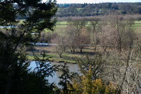
Before our walk really started we spent a little time in Pangbourne, visiting the parish church and photographing the Pang before rejoining the Thames Path at Whitchurch Bridge. Crossing the bridge takes you to Whitchurch, perhaps a prettier village than Pangbourne. Here the path takes quite a long detour away from the river bank and up on a hillside, with some extensive views through trees of the river and country to the south, before going back down to the riverside.
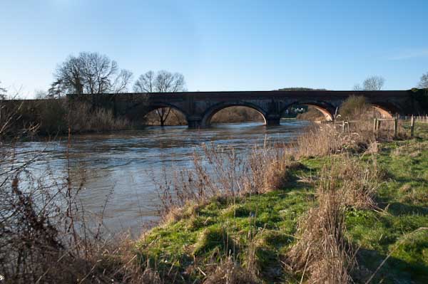
The railway line crosses the path and the river at Gatehampton Bridge, built by Brunel for the GWR main line in 1838 but the path stays on the north bank, passing between the tree-covered slopes of the Goring Gap, where the river cut through to seperate the Chilterns from the Berkshire Downs. Winter sun on the leafless bare branches was magical.
The bridge linking Goring on the north bank with Streatley on the south seems a rather primitive and temporary wooden structure, but has been here since 1923 when it replace the earlier bridge from 1837. Before then there had been both a ferry and a ford, though this was probably more often passable on horseback than on foot. It takes two bridges to reach Streatley from where the Thames Path proceeds westward on the south bank.
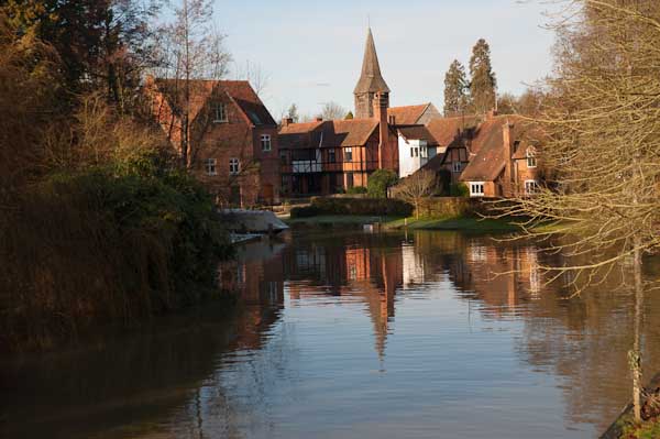
Streatley from Goring lock
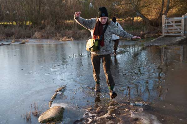
At Streatley, a village until 1938 owned by the Oxfordshire brewers Morrell we visited the church and then set out on a partly underwater path by the river. December 2009 had been one of the wettest months on record and we began to doubt the wisdom of We thought about turning back and abandoning the walk, taking a train from Goring, but after seeing a walker paddle through towards us decided to continue.
Fortunately it was only a few inches deep, but despite our boots I think we all got wet feet. The day was around freezing, but walking kept our feet warm, and many of the smaller puddles along the rest of our route were frozen over, as well as the mud, and it was much easier to walk than had it been warmer.
The Beetle and Wedge at Mouslford looked very closed
A little further on the tow path moves from the south to the north bank, not a great problem in the past for craft being towed who could pole over to the other side, but more so for walkers, who need to take a path away from the river and along a main road for a mile or so leaving the path were it went down towards the Moulsford railway bridge and continuing to a footpath beside the railway to Cholsey station.
Railway Bridge, River Thames, Battersea Power Station, Grosvenor Rd, Pimlico, Westminster, 1988 88-5f-62
These seven pictures all come from the same film I took at the end of a fairly long day’s walk around Chelsea on Sunday 8th May 1988 which had taken me down to the Thames on Grosvenor Road. I spent some time wandering around on the road and also where it was possible to get onto the riverbank, though most was fenced off.
Railway Bridge, River Thames, Battersea Power Station, Grosvenor Rd, Pimlico, Westminster, 19888 8-5f-64
The views today are rather different, although the railway bridge carrying the main line to and from Victoria is still much the same. In the pictures you can see some work being carried on in Battersea Power Station, but now new flats hide most of the building apart from the chimneys from here, and the gas works have completely gone.
Railway Bridge, River Thames, Battersea Power Station, Grosvenor Rd, Pimlico, Westminster, 1988 88-5f-51
You may still see lighters moored in the river here, but I think this rather odd structure close to the mouth of the vestigial Grosvenor Canal here has gone. I wasn’t absolutely sure why there was this wooden platform with what looked to me like small dog-kennels on it, but perhaps as the rope shows they were simply for mooring barges waiting to use the canal. Technically I think this is a dolphin, as the picture below shows.
Chelsea Bridge, River Thames,Grosvenor Rd, Westminster, 1988 88-5f-52
The first bridge here was built in 1858 when Chelsea Embankment was being built and was a suspension bridge intended to give the large population of Pimlico access to the new Battersea Park – if they could afford the toll – though it was made free on Sundays. It was then called Victoria Bridge, named like the station after the Queen. It became even less popular after Albert Bridge was built at the other end of the park in 1873. It was bought by the Metropolitan Board of Works in 1877 and they abolished the tolls in 1979. It was a narrow bridge and found to be structurally unsound, so fearing it might embarass the Queen if it collapsed they renamed it Chelsea Bridge. It didn’t collapse and apparently took several years to demolish when they decided to replace it with the current bridge which opened in 1937.
As the picture shows, the main cables are attached to the end of the bridge rather than on solid ground on the banks, and it was the first such ‘self-anchored’ suspension bridge in Britain. The LCC couldn’t afford to fund the entire cost and the Ministry of Transport only agreed to stand 60% oof the cost on the condition that all the materials used came from the British Empire.
When Billy Strayhorn named his most famous composition ‘Chelsea Bridge’ it was not this structure that he had in mind, but something more ethereal, probably Whistler’s Nocturne: Blue and Gold – Old Battersea Bridge.
Grosvenor Canal, entrance, River Thames, Pimlico, Westminster, 1988 88-5f-53
I wrote at some length in a previous post about the Grosvenor Canal, London’s last working canal, still in use when I took this picture. You can see part of one of the barges still in use to carry Westminster’s rubbish downriver through the bridge.
Chelsea Bridge, River Thames, Battersea Power Station, Chelsea Embankment, Kensington & Chelsea, 1988 88-5f-43
The pictures here (and on Flickr) are from around 20 exposures I made on this small area of riverside, though many of the others are very similar. There were very few boats around moving on the river at the time.
Pagoda, Battersea Park, River Thames, Chelsea Embankment, Kensington & Chelsea, 1988 88-5f-34
I walked upriver along Chelsea Embankment on my way to catch a bus across Battersea Bridge to take me to Clapham Junction for the train home. On my way I took a few pictures of the impressive late-Victorian houses – which haven’t made it to my Flickr album – and four pictures across the river of the Battersea Park Peace Pagoda, this one of which has. I’m not sure about the framing and I think it would perhaps be better in a square format but I felt it had a suitably Japanese feel to it.
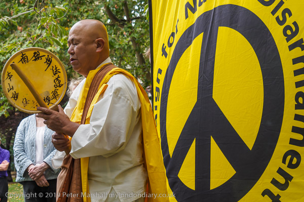
Reverend Gyoro Nagase at Hiroshima Day, Tavistock Square, 2019
After the destruction of Hiroshima and Nagasaki by US atom bombs in August 1945, Nichidatsu Fuji who had in 1917 founded the Japanese Buddhist movement, Nipponzan Myohoji, in 1947 decided they would set up Peace Pagodas around the world to promote peace and non-violence. The first opened in Japan in 1954 and the London Peace Pagoda was built by Nipponzan Myohoji monks and opened in 1985, shortly after Nichidatsu Fuji died aged 100. Since 1978 it has been looked after by Reverend Gyoro Nagase who I have met and photographed at many events calling for peace. There are also Peace Pagodas in Milton Keynes and Birmingham among over 80 around the world.
Click on any of the black and white images to go to a larger version in my album 1988 London Photos from where you can browse to other images.
All photographs on this and my other sites, unless otherwise stated, are taken by and copyright of Peter Marshall, and are available for reproduction or can be bought as prints.