Leyton and a Puzzle: Pictures from walks around parts of Leyton in August or September 1994 and a puzzle from south of the river.
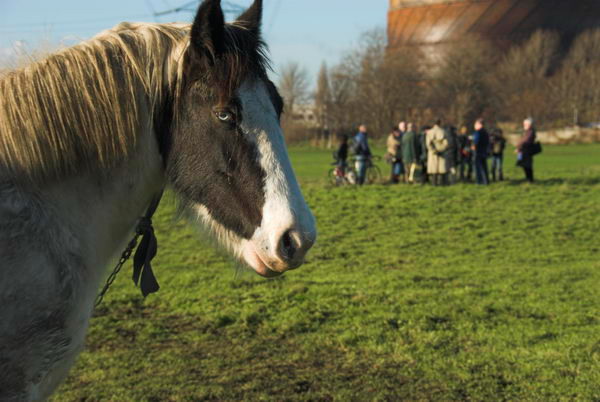
New Spitalfields Market, Sherin Rd, Leyton, Waltham Forest, 1994, 94-901-53
Traffic congestion, lack of space and outdated buildings led the City of London Corporation to relocate its wholesale fruit and vegetable market out of Spitalfields to a purpose-built 31 acre site in Leyton which opened in 1991.
Stratford Market, which had been founded in 1879 by the Great Eastern Railway as a competitor to Spitalfields also moved to the new site. According to Wikipedia, New Spitalfields Market “is Europe’s leading horticultural market specialising in exotic fruit and vegetables – and the largest revenue earning wholesale market in the UK.”
New Spitalfields Market, Sherin Rd, Leyton, Waltham Forest, 1994, 94-901-43
There were plans for this, Billingsgate Fish Market (in the West India Docks) and Smithfield Market to move to a new consolidated site in Dagenham Dock and planning permission was given in 2021, but in November 2024 the City decided this was no longer economically viable. New Spitalfields will remain in use while there are now plans to relocate the two other markets to Albert Island at the east end of the Royal Docks.
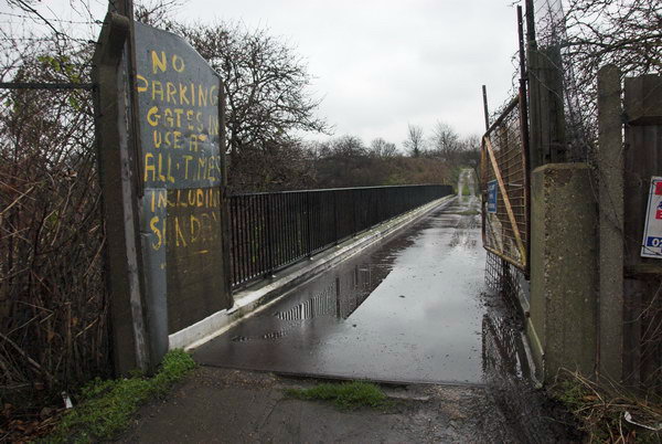
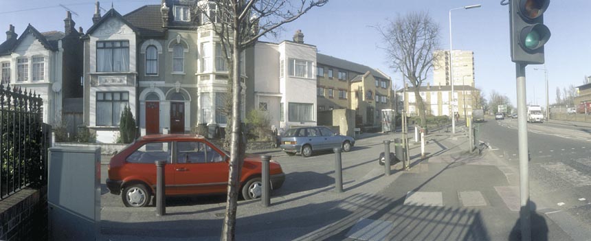
Leyton, Waltham Forest, 1994, 94-901-45
The market is on the east side of Hackney Marshes a short distance from the River Lea and I walked east along Ruckholt Road into Leyton. I think this building was probably in a side turning just off this road and I think has probably been demolished. But I was only interested in the colours an shapes.
A E Cornell, Furniture, 363, High Rd, Leyton, Waltham Forest, 1994, 94-901-46
This shop is now occupied by Woodland Estate Agents who opened here in 2005 and the building looks rather less run-down. Of course I was attracted by the Union Flags in the windows and door as well as the Churchillian poster with its pointing finger, though I’m unclear what we should DESERVE. Perhaps someone will have memories of this shop.
Chinese Takeaway, Fish & Chips, London, 1994, 94-901-32
I think this was also in Leyton as another almost identical image is on the next frame of film to the picture of A E Cornell’s furniture shop. The Chinese Takeaway seems to have been at 17D and had a name ending in GARDEN. But of course my interest was mainly in the peeling mural of two rather strange-looking jockeys and horses on the side of the neighbouring bookies.
Frederick Place, Bloomfield Rd, Woolwich, Greenwich, 1994, 94-901-24
And finally a little puzzle from the same film but taken south of the river on Bloomfield Road in Plumstead. The L and the S are clear and there are hints of two other letters, perhaps an I and a T. There could have been other letters, out of frame to the left. The building has been demolished and replaced by new housing, though some parts of the unusual paving remain. I can’t remember now if I knew what the site was, but have a vague feeling it may have been a garage and there is still a garage at the back of the new houses.
Please comment if you know more about this or any other of the pictures. More colour from 1994 to come.
Lammas Lands, Leyton, Columbia Market & Bethnal Green: On Sunday 17th December 2006 I went to an event by local residents seeking to protect the Leyton Lammas Lands from the sprawling London 2012 Olympics before going to a meeting with a friend at Columbia Market. Unfortunately on my way there I got a phone call telling me he was unable to make it, so I took a few pictures there before walking on in a roundabout way to visit another friend in Bethnal Green. Below I’ll post what I wrote back in 2006 (with minor corrections) and some of the pictures from that day.
Loss of Common Land
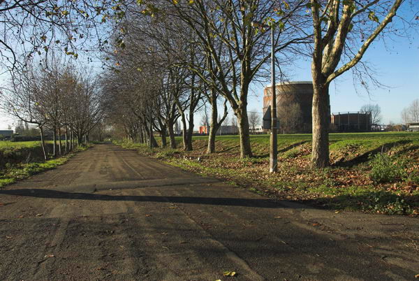
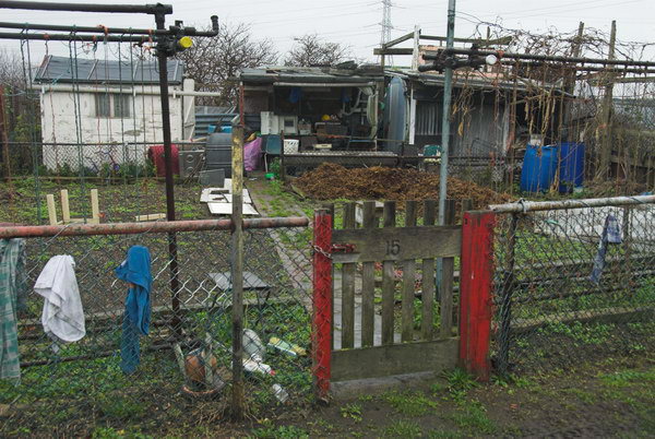
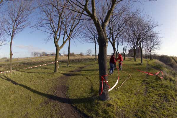
Leyton Lammas Lands, Marsh Lane, Leyton
Allotments displaced by the Olympics may be relocated here on Leyton Lammas Lands
History seems about to repeat itself in Leyton, although the outcome may be different this time. It was in 894 that King Alfred drained Leyton Marsh and gave the local people the right to graze their animals on the Lammas Land created. (Details in this post come from a leaflet written by Lorraine Metherall and Neil Bedford, published by the New Lammas Lands Defence Committee (NLLDC) and from Martin Slavin’s Games Monitor web site – now archived here.)
Marsh Lane, now mainly a cycle route, may become a busy road in the Olympic Development Authority has its way. The ‘New Lammas Lands Defence Committee’ hope to protect ancient rights.
In the 1890s, the East London Waterworks Company tried to take over the Lammas Lands, and on Lammas Day, 1st August 1892, a large demonstration met on the marshes and ripped up their fences. The company tried to sue one of the people involved, and locals set up the ‘Leyton Lammas Lands Defence Committee‘ (LLLDC) and fought the case in court. The water company ended up admitting defeat, paying all costs and giving money for a local essay prize.
The efforts of the LLLDC led to the ‘1904 Leyton Urban District Council Act‘, in which parliament vested the lands in the council, making them responsible for maintaining them as “an open space for the perpetual use therof for exercise and recreation…”. The act made them a permanent public open space in return for the giving up of the lammas rights, and was confirmed by parliament in 1965.
Over the years parts of the land have been taken for other uses, including railway sidings, Gas Board land and, more recently, the Lea Valley Riding School and Ice Rink. When the Lea Valley Regional Park acquired most of the Lammas Lands by compulsory purchase in 1971, they for some reason felt able to ignore the 1904 act, and have blocked public access to some areas.
The latest threat to Leyton Lammas Lands come from the London Olympic Delivery Authority (ODA). Although outside the Olympic area, the Lammas Lands are a handy place to dump the unwanted, in this case the allotment holders of Manor Gardens. In the late 1880s the Blessed Virgin Mary appeared at Eton College and prompted them to set up a charitable settlement in Hackney. The Eton Manor Settlement bought up land, including lammas land in Hackney and Leyton and set up various sports clubs and related activities including the Manor Garden Allotments.
A new short section of road would link Marsh Lane to Orient Way here.
Although the ODA is apparently set on jettisoning inconvenient requirements that were a part of its original agreement – such as the need to replace common land – it apparently still has to re-site the allotments, and its preferred site is on Marsh Lane, part of the Leyton Lammas Lands. Unfortunately the current land is unsuitable, being heavily polluted with a relatively thin layer of topsoil on top of wartime rubble.
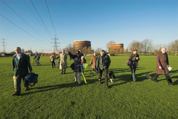
This is the area of the Lammas Lands that would be taken for the allotments
Making them usable means removal of some existing soil and bringing in many lorry loads of new topsoil, probably half a metre over the whole site. This would mean an new vehicle access to Marsh Lane, bringing traffic the few yards from Orient Way, along with widening Marsh Lane with the loss of some of the fine avenue of trees currently on both sides. This would also need to stay open for the use of the allotment holders, and would almost certainly result in the newly widened Marsh Lane becoming a heavily trafficked short cut to Church Road.
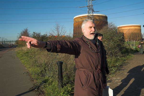
Singing ‘The Lammas Land Song’ “We will not be robbed when there’s a ballot in this land…”
The ODA needs the support of the local council for their application, and the NLLDC hope to raise enough local support to make them think again. It is of course possible that the courts could be asked to ensure that the provisions of the 1904 act are enforced.
[The Manor Gardens allotments were moved here in 2007 but the site allocated was in very poor condition. The ODA reneged on its promise to return them to their original site – but eventually in 2016 they were given a new site – only one fifth the area of their original site – on Pudding Mill Lane. This is now under threat from more and more tall buildings around it blocking out the sun.]
Leyton
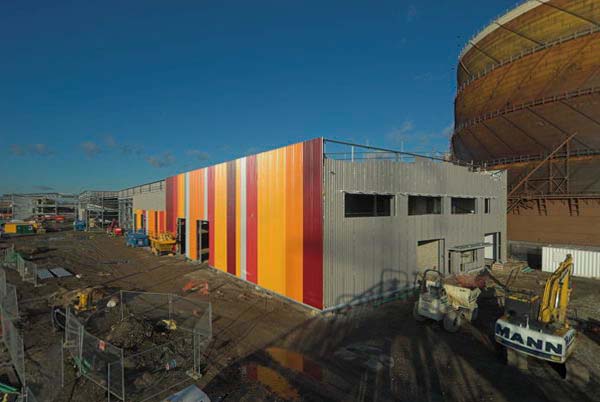
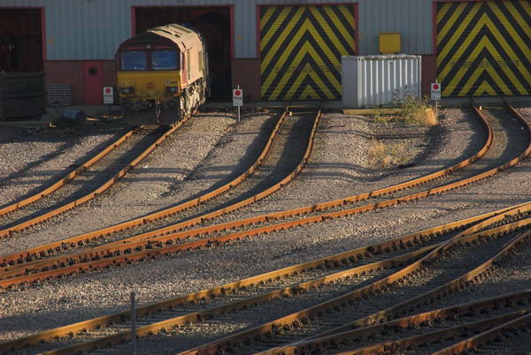
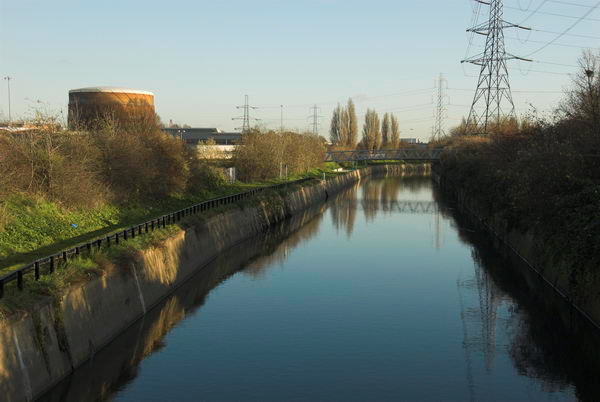
Brightly painted sheds were being erected on the gas holder siteRail sidings& shedsFlood relief channel
I was in the East End partly to meet a mate at Columbia Market, but in the end he couldn’t make it. With Christmas just over a week to go, prices were high. I calculated we’d just sent several hundred pounds worth of eucalyptus twigs to the incinerator after I did a bit of pruning recently, and those three holly trees in the back garden would be a goldmine. Strangely, even at these prices, some people seemed to be buying the stuff, though by the end of they day there did seem to be quite a lot of plants being loaded back into the lorries, and there were certainly plenty of Christmas Untrees left.
Rootless trees
Real trees of course have roots, and we always get one that has them, and grow it on for a few years between January and December. A few die off, and others eventually get too big to get through the door, and there are three that would suit Trafalgar Square down the garden. [Two huge and still growing but I had to fell one of them a few years ago.]
I took a few snaps, and then wandered through Hackney and Bethnal Green on my way to visit another friend who had written a book, The Romance of Bethnal Green, on the area and is using some of my pictures, to take a look at the design.
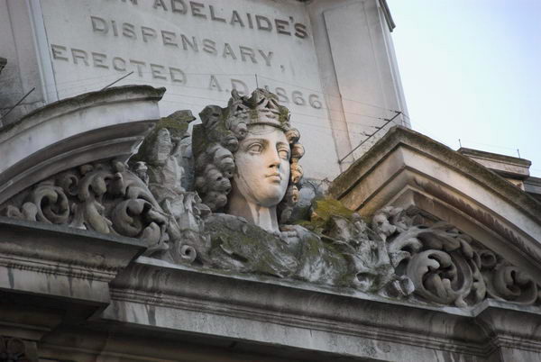
Queen Adelaide’s Dispensary
There was some nice light on some of the streets and buildings, and Queen Adelaide’s head curiously lit up as I passed.
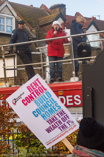
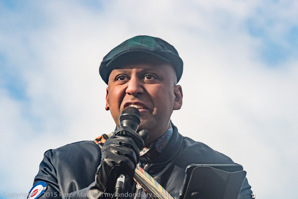
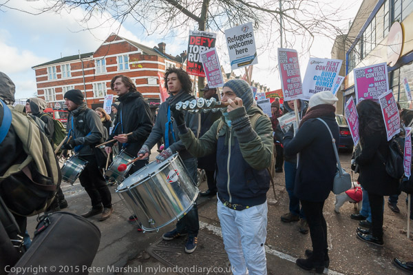
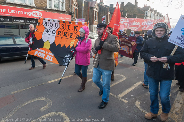
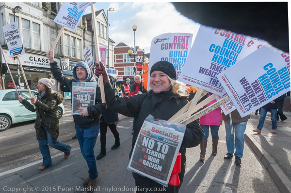
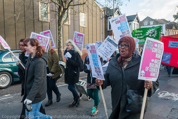
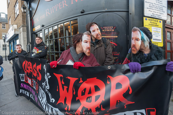
Walthamstow Housing Action & Class War at the Ripper Museum: On Saturday 21st November 2015 I spent an hour covering a lunchtime rally and march about the housing problems in the London Borough of Waltham Forest before rushing to Whitechapel where Class War were holding another of their protests outside the sensational tourist attraction celebrating the horrific acts of ‘Jack the Ripper’.
Homes for All against social cleansing
Leyton & Walthamstow
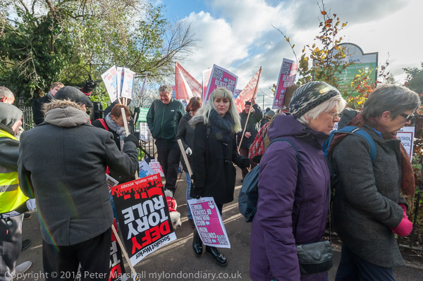
People met in Abbots Park Leyton for a rally organised by Waltham Forest Housing Action before they marched to a longer rally in the centre of Walthamstow. over the severe housing problems faced by those living in the borough of Waltham Forest.
Green Party Deputy Leader Dr Shahrar Ali
The council has a housing waiting list of over 20,000 families, and although there is considerable home building taking place in the borough only 400 of 12,000 homes planned in Walthamstow in the next 5 years are for low earners.
As in most of London’s boroughs, mainly held by Labour councils, the ‘regeneration’ schemes begun under New Labour has led to the loss of social housing, pricing most local people in the many lower paid and middle-income jobs which are essential for the city to run. Regeneration has led to social cleansing with poorer residents being forced out to areas further from the centre.
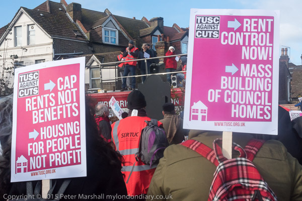
The campaigners called for an end to housing evictions in the area – then taking place at twice the average rate for London, and the capping of private rents which are on average much higher than the maximum set by housing benefit, as well as a huge increase in social housing.
Housing benefit acts as a huge public subsidy for landlords, passing money to them. The public and those who live in rented accommodation would be much better served by money being spent of building social housing which would give a return to local councils from the rents.
Private rents allow landlords to get housing benefit and the excess rent paid by the tenants to pay off the loans they take out so they can buy property and get the benefit of increasing their capital – at our and the tenant’s expense.
Rising rents have increasingly made it impossible for many key workers – teachers, firefighters and others – to afford to live in the boroughs they serve.
Press TV interviewed one of the campaigners who holds a placard ‘I have moved 4 times in 3 years! I want secure affordable housing’
Although Press TV covered the event there was (as usual) no interest shown by mainstream UK media
Among the trade unions supporting the march were the National Union of Teachers and the Fire Brigades Union – who provided their fire engine as a platform for speakers and to lead the march.
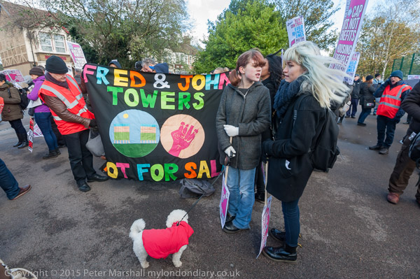
Local politicians also came for the event along with Green Party Deputy Leader Dr Shahrar Ali. Among local groups with banners were residents of Residents of Fred Wigg and John Walsh towers on the edge of Wanstead Flats in Leytonstone., where the 234 social housing units are to be replaced by only 160 and new private flats were to be sold to raise £30 million.
I left as the march was on its way to Walthamstow to go to Whitechapel.
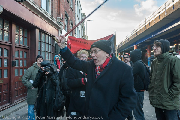
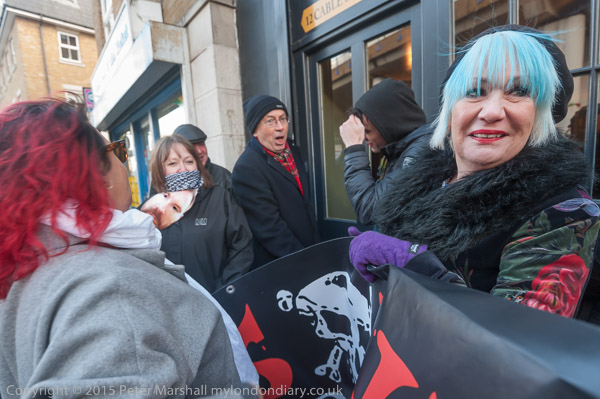
I met Class War as they arrived outside the Jack the Ripper tourist attraction in Cable St with their ‘Womens Death Brigade‘ banner for another in their series of protests against the ‘museum’ which celebrates the brutal and macabre killings of working class women in Whitechapel in 1888.
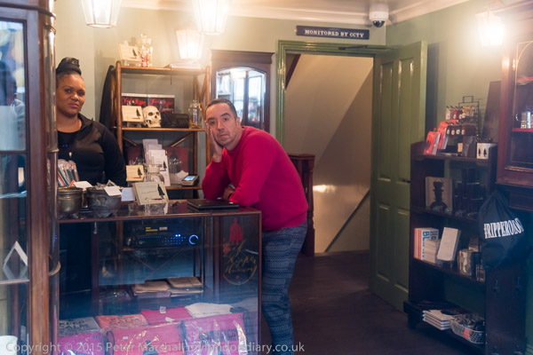
Owner Mark Palmer-Edgecumbe’s partner Julian Pino and an employee in the shop
The murderer was an insane serial killer who ripped open the bodies of his victims, removing the uterus and heart and a whole industry has arisen over trying to establish his identity, spurred on by the particularly gory details of his crimes.
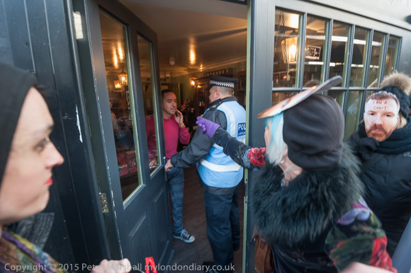
An officer tells Puno to stop phoning ‘999’ as the police are already here
Although the police at the time were unable to solve the case, they appear to have given up after Montague Druitt drowned himself in the Thames shortly after the final one of these murders. But those aiming to profit from the whole series of articles, books and films have done their best to build up doubt and uncertainty, putting forward others, often very unlikely such as painter Walter Sickert, as the criminal.
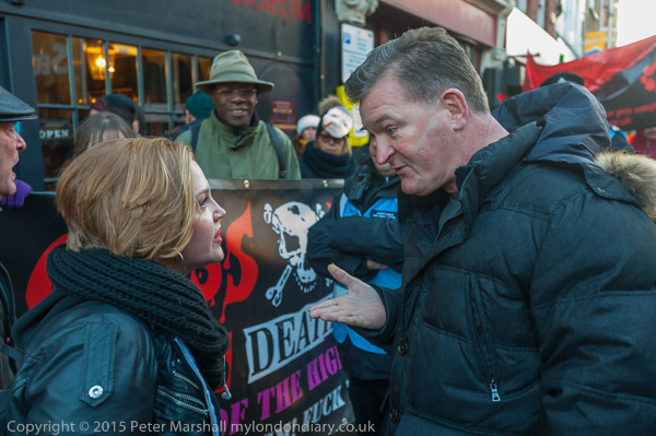
Lisa McKenzie speaks her mind
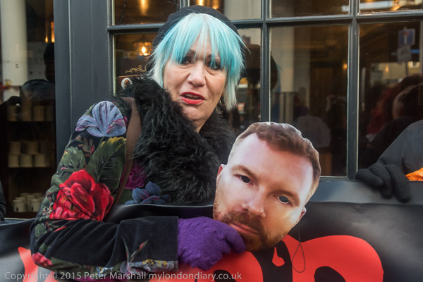
The protest was noisy but peaceful with many of those taking part wearing masks of the shop’s owner – who had lied about the site becoming a museum to celebrate women’s history to gain support and planning permission.
Jane Nicholl and Mark’s mask
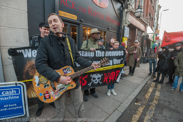
It was enlivened by the arrival of activist singer/guitarist Cosmo who performed three appropriate songs which raised everyone’s spirits, and even the police obviously enjoyed the protest.
Shop owner Mark Palmer-Edgecumbe had left a shop worker and his partner Julian Pino inside the ‘museum’ to face the protesters and their was one spot of farce when a police officer went inside to tell him to stop continually phoning ‘999’ as the police were already there.
Cosmo sings
A man claiming to be a local resident and seemed to be a friend of the ‘museum’ came to complain to Class War against them protesting against a business that was bringing investment to an area that was so obviously in need of it. He was told that this kind of investmentglorified violence against women and was clearly detrimental to the area and offensive to many – including the living descendants of the victims.
It was hard to avoid the conclusion that his intervention had been prompted and possibly funded by the owner of this tacky tourist attraction, which noticeably attracted no customers while the protest was taking place.
Poplar, Bow, Leyton, North Woolwich & Silvertown: These pictures come from a number of visits to areas of London working on several different projects and are my final selection of colour panoramas made in 1995. There are a few more colour images, including some panoramas I made in 1995 in the images in the Flickr album as well as many I have not digitised; some very similar to those online, others that I now find of less interest. Some of these were taken as a part of my project on the Greenwich Meridian in London – you can see a set of 16 images from this on the urban landscape web site.
Bow Locks, River Lea, Bow Creek, Bow, Tower Hamlets, 1995, 95p4-752
Bow Locks separate the tidal River Lea from the Lea Navigation and the Limehouse Cut which offers an alternative route to the Thames to avoid the winding and dangerous Bow Creek. First built in 1850 they were remodelled in 1930. At the highest Spring tides water from Bow Creek would overtop the locks and raise the level of the canals here – the locks were modified in 2000 to stop this and avoid the silting it caused.
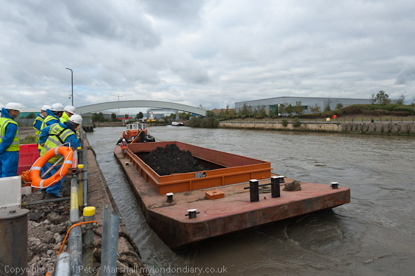
London Galvanizers, Leven Rd, Poplar, Tower Hamlets, 95p4-743
The Poplar Gas Coompany built a local gas works here in the 1820s at the request of the Poplar Vestry after ratepayers lobbied them to provide gas street lighting. The site was cleared in 2011 and I was commissioned to photograph the removal of toxic earth from the site using barges on Bow Creek. Something around an eigth of the material was removed in this way, tides making the removal of more difficult. The original gasholders had to be built to special safety standards because of their proximity to the West India Dock wall. The last of the gasholders was removed in 2017.
London Galvanizers had modernised their galvanizing plant here in 1983-5 and were one of the most important jobbing galvanizers in London and the Home Counties.
This street corner is close to the Meridian and I had stood here for some time outside the Chinese restaurant which was having some joinery work done. I liked the contrast between its orange paint and the blue on the opposite corner and the warm brown of the Birkbeck Tavern at right. I think I had made at least one exposure when a young girl in a red coat on roller skates came to see what I was doing – and I made this exposure as a red car come around, filling an otherwise rather empty grey space.
The Meridian also passes through this cemetery and I chose a viewpoint which included the cemetery chapel with a fine group of monuments in the foreground, I think all for people of Italian origin.
Stratford Station, Great Eastern Rd, Stratford, Newham,1995, 95p4-963
I’m unsure what this railway building to the east of the station was, perhaps a 1930s signal box. Parts of this area have now been redeveloped, and this has been behind fences for more than ten years and could stil be there, as least in part.
King George V Dock, Woolwich Manor Way, North Woolwich, Newham, 1995, 95p9-171
Finally four pictures from a walk along Woolwich Manor Way, this taken looking westwards along the south side of the King George V Dock. You can see the bridge over the dock entrance at right and the City Airport terminal and Canary Wharf at the end of the dock.
Royal Albert Dock Basin, Woolwich Manor Way, North Woolwich, Newham, 1995, 95p9-161
At left is the old swing bridge that took the road over the dock entrance from the basin. To its right is the elevated DLR and the pumping station at the centre of the Gallions roundabout. Further on only two buildings were standing along the side of the Basin, the Gallions Hotel and the Royal Docks Pumping Station.
Containers, Woolwich Manor Way, North Woolwich, Newham, 1995, 95p9-162
Land to the south of the Royal Albert Dock Basin just east of Woolwich Manor Way.
King George V Lock, Woolwich Manor Way, North Woolwich, Newham, 1995, 95p9-153
This swing bridge across the dock entrance is still there.
Royal Victoria Dock, Silvertown, Newham, 1995, 95p11-262
This was taken from Silvertown Way, looking across the Royal Victoria Dock. There are still cranes along the dockside here but the foreground now has flats. The Millenium Mills are still there, but there is nothing in the picture where the Excel Centre now stands and none of the other new developments on the north side of the dock. The council flats at the right have been demolished.
You can see these and some other colour pictures I took in 1995 at 1995 London Colour.
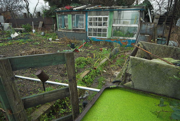
Hackney Wick & Manor Gardens: On Tuesday January 16 2007 I took a walk in Hackney Wick on my way to what was to become one of many casualties to the London Olympics, the Manor Gardens allotments, for an open day when the press and public were invited to see the vibrant site that was under threat.
Here with a few corrections and some of the pictures is what I wrote about the day. Many more pictures are still on My London Diary.
Hackney Wick remains one of the more interesting areas of London, and I took a few pictures despite the light rain on my rather meandering way to the Manor Gardens Allotments off Waterden Road.
A bridge over the River Lea led to Manor Garden Allotments
The Manor Gardens Allotments were another of the charitable provisions that came out of the link with Eton College and the Eton College Mission set up in Hackney Wick.
Arthur Villiers was one of four Old Etonians (the others were Gerald Wellesley, founder of the Eton Manor Old Boys Club for over 18s, Alfred Wagg and Sir Edward Cadogan) who in 1924 set up a charitable trust to keep the clubs running.
Villiers, who was a director of Barings Bank, had previously in around 1900 provided the Manor Gardens Allotments on an adjoining site as a means of providing both healthy exercise as well as suitable nutrition for the young men of the area. The land was provided for the community to use in perpetuity.
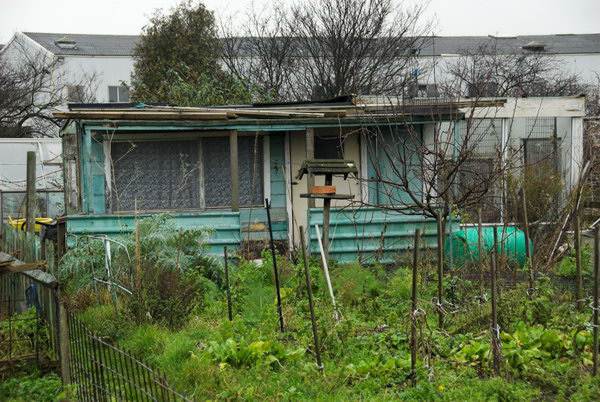
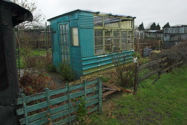
Since then it has continued in use, with a short break when the area was used for a wartime gun battery. At least a couple of the allotment ‘sheds’ are heavy concrete structures left over from this use.
Over the years it has been a thriving community of cultivators, recovering in recent years from some slight loss of interest, with the current renewal of interest in green and healthy living and eating.
Then came the London Bid for the 2012 Olympics, which put the allotments within the site. It could have been seen as a golden opportunity to give the games some green credibility behind the lip-service the bid gave to biodiversity and sustainability, and certainly as a commitment to the post-2012 legacy of the games – to leave sites such as Manor Gardens and the adjoining nature reserve as a green centerpiece to the site. Unfortunately the architects and developers seem hell-bent to create a brown Olympics, creating an irredeemably distressed site that will only be economically recoverable when all the concrete has crumbled.
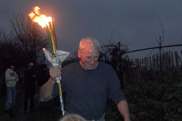
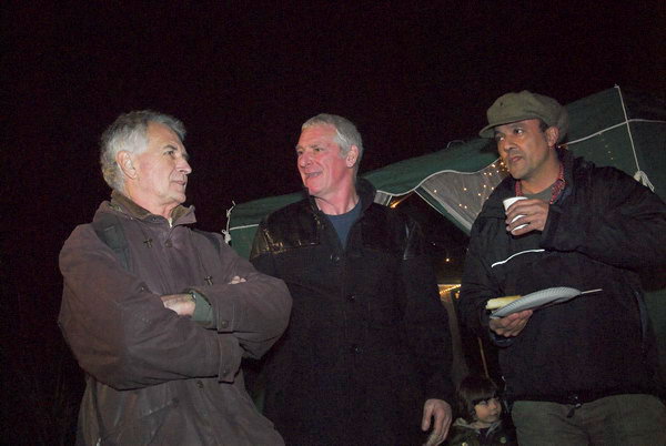
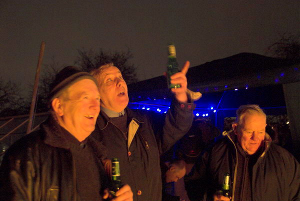
The New Year Feast was an Open Day at Manor Garden Allotments, inviting the public and press to see the site and the 80 plots for themselves. A rather low-tech ‘Olympic torch’ was carried across the bridge to the site and used to start a bonfire.
Then we had a party around it, with a couple of speeches and some tasty refreshments. There was support from some celebrities, as well as the opportunity to meet some of the plot-holders, some of whom have raised crops here since the 1940s – and those whose parents had plots in the 1920s. There are also many newer tenants, very much reflecting the multicultural nature of the surrounding area.
It would be a great shame to lose this splendid facility for four weeks of use in 2012, when it could easily be built around. It isn’t in a critical area but will simply be under concrete as a footpath, and probably also the site of a huge advertising ‘scoreboard’ for the games sponsor.
What will it say about the 2012 Olympics for a site that is currently a beacon for healthy green eating to be selling Big Macs?
The planning application was to submitted on 1st Feb 2007, with eviction expected on 2nd April 2007. it is unlikely that the replacement site offered at Marsh Lane can be ready before 2008. Hopes are not high, but it would certainly be a great green miracle if the allotments survive.
Of course the miracle did not happen, and the Olympic juggernaut took its course, destroying the allotments and much else. By June 2008 allotment holders were struggling to grow crops on a new site on common land at Leyton. The move was expensive and the contractors used to prepare the site had ruined it by sterilising and compacting soil with heavy equipment and much of the site was waterlogged, with the only healthy crops being grown in grow-bags.
The allotment holders had been promised they would be able to return to their old home after the Olympics, but this promise was not kept. Eventually in 2017 some were able to go to a much smaller new site at Pudding Mill Lane. It’s future came under threat in 2022 by plans for extensive development around its edges which will overshadow it restricting cultivation on much of the site.
This is the final section of my walk on Sunday September 3rd 1989 which had begun in Stratford, from which some images appeared in my web site and self-published book ‘1989’, ISBN: 978-1-909363-01-4, still available. The pictures here are in the order I took them, and almost all of these final images are in the book so you can read my deliberately disjointed thoughts that made up the text on the book pages here. Although this was the end of this walk I returned to the area for another walk a few days later.
Dove Cafe, 390, High Road, Leyton, Waltham Forest, 1989 89-9b-54
Andy & Co, Catering Equipment, 376-80, High Rd, Leyton, Waltham Forest, 1989 89-9b-55
Good As New Clothes, High Rd, Leyton, Waltham Forest, 1989 89-9b-41
Jesus is Alive, Leyton Rd, Stratford, Newham, 1989 89-9b-43
178-80 High Rd, Leytonstone, Waltham Forest, 1989 89-9b-44
Here you can see the buildling where I took a photograph in a earlier post of Eves, a ‘STRICTLY LADIES ONLY HEALTH CLINIC’. The road on the corner at the left of the picture is Eve Rd. As you can read the building was also BeCKS Driving Lessons, BRITAINS LARGEST PRIVATELY OWNED DRIVING SCHOOL FOR CAR & H,,G,V.’.
There are some clues as to the origin of this building, including the intertwined initials J and S but I have been unable to find out more. Currently it is a bookmakers.
Noted Eel & Pie House, West St, 481, High Rd, Leytonstone, Waltham Forest, 1989 89-9b-45
Finally I photographed the Noted Eel & Pie House, still present at the start of West Street although the Potato Dealers and Farm Produce shop at left is now an off-licence. The shop sign for the Eel & Pie House has changed and now spreads across three bays and all those white tiles have been replaced by green and the shopfront also now has a large eel at right.
You can read the history of the shop, with some pictures on their web site. It began with the great grandfather of the current owners who was the skipper of an eel barge sailing out of Heeg, a fishing village in the Netherlands. Eels were exported to London from there until 1938. Around 1894 his youngest son came London at the age of nine to live with a family who owned a pie shop and learn the trade, opening a pie shop in Hoxton with a cousin just before the outbreak of The Great War. He married the daughter of another pie shop owner and in 1926 with a loan from his father-in-law set up his own shop under his father-in-law’s name, E Newton, on Bow Road.
The shop name was changed soon after the outbreak of the Second World War when the Home Office insisted his name as a “friendly alien” had to be on the shop front. It became the “Noted Eel & Pie House” with his name, “H HAK” in the smallest font permitted in the bottom right corner as he worried customers might think it German.
In 1976 when two of his sons were then running the business the shop was compulsory purchased by the council and the business opened in Leytonstone in 1978. I suspect the sign in my picture may have come with them as it doesn’t quite fit and there is a name painted over at bottom right.
This was the final frame exposed on this walk. But I was soon to return to take more pictures in the London Borough of Waltham Forest.
Mecca, Statues, Bakers Ladders, Timber… Continuing my walk on Sunday September 3rd 1989 which had begun in Stratford, from which some images appeared in my web site and self-published book ‘1989’, ISBN: 978-1-909363-01-4, still available. The pictures here are in the order I took them. For those images which were in the book I’ll show the book pages here.
Back at the Bakers Arms after a little stroll on Leyton Flats I found this closed Mecca Leisure Bingo Hall on Hoe Street, its ground floor frontage covered with flyposting. Cinema Treasures says it opened as The Scala Cinema in 1913, was renamed the Plaza Cinema in 1931 and then closed, reopening in 1933. After its next name change in 1961 to The Cameo Cinema in 1961 it kept going for two years before becoming a Mecca Bingo Club. Left derelict for 18 years after this closed in 1986, it was taken over by a church in 2004, Grade II listed in 2006 and now looks much better. The listing text calls it the Former Empress Cinema and notes its still existing elaborate interior plasterwork.
The London Master Bakers’ Pension Society (now the Bakers’ Benevolent Society) was founded in 1832 and in 1854 decided to build almshouses. The foundation stone for the first was laid in 1857 and the first block of 18 were finished by 1861 and the rest by 1866, providing homes for elderly poor bakers and their widows.
In the late 1960s the site was purchased, probably as a part of a GLC road-widening scheme and the Bakers moved out to new villas in Epping. The almshouses were saved from further threats to demolish them by Grade II listing in 1971 and were purchased by Waltham Forest Council for use as 1-bed flats.
Rather to my surprise this corner of Russel Road and Lea Bridge Road still looks remarkably similar although the names have changed and the central buildings have been rebuilt, I think with a slightly wider pavement. But it still sells tyres and cars and there is still a shed on the corner, though no longer named the DUCK INN, and the buildings down Russell Road still look much the same.
This house was demolished to build a modern office for the Capworth Panel & Timber Co Ltd, which was dissolved in 2012. As well as the main house all of the sheds and buidings at right also went.
The house had obviously seen grander days, and I wonder it it had originally had a carriage entrance at left where the brickwork does not quite match and the window and door are clearly much more modern, perhaps having been added at the same time as the first floor windows were given a makeover probably in the 1930s or 50s.
I still had time to continue my wandering around the area and take a few more pictures and will post a final set from this walk shortly.
Back in 2005 many were still hoping that London would not win their bid to hold the Olympics, particularly those who lived in the area who could see how their lives would be disrupted by this huge event (though in the end it was far worse than they had imagined.)
One of many businesses on Carpenters Road
They also saw how it would impact on the longer term development of the area. Many planners warned how it would distort the proper planning of the area and its future; although investment in the area was welcome, much or most of it would be put into white elephants which would have little long-term utility.
Waterworks River and Old River Lea at Carpenters Lock
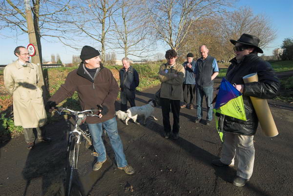
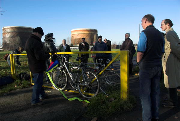
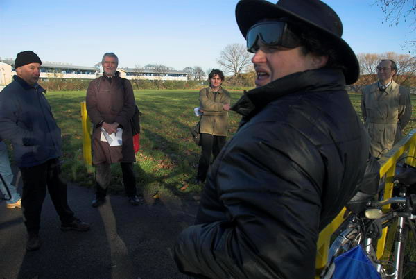
On Sunday 23 January 2005 I took my bike with me to Stratford and cycled to the meeting point at Temple Mills for a tour of the Olympic area with No to London 2012, a coalition of east london community groups and social justice campaigners.
Bully Point Nature Reserve
Around 20 of us then took a walk around the area, getting some informative comments at a number of locations. As I remarked in my write-up of the event in My London Diary:
It was an opportunity that IOC delegates are not likely to have, with their view of these particular areas expected to be with a pair of binoculars from a distant tower block.
I was already familiar with the area, having photographed around it since the 1980s, but still learnt a lot from some of those who spoke – and had just a little to add.
BMX track at Eastway Cycle Circuit is marked out
On our route around and also on my way to the meeting point I took the opportunity to take a few pictures, and after I’d sat down after the tour to eat my sandwiches by the Lea Navigation, to cycle to another area which was to be affected by the Olympics, Marsh Lane in Leyton, before making my way back to Stratford.
Wick Field, Hackney Wick
We were lucky with the weather, mild for January and with some sunshine, and I’d enjoyed the fairly short rides as well as the guided tour. I’d made several hundred pictures, including a number of panoramic images and felt I’d had a good day.
Leyton Marsh
Of course, London lost – and was condemned to host the Olympics. It was an event that caught the imagination of many of the public for the few weeks it was on, but has left a toxic legacy that will last decades.
You can see more of these pictures on My London Diary, where I’ve also written more about it.
All photographs on this and my other sites, unless otherwise stated, are taken by and copyright of Peter Marshall, and are available for reproduction or can be bought as prints.
Continuing with pictures from my walk along the Greenwich Meridian in Greater London in 1984-6.
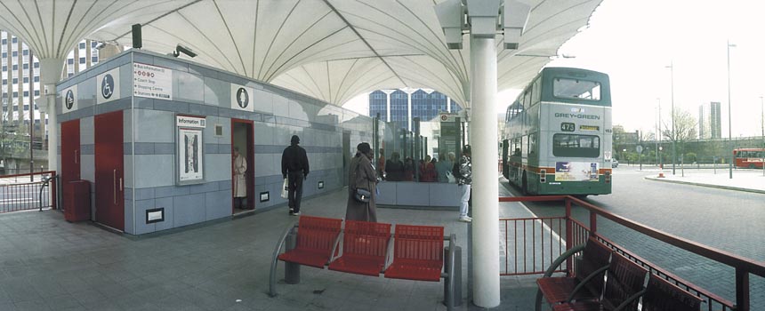
Stratford Bus Station – Peter Marshall, 1995
My walks took me as close to the line of the Meridian I had pencilled on my 1983 1:25000 OS map as possible, though that line may not have been quite exact. I think it goes through the area at the extreme left of the picture above, here just a few yards east of the roadway. My series of walks kept as close as possible to the pencil line, but it often runs through private property, buildings, across rivers etc and many detours, some quite lengthy were required.
Barge carries contaminated earth from Poplar gasworks site, Peter Marshall, 2011
One of those fairly lengthy detours was north from Poplar, where the line ran through the gas works site and across Bow Creek. It wasn’t until 2011 that I was able to go onto the former gas works site, having been engaged to photograph the use of a barge to carry away the heavily contaminated soil from the site. The line crosses the river here, going through the left end of the large shed close to the opposite bank, near to Cody Dock. This is also part of a private business estate, though you can now walk along the roadways in it. There are several such areas I have been able to photograph in later years, but I won’t add any other later pictures to these posts.
Stratford Station – Peter Marshall, 1995
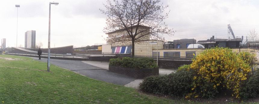
The line continues through the east end of Stratford Station.
Thinking of the line of the Meridian, I had decided it was appropriate to use a panoramic format, and these pictures were all taken with a swing lens panoramic camera. I think at the time I owned two such cameras, an expensive Japanese model and a cheap Russian one. The Russian was a little more temperamental and it was sometimes difficult to wind on the film, but had a much better viewfinder and I think was probably used for most of these. Both give negatives which are roughly the width of medium format film – 55-58mm – but only 24mm high, the limit of 35mm film, giving a roughly 2.3:1 aspect ratio. There is no discernible difference in image quality.
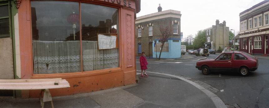
Langthorne Rd, Leyton – Peter Marshall, 1995
Both used 35mm film and curve it in the horizontal plane around a little over a third of the outside of a circle, with the lens pivoting roughly 130 degrees around the centre of that circle during the exposure. This keeps the distance between the centre of the lens and film constant, avoiding the distortion produced by using flat film, where the edges of the film are further from the lens node. This gives a very noticeable distortion with ultra-wide lenses, limiting them to an angle of view (horizontal) of roughly 100 degrees.
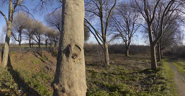
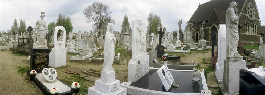
St Patrick’s Cemetery, Leyton
Swing lens cameras are limited in angle of view only by the mechanical limitations and can generally cover 130-140 degrees. But the curvature of the film does produce its own unique view. Assuming you keep the camera upright, straight vertical lines remain straight as the film is not curved vertically, but non-vertical lines show curvature, increasingly so as you move away from the centre of the film. You can see this clearly in the shop window in Langthorne Rd.