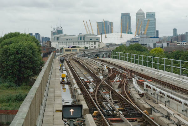
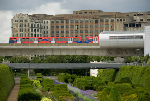
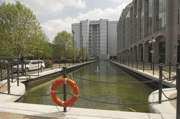
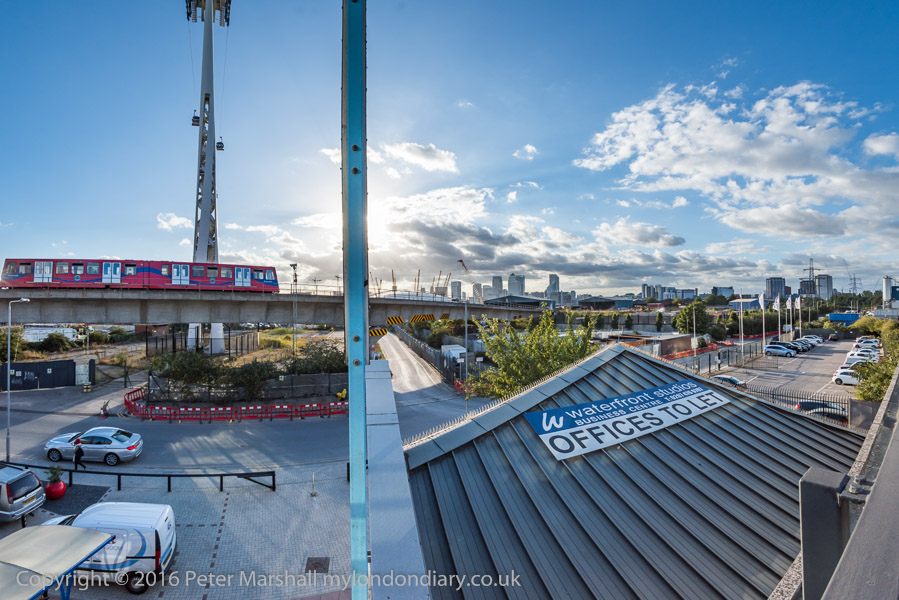
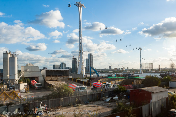
Take the DLR from Pontoon Dock to East India Station. [There is now a train every 10 minutes during normal hours.]
From the platform level you get good views, both through the windows and at each end of the long platform, of the Park, Barrier Point, Royal Victoria Dock and elsewhere.
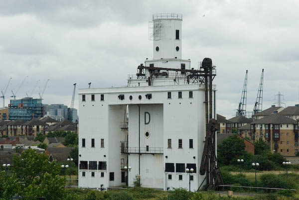
Listed Grain silo at Pontoon Dock
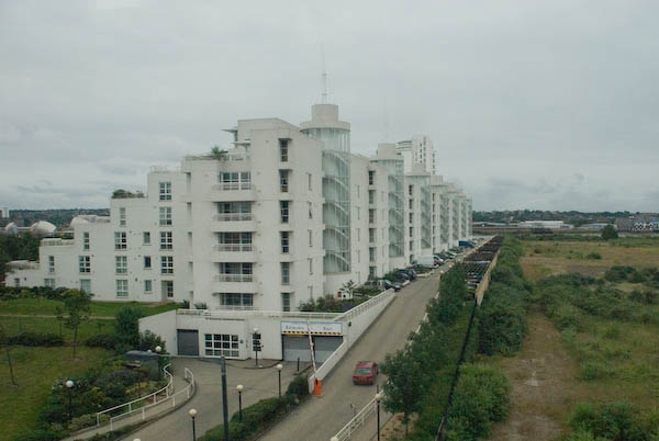
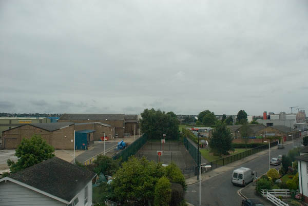
The train journey provides some of the best views of the riverside properties in this area, which otherwise are often impossible to access. It also gives a rapid overview of an area that is time-consuming to access on foot.
Barrier Point from the DLR
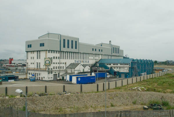
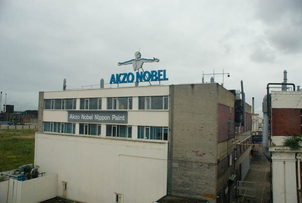
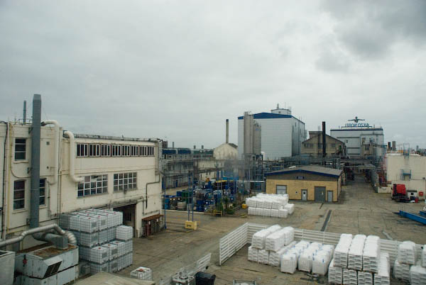
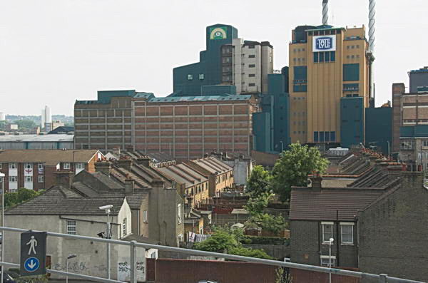
You should have no problem in identifying one of the Tate & Lyle buildings on the route, as well as Akzo Nobel, although you may recognise some of their brand-names – such as Crown, Bergger and International Paints, Sandtex and Sadolin – more easily. [I think only the Tate & Lyle Plaistow Wharf factory remains. Much was demolished to build Royal Wharf, as well as to the west of Plaistow Wharf where the land now remains empty.]
Lyle Park from the DLR
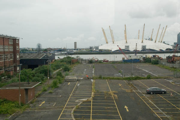
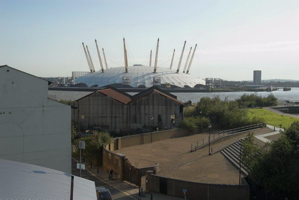
From the train you can also see the mouth of the River Lea and Trinity Buoy Wharf with its lighthouse and stack of containers in use as artists studios, as well of course as the Millennium Dome.
After Canning Town station, the line curves around the River Lea and climbs through the ecological reserve at Bow Creek and over the viaduct across Bow Creek. This section of the DLR was built in 1994 for the Becton extension.
From East India you have the choice continuing on the DLR towards the centre of London (change at Poplar for the DLR to Canary Wharf and the Jubilee Line), or taking a journey back to Canning Town.
If you have time and energy for a further walk, go north out of the station onto East India Dock Road and after crossing Bow Creek follow the path beside the creek to go over the Lower Lea Crossing. Again this elevated bridge gives good views across the Thames and Bow Creek to the south. [Now you can if you wish take a short cut by going out of the Bow Creek exit of the station, across the red bridge and through London City Island to the Lower Lea Crossing.]
Leamouth, Thames & Millennium Dome, 2009
When the bridge descends to a roundabout under the Silvertown Viaduct, you can either continue under it to Royal Victoria Station, or cross the road just before the roundabout and take the steps up to the top of the viaduct and walk to Canning Town station.
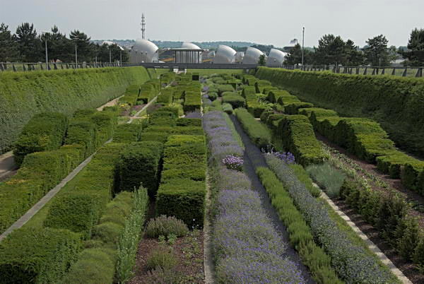
The children’s fun area is a nice idea, [32 computer controlled fountains] but this works better at Parc Citroen in Paris, and hasn’t stood up to British weather or use. We just don’t have the same level of upkeep in Newham as does the City of Paris. Competitions such as was carried out for this are a good idea, but only if the judges think rather more about what the result will look like in ten years time rather than on the sketches. It is also unfortunately not possible to enter the Green Dock at the ground level at the north end and walk through it (there is still an entry at the south end.)
[The park is managed by the Greater London Authority and was built on one of the most polluted sites in the country, the former PR Chemicals factory, which took years to decontaminate.]
The sides of the dock were lined by a metal fence with lower wires, which have currently been removed. In their place the fence is lined by normal street safety barriers, tied together with plastic bags. Although it may be effective, it is visually unacceptable and hopefully the fences are to be repaired and these removed.
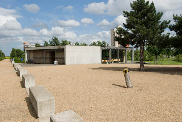
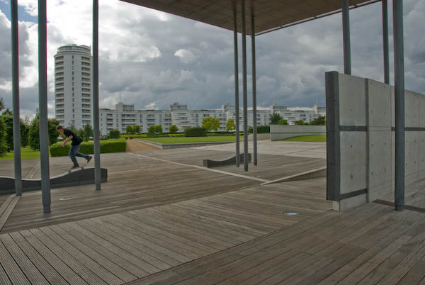
The two buildings in the park have a Japanese feel. One usefully houses toilets and a café, while the other was erected by Newham in memory of the victims of war. Its undulating seating was intended to carry on the wave theme of the Green Dock, but is perhaps of more interest to skateboarders than for comfort.
Walk along the edge of the ‘Green Dock’ to the riverside.
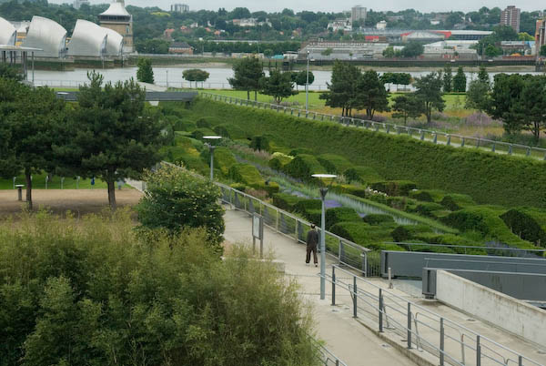
The park gives an excellent view of the Thames Barrier. Silvertown was one of the areas to be flooded in 1953, though rather less disastrously than Canvey, although some 1130 homes here were flooded. It took until 1982 for the Thames Barrier to be completed. Estimates of how much longer it will remain effective with the sea level rise due to global warming vary widely, but certainly at the moment it is getting used rather more often than was envisaged.
Walk back along the other edge of the Green Dock to the cafe and/or the station.
It’s some years since I’ve been back to the park, and it would be interesting to see how it has changed over the years. Perhaps I’ll find time this summer.
This walk will continue in a later post with Part 10: Riverside which mainly looks at views from the DLR.
From the top of the bridge there is a splendid view in all directions. Starting at the ExCeL centre and moving clockwise we see:
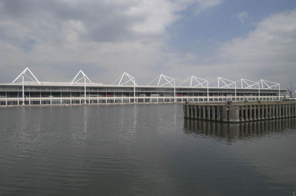
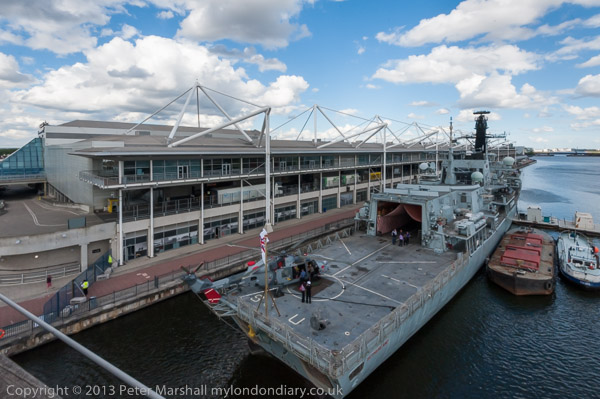
ExCel, standing for Exhibition Centre London. This was an LDDC idea, but not completed and opened until 2000. It has attracted many hotels to the area – including the floating Sunborn Yacht hotel.
In the distance, you can see East London University, one of the developments on the Royal Albert Dock, which is worth a visit of its own, particularly for the group of cylindrical student residences, looking rather like oil storage tanks.
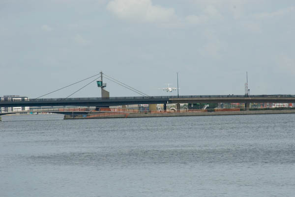
East London University and flight path beacons for City Airport, King George V Dock, North Woolwich
Closer than that, spanning the area and separating the Royal Victoria Docks from the two later Royal Albert and King George V docks is the Connaught Crossing, completed in 1990.
Millennium Mills and Eastern Quay
The large area on the right of the dock, including the area of water off from the main dock and the large bulk of Millennium Mills (built for Spillers flour in 1933) is the Silvertown Quays site, a £1.5 billion development that got planning permission in May 2007. This includes conversion of the mills into flats, 5,000 new homes, various community facilities, a lively town centre for Silvertown and the Biota! Project, a large aquarium designed by Terry Farrell & Partners for London Zoo. (though we don’t expect it to be anything like as good as The Deep in Hull!)
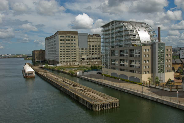
Close to the bridge is Eastern Quay (2003 Gardner Stewart Architects), constructed with a steel frame and is one of the first residential apartment blocks in the United Kingdom to have fully-glazed exterior walls. It uses advanced glazing technology to stop residents getting fried.
The large development, mainly of fairly small houses is Brittania Village, which began in 1994 with a Peabody development of 85 homes. The LDDC then made a deal with Wimpey for 777 more, along with some limited community facilities, including a primary school, in 1995. The area was completed with a few more Peabody trust and East Thames Housing Group properties.
Walk or take the lift down to dock level at the south end of the bridge, and walk through the arch at the centre of the semi-circular ring of shops.
Here there is a plaque marking the opening of the West Silvertown Urban Village by the government minister Selwyn Gummer in 1996.
Turn left and then right at the roundabout with a tall chimney and walk down Mill Road to the main road (North Woolwich Road.)
The large chimney in the middle of the roundabout dates from the 1930s. At the southern end of Mill Road are some workers cottages which appear to date from around 1900.
Cross the main road to the south side, taking great care. A suitably placed pedestrian crossing is only in planning application stage! [There is now a light-controlled crossing for pedestrians and cyclists.]
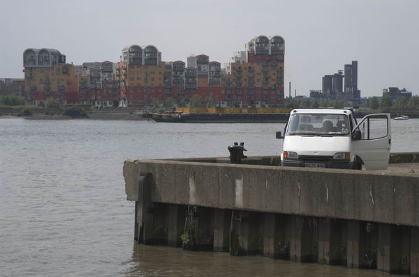
If you have plenty of time, you might like to make a detour to Lyle Park at this point, off Bradfield Road, a couple of hundred yards to the east. The park was presented to West Ham by Abraham Lyle & Son in 1924 and contains the fine metal gates from Harland & Wolff Ltd, ship builders, ship repairers and engineers in Woolwich Manor Way, Beckton from 1924-1972 (their actual shipyards were in Belfast and Govan.) The park also provides good views across the Thames to Greenwich Millenium Village and elsewhere.
This walk will continue in a later post with Part 8: North Woolwich Road.
Canary Wharf and the Millenium Dome from Silvertown
Stratford & Silvertown: One of the shorter posts I wrote on My London Diary was about my trip to Silvertown and Stratford in East London on 21st June 2006. Here it is in full, just as I published it then:
on wednesday 21st i took the DLR to stations in silvertown, taking pictures from the train, the platforms and around the stations. then i went to stratford to make more pictures there.
I left home in mid-afternoon and began photographing from the DLR a little after 4pm. It was a fine day and I was going to join a walk around Stratford in the evening by the Greater London Industrial Archaelogy Society and had a couple of hour before I was to meet with them at Stratford Station.
It was almost a year since London had been awarded the 2012 Olympics and I had made a number of visits to the Olympic area to record it before the huge changes that were about to take place.
The DLR extension to King George V station in North Woolwich had opened in December 2005, but had yet made little impact on the surrounding area. Construction had already begun on its extension under the River Thames to Woolwich Arsenal which opened in January 2009.
The line is largely elevated on a concrete viaduct which gives extensive views of the area. As the trains are driver-less I was able to sit at the front of the train and photograph through the front window. Then the DLR was relatively little used and at least on schooldays there was little competition for the front seats – and I think the train windows were usually cleaner.
Trains on the line were then reasonably frequent so I was able to get off at various stations to walk around a little and then return to the station to continue my journey, including a visit to Lyle Park with views across the River Thames.
The station platforms also provide elevated viewpoints to photograph the area. I went as far as Silvertown station and then made my way back to Stratford.
Here I left the train to join the GLIAS walk around the area to the south of the Olympic site, including the Carpenters Estate, a popular council estate close to the station which Newham were then trying to empty and sell off against local opposition, Stratford High Street and the Waterworks River.
By the time this evening walk ended although it was the middle of June the light was fading, though I think this picture exaggerates this a little.
There are quite a few more pictures on My London Diary, beginning here, but I took many more that day, particularly on the evening walk. Perhaps I will post more from this here some time.
I spent a long day in July 1994 travelling up and down the recently opened Beckton Extension, taking some pictures from the trains but also getting off at every station and explouring the area around the stations, sometimes at some length. The previous set of pictures, DLR – Beckton Extension – 1994, began from around the end of the line at Beckton, and these images start with those from a walk from the next station along, Gallions Reach.
In the 2000s there was a plan to extend the DLR from here to Dagenham Dock, but these were cancelled in 2008; now plans have been approved for an extension to a Beckton Riverside station and on under the Thames to Thamesmead.
From the Gallions roundabout you can go north and south along Woolwich Manor Way or take the more recent roads, Royal Albert Way, Royal Docks Road and Atlantis Avenue. My picture was made from Woolwich Manor Way looking roughly north. In the centre of the roundabout is a pumping station, which I think is a 16-sided building, though I always lose count. On top in its centre is a small 8 sided pimple. Locally listed, it was built for Thames Water in 1974.
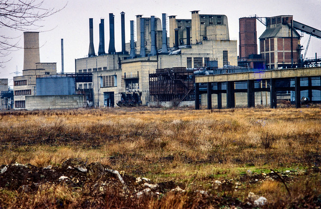
Ruins, Beckton Gas Works, Beckton, Newham, 1994, 94-717-61
Beckton Gas Works were built on the East Ham Levels from 1868-1870 by the Gas Light and Coke Company which had been founded in 1812 by Frederick Albert Winsor and was not only the UK’s first gas company but the first public gas company in the world. It was for some years the largest gas works in Europe and until 1969 produced gas for industry and homes across much of East London.
The site was named Beckton after then company chairman Simon Adams Beck and covered a huge of 550 acres. As well as giving room for the huge works, its site on the Thames well to the east of London meant that larger colliers could bring coal to it than to the gas works closer to the city.
As well as town gas, the site also contained the Beckton Product Works which became the largest UK manufacture of tar and ammonia by-products. Beckton was a huge local employer, providing jobs for as many as 10,000 men.
For many years after it closure the site remained derelict and was used in a number of films, most notably Stanley Kubrick’s Vietnam War film ‘Full Metal Jacket’. Back in 1994 there was little left on the site which is now largely a retail park.
I’d taken a few pictures in the area in black and white and colour ten years earlier when more of the works where still there – such as this one:
Beckton Gas Works, Beckton, Newham, 1984
[If you open the image you can browse a few more on Flickr.]
I went up to the station platform and made this picture as I waited for a train to arrive. At right you can see the Thames Water pumping station in the middle of the Gallions roundabout. On the left others waiting on the platform can be seen in a mirror. Beyond that is the Royal Albert Dock and in the distance the hills on the other side of the Thames. In the sky is a plane shortly after take-off from London City Airport.
Beckton Park Station, DLR, Beckton, Newham, 1994, 94-717-31
I can’t remember if I got off the train first at Cyprus station or continued directly to the next stop, Beckton Park. The two stations are fairly similar and both are in the centre of roundabouts in the Royal Albert Way, built for the LDDC and opened in 1990.
DLR, Royal Albert Dock, West Beckton, Newham, 1994, 94-717-11
I got back on a train to go to the next stop on the line, Royal Albert, where I took a walk around the area beside Royal Albert Dock dock, making this picture from its west end looking east down the dock. In the distance is a DLR train approaching and to the left is the road leading the the Connaught Bridge. I think the brick structure at left of picture is a ventilator for the railway tunnel below.
Connaught Bridge, Royal Albert Dock, Silvertown, Newham, 1994, 94-717-12
I made this from a temporary footpath across the channel between the Royal Victoria and Royal Albert Docks a few yards to the west of the Connaught Bridge. Under the bridge is the full 1.75 miles of the Royal Albert Dock, built in 1875-80 and opened by the Duke of Connaught. The dock finally closed to commercial traffic in 1981.
In 1984 I got permission to go onto the site and photograph the remaining buildings – virtually all now demolished. They had no great architectural value but were an important part of London’s history. You can see some of the black and white pictures I took in the book The Deserted Royals – there is a good preview with over 40 pictures on the website and the PDF version is reasonably priced – and rather more, including colour work on Flickr – in the two albums 1984 London Photographs and 1984 Docklands Colour.
More Docklands colour from 1994 in my next post in this series.
Poplar, Bow, Leyton, North Woolwich & Silvertown: These pictures come from a number of visits to areas of London working on several different projects and are my final selection of colour panoramas made in 1995. There are a few more colour images, including some panoramas I made in 1995 in the images in the Flickr album as well as many I have not digitised; some very similar to those online, others that I now find of less interest. Some of these were taken as a part of my project on the Greenwich Meridian in London – you can see a set of 16 images from this on the urban landscape web site.
Bow Locks, River Lea, Bow Creek, Bow, Tower Hamlets, 1995, 95p4-752
Bow Locks separate the tidal River Lea from the Lea Navigation and the Limehouse Cut which offers an alternative route to the Thames to avoid the winding and dangerous Bow Creek. First built in 1850 they were remodelled in 1930. At the highest Spring tides water from Bow Creek would overtop the locks and raise the level of the canals here – the locks were modified in 2000 to stop this and avoid the silting it caused.
London Galvanizers, Leven Rd, Poplar, Tower Hamlets, 95p4-743
The Poplar Gas Coompany built a local gas works here in the 1820s at the request of the Poplar Vestry after ratepayers lobbied them to provide gas street lighting. The site was cleared in 2011 and I was commissioned to photograph the removal of toxic earth from the site using barges on Bow Creek. Something around an eigth of the material was removed in this way, tides making the removal of more difficult. The original gasholders had to be built to special safety standards because of their proximity to the West India Dock wall. The last of the gasholders was removed in 2017.
London Galvanizers had modernised their galvanizing plant here in 1983-5 and were one of the most important jobbing galvanizers in London and the Home Counties.
This street corner is close to the Meridian and I had stood here for some time outside the Chinese restaurant which was having some joinery work done. I liked the contrast between its orange paint and the blue on the opposite corner and the warm brown of the Birkbeck Tavern at right. I think I had made at least one exposure when a young girl in a red coat on roller skates came to see what I was doing – and I made this exposure as a red car come around, filling an otherwise rather empty grey space.
The Meridian also passes through this cemetery and I chose a viewpoint which included the cemetery chapel with a fine group of monuments in the foreground, I think all for people of Italian origin.
Stratford Station, Great Eastern Rd, Stratford, Newham,1995, 95p4-963
I’m unsure what this railway building to the east of the station was, perhaps a 1930s signal box. Parts of this area have now been redeveloped, and this has been behind fences for more than ten years and could stil be there, as least in part.
King George V Dock, Woolwich Manor Way, North Woolwich, Newham, 1995, 95p9-171
Finally four pictures from a walk along Woolwich Manor Way, this taken looking westwards along the south side of the King George V Dock. You can see the bridge over the dock entrance at right and the City Airport terminal and Canary Wharf at the end of the dock.
Royal Albert Dock Basin, Woolwich Manor Way, North Woolwich, Newham, 1995, 95p9-161
At left is the old swing bridge that took the road over the dock entrance from the basin. To its right is the elevated DLR and the pumping station at the centre of the Gallions roundabout. Further on only two buildings were standing along the side of the Basin, the Gallions Hotel and the Royal Docks Pumping Station.
Containers, Woolwich Manor Way, North Woolwich, Newham, 1995, 95p9-162
Land to the south of the Royal Albert Dock Basin just east of Woolwich Manor Way.
King George V Lock, Woolwich Manor Way, North Woolwich, Newham, 1995, 95p9-153
This swing bridge across the dock entrance is still there.
Royal Victoria Dock, Silvertown, Newham, 1995, 95p11-262
This was taken from Silvertown Way, looking across the Royal Victoria Dock. There are still cranes along the dockside here but the foreground now has flats. The Millenium Mills are still there, but there is nothing in the picture where the Excel Centre now stands and none of the other new developments on the north side of the dock. The council flats at the right have been demolished.
You can see these and some other colour pictures I took in 1995 at 1995 London Colour.
North Woolwich Photos: My account of my day on Friday 16 June 2006 is rather short – and manages to include a mis-spelling: “I took a trip to North Woolich and made some pictures there.” And the 45 pictures I posted had only the additional heading “North Woolwich, Thames, Royal Docks & Silvertown” but no captions. I think they deserve more, so I’ll correct that for a few of them in this post.
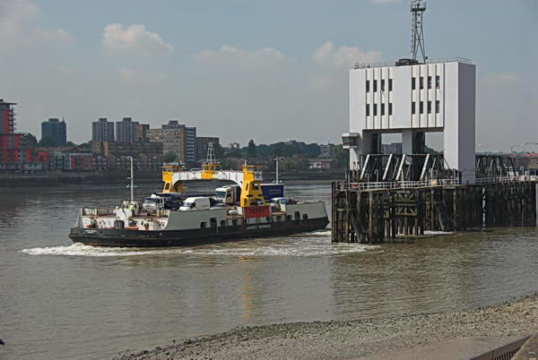
Woolwich Ferry, North Woolwich, 2006
The ferry is the James Newman, built in 1963 and named after a prominent local figure who was Mayor of Woolwich in 1923–25 and was taken out of service in 2018. But I hadn’t arrived on the ferry but had put my folding bike onto a Silverlink service on the North London Line which then ran from Richmond to North Woolwich Station (the section from Stratford to North Woolwich close at the end of 2006.)
The building in the background of the second image is North Woolwich Station, though it had by that date been abandoned by trains which stopped being used as a station in 1979, replaced by a considerably less grand and basic structure on its south side. For some years it was a museum and this fine 1854 building is now home to the New Covenant Church. My picture is taken from the riverside path.
Old Bargehouse Draw Dock and Causeway
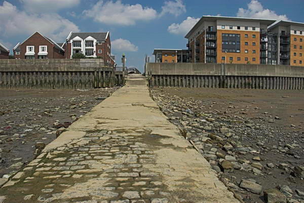
Next came three pictures showing the reverside flats just past the Old Bargehouse Draw Dock and Causeway at the end of Bargehouse Road. Until the Woolwich Free Ferry was introduced in 1889 this was where ferries ran across the river to Woolwich. On this occasion I’d cycled past the remains of the Free Ferry without taking any pictures, probably because I had photographed them on several occasions before. You can see the other two pictures of the flats on My London Diary.
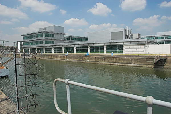
I took a few pictures looking across the River Thames most of which I didn’t post on My London Diary and then this one after I’d crossed the lock gates of the King George V Dock entrance and had come to the lock entrance to the Royal Albert Dock Basin. The building here has since been replaced by the flats of Lockside Way.
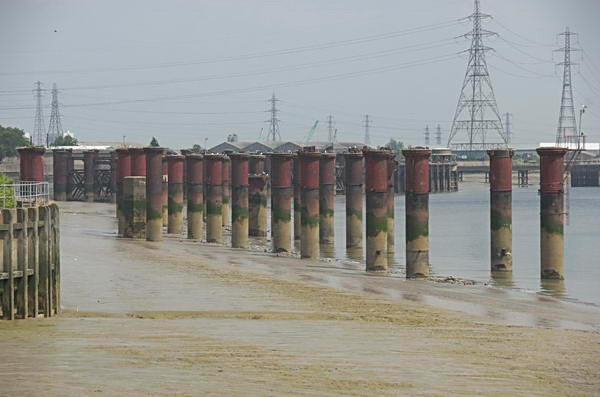
The riverside path – part of the Capital Way – continues north to an abrupt end close to Atlantis Avenue and this view from its end shows the remains of the jetty which brought coal to the Beckton Gas Works. I retraced my path, taking more pictures – some concrete pipe sections, a disused lock gate and a lorry park on My London Diary and then made my way to Woolwich Manor Way.
Royal Albert Dock
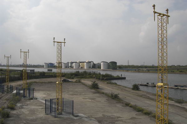
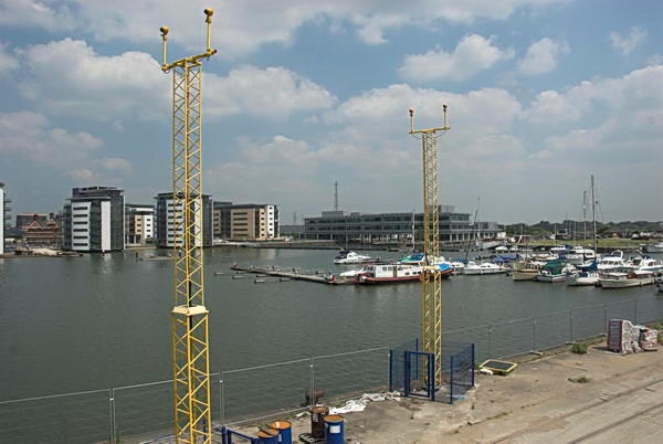
Here I could photograph across the dock. At the left are new flats built between the dock and University Way and in the foreground are two yellow towers carrying approach lights for the runway of London City Airport.
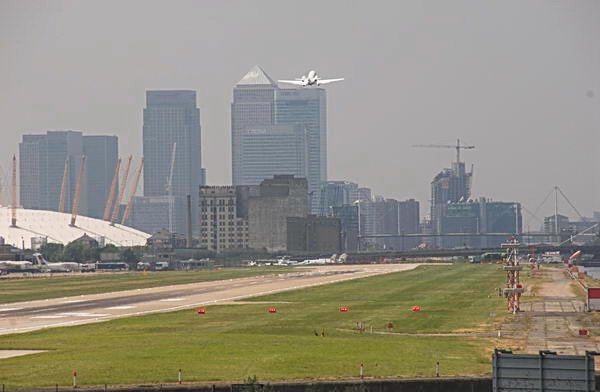
A plane takes off from London City Airport
The haze that you see in this picture, taken with a 300mm (equivalent) lens is a little more obvious than in the other pictures thanks to air pollution, which the airport contributes to.
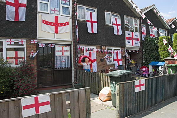
I made some more photographs in North Woolwich – tthere was a Football World Cup taking place in Germany – England were eventually knocked out by Portugal in the quarter-finals.
London City Airport DLR station had opened in December 2005 and I was able to take photographs from there both of the Airport Terminal and of Tate & Lyle’s sugar refinery.
Thame Barrier Park
I took more pictures in Silvertown and Canning Town, some of which you can see on My London Diary, before making my way back to Central London. There I took some more pictures around Brick Lane, some of which I put on My London Diary in a seperate post. It had been a good day for me.
Canary Wharf, East India, Silvertown, Beckton & Woolwich: I was back in London’s docklands on 16th May 2004, a week after I had led a small workshop there, this time on my own, and rather than walking I had gone with my Brompton folding bike.
The Brompton is an ideal way to cover larger distances when taking photographs. It can be folded to go on public transport and is very easy to get on and off and park in little or no space. It folds and unfolds in seconds. It’s a lively ride with a short wheelbase and good for riding in traffic, though for longer rides I prefer my road bike.
The Brompton has some minor problems. They are not cheap – which delayed me buying one for years. It’s not built for off-road use and mine has mudguards that can clog and stop the wheel turning on muddy ground. And now I’m a bit older it is just a little heavy to carry for any distance in stations. But my main problem is that it is a thief magnet, dangerous to leave anywhere for any length of time even if you have a good lock. No bike lock can defy the well-equipped thief for more than around half a minute and it slips easily into a car boot and fetches a good price.
I’d hoped to get the Jubilee Line to Canning Town, but trains were only running as far as North Greenwich, so instead I got off at Canary Wharf before the train went under the Thames again. It was no problem as I had the bike.
I took a few pictures around Canary Wharf, then rode off to the east past Blackwall Basin and on to the East India Docks probably the most boring of all the redeveloped docks.
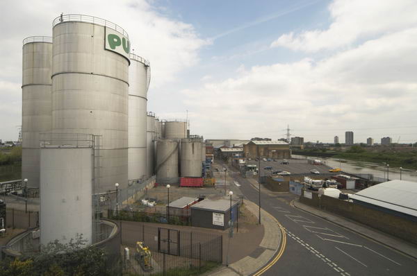
From there I went up on the Lower Lea Crossing, taking pictures of Pura Foods to the north and the view south across Trinity Buoy Wharf and the Thames towards the Millenium Dome.
I photographed the Dome again from Silvertown Way, as well as the works taking place for the DLR extension to London City Airport.
A big advantage of being on a bike is that you can wander around, and I went down to the Royal Victoria Dock, then back to Silvertown Way and Lyle Park, then back to Victoria Dock again.
I couldn’t resist going onto the high level bridge across the dock, though the lift wasn’t working and I was cursing the weight of the bike and cameras by the time I reached the top of the stairs.
Eventually after making rather a large number of pictures I forced myself to come down and continued my ride along the North Woolwich Road to the futuristic Barrier Point, its west front like some space city.
In Thames Barrier Park I went down to the riverside to photograph the barrier before continuing on to Silvertown, stopping a few times for more pictures. Near North Woolwich I sloweed to photograph two boys on a scooter being towed by a woman on a bicycle. I stopped take more pictures but later I met them in North Woolwich and they told me she had soon given up.
I took some more pictures in North Woolwich and then rode on to Beckton Retail Park, then turned around and went down Woolwich Manor Way across the Royal Albert and King George Docks.
Back in 2004 flights from London City Airport were fairly infrequent and I had quite a long rest waiting to photograph a plane going overhead.
I rode on to North Woolwich ferry pier where I had a wait for the ferry and took some more pictures. In 2004 I wrote that the Woolwich Ferry is “London’s best-value river trip. I wonder how much longer this free ferry will operate?” It was upgraded in 2018 with new, modern, low-emission boats which proved rather a disaster. Services had been severely reduced, working with only one of the two new boats.
But Transport for London a week ago in May 2024 restored the two-boat service and expanded operating hours. They say the service will continue as long as there is demand. A short ride took me to Woolwich Arsenal Station where I folded the Brompton for the journey home.
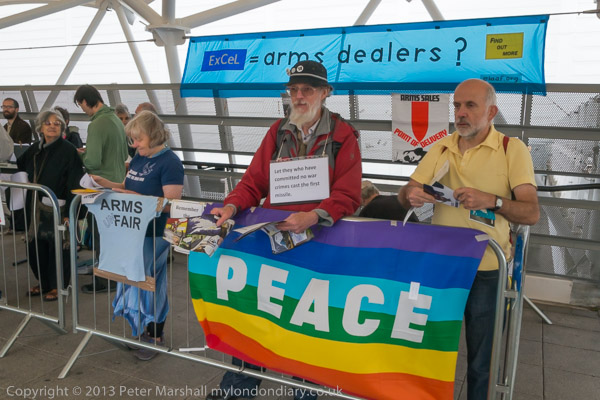
EDL Stopped, Musicians at Arms Fair, Silvertown: On Saturday 7th September 2013 after photographing the EDL attempting to march into Tower Hamlets and the people coming out to stop them I went on to the Excel Centre in Newham where East London Against Arms Fairs were holding a Musical Protest against next weeks DSEi arms fair. And on my way home I took more pictures.
EDL Try To March Into Tower Hamlets
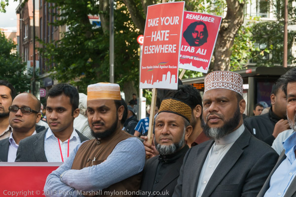
Whitechapel says ‘Take Your HATE Elsewhere’
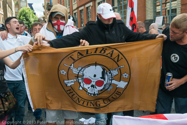
I started the day in Bermondsey were around a thousand EDL supporters were gathering for a march across Tower Bridge to Aldgate High St.
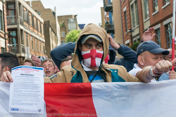
Police had laid down very strict conditions for the march, specifying the exact route and timings and more, which where specified on A4 sheets they handed out to protesters and were also broadcast every few minutes from a loudspeaker van where the marchers were gathering.
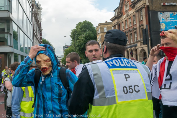
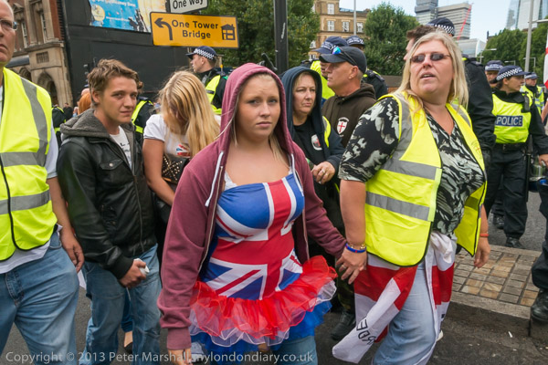
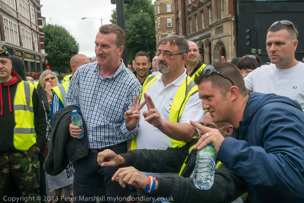
There was a very strong police presence on the streets with police on all sides around the marchers and some mingling with them. The EDL were also on their best behaviour, with many posing for photographs. A couple who arrived in pig’s head masks were forced by police to remove them and hand them over.
There was still a great deal of racism and hate in the comments that were being made and when the march got under way the majority took up the usual Islamophobic chants including “Allah, Allah, who the f**k is Allah“.
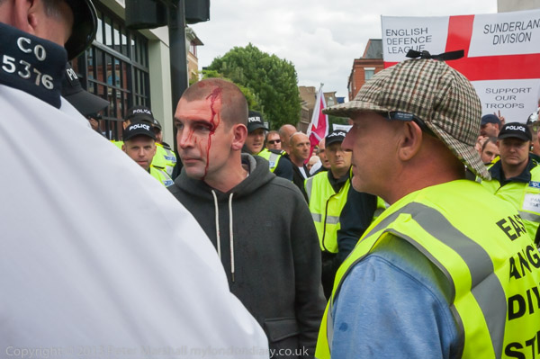
There were a small number of anti-fascist protesters in the area, and police tried to keep them well away from the march, although EDL stewards who led away one man with a bleeding face from the crowd alleged he had been hit by a bottle thrown from across the road.
As the march set off, police moved photographers well away, and police handlers with dogs walked in advance of the marchers. Later I was able to get a little closer.
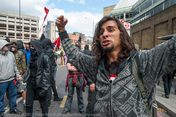
After crossing Tower Bridge I saw red smoke in the distance coming from the ground in front of a row of police vans in Mansell St and rushed there to find a group of around 50 anti-fascist protesters, mainly dressed in black, with red and black flags and a few with Unite Against Fascism placards.
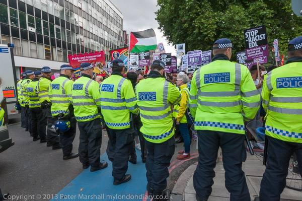
The EDL march stopped for a couple of minutes opposite them and the two sides shouted insults at each other with the police keeping them well apart before the march moved on to Aldgate High Street without further incident. I later heard that the anti-fascists here had been kettled for some hours before many of them were arrested.
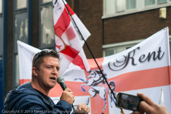
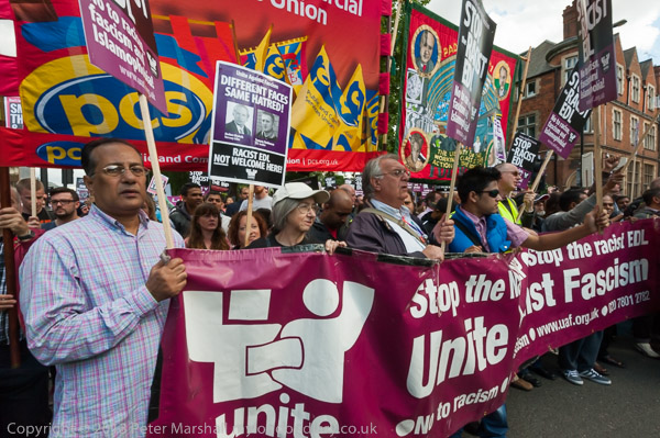
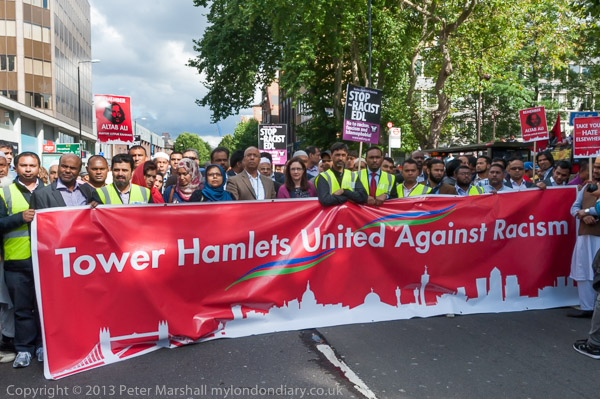
I photographed Tommy Robinson addressing the rally, then made my way to where a counter-protest was being held by the community of Tower Hamlets, united in opposing the EDL. I had to go through several lines of police, showing my Press Card. A few officers refused to let me through, but I was able to walk along the line and make my way through.
As I commented, “It was a remarkable change in atmosphere from the feeling of hate and Islamophobia that filled the air with gestures and chanting from the EDL to the incredible unity and warmth of the several thousands largely from the local community who had come out to oppose them and make a statement based around love and shared experience of living in Tower Hamlets with people of different backgrounds and religion.”
There was clearly a determination in Whitechapel, as there was in the 1930s at the Battle of Cable Street which had taken place not far away of a community that had decided that ‘They shall not pass’. And although most had come to protest peacefully, had the police not kept the two sides well apart, the EDL would have been heavily outnumbered by local youths angry at their presence.
I’d left the EDL rally before Tommy Robinson was arrested for incitement, apparently for suggesting that people break some of the restrictions that police had imposed on the EDL march and rally. The police presence had prevented any large outbreaks of public disorder and although the EDL were up in arms over the arrest of their leader had protected them from a severe beating.
Musical Protest against Arms Fair – Excel Centre, Custom House
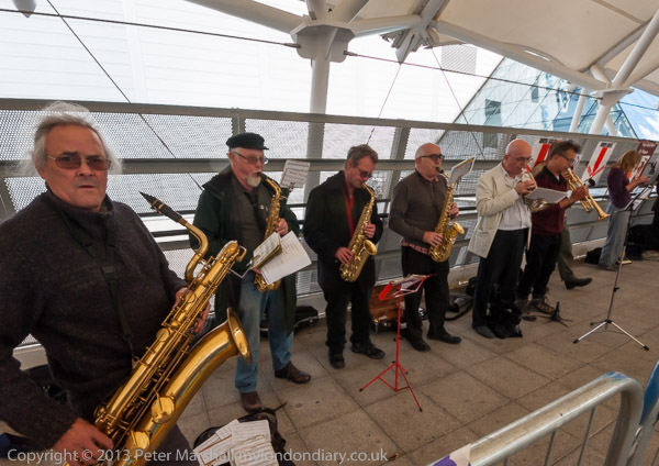
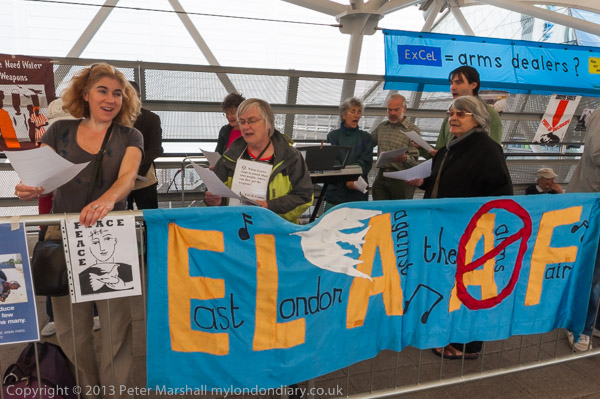
I didn’t stay long in Whitechapel but took the tube and bus to Custom House where on the walkway leading the the ExCel Centre East London Against Arms Fairs (ELAAF) were holding a Musical Protest against next weeks DSEi arms fair with a big band and singers and others handing out leaflets opposing the event.
THe DSEi arms fair, held every other year at the ExCel Centre in London Docklands attracts buyers from all over the world, including those from many countries with oppressive regimes. It’s a showcase for the weapons they need to continue to oppress their populations and to wage war on their neighbouring states and others.
There were more and larger protests in the following week against the arms fair.
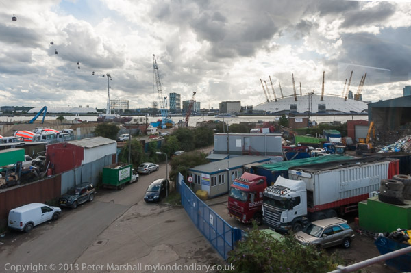
Although the DLR wasn’t running on the branch leading to Custom House, there were trains running on the branch through Silvertown and I walked to there across Victoria Dock on the high-level bridge, taking a few photographs.
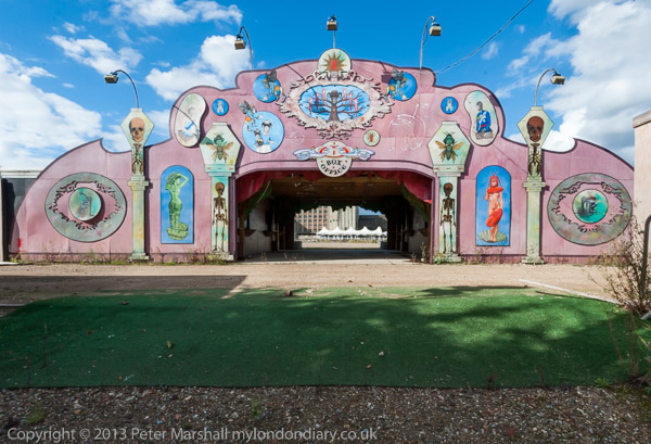
The gates to the London Pleasure Gardens which had closed recently only a few weeks after its opening were locked but I was able to take pictures through the gates. I walked on to the elevated Pontoon Dock DLR station and made some panoramas from there before catching a train.
For once the DLR train had a very clean window and I took advantage of this to take some more pictures on the way to Canning Town where I changed to the Jubilee line.
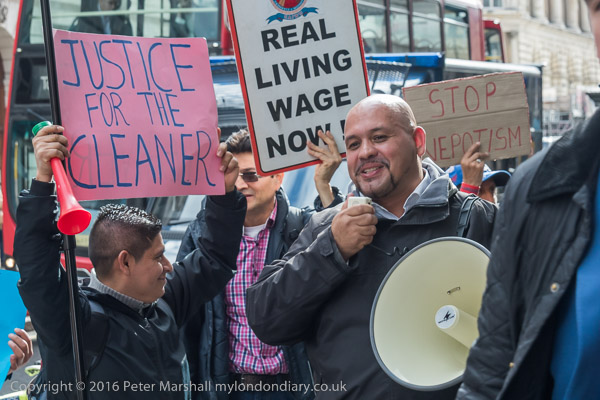
Thursday 6th October 2016 was another of those varied days I love. I began with a lunchtime protest against victimisation and nepotism by cleaners, then went for a walk by Bow Creek before finally photographing a protest outside RIBA where the annual Stirling Prize presentation was taking place.
Cleaners demand ‘End Nepotism’ – 155 Moorgate
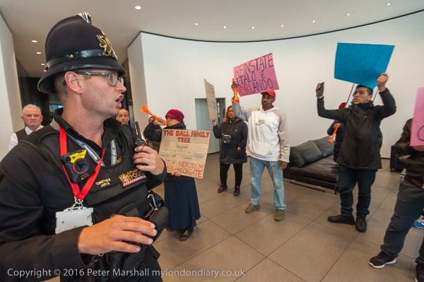
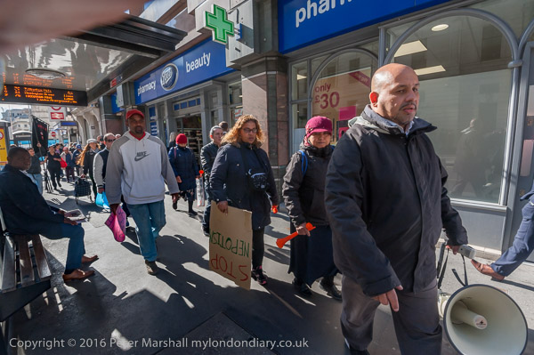
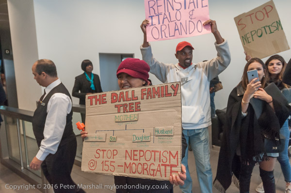
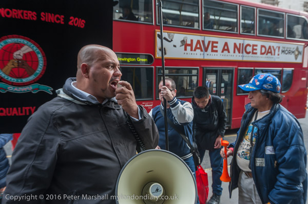
The Independent Workers Union CAIWU occupied the lobby of Mace’s headquarters building in Moorgate at lunchtime protesting noisily against cleaning contractor Dall Cleaning Services. I met the cleaners and supporters outside Moorgate station where they got out posters and a banner before marching quietly to pay an unannounced visit to Mace’s headquarters building where they walked into the lobby and started making a lot of noise.
They called for the reinstatement of two cleaners who they say were dismissed illegally without proper notice or other procedures being followed. They say that the cleaners have been dismissed simply to give jobs to members of the family of a Dall Cleaning Services supervisor.
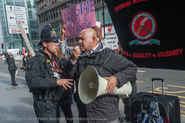
After around 15 minutes a police officer arrived, but it was too noisy to hear what he was saying and the protest continued. He stood a little to the side and called for reinforcements, and as these arrived the protesters walked out to join those who had stayed outside and the protest continued on the pavement for another 20 minutes.
Police came to tell the protesters they were making a lot of noise, and were told that was the idea – they came here to do so and shame Mace and Dall Cleaning Services.
Eventually another officer who had been present at several previous CAIWU protests arrived and was told they would soon be stopping.
And after a couple more minutes, Alberto ended the protest with the usual warning “We’ll be back – and that’s a fact”.
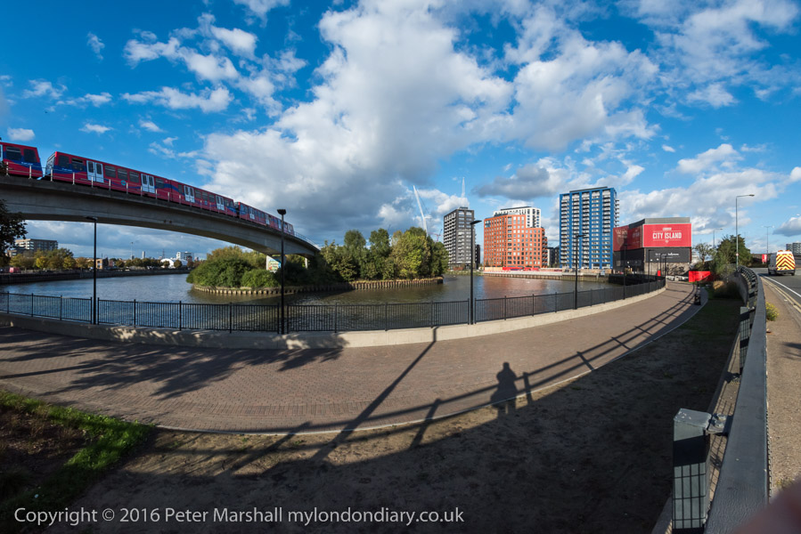
I had the afternoon to fill before the next protest and it was a fine day so I decided it was time to take another trip to Bow Creek. I took the DLR from Bank to West India Dock to start my walk, and took the opportunity and a fairly clean train window to take a few pictures on my way there.
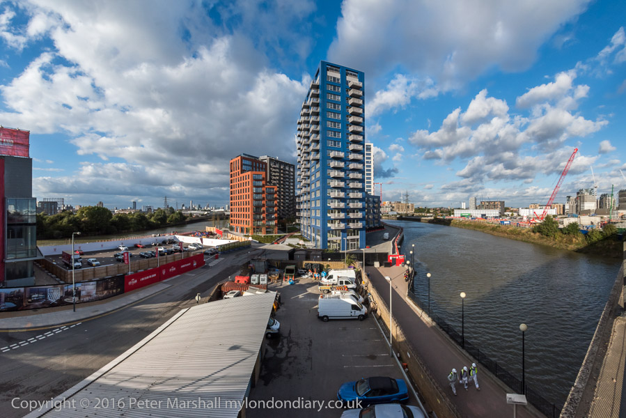
City Island is not quite an island
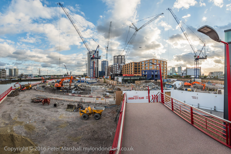
I walked over the Lower Lea Crossing, which provided a view of work which was now rapidly going ahead on ‘City Island’, where a loop in Bow Creek goes around what was previously the site of Pura Foods. This development had stalled with the financial crash in 2008 but was now in full swing.
From there I walked on along the elevated Silvertown Way, giving views of the surrounding area, before taking the DLR back to Canning Town, again taking advantage of a fairly clean train window on the ride.
Rather to my surprise, at Canning Town I found that the exist to the riverside walk was finally open. I think the walk here beside Bow Creek was constructed in the 1990s and I’d been waiting for around 20 years for this exit from the station to open and give access to it. I didn’t have as much time left as I would have liked but did make a few pictures.
For years there have been plans to create a walk from the path beside the Lea Navigation at Bromley-by-Bow to the Thames at Trinity Buoy Wharf, and the section as far as Cody Dock had opened a few years earlier – with the ridiculous name of ‘The Fatwalk’. It hasn’t really got any further yet, though at least it has been renamed as the ‘Leaway’.
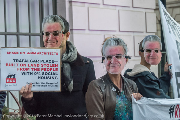
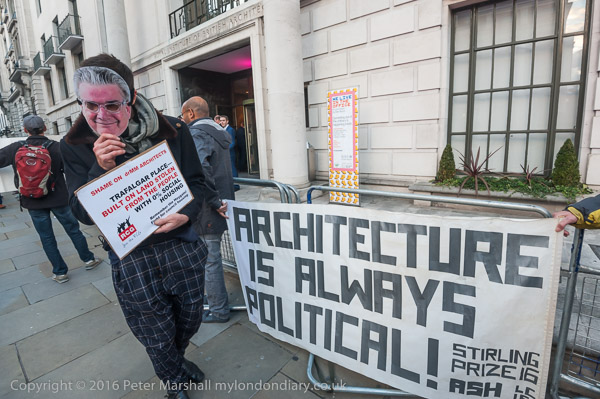
Many of the protesters wore masks showing RIBA President Elect Ben Derbyshire
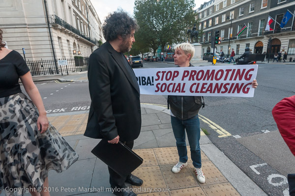
Architects for Social Housing (ASH) led a protest outside the Stirling Prize awards ceremony pointing out that one of the short-listed projects, Trafalgar Place, was built on the demolished Heygate Estate, which was ‘stolen from the people’ with hundreds of social housing tenants and leaseholders being evicted and the site sold at one tenth of its value to the developers.
‘Architecture is Always Political!’, a quote from Richard Rogers
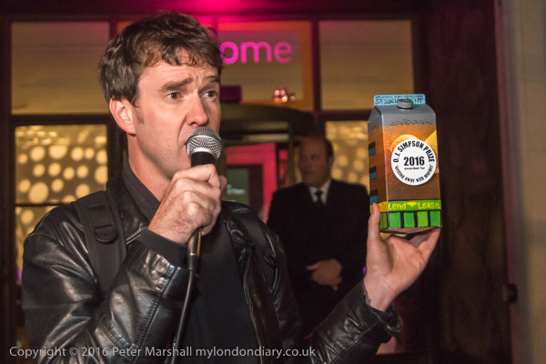
Together with other housing protesters than held their own awards ceremony on the pavement in front of the RIBA building, awarding the ‘O J Simpson Award for getting away with murder’ to drMM Architects for this project, the first phase of Lendlease’s £1.5 billion Elephant & Castle redevelopment. This will replace 1214 social housing homes with few or no affordable homes.
There were no other contestants for the Ben Derbyshire Foot In Mouth Award than RIBA President Elect Ben Derbyshire but there was a vote to select which of five of his totally ridiculous statements by him about social housing should be the winner.
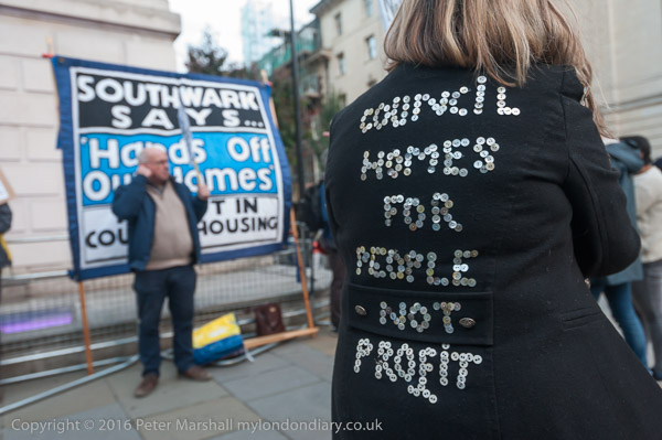
Among those at the protest were residents opposing the demolition of the Aylesbury estate, close to the Heygate, where Southwark Council are also demolishing social housing properties rather than carry out relatively low cost Aylesbury estate,that was voted for by the residents and could continue the useful life of these properties for many years.
Simon Elmer of ASH holds up the award for the ‘O J Simpson Award for getting away with murder’ awarded to drMM Architects and developers Lend Lease for Trafalgar Place
Estate demolition has a huge social and environmental cost and schemes like these in the borough of Southwark result in huge losses of social housing. But they provide expensive properties often sold largely to investors who will never live in them and large profits to the developers. Councils hope to share in these profits, but on the Heygate made huge losses, though some individuals involved have gained highly lucrative jobs.