Posts Tagged ‘East India’

More Around the Meridian – 1995 Colour – Part 3

Tuesday, January 21st, 2025

More around the Meridian – It’s seldom possible to actually walk for more than a few yards actually on the Greenwich Meridian in London and while planning my Meridian Walk I often wandered around considerably, having to make detours and also looking for the more interesting routes. So not all these images are exactly on the Meridian, but most were taken within a short distance from it.

Greenway, Abbey Lane, Abbey Rd, Stratford, Newham, 1995, 95p4-1151

When I began this project the Meridian was not marked on the Ordnance Survey or Street maps, and one of may first tasks was to get a ruler and pencil it on to them. In 1999 it was added to the OS maps of the area, but does not seem to be on the latest versions. In 1995 there were no smart phones with online maps and GPS which would have made things so much easier.

Greenway, Abbey Lane, Abbey Rd, Stratford, Newham, 1995, 95p4-1152

The Greenway was the recently rebranded path above the Northern Outfall Sewer which rans across East London from Hackney Wick to the sewage treatment plant at Beckton, going under the road here close the the bridge over Abbey Creek on the Channelsea River, where Abbey Lane becomes Abbey Road. You can see the bridge at the left of the picture.

Greenway, Channelsea River,  Stratford, Newham, 1995, 95p4-1153
Greenway, Channelsea River, Stratford, Newham, 1995, 95p4-1153

The Greenway is a great traffic-free cycle route for pedestrians and cyclists, running straight and level and this picture gives some evidence of that.

Channelsea River, Long Wall, Stratford, Newham, 1995, 95p4-1111

I’m not sure what this pipe was for, perhaps for taking gas across the river. Not far away on the other side of this tidal creek was one of the largest gas works in London – and you can still see its listed gasholders, though the view is likely to change soon with the site being redeveloped.

But behind me when I made this picture was the Abbey Mills sewage pumping station and on the edge of the creek below were the storm outfalls where sewage would be released after heavy rains. With the changing tides it would flow downstream a little and then could be taken miles upriver along the Prescott channel and the River Lea.

Gasholders, Leven Rd, Poplar, Tower Hamlets, 1995, 95p4-1332
Flats, East India Dock Rd, South Bromley, Tower Hamlets, 1995, 95p4-1321

I think the Meridian went through the centre of the taller gas holder at Poplar Gas works.

Flats, East India Dock Rd, South Bromley, Tower Hamlets, 1995, 95p4-1321

Another view with the gasholders in the background.

Clove Crescent, East India, DLR, South Bromley, Tower Hamlets, 1995, 95p4-1273

My pencilled line for the Meridian shows it going through both the water in the dock and the brick building at left which was the former Blackwall Power Station in both of these pictures.

Clove Crescent, East India DLR, South Bromley, Tower Hamlets, 1995, 95p4-1263

South of the East India Docks the line crosses the River Thames above and between the two bores of the Blackwall Tunnel, closer to the original western tunnel now used by northbound traffic. I couldn’t take photographs in the tunnel – though it was possible for those on foot to take a bus across, but these would have been rather boring in any case.

Blackwall Tunnel Entrance, Greenwich, 1995, 95p4-1672

This picture shows the southern entrance to the tunnel with its 1897 Grade II listed gatehouse by the London County Council’s Superintending Architect Thomas Blashill. In front of it a less ornate red and white striped arch with heigh and weight restriction signs and hangers to hit any overtall vehicles and hopefully prevent damage to the gatehouse.

Dorringtons, Blackwall Tunnel Southern Approach, Greenwich, 1995, 95p4-1551

One picture not I think actually on the Meridian but not far from it, taken from the long footbridge over the Blackwall Tunnel Southern Approach.

Riverside Path, Greenwich, 1995, 95p4-1762

My path continued south along the riverside path, with the Meridian going into the River Thames on the extreme left of this picture.

Riverside Path, Greenwich, 1995, 95p4-1742

I kept to the land continuing along a path I’ve walked many times and making a few more pictures.

Riverside Path, Greenwich, 1995, 95p4-1743

Like much of London’s riverside almost all of the industry has now gone, but some relics remain, though most of this part of my route is now lined by rather boring flats.

I rejoined the Meridian where it made landfall in Greenwich – where I made some of the pictures at the end of my earlier post.

More colour work from 1995 including some more panoramas in a later post.


FlickrFacebookMy London DiaryHull PhotosLea ValleyParis
London’s Industrial HeritageLondon Photos

All photographs on this page are copyright © Peter Marshall.
Contact me to buy prints or licence to reproduce.


Canary Wharf, East India, Silvertown, Beckton & Woolwich

Thursday, May 16th, 2024

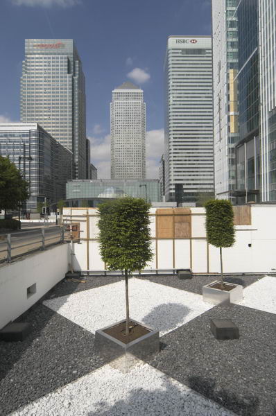
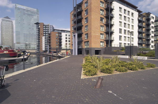
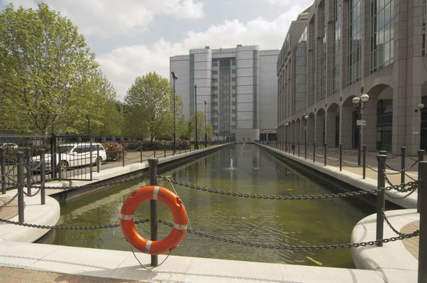
Canary Wharf, East India, Silvertown, Beckton & Woolwich: I was back in London’s docklands on 16th May 2004, a week after I had led a small workshop there, this time on my own, and rather than walking I had gone with my Brompton folding bike.

Canary Wharf, East India, Silvertown, Beckton & Woolwich

The Brompton is an ideal way to cover larger distances when taking photographs. It can be folded to go on public transport and is very easy to get on and off and park in little or no space. It folds and unfolds in seconds. It’s a lively ride with a short wheelbase and good for riding in traffic, though for longer rides I prefer my road bike.

Canary Wharf, East India, Silvertown, Beckton & Woolwich

The Brompton has some minor problems. They are not cheap – which delayed me buying one for years. It’s not built for off-road use and mine has mudguards that can clog and stop the wheel turning on muddy ground. And now I’m a bit older it is just a little heavy to carry for any distance in stations. But my main problem is that it is a thief magnet, dangerous to leave anywhere for any length of time even if you have a good lock. No bike lock can defy the well-equipped thief for more than around half a minute and it slips easily into a car boot and fetches a good price.

Canary Wharf, East India, Silvertown, Beckton & Woolwich


I’d hoped to get the Jubilee Line to Canning Town, but trains were only running as far as North Greenwich, so instead I got off at Canary Wharf before the train went under the Thames again. It was no problem as I had the bike.

Canary Wharf, East India, Silvertown, Beckton & Woolwich

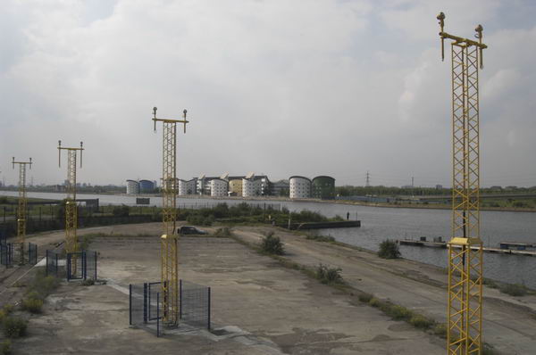
I took a few pictures around Canary Wharf, then rode off to the east past Blackwall Basin and on to the East India Docks probably the most boring of all the redeveloped docks.

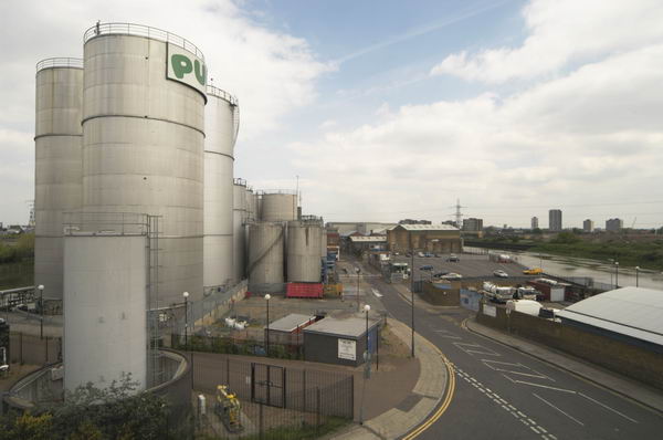
From there I went up on the Lower Lea Crossing, taking pictures of Pura Foods to the north and the view south across Trinity Buoy Wharf and the Thames towards the Millenium Dome.

I photographed the Dome again from Silvertown Way, as well as the works taking place for the DLR extension to London City Airport.

A big advantage of being on a bike is that you can wander around, and I went down to the Royal Victoria Dock, then back to Silvertown Way and Lyle Park, then back to Victoria Dock again.

I couldn’t resist going onto the high level bridge across the dock, though the lift wasn’t working and I was cursing the weight of the bike and cameras by the time I reached the top of the stairs.

Eventually after making rather a large number of pictures I forced myself to come down and continued my ride along the North Woolwich Road to the futuristic Barrier Point, its west front like some space city.

In Thames Barrier Park I went down to the riverside to photograph the barrier before continuing on to Silvertown, stopping a few times for more pictures. Near North Woolwich I sloweed to photograph two boys on a scooter being towed by a woman on a bicycle. I stopped take more pictures but later I met them in North Woolwich and they told me she had soon given up.

I took some more pictures in North Woolwich and then rode on to Beckton Retail Park, then turned around and went down Woolwich Manor Way across the Royal Albert and King George Docks.

Back in 2004 flights from London City Airport were fairly infrequent and I had quite a long rest waiting to photograph a plane going overhead.

I rode on to North Woolwich ferry pier where I had a wait for the ferry and took some more pictures. In 2004 I wrote that the Woolwich Ferry is “London’s best-value river trip. I wonder how much longer this free ferry will operate?” It was upgraded in 2018 with new, modern, low-emission boats which proved rather a disaster. Services had been severely reduced, working with only one of the two new boats.

But Transport for London a week ago in May 2024 restored the two-boat service and expanded operating hours. They say the service will continue as long as there is demand. A short ride took me to Woolwich Arsenal Station where I folded the Brompton for the journey home.


FlickrFacebookMy London DiaryHull PhotosLea ValleyParis
London’s Industrial HeritageLondon Photos

All photographs on this page are copyright © Peter Marshall.
Contact me to buy prints or licence to reproduce.