Guns & Knives, Pineapple, Orange & Thames: On Saturday 20th September 2008 after photographing a protest over gun and knife crime, a festival in Stockwell and being assaulted at an Orange March I went to Open House Day at Trinity Buoy Wharf and then crossed the river to walk along the riverside path from North Greenwich to Greenwich.
The Peoples March – Kennington Park
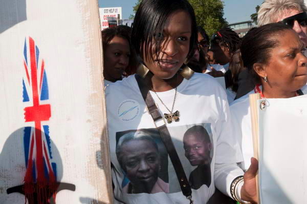
The Peoples March’ against gun and knife crime from Kennington Park was organised by the Damilola Taylor Trust and other organisations and supported by the Daily Mirror and Choice FM and came at the end of London Peace Week.

In 2007 there were 26 teenagers killed on the streets of London, and many of those on the march “were the families and friends of young people whose lives were ended prematurely by violent death, and the grief felt by many of those I photographed was impossible to miss. They were stricken and angry and demanding that something was done to stop the killing.”
These deaths continue. They peaked in 2021 when 30 were killed, but most years there have been around 20 such tragic deaths. Despite many marches such as this and projects such as the Violence Reduction Unit set up in 2019 by London Mayor Sadiq Khan these deaths continue.
Prime Minister Keir Starmer met with victims’ families just a few days after the election and earlier this month held a knife crime summit at Downing Street aimed at halving it over the next decade. Earlier in the year King Charles and actor Idris Elba hosted a mini-summit on knife crime at St James’s Palace in July. A ban on the sale and possession of zombie-style knives and machetes will come into force in 4 days time.

It remains to be seen if these initiatives will have any effect. Back in 2008 I commented that “Effective action would involve huge cultural shifts and a direction of change that would reverse much of what we have seen over the past 50 or so years” and unfortunately there still seems little chance of this happening.
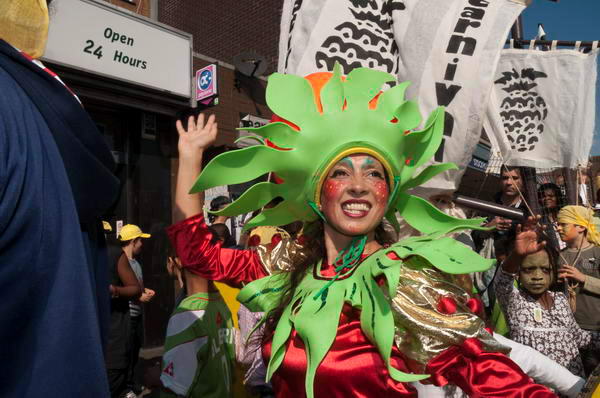
Stockwell Festival – Pineapple Parade
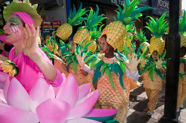
My spirits were lifted by seeing so many people taking part in the Pineapple Parade, part of the Stockwell Festival, clearly enjoying themselves taking part with others in the event. As I commented, “Community festivals such as this have an important role in building the kind of relationships that lead to healthy communities.”
John Tradescant the Elder (1577-1638) and his son John Tradescant the Younger (1608-1662) had their extensive nurseries a little up the road from where I was taking pictures and brought many exotic species to this country in the seventeenth century, and possibly pineapples were among them, although sources differ on this. Some pineapples were imported here in that era but apparently they were only cultivated here in heated greenhouses in the nineteenth century.
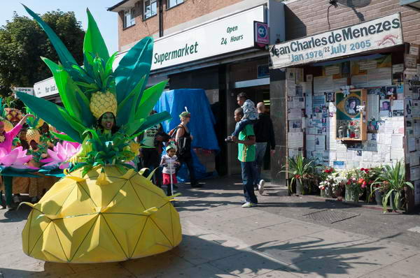
But as I wrote in 2008 “among the dancing and fancy dress I also found a reminder of violent death, Stockwell is probably best known for the brutal shooting by police of an innocent unarmed Brazilian man who had just boarded an underground train at Stockwell Station in 2005.”
More pictures Stockwell Festival – Pineapple Parade.
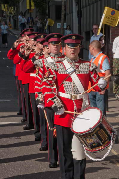
Apprentice Boys of Derry March – Temple
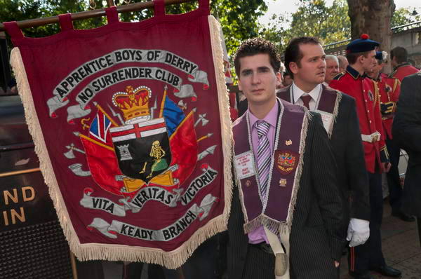
I shivered a little as I went down the escalator and boarded the tube on my way to Temple to photograph the Apprentice Boys of Derry March in which various Orange Order associations were taking part.
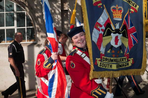
As you can see from my pictures, most of those taking part were proud to be there and happy to be photographed.
“But at one point I found myself being pushed backwards by a large man in dark glasses and instructed very fimly to leave. This kind of intimidation certainly isn’t acceptable and of course I continued to take pictures of the event. But it was a reminder of the darker side of Loyalist Ulster, which I hadn’t expected to see on the streets of London.”
More pictures on My London Diary at Apprentice Boys of Derry March.
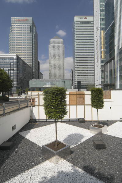
Open House at Container City – Trinity Buoy Wharf, Leamouth
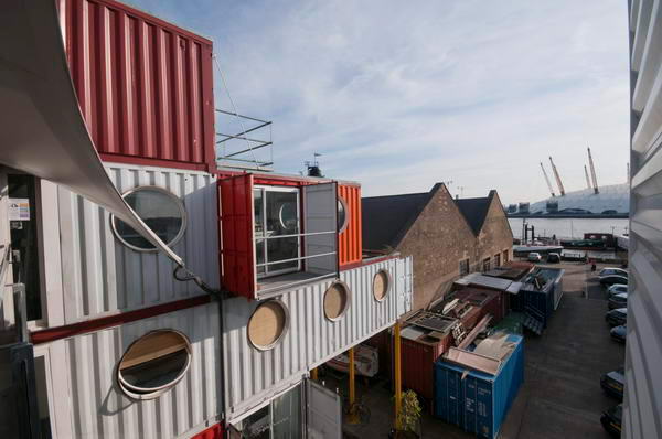
I took the tube to Canning Town and then walked down the long way to Trinity Buoy Wharf, cursing that the path beside Bow Creek and long-promised bridge had not been built. Part of the walkway is now open and an new bridge to the redeveloped Pura Foods site now provides more convenient access.
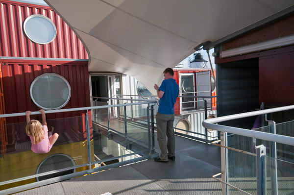
It was Open House Day in London and I took advantage of this to visit Trinity Buoy Wharf and the Container City there, a set of artists studios built using containers. Begun on the site in 2001, this had by then expanded considerably.
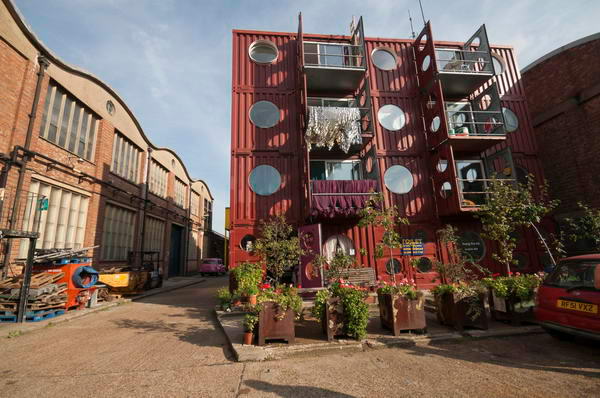
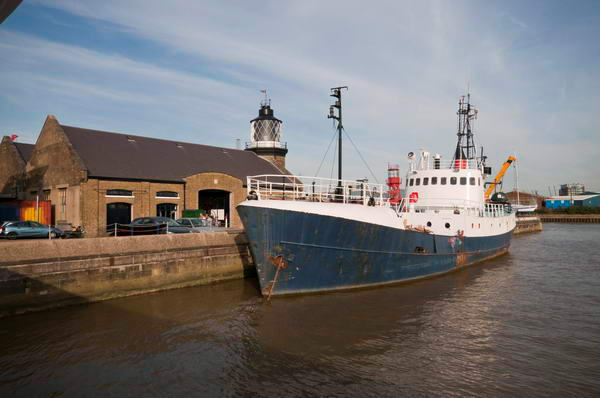
Trinity Buoy Wharf is open every day of the year except Christmas Day, but in 2008 as this year there were many extra activities for Open House. And at the end of 2023 the only complete Victorian steam ship in existence, the SS Robin has joined the collection of Heritage Vessels there, though tours for Open House on Sat 21st & Sun 22nd September 2024 are fully booked.
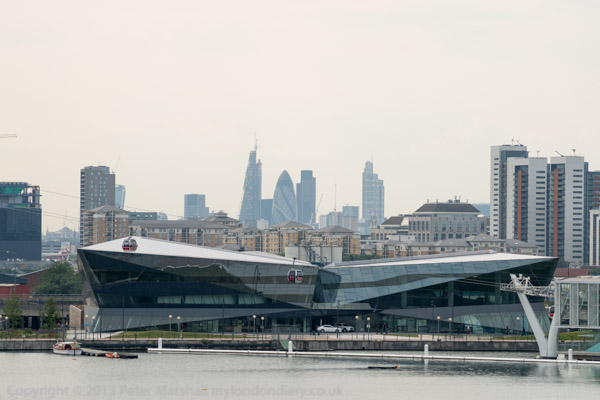
The containers were interesting but I think it was other aspects of the site and the view from it that interested me most, as well as the chance to take the specially laid-on ferry across the Thames to North Greenwich.
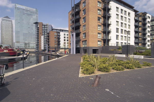
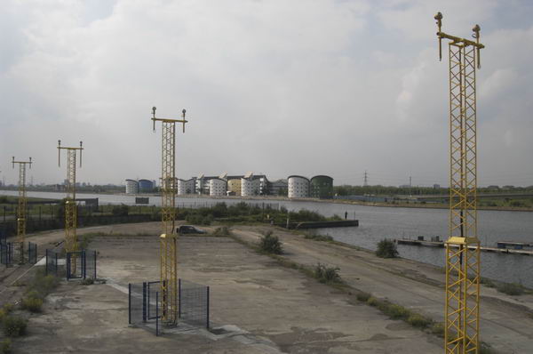
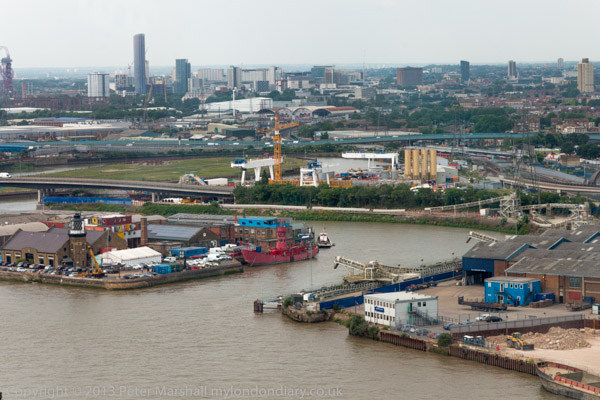
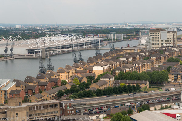
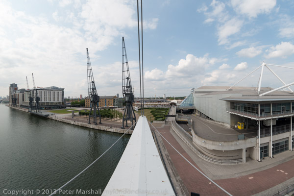
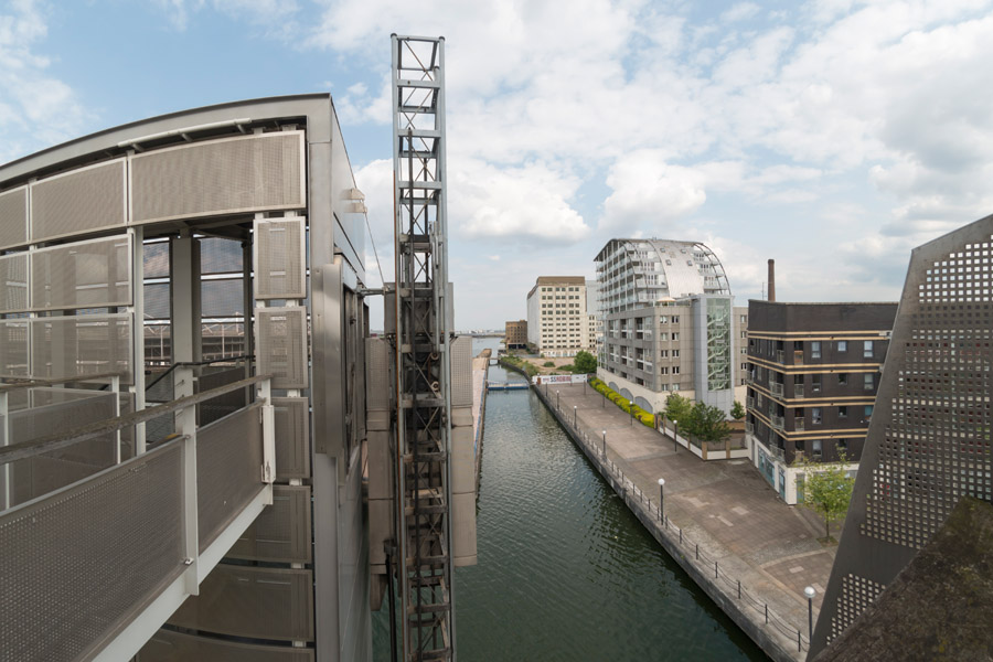
North Greenwich to Greenwich – Thames Path, Greenwich
The riverside walk is one I’ve done many times and its always of interest although the section at North Greenwich was only opened up in the 1990s and in more recent times parts of the walk have been blocked during the construction of some of the new blocks of riverside flats.
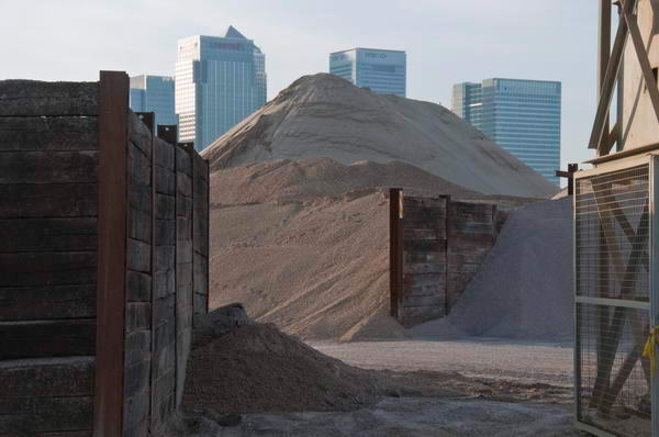
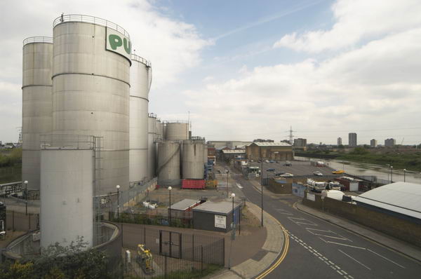
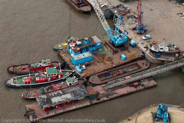
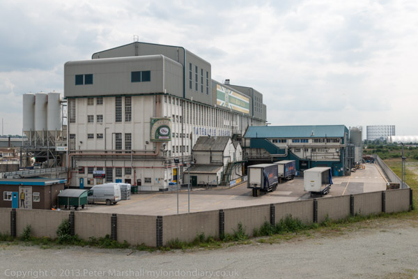
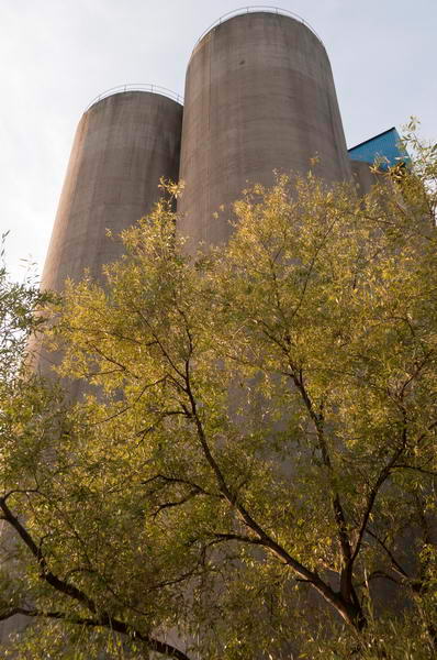
A large aggregate wharf remains although most of the riverside industry has gone, including the silos and the rest of the works at Morden Wharf. And only Enderby House remains of the site from which ships left to lay undersea cables across the world.
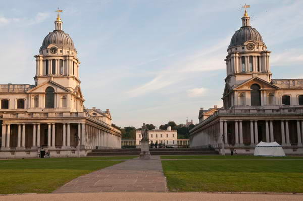
Greenwich of course retains its grand buildings, now a part of Greenwich University.
On My London Diary there are also some views across the river, both to buildings Canning Town, Leamouth, Canary Wharf and the Isle of Dogs. It’s a walk I’ve done several times since and might well do again, probably starting from North Greenwich Station. You can see pictures from a walk in 2018 on My London Diary. And there are still some good pubs when you reach Greenwich on your way to the buses or stations there.
More pictures from September 20th 2008 at North Greenwich to Greenwich.
Flickr – Facebook – My London Diary – Hull Photos – Lea Valley – Paris
London’s Industrial Heritage – London Photos
All photographs on this page are copyright © Peter Marshall.
Contact me to buy prints or licence to reproduce.