Posts Tagged ‘wharves’

Dangleway, Silvertown and Stratford Marsh

Sunday, June 26th, 2022

Dangleway, Silvertown and Stratford Marsh: My day out on Wednesday 26 June 2013 began by taking the tube to North Greenwich and then walking to the cablecar for the ride across the Thames.
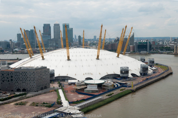
Back then I commented “Given the huge losses it is sustaining I can’t see it remaining open too much longer, so if you’ve not taken a ride don’t leave it too long“, and I’m surprised to find it still running 8 years later. But perhaps not for much longer, as the sponsorship deal with the Emirates Airline comes to an end this month, and no other company has come forward to pick up the tab, even though TfL have offered a huge reduction for the privilege.
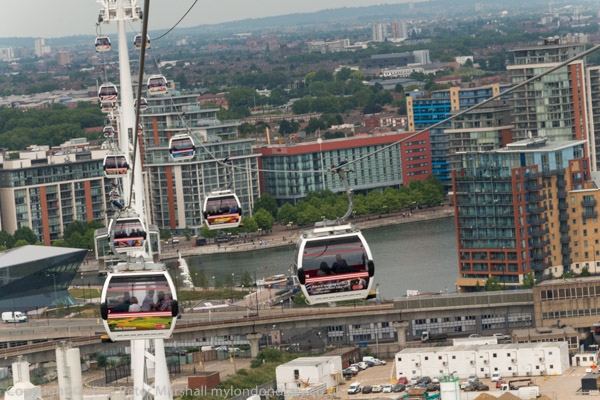
Never a sensible contribution to London’s travel network it remains one of London’s cheaper and more interesting tourist attractions. I’m not sure whether the fact that it now lands on the north bank spitting distance from London’s now misplaced County Hall adds to its chances of retention, but it could make it more likely to be brought within the normal London fare structures.
There are already fare reductions for people with Travelcards, and frequent users can buy a ticket which reduces the cost to make it a viable part of a commute to work, particularly as you can take a bike with you for free. However I suspect the number of ‘frequent fliers’ is probably only in two figures. Its also a service which is more affected by weather than surface transport, closing down in high winds.
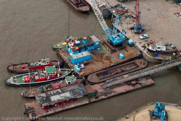
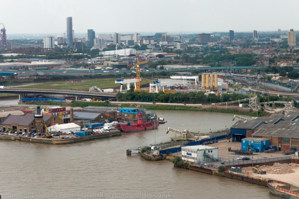
But it does have the height to give some splended views, even if the surrounding area is perhaps less rich than that of London’s other aerial attraction, the London Eye. Actually for me is considerably more attractive, and it’s an area which is now rapidly developing on both sides of the river, with new residential developments replacing old industrial and commercial uses.
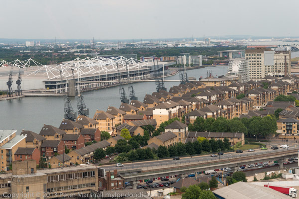
The dangleway is also a part of the East London sculpture trail, The Line, which vaguely follows the Greenwich Meridian, from North Greenwich to Stratford and makes an interesting walk, although this will become a more interesting walk once the riverside path from Cody Dock to the East India Dock Road is opened, something we have been waiting for around 20 years. One day it might even extend past Canning Town station to Trinity Buoy Wharf, but we may not live that long.
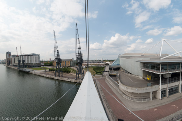
Although you can see the riverside from above, little of it is now publicly accessible, though I walked along Bow Creek and a little of the Thames here back in the 1980s taking photographs now on Flickr. But back then the Royal Victoria Dock was largely fenced off and you can now walk around it and over a high-level bridge which also has interesting views.
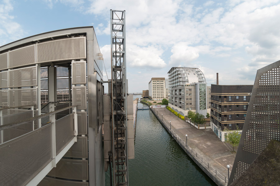
Or at least you can most of the time. But the area becomes a high security zone with the bridge closed when the Excel Centre is full of arms dealers selling often illegal arms to repressive regimes around the world – every other September. Fortunately it was June, though I was back there for the DSEI protests in September – and in other years.
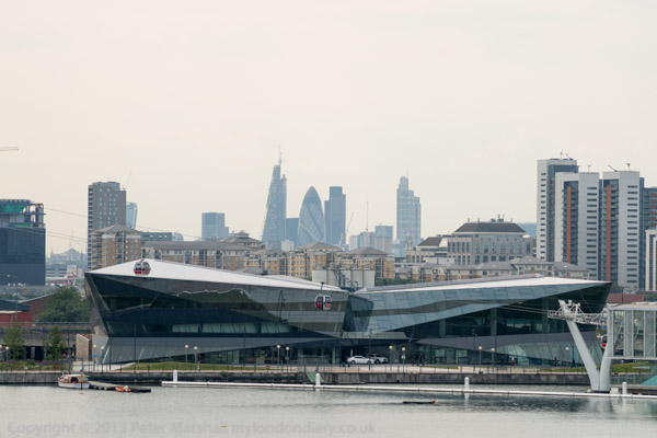
The DLR also runs through the area on a viaduct, and from the train and the stations you also get some interesting views, though the train windows are often rather to dirty for taking photographs. That you are looking south from the line can also mean the sun is shining directly into the lens.
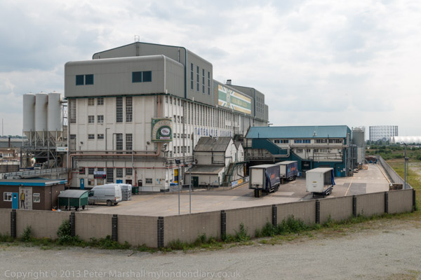
This is the Woolwich branch of the DLR and at Canary Wharf I changed onto a train towards Stratford, alighting at Pudding Mill Lane to walk up onto the Greenway. I arrived just too late to go into the View Tube there so I had to be content with making pictures from the Greenway which runs high through the area.
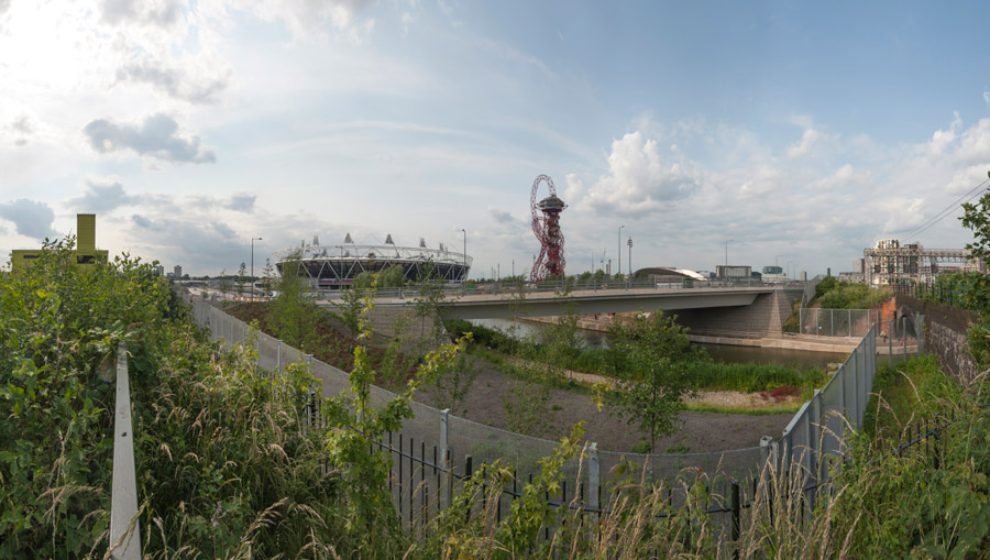
I’d begun making photogrfaphs here back in the 1980s, and had published some of these on my my River Lea/Lee Valley web site – and in the Blurb book ‘Before The Olympics‘, returning to the area occasionally and photographing it as it changed and particularly as the Olympic site developed. Progress on restoring the area to some useful purpose appeared to be very slow
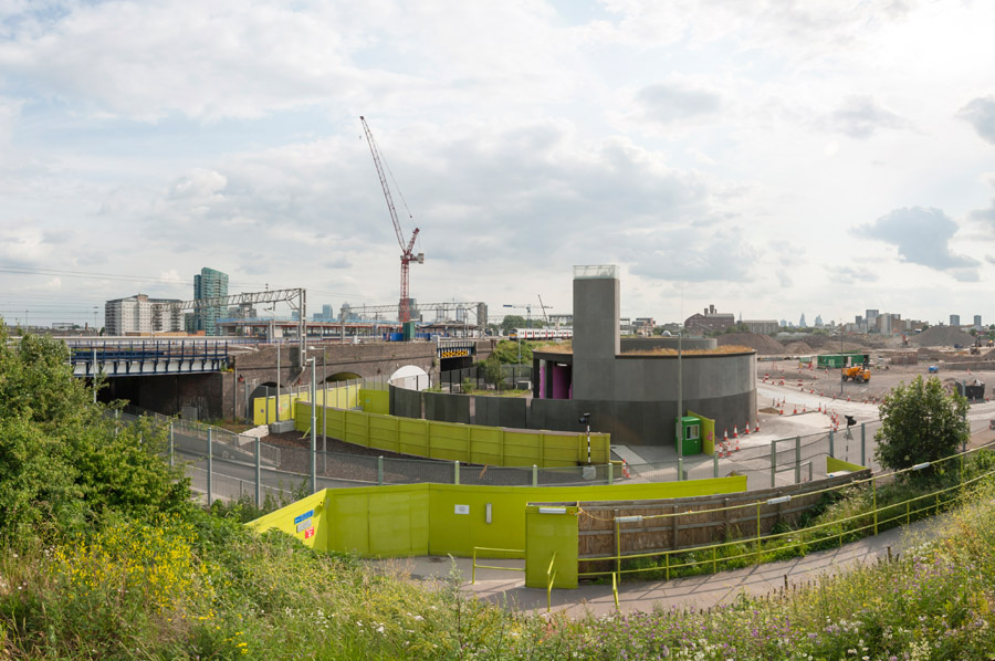
More on My London Diary where the pictures are also larger – though you can see these ones larger by opening the images in their own window.
Stratford Greenway Olympic Revisit
Victoria Dock and Silvertown
Emirates ‘Airline’ – Arab Dangleway


Thames, Rotherhithe & Wapping 1988

Thursday, June 23rd, 2022

From Southwark Park Schools which ended the previous post on this walk, Rotherhithe New Road & Southwark Park Schools, I walked a few yards up Southwark Park Road to the corner with Banyard Road, where I photographed the taxi office (still there but changed from A-Z Star Cars to 5 Star Cars) with the pub on the opposite corner, the Southwark Park Tavern, now closed and converted to residential around 2003.

There was a pub around here, the Green Man, possibly on this site before Southwark Park opened in 1869 but I think this building probably came shortly after the park was opened, and is opposite the Carriage Drive leading into the park.

Unfortunately I haven’t yet digitised this picture, nor one of rather plain two-storey terrace on Banyard Rd or an image showing a play area in the park. I hurried through the park to the Jamaica Road gate at its north, crossing to make my way to Kings Stairs Gardens and the River Thames.

River Thames, Downstream, Rotherhithe, Southwark, 1988 88-10l-63-Edit_2400
River Thames, Downstream, Rotherhithe, Southwark, 1988 88-10l-63

The two jetties visible here I think have now gone and there is certainly no line of lighters as in this picture, and there is one striking new building on the riverfront.

River Thames, Downstream, Rotherhithe, Southwark, 1988 88-10l-65-Edit_2400
River Thames, Downstream, Rotherhithe, Southwark, 1988 88-10l-65

A second picture taken with a short telephoto lens from almost exactly the same place shows the central area more clearly, with new flats being built on Rotherhithe St.

Wapping, River Thames, Rotherhithe, Southwark, 198888-10l-51-Edit_2400
Wapping, River Thames, Rotherhithe, Southwark, 198888-10l-51

Looking across the Thames downstream, with Free Trade Wharf at the extreme right and just to the left the cylinder ventilation shaft of the Rotherhithe tunnel in the King Edward Memorial Park. Both Metropolitan Wharf and New Crane Wharf are covered iwth scaffolding.

Wapping, River Thames, Rotherhithe, Southwark, 1988 88-10l-52-Edit_2400
Wapping, River Thames, Rotherhithe, Southwark, 1988 88-10l-52

Part of St John’s Wharf and King Henry’s Wharves seen across the River Thames.

Wapping, River Thames, Rotherhithe, Southwark, 198888-10l-53-Edit_2400
Wapping, River Thames, Rotherhithe, Southwark, 1988 88-10l-53

More of St John’s Wharf, including one of the earlier warehouse conversions and the Grade II listed Wapping Police Station, built 1907-10, Metropolitan Police architect John Dixon Butler. At extreme left is a part of Aberdeen Wharf built in 1843–4 by the Aberdeen Steam Navigation Company.

Wapping, River Thames, Rotherhithe, Southwark, 1988 88-10l-54-Edit_2400
Wapping, River Thames, Rotherhithe, Southwark, 1988 88-10l-54

The end of Aberdeen Wharf is at the right edge of this picture, and at its left the Wapping Police Boatyard, an unnecessarily ugly building opened in 1973. The new building in the centre of the picture also seems something of an eyesore, at least at its ends.

Wapping, River Thames, Rotherhithe, Southwark, 1988 88-10l-55-Edit_2400
Wapping, River Thames, Rotherhithe, Southwark, 1988 88-10l-55

Continuing up-river from the Police Boatyard are St Thomas Wharf, Pierhead Wharf, Oliver’s Wharf – the first warehouse in Wapping to be converted into luxury flats in 1972 – and Wapping Pierhead, with houses designed by Daniel Alexander in 1811 and the main entrance to London Docks.

Bermondsey, River Thames, Rotherhithe, Southwark, 1988 88-10l-41-Edit_2400
Bermondsey, River Thames, Rotherhithe, Southwark, 1988 88-10l-41

Looking upriver on the south bank with Tower Bridge at the extreme right and Guy’s Hospital tower just left of centre. Cherry Garden Pier is at left.

Silver Jubilee, marker, EIIR, River Thames, Rotherhithe, Southwark, 1988 88-10l-43-Edit_2400
Silver Jubilee, marker, EIIR, River Thames, Rotherhithe, Southwark, 1988 88-10l-43

There is still a marker for the Queen’s Silver Jubilee here but it looks far less impressive than this rugged stonework I photographed in 1988. London has also gained quite a few tall buildings, but the view along the river remains clear and you can still see the dome of St Paul’s Cathedral.

Braithwaite & Dean, Rotherhithe St, Rotherhithe, Southwark, 1988 88-10l-44-Edit_2400
Braithwaite & Dean, Rotherhithe St, Rotherhithe, Southwark, 1988 88-10l-44

41 Rotherhithe St, now apparently 1 Fulford St at least according to Google Maps, was the offices of lighterage company Braitwaite & Dean, where their lightermen would come to collect their weekly wage. Apparently it was known locally as the Leaning Tower of Rotherhithe, though the building’s lean is more apparent from across the river than in my picture.

It was left more or less alone on this stretch of the river with just the Angel pub equally isolated a few yards upriver after Bermondsey council bought many of the buildings in 1939 to create a park, with wartime bombing continuing the demolition job. There was some temporary housing by the river when I first walked along here in the early 1980s, but that soon disappeared.

My walk in Bermondsey continued – more about it in a later post.


Greenwich and Deptford Creek October 1988

Tuesday, May 17th, 2022

Caesars American Restaurant, Waterloo Rd, Lambeth, 1988 88-10e-55-Edit_2400
Caesars American Restaurant, Waterloo Rd, Lambeth, 1988 88-10e-55

I had spent several days wandering around Hackney in the previous months and decided it was time to go back south of the river and picked on Deptford for my next walk. I’d decided to get a train from Waterloo East to Greenwich as my starting point, but arrived in to Waterloo with some time to spare and walked briefly along Waterloo Road. You won’t find Caesars there now, its place taken by a vape shop and Tesco Express.

Norman Rd, Greenwich, 1988 88-10e-56-Edit_2400
Norman Rd, Greenwich, 1988 88-10e-56

I took the train to Greenwich Station and came out onto Norman Road which is on the east side of Deptford Creek. There are still some industrial sites here but the area to the north shown in my photograph now has tall blocks of flats both on the creek side (to the left of my picture) and on the right. There was no access to the Creek here.

Posters, Norman Rd, Greenwich, 1988 88-10e-41-Edit_2400
Posters, Norman Rd, Greenwich, 1988 88-10e-41

The area around Deptford Creek now has many artists studios, but back in 1988 I wasn’t expecting to see this kind of display in the area, and it wasn’t at all clear whether this was a result of fly-posting followed by vandalism or art, though I inclined to the latter. It certainly had become art by the time I photographed it.

Deptford Creek, Creek Rd, Deptford, Greenwich, 1988 88-10e-44-Edit_2400
Deptford Creek, Creek Rd, Deptford, Greenwich, 1988 88-10e-44

Finally on Creek Road I was able to see the creek itself, looking across to Deptford from the Greenwich end of the bridge. In the distance is the spire of St Paul’s Deptford. Tall blocks built around 2017 on Copperas Street now block that view.

Deptford Creek, Creek Rd, Deptford, Greenwich, 1988 88-10e-45-Edit_2400
Deptford Creek, Creek Rd, Deptford, Greenwich, 1988 88-10e-45

Walking across the bridge gave me this view of the Deptford side. Creek Road Bridge is a lifting bridge and in 1988 often caused severe traffic delays in the area when lifted at high tides to allow vessels to pass. I think bridge lifts are now rare, though at least until recent years they were still occasionally needed to allow vessels carrying aggregate to berth at Brewery Wharf just below the bridge on the Greenwich side.

In the distance you can see the Deptford Creek Railway Bridge which was also a lifting bridge, though of very different design. I understand this is now welded in place and incapable of lifting.

Deptford Creek, Creek Rd, Deptford, Greenwich, 1988 88-10e-46-Edit_2400
Deptford Creek, Creek Rd, Deptford, Greenwich, 1988 88-10e-46

Although Deptford Creek forms the boundary between Deptford (in the London Borough of Lewisham) and Greenwich for much of its length, the area around its mouth from a little south of Creek Road as far west as Watergate Street in Deptford is in the London Borough of Greenwich, including the whole now former site of Deptford Power Station. Both sides of the Creek were industrial in 1988, though the last of the three power stations had ceased operation in 1983, and it was spectacularly demolished in 1992. The first station, designed by Sebastian de Ferranti and opened in 1889 was the world’s first ‘central’ power station, operating at high voltage and on an unprecedented scale and closed in the 1960s.

Deptford Creek, Creek Rd, Deptford, Greenwich, 1988 88-10e-32-Edit_2400
Deptford Creek, Creek Rd, Deptford, Greenwich, 1988 88-10e-32

Much of the Deptford side of the Creek north of Creek Road was occupied by scrap metal dealers and in 1988 this brick building at Crown Wharf was the offices of London Iron & Steel Limited.

Deptford Creek, Creek Rd, Deptford, Greenwich, 1988 88-10e-33-Edit_2400
Deptford Creek, Creek Rd, Deptford, Greenwich, 1988 88-10e-33

The Creek turns west after going under Creek Road, then around to the north to enter the RIver Thames. There is a large pile of scrap on the wharf in front of the disused power station and Turbulence, a general cargo vessel, 1426 tons gross built in Selby, Yorkshire in 1983 is moored there. Large heaps of sand and gravel are at an aggregate works on the Greenwich bank, though previously there had been a gas works here.

Today the scene is entirely different, with large residential developments on both sides of the Creek, at Millennium Quay on the west and New Capital Quay on the east. A new footbridge joining the two across the mouth of the Creek was opened in 2015. This is a swing bridge which also occasionally has to be opened to let vessels pass at high tide.

My walk continues in a later post.