Posts Tagged ‘Wapping’

Thames, Rotherhithe & Wapping 1988

Thursday, June 23rd, 2022

From Southwark Park Schools which ended the previous post on this walk, Rotherhithe New Road & Southwark Park Schools, I walked a few yards up Southwark Park Road to the corner with Banyard Road, where I photographed the taxi office (still there but changed from A-Z Star Cars to 5 Star Cars) with the pub on the opposite corner, the Southwark Park Tavern, now closed and converted to residential around 2003.

There was a pub around here, the Green Man, possibly on this site before Southwark Park opened in 1869 but I think this building probably came shortly after the park was opened, and is opposite the Carriage Drive leading into the park.

Unfortunately I haven’t yet digitised this picture, nor one of rather plain two-storey terrace on Banyard Rd or an image showing a play area in the park. I hurried through the park to the Jamaica Road gate at its north, crossing to make my way to Kings Stairs Gardens and the River Thames.

River Thames, Downstream, Rotherhithe, Southwark, 1988 88-10l-63-Edit_2400
River Thames, Downstream, Rotherhithe, Southwark, 1988 88-10l-63

The two jetties visible here I think have now gone and there is certainly no line of lighters as in this picture, and there is one striking new building on the riverfront.

River Thames, Downstream, Rotherhithe, Southwark, 1988 88-10l-65-Edit_2400
River Thames, Downstream, Rotherhithe, Southwark, 1988 88-10l-65

A second picture taken with a short telephoto lens from almost exactly the same place shows the central area more clearly, with new flats being built on Rotherhithe St.

Wapping, River Thames, Rotherhithe, Southwark, 198888-10l-51-Edit_2400
Wapping, River Thames, Rotherhithe, Southwark, 198888-10l-51

Looking across the Thames downstream, with Free Trade Wharf at the extreme right and just to the left the cylinder ventilation shaft of the Rotherhithe tunnel in the King Edward Memorial Park. Both Metropolitan Wharf and New Crane Wharf are covered iwth scaffolding.

Wapping, River Thames, Rotherhithe, Southwark, 1988 88-10l-52-Edit_2400
Wapping, River Thames, Rotherhithe, Southwark, 1988 88-10l-52

Part of St John’s Wharf and King Henry’s Wharves seen across the River Thames.

Wapping, River Thames, Rotherhithe, Southwark, 198888-10l-53-Edit_2400
Wapping, River Thames, Rotherhithe, Southwark, 1988 88-10l-53

More of St John’s Wharf, including one of the earlier warehouse conversions and the Grade II listed Wapping Police Station, built 1907-10, Metropolitan Police architect John Dixon Butler. At extreme left is a part of Aberdeen Wharf built in 1843–4 by the Aberdeen Steam Navigation Company.

Wapping, River Thames, Rotherhithe, Southwark, 1988 88-10l-54-Edit_2400
Wapping, River Thames, Rotherhithe, Southwark, 1988 88-10l-54

The end of Aberdeen Wharf is at the right edge of this picture, and at its left the Wapping Police Boatyard, an unnecessarily ugly building opened in 1973. The new building in the centre of the picture also seems something of an eyesore, at least at its ends.

Wapping, River Thames, Rotherhithe, Southwark, 1988 88-10l-55-Edit_2400
Wapping, River Thames, Rotherhithe, Southwark, 1988 88-10l-55

Continuing up-river from the Police Boatyard are St Thomas Wharf, Pierhead Wharf, Oliver’s Wharf – the first warehouse in Wapping to be converted into luxury flats in 1972 – and Wapping Pierhead, with houses designed by Daniel Alexander in 1811 and the main entrance to London Docks.

Bermondsey, River Thames, Rotherhithe, Southwark, 1988 88-10l-41-Edit_2400
Bermondsey, River Thames, Rotherhithe, Southwark, 1988 88-10l-41

Looking upriver on the south bank with Tower Bridge at the extreme right and Guy’s Hospital tower just left of centre. Cherry Garden Pier is at left.

Silver Jubilee, marker, EIIR, River Thames, Rotherhithe, Southwark, 1988 88-10l-43-Edit_2400
Silver Jubilee, marker, EIIR, River Thames, Rotherhithe, Southwark, 1988 88-10l-43

There is still a marker for the Queen’s Silver Jubilee here but it looks far less impressive than this rugged stonework I photographed in 1988. London has also gained quite a few tall buildings, but the view along the river remains clear and you can still see the dome of St Paul’s Cathedral.

Braithwaite & Dean, Rotherhithe St, Rotherhithe, Southwark, 1988 88-10l-44-Edit_2400
Braithwaite & Dean, Rotherhithe St, Rotherhithe, Southwark, 1988 88-10l-44

41 Rotherhithe St, now apparently 1 Fulford St at least according to Google Maps, was the offices of lighterage company Braitwaite & Dean, where their lightermen would come to collect their weekly wage. Apparently it was known locally as the Leaning Tower of Rotherhithe, though the building’s lean is more apparent from across the river than in my picture.

It was left more or less alone on this stretch of the river with just the Angel pub equally isolated a few yards upriver after Bermondsey council bought many of the buildings in 1939 to create a park, with wartime bombing continuing the demolition job. There was some temporary housing by the river when I first walked along here in the early 1980s, but that soon disappeared.

My walk in Bermondsey continued – more about it in a later post.


Spitalfields & Wapping 1987

Sunday, October 18th, 2020
Spitalfields 87-7m-12-positive_2400
Interior, Christ Church, Commercial St, Spitalfields, Tower Hamlets, 1987

I think I had gone to Liverpool St to see off some visitors from Germany who had been staying with us and we arrived at the station long before their train was due to leave for Harwich, so I took them to see Christ Chruch, which was then in the middle of building works. The air was rather dusty and the light a little dim, but the structure was still impressive, and we were greeted by one of the clergy who gave us a short conducted tour.

Christ Church, Commercial St,  Spitalfields, Tower Hamlets, 198787-7m-22-positive_2400

One of Nicholas Hawksmoor’s great pentagram of London churches much celebrated in the writings of Iain Sinclair, Peter Ackroyd and others it is a building I find more satisfying seen close too and at and angle as in this picture than in more prosaic and distant views.

Peach, Fashion, Commercial St,  Spitalfields, Tower Hamlets, 1987 87-7m-21-positive_2400

Close to the church in Commercial Rd was this builidng, housing Peach and several other fashoion and clothing firms as well as The Colour Assembly litho printers. But I didn’t have long to take pictures as our visitors had a train to catch and we made our way back to Liverpool Street.

St Katharine's Way, Wapping, Tower Hamlets, 1987 87-7n-23-positive_2400
St Katharine’s Way, Wapping, Tower Hamlets, 1987

Afterwards I walked down to St Katherine’s Way, where some of the old warehouse buildings were being gutted and turned into flats, while keeping the basic facades. Miller’s Wharf dates from 1865, but once beyond the front wall is mostly from 1989. A 2 bed flat with a river view is currently for sale at £1.6m should you be looking to move.

Tower Bridge, River Thames, Thames Path, Wapping, Tower Hamlets, 1987 87-7n-36-positive_2400
Tower Bridge, River Thames, Thames Path, Wapping, Tower Hamlets, 1987

Just a few yards east is a part of the Thames Path from which you can get similar views (though only at ground level) without the huge price tag. Somewhere around this time I went with a group walking along the north bank of the river with the person from Tower Hamlets responsible for footpaths and we found then a number of places where there was supposed to be public access to the river had their gates locked. More recently when I’ve walked along here I think I have been able to access most or all of them.

River Thames,  Rotherhithe, Wapping New Stairs,Wapping, Tower Hamlets, 1987 87-7n-31-positive_2400

I think this picture, which has police launches moored in the foreground is taken from Wapping New Stairs – which are of course very old.

Discovery Walk, Wapping Lane,  Wapping, Tower Hamlets, 1987  87-7n-53-positive_2400

Little remains of the old London Docks, with new housing covering much of the area, here alongside the ornamental canal which I think includes some sections of the old dock wall. I took two pictures from the road overlooking the canal, one concentrating on the south and the other the north side.

Ornamental canal, News International, Print Works, Wapping, Tower Hamlets, 1987 87-7n-55-positive_2400

The two pictures actually overlap and can be joined to make a narrow panorama, though I don’t think I particular intended this when I took them.

The right of the picture is dominated by the large Wapping printing works of News International, the site of a protests for over a year from 1986-7 by the print unions against Murdoch. The strike ended in what seemed an inevitable defeat for the unions who were trying to prevent the introduction of new technology, moving away from the hot metal of Fleet St which employed several thousand type setters to litho printing which allowed journalists to directly input there stories.

More pictures on page 6 of 1987 London Photos.


All photographs on this and my other sites, unless otherwise stated, are taken by and copyright of Peter Marshall, and are available for reproduction or can be bought as prints.


1986 Page 8

Thursday, June 4th, 2020

Page 8 of my album 1986 London Photographs begins with pictures from Wapping in August 1986.

Wapping High St, Wapping, Tower Hamlets  86-8t-55-Edit_2400

I photographed some slogans in Russian on fences – left I understand from the making of a film, supposedly set in Russia, but actually filmed here.

Wapping High St, Wapping, Tower Hamlets 86-8t-54-Edit_2400

Wapping High Street never failed to interest me back then, though it has now lost a great deal of the old atmosphere. The doorway at the right of this picture now leads to the Captain Kidd pub, converted from an old warehouse which used to store various goods including coffee, edible gums, dried fruit and wool from Australia. Sam Smith’s have done some excellent conversions of a number of historic properties and this is now a pleasant place to sit on a terrace overlooking the river and enjoy a pint of Old Brewery Bitter in a pub blessedly without TV or canned music.

Hays Wharf, Tower Bridge, Bermondsey, Southwark 86-8u-61-Edit_2400

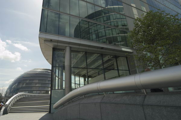
After making some pictures there I walked back to Tower Bridge and crossed it to wander around a little of Bermondsey and Southwark as I made my way back to Waterloo station. The view towards Guy’s Hospital from Tower Bridge is rather different now, with City Hall and More London almost hiding the hospital tower and a wide walkway along the river bank.

Gainsford St, Bermondsey, Southwark 86-8u-54-Edit_2400

As in Wapping, many of these pictures south of the river show evidence of the great deal of building work then taking place, with many buildings being reduced to street-facing facades. For many buildings keeping the facades is probably the only possible way – if done sympathetically – of retaining some of the atmosphere of the areas, though when done badly a complete modern replacement would be preferable; not all buildings deserve to be kept. Mostly I avoided people in making these pictures, but some were desperate to be photographed.

Southern 777, Steam Engine, Cannon St Station, City 86-8v-65-Edit_2400

Another day in August I went with my two young sons, both keen railway enthusiasts and members of a British Rail kids group ‘Railriders’ to an event taking place at Cannon St station, with vintage Southern Railway electric trains and a steam engine.

Skin Market Place, Southwark 86-8w-01-Edit_2400

The trains didn’t greatly interest me, but I took a few pictures before we left and went over Southwark Bridge for a walk around Southwark, again on our way to Waterloo. Bankside Power Station is now Tate Modern, but I think Skin Market Place and its council depot has disappeared without trace.

100 pictures at 1986 London Photographs Page 8


All photographs on this and my other sites, unless otherwise stated, are taken by and copyright of Peter Marshall, and are available for reproduction or can be bought as prints.


City, Whitechapel and Wapping 1986

Sunday, May 31st, 2020

Page 7 of my black and white work in 1986 London Photos begins in the City but then gravitates east to Aldgate, Whitechapel and Wapping.

Holborn Viaduct, Farringdon St, West Smithfield, City  86-7v-12_2400

Holborn Viaduct which carries the road over the Fleet valley – Farringdon St – is a remarkable piece of Victoriana, and a considerable feat of engineering at the time as well as well as a remarkable example of city planning. The scheme, which included the buildings at the four corners of the bridge as well as roads around including Holborn Circus, streets leading to Smithfield Market, as well as provision for gas, water, sewage and other services cost around £2 million in 1863-69 and has been described as “the most ambitious and costly improvement scheme of the [nineteenth] century” and as the world’s first flyover. You can read a detailed account of it at The Victorian Web.

What interested me most were the sculptures which adorn the bridge and I’ve photographed them on various occasions over the years. In 1986 I could only bring myself to stop taking pictures when I came to the end of a cassette of film and also photographed the bridge from below and the corner buildings. I’ve only put two of the 18 frames I took onto Flickr.

Smithfield Market, City 86-8r-45-Edit_2400

There are a number of pictures from the area around Smithfield Market, though I’ve never got up early enough to photograph the market truly in progress – and other photographers have done so pretty well so I didn’t feel I needed to make the effort.

Albion Buildings, Little Britain, City 86-8r-64-Edit_2400

Little Britain remains a fascinating street though now I think only the facades remain and the area behind has been destroyed. I came across it a little too late when demolition of much of it was already underway and by 1986 I think it was well advanced. These properties in Albion Place, for Overbury & Sons Limited at 7 and 8 and John Lovegrove & Co Ltd at 6 had long been closed.

Hessel St, Whitechapel, Tower Hamlets 86-8s-55-Edit_2400

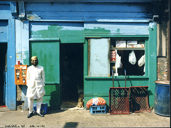
Hessel St in Whitechapel was a remarkable street full of old shops, some now junk shops, others Bangladeshi grocers but with some still retaining the names and descriptions of their earlier Jewish shops. As well as these black and white picture I also photographed some of the shops in colour.

These pictures were made in August 1986 and I returned some time later hoping to take more but I think then most of the street had disappeared.

Prescot St, Aldgate, Tower Hamlets 86-8s-61-Edit_2400
Prescot St, Aldgate, Tower Hamlets 86-8s-64-Edit_2400

Prescott Street now looks a little different, though a number of the older buildings have survived, including a fine pub. But most are now in very different uses and in rather better condition than when I took these pictures in 1986.

Discovery Walk, Wapping Lane, Wapping, Tower Hamlets Discovery Walk, Wapping Lane, Wapping, Tower Hamlets 86-8s-23-Edit_2400

My street map describes this as ‘Ornamental Canal’ and I think that the redevelopment of the London Docks in Wapping is perhaps the least successful of all docklands redevelopment in retaining any real impression of the former dock with the exception of just a small area at its southwest and Shadwell New Basin. Wapping outside the dock area has fared a little better too, though it is sometimes only skin deep.

Page 7 1986 London Photos.


All photographs on this and my other sites, unless otherwise stated, are taken by and copyright of Peter Marshall, and are available for reproduction or can be bought as prints.


More from Page 5

Wednesday, May 27th, 2020

The previous post Page 5 of my London 1986 pictures looked at some from Hoxton and Islington and there were many more in the album that in my post, including a number form Shoreditch. Later in July I returned to Wapping, Shadwell, Limehouse and the West India Docks with a few other images from Greenwich, Finsbury and the City.

New Crane Wharf, Wapping, Tower Hamlets 86-7i-23_2400
New Crane Wharf, Wapping
Gun Wharves, Wapping,  Tower Hamlets 86-7i-32
Gun Wharves, Wapping
Rotherhithe from Wapping, Tower Hamlets v 86-7i-35_2400
Rotherhithe from Wapping
Limehouse Dock entrance, Limehouse, Tower Hamlets 86-7j-46_2400
Limehouse Dock entrance
Limehouse Dock, Limehouse Cut, Limehouse, Tower Hamlets 86-7j-51_2400
Limehouse Dock
West India Dock, Isle of Dogs, Tower Hamlets  86-7k-65_2400
West India Docks

These are just a few of my favourite pictures from the 100 on page 5 of my Flickr album of pictures I made in London in 1986. Clicking on any image will take you to a larger version on Flickr.


All photographs on this and my other sites, unless otherwise stated, are taken by and copyright of Peter Marshall, and are available for reproduction or can be bought as prints.


Back to 1986: Page 4

Wednesday, May 20th, 2020
Broadway Bakeries, Brougham Rd, Benjamin Close, Broadway Market, Hackney 86-6m-35_2400
Borough Market

Returning to my London pictures for 1986, and to page 4 of my Flickr album 1986 London Photographs.

The Oval, Bethnal Green, Tower Hamlets 86-6m-65_2400
The Oval, Bethnal Green

1986 was the year I began to photograph London in depth, and the album reflects this, with 1370 black and white photographs, a fraction of the number I took that year. The hundred on page 4 are from the boroughs of Hackney and Tower Hamlets and include pictures from Dalston, Shoreditch, Hackney, Bethnal Green, Wapping, Shadwell, Limehouse, Whitechapel and other parts east of the city. There is just the odd image from elsewhere in London.

War Memorial, Cyprus St, Bethnal Green, Tower Hamlets 86-6o-31_2400
Cyprus St, Bethnal Green

Unlike in some earlier years the routes for my walks around the area were carefully planned, with research from a number of published sources, though information was much less readily available than now before the days of the world wide web. Of course I didn’t always stick to my planned routes, but I did carry a notebook to write down where I actually went and even sometimes some details of what I was photographing.

Hessel St, Whitechapel, Tower Hamlets
Hessel St, Whitechapel

One of my major resources was of course maps, both new and old, not just for the streets but also for the other information included on them. Some marked industrial areas in brown, most showed churches and public buildings and some gave names of various features. The invaluable series of reprints of old 1:2500 OS maps was begun by Alan Godfrey in 1983, but few were available in 1986. I now have a very large collection.

Kingsland Basin, Regent's Canal, Hackney 86-7c-26_2400
Kingsland Basin

My aim was to not to walk along every street (as the woman who produced the London A-Z was sometimes said to have done) but at least to look down nearly all of them, and to photograph all buildings of interest as well as other things I found on my journeys. Later when I had bought a scanner I produced enlarged versions of the A-Z pages, printing them on a black and white laser printer and used highlighter pen after I came home to mark where I had walked. These both showed me any areas I had missed and helped me, together with the notebooks, to mark on the contact sheets where the pictures were taken.

Nuttal St, Hackney 86-7c-36_2400
Nuttal St, Hackney

I mostly travelled by train or underground so often several walks started from a particular station, and perhaps along the same streets close to them. There were also some areas that particularly interested me, either for simple visual reasons or because they were obviously changing, to which I returned.

I’ve posted some of the pictures on this page previously on >Re:PHOTO and I’ve tried to find others to put on this post. You can see all of the pictures – 100 on page 4 – on Flickr – where you can view them larger than on here – by clicking on the link or the image below.

Russia Lane, Bethnal Green, Tower Hamlets 86-6l-66_2400

All photographs on this and my other sites, unless otherwise stated, are taken by and copyright of Peter Marshall, and are available for reproduction or can be bought as prints.


A Slice of London

Friday, April 3rd, 2020

What do the following have in common?

Crystal Palace
Peckham Rye
Bermondsey
Wapping
Whitechapel
Bethnal Green
Hackney

ANSWER

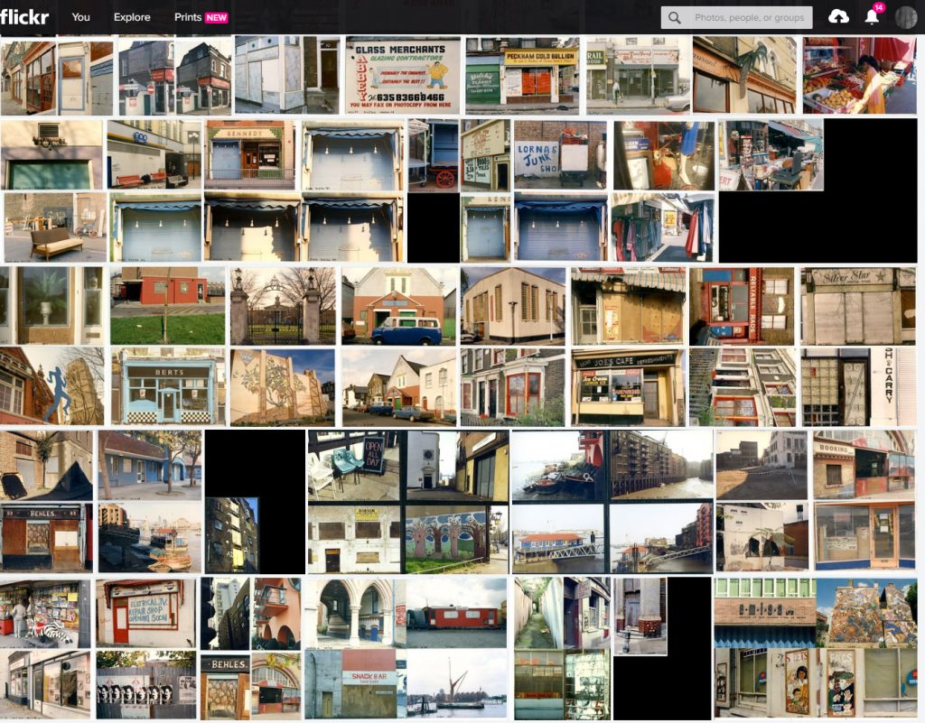
They all fall on the National Grid in the vertical column TQ34, and there are more pictures from all of them in the albums of colour enprints I put together from 1986 to 1992 as a project with the rather tentative title ‘Cross-section’. TQ34 is just one km wide and I have a row of A4 files covering around 20 such columns across the city, though those at the outer edges have fewer images.

The roughly A4 album pages could each hold four 6″ x 4″ enprints. I started by gluing the prints in place on scrap cartridge paper (unused from A level Art exams and cut down to size) but though that worked well it became tedious, and I moved on to purpose-designed plastic filing sheets, at first transparent and later black.

I tried at first to keep all four prints on any page either landscape or portrait format and from the same kilometre grid square, but as you will see on Flickr there are a few exceptions. The album TQ34 includes just over 70 pages and is shown on Flickr as in the album with most images having four prints.

These enprints were all trade processed and I sent the films off to various cheap consumer labs. The different colour casts they produced for each roll of 35mm film I felt added to the project, and I accepted some packets of pictures where I really should have demanded a reprint. A few of the worst I have done a little colour correction before posting online.

I finished – or rather abandoned – this project around 1992 when I installed a print processing line in my own darkroom and going over to bulk loading and home processing of my colour negative film. Producing enprints was too slow and fiddly, but I was able to make larger prints, and a small selection of these images where exhibited and sold over the years.

We are all stuck inside but you can take a virtual walk through London with me on Flickr.

July 1986 on Flickr

Wednesday, April 1st, 2020
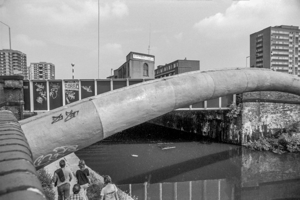
Pipe Bridge, Regent’s Canal, Baring St, Islington

I had more time to take pictures in July as my teaching came to an end for the summer vacation around halfway through the month. This meant I could go up to London on some weekdays, though I still had two small boys to look after on days my wife was working. That usually meant staying at home, but sometimes I took them both out with me to London.

Regent’s Canal

I spent some time in Shadwell and Bethnal Green, but also further north in Shoreditch, Hoxton and Dalston, occasionally wandering into Islington. Though I obviously photographed on foot, I had to travel from my home outside London and then around London to the starting point for my walks, and the One Day Capitalcard, valid on all public transport in London after 9.30am made this much simpler after its introduction in June 1986 – the one-day Travelcard launched in 1984 had been for bus and tube only.

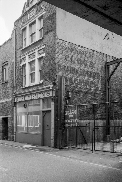
The Mission, Holywell Lane, Shoreditch, Hackney

Towards the end of the month I moved my focus to the City of London, even easier for transport then as the Waterloo and City line was still run by British Rail and my ‘London Terminals’ ticket was valid all the way to Bank.

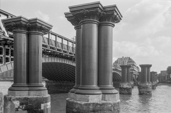
Blackfriars Rail Bridges

When I began photographing London there were two railway bridges across the River Thames at Blackfriars, but all that remained of one of these by 1986 were the pillars that had supported it. And while these were rather a fine set of pillars they were (and remain) a rather curious river feature, presumably left in position simply to save the cost of removing them.

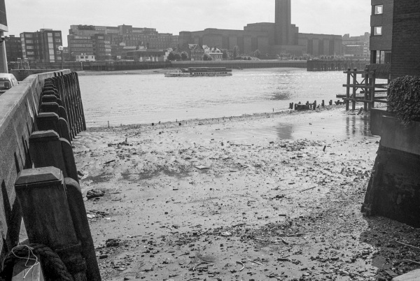
Queenhithe and the River Thames

Queenhithe, a small inlet on the City side of the river has a long history. The Romans built a quay here, and buried deep down in the wet mud some of the timbers they put here survive, as do remains of the dock contructed when Alfred the Great, King of Wessex re-established the City of London aroudn 886 AD. It got the name Queenhithe (a hythe is a small harbour) when Henry I gave the right to levy dues on goods landed there to his wife Matilda around the time of their marriage in 1100. Queenhithe was still a major harbour for the city hundreds of years later and remained in use, with lighters bringing skins for the fur trade which was based a short distance to the north until the Second World War.

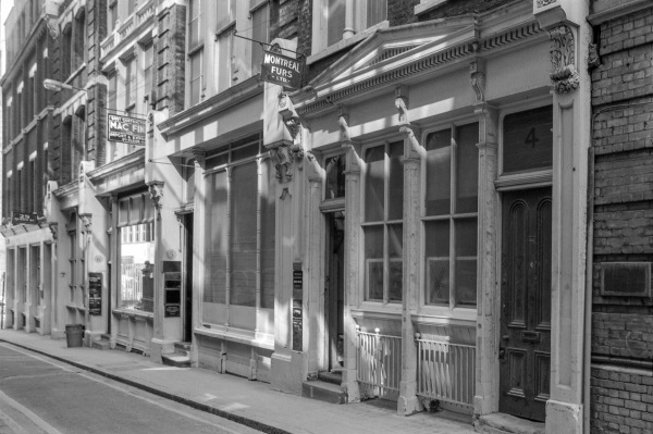
Fur shops in Great St Thomas Apostle

Around 300 of the black and white pictures I took in July 1986 are now online:
Peter Marshall: 1986 London Photographs on Flickr.
July’s pictures start here.

The images are copyright but may be shared on non-commercial personal social media. A licence is required for any corporate, commercial or editorial use.


All photographs on this and my other sites, unless otherwise stated, are taken by and copyright of Peter Marshall, and are available for reproduction or can be bought as prints.

There are no adverts on this site and it receives no sponsorship, and I like to keep it that way. But it does take a considerable amount of my time and thought, and if you enjoy reading it, please share on social media.
And small donations via Paypal – perhaps the cost of a beer – would be appreciated.


Wapping & the Thames

Sunday, September 1st, 2019

I arrived early for a private celebration of May Day with friends in a Wapping pub and took a short walk along the High St and riverside path, where I sat and ate my lunch sandwiches.

I’d made photographs here in the 1980s, and there were one or two that I’d hoped I would be able to fix the locations more precisely. It wasn’t easy as vitually everything between Wapping High Street and the river has been rebuilt with expensive riverside flats. New Crane Wharf (above) was still recognisable as here the old buildings had been converted.

The Thames sweeps around to the south to go around the Isle of Dogs, and from Wapping you can see Canary Wharf to the North of the River and the gasholder in Rotherhithe to the south – and both appear in photographs to be across the river.

You also see rather too much very pedestrian riverside architecture like the flats above. So little new building on the river bank has any architectural merit, all about maximising profit within the planning restrictions. It’s such a shame that the LDDC didn’t have higher aspirations for its control of the redevelopment of docklands.

Relatively little of the old riverside survives here, and Tunnel Mills and the other buildings at Rotherhithe are one very welcome exception. There are parts of the north bank too where some of the better warehouses have been saved, converted into expensive flats.

It was good also to be able to walk out onto Tunnel Pier, where I met two old friends also taking advantage of the opportunity.

And though the Captain Kidd pub to the left of Phoenix Wharf is relatively modern, dating from the 1880s, like many Sam Smith’s pubs it is a sensitive conversion of an old building, Sun Wharf, which along with Swan Wharf (now renamed Phoenix Wharf) and St John’s F & G Wharf at left were owned or leased by W H J Alexander and Company, who as well as wharfingers dealing in a wide range of goods including coffee, dried fruit, gum and bales of Australian wool, also used these premises to repair their tugs. Swan Wharf I think is the oldest of these buildings, dating from the 1840s and possibly designed by Sidney Smirke.

More pictures at Wapping and the Thames .


All photographs on this and my other sites, unless otherwise stated, are taken by and copyright of Peter Marshall, and are available for reproduction or can be bought as prints.

There are no adverts on this site and it receives no sponsorship, and I like to keep it that way. But it does take a considerable amount of my time and thought, and if you enjoy reading it, please share on social media.
And small donations via Paypal – perhaps the cost of a beer – would be appreciated.