Deptford & Greenwich: Some pictures from two bike rides in April 2005, the second cut rather short by a puncture, around one of my favourite areas of London, mainly along the southern bank of the River Thames. The area has changed fairly dramatically in recent years with new blocks of riverside flats replacing riverside industry, much of which had already ceased work by 2005. I first photographed here around 1980 and it still now makes an interesting walk (or ride) and I’ve done most or all of it a few times since 2005.
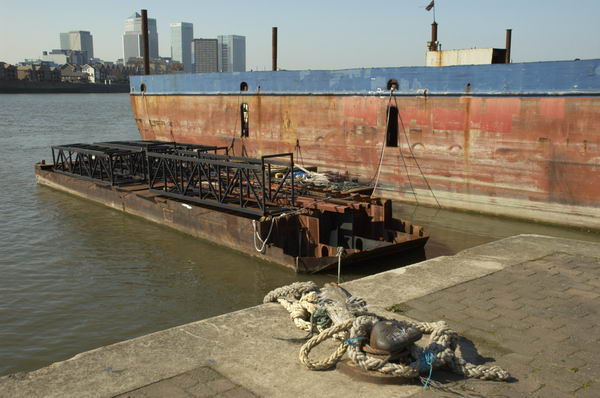
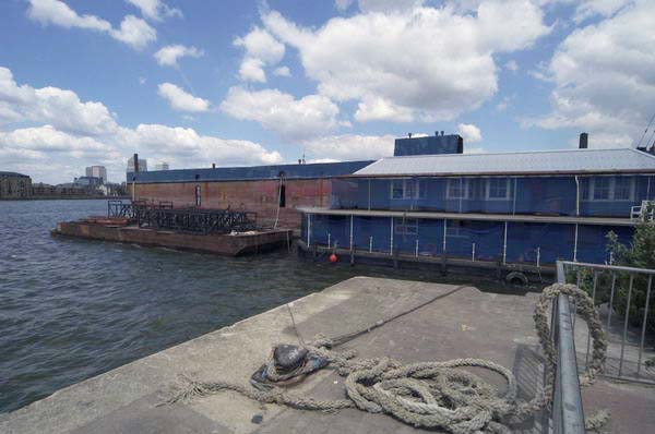
River Thames and Drydock, North Greenwich.
As usual I’ll post a slightly amended version of what I wrote at the time on My London Diary together with links to that site which has some more pictures. But I didn’t write anything about the actual pictures except the captions.
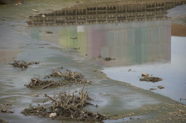
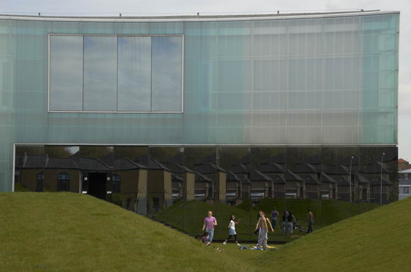
Reflection of the Laban building in Deptford Creek, London.
It was a fine sunny day on Thursday 21 April 2005 and I put my Brompton folding bike on the train to Waterloo, then cycled east from there to Deptford and Geenwich, taking another trip along one of my favourite riverside paths around the Greenwich Peninsula.
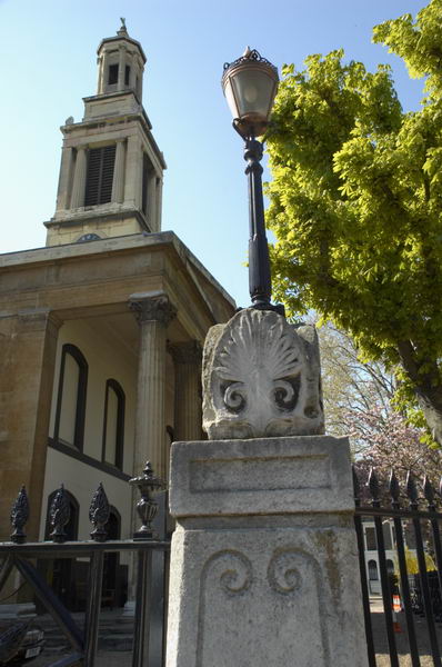
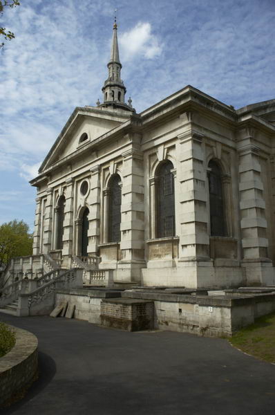
Trinity Square, Southwark, London SE1. Church is now a rehearsal studio
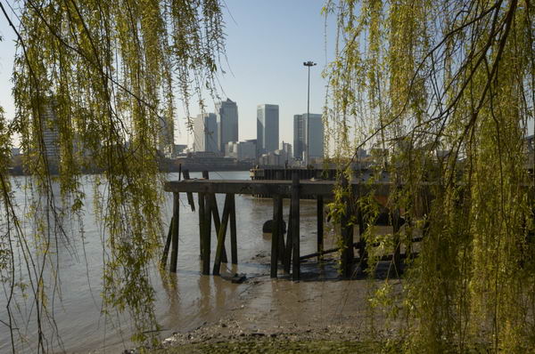
North Greenwich is still interesting, although the area by the Dome is now rather bleak. Time went surprisingly quickly, and I had only got just past the Dome when it was time to make my way back.
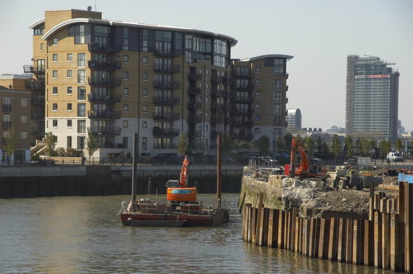
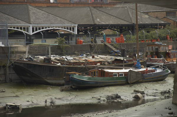
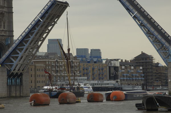
Dry Dock, North Greenwich, London.
Just over a week later I tried to take up the ride from where I left off, but only made it as far as the footbridge over Deptford Creek, when I heard a loud bang as my rear tyre punctured. I should have stopped, mended the puncture and gone on, but I couldn’t face it.
Deptford Creek close to its junction with RIver Thames, Deptford, London.
I wheeled the bike to Greenwich station, got on the train and came home. One of my few gripes about the Brompton is that mending punctures is a bit of a pain; the small tyres are hard to take off and even harder to replace, and if you want to take the rear wheel off, it is a rather tricky business that I’ve yet to master. I have tyres with kevlar inserts that are supposed to be puncture-resistant, but they don’t seem very effective.
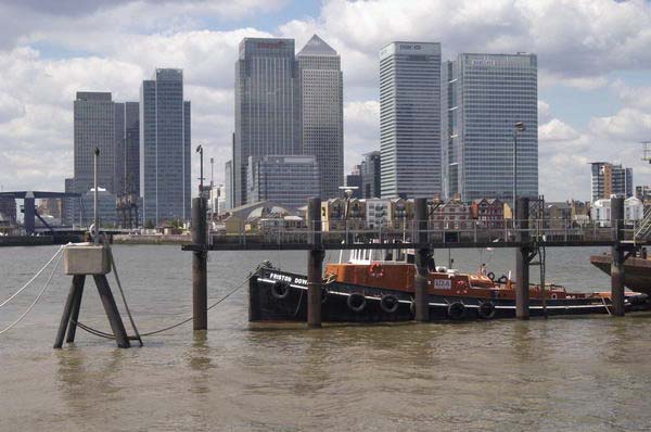
Canary Wharf and River Thames from North Greenwich, London
After I’d arrived home and had a cup of coffee, the puncture turned out to be a straightforward job.
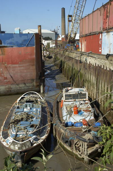
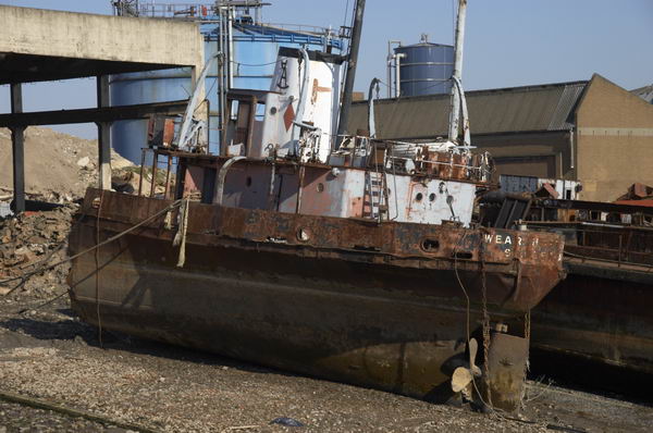
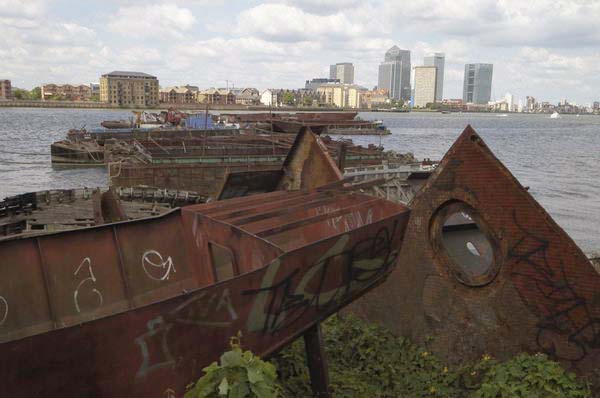
Ship breaker’s yard, North Greenwich, London, April 2005Doorway, Albury St, Deptford,St Pauls, Deptford, London built by Thomas Archer in 1713Laban dance centreDeptford Creek
From Northey Street I turned right into Brightlingsea Place, another street name still there in Limehouse although little of its buildings remain. The exception is Faraday House, a five storey block built by Stepney Borough Council in 1931 as a part of their Limehouse Fields slum clearance scheme. Much of the area to the east was also destroyed in the war, apparently by a V2 rocket and was finally cleared and excavated for the Limehouse Link Tunnel. It is now a public park, Ropemakers Field.
On the west side of Brightlingsea Place was the Limehouse Power Station (also known as Stepney Power station) built in 1907, decommissioned in 1972 and demolished.
Parts of the power station were still in place in 1990 and a notice on the gates at right confirm this is Stepney Transforming Station and warn of the danger of 66,000 volts. But Stepney – and Limehouse – was now undergoing a very different transformation.
The House They Left Behind, Ropemakers Fields, Narrow Street, Limehouse, Tower Hamlets, 1990, 90-1a-24
The pub, The House They Left Behind, at the entrance to the cleared area between Brightlinsea Place and Ropemakers Fields a few yards north of Narrow Street was indeed the only building left standing in this area. At 27 Ropemaker’s Fields built in 1857 it had previously been called The Black Horse and was on the edge of the Barley Mow Brewery Site. After several further name changes and becoming a bar/restaurant it closed around 2010 and is now residential.
An Instagram post by londondeadpubs tells the interesting story of the stabbing there in 1998 of “Christopher Dunhill, heir to the vast Dunhill tobacco (and, weirdly, cufflinks) fortune” who was then a resident there and “helping out at the oyster bar“. He had earlier in 1987 been convicted of drug dealing but somehow only served 15 months in prison and “today he appears to be CEO of a Bahamian financial company.” But do read the full post.
To the east are these tower blocks of the Barley Mow Estate on Oak Lane, seen here from Ropemakers Fields. These blocks were built on the Barley Mow Brewery site and were built around 1967 for the London County Council using the same “Large Panel System” which failed in the Ronan Point disaster in 1968.
Reports led to additional strengthening work on Brewster and Malting House, but it was decided to demolish Risby House as it would be adversely affected by the contruction of the Limehouse Link Tunnel.
This was one of the best-known lighterage firms on the river until the business was closed down in 1973 by ‘Dolly’ Fisher on her 79th birthday. In its heyday had around a hundred barges on and nine tugs on the river.
Dorothea Woodward Fisher and her husband William, a lighterman who she had married over the protests of her family had formed the company with only £20 and one barge. And when her husband died in the 1960s she took over the running of it – and was described by many on the river and in a 1972 BBC documentary as ‘Mother Thames‘.
Dunbar Wharf on Narrow Street backs onto Limekiln Dock. Duncan Dunbar came to Limehouse from Scotland and made a fortune as a brewer and wine merchant, leaving his son – also Duncan Dunbar – sufficient to found a shipping business in 1827. By 1842 he had 11 ships and in the next 20 years ordered another 42.
As well as trading in various goods iuncluding wine and spirits, Dunbar’s ship’s made 37 voyages taking convicts to Australia and were troop carriers for the Crimean War. When he died in 1862 his estate was worth £2 million. His family then sold up all of the business. Apparently one of his former ships, the Edwin Fox is a museum attraction in New Zealand.
Thames Day: I probably won’t be going to Thames Day which takes place this year next Sunday 22nd September 2024, organised by the Thames Festival Trust and the City of London Corporation as “An exciting day of free family activities, Thames Day celebrates World Rivers Day and the significance of the river Thames to the nation’s capital city.”
Thames Day is a part of the larger Thames Festival which began in 1997 when it included a high wire walk across the Thames, and until 2012 organised activities on and around the river between Tower Bridge and Westminster Bridge.
“In 2013, Thames Festival was relaunched as Totally Thames, a month-long season of river and river-related events along the whole 43 miles of the River Thames riverfront in London, from Hampton Court Bridge in the west to the Dartford Crossing in the east.”
Back in 2005, it was the London Mayor’s Thames Day and I spent much of Sunday 18th September photographing some of the range of activities taking place, though I left before the fireworks. Here’s what I wrote at the time, along with some pictures from the day.
“Thames day reminds London of its river, and its heritage, as well as providing some free entertainment. Some of the activities that make it up perhaps lack visual interest, and it didn’t help that the day was grey and dull. The flotilla of boats disappointed, although the sight and smell of a coal-fired screw steam tug in the upper pool brought back some memories.
The river police also were obviously having a good day, showing off the fairly impressive speed of their launches, and it was good to see the river looking almost crowded at times.
The barge race seemed rather false, relying more on weight and fitness of a crew rather than the traditional skills of watermen, who often managed such vessels single-handed.
Then there were various performances, including a large and enthusiastic children’s choir in The Scoop, and some Japanese drums and dance.
It livened up the day for lots of Londoners (and tourists) and the fireworks (i didn’t stay for them) will have given them some evening entertainment too.”
Greenwich, Bikefest and the 1940s: Twenty years ago on Sunday 13th June 2004 I had a day out in London, beginning with a walk beside the Thames at Greenwich, then coming to Westminster for a bike festival in Trafalgar Square and then a rather peaceful ‘War in the West End’ in Leicester Square. You can find what I wrote then about all these a little way down the June 2004 page of My London Diary.
Greenwich to North Greenwich Walk
I’d decided to get up early on Sunday and take a walk by the River Thames in Greenwich. Unfortunately engineering work meant no trains were running there so I had rather a long bus journey from Waterloo to get there. At least there was little traffic to hold the bus up.
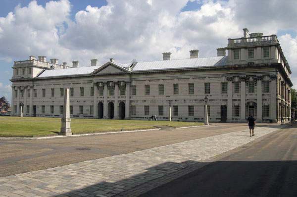
I began with a walk around the grounds of the former Royal Naval College, now Greenwich University before taking the path past the power station and along Ballast Quay an on.
The path was open to North Greenwich and I made my way along it. Some of the pictures I made are now difficult to locate as this whole riverside is getting replaced by blocks of flats.
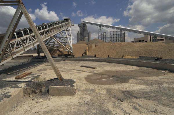
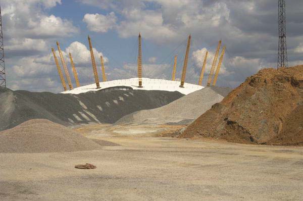
I didn’t put many images on line in 2004, as most viewers were still on slow internet connections. Further on towards North Greenwich there is still – at least the last time I walked along here a couple of years ago – an aggregate wharf with huge piles of sand and gravel on the landward side.
One of the huge gasholders at Greenwich was still standing in 2004, since demolished, and across the river Canary Wharf tower for long the only tower on the site was now almost hidden by others sprouting around it.
Eventually I could see the Millennium Dome looming above the sand and gravel which I felt “perhaps looks more at home in this almost lunar landscape” and I knew I was not far from North Greenwich station where I could catch the tube to Westminster.
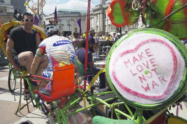
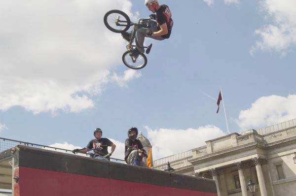
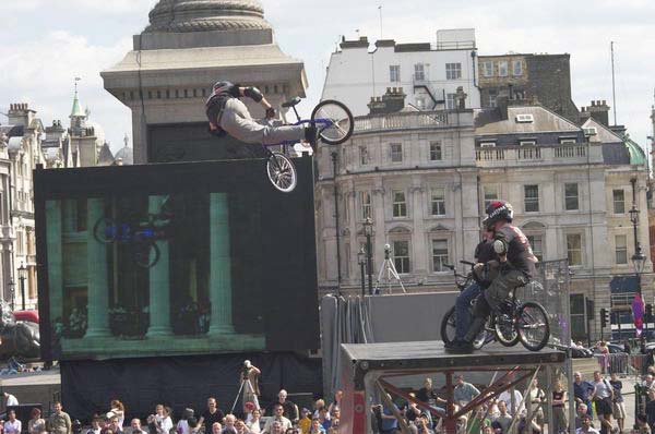
Bikefest was the first bicycle festival in Trafalgar Square, but I was surprised to find that bicycles were not allowed on the square. Though perhaps they would have got in the way, but it would have been nice at least to have had some temporary secure bike parking.
Except of course those taking part officially in the event including Team Extreme performing on the half-pipe and some great cycle powered musical systems such as Rinky-Dink.
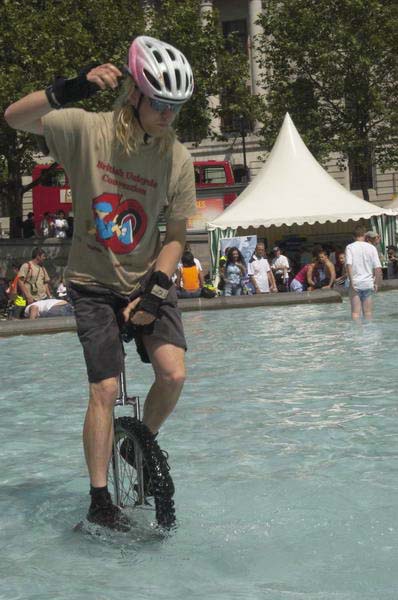
But I had agreed to meet one of my sons there and he managed to smuggle his unicycle in to the event. But by the time I found him he had already been hassled by the heritage wardens (who I described as ‘Ken’s SS’) but he still decided to have a go at riding in the fountains where he could not possibly be endangering the public.
But he had hardly got going when he was ordered out and made to leave the area, though he did so riding the unicycle after a few quick bounces to shake off the water.
I went back to watching Team Extreme and taking a few more pictures, although I found it hard to convey quite how extreme they were, before leaving to join the Second World War in Leicester Square.
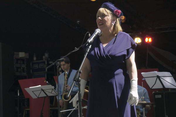
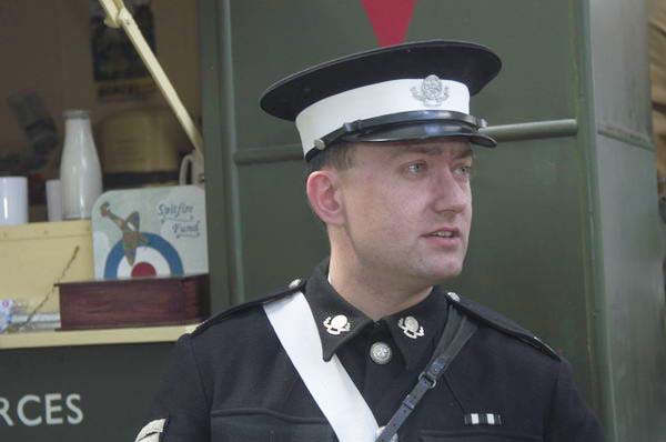
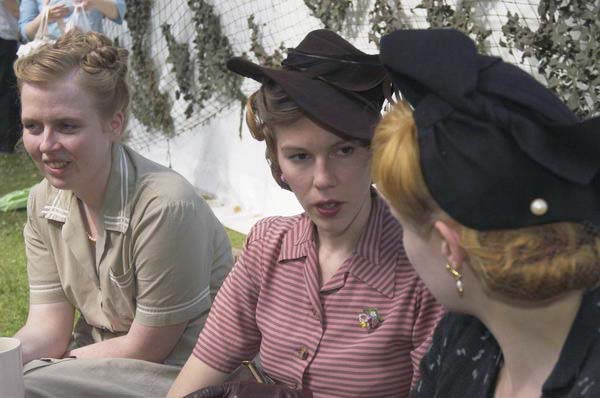
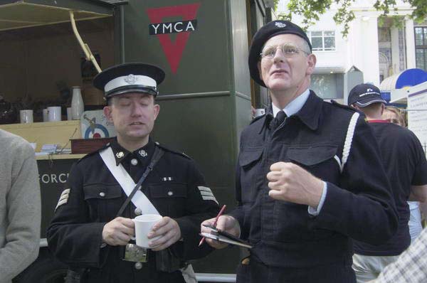
Westminster Council had organised a festival turning Leicester Square into 1940’s London for the weekend, going back 60 years to 1944.
Although 60 years ago bombs were still falling on Westminster and rationing made life difficult (though for the wealthy – and there were plenty in Westminster – the black market was flourishing) the West End was full of servicemen on leave and many servicewomen determined to have fun, “letting their hair down” in cinemas, on dance floors, in clubs, pubs and hotels.
I found the scene in the square rather sad, although obviously a lot of effort had been put into the displays and performances and there were a few 1940s dressed re-enactors among the crowds in modern dress.
60 Years earlier Allied troops had landed in France on D-Day to fight to reclaim Europe, but the previous Thursday we had seen a large vote here in the European Parliament election rejecting it with both Conservative and Labour votes well down and the Lib-Dems coming in 4th place behind the UK Independence Party.
Things of course got worse in 2016, when the leave vote gained a small majority over those wishing to remain. Although the vote was not binding, stupidly Tory Prime Minister David Cameron had promised to abide by it – rather than more sensibly pointing out that a major constitutional change such as this should require a substantial majority rather than a momentary electoral whim – as would surely have been the case if we had a written constitution. And for once a politician kept his promise.
The latest opinion poll (May 1st 2024) has 55% saying we were wrong to leave against 31% thinking we were right with 13% of Don’t Knows.
From Southwark Park Schools which ended the previous post on this walk, Rotherhithe New Road & Southwark Park Schools, I walked a few yards up Southwark Park Road to the corner with Banyard Road, where I photographed the taxi office (still there but changed from A-Z Star Cars to 5 Star Cars) with the pub on the opposite corner, the Southwark Park Tavern, now closed and converted to residential around 2003.
There was a pub around here, the Green Man, possibly on this site before Southwark Park opened in 1869 but I think this building probably came shortly after the park was opened, and is opposite the Carriage Drive leading into the park.
Unfortunately I haven’t yet digitised this picture, nor one of rather plain two-storey terrace on Banyard Rd or an image showing a play area in the park. I hurried through the park to the Jamaica Road gate at its north, crossing to make my way to Kings Stairs Gardens and the River Thames.
River Thames, Downstream, Rotherhithe, Southwark, 1988 88-10l-63
The two jetties visible here I think have now gone and there is certainly no line of lighters as in this picture, and there is one striking new building on the riverfront.
River Thames, Downstream, Rotherhithe, Southwark, 1988 88-10l-65
A second picture taken with a short telephoto lens from almost exactly the same place shows the central area more clearly, with new flats being built on Rotherhithe St.
Wapping, River Thames, Rotherhithe, Southwark, 198888-10l-51
Looking across the Thames downstream, with Free Trade Wharf at the extreme right and just to the left the cylinder ventilation shaft of the Rotherhithe tunnel in the King Edward Memorial Park. Both Metropolitan Wharf and New Crane Wharf are covered iwth scaffolding.
Wapping, River Thames, Rotherhithe, Southwark, 1988 88-10l-52
Part of St John’s Wharf and King Henry’s Wharves seen across the River Thames.
Wapping, River Thames, Rotherhithe, Southwark, 1988 88-10l-53
More of St John’s Wharf, including one of the earlier warehouse conversions and the Grade II listed Wapping Police Station, built 1907-10, Metropolitan Police architect John Dixon Butler. At extreme left is a part of Aberdeen Wharf built in 1843–4 by the Aberdeen Steam Navigation Company.
Wapping, River Thames, Rotherhithe, Southwark, 1988 88-10l-54
The end of Aberdeen Wharf is at the right edge of this picture, and at its left the Wapping Police Boatyard, an unnecessarily ugly building opened in 1973. The new building in the centre of the picture also seems something of an eyesore, at least at its ends.
Wapping, River Thames, Rotherhithe, Southwark, 1988 88-10l-55
Continuing up-river from the Police Boatyard are St Thomas Wharf, Pierhead Wharf, Oliver’s Wharf – the first warehouse in Wapping to be converted into luxury flats in 1972 – and Wapping Pierhead, with houses designed by Daniel Alexander in 1811 and the main entrance to London Docks.
Bermondsey, River Thames, Rotherhithe, Southwark, 1988 88-10l-41
Looking upriver on the south bank with Tower Bridge at the extreme right and Guy’s Hospital tower just left of centre. Cherry Garden Pier is at left.
Silver Jubilee, marker, EIIR, River Thames, Rotherhithe, Southwark, 1988 88-10l-43
There is still a marker for the Queen’s Silver Jubilee here but it looks far less impressive than this rugged stonework I photographed in 1988. London has also gained quite a few tall buildings, but the view along the river remains clear and you can still see the dome of St Paul’s Cathedral.
41 Rotherhithe St, now apparently 1 Fulford St at least according to Google Maps, was the offices of lighterage company Braitwaite & Dean, where their lightermen would come to collect their weekly wage. Apparently it was known locally as the Leaning Tower of Rotherhithe, though the building’s lean is more apparent from across the river than in my picture.
It was left more or less alone on this stretch of the river with just the Angel pub equally isolated a few yards upriver after Bermondsey council bought many of the buildings in 1939 to create a park, with wartime bombing continuing the demolition job. There was some temporary housing by the river when I first walked along here in the early 1980s, but that soon disappeared.
My walk in Bermondsey continued – more about it in a later post.
Three Mills Lane which runs from Hancock Road, a short walk from Bromley by Bow Underground station takes you across the Lea Navigation and Bow Creek to a remarkable ensemble of four of Newham’s listed buildings, including the Grade I listed House Mill from 1776, the early 19th century offices and the 1817 Clock Mill, with its 1753 Clock Tower. The fourth is easy to miss, as it is the stone setts and flagstones under your feet, dating back to the 19th century.
Together they make a splendid early industrial landscape, though now a little hemmed in by rather more recent flats. When I photographed there in the 1980s and 1990s, the area around was full of largely 20th century industrial sites, mainly along the navigation, and a little still remains, particularly an impressive set of gas holders (seven Grade II listings) on the southern side of the Channelsea River at the former Bromley-by-Bow gas works (which also has listings for its bridge across the canal and Bow Creek as well as its war memorial and statue of Sir Corbet Woodhall.)
Three Mills Wall River
In more normal times the House Mill, which was saved from demolition in the 1970s and has been partially restored offers reasonably priced guided tours on Sundays from May to October and at some other times as well as hosting various events. The mill is a tide mill, and is on a site recorded in the Domesday Book, with foundations dating back to the end of the 14th century. It was able to generate power for 7-8 hours a day, though the output varied with the monthly changes in tides. Together with the Clock Mill it would grind an average of 125 tons of grain a week.
The towpath running south from Three Mills is on a narrow strip with the navigation on the west and Bow Creek to the west, and it leads down under railway bridges to Twelvetrees Crescent (where recent stairs now allow you to go on to the bridge and continue your walk beside Bow Creek) and under the bridge to Bow Locks where you can continue along the Limehouse Cut.
You won’t see the empty lighters on the navigation that were there when I walked along here in 1983, not long after commercial traffic ended. The large pipe across in front of the bridge would have carried gas from the Bromley gas works across to deliver gas to London west of the works. The listed bridge dates from 1872. Under it you can see the bridge which takes the path across Bow Locks and on to Gillender St or to the towpath beside the Limehouse Cut.
More on page 4 of River Lea – Lea Navigation. Click any of the images above to go to larger versions on my Flickr site.
All photographs on this and my other sites, unless otherwise stated, are taken by and copyright of Peter Marshall, and are available for reproduction or can be bought as prints.