Limehouse and East India – 1994

Limehouse and East India: I spent most of Saturday 11th June 1994 wandering in the area between Limehouse, Blackwall and the former East India Docks, concentrating on making panoramas, some of which were the post Limehouse, Poplar, Blackwall and East India Panoramas – 1994 but I also took a number of black and white and colour images. You can find more of both in two Flickr albums – links at the bottom of this post – but here is some of the colour work. These pictures will have been made using an Olympus OM$ camera on Fuji film. I carried a range of lenses from 21mm to 200mm, though probably most all were taken with 28mm or 50mm lenses.

Limehouse Link Tunnel, Aspen Way, Poplar, Tower Hamlets, 1994, 94-61-55

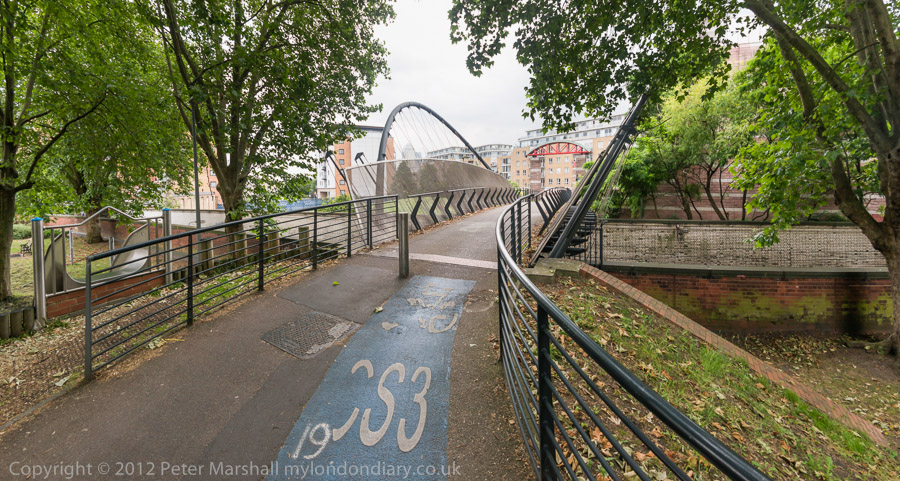
The eastern entrance to the Limehouse Link Tunnel which was officially opened in 1993. Both portals have decorative sculptures, this one an untitled abstract by Nigel Hall which I find it hard to find any point in. The 1.1 mile tunnel took 4 years to build and cost £293,000,000 making it the most expensive road scheme in Britain per mile.

Limehouse Link Tunnel, Three Colts St, Limehouse, Tower Hamlets, 1994, 94-61-44

This is the Limehouse Link Eastern Service Building. With a huge volume of traffic passing through the tunnel presumably the main service needed is ventilation and those chimneys presumably are on top of huge fans for the purpose, sharing the pollution with the community.

St Dunstan's Wharf, Dunbar Wharf, Narrow St, Limehouse, Tower Hamlets, 1994, 94-61-33
St Dunstan’s Wharf, Dunbar Wharf, Narrow St, Limehouse, Tower Hamlets, 1994, 94-61-33

The story of Dunbar Wharf is told on the Isle of Dogs Life web site in the article Dunbar Wharf and the Remarkable Story of Duncan Dunbar, and I’ve written more about it in previous posts. Duncan Dunbar made a fortune as a brewer and wine merchant and on his death in 1825 his son, also Duncan Dunbar used this to set up a large shipping fleet, becoming one of the richest men in Britain.

As well as goods to and from the world Dunbar’s shipping line made 37 trips carrying convicts to Australia and were troopships for the Crimean War. He never married and had no children and on his death in 1862 the ships were all sold and the business closed.

The buildings here date from the mid 19th century and are Grade II listed.

London Art Fashions, Limehouse, Tower Hamlets, 1994, 94-61-34

I think this was the window of a tailor’s shop in Limehouse, but cannot recall its exact location. The caption I gave it came from the black and white poster at the back which I suspect is from the 1920s or 30s, though I’m certainly no fashion expert, while the blue framed image at lower left looks to me a little older and has an interesting lady golfer.

Chinese Restaurant, Limehouse, Tower Hamlets, 1994, 94-61-23

Limehouse and Poplar used to be London’s Chinatown before that moved to Soho, and some traces remain, rather more back in 1994 than now. On the wall is a calendar for the ‘Year of the Dog’ and a notice informing us that:

‘*WE NOW SELL
‘CHICKEN’ BALLS’ IN BATTER
PLEASE ASK STAFF
£2 A PORTION THANK YOU’

The two green hexagons floating in the centre close to the top of the picture (with some more very faint and above them to their right) are photographic artifacts, lens flare, images of the lens iris reflected from some interior lens surface from a light source just outside the frame. But I rather like the effect here.

Hairdresser, Limehouse, Tower Hamlets, 1994, 94-61-24

Looking through a window into a hairdressers with a red-edged counter and mirrors, red chairs and red towels hanging on hooks seen in the mirror. It wasn’t possible for me to get enough depth of field to make everything in the picture pin sharp, but this perhaps makes the mirrored image stand out a little more.

East India Dock Tunnel, Aspen Way, Poplar, Tower Hamlets, 1994, 94-61-51

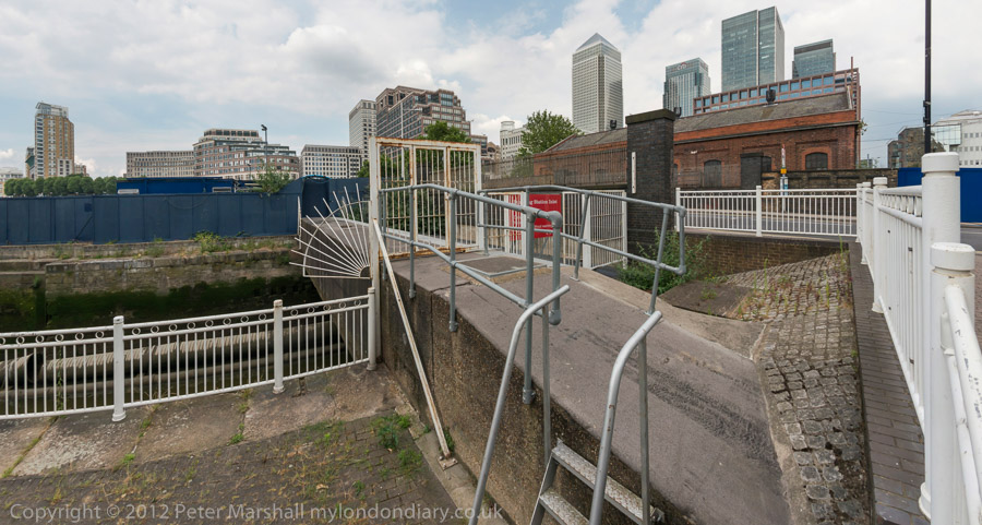
The lane closer to the centre of the image dives here into the East India Dock Tunnel with the red brickwork of the tunnel mouth at the right of the picture. The tunnel was opened in 1993. At the left is Canary Wharf Tower, then in isolation, in front of it the bridge and red tower of East India DLR station. The rather depressing 1990 ten-storey granite clad post-modern office blocks on the site of the main East India Dock have now been comprehensively redeveloped mainly for residential use and rebranded as ‘Republic’.

Canary Wharf, DLR, Power Station, South Bromley, Tower Hamlets, 1994, 94-61-53

Further east also looking back to Canary Wharf from underneath the DLR viaduct with the former switchgear house of Brunswick Wharf Power Station at right. Planned in 1939 but not built until after the war this was a coal fired power station on the site of the East India Export Dock. In 1948 the dock was filled in but post-war financial constraints meant the power station was only became operational in 1952, and finally completed in 1956.

In 1970 it was converted to burn oil, probably to reduce air pollution in London. Increases in oil prices later made this one of the more expensive generating stations and it was closed in 1984 and sold for redevelopment in 1987.

Most of the power station was demolished in 1989 but this building remained, I think until around 2005 when it was demolished for a large residential development, Virginia Quays, which has on the riverbank the 1951 Grade II listed Virginia Quay Settlers Monument.

My 1984 albums on Flickr:

1994 London Colour
1994 London Photos (Black and White)


FlickrFacebookMy London DiaryHull PhotosLea ValleyParis
London’s Industrial HeritageLondon Photos

All photographs on this page are copyright © Peter Marshall.
Contact me to buy prints or licence to reproduce.


More from Narrow Street – 1990

More from Narrow Street – 1990: My walk in Limehouse on Sunday 6th January 1990 continued. The previous post from this walk is Around Narrow Street, Limehouse – 1990

Dunbar Wharf, Narrow St, Limehouse, Tower Hamlets, 1990, 90-1b-62

It was hard not to take picture after picture on Narrow Street, particularly as I was aware much was soon to disappear, and I made over 20 exposures, though I’ve digitised less than half of these, and I’ll only post a few of these as some of the others are rather similar or at least overlap in terms of subject. This view shows some of the same buildings from the picture that ended the previous post, but from a slightly different viewpoint. Most including all in this view ,were demolished shortly afterwards.

Dunbar Wharf, Narrow St, Limehouse, Tower Hamlets, 1990, 90-1b-45
Listed properties in Dunbar Wharf, Narrow St, Limehouse, Tower Hamlets, 1990, 90-1b-45

My previous post told the story of Duncan Dunbar and his son of the same name who built up a huge shipping empire based around Dunbar Wharf but sold off at his death in 1862. The four warehouses at 136, 136½, 138, 140 were Grade II listed in 1973 and some at least were still in various commercial use back in 1990.

Until the 1970s it was a working wharf – E W Taylor, a lighterage company had begun using it for oversize cargo in 1857 – and the company also “became experts in the warehousing and fumigation of the botanicals used in making gin.” The company, now part of Dunbar Wharf Holdings Limited, acquired Dunbar Wharf in the 1940s.

Barlow & Sons, Dunbar Wharf, Narrow St, Limehouse, Tower Hamlets, 1990, 90-1b-46

All the remaining properties in Dunbar Wharf have now been converted into flats and you can read online about the 2020 renovation of one of the 1790s warehouse buildings into “a beautiful residence by the Thames.”

Barlow and Sons Auto Repairs were at 144 Narrow Street and offered their auto repairs with the aid of some really king-size spanners. This building was replaced in 1997 by Creek House.

Narrow St, Limehouse, Tower Hamlets, 1990, 90-1b-51

These buildings were demolished shortly after I made these photographs for the development of the Limehouse Link tunnel and were then replaced by modern flats with a vaguely pastiche frontage. Their demolition enabled archaeological investigation of the site of Joseph Wilson and Company’s Limehouse Porcelain Manufactory operating here from 1745-8.

St Dunstan's Wharf, Narrow St, Limehouse, Tower Hamlets, 1990, 90-1b-44
St Dunstan’s Wharf, Narrow St, Limehouse, Tower Hamlets, 1990, 90-1b-44

St Dunstan’s Wharf at 142 Narrow Street is also Grade II listed and has survived. Together with the listed buildings of Dunbar Wharf it backs onto Limekiln Dock. Above the doorway is its name and a floral decoration together with what appears to be a large pair of blacksmiths’ tongs, the pincers used by St Dunstan to grab the together with another tool I don’t recognise.

Along is bottom are the initials W & G.G and the date 1878. Gardner & Gardner, hay & straw salesmen, are listed at this address as well as in Spread Eagle Yard in Whitechapel High Street. The listing text states this is on a metal plate, but it looks more like terracotta in my picture. Apparently the building was also used as a store for materials including juniper berries and flowers used to make gin.

I was more or less at the end of Narrow Street and my walk will continue along Three Colt Street in another post.


FlickrFacebookMy London DiaryHull PhotosLea ValleyParis
London’s Industrial HeritageLondon Photos

All photographs on this page are copyright © Peter Marshall.
Contact me to buy prints or licence to reproduce.


Around Narrow Street, Limehouse – 1990

My walk in Limehouse on Sunday 6th January 1990 continued. The previous post from this walk is Limehouse Basin and Limehouse Cut – 1990.

Brightlingsea Place, Limehouse, Tower Hamlets, 1990, 90-1a-21

From Northey Street I turned right into Brightlingsea Place, another street name still there in Limehouse although little of its buildings remain. The exception is Faraday House, a five storey block built by Stepney Borough Council in 1931 as a part of their Limehouse Fields slum clearance scheme. Much of the area to the east was also destroyed in the war, apparently by a V2 rocket and was finally cleared and excavated for the Limehouse Link Tunnel. It is now a public park, Ropemakers Field.

On the west side of Brightlingsea Place was the Limehouse Power Station (also known as Stepney Power station) built in 1907, decommissioned in 1972 and demolished.

Stepney Transforming Station, Brightlingsea Place, Limehouse, Tower Hamlets, 1990, 90-1a-23

Parts of the power station were still in place in 1990 and a notice on the gates at right confirm this is Stepney Transforming Station and warn of the danger of 66,000 volts. But Stepney – and Limehouse – was now undergoing a very different transformation.

The House They Left Behind, Ropemakers Fields, Narrow Street, Limehouse, Tower Hamlets, 1990, 90-1a-24

The pub, The House They Left Behind, at the entrance to the cleared area between Brightlinsea Place and Ropemakers Fields a few yards north of Narrow Street was indeed the only building left standing in this area. At 27 Ropemaker’s Fields built in 1857 it had previously been called The Black Horse and was on the edge of the Barley Mow Brewery Site. After several further name changes and becoming a bar/restaurant it closed around 2010 and is now residential.

An Instagram post by londondeadpubs tells the interesting story of the stabbing there in 1998 of “Christopher Dunhill, heir to the vast Dunhill tobacco (and, weirdly, cufflinks) fortune” who was then a resident there and “helping out at the oyster bar“. He had earlier in 1987 been convicted of drug dealing but somehow only served 15 months in prison and “today he appears to be CEO of a Bahamian financial company.” But do read the full post.

Ropemakers Fields, Limehouse, Tower Hamlets, 1990, 90-1a-12

To the east are these tower blocks of the Barley Mow Estate on Oak Lane, seen here from Ropemakers Fields. These blocks were built on the Barley Mow Brewery site and were built around 1967 for the London County Council using the same “Large Panel System” which failed in the Ronan Point disaster in 1968.

Reports led to additional strengthening work on Brewster and Malting House, but it was decided to demolish Risby House as it would be adversely affected by the contruction of the Limehouse Link Tunnel.

W J Woodward Fisher, 94, Narrow St, Limehouse, Tower Hamlets, 1990, 90-1a-15

This was one of the best-known lighterage firms on the river until the business was closed down in 1973 by ‘Dolly’ Fisher on her 79th birthday. In its heyday had around a hundred barges on and nine tugs on the river.

Dorothea Woodward Fisher and her husband William, a lighterman who she had married over the protests of her family had formed the company with only £20 and one barge. And when her husband died in the 1960s she took over the running of it – and was described by many on the river and in a 1972 BBC documentary as ‘Mother Thames‘.

Dunbar Wharf, Narrow St, Limehouse, Tower Hamlets, 1990, 90-1a-16
Dunbar Wharf, Narrow St, Limehouse, Tower Hamlets, 1990, 90-1b-62

Dunbar Wharf on Narrow Street backs onto Limekiln Dock. Duncan Dunbar came to Limehouse from Scotland and made a fortune as a brewer and wine merchant, leaving his son – also Duncan Dunbar – sufficient to found a shipping business in 1827. By 1842 he had 11 ships and in the next 20 years ordered another 42.

As well as trading in various goods iuncluding wine and spirits, Dunbar’s ship’s made 37 voyages taking convicts to Australia and were troop carriers for the Crimean War. When he died in 1862 his estate was worth £2 million. His family then sold up all of the business. Apparently one of his former ships, the Edwin Fox is a museum attraction in New Zealand.

More from 1990 Limehouse later.


FlickrFacebookMy London DiaryHull PhotosLea ValleyParis
London’s Industrial HeritageLondon Photos

All photographs on this page are copyright © Peter Marshall.
Contact me to buy prints or licence to reproduce.


Limehouse Basin and Limehouse Cut – 1990

Limehouse Basin and Limehouse Cut: More pictures from my walk around Limehouse on on 6th January 1990. The previous post from this walk is Ratcliff Highway and Limehouse Basin – 1990.

Former Limehouse Cut, Northey St, Narrow St, Limehouse, Tower Hamlets, 1990, 90-1a-24
Former Limehouse Cut, Northey St, Narrow St, Limehouse, Tower Hamlets, 1990

The Limehouse Cut is London’s oldest canal, opened in 1770 to provide an easier route from the Lea Navigation, an important river for transporting grain into London from the agricultural areas to north in Hertfordshire. Used from the Bronze age and later by Viking raiders, alterations had been made to improve navigation on the River Lee since at least 1190 and was later followed by various Acts of Parliament. The first river lock in England was built on it at Waltham Abbey in 1577, but it was only the the River Lee Navigation Act 1767 that really began its modernisation.

Former Limehouse Cut, Northey St, Narrow St, Limehouse, Tower Hamlets, 1990, 90-1a-41

Part of the work made under the 1767 Act when the navigation was surveyed John Smeaton was the suggestion to dig of the Limehouse Cut, allowing boats to avoid the treacherous and winding tidal lower reaches of Bow Creek on their way to the River Thames. The actual surveyor when the work began was his assistant Thomas Yeoman. It was a considerable short cut as it emerged into the river to the west of the long haul around the Isle of Dogs.

The original canal was narrow and had to be later widened and improved and it was only in the Victorian era that it was finally in something like its final state. The canal until 1968 entered directly into the Thames though Limehouse Lock in front of the row of small houses in these pictures, but it also had a basin, Limehouse Basin, at its southern end.

Limehouse Dock, Limehouse, Tower Hamlets, 1990, 90-1a-45
Limehouse Basin, Limehouse, Tower Hamlets, 1990, 90-1a-45

The first Limehouse Basin was at first simply a basin at the end of the Limehouse Cut, dug out by 1795. It had an island in it and on its bank was a a sawmill driven by a windmill, built a little earlier when sawmills were still widely thought to be illegal in England. It was attacked and the machinery destroyed by rioters – including hand-sawyers – in 1768. Restored the following year it closed around 35 years later. A lead mill opened on the island soon after and the company only ceased to exist in 1982. Victory Place is built on the site of this original Basin, and the old streets Island Row and Mill Place to its north are still there.

The Limehouse Cut was in 1854 linked to the Limehouse Basin of the Regent’s Canal which had opened in 1820 as the Limehouse Lock needed to be repaired. But this link was opposed by the boatmen from the Lee and Stort who fought a legal battle and in 1864 it was filled in and the site built on. It was not until over a hundred years later in 1968 that a new link – only 200 metres long – was made and Limehouse Lock finally closed.

Limehouse Cut, Limehouse, Tower Hamlets, 1990, 90-1a-32

The Limehouse Cut runs on a straight route through Poplar but curves around at its sourthern end. It was blocked here in 1990, probably in connection with the buildilng of the Limehouse Link tunnel between 1989 and 1993. But there was also work on the Cut around then, with the vertical guillotine gate on the north side of Britannia Bridge across the Commercial Road being removed.

Northey St, Limehouse, Tower Hamlets, 1990, 90-1a-32
Limehouse Cut, Limehouse, Tower Hamlets, 1990, 90-1a-32

Northey Street still has a bridge over the remains of the old route of the Limehouse Cut to Limehouse Lock, but all of the buildings including wharves and works on the banks of the Cut have now been replaced by modern development. The tower blocks beyond are on Oak Lane, and I think in the distance are cranes working on developments on the Isle of Dogs around Canary Wharf.

Northey St, Limehouse, Tower Hamlets, 1990, 90-1a-36

Another view of buildings on Northey Street in the 1990s.

Still more from Limehouse to come in later posts.


FlickrFacebookMy London DiaryHull PhotosLea ValleyParis
London’s Industrial HeritageLondon Photos

All photographs on this page are copyright © Peter Marshall.
Contact me to buy prints or licence to reproduce.


Ratcliff Highway and Limehouse Basin – 1990

Ratcliff Highway and Limehouse Basin: My first photographic walk in 1990 came at the end of the Christmas and New Year season on 6th January 1990 when I returned to Limehouse for another walk. I’d taken quite a few pictures there back in 1984 and I thought it was time for another extensive visit. Getting there was easier now that the DLR ran to Limehouse. I left the station and walked down Branch Road.

Scout HQ, Branch Rd, Limehouse, Tower Hamlets, 1990, 89-12d-46

Obviously not built as a Scout HQ, but something rather more official, and this was built in 1898 as the Stepney Borough Coroner’s Court.

Branch Road was apparently earlier called Horseferry Branch Road and led to a ferry across the Thames here – and Branch Road still leads to a road called Horseferry Rd. An ancient ferry ran from Ratcliff Cross Stairs and would have taken horses and carts as well as people across to Rotherhithe. You can still go down to the foreshore here from Narrow Street down the Grade II listed stairs but of course there is no ferry. The listing is probably more for the historic interest of the site – the stairs themselves are are relatively modern concrete replacement and the ancient causeway here apparently disappeared around 2000.

Tubular Barriers, The Queens Head, The Highway, Limehouse, Tower Hamlets, 1990, 89-12d-34

At 491 The Highway – formerly known as Ratcliffe Highway – close to the corner with Butcher Row – the Queens Head pub to the right of this view – was demolished soon after I made this picture in 1990, along with the rest of these buildings. At the left is a sign for the Limehouse Link tunnel, built between 1989 and 1993 and I think this was a storage yard for the work. The western end of the tunnel is a short distance to the east.

Electrocute Murdoch, Tubular Barriers, 493, The Highway, Limehouse, Tower Hamlets, 1990, 89-12d-35

Another part of the Tubular Barriers site on The Highway which I think I photographed mainly for the graffiti ‘ELECTROCUTE MURDOCH’ on its wall. I think this was at the corner with Butcher Row. Though the company name also made me think of the Mike Oldfield album Tubular Bells.

There had been a particularly bitter and hard fought (sometimes literally) fight over the opening of Murdoch’s News International print works at Wapping in 1986, following the dismissal of all 6000 of the print workers at the previous Fleet Street hot metal print plant.

Works, 503-9, The Highway, Limehouse, Tower Hamlets, 1990, 89-12d-25

Control of the development of the Docklands areas was in 1981 taken away from the local authorities and given to the London Docklands Development Corporation (LDDC) a quango agency set up by Margaret Thatcher’s Secretary of State for the Environment, Michael Heseltine. Although this resulted in a faster regeneration of the area this was largely driven by the interests of global capital and often went against the interests and needs of the local communities. This whole area was demolished around 1990. I did wonder if the three-storey building might be a former pub.

Works, 503-9, The Highway, Limehouse, Tower Hamlets, 1990, 89-12d-12

Notices on the shop-front at right read

‘DOCKLANDS LOCAL
PLUMBERS & ELECTRICIANS

CAN THE LDDC LEGALLY
STEAL OUR LAND?
57 MEN
TO LOSE THEIR JOBS’

The LDDC had wide ranging powers and legalised thefts such as this. It was an area in need of redevelopment and the LDDC got this moving at pace, but it would have been far better to have found ways to retain former businesses and provide more social housing and other community assets.

Limehouse Dock, Redevelopment, 1990, Limehouse, Tower Hamlets, 90-12d-14
Limehouse Basin, Redevelopment, 1990 Limehouse, Tower Hamlets, 89-12d-14

Much of the area around Limehouse Basin was derelict in 1990 as this view from the south shows. At the right is St Anne’s Limehouse.

Entrance Lock, River Thames, Limehouse Basin, Narrow St, Limehouse, Tower Hamlets, 1990, 90-1a-63

Considerable building work was taking place around the lock linking Limehouse Basin to the River Thames.

This is the ship lock and there had once been two narrower barge locks a short distance west. The ship lock was built slantwise to make for and easier entry by larger ships (up to 2000 tons) from the river and was a part of its enlargement in 1869. The lock had two compartments with three gates. In 1990 the outer gates to the Thames were still in place (in pictures not yet digitised) but no longer in use and the other two replaced by this much narrower single lock, suitable for the smaller vessels now using the Basin as a Marina.

Entrance, Limehouse Basin, Narrow St, Limehouse, Tower Hamlets, 1990,
Entrance, Limehouse Basin, Narrow St, Limehouse, Tower Hamlets, 1990, 90-1a-53

A building for Limehouse Waterside and Marina on the corner of the 1869 Ship Lock and Limehouse Basin. Running across on the opposite side of the water is London’s third oldest railway viaduct, built in 1840 for the London and Blackwall Railway and now in use for the DLR.

More from Limehouse in a later post.


FlickrFacebookMy London DiaryHull PhotosLea ValleyParis
London’s Industrial HeritageLondon Photos

All photographs on this page are copyright © Peter Marshall.
Contact me to buy prints or licence to reproduce.


Cycling Around the Isle of Dogs

Cycling Around the Isle of Dogs: Tuesday June 24th 2014 was a nice Summer day in London. Not too hot, with a maximum in the low twenties, and with a blue sky tempered by some nice clouds and just a few light showers to cool me down. For me it was an ideal day for a bike ride and also for making some panoramic images.

Cycling Around the Isle of Dogs

It was a while since I’d been to the Isle of Dogs, and there had been quite a few changes around there in recent years, so after an early lunch I put my folding bike on the train and made my way to Limehouse.

Cycling Around the Isle of Dogs

It wasn’t really a bike ride, more just using the bike to carry me and my camera around the area, stopping on my way to make well over two hundred panoramic images in the roughly two and a half hours it took me to get to Island Gardens, opposite Greenwich for the train home. Later I worked on these images, selecting around 90 to put on-line – a higher than usual proportion. But I do rather more thinking about panoramic images and they require rather more care, particularly to get the camera absolutely level to keep the horizon straight.

Cycling Around the Isle of Dogs

I posted them in two groups, Limehouse pans and Millwall – Isle of Dogs pans. All the images were converted using the PT Gui software implementation of the Vedutismo perspective (also called Panini) made popular by Canaletto and other Italian cityscape painters in the 18th century which allows a more realistic representation of extreme angles of view – something like 147 degrees horizontally in these images. These would be impossibly stretched towards the edges in a normal rectilinear view, which only works up to around 90 degrees.

Cycling Around the Isle of Dogs

You can see any of these images larger on the links given to My London Diary at the end of this post, or by right-clicking on any of them and selecting to view them. Rather than write more about the ride here, I’ll quote from one of the posts there:

When I first walked these streets there was virtually no access to the riverside, with wharf after wharf between Westferry Rd and the river until you came to the park (Sir John McDougall Gardens.) A footbridge led from the Barkantine estate – built to replace a heavily bombed area of densely-packed small houses. South of this you again walked along the busy street until there were a few empty wharves around the south of the Isle of Dogs.

Now you can walk mainly along the riverside, with only one working area blocking the path. But there are several other places where you have to divert, including one wall dividing social housing from its wealthy neighbours. There was also a temporary diversion in one area, though it wasn’t clear why.

Further on are fine views across the river to Greenwich, along with further diversions from the riverside, where several earlier developments did not include riverside walks.

My London Diary

The Thames is too wide here for a panorama to work well without some foreground interest, or cropped to a very narrow strip. At the end of the ride, I did make a few pictures from Island Gardens across the river with a rather longer lens. These are in a separate post, also linked below.

Limehouse pans
Millwall – Isle of Dogs pans
Greenwich from the Isle of Dogs