DLR – Connaught Rd & Bow Creek 1994

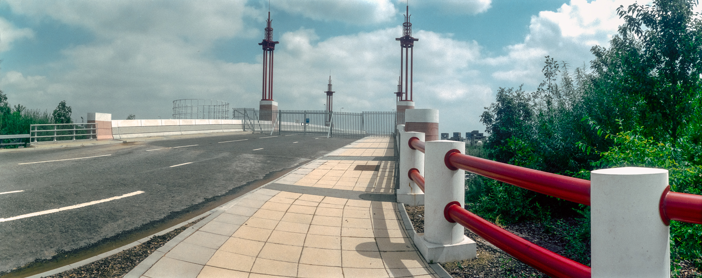
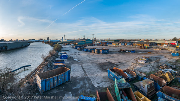
DLR – Connaught Rd & Bow Creek 1994. Continuing my panoramic images made along the path of the DLR in July 1994.

DLR, near Connaught Bridge, Custom House, Newham, 1994, 94-721-33
DLR, Connaught Rd, Custom House, Newham, 1994, 94-721-33

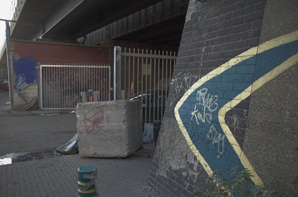
The road layout in this area has changed completely since 1994, but you can see at right the DLR Beckton branch going over the concrete lead-up to the Connaught Bridge. I think GATE 30 at extreme left is to the Excel site and the Connaught Tavern is hidden by the trees in the centre of the picture – and so this road was the old Connaught Road which led to the old swing bridge. I think where I was standing is now the middle of a hotel car park.

Bridges, Bow Creek, East India Dock Rd, East India, Tower Hamlets, Newham, 1994, 94-719-61

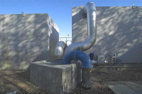
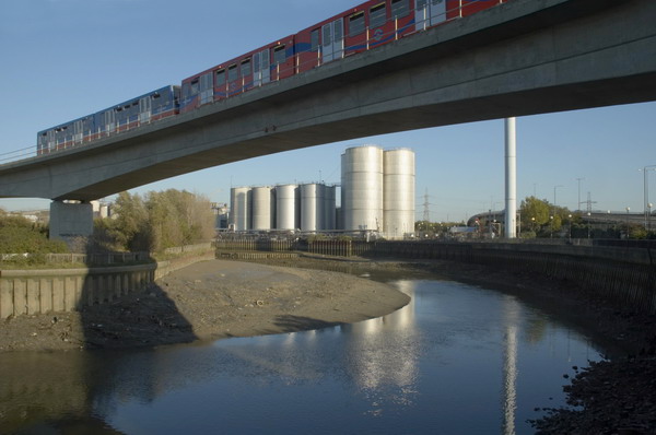
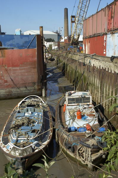
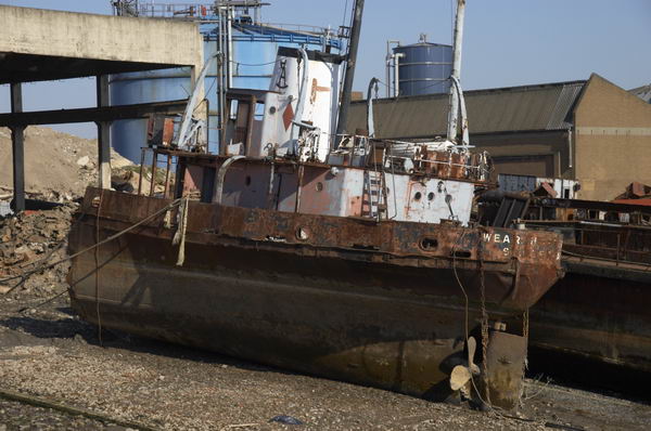
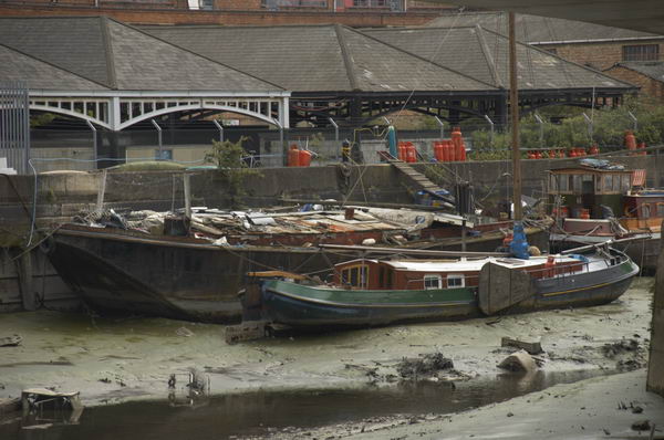
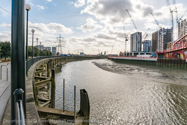
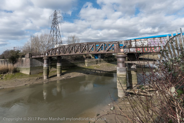
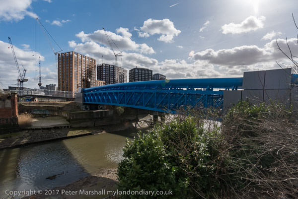
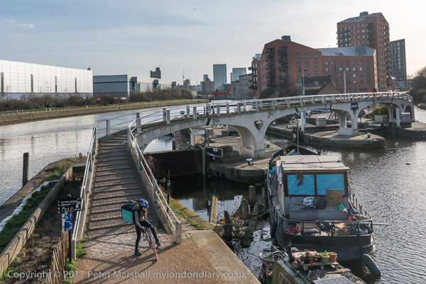
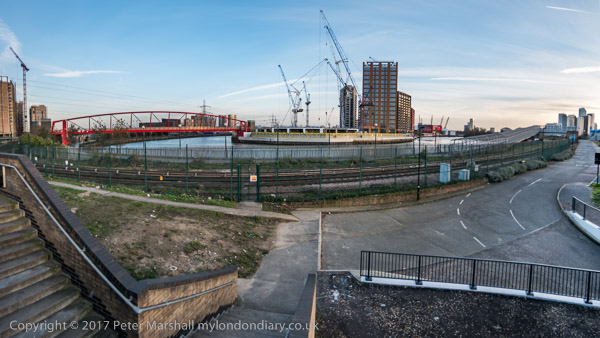
I moved around a mile and a half west and four stops along the DLR line to Canning Town and one of my favourite areas around Bow Creek, which here does two more or less 180 degree turns before flowing into the Thames. These two ‘bridges’ are a few yards south of East India Dock Road and I think both were built as pipe bridges to carry gas across the river.

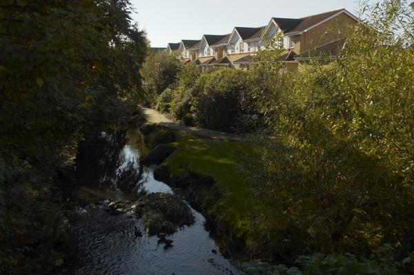
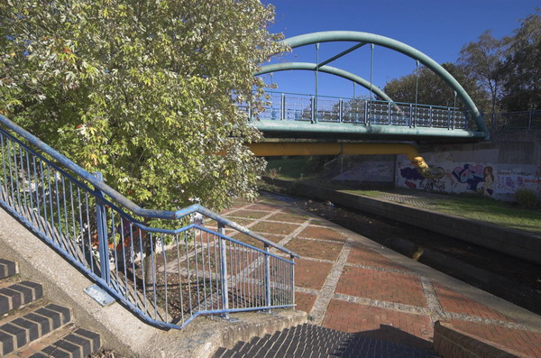
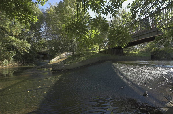
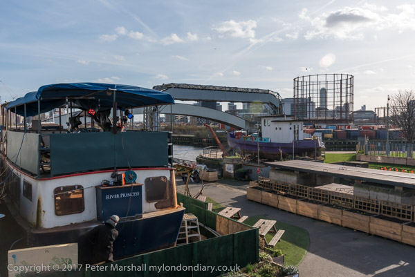
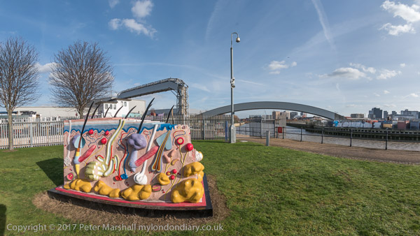
Only the brick end supports of first remain on each bank. The metal bridge in the centre of the image is also a footbridge, now painted blue and leading across the river to the ecology park. Just beyond it, almost completely hidden is a third bridge, a long disused rail bridge. At left are the sheds of a timber yard.

DLR, Bow Creek, Wharfside Rd, Canning Town, Tower Hamlets, Newham, 1994, 94-719-52

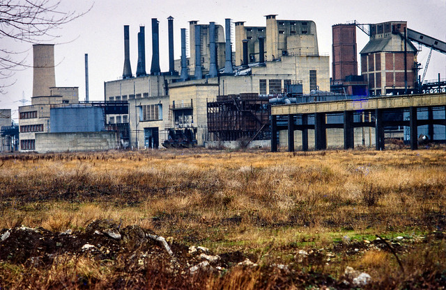
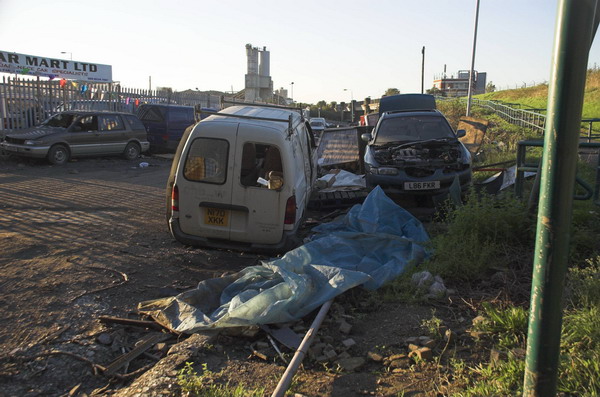
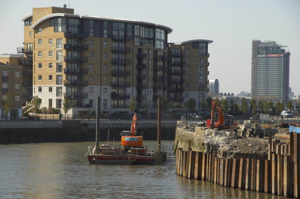
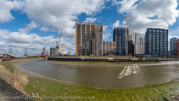
Further East on the East India Dock Road I made this panorama with a sawmill in Wharfdale Road. Beyond that road is a train on the DLR line, and over the top of this you can see the Pura Foods factory on the site where London City Island now is.

DLR, Bow Creek, Wharfside Rd, Canning Town, Tower Hamlets, Newham, 1994, 94-720-31

A few yards further east on East India Dock Road gave this view of Bow Creek, curving 180 degrees around Pura Foods. Locals were pleased to see this London City Island factory go as you could smell it across much of Canning Town.

DLR, Bow Creek, Wharfside Rd, Canning Town, Tower Hamlets, Newham, 1994, 94-720-32

And a similar view but including a DLR train.

DLR, Bow Creek, Wharfside Rd, Canning Town, Tower Hamlets, Newham, 1994, 94-720-23

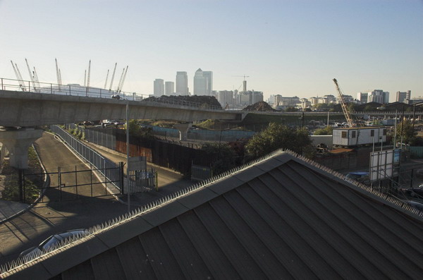
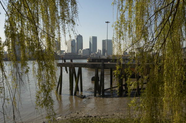
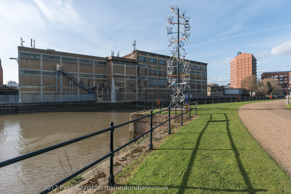
A few yards away I used a crane to frame the image of Pura Foods on its not quite island site. At right of the picture is a bridge across the DLR leading to a riverside walk to Canning Town Station. Although I managed to walk across Reuben’s Bridge several times, it has been mainly locked for the last thirty years, despite being a useful short cut to the riverside station entrance.

Apparently it was closed because people were throwing stones from it onto the DLR, and more recently in 2019 a survey determined that it is non-compliant with current Health & Safety Legislation, Building Regulations, British Standards and associated supplementary guidance.

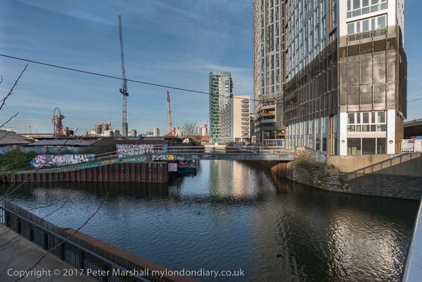
The initial plans were for the riverside walkway to lead all the way to Trinity Buoy Wharf at the mouth of Bow Creek – and a competition was held and awarded for a new footbridge to enable this – but then the plans were dropped. Until a new bridge was built for London City Island the riverside entrance to Canning Town station only led to two dead ends.

More to come.


FlickrFacebookMy London DiaryHull PhotosLea ValleyParis
London’s Industrial HeritageLondon Photos

All photographs on this page are copyright © Peter Marshall.
Contact me to buy prints or licence to reproduce.


Panoramas Around Albert & Victoria Docks – 1994

Panoramas Around Albert & Victoria Docks: More panoramas I made in July 1994 on and around the Beckton Extension of the DLR, getting off the train at each stop, taking a walk around and making a few pictures before boarding the train again

DLR, Roundabout, Royal Albert Way, West Beckton, Newham, 1994, 94-718-33

One of the few pictures I made with a deliberate tilt of the camera in order to get the whole circle of the roundabout in the image. As you can see this results in a curved horizon.

DLR, Albert Dock, West Beckton, Newham, 1994, 94-719-11

The DLR stations on the elevated line often provided a useful viewpoint. Along the horizon here at left you can see the church at Silvertown, then the Silvertown Flyover. Around the centre are the mills on Royal Victoria Dock, then the more distant Canary Wharf and past that the Grade II listed 1881 Connaught Tavern. At right is the Compressor House, built in 1914 as a cold store for the dock.

DLR, Albert Dock, West Beckton, Newham, 1994, 94-721-22

A view through the front window of a DLR train which shows the Compressor House next to the Royal Albert Dock Station and the long stretch of the Royal Albert Dock. At the left are the houses of West Beckton. At right is London City Airport with a couple of planes.

DLR, Connaught Crossing,  Custom House, Newham, 1994, 94-721-42
DLR, Connaught Crossing, Custom House, Newham, 1994, 94-721-42

A view from the side of the train as it goes across Connaught Road looking over the recently built cable stayed swing bridge with reinforced concrete approach viaducts, opened around 1990. It replaced an earlier swing bridge built in 1904 to carry both the road and the North Woolwich Railway across the Connaught Passage between the Royal Victoria and Royal Albert Docks. The small octagonal building to the left of the bridge pumps water from the Connaught Tunnel, originally by hydraulic pumps but now by electric pumps. This was replaced by a larger circular structure when the tunnel was rebuilt for the Crossrail.

DLR, Victoria Dock Rd, Canning Town, Newham, 1994, 94-718-53

The DLR line runs beside Victoria Dock Road and this picture was made from Custom House Station and shows the junction with Freemasons Rd. Further along Victoria Dock Road you can see The Missions to Seaman Institute, Flying Angel House, built in red-brick Art Deco style in 1936. It closed in 1973 and after being used for some time as a college was converted into flats.

Royal Victoria Dock, Canning Town, Newham, 1994, 94-718-41

The western end of Royal Victoria Dock which closed in 1981. This picture was taken roughlky from where the cable car ride now has its northern terminal. The dockside sheds have been replaced by tall waterside blocks – around 17 storeys. There are still some of the old cranes on the quayside.

More panoramas from 1994 to follow.


FlickrFacebookMy London DiaryHull PhotosLea ValleyParis
London’s Industrial HeritageLondon Photos

All photographs on this page are copyright © Peter Marshall.
Contact me to buy prints or licence to reproduce.


More From Beckton, Cyprus and Silvertown – 1994

I spent a long day in July 1994 travelling up and down the recently opened Beckton Extension, taking some pictures from the trains but also getting off at every station and explouring the area around the stations, sometimes at some length. The previous set of pictures, DLR – Beckton Extension – 1994, began from around the end of the line at Beckton, and these images start with those from a walk from the next station along, Gallions Reach.

In the 2000s there was a plan to extend the DLR from here to Dagenham Dock, but these were cancelled in 2008; now plans have been approved for an extension to a Beckton Riverside station and on under the Thames to Thamesmead.

DLR, Roundabout, Woolwich Manor Way, Cyprus, Newham, 1994, 94-716-13
DLR, Gallions Roundabout, Woolwich Manor Way, Cyprus, Newham, 1994, 94-716-13

From the Gallions roundabout you can go north and south along Woolwich Manor Way or take the more recent roads, Royal Albert Way, Royal Docks Road and Atlantis Avenue. My picture was made from Woolwich Manor Way looking roughly north. In the centre of the roundabout is a pumping station, which I think is a 16-sided building, though I always lose count. On top in its centre is a small 8 sided pimple. Locally listed, it was built for Thames Water in 1974.

Ruins, Beckton Gas Works, Beckton, Newham, 1994, 94-717-61

Beckton Gas Works were built on the East Ham Levels from 1868-1870 by the Gas Light and Coke Company which had been founded in 1812 by Frederick Albert Winsor and was not only the UK’s first gas company but the first public gas company in the world. It was for some years the largest gas works in Europe and until 1969 produced gas for industry and homes across much of East London.

The site was named Beckton after then company chairman Simon Adams Beck and covered a huge of 550 acres. As well as giving room for the huge works, its site on the Thames well to the east of London meant that larger colliers could bring coal to it than to the gas works closer to the city.

As well as town gas, the site also contained the Beckton Product Works which became the largest UK manufacture of tar and ammonia by-products. Beckton was a huge local employer, providing jobs for as many as 10,000 men.

For many years after it closure the site remained derelict and was used in a number of films, most notably Stanley Kubrick’s Vietnam War film ‘Full Metal Jacket’. Back in 1994 there was little left on the site which is now largely a retail park.

I’d taken a few pictures in the area in black and white and colour ten years earlier when more of the works where still there – such as this one:

Beckton Gas Works, Beckton, Newham, 1984 81-NorthWoolwich-008
Beckton Gas Works, Beckton, Newham, 1984

[If you open the image you can browse a few more on Flickr.]

Royal Docks Rd, Galions Reach, Newham, 1994, 94-717-52
Atlantis Avenue, Gallions Reach, Newham, 1994, 94-717-52

A view made from underneath Gallions Reach Station looking roughly north-east towards the former gas works site.

DLR, Approaching Woolwich Manor Way, Cyprus, Newham, 1994, 94-717-43
View from Gallions Reach DLR, Station, Atlantis Avenue, Gallions Reach, Newham, 1994, 94-717-43

I went up to the station platform and made this picture as I waited for a train to arrive. At right you can see the Thames Water pumping station in the middle of the Gallions roundabout. On the left others waiting on the platform can be seen in a mirror. Beyond that is the Royal Albert Dock and in the distance the hills on the other side of the Thames. In the sky is a plane shortly after take-off from London City Airport.

DLR Station, Beckton Park, Beckton, Newham, 1994, 94-717-31
Beckton Park Station, DLR, Beckton, Newham, 1994, 94-717-31

I can’t remember if I got off the train first at Cyprus station or continued directly to the next stop, Beckton Park. The two stations are fairly similar and both are in the centre of roundabouts in the Royal Albert Way, built for the LDDC and opened in 1990.

DLR, Royal Albert Dock, West Beckton, Newham, 1994, 94-717-11

I got back on a train to go to the next stop on the line, Royal Albert, where I took a walk around the area beside Royal Albert Dock dock, making this picture from its west end looking east down the dock. In the distance is a DLR train approaching and to the left is the road leading the the Connaught Bridge. I think the brick structure at left of picture is a ventilator for the railway tunnel below.

Connaught Bridge, Royal Albert Dock, West Beckton, Newham, 1994, 94-717-12
Connaught Bridge, Royal Albert Dock, Silvertown, Newham, 1994, 94-717-12

I made this from a temporary footpath across the channel between the Royal Victoria and Royal Albert Docks a few yards to the west of the Connaught Bridge. Under the bridge is the full 1.75 miles of the Royal Albert Dock, built in 1875-80 and opened by the Duke of Connaught. The dock finally closed to commercial traffic in 1981.

In 1984 I got permission to go onto the site and photograph the remaining buildings – virtually all now demolished. They had no great architectural value but were an important part of London’s history. You can see some of the black and white pictures I took in the book The Deserted Royals – there is a good preview with over 40 pictures on the website and the PDF version is reasonably priced – and rather more, including colour work on Flickr – in the two albums 1984 London Photographs and 1984 Docklands Colour.

More Docklands colour from 1994 in my next post in this series.


FlickrFacebookMy London DiaryHull PhotosLea ValleyParis
London’s Industrial HeritageLondon Photos

All photographs on this page are copyright © Peter Marshall.
Contact me to buy prints or licence to reproduce.


DLR – Beckton Extension – 1994

DLR – Beckton Extension: One of the earliest projects I had used a panoramic camera on was the building of the Docklands Light Railway Beckton extension which had been a part of a transport show at the Museum of London in 1992. I had made these pictures on black and white film – you can view these along with many other pictures in my Flickr album ‘1992 London Photos

DLR, Train, Station, Beckton, Newham, 1994, 94-715-11

So when the Beckton branch from Poplar opened at the end of March 1994 I made a note to myself to return there and make more panoramas along the completed route, but this time working in colour. But I was busy with other things and it was only in July 1994 that I finally managed to go and take some new pictures.

Station Entrance, DLR, Beckton, Newham, 1994, 94-715-13

I began by taking a DLR train to the end of the line, Beckton Station, and then walked out to make a few pictures in the area surrounding the station.

Horses, sculpture, Brian Yale, Beckton Bus Station, Woolwich Manor Way, Beckton, Newham, 1994, 94-716-62

I’d first visited Beckton in 1981, and had gone back briefly when I was working on the DLR construction in 1982, but by 1994 things were very different to my first visit. Then Beckton was still a largely uninhabited area, noted for its gas works – then mainly in ruins and for being at the end oof London’s Northern Outfall sewer.

Station Entrance, DLR, Beckton, Newham, 1994, 94-716-51

There had also been a large postwar prefab estate, but that had been swept away and plans to build large council estates to help solve Newham’s huge housing problems were swept away with the advent of the London Docklands Development Corporation, who sold off most of the land for private housing. The LDDC also commissioned the Horses sculpture by Brian Yale, who had worked for many years as an artist and environmental designer for the architecture department of the Greater London Council, creating “designing murals, sculptures, public art works and play spaces for GLC housing estates and schools“. He was also commisioned by them to produce the long 50 panel The Docklands Frieze at Prince Regent Station.

Robert, Steam Engine, Winsor Terrace, Beckton, Newham, 1994, 94-716-32

Robert, a 0-6-0 tank engine was built in 1933 for the Staveley Coal and Iron works and worked in their sidings until 1969. It then went to various preserved railway sites, at one of which it gained its name. Kew Bridge Steam Museum in 1993 restored it to look like a Beckton Gas Works engine (presumably for the LDDC) and it was placed here. After some vandalism Newham Council took Robert over and moved it close to Stratford Station. The engine was again moved during building works assocatied with the 2012 Olympics and finally came back to a different location outside Stratford Station in 2011. It was still there when I last went to Stratford a few weeks ago.

Beckton, Newham, 1994, 94-716-43

I took a long walk around Beckton, and made quite a few normal format images in black and white, but relatively few colour panoramas, mainly close to the station, then walked rather futher around the area making more panoramas, only relatively few of them on-line at Flickr – two of those in this post are online for the first time including ‘Link Road, Beckton’ below.

Link Road, Beckton, Newham, 1994, 94-716-11

I this was part of one of the ring road schemes around London that was never built, Ringway 2, which was planned go under the River Thames at Gallions Reach in a new tunnel between Beckton and Thamesmead. When I made this picture it simply came to a dead end not far on.

More panoramic pictures from around the DLR Beckton branch in a later post.


FlickrFacebookMy London DiaryHull PhotosLea ValleyParis
London’s Industrial HeritageLondon Photos

All photographs on this page are copyright © Peter Marshall.
Contact me to buy prints or licence to reproduce.


Clock House to Olympic Site – 2005

Clock House to Olympic Site: Thursday October 27 2005 was a fine late autumn day and I decided to go for a bike ride, putting my folding bike on a couple of trains to my start point, Clock House station. This is in south east London, halfway between Penge and Beckenham and just inside the London Borough of Bromley.

Big Party, Clockhouse

The Chaffinch Brook runs close by and joins with the River Beck to form the River Pool (aka Pool River) a mile or so north and a footpath going north from there is now part of a national cycle route. Parts of the Pool River which were once culverted have now been restored to an open stream, which will help prevent flooding downstream. The river’s main claim to fame is that four years after my ride then London Mayor Boris Johnson fell into it on an official visit to encourage volunteers who were cleaning the river up.

Big Pipes, New Beckenham

The Pool River is a tributary of the River Ravensborne and I had planned to continue along this as closely as I could to Deptford Creek where it joins the Thames. But I ran out of time, so took the Docklands Light Railway at Lewisham rather than Greenwich to cross the river to Canning Town.

Lower Sydenham

My ride then continued with a loop around Bow Creek and over the Lower Lea Crossing back through Canning Town and on to Stratford Marsh where work was then just beginning to turn this whole area into the Olympic site.

Bell Green

It wasn’t a long ride – probably around ten miles in all, perhaps a little longer with all the small diversions I took. All the pictures here were taken on this ride and there are more on My London Diary, along with the account below that I wrote back in 2005. As usual I’ve made a few small corrections.


Pool River and Ravensbourne (left) join

The Brompton folding bike is really an ideal form of transport for London, an essential tool for the urban photographer. It’s short wheelbase is great in slow-moving crowded traffic, and it can be folded in 15s to travel by tube, rail, taxi or even bus. [I’ve never put mine in a taxi.] The only problem is that they are highly prized by cycle thieves. [They are fairly expensive and slip easily into a car boot.]

Bridges over Bow Creek, River Lea, Canning Town, London

The weather forecast was for a fine summery day, so I took the opportunity to check up on a few things and fill in some little gaps, where I’d not quite managed to photograph things before. First I wanted to go along the footpath at Bell Green, next to Sainsbury’s, so I decided to make a slightly longer trip of it by starting at Clock House Station. There is a good, almost traffic-free route north from there along the Pool River, then the River Ravensbourne, at times surprisingly rural.

DLR viaduct over Bow Creek

Taking photographs slows you down, as does stopping to sit in the sun and eat sandwiches, so at Lewisham I decided to get on the DLR with the bike to travel to Canning Town.

DLR extension, Millenium Dome and Canary Wharf from Silvertown Way.

Perhaps one day the riverside walkway by Bow Creek from the station will open [it did, but only to go across a new bridge to City Island – the route south still comes to a dead end], but it seems unlikely to be in our lifetime. I went round the creek, over the Lower Lea Crossing and on to Silvertown Way to see how the new stretch of DLR was progressing. [It opened north of the river at the end of 2005.]

Car sales, Stratford Marsh

Then I cycled up to Stratford to take a look at Stratford Marsh again before work starts in earnest to demolish the existing businesses and create the Olympic waste. It was getting later and noticeably darker by the time I was there, although the day felt like summer, it gets dark rather earlier at the end of October.

The Greenway goes under the railway line on Stratford Marsh.

What really makes no sense at all is to put our clocks back to make it even darker still, as we were going to do in a couple of days time. If I were in charge, we’d move to the same time as France and the rest of our neighbours across the channel. I don’t like dark mornings, but it would be much better than having it get dark in the middle of the afternoon in winter. Orcadians or even Scots would be welcome to have their own time zone if they really must, but its about time they stopped imposing it on the rest of us. The sun set around 5.30, and next week that means it will be 4.30pm.

Twilight for Stratford Marsh

More pictures start here on My London Diary.


FlickrFacebookMy London DiaryHull PhotosLea ValleyParis
London’s Industrial HeritageLondon Photos

All photographs on this page are copyright © Peter Marshall.
Contact me to buy prints or licence to reproduce.


Limehouse and East India – 1994

Limehouse and East India: I spent most of Saturday 11th June 1994 wandering in the area between Limehouse, Blackwall and the former East India Docks, concentrating on making panoramas, some of which were the post Limehouse, Poplar, Blackwall and East India Panoramas – 1994 but I also took a number of black and white and colour images. You can find more of both in two Flickr albums – links at the bottom of this post – but here is some of the colour work. These pictures will have been made using an Olympus OM$ camera on Fuji film. I carried a range of lenses from 21mm to 200mm, though probably most all were taken with 28mm or 50mm lenses.

Limehouse Link Tunnel, Aspen Way, Poplar, Tower Hamlets, 1994, 94-61-55

The eastern entrance to the Limehouse Link Tunnel which was officially opened in 1993. Both portals have decorative sculptures, this one an untitled abstract by Nigel Hall which I find it hard to find any point in. The 1.1 mile tunnel took 4 years to build and cost £293,000,000 making it the most expensive road scheme in Britain per mile.

Limehouse Link Tunnel, Three Colts St, Limehouse, Tower Hamlets, 1994, 94-61-44

This is the Limehouse Link Eastern Service Building. With a huge volume of traffic passing through the tunnel presumably the main service needed is ventilation and those chimneys presumably are on top of huge fans for the purpose, sharing the pollution with the community.

St Dunstan's Wharf, Dunbar Wharf, Narrow St, Limehouse, Tower Hamlets, 1994, 94-61-33
St Dunstan’s Wharf, Dunbar Wharf, Narrow St, Limehouse, Tower Hamlets, 1994, 94-61-33

The story of Dunbar Wharf is told on the Isle of Dogs Life web site in the article Dunbar Wharf and the Remarkable Story of Duncan Dunbar, and I’ve written more about it in previous posts. Duncan Dunbar made a fortune as a brewer and wine merchant and on his death in 1825 his son, also Duncan Dunbar used this to set up a large shipping fleet, becoming one of the richest men in Britain.

As well as goods to and from the world Dunbar’s shipping line made 37 trips carrying convicts to Australia and were troopships for the Crimean War. He never married and had no children and on his death in 1862 the ships were all sold and the business closed.

The buildings here date from the mid 19th century and are Grade II listed.

London Art Fashions, Limehouse, Tower Hamlets, 1994, 94-61-34

I think this was the window of a tailor’s shop in Limehouse, but cannot recall its exact location. The caption I gave it came from the black and white poster at the back which I suspect is from the 1920s or 30s, though I’m certainly no fashion expert, while the blue framed image at lower left looks to me a little older and has an interesting lady golfer.

Chinese Restaurant, Limehouse, Tower Hamlets, 1994, 94-61-23

Limehouse and Poplar used to be London’s Chinatown before that moved to Soho, and some traces remain, rather more back in 1994 than now. On the wall is a calendar for the ‘Year of the Dog’ and a notice informing us that:

‘*WE NOW SELL
‘CHICKEN’ BALLS’ IN BATTER
PLEASE ASK STAFF
£2 A PORTION THANK YOU’

The two green hexagons floating in the centre close to the top of the picture (with some more very faint and above them to their right) are photographic artifacts, lens flare, images of the lens iris reflected from some interior lens surface from a light source just outside the frame. But I rather like the effect here.

Hairdresser, Limehouse, Tower Hamlets, 1994, 94-61-24

Looking through a window into a hairdressers with a red-edged counter and mirrors, red chairs and red towels hanging on hooks seen in the mirror. It wasn’t possible for me to get enough depth of field to make everything in the picture pin sharp, but this perhaps makes the mirrored image stand out a little more.

East India Dock Tunnel, Aspen Way, Poplar, Tower Hamlets, 1994, 94-61-51

The lane closer to the centre of the image dives here into the East India Dock Tunnel with the red brickwork of the tunnel mouth at the right of the picture. The tunnel was opened in 1993. At the left is Canary Wharf Tower, then in isolation, in front of it the bridge and red tower of East India DLR station. The rather depressing 1990 ten-storey granite clad post-modern office blocks on the site of the main East India Dock have now been comprehensively redeveloped mainly for residential use and rebranded as ‘Republic’.

Canary Wharf, DLR, Power Station, South Bromley, Tower Hamlets, 1994, 94-61-53

Further east also looking back to Canary Wharf from underneath the DLR viaduct with the former switchgear house of Brunswick Wharf Power Station at right. Planned in 1939 but not built until after the war this was a coal fired power station on the site of the East India Export Dock. In 1948 the dock was filled in but post-war financial constraints meant the power station was only became operational in 1952, and finally completed in 1956.

In 1970 it was converted to burn oil, probably to reduce air pollution in London. Increases in oil prices later made this one of the more expensive generating stations and it was closed in 1984 and sold for redevelopment in 1987.

Most of the power station was demolished in 1989 but this building remained, I think until around 2005 when it was demolished for a large residential development, Virginia Quays, which has on the riverbank the 1951 Grade II listed Virginia Quay Settlers Monument.

My 1984 albums on Flickr:

1994 London Colour
1994 London Photos (Black and White)


FlickrFacebookMy London DiaryHull PhotosLea ValleyParis
London’s Industrial HeritageLondon Photos

All photographs on this page are copyright © Peter Marshall.
Contact me to buy prints or licence to reproduce.


Limehouse, Poplar, Blackwall and East India Panoramas – 1994

Limehouse, Poplar, Blackwall and East India Panoramas: In June 1994 I took a walk east from Limehouse, making a new series of panoramic images as well as taking some more normal photographs. I think these images were taken on a couple of different walks, but here I’ll present them in a roughly geographical order, going east from Limehouse Basin to East India Dock Basin station and largely following the Docklands Light Railway.

Limehouse Dock, Limehouse, 1994, 94-62-32
Limehouse Dock, Limehouse, Tower Hamlets, 1994, 94-62-32

Limehouse Dock in 1994 was not surrounded by flats and there was a clear view from the the council flats – John Scurr House – on the corner of Ratcliffe Lane and Branch Road – which you can see at the right.

And in 1994, as in many such blocks, there was little or no entrance security so I could simply walk in and up the stairs to take pictures such as this. The DLR viaduct runs from the left side to St Anne’s Church and the marina is almost empty, while Canary Wharf Tower in the distance is twice the height of the buildings around it, but now is surrounded by other tall towers.

Bridge, Aspen Way, Poplar DLR, Poplar, Tower Hamlets, 1994, 94-65-62

The bridge that leads across Aspen Way from the West India Docks to Poplar DLR station at the extreme right of the picture. At left you can see the DLR line from West India Quay which crosses the road in a blue bridge to join the line from Limehouse.

This picture made a rather nice album cover for the 1998 album The Limehouse Link by Mucho Macho, particularly impressive on the 12″ vinyl where it is carried across both front and back – reproduced at 24 by 12 inches, considerably larger than the CD version.

As Darryl Sterdan’s 1999 review stated “No vocals are no problem for the British DJs on their auspicious debut release” and despite its cover it made little impact.

DLR, Canary Wharf, Blackwall, Tower Hamlets, 1994, 94-63-22

I’d taken photographs in earlier years around the building of the Beckton extension of the DLR and the Limehouse Link tunnel and both had caused major changes in the area. Among which was this rather convoluted footpath leading under the road and DLR south from Blackwall Station.

Bridge, Blackwall Tunnel Approach, Naval Row, Blackwall, Tower Hamlets, 1994, 94-63-62

Parts of the Grade II listed inscription on the Northern portal of the Blackwall tunnel, built in 1897 are hard to read in my picture, so here it is in full: ‘THIS TUNNEL CONSTRUCTED BY THE LONDON COUNTY COUNCIL WAS OPENED BY/ HRH THE PRINCE OF WALES K.C. ON BEHALF OF HER MAJESTY QUEEN VICTORIA ON 22nd MAY 1897 IN THE 60th YEAR OF HER REIGN/ SIR ALEX R. BINNIE ENGINEER’

I had to wait some time back in 1994 for a train to pass across on the DLR. Services now are usually more frequent.

Dock, DLR Station, East India, South Bromley, Tower Hamlets, 1994, 94-63-52

I wandered rather a long time around East India Dock station, using the bridge across Aspen Way to photograph on both sides of the road. Here I photographed the station across an area of water which has been created in a part of the area formerly occupied by the East India Dock (Import), though I think nothing original remains. So probably I should caption this ‘water feature’ rather than ‘dock’.

East India DLR Station, South Bromley, Tower Hamlets, 1994, 94-64-52

Framed at the centre of this image are two towers, Canary Wharf and the much closer tower in Naval Row of the mid 19th century Italianate East India Dock Pumping Station, Grade II listed and one of the few relics of that dock, along with some listed walls and steps and the areas of water. The two towers are a similar shape but actually very different in size and detail.

More pictures from these June walks later.


FlickrFacebookMy London DiaryHull PhotosLea ValleyParis
London’s Industrial HeritageLondon Photos

All photographs on this page are copyright © Peter Marshall.
Contact me to buy prints or licence to reproduce.


NHS at 65, Lewisham & the DLR – 2013

NHS at 65, Lewisham & the DLR: Friday 5th July 2013 was the 65th anniversary of the founding of our National Health Service and I photographed three events connected with this, two in Westminster and one opposite Lewisham Hospital where campaigners were fighting to keep services. And on the way back from Lewisham I took some pictures though the window of the DLR train, mainly as we went past Deptford Creek.

The National Health Action Party was a publicity stunt and single issue parties such as this are never likely to make much widespread impact on British politics. But given the strength of the recent Labour rebellion over Starmer’s attack on the disabled I wonder if a new left of centre political party might result in a radical change in our political system, with possibly a significant number of Labour MPs deserting the sinking ship in favour of a party which represents traditional Labour values. We could then have two different parties fighting out the next election.


NHS 65: GMB – Westminster

NHS at 65, Lewisham & the DLR - 2013

The GMB trade union came with three vintage ambulances to protest outside Parliament where trade unionists in vintage ambulance uniforms posed with MPs including Dennis Skinner and Sadiq Khan warning that the NHS is at risk.

NHS at 65, Lewisham & the DLR - 2013
Dennis Skinner
NHS at 65, Lewisham & the DLR - 2013
Sadiq Khan, then MP for Tooting, poses for his own photographer

I’m afraid I’ve forgotten who the other MPs were, but you can see a couple more in the pictures on My London Diary I took as the photographer for the GMB posed and photographed them. I have a personal antipathy to posing people, though I might occasionally deliberately attract their attention and even very occasionally ask them to keep still or look at me. But generally I see my role as recording what is happening rather than directing it. And here what was happening was that people were being photographed.

NHS at 65, Lewisham & the DLR - 2013

Later I went with them (and the ambulances) as they took 65th Birthday cards for the NHS, with the message inside “Do Not Pension Off Our NHS’ to the Ministry of Health, then still in Richmond House on Whitehall.

More at NHS 65: GMB.


NHS 65: Lewisham Hospital

NHS at 65, Lewisham & the DLR - 2013

In the memorial garden opposite the Save Lewisham Hospital Campaign were holding a lunchtime party to celebrate the 65th Birthday of the NHS, and as a part of their campaign to keep this busy, successful and much needed hospital open.

The plans for its closure were not related to the hospital’s performance in any way but because the health authority needed to make drastic cuts to meet the disastrous PFI debts of a neighbouring hospital.

There had been a massive community campaign to save vital NHS services at the hospital, backed by “Patients, NHS staff, Lewisham Council, MPs, schools, pensioners, families, businesses, faith groups, charities, unions, students and health campaigners” – the whole community including the Millwall Football Club.

Later at the end of July 2013 the High Court ruled in favour of the Judicial Reviews by the Save Lewisham Hospital Campaign and Lewisham Council and quashed the Government’s closure plans. And ten years later in July 2023 on the 75th anniversary of the founding of the NHS a newly engraved community bench was unveiled to celebrate the victory. I’m sorry I wasn’t present to record that occasion.

More at NHS 65: Lewisham Hospital.


DLR Views – Deptford-Canary Wharf

I decided to travel back from Lewisham into central London by taking the DLR to Canary Wharf where I could change to the Jubilee Line because I could try to take some pictures from the train, particularly on the section where the viaduct goes alongside and over Deptford Creek.

There are many problems in taking pictures from trains. Finding a reasonably clean window is the first, and avoiding reflections another. It was easier back in the 1970s when there were windows you could pull down and lean out! And now apparently AI can remove reflections, though I’ve yet to try it.

DLR Views


NHS 65: Rally & Camarathon – Westminster

On the 65th Birthday of the NHS, Dr Clive Peedell began a 65 mile ultramarathon to David Cameron’s Witney constituency to bury the NHS coffin and launch the National Health Action Party plan by doctors and health professionals to revive the NHS.

Dr Clive Peedell posed in a Cameron mask with the coffin and wreath and had come with a small group of supporters, including one wearing a mask of his coalition partner Nick Clegg. Campaigners accuse both of deliberately running down our NHS, with more and more NHS services being delivered by private healthcare companies.

After posing in front of the Ministry of Health, the campaigners crossed Whitehall to stand in front of the gates of Downing St before processing behind the coffin to Parliament for more pictures, ending with some street theatre involving severed hands and speeches by several distnguished health professions including the Chair of the Royal College of GPs in Old Palace Yard.

I left before Dr Peedell and two others set off on his long run – though I’m sure others would be carrying the wreath and coffin. The event had clearly been set up to attract the media, but received little publicity.

On My London Diary you can read a long statement by Dr Peedell about how the “2012 Health and Social Care Act, will result in the NHS being increasingly dismantled and privatised” with the Labour Party whose “previous pro-market, pro-privatisation reforms, actually set the platform for the current changes” had failed to sufficiently oppose. Health professionals had “formed the National Health Action Party to raise awareness and inform the public about what is happening to their NHS” and had today “set out our own 10 point plan to reinstate, protect and improve the NHS“.

Much more on My London Diary at NHS 65: Rally & Camarathon.


FlickrFacebookMy London DiaryHull PhotosLea ValleyParis
London’s Industrial HeritageLondon Photos

All photographs on this page are copyright © Peter Marshall.
Contact me to buy prints or licence to reproduce.


Deptford & Greenwich – 2005

Deptford & Greenwich: Some pictures from two bike rides in April 2005, the second cut rather short by a puncture, around one of my favourite areas of London, mainly along the southern bank of the River Thames. The area has changed fairly dramatically in recent years with new blocks of riverside flats replacing riverside industry, much of which had already ceased work by 2005. I first photographed here around 1980 and it still now makes an interesting walk (or ride) and I’ve done most or all of it a few times since 2005.

Deptford & Greenwich - 2005
River Thames and Drydock, North Greenwich.

As usual I’ll post a slightly amended version of what I wrote at the time on My London Diary together with links to that site which has some more pictures. But I didn’t write anything about the actual pictures except the captions.

Deptford & Greenwich - 2005
Reflection of the Laban building in Deptford Creek, London.

It was a fine sunny day on Thursday 21 April 2005 and I put my Brompton folding bike on the train to Waterloo, then cycled east from there to Deptford and Geenwich, taking another trip along one of my favourite riverside paths around the Greenwich Peninsula.

Deptford & Greenwich - 2005
Trinity Square, Southwark, London SE1. Church is now a rehearsal studio

North Greenwich is still interesting, although the area by the Dome is now rather bleak. Time went surprisingly quickly, and I had only got just past the Dome when it was time to make my way back.

Deptford & Greenwich - 2005
Dry Dock, North Greenwich, London.

Just over a week later I tried to take up the ride from where I left off, but only made it as far as the footbridge over Deptford Creek, when I heard a loud bang as my rear tyre punctured. I should have stopped, mended the puncture and gone on, but I couldn’t face it.

Deptford & Greenwich - 2005
Deptford Creek close to its junction with RIver Thames, Deptford, London.

I wheeled the bike to Greenwich station, got on the train and came home. One of my few gripes about the Brompton is that mending punctures is a bit of a pain; the small tyres are hard to take off and even harder to replace, and if you want to take the rear wheel off, it is a rather tricky business that I’ve yet to master. I have tyres with kevlar inserts that are supposed to be puncture-resistant, but they don’t seem very effective.

Canary Wharf and River Thames from North Greenwich, London

After I’d arrived home and had a cup of coffee, the puncture turned out to be a straightforward job.

Ship breaker’s yard, North Greenwich, London, April 2005
Doorway, Albury St, Deptford,
St Pauls, Deptford, London built by Thomas Archer in 1713
Laban dance centre
Deptford Creek

More pictures on My London Diary
From April 21st 2005
From April 29th 2005


FlickrFacebookMy London DiaryHull PhotosLea ValleyParis
London’s Industrial HeritageLondon Photos

All photographs on this page are copyright © Peter Marshall.
Contact me to buy prints or licence to reproduce.


Canning Town, Cody Dock and Stratford – 2017

Canning Town, Cody Dock and Stratford: On Thursday 2nd March 2017 I made a rather convoluted walk along Bow Creek and the Lea Navigation, arranged around a meeting I had at Cody Dock. You couldn’t then – and can’t quite yet walk beside the river the whole way, but to get to the meeting I had to abandon a small part of the first stretch and catch the DLR, walking on from the meeting to Stratford High Street where I caught the DLR again to go back and complete the short part I’d had to miss out earlier.

Bow Creek & Canning Town

Canning Town, Cody Dock and Stratford - 2017

In this section of My London Diary I included pictures taken both at the start and at the end of my walk, which began at Canning Town Station.

Canning Town, Cody Dock and Stratford - 2017

The riverside walkway at Canning Town is open after many years and can take you to the bridge to London City Island.

Canning Town, Cody Dock and Stratford - 2017

People were living in some of the blocks on the “Island” but there was still a lot of work continuing in this area which Bow Creek loops around on three sides. Another bridge was built across the DLR tracks to allow people from South Bromley in Tower Hamlets a pedestrian route to the riverside path and Canning Town station. Open for a short time it closed well before the station entrance became open, and a gate on it was firmly locked when I tried to cross it.

Canning Town, Cody Dock and Stratford - 2017

This meant I had to make a lengthy detour walking around the Ecology park to get to the Blue Bridge which took me to the East India Dock Road.

Canning Town, Cody Dock and Stratford - 2017

This meant I had to hurry back to Canning Town Station to get the DLR to Star Lane for my meeting at Cody Dock and couldn’t then walk along the north side of the road to take more pictures.

Cody Dock

I made a few pictures on my walk from Star Lane to Cody Dock, and then rather more after my meeting, at first in the dock itself,

and then on the riverside path, thankfully renamed from ‘Fatwalk’ to ‘Leawalk’ and a part of ‘The Line’ sculpture trail.

Leawalk to Bow Locks

I paused briefly to photograph a sculpture made from shopping trolleys in a mock DNA double helix.

My next stop was to photograph the The Imperial Gas Light and Coke Co’s 1872-8 Bromley-by-Bow gasholders and the war memorials – originally at Beckton – with an eternal flame next to a monument to company workers killed in both World Wars.

Steps leading down from Twelvetrees Bridge at Bow Locks took me down to the towpath beside the Lea Navigation.

Bow Locks

Three Mills & Stratford

Three Mills is a tide mill dating from 1776 (though on the site of earlier tide mills mentioned in the Domesday Book) on the Three Mills Wall River. It is the largest tide mill in the UK and the largest surviving in Europe.

Another sculpture on The Line, unveiled on the centenary on Three Mills Green and moved to this position on Short Wall is by Alec Peever and commemorates three men who died in 1901 They died going to the aid of a fourth who had been overcome by the lack of oxygen at the bottom of a well they were investigating.

I walked on to Stratford High Street, turning west to go to Bow Bridge and the Lea Navigation before going back beside St Thomas’s Creek and along Stratford High Street to the DLR Stratford High Street Station for the train to Canning Town.

More from Bow Creek

It was beginning to get a little dark as I came out from the station to photograph from the north side of East India Dock Rd.

This was still an industrial area although a large area seemed now to be unused. I thought it would probably not be long before this area too was covered in flats as I walked back to the station.

You can see many more pictures and read more about the walk in my four posts on My London Diary:
Three Mills & Stratford
Leawalk to Bow Locks
Cody Dock
Bow Creek Canning Town


FlickrFacebookMy London DiaryHull PhotosLea ValleyParis
London’s Industrial HeritageLondon Photos

All photographs on this page are copyright © Peter Marshall.
Contact me to buy prints or licence to reproduce.