Lewisham Hospital, Greenwich Peninsula, Syria & Mali – 2013

Lewisham Hospital, Greenwich Peninsula, Syria & Mali: As often when I had a long break between two events I took the opportunity to take an extensive walk in one of my favourite areas of London and on Friday 15th February I went to the Thames Path at Greenwich after a lunchtime protest at Lewisham Hospital. Then I went to Whitehall for a small protest against Western military intervention in Mali and Syria and a possible attack on Iran.

Lewisham Hospital, Greenwich Peninsula, Syria & Mali

Fight to Save Lewisham Hospital Continues

Lewisham Hospital, Greenwich Peninsula, Syria & Mali

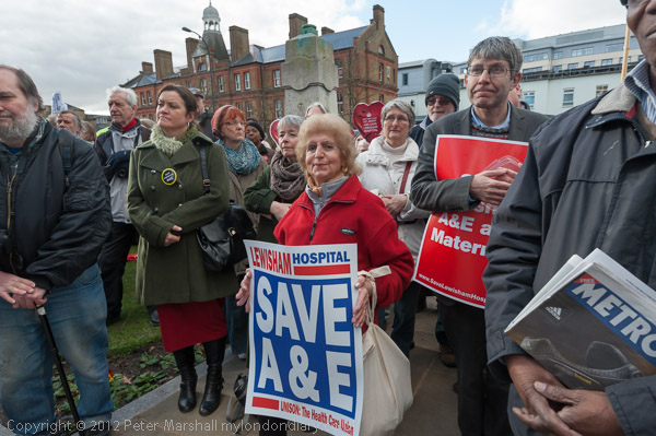
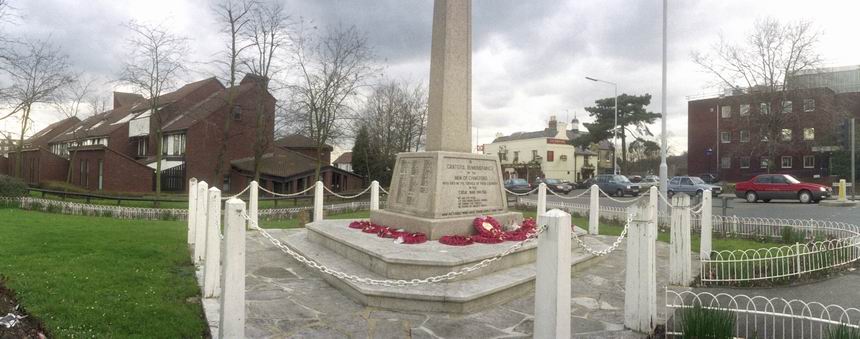
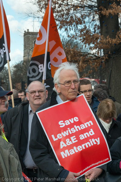
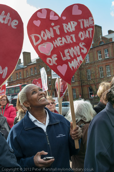
A lunchtime rally at the war memorial opposite the Hospital made clear that the fight by the entire local community to save services at their hospital was continuing.

Lewisham Hospital, Greenwich Peninsula, Syria & Mali

As well as a legal challenge there were to be further mass demonstrations including a ‘Born in Lewisham Hospital’ protest the following month.

Lewisham Hospital, Greenwich Peninsula, Syria & Mali
Lewisham Mayor Sir Steve Bullock

People in the area and all concerned with the future of the NHS were appalled by Jeremy Hunt’s decision to accept to the proposals for closure, which are medically unsound and would lead to more patients dying, but they would result in a huge waste of public funds.

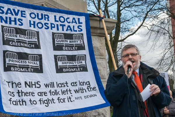
The financial problem that led to the proposal was caused not by Lewisham but by a disastrous PFI (private finance initiative) agreement to build a hospital a few miles away.

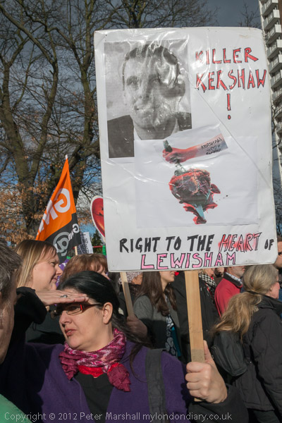
As I wroteL “Lewisham is a successful and financially sound hospital which has received sensible public investment to provide up to date services, and the services that will be cut there will have to be set up again and provided elsewhere by other hospitals. Closing Lewisham will not only incur high costs, but will result in the waste of the previous investment in its facilities.”

Louise Irvine, the Chair of Save Lewisham Hospital Campaign

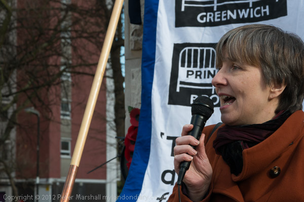
In making his decision Hunt deliberately set out to mislead the public by describing the replacement of A&E as only a small reduction in A&E services. The proposed urgent care centre could only deal with around 30% of the cases currently being covered. Similar the replacement of the current maternity service by a midwife only unit could only deal with around 10% of current births – and life-threatening transfers would be necessary if complications rose in these.

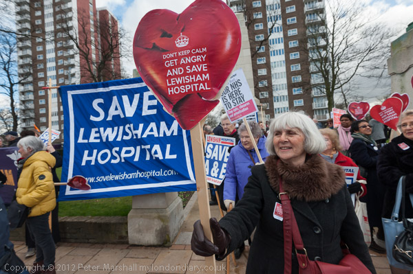
You can read a fuller account of the protest and more pictures at Fight to Save Lewisham Hospital Continues.


Thames Path – North Greenwich – Greenwich

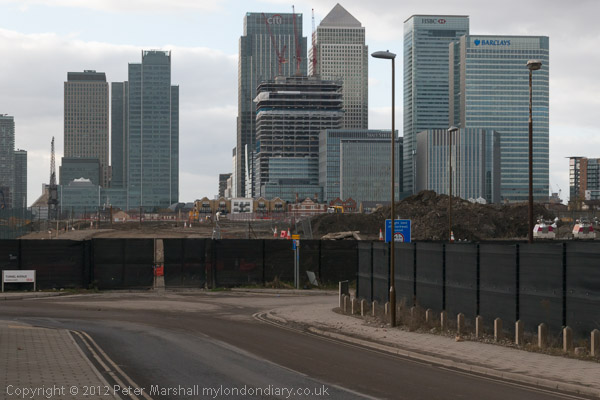
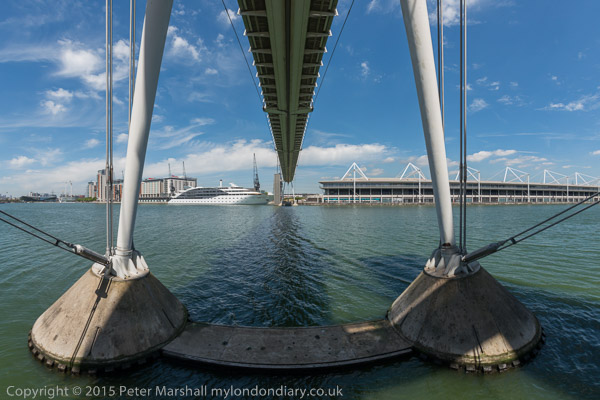
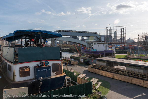
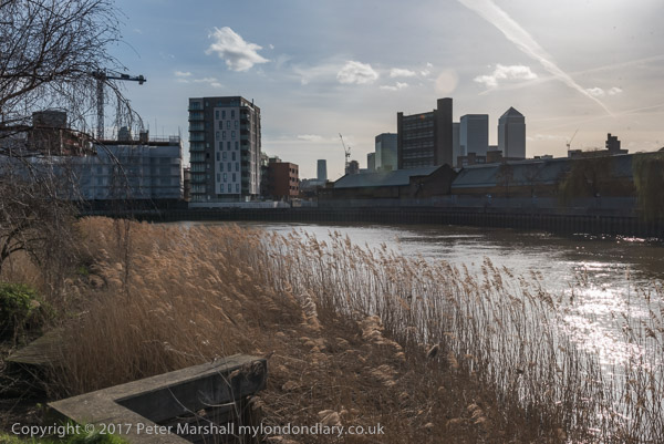
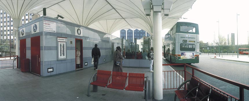
I took a bus to North Greenwich and tried to walk along the Thames Path, parts of which had reopened after a long closure. It was a warm day for February and started off sunny, though later the weather changed giving some dramatic skies.

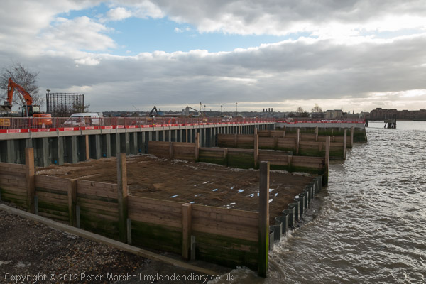
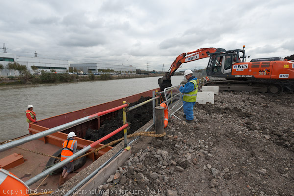
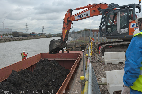
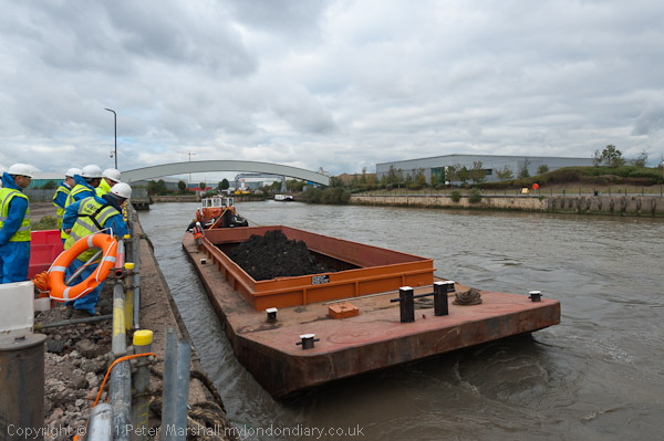
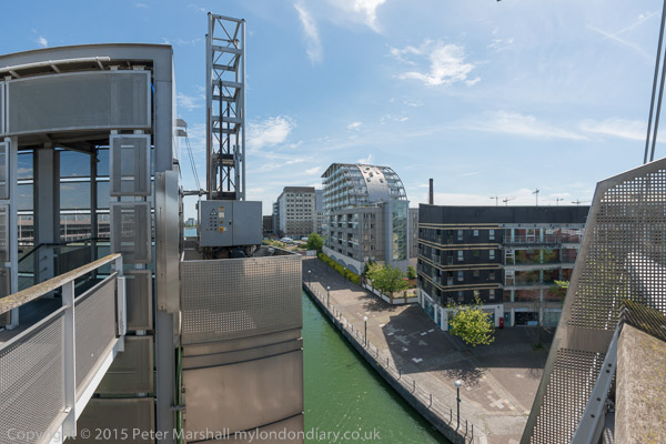
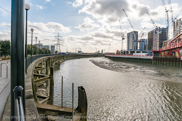
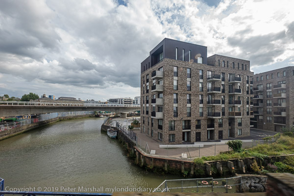
The path from Delta Wharf and north to Drawdock Road was still vlosed but beyond that in both directions the path was open. I’m not sure what all the work taking place was about, but in part it was to provide a new section of the path, and to put in new breakwaters. Some time later of course there will be new riverside flats here, but for the moment these were being built closer to Greenwich.

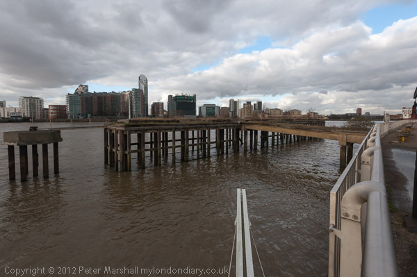
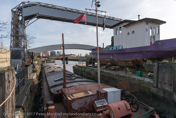
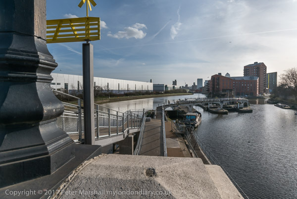
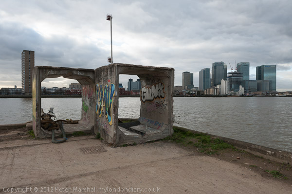
One fairly recent addition to the path was the Greenwich meridian marker at the bottom centre of this picture, the line going along in the gap between two metal beams and pointing north across the river.

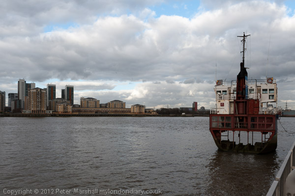
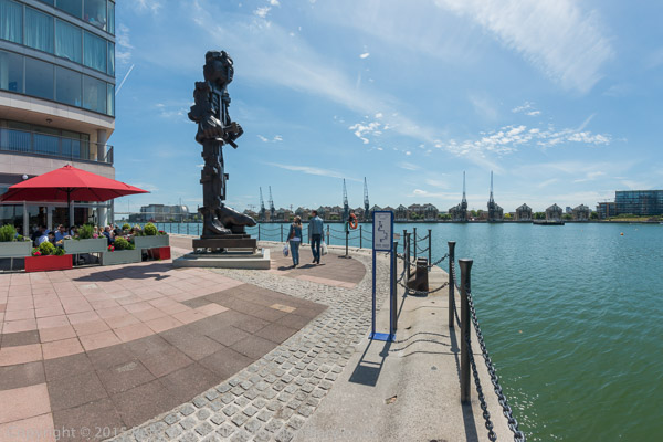
And a little further to the east is the sculpture A Slice of Reality by Richard Wilson. In the following year this was to become part of London’s first public art walk, The Line. It is a 30ft slice of the former sand dredger Arco Trent – Google’s AI gets it badly wrong by describing it as “an eighth-scale replica“. As the name suggests it is a slice of the actual ship.

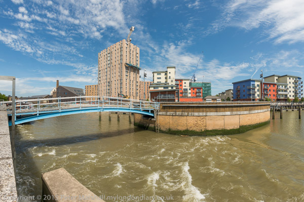
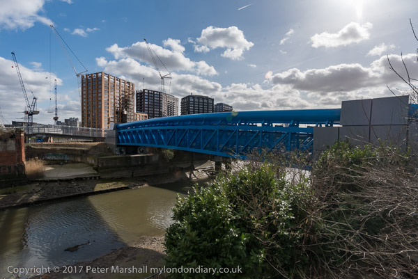
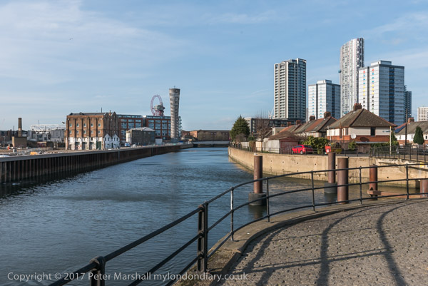
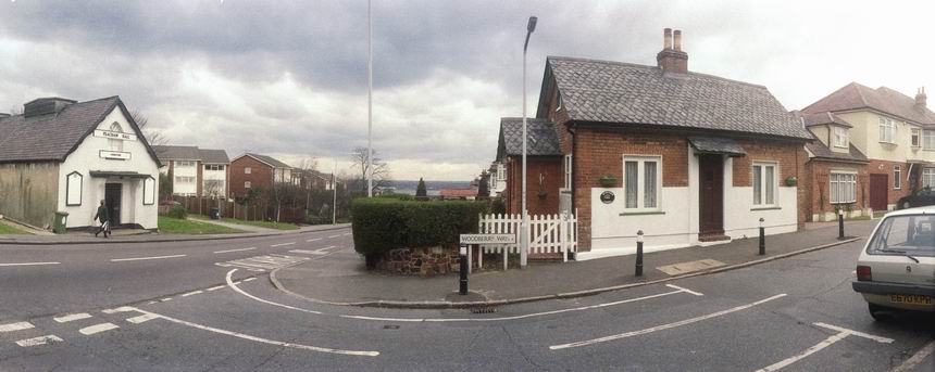
As I turned back and walked towards Greenwich there were some dramatic skies and lighting, but also some slightly boring road walking where the path was diverted away from the river.

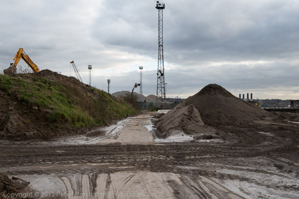
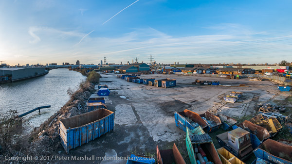
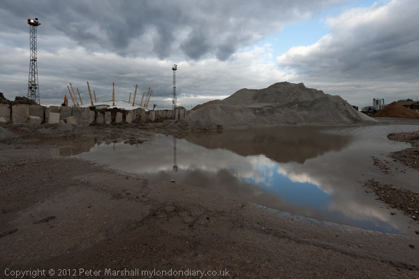
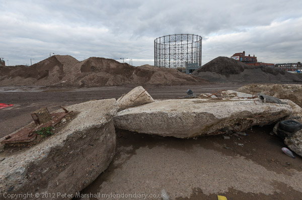
Soon I was able to return to the riverside path and walk through the surreal landscape of an aggregate wharf.

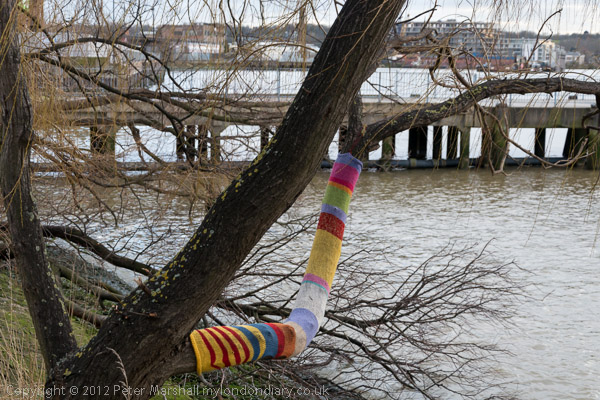
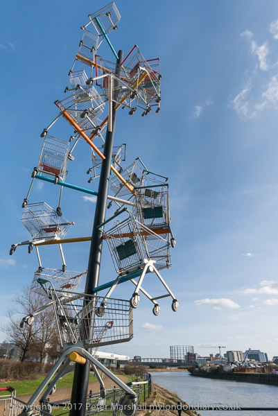
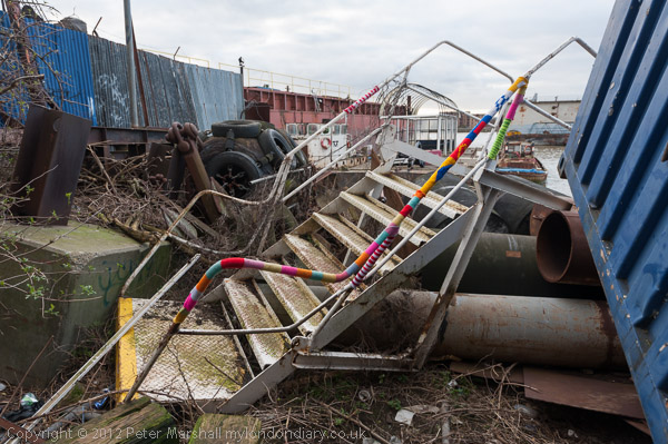
The final section of the walk on my way into Greenwich had been targeted by guerilla knitters.

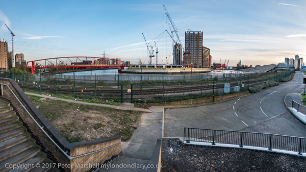
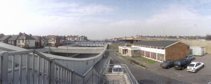
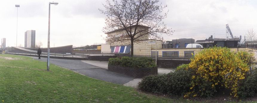
I was getting short of time, and could only stop to make one panorama although the weather was perfect for it.

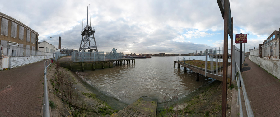
This view shows the riverside path at left going south at the left and north at the right – a view of over 180 degrees. The shoreline here highly curved was in reality straight. I think the image digitally combines half a dozen overlapping frames.

By then I was having to hurry to catch the train back into central London – and the light was falling.

Many more pictures from this walk at Thames Path Greenwich Partly Open.


Stop Western Intervention in Syria & Mali – Downing St

This protest had been called by Stop the War on the 10th anniversary of the march by 2 million against the Iraq war in 2003, the largest protest march ever seen in the UK (and with many others around the world also marching.)

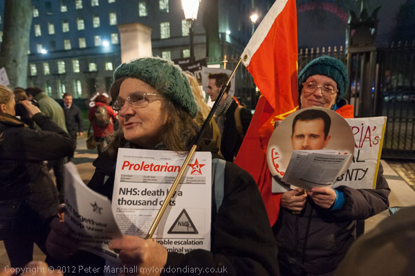
On this occasion they were calling for a stop to Western intervention in Mali and Syria and against the possible attack on Iran but the numbers taking part were very much smaller, with only around a hundred turning up.

Among them were supporters of Syria’s President Assad and Stop the War had lost a great deal of support by opposing the help being given to groups against his regime, with many on the left calling for an end to his regime.

Stop Western Intervention in Syria & Mali


FlickrFacebookMy London DiaryHull PhotosLea ValleyParis
London’s Industrial HeritageLondon Photos

All photographs on this page are copyright © Peter Marshall.
Contact me to buy prints or licence to reproduce.


More Around the Meridian – 1995 Colour – Part 3

More around the Meridian – It’s seldom possible to actually walk for more than a few yards actually on the Greenwich Meridian in London and while planning my Meridian Walk I often wandered around considerably, having to make detours and also looking for the more interesting routes. So not all these images are exactly on the Meridian, but most were taken within a short distance from it.

Greenway, Abbey Lane, Abbey Rd, Stratford, Newham, 1995, 95p4-1151

When I began this project the Meridian was not marked on the Ordnance Survey or Street maps, and one of may first tasks was to get a ruler and pencil it on to them. In 1999 it was added to the OS maps of the area, but does not seem to be on the latest versions. In 1995 there were no smart phones with online maps and GPS which would have made things so much easier.

Greenway, Abbey Lane, Abbey Rd, Stratford, Newham, 1995, 95p4-1152

The Greenway was the recently rebranded path above the Northern Outfall Sewer which rans across East London from Hackney Wick to the sewage treatment plant at Beckton, going under the road here close the the bridge over Abbey Creek on the Channelsea River, where Abbey Lane becomes Abbey Road. You can see the bridge at the left of the picture.

Greenway, Channelsea River,  Stratford, Newham, 1995, 95p4-1153
Greenway, Channelsea River, Stratford, Newham, 1995, 95p4-1153

The Greenway is a great traffic-free cycle route for pedestrians and cyclists, running straight and level and this picture gives some evidence of that.

Channelsea River, Long Wall, Stratford, Newham, 1995, 95p4-1111

I’m not sure what this pipe was for, perhaps for taking gas across the river. Not far away on the other side of this tidal creek was one of the largest gas works in London – and you can still see its listed gasholders, though the view is likely to change soon with the site being redeveloped.

But behind me when I made this picture was the Abbey Mills sewage pumping station and on the edge of the creek below were the storm outfalls where sewage would be released after heavy rains. With the changing tides it would flow downstream a little and then could be taken miles upriver along the Prescott channel and the River Lea.

Gasholders, Leven Rd, Poplar, Tower Hamlets, 1995, 95p4-1332
Flats, East India Dock Rd, South Bromley, Tower Hamlets, 1995, 95p4-1321

I think the Meridian went through the centre of the taller gas holder at Poplar Gas works.

Flats, East India Dock Rd, South Bromley, Tower Hamlets, 1995, 95p4-1321

Another view with the gasholders in the background.

Clove Crescent, East India, DLR, South Bromley, Tower Hamlets, 1995, 95p4-1273

My pencilled line for the Meridian shows it going through both the water in the dock and the brick building at left which was the former Blackwall Power Station in both of these pictures.

Clove Crescent, East India DLR, South Bromley, Tower Hamlets, 1995, 95p4-1263

South of the East India Docks the line crosses the River Thames above and between the two bores of the Blackwall Tunnel, closer to the original western tunnel now used by northbound traffic. I couldn’t take photographs in the tunnel – though it was possible for those on foot to take a bus across, but these would have been rather boring in any case.

Blackwall Tunnel Entrance, Greenwich, 1995, 95p4-1672

This picture shows the southern entrance to the tunnel with its 1897 Grade II listed gatehouse by the London County Council’s Superintending Architect Thomas Blashill. In front of it a less ornate red and white striped arch with heigh and weight restriction signs and hangers to hit any overtall vehicles and hopefully prevent damage to the gatehouse.

Dorringtons, Blackwall Tunnel Southern Approach, Greenwich, 1995, 95p4-1551

One picture not I think actually on the Meridian but not far from it, taken from the long footbridge over the Blackwall Tunnel Southern Approach.

Riverside Path, Greenwich, 1995, 95p4-1762

My path continued south along the riverside path, with the Meridian going into the River Thames on the extreme left of this picture.

Riverside Path, Greenwich, 1995, 95p4-1742

I kept to the land continuing along a path I’ve walked many times and making a few more pictures.

Riverside Path, Greenwich, 1995, 95p4-1743

Like much of London’s riverside almost all of the industry has now gone, but some relics remain, though most of this part of my route is now lined by rather boring flats.

I rejoined the Meridian where it made landfall in Greenwich – where I made some of the pictures at the end of my earlier post.

More colour work from 1995 including some more panoramas in a later post.


FlickrFacebookMy London DiaryHull PhotosLea ValleyParis
London’s Industrial HeritageLondon Photos

All photographs on this page are copyright © Peter Marshall.
Contact me to buy prints or licence to reproduce.


1995 Colour – Part 2 – Greenwich Meridian

1995 Colour – Greenwich Meridian: The second of a series of posts on my colour work, mainly in London, from 1995, 35 years ago and when I’d been working extensively with colour negative film for ten years, though still continuing to work with black and white.

Obelisk, Trig Point, Pole Hill, Chingford, Waltham Forest, 1995, 95p03-841

In 1992 I began making colour panoramas using a Japanese Widelux F8 swing lens panoramic camera – and later I used a Russian Horizon which gave similar results. Both worked with normal 35mm film but produced negatives that were a little under 60mm wide rather than the 36mm of normal cameras. Both use clockwork to swing the taking lens around a third of a circle exposing the film through a narrow slit behind the lens. The film was held in a curved path – again around a third of a circle – with the lens at the centre of the circle so that the lens to film distance remained constant.

Peacham Hall, King's Head Hill, Woodberry Way, Chingford, Waltham Forest, 1995, 95p03-411
Peacham Hall, King’s Head Hill, Woodberry Way, Chingford, Waltham Forest, 1995, 95p03-411

This arrangement avoided the change in distance from the lens to film that gives some stretching of the subject towards the edges of the frame – and begins to become very noticeable in ultra-wide lenses, particularly wider than around 18mm focal length on a 35mm camera.

95p03-552-Edit
Level Crossing, Highams Park, Waltham Forest, 95p03-552

Using the curved film plane avoids this distortion and enables a much wider field of view, while using a fairly moderate focal length – the Widelux has a 26mm f2.8 lens and gives negatives 24x56mm with a horizontal angle of view of 123 degrees.

Bridges, North Circular, Hale End Rd, Hale End, Waltham Forest, 1995, 95p03-463

But there is a downside. Creating the image in this way gives a curvature to objects which is unlike our normal vision which is particularly noticeable on any straight lines, though lines parallel to the axis the lens rotates around remain straight – so if you hold the camera level, verticals will remain straight. But other lines become curved with the effect increasing away from the image centre, giving what is often called a “cigar effect“.

Raglan Rd, Lea Bridge Rd, Whipps Cross, Waltham Forest, 1995, 95p4-373

This is a constraint which makes composition far more difficult using a swing lens camera, and was not helped by a rather poor viewfinder on the Widelux. Usually for landscape work I tried to visualise the effect of the curvature and chose a suitable camera position, levelled the camera on a heavy Manfrotto tripod using the spirit level on the camera top plate, lining the camera up using two arrows on the top plate to show the extent of the view (more accurately than the viewfinder) and then pressing the cable release to make the picture.

Stratford Bus Station, Great Eastern Rd, Stratford,, 1995, 95p4-922
Stratford Bus Station, Great Eastern Rd, Stratford, Newham, 1995, 95p4-922

For photographing events and some creative effects this is a camera you can use handheld, but you have to remember that even when using its fastest speed of 1/250 second the camera actually takes quite a lot longer to scan around the curved film.

Crowley's Wharf, River Thames, Greenwich, 1995, 95p4-672
Crowley’s Wharf, River Thames, Greenwich, 1995, 95p4-672

These pictures are from a project I began in 1995 with the approaching Millennium in mind. It seemed to me to make sense to carry out a project based on the Greenwich Meridian.

Greenwich Boating Pond, Park Vista, Greenwich, 1995, 95p4-1431

So I set about walking the Meridian, photographing it at various points in London and used some of these pictures in an attempt to get public funding for a Meridian Walk with some markers in pavements and a web site and publication. Panoramic images seemed a very appropriate format for illustrating the line.

Greenwich Meridian, Royal Observatory, Greenwich, 1995, 95p4-1242

Unfortunately my grant application as usual was unsuccessful, but I did go on to take some more photographs. In 2009 others produced a Greenwich Meridian Long Distance Path covering all of the Meridian in England from Peacehaven to Sand La Mere which of course goes through London and we also have The Line Sculpture Trail. Quite a few more Meridian markers were also added in London since I made this walk.

Many more panoramas from my Meridian project and other colour images from 1995 in the album 1995 London Colour.


FlickrFacebookMy London DiaryHull PhotosLea ValleyParis
London’s Industrial HeritageLondon Photos

All photographs on this page are copyright © Peter Marshall.
Contact me to buy prints or licence to reproduce.


Barging on Bow Creek – 2011

Barging on Bow Creek: On Wednesday 12 October 2011 I was pleased to get paid to go back to Bow Creek and take photographs of a working barge on Bow Creek in Poplar.

Barging on Bow Creek - 2011

Bow Creek is the lower part of the River Lea, between Bow Locks and the River Thames. Bow Locks mark the southern end of the Lea Navigation and since London’s oldest canal, the Limehouse Cut opened in 1770, most canal traffic took advantage of this to take a more direct route to the Thames and avoid the dangerous and meandering tidal Bow Creek.

Barging on Bow Creek - 2011

The River Lea remains tidal some miles above Bow Lock, but this tidal section is separate from the navigation, although there are various channels and locks such as City Mill Lock and Carpenters Lock on the Olympic site which link the two.

Barging on Bow Creek - 2011

Bow Creek continued to be used for navigation, including for bring coal to West Ham Power Station and the huge Imperial Gas Light & Coke Company gas works at Bromley-by-Bow.

Barging on Bow Creek - 2011

But the gas works closed in 1976 although its gasholders remain – they were still in use for gas storage until 2010. (I went inside the site to photograph them in 2022.) Planning permission has now been granted for 2,200 new homes on the site, retaining the seven gasholders. The gas works dock is now Cody Dock, a creative and community hub with moorings and a short walk from the DLR at Star Lane, hosting many intersting events.

West Ham Power Station ended production in 1983 and was then demolished to build a business park. In the lower sections of Bow Creek there were still a number of timber yards and a ship repair business still using the creek at least in the 1980s, but I think all all commercial traffic has now ended.

Much was made during the construction of the Olympic site of the use of barges to carry waste away from the area, and a new lock was built at great expense on the Prescott Channel at Three Mills Green, but I think barges were only used for PR photographs and the huge majority of waste was taken out by lorries.

So I was pleased to hear that “the people cleaning up the gas works site at Poplar … were using barges to carry out the highly toxic soil from the site* and “… “was delighted to be given a commission to go and photograph the barging.”

This is what a rubbish recycling plant looks like

On My London Diary I write more about my relationship with the River Lea which had begun in 1981 when “I heard a story on the radio that commercial barge traffic was about to come to an end on the Lea Navigation, and decided to travel across London to record its last days.” From then I carried out a major project on the river, but was disappointed to have a funding application turned down.

I returned to the River around ten years later and again in the early 2000s, with more frequent visits after the Olympic bid was successful – although access to the main site was soon impossible. In 2010 I published Before the Olympics, ISBN: 978-1-909363-00-7 with over 200 pictures from the source to the Thames.

The My London Diary post also describes my experience on the visit – how I had to dress up to take the pictures – and that although I’d been promised I would have half an hour to take photographs it actually ended up as 11 minutes.

After taking the pictures – both for the project PR and myself – I had the rest of the day to take a walk along Bow Creek again and made my way to the Thames on the Greenwich meridian, where I found “a new marker installed in the Virginia Quay estate next to West India Docks station, built since I carried out my ‘Meridian Project‘ in the 1990s and made an unsuccessful bid to create a’Meridian Walk’ to mark the new millennium.” Now there is a sculpture trail, The Line, which in part follows Bow Creek – and includes work at Cody Dock.

All pictures in this post are from Wednesday 12 October 2011. There are many more pictures from my walk as well as the barging at Barging on Bow Creek


FlickrFacebookMy London DiaryHull PhotosLea ValleyParis
London’s Industrial HeritageLondon Photos

All photographs on this page are copyright © Peter Marshall.
Contact me to buy prints or licence to reproduce.


G4S Abuses, The Line & Barking Creek 2015

G4S Abuses, The Line & Barking Creek: My day on Thursday 4th June 2015 began with a protest outside the AGM of G4S on the UN International Day of Innocent Children Victims of Aggression, after which I took a walk around the Royal Victoria Dock looking at the three sculptures then on London’s meridian sculpture trail before going for a longer walk around Barking Creek on this fine early summer day.


G4S AGM Torture Protest, Excel Centre, Custom House

G4S Abuses, The Line & Barking Creek

I travelled out to the Royal Victoria Dock in Newham for a protest outside the Excel Centre where G4S was holding its AGM. It was the UN International Day of Innocent Children Victims of Aggression and protesters were there as G4S runs the Israeli prisons where Palestinian children are held in small underground cells in solitary confinement, often for many days.

G4S Abuses, The Line & Barking Creek

An Avaaz petition with 1,792,311 signatures had called on G4S to stop running Israeli prisons and Inminds had held regular protests outside the Victoria St head offices of the company.

G4S Abuses, The Line & Barking Creek

Some had bought shares in 2014 so they could attend the AGM and ask questions, and there were angry scenes inside the AGM as they were forcibly ejected. In 2015 there were also shareholder protesters, but security for the meeting was tight and mobile phones were prohibited and press were very definitely not allowed access.

G4S Abuses, The Line & Barking Creek

As the protest outside continued, some of those who were ejected this year came and spoke about what had happened when they tried to ask questions, and the general feeling inside the AGM, which appeared to be one of some despondency.

G4S Abuses, The Line & Barking Creek

Security at Excel made attempts to move the protesters further away from the building. Eventually a request was made to reduce the noise as there were students inside taking an exam and after some discussion the protesters moved back

G4S also runs immigration detention centres in the UK where various human rights abuses have been disclosed by reporters.

More at G4S AGM Torture Protest.


The Line – Sculpture Trail, Royal Victoria Dock

I left the protest and took the opportunity to walk across the high level bridge over the dock, taking a few pictures, and then along the path around the dock to the DLR station at Royal Victoria.

As on other occasions I found the views from the bridge stunning, and those at ground level were also interesting.

By the time I came to the first of the three sculptures on London’s sculpture trail on the Greenwich meridian the first two of these seemed extremely underwhelming. All have now been replaced by other works in a trail that regularly changes.

The only one I found of any interest was ‘Vulcan’ (1999), a 30ft-high bronze figure by late Scottish artist Eduardo Paolozzi, now in Edinburgh, close to his home town of Leith. You can see pictures of the other two on My London Diary.
The Line – Sculpture Trail


Barking Creek

It was a fine afternoon and I decided to return to Barking, hoping to go along the path on the west bank of Barking Creek to the hames, marked on my OS map as a traffic-free cycle route. But as in the previous year I found it fenced off and with a locked gate.

Instead I made my way north along Barking Creek, past Cuckold’s Haven to the Barking Barrage, a half tide barrier opened in 1998, going across this and returning alongside the east bank of the Creek to the A13, where I took a bus to Beckton and the DLR.

Barking in the nineteenth century claimed the world’s largest fishing fleet, with 220 commercial boats, going out into the North Sea fishing grounds, and fishing was the major industry of the town. But in the 1860s the fleet moved out to Gorleston in Suffolk and Grimsby in Lincolnshire, both much closer to the fishing grounds.

Until then the fish had been kept fresh by ice, gathered on Barking marshes in the winter and stored in large ice houses until taken out in the boat, or stored live, swimming in sea water tanks inside the boats. A fast schooner was used in the heyday to bring the catch from the fleet back to Barking so they could continue fishing for up to a couple of months. Once in Barking the fish was then well-placed for the London markets.

The coming of the railways meant that fish from Gorleston or Grimsby could be taken rapidly to London for sale, and the industry in Barking collapsed almost overnight. There are still a few boats moored on the river at Roding, but the only fishing is a few mainly elderly men sitting by the river with rod and line, who I’ve never seen getting a bite. And it would certainly be a brave man who would eat anything out of the Roding or Thames.

But fish is now coming back to Barking, or at least nearby Dagenham Dock, under a City of London Scheme, but although this has received planning permission it apparently still needs an Act of Parliament. Progress on this was halted by the dissolution of Parliament on 30 May 2024.

More pictures on My London Diary: Barking Creek.


FlickrFacebookMy London DiaryHull PhotosLea ValleyParis
London’s Industrial HeritageLondon Photos

All photographs on this page are copyright © Peter Marshall.
Contact me to buy prints or licence to reproduce.


Excalibur – The Estate – 2014

Excalibur“, Wikipedia tells me, “is the mythical sword of King Arthur that may be attributed with magical powers or associated with the rightful sovereignty of Britain.” As a French poem of around 1200AD where it first appears relates, “Arthur obtained the British throne by pulling a sword from an anvil sitting atop a stone that appeared in a churchyard on Christmas Eve“.

Excalibur - The Estate

In this account, as foretold by Merlin, the act could not be performed except by ‘the true king’, meaning the divinely appointed king or true heir of Uther Pendragon“. This won’t happen at today’s event in Westminster Abbey, although there does appear to be rather a lot of medieval mumbo-jumbo – described by the Concise Oxford Dictionary as “an object of senseless veneration or a meaningless ritual.

Excalibur - The Estate

But Excalibur is also the name of of what was one of the more interesting estates in London, a pre-fab estate built during 1945-6 by German and Italian prisoners of war using two prefabricated designs of housing, and was initially intended to last 10 years.

Excalibur - The Estate

The owner of the land, a Lord Forster gave it to the London County Council on a promise it would be returned to parkland when these single-storey two bedroom temporary houses were cleared.

Excalibur - The Estate

The estate lasted rather longer than expected and most of the 187 homes were still being lived in when I paid another visit on 6th May 2014 to make some panoramic images and also to visit the Prefab Museum, an art project by Elisabeth Blanchet.

My first visit had been back in the 1990s, when I walked the Greenwich Meridian in London as a part of a proposed Millennium project, Meridian, which failed to attract the funding needed to complete it, though I had taken all the photographs I needed. Only some of those north of Greenwich are on line. The Greenwich meridian actually ran through the centre of the pre-fab which housed the museum.

I’d returned back in 2010 to take more pictures after reading that the estate was to be demolished, despite valiant attempts to save it. And of course that promise made to John Forster, 1st Baron Forster of Harraby was forgotten – and he had in any case died in 1972.

Half a dozen of the pre-fabs were eventually listed after a long battle and so should survive the demolition of the estate. But it was really the estate that was important rather than the individual buildings. Although parts of the estate have now gone, much still remains, but has been allowed to decay considerably since I made these panoramas on May 6th 2014. All of these pictures show a roughly 140 degree horizontal angle of view – and roughly 90 degrees horizontal, with some fine clouds in a blue sky. These are a small sample of the roughly 70 images I made on the day.

The images online – much smaller than the orginals – are actually twice the width they appear on this post and you can view them larger – as well as many more – on My London Diary at Excalibur Estate.


A Walk Along Bow Creek, 2017

On Thursday 2nd March 2017 I had a meeting at Cody Dock about my photographic exhibition there later in the year. The weather forecast was good and promised me a day with blue sky and some clouds, perfect for my photography, particularly for some panoramas, where a clear blue sky or sullen grey overcast are both killers, so I rushed to get on an earlier train than I needed for the meeting to give time to take a walk along a part of Bow Creek before the meeting.

Years earlier there had been plans for a walk beside Bow Creek all the way from where it meets the Thames at Trinity Buoy Wharf up to the Stratford to join the tow path beside the Lea Navigation, but so far only some separate sections have materialised. The original plans envisaged two bridges taking the path across Bow Creek, and although a competition was organised (and won) for designs for one of these, neither had been built, largely because the money wasn’t there.

This section of the Leawalk has yet to open

Instead the plans were changed to make use of existing bridges, but vital riverside sections remain closed, either because of existing users of the land refusing access or because of new developments taking place in the area. One such development, that of London City Island has recently provided a new bridge which allows an alternative route to the mouth of the creek.

The red bridge built for London City Island

Part of the problem has probably been that the walk is along the boundary of two local authorities, Tower Hamlets and Newham, with sections in both.

Cody Dock

I walked one section before the meeting, but came to a locked bridge which led to a fairly lengthy detour, and ended up with me having to run along the West India Dock Road to catch the DLR to get to the meeting in time.

Cody Dock

There is currently no path between that road and Cody Dock which would have been a faster route for me. Instead I took the DLR from Canning Town one stop to Star Lane, from where a walk through an industrial estate took me to Cody Dock.

After the meeting I was able to rejoin the riverside path, now renamed the Leaway after I and many others made fun of its previous title as the Fatwalk, and made my way to Stratford.

One of the works on ‘The Line’

On my way I was pleased to find a newly opened link from Twelvetrees Crescent (named after a Mr Twelvetrees who built a bridge there to his factory) to the footpath between the river and the Lea Navigation, enabling me to avoid the rather nasty detour between here and the path via the horrendously busy Blackwall Tunnel Approach road.

This part of the Leaway is now walked much more, not least because if forms part of of ‘The Line’ sculpture trail, which rather roughly follows the Meridian from Greenwich to Stratford. But those following this still have, like me, to take the DLR or walk along busy and dusty roads from Canning Town to Cody Dock.

There was still plenty of daylight left by the time my wanderings took me to the DLR Stratford High Street station, where I entrained back to Canning Town for a few more pictures which both lack of time and the position of the sun had made impossible before my meeting. Then it was back to the station for the Jubilee Line back to central London.

Many more pictures from these walks on My London Diary at:
Three Mills & Stratford
Leawalk to Bow Locks
Cody Dock
Bow Creek Canning Town


XR, Hong Kong, Animal Rights & London – 2019

XR, Hong Kong, Animal Rights & London

XR, Hong Kong, Animal Rights & London – 2019 Three years ago today, on Saturday 17th August I made a few journeys around London to photograph protests in Greenwich by Extinction Rebellion and Animal Rights marchers in central London as well as protests supporting Hong Kong’s Freedom marches and Chinese students opposed to them in Westminster.

Royal College and Thames with sailing barge from Greenwich Park, Greenwich. 1982 31p-44: barge, college, palace, river, Thames

My day taking pictures ended in Greenwich Park, where I made the picture at the top of this post, a view looking down the Queen’s House and the Old Royal Naval College and on towards Canary Wharf. I’d made a photograph from a very similar position in 1992 and the pair make an interesting comparison.


XR Rebel Rising March to the Common – Greenwich

XR, Hong Kong, Animal Rights & London

Supporters of South East London Extinction Rebellion met beside the Cutty Sark in Greenwich to march to a two-day festival on Blackheath Common, calling for urgent action on Global climate change.

XR, Hong Kong, Animal Rights & London

Blackheath Common has a long history of involvement in protest. It was here that around 100,000 anti-poll tax rebels gathered under Wat Tyler in 1381, and in 1450 that Jack Cade’s 20,000 Kent and Essex yeomen camped in their revolt against Henry VI’s tax hikes. Neither of these events ended well, nor did the several thousand Cornishmen killed and buried on the common after they rose up against taxes levied to fight the Scots 1497. The Chartists who met here also largely failed, but the Suffragettes did better.

XR, Hong Kong, Animal Rights & London

Ten years earlier, I’d come with Climate Camp to swoop to a secret destination which turned out to be Blackheath Common, and photographed the camp being setup and spent another day there as a part of the Climate Camp documentation team. But that too had failed to spur the UK into any really effective action, though perhaps more lip-service.

The situation by 2019 was clearly critical and Extinction Rebellion were calling on our and other governments to take the urgent actions needed to avoid the extinction of species including our own, and also for local councils to do everything within their powers.

Unfortunately I wasn’t able to stay with the marchers all the way to the festival ground as the march started late, waiting for the samba band to arrive. I had to leave them halfway up the hill and rush back down to the station for a train to central London.

XR Rebel Rising March to the Common


Stand with Hong Kong & opposition – Trafalgar Square

My train took me into Charing Cross and I rushed the short distance to Trafalgar Square where I found a rather confusing situation. It took me a few moments to realise that the first group of Chinese protesters I met were supporters of the Chinese government, but the number of Chinese flags they were waving was an undeniable clue.

There are many Chinese students studying at UK universities, providing a very useful source of finance to these institutions. Most of that money comes from the Chinese government or from families that are very wealthy from their Chinese businesses which depend on that government, and as they intend to return to China have no choice but to come and be seen showing their support for China.

I spent a few minutes photographing their protests, then moved on a few yards to a protest with a very different colour, dominated by yellow posters, banners and umbrellas of the Hong Kong Freedom Movement.

Eventually they set off to march down Whitehall, stopping to protest opposite Downing
St. The Chinese students followed them, but police largely kept the two groups on opposite sides of the road, with the Chinese supporters shouting to try and drown out the speakers opposite.

After a rally at Downing St the Hong Kong freedom protesters moved off towards a final rally in Parliament Square – followed too by some of the Chinese who continued to shout and mock them. But I left to go elsewhere.

Stand with Hong Kong & opposition


Official Animal Rights March 2019

I’d missed the start of the vegan Animal Rights march in Hyde Park, but met them and took some pictures as they came to Trafalgar Square, where they halted, blocking all the roads leading in and out of the square.

This march was organised by the vegan activist collective Surge and non-violent civil disobedience movement Animal Rebellion, who say animal lives matter as much as ours and call for an end to speciesism, and the misuse of animals for food, clothing and sport.

Some of the marchers wore t-shirts with the number 269, the number of a calf on an Israeli diary farm whose number Israeli animal rights activists branded themselves with in a 2012 protest after which 269life became a worldwide movement.

Official Animal Rights March 2019


Charing Cross to Greenwich & Back

Deptford Creek

For once my trains to Blackheath and back from Greenwich after photographing the central London protests both had reasonably clean windows, and I took a number of photographs on the outward and return journeys. Also in this section I included the picture from Greenwich Park at the top of this post, along with a couple of others from much the same position.


Charing Cross to Greenwich

XR Rebel Rising Royal Observatory Die-In – Greenwich

From Blackheath Station I rushed to the Rebel Rising festival on Blackheath Common, arriving just in time for the start of a march from the festival to protest at the Royal Observatory in Greenwich Park.

The march proceeded behind a black banner with the text asking the question ARE WE THE LAST GENERATION? Unfortunately at least for the younger members of the marchers, some of whom were in push-chairs the answer could well be YES.

At the Royal Observatory there was a die-in on the area in front of the gates, the site chosen to symbolise we have zero time left and that we need to act now on climate change. Some taking part had clock faces drawn on their faces and the protest was just a few yards to the east of the markers for the Greenwich meridian, zero longitude.

Many of the tourists passing the protest including those going in and out of the Royal Observatory stopped at least for a few moments on the crowded paths to watch and listen, and many expressed their support for the need to take urgent actions to avoid global climate catastrophe.

Rebel Rising Royal Observatory Die-In


Meridian 3

Following the Greenwich Meridian is rather easier since the Ordnance Survey helpfully added it to their 1:25000 maps in 1999, but these pictures were made five years earlier in my project in preparation for the Millennium. I’d had to draw my own pencil line in their maps, which fortunately did show in their outer margins the Longitude at one minute intervals, including 0°00′, so it wasn’t hard to add the line.

I’ve never quite understood why the National Grid doesn’t quite align with this, the Prime Meridian, but presumably there were good reasons for choosing another starting point and working very slightly at an angle. The street maps which I needed to work out my actual route as they had the street names follow the National Grid, though they rather hide this behind their own system of letters and numbers based on half-kilometre squares.

For the northern part of my walk, the Meridian ran roughly down the gap between two pages of my Master Atlas of Greater London, a book too large and heavy to carry on my walks, and I marked out my route with highlighter pens on illegal photocopies of its pages.

There are several crossings of Southend Road, the North Circular Road at this point close to the Meridian which I think was actually a few yards to my east as I took a picture looking roughly west. But the road layout had changed a little from that since my OS map had been revised. It was a view which made a better picture – and close enough to the line for me, as was the level crossing at Highams Park – where again the actual line is a few yards behind me – to the west.

The view of Mapleton Rd and Stapleton Close (wrongly titled Mapleton Drive in my notes) is perhaps a hundred yards west of the Meridian, but close enough for me. The war memorial at the junction of The Ridgeway and Kings Head Hill is spot on target, while Woodberry Way is perhaps around a hundred yards to the west.

Finally, Pole Hill has two markers; the obelisk, set up by the Astronomer Royal to align his telescope in Greenwich due north is on the old Meridian, but the trig point to its left is on the version adopted internationally (except by France) in 1884. Nowadays we use GPS based on the International Terrestrial Reference Frame which has its zero meridian 102.478 metres further east.


All photographs on this and my other sites, unless otherwise stated, are taken by and copyright of Peter Marshall, and are available for reproduction or can be bought as prints.


Meridian 2

Continuing with pictures from my walk along the Greenwich Meridian in Greater London in 1984-6.

Stratford Bus Station – Peter Marshall, 1995

My walks took me as close to the line of the Meridian I had pencilled on my 1983 1:25000 OS map as possible, though that line may not have been quite exact. I think it goes through the area at the extreme left of the picture above, here just a few yards east of the roadway. My series of walks kept as close as possible to the pencil line, but it often runs through private property, buildings, across rivers etc and many detours, some quite lengthy were required.

Barge carries contaminated earth from Poplar gasworks site, Peter Marshall, 2011

One of those fairly lengthy detours was north from Poplar, where the line ran through the gas works site and across Bow Creek. It wasn’t until 2011 that I was able to go onto the former gas works site, having been engaged to photograph the use of a barge to carry away the heavily contaminated soil from the site. The line crosses the river here, going through the left end of the large shed close to the opposite bank, near to Cody Dock. This is also part of a private business estate, though you can now walk along the roadways in it. There are several such areas I have been able to photograph in later years, but I won’t add any other later pictures to these posts.

Stratford Station – Peter Marshall, 1995

The line continues through the east end of Stratford Station.

Thinking of the line of the Meridian, I had decided it was appropriate to use a panoramic format, and these pictures were all taken with a swing lens panoramic camera. I think at the time I owned two such cameras, an expensive Japanese model and a cheap Russian one. The Russian was a little more temperamental and it was sometimes difficult to wind on the film, but had a much better viewfinder and I think was probably used for most of these. Both give negatives which are roughly the width of medium format film – 55-58mm – but only 24mm high, the limit of 35mm film, giving a roughly 2.3:1 aspect ratio. There is no discernible difference in image quality.

Langthorne Rd, Leyton – Peter Marshall, 1995

Both used 35mm film and curve it in the horizontal plane around a little over a third of the outside of a circle, with the lens pivoting roughly 130 degrees around the centre of that circle during the exposure. This keeps the distance between the centre of the lens and film constant, avoiding the distortion produced by using flat film, where the edges of the film are further from the lens node. This gives a very noticeable distortion with ultra-wide lenses, limiting them to an angle of view (horizontal) of roughly 100 degrees.

St Patrick’s Cemetery, Leyton

Swing lens cameras are limited in angle of view only by the mechanical limitations and can generally cover 130-140 degrees. But the curvature of the film does produce its own unique view. Assuming you keep the camera upright, straight vertical lines remain straight as the film is not curved vertically, but non-vertical lines show curvature, increasingly so as you move away from the centre of the film. You can see this clearly in the shop window in Langthorne Rd.

Whipps Cross – Peter Marshall, 1985

To be continued…