Ravensbourne, Quaggy & More -Lewisham – 1990

Ravensbourne, Quaggy & More -Lewisham: The real end of my walks on April 1st 1990 was a short walk around Lewisham. The previous post from these walks was Monkey Business, Wrecked Cars & Roupell – 1990.

River Ravensbourne, River Quaggy, Lewisham, 1990, 90-4b-11

Arriving at Lewisham Station I crossed to the opposite platform and walked along it away from the exit to photograph this view looking south along the River Ravensbourne which curves away to the west – towards the right of the frame. Just after the river runs down a small slope it is joined by Lewisham’s other river, the smaller flow of the River Quaggy. There is now a small park, Confluence Park, where the two rivers meet, opened in 2021.

The scrap yard and the car sales and Allied Carpets are gone replace and the whole area redeveloped with tall blocks since around 2020. There is now another tall apartment block – around 15 storeys tall – to the left of the river,

Maggie's Cafe, Silk Mills Path, Lewisham, 1990, 90-4b-14
Maggie’s Cafe, Silk Mills Path, Lewisham, 1990, 90-4b-14

Silk Mills Path runs alongside the north platform of the station and Maggie’s is still there now offering Breakfast-Lunch-Dinner. It gets excellent customer reviews for its reasonably priced meals and friendly staff. At right one of the arches leads under the railway to Station Road.

Lewisham did have a number of mills using power from the flow of the Ravensbourne, and the silk mills were a short distance downstream on its east bank at the end of Conington Road, close to Elverson Road DLR station. The site is now occupied by flats, built around 20 years ago. The mill had a large mill pond, part of which is now Tesco’s car park.

Although there are still some mulberry trees in the area, the essential feed for the silk worms, the Lewisham mill apparently relied on imported silk.

Houses, Lewisham High St, Lewisham, 1990, 90-4b-15

The River Quaggy runs in a an open channel in front of this long terrace at 15-31 Lewisham High Street, some way below street level, emerging into this from a tunnel under the central streets of Lewisham. It can next be seen from a bridge on Clarendon Rise just south of Lee High Road – see below.

River Ravensbourne, Riverdale House, Molesworth St, Lewisham, 1990, 90-4c-64

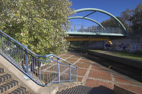
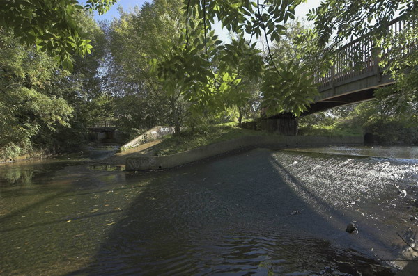
The Ravensbourne runs under recent flats on Molesworth Street and can be seen from the west side of the street where it runs under the railway line there. There is a small park, River Mill Park, with a bridge across the river.

This section of the river was channelled between tall concrete banks I think in the 1960s to alleviate the flood risk. The rather fortress-like Riverdale House was designed by Frederick Gibberd in 1981 as offices. In 2013 planning permission was granted for its conversion into luxury flats.

The site had a mill at the time of the Domesday Book and Riverdale Mill was restored as flats when this new building was erected on the rest of the site. It was built on the site of earlier mills as a leather mill in 1828, later becoming a flour mill and in 1901 was bought and turned into the John Wallis bakery, closing around 1970. It is the only remaining mill building in Lewisham.

Houses, St Stephens Grove, Lewisham, 1990, 90-4c-66

The River Quaggy emerges from a tunnel under the end of St Stephen’s Grove where it meets Lewisham High Street at the south side of Saint Stephen With Saint Mark, Lewisham, a Grade II listed Parish Church by Sir George Gilbert Scott built in 1863. This and St Stephen’s Terrace also date from the mid-1860s.

90-4c-52-Edit
River Quaggy, Clarendon Rise, Lewsiham, 1990, 90-4c-52

The Quaggy apparently got its name for being very muddy – a real quagmire. Here it runs along the backs of the buildings on Lee High Road.

Following pressure from and plans developed by the Quaggy Waters Action Group under the name Operation Kingfisher in 1995, parts of the river have been restored to a more natural state and brought back above ground. Much of the work already completed has been driven by the need to control flooding by the river.

Mecca Leisure, Lewisham High St, Lewisham, 1990, 90-4c-54

Taken from the pavement in front of the building at 233-241 Lewisham High St, this shows some detail of the building, built as a Temperance Billiards Hall in 1910, architect Norman Evans, the company architect for Temperance Billiard Halls Ltd. This Grade II listed building was derelict when bought as new premises for The Tabernacle Church around 2010 and is slowly and carefully being restored – details on their web site.

Later on the walk I photographed the building again from across the road which gives a far better impression of the building when it was in use as a Mecca Bingo Hall – I’ll post this picture in the final post on this walk shortly.


FlickrFacebookMy London DiaryHull PhotosLea ValleyParis
London’s Industrial HeritageLondon Photos

All photographs on this page are copyright © Peter Marshall.
Contact me to buy prints or licence to reproduce.

Crime, Cleaners and Lewisham – 2007

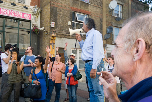
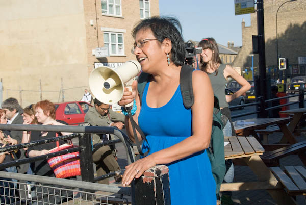
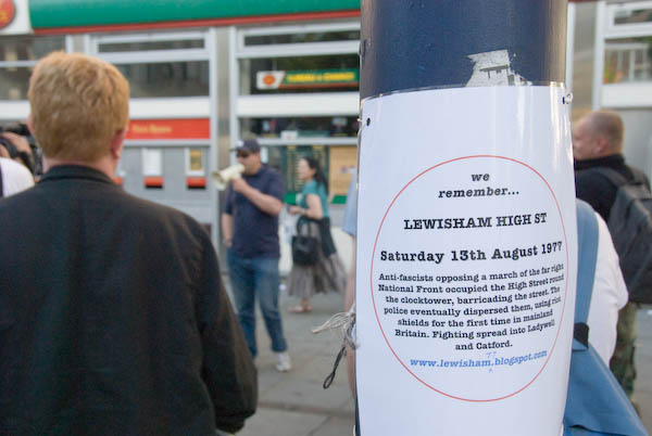
Crime, Cleaners and Lewisham: On Saturday 15 September 2007 I went to Brent for a march against gun and knife crimes. Next I was in the City of London, usually deserted on a Saturday, but this was Open House Day and cleaners were taking the opportunity to protest at Lloyd’s of London where people were queueing to visit the buildings. Finally I travelled to New Cross where an event was taking place to remember the Battle of Lewisham on 13th August 1977, a month after its 30th anniversary.

Below are my three posts from My London Diary in 2007 (with usual corrections) and a few of the pictures and links to those I posted back then.


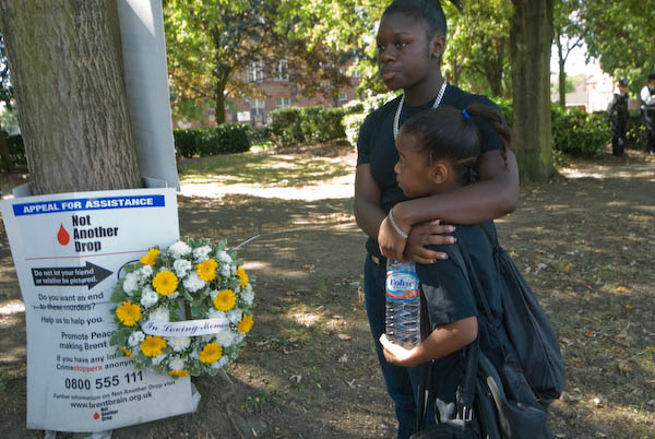
Not Another Drop – March against Gun and Knife Crime

Stonebridge Park, Brent

Crime, Cleaners and Lewisham - 2007
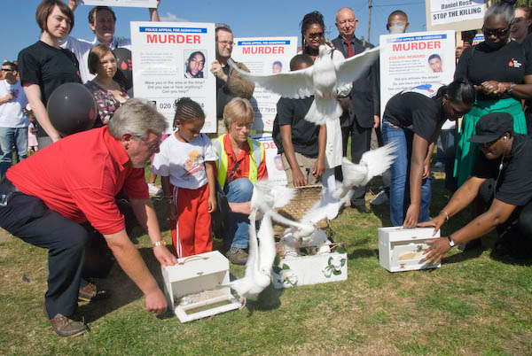
White doves were released just before the start of the march
Crime, Cleaners and Lewisham - 2007

Brent has suffered more than most London boroughs from gun and knife crimes resulting in the deaths of far too many young men (and women) on its streets.

Crime, Cleaners and Lewisham - 2007

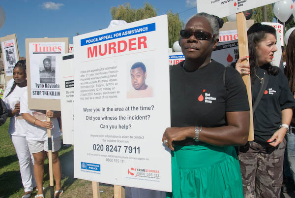
The annual police march was started in 2004 by Patsy Hopwood, whose son, Kavian Francis-Hopwood was shot dead on the Stonebridge Estate in 2003, and is part of the ‘Not Another Drop’ campaign organised by the Met and Brent Council.

Crime, Cleaners and Lewisham - 2007

Around 250 people including two large church groups set off on the march across the borough to South Kilburn.

More pictures on My London Diary at not a drop more


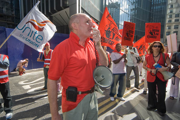
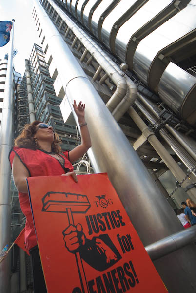
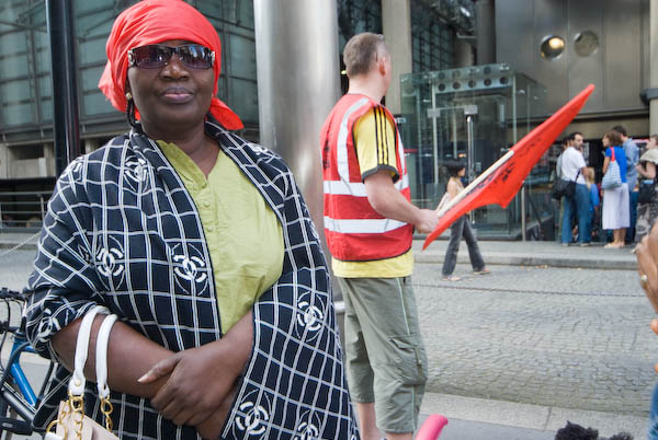
Cleaners picket Lloyd’s Building

City of London

Crime, Cleaners and Lewisham - 2007
Cleaners from London Citizen Workers picket for a living wage

Cleaners at Lloyd’s Of London – a bastion of wealth and privilege in the City – are among the lowest paid workers in London and don’t get sick pay or holiday pay.

Crime, Cleaners and Lewisham - 2007

Open House Day provided a good audience for the London Citizen Workers Association to publicise their appalling treatment.

Crime, Cleaners and Lewisham - 2007

[The cleaning at Lloyd’s – and almost all other office buildings is outsourced with cleaners being employed by contractors, notoriously poor employers.]

More pictures at Picket at Lloyd’s.


Remembering The Battle of Lewisham

New Cross to Lewisham

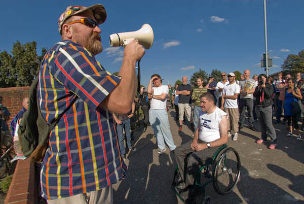
Photographer Red Saunders talks about his experiences in Lewisham on 13 Sugust 1977

It is now just over 30 years since the battle of Lewisham in which protesters humiliated the National Front when they attempted a march through the area.

The event began outside the New Cross Inn

Having escorted the National Front home, the police then turned on the anti-racist protesters, using horses, batons, and, for the first time on the British mainland, riot shields.

Batwinder Rana describes what happened to him in 1977

At this incredible outbreak of police violence, the community came out onto the streets and the police lost control. Lewisham now has a massive police fortress.

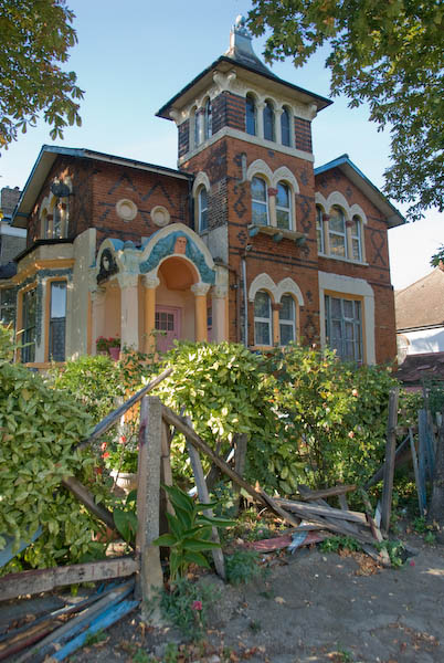
Our route took us past Mr Brenton Pink’s painted house on Loampit Hill

On a walk around the area, a number of those present [in 1977] talked about the event and their own experiences on the day.

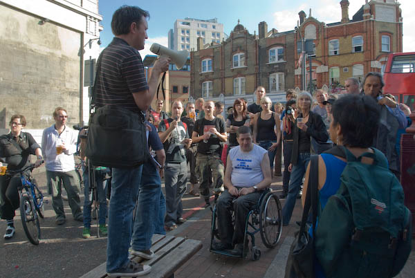
and on to Lewisham High Street where the police used riot shields for the first time on the UK mainland
Here more people shared their experiences and the event ended.

On My London Diary you can see many more pictures including of others who spoke at the event at Lewisham77


FlickrFacebookMy London DiaryHull PhotosLea ValleyParis
London’s Industrial HeritageLondon Photos

All photographs on this page are copyright © Peter Marshall.
Contact me to buy prints or licence to reproduce.

Lewisham, Black Heath and Heathside – 1990

Lewisham, Black Heath and Heathside: Pictures from the final part of my walk on Sunday 18th March 1990. The previous post on this walk was Deptford, Greenwich and The Point – 1990.

House, 17, West Grove, Greenwich, 1990, 90-3m-56
House, 17, West Grove, Blackheath, Greenwich, 1990, 90-3m-56

I came down from The Point onto more or less the top of Point Hill, which rises steeply from Greenwich and turned east into West Grove where a few houses including this one overlook the western edge of the Black Heath – and a short distance across the grass the A2. Different maps show this section as the east section of Blackheath Hill or the start of Shooters Hill, though this section is more or less flat. There are a few trees in the grass which is criss-crossed by footpaths.

This Grade II* listed house, Manna Mead at 17 West Grove, was built around 1800. Although a fine building I think it owes its unusual Grade II* listing at least partly because of its position on the edge of Black Heath and its views. It is divided into flats.

Dartmouth House, Dartmouth Row, Blackheath, Lewisham, 1990, 90-3m-34

I walked along to the well-known Rangers House on the edge of Greenwich Park and taking a few pictures there and on the way, including the listed Conduit Head for the water supply to the Greenwich Royal Hospital, none of which I have yet digitised. I went across the A2 and down Dartmouth Hill to Dartmouth Row.

Dartmouth House was a very substantial house and the sign outside suggests it was in process of being converted into flats. It was built in 1928-9 as a nurses home for the Miller General Hospital. This had been built in the grounds of the Royal Kent Dispensary in 1883 to celebrate the Dispensary’s 100th anniversary and “as a memorial to the Revd Canon John Cale Miller (1814-1880), the founder of Hospital Sunday”. This was an important national collection day every June, established in 1873 to support the work of voluntary hospitals, vital before the foundation of the NHS. Its inception is more generally attributed to London’s Lord Mayor.

Miller was Vicar of St Alfege, Greenwich and had greatly supported the work of the Dispensary. The hospital was closed in 1974 and the home was redundant. It briefly became a home for single mothers and was being converted into 17 2- and 3-bed flats.

This Dartmouth House is sometimes confused with the Grade II listed Blackheath House of the Earl of Dartmouth which was also in Dartmouth Row, just south of the church.

Church of the Ascension,  Dartmouth Row, Blackheath, Lewisham, 1990, 90-3m-35
Church of the Ascension, Dartmouth Row, Blackheath, Lewisham, 1990, 90-3m-35

Dartmouth Chapel was established in 1699 as private chapel for the Earls of Dartmouth so the Vicar of Lewisham could to preach a sermon for the family every Sunday. Traces of the original building may have survived the considerable rebuilding in around 1750 and 1834.

It had served as a temporary parish church for Lewisham in 1774-7 but was consecrated as a separate parish church, the Church of the Ascension in 1883. Much older material was also removed during rebuilding after wartime damage in 1950. The church is Grade II* listed.

View, Council Estate, Morden Lane, 1990, 90-3m-24
View, Heathside Council Estate, Morden Lane, Lewisham, 1990,

These flats on the side of Blackheath Hill were the Heathside Estate – Ferguson House, Melville House, Varden House, Glennie House and Travis House – built in 1948 by the LCC. They have since been demolished and the area redeveloped.

Stairs and View, Council Estate, Morden Lane, 1990, 90-3m-26
Stairs and View, Heathside Council Estate, Morden Lane, Lewisham, 1990, 90-3m-26

Noted for its vibrant community life, this estate on the edge of the London Borough of Lewisham was in a poor state structurally by the 2000s and in 2009 plans were approved for its demolition and replacement by new Heathside and Lethbridge estates.

House, 83, Morden Hill, , 1990, 90-3m-12
House, 83, Morden Hill, Lewisham, 1990, 90-3m-12

A fine example of a 1930s house with its Crittall windows intact. Although many houses like this were built with flat roofs, this had a pitched roof with a large overhang you can see here. The house still looks in good condition now, though the carefully trimmed bushes have gone.

Railway, Offices, Multi-storey Car Park, Molesworth St, Lewisham, 1990, 90-3n-01

I began and ended the walk at Lewisham Station and I’m unsure whether I made this image – taken on another camera – at the start or finish of my walk. The picture is made on a footpath that leads over the River Ravensbourne around a quarter of a mile south of the station and was taken from just on the east side of the river looking under the railway line towards Molesworth St. Although central Lewisham has changed drastically in the past decade or so, I think both the buildings in the background remain.

My next photographic walk was in North London two weeks later. Coming here shortly.


FlickrFacebookMy London DiaryHull PhotosLea ValleyParis
London’s Industrial HeritageLondon Photos

All photographs on this page are copyright © Peter Marshall.
Contact me to buy prints or licence to reproduce.

Deptford, Greenwich and The Point – 1990

Deptford, Greenwich and The Point: More pictures from my walk on 18th March 1990. The previous post on this walk was Lewisham and Deptford – 1990.

I walked from Deptford into the area between Deptford and Lewisham, mainly in the London Borough of Greenwich, then up the hills towards Blackheath. As often on my walks there was a good deal of wandering around as I tried to at least look down every street on my way.

Eagle, 20, Deptford Broadway, Deptford, Lewisham, 1990, 90-3g-11

This terrace of buildings from 17-21 Deptford Broadway dates from the late 17th century and is Grade II listed. The Eagle is perched on top of the Transport Cafe which was at some long past time a tavern. The listing says the building is probably from the late 17th century and still has two original staircases.

Houses, 25, 27, Blackheath Rd, Greenwich, 1990, 90-3g-14

Two houses which caught my attention for their verandas. Both were built in the 1840s and are larger than you might think as you can just see they have basements. I wondered if the left hand house of the pair was built for a client with a larger family.

Ditch Alley, Blackheath Rd, Greenwich, 1990, 90-3g-15
Ditch Alley, Blackheath Rd, Greenwich, 1990

Ditch Alley runs from Blackheath Road to John Penn St which gets its name from the engineering works of John Penn & Sons which were begun in 1799 and from 1825 produced marine engines here as well as boilers at its riverside site at Palmers Payne Wharf, Deptford.

The alley went through the centre of the site and I think all the buildings in my two pictures date from 1863 or later. Among other claims to engineering fame the company produced the world’s first wind tunnel in 1868. The company declined as shipbuilding declined in London and was wound up in 1914.

Ditch Alley, John Penn St, Greenwich, 1990, 90-3m-62

John Penn Street was originally known as Cold Bath Lane but was renamed John Penn Street in the 1870s. Parts of the works site were later occupied by the Broomfield Bakery which closed in 1992 (and is still missed by some locals – Gregg’s sausage rolls are not the same), and while Lewisham Council dithered over adding some of the remaining buildings to the Statutory List they were demolished. The site is now occupied by Wickes, Pets at Home and a large car park for these stores along with housing. More details on the Greenwich Industrial History site.

Parry's Dispensing Chemist, Lewisham Rd, Lewisham, Greenwich, 1990, 90-3m-64
Parry’s Dispensing Chemist, Lewisham Rd, Greenwich, 1990, 90-3m-64

By 2009 Parry’s Dispensing Chemist’s premises at 6-8 Lewisham Road were occupied by Juliet Q Unisex Hair Beauty Salon but this closed shortly after and I think the ground floor has since remained unoccupied. But although Mr Yip may well have left us, the shop next door at No 4 is still a Chinese Take Away.

Maidenstone Hill, Greenwich, 1990, 90-3m-66
Dutton Street, Maidenstone Hill, Greenwich, 1990, 90-3m-66

Although Google Maps calls this Maidenstone Hill, the name on the houses clearly reads Dutton Street, while a newer sign on the other side of the road favours Google’s choice. This is certainly a hilly part of London and I made my way to the top of the hill.

View, The Point, Greenwich, 1990, 90-3m-51

The Point has been noted for centuries as a viewpoint over London with wide views to the north and the west, and remains as a small area of public open space. Although now in Greenwich it was formerly in the Hundred of Blackheath, Kent, and was named The Blackheath Point.

On a clear day there is a protected view of St Paul’s Cathedral, but although I had good weather, the city was covered in the usual murk of pollution, atmospheric but hiding it. I think to get a clear view you would need to be up here after a thunderstorm had scrubbed the London air.

Point Hill, Westgrove Lane, from, The Point, Greenwich, 1990, 90-3m-53

The land drops away steeply here to a road full of houses for the fashionable and wealthy in the Victorian era – and still now for the rich. These houses are quite a contrast to the working class homes in my Dutton Street picture above.

View, The Point, Greenwich, 1990, 90-3m-55

Looking roughly north there are more plebeian residencies close to The Point and in the middle distance a number of large council blocks from the 1930s or 1950s. Beyond them is housing on the Isle of Dogs and the growing development of Docklands, as yet without its towers, though the cranes are busy.

I was coming close to the end of my walk but I took a few more pictures before leaving for home which I’ll post shortly in the final selection from this walk.


FlickrFacebookMy London DiaryHull PhotosLea ValleyParis
London’s Industrial HeritageLondon Photos

All photographs on this page are copyright © Peter Marshall.
Contact me to buy prints or licence to reproduce.

Lewisham and Deptford – 1990

More From Lewisham: More pictures from my walk on 18th March 1990. The previous post on this walk was St Johns Lewisham – 1990.

Denture Repairs, Loampit Hill, Lewisham, 1990, 90-3g-45

False teeth were still very common when I was growing up. Many if not most adults still went to bed with their teeth in a glass of water beside them on the bedside table like my parents. One of their wedding presents in 1932 from a wealthy relative had been for both of them to be given a ‘full set’, while others were often given the same as a coming of age present for their 21st birthday.

As many of us are still aware, tooth pain can be excruciating and few working-class people could afford proper dentistry. People extracted their own teeth or those of their friends with pliers, or tied strong thread around them and fixed it to a door handle asking for someone to slam the door. With current problems in getting NHS treatment there are again now people resorting to painful and dangerous DIY treatments.

Denture Repairs, Loampit Hill, Lewisham, 1990, 90-3g-32

Things had improved a little after the war, particularly with the school dental service, and I went regularly to the clinic on Bath Road until I was 16 and no longer qualified for their services. It was around ten years before my teeth saw a dentist again and by then the rot had truly set in. But back then it was simple to find a NHS dentist and become a regular patient.

Dentistry never really became a proper part of the NHS and NHS dentistry is now in dire straits, though there have been great advances in dental treatment – and so little need for shops such as this. I’m fortunate still to have a NHS dentist with regular check-ups and still enough of my own teeth to just about eat. And although the NHS charges increase regularly it remains cheap compare to private practice. But sorting it out should be another item on Andy Burnham’s list.

R Holt, Crash Centre, Thurston Rd, Lewisham,  1990, 90-3g-33
R Holt, Crash Centre, Thurston Rd, Lewisham, 1990, 90-3g-33

Car crashes are still common and there are still garages offering crash repairs, though I think rather more cars now get written off after crashes, partly because of changes in the way cars are built but also because of stricter safety laws. MOT testing was introduced in the 1960s but the tests are now much more detailed and rigorous.

Behind the yard is a row of trees at the edge of the site and a railway viaduct on the line to Lewisham station. This yard is long gone and the street is lined with tall flats.

R Holt, Crash Centre, Viaduct, Thurston Rd, Lewisham, 1990, 90-3g-34

The crashed cars on the lorry close to my camera make those by the fence look like toy models. I think many these cars would have been cannibalised for parts and then sold as scrap as they look beyond repair, even by specialists such as R Holt. The picture also gives a better view of the railway viaduct.

Crescent House, Bliss Crescent, Lewisham, Greenwich, 1990, 90-3g-22

A bridge over the River Ravensbourne leads to the flats of Crescent House, a large 1950s council development. A few years later the DLR extension to Lewisham from Island Gardens was built through here, opening in 1999. The Elverson Road DLR station is a short walk away.

Carrington House, Brookmill Rd, Deptford, Lewisham, 1990, 90-3g-24

Built for the London County Council in 1903, Carrington House was a lodging house which replaced several small doss houses on the site. It was based on the Rowton Houses founded by Lord Rowton to provide cheap lodging for working men and named after Lord Carrington, chairman of the LCC’s Housing of the Working Classes Committee.

Carrington House, Brookmill Rd, Deptford, Lewisham, 1990, 90-3g-26

It provided cubicles for 800 men to sleep in and communal facilities including washrooms, dining, reading and smoking rooms. During the Great War it housed refugees, afterwards returning as a lodging house, continuing in this at least until the late 1970s and possibly still when I took these pictures.

In 1995 it was converted into social housing flats and renamed Mereton Mansions. The railings are said to be made from wartime stretcher frames.

More to come from Deptford.


FlickrFacebookMy London DiaryHull PhotosLea ValleyParis
London’s Industrial HeritageLondon Photos

All photographs on this page are copyright © Peter Marshall.
Contact me to buy prints or licence to reproduce.

St Johns Lewisham – 1990

St Johns Lewisham: More pictures from my walk on 18th March 1990. The previous post on this walk was More From Brockley.

I walked up Malpas Rd, taking a few pictures on my way that I’ve not digitised, and on to Lewisham Way, where I turned into Friendly Street, wondering how it got that name. No one seems to know. There is also a Friendly Place in Lewisham, some distance away.

Clarendon Cottages, Scotts Coachworks, Friendly St, St Johns, Lewisham, 1990, 90-3g-61
F H Pierce, Friendly Upholstery, Friendly St, St Johns, Lewisham, 1990, 90-3f-16

Friendly Street was built as a part of the Deptford New Town development which had begun in around 1795, though the earliest existing buildings in Friendly Street (earlier named Dog Kennel Row and then George Street) date from 1806 and most from the 1840s. Its name was apparently officially changed from George Street in the early years of the twentieth century to avoid confusion with other George Streets in London.

Friendly Upholstery at No 2 and Boot Repaier F H Pierce at No 4 have long closed. No 2 still has the shopfront but that at 4 has been replaced and both properties are now residential.

Clarendon Cottages, Scotts Coachworks, Friendly St, St Johns, Lewisham, 1990, 90-3g-61

This property at 3 Friendly Street is still standing though that on the left has been replaced by a new building. The open area to the right is Friendly Gardens, an area cleared after bomb damage in the Second World War.

The Deptford New Town estate was developed on land owned by the Lucas family, who grew rich from building and running rice mills in the USA. Many of the early residents were shipbuilders and sailors. The opening of the railway in 1836 with a station at New Cross Gate in 1839 with trains to London Bridge prompted further development in the area as a commuter suburb. St Johns got its church in 1855 and its own station in 1873.

Bank, Lewisham Way, Friendly St, St Johns, Lewisham, 1990, 90-3g-63

The former bank at 293 Lewisham Way was acquired by Barclays in 1918. The building was Grade II listed in 1994 and according to this: “The London and South Western Bank – New Cross Branch at 293 Lewisham Way was acquired by Barclays in 1918. ” and was “designed in 1885 and built in about 1886 by J and J S Edmeston.”

It appeared to have closed as a bank by the time I made my picture and has been converted into residential apartments.

Stone House, Lewisham Way, St Johns, Lewisham, 1990, 90-3g-64

Grade II* listed house built 1771 – 1773 designed by architect George Gibson the Younger (or possibly his father, also George Gibson) as built as his own residence, it was known in the 19th century as the Comical House for its unusual design.

House, 70, Loampit Hill, St Johns, Lewisham, 1990, 90-3g-53

One of four similar highly ornamented houses built late 1850s by local architect Alfred Cross who also built one for himself at No 62, now particularly notable for its vibrant colour scheme – and which I photographed on several occasions in colour.

House, Loampit Hill, St Johns, Lewisham, 1990, 90-3g-55

A closer view of one of the houses, largely hidden by greenery shows a little of the decorations.

90-3g-42-Edit
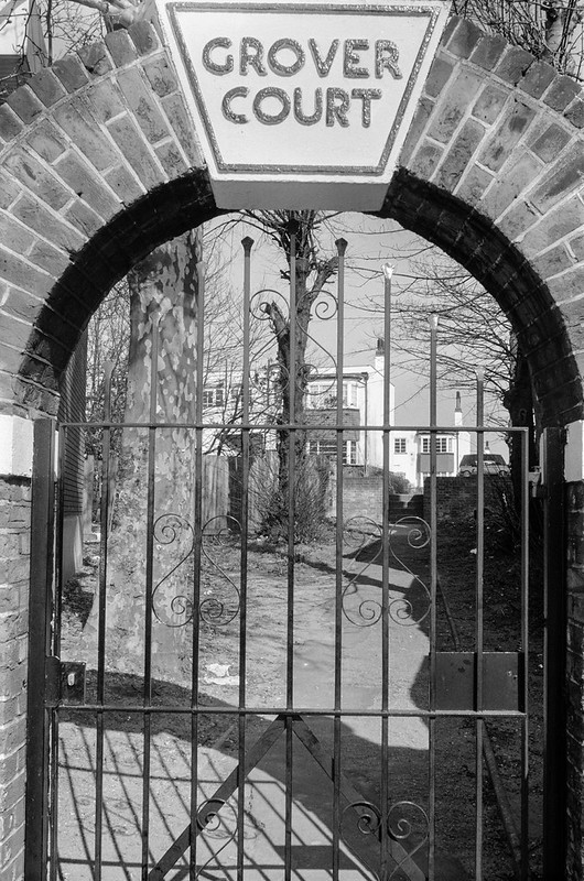
Grover Court, Loampit Hill, Lewisham, 1990, 90-3g-42
Grover Court, Loampit Hill, Lewisham, 1990, 90-3g-44

Grover Court was built as a luxury Art Deco estate of 51 residential flats in 1938, on the site of Ellerslie House, built in the 1790s for the brothers John and Henry Lee who owned the neighbouring brickworks. A large house, after the Lee family moved out in 1860 it became a private girls preparatory school.

More from Lewisham in a later post.


FlickrFacebookMy London DiaryHull PhotosLea ValleyParis
London’s Industrial HeritageLondon Photos

All photographs on this page are copyright © Peter Marshall.
Contact me to buy prints or licence to reproduce.

More From Brockley – 1990

More From Brockley: Pictures from my walk on 18th March 1990 in Brockley. The previous post on this walk was Nunhead and Brockley. The pictures in this post are all from a small area of Brockley.

Mantle Rd, Brockley, Lewisham, 1990, 90-3f-31

Two men walk around a street corner into the sun, their shadows clean on the pavement behind them. Like many who lived# in the area the two men are black.

This Brockley Cross at the north end of Mantle Road and it slopes down under a railway bridge to Brockley Station. Two railway lines cross here and I think the 4 aspect signal was on the line from London Bridge to Brockley. The other line, according to Edith’s Streets, was a goods line and the area behind the hoardings was Martin’s sidings with room for 36 coal waggons. This was on land belonging to Martins Dairy at 4 Endwell Road, leased to leased to the London North West Railway and sub let to coal merchant Charrington Warren Ltd.

The steps at right lead to the side entrance to Endwell Court, a block features in my previous post.

Josies CAFE, Mantle Rd, Brockley, Lewisham, 1990, 90-3f-34

Josies Cafe was next to the railway bridge on Mantle Road which is at the right of the picture. There was still a café here (no longer Josie’s) until around 2010, but since then this has been a small empty plot.

Josies CAFE, Mantle Rd, Brockley, Lewisham, 1990, 90-3f-23

Josies Cafe seen from the opposite side of Mantle Road with the grassy bank leading up to the goods line which crosses Mantle Road here.

Brockley Paper Co, Mantle Rd, Brockley, Lewisham, 1990, 90-3f-35

I think this building housing the Brockley Paper Co was next to Josies Cafe, and has been demolished and replaced by a block of flats with shops on the ground floor. One of these at 1a Mantle Road is now the London Print Shop.

O'Shea, Low Cost Flats, Mantle Rd, Brockley, Lewisham, 1990, 90-3f-36
O’Shea, Low Cost Flats, Mantle Rd, Brockley, Lewisham, 1990, 90-3f-36

This small row was just south of Foxwell Road and you can see the railway bridge in the distance at right and the sign for Josies Cafe.

This block which included The Maypole Inn whose sign can be seen was demolished before 2008 – the pub closed in 2006. A block of flats was built on the northern part of the site around 2012, but I don’t know where the ‘low cost flats’ advertised here were located.

Free Winston Silcott, Harefield Rd, Brockley Rd,  Brockley, Lewisham, 1990, 90-3f-24
Free Winston Silcott, Harefield Rd, Brockley Rd, Brockley, Lewisham, 1990, 90-3f-24

I walked to the other side of Brockley Station over the station footbridge and along Coulgate Street to Brockley Road and into Harefield Road. The building in the centre background is the back of a house on the corner of Foxberry Street and Coulgate Street,.

This post began with two men, so I’ll end it with two women who walked in front of me to cross the road as I was looking at the graffiti on the wall at the read of the corner shop.

This had the message ‘FREE WINSTON SILCOTT’ above a lot of less legible scrawls. Silcott was one of the ‘Tottenham 3‘ convicted in 1987 for the murder of PC Keith Blakelock on the Broadwater Farm Estate in Tottenham in October 1985, but had been nowhere near the scened. All three convictions were quashed in 1991 after it was found the police had fabricated their confessions. He remained in jail as he was convicted for an unrelated murder of a boxer and nightclub bouncer and was only released in 2003.

More from this walk in a later post.


FlickrFacebookMy London DiaryHull PhotosLea ValleyParis
London’s Industrial HeritageLondon Photos

All photographs on this page are copyright © Peter Marshall.
Contact me to buy prints or licence to reproduce.

Nunhead and Brockley

Nunhead and Brockley: Pictures from my walk on 18th March 1990 in Nunhead and Brockley.

Beer and Wine Trade Homes, Nunhead Green, Nunhead, Southwark, 1990, 90-3e-25

The Beer and Wine Trade Society decided in 1851 to provide an asylum for its elderly poor members and purchased land on the north side of Nunhead Green, launching an appeal to its members to build these almshouses. They were built at at a cost of around £3,000 as a terrace of seven dwellings to house 13 people. The Metropolitan Beer and Wine Trade Society almshouses, architect William Webbe, opened in 1853.

The accommodation was on a generous scale, with each having four rooms and a kitchen and a part of the garden behind to grow vegetables. As well as the accommodation the residents also received a weekly allowance.

The almshouses are Grade II listed and are now private homes.

Nunhead Library, Gordon Rd, Nunhead, Southwark, 1990, 90-3e-26

Nunhead Library was designed by Robert Whellock of Camberwell in an Arts and Crafts style and built in 1896. Since 1965 in the London Borough of Southwark where it is one of four libraries which were founded by philanthropist John Passmore Edwards and is still in use as a library. Edwards founded another 11 libraries in London, most no longer in use.

Nunhead had been a part of the ancient parish of Camberwell but became a separate parish in 1878 and became part of the Metropolitan Borough of Camberwell in 1900, which became part of the London Borough of Southwark in 1965.

Shops, Gibbon Rd, Nunhead, Soutwwark, 1990, 90-3e-16
Shops, Gibbon Rd, Nunhead, Southwwark, 1990, 90-3e-16

Nunhead Railway station is in Gibbon Road and this Gents Hairdresser at 52 and Launderette at 54 (and the Fish & Chip shop at 50 whose frying times are in the corner of their window) are just past the bridge north of the station entrance. Rather to my surprise there is still Gents Hairdresser and a Fish and Chip shop here, though the Launderette closed around 2010 and is now two homes at 54 and 54a.

The two people sitting reading outside – before the age of mobile phones – are doubtless waiting for their washing to finish inside the launderette.

Prefabs, Temporary Housing, Drakefell Rd, Brockley, Lewisham, 1990, 90-3f-51

I went down Gibbon Road and turned left into Hathway Terrace, which turns into Kitto Road and leads on to Drakefell Rd. Somewhere here was this path with a broken-down fence leading to an area of prefabs.

In 201 Elisabeth Blanchet and Jame Hearn from the Prefab Museum photographed the interior of a prefab in Drakefell Road and posted a video of the resident, John De’Ath, who had moved in when these prefabs were new in 1948 and stayed there until his death in 2017, a very satisfied resident. You can read more about London’s prefabs and see a photograph of one of them in a GLIAS Journal, when in 2024 the two last prefabs there were awaiting demolition.

Telegraph Hill Park, Brockley, Lewisham, 1990, 90-3f-55

The 10 acres site the hill top on Kitto Road was created in 1894 thanks to George Livesey, chairman of the South Metropolitan Gas Company and a local philanthropist. It has good views to central London and south and east towards Croydon and Shooters Hill, which made it a great side for a semaphore station which was built around 1795 – as one of a series which formed an optical communication system from London to Dover and Southampton with large arms which could be moved to different positions to convey letters or codes.

The French had invented the system for their military and we copied it – and it was able to speedily deliver the new of Wellington’s victory at Waterloo (among many other messages over the years) back to London. The signal station was out of use by 1823, but the name it gave to what had previously been ‘Plowed Garlic Hill’ stuck.

Rather than take the views, I decided to make a picture that showed a hill. I don’t think it shows the part of the park which once had the telegraph station.

Endwell Court, Mantle Rd, Endwell Rd, Brockley, Lewisham, 1990, 90-3f-45

Mantle Road and Endwell Road meet at Brockley Cross, just to the north of Brockley Station, which is just down the hill which goes under the railway bridge at the left of Endwell Court. This rather isolated block appears to have been built as a mansion block with perhaps four flats and looks very similar now.

Houses, 169, 171, Drakefell Rd, Brockley, Lewisham, 1990, 90-3f-46

A small group of three semi-detached houses on the north side of Drakefell Road close to Brockley Cross have some rather unusually detailed ornamentation. This end of Drakefell Road was Penmartin Road until 1902, and I think these houses probably date from a few years before then. The houses are now flats.

As always, comments and corrections are welcome. More from Brockley in a later post.


FlickrFacebookMy London DiaryHull PhotosLea ValleyParis
London’s Industrial HeritageLondon Photos

All photographs on this page are copyright © Peter Marshall.
Contact me to buy prints or licence to reproduce.

Clock House to Olympic Site – 2005

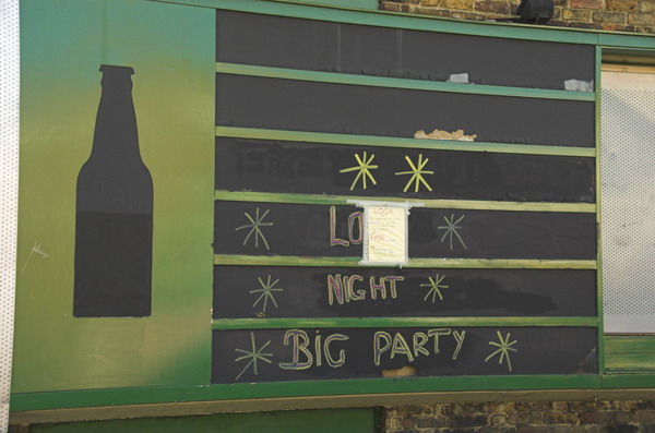
Clock House to Olympic Site: Thursday October 27 2005 was a fine late autumn day and I decided to go for a bike ride, putting my folding bike on a couple of trains to my start point, Clock House station. This is in south east London, halfway between Penge and Beckenham and just inside the London Borough of Bromley.

Big Party, Clockhouse

The Chaffinch Brook runs close by and joins with the River Beck to form the River Pool (aka Pool River) a mile or so north and a footpath going north from there is now part of a national cycle route. Parts of the Pool River which were once culverted have now been restored to an open stream, which will help prevent flooding downstream. The river’s main claim to fame is that four years after my ride then London Mayor Boris Johnson fell into it on an official visit to encourage volunteers who were cleaning the river up.

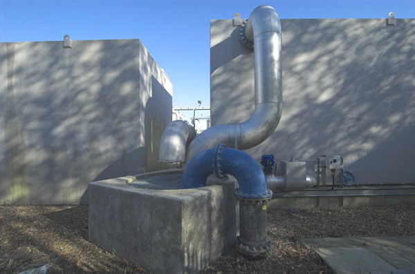
Big Pipes, New Beckenham

The Pool River is a tributary of the River Ravensborne and I had planned to continue along this as closely as I could to Deptford Creek where it joins the Thames. But I ran out of time, so took the Docklands Light Railway at Lewisham rather than Greenwich to cross the river to Canning Town.

Lower Sydenham

My ride then continued with a loop around Bow Creek and over the Lower Lea Crossing back through Canning Town and on to Stratford Marsh where work was then just beginning to turn this whole area into the Olympic site.

Bell Green

It wasn’t a long ride – probably around ten miles in all, perhaps a little longer with all the small diversions I took. All the pictures here were taken on this ride and there are more on My London Diary, along with the account below that I wrote back in 2005. As usual I’ve made a few small corrections.


Pool River and Ravensbourne (left) join

The Brompton folding bike is really an ideal form of transport for London, an essential tool for the urban photographer. It’s short wheelbase is great in slow-moving crowded traffic, and it can be folded in 15s to travel by tube, rail, taxi or even bus. [I’ve never put mine in a taxi.] The only problem is that they are highly prized by cycle thieves. [They are fairly expensive and slip easily into a car boot.]

Bridges over Bow Creek, River Lea, Canning Town, London

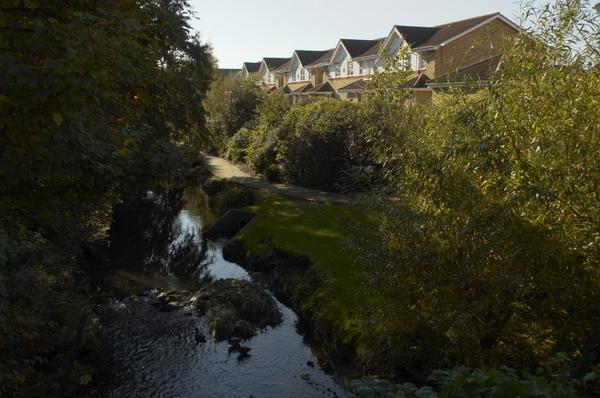
The weather forecast was for a fine summery day, so I took the opportunity to check up on a few things and fill in some little gaps, where I’d not quite managed to photograph things before. First I wanted to go along the footpath at Bell Green, next to Sainsbury’s, so I decided to make a slightly longer trip of it by starting at Clock House Station. There is a good, almost traffic-free route north from there along the Pool River, then the River Ravensbourne, at times surprisingly rural.

DLR viaduct over Bow Creek

Taking photographs slows you down, as does stopping to sit in the sun and eat sandwiches, so at Lewisham I decided to get on the DLR with the bike to travel to Canning Town.

DLR extension, Millenium Dome and Canary Wharf from Silvertown Way.

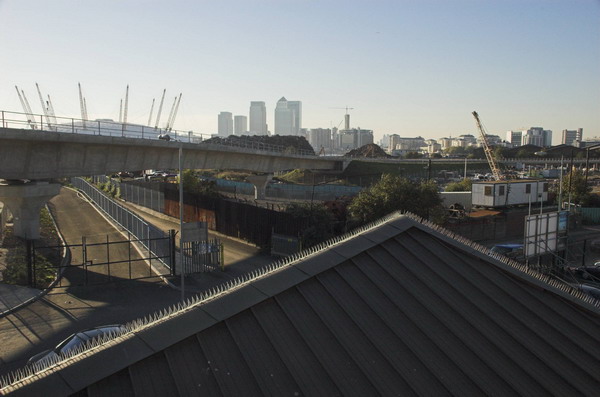
Perhaps one day the riverside walkway by Bow Creek from the station will open [it did, but only to go across a new bridge to City Island – the route south still comes to a dead end], but it seems unlikely to be in our lifetime. I went round the creek, over the Lower Lea Crossing and on to Silvertown Way to see how the new stretch of DLR was progressing. [It opened north of the river at the end of 2005.]

Car sales, Stratford Marsh

Then I cycled up to Stratford to take a look at Stratford Marsh again before work starts in earnest to demolish the existing businesses and create the Olympic waste. It was getting later and noticeably darker by the time I was there, although the day felt like summer, it gets dark rather earlier at the end of October.

The Greenway goes under the railway line on Stratford Marsh.

What really makes no sense at all is to put our clocks back to make it even darker still, as we were going to do in a couple of days time. If I were in charge, we’d move to the same time as France and the rest of our neighbours across the channel. I don’t like dark mornings, but it would be much better than having it get dark in the middle of the afternoon in winter. Orcadians or even Scots would be welcome to have their own time zone if they really must, but its about time they stopped imposing it on the rest of us. The sun set around 5.30, and next week that means it will be 4.30pm.

Twilight for Stratford Marsh

More pictures start here on My London Diary.


FlickrFacebookMy London DiaryHull PhotosLea ValleyParis
London’s Industrial HeritageLondon Photos

All photographs on this page are copyright © Peter Marshall.
Contact me to buy prints or licence to reproduce.

NHS at 65, Lewisham & the DLR – 2013

NHS at 65, Lewisham & the DLR: Friday 5th July 2013 was the 65th anniversary of the founding of our National Health Service and I photographed three events connected with this, two in Westminster and one opposite Lewisham Hospital where campaigners were fighting to keep services. And on the way back from Lewisham I took some pictures though the window of the DLR train, mainly as we went past Deptford Creek.

The National Health Action Party was a publicity stunt and single issue parties such as this are never likely to make much widespread impact on British politics. But given the strength of the recent Labour rebellion over Starmer’s attack on the disabled I wonder if a new left of centre political party might result in a radical change in our political system, with possibly a significant number of Labour MPs deserting the sinking ship in favour of a party which represents traditional Labour values. We could then have two different parties fighting out the next election.


NHS 65: GMB – Westminster

NHS at 65, Lewisham & the DLR - 2013

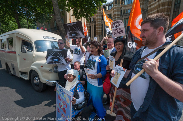
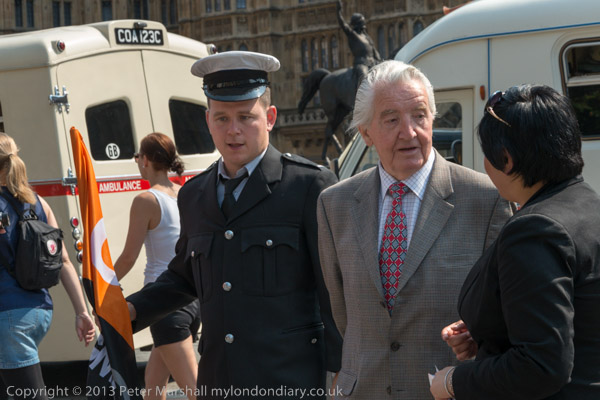
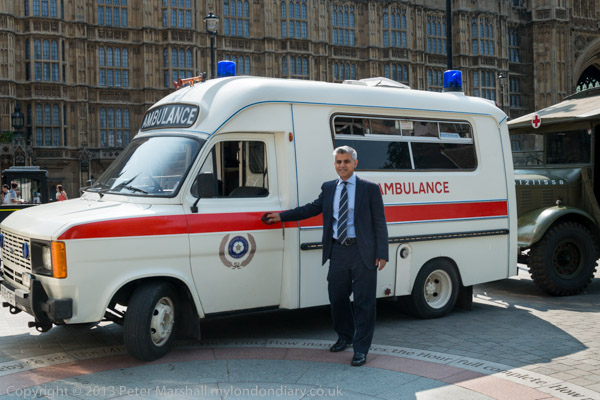
The GMB trade union came with three vintage ambulances to protest outside Parliament where trade unionists in vintage ambulance uniforms posed with MPs including Dennis Skinner and Sadiq Khan warning that the NHS is at risk.

NHS at 65, Lewisham & the DLR - 2013
Dennis Skinner
NHS at 65, Lewisham & the DLR - 2013
Sadiq Khan, then MP for Tooting, poses for his own photographer

I’m afraid I’ve forgotten who the other MPs were, but you can see a couple more in the pictures on My London Diary I took as the photographer for the GMB posed and photographed them. I have a personal antipathy to posing people, though I might occasionally deliberately attract their attention and even very occasionally ask them to keep still or look at me. But generally I see my role as recording what is happening rather than directing it. And here what was happening was that people were being photographed.

NHS at 65, Lewisham & the DLR - 2013

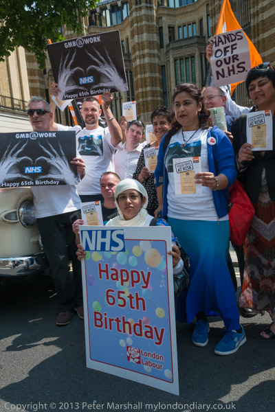
Later I went with them (and the ambulances) as they took 65th Birthday cards for the NHS, with the message inside “Do Not Pension Off Our NHS’ to the Ministry of Health, then still in Richmond House on Whitehall.

More at NHS 65: GMB.


NHS 65: Lewisham Hospital

NHS at 65, Lewisham & the DLR - 2013

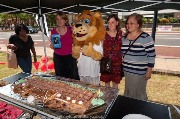
In the memorial garden opposite the Save Lewisham Hospital Campaign were holding a lunchtime party to celebrate the 65th Birthday of the NHS, and as a part of their campaign to keep this busy, successful and much needed hospital open.

The plans for its closure were not related to the hospital’s performance in any way but because the health authority needed to make drastic cuts to meet the disastrous PFI debts of a neighbouring hospital.

There had been a massive community campaign to save vital NHS services at the hospital, backed by “Patients, NHS staff, Lewisham Council, MPs, schools, pensioners, families, businesses, faith groups, charities, unions, students and health campaigners” – the whole community including the Millwall Football Club.

Later at the end of July 2013 the High Court ruled in favour of the Judicial Reviews by the Save Lewisham Hospital Campaign and Lewisham Council and quashed the Government’s closure plans. And ten years later in July 2023 on the 75th anniversary of the founding of the NHS a newly engraved community bench was unveiled to celebrate the victory. I’m sorry I wasn’t present to record that occasion.

More at NHS 65: Lewisham Hospital.


DLR Views – Deptford-Canary Wharf

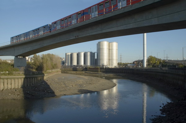
I decided to travel back from Lewisham into central London by taking the DLR to Canary Wharf where I could change to the Jubilee Line because I could try to take some pictures from the train, particularly on the section where the viaduct goes alongside and over Deptford Creek.

There are many problems in taking pictures from trains. Finding a reasonably clean window is the first, and avoiding reflections another. It was easier back in the 1970s when there were windows you could pull down and lean out! And now apparently AI can remove reflections, though I’ve yet to try it.

DLR Views


NHS 65: Rally & Camarathon – Westminster

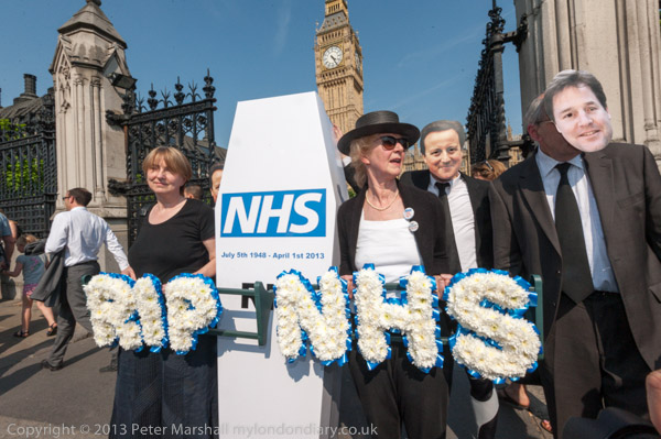
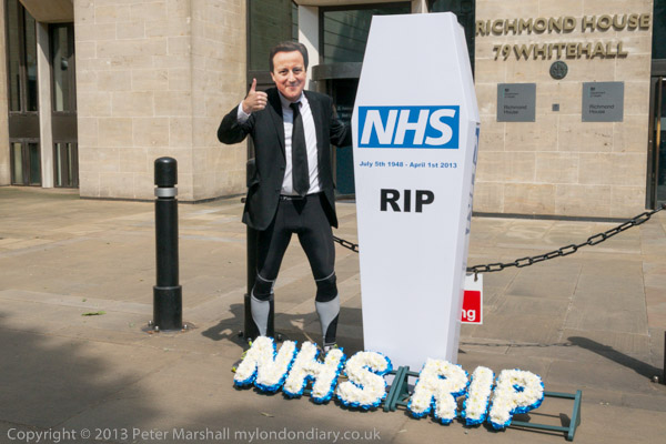
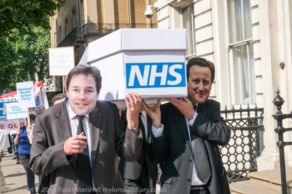
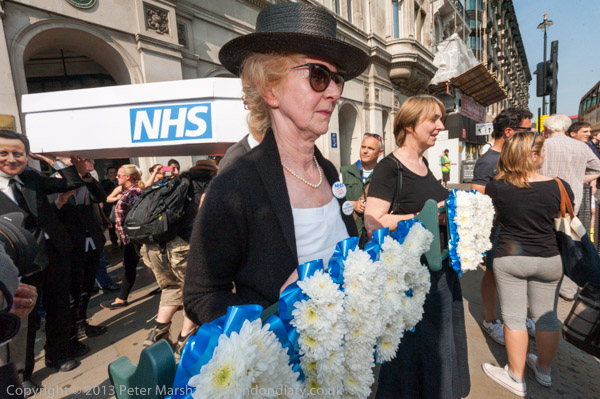
On the 65th Birthday of the NHS, Dr Clive Peedell began a 65 mile ultramarathon to David Cameron’s Witney constituency to bury the NHS coffin and launch the National Health Action Party plan by doctors and health professionals to revive the NHS.

Dr Clive Peedell posed in a Cameron mask with the coffin and wreath and had come with a small group of supporters, including one wearing a mask of his coalition partner Nick Clegg. Campaigners accuse both of deliberately running down our NHS, with more and more NHS services being delivered by private healthcare companies.

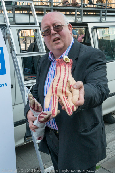
After posing in front of the Ministry of Health, the campaigners crossed Whitehall to stand in front of the gates of Downing St before processing behind the coffin to Parliament for more pictures, ending with some street theatre involving severed hands and speeches by several distnguished health professions including the Chair of the Royal College of GPs in Old Palace Yard.

I left before Dr Peedell and two others set off on his long run – though I’m sure others would be carrying the wreath and coffin. The event had clearly been set up to attract the media, but received little publicity.

On My London Diary you can read a long statement by Dr Peedell about how the “2012 Health and Social Care Act, will result in the NHS being increasingly dismantled and privatised” with the Labour Party whose “previous pro-market, pro-privatisation reforms, actually set the platform for the current changes” had failed to sufficiently oppose. Health professionals had “formed the National Health Action Party to raise awareness and inform the public about what is happening to their NHS” and had today “set out our own 10 point plan to reinstate, protect and improve the NHS“.

Much more on My London Diary at NHS 65: Rally & Camarathon.


FlickrFacebookMy London DiaryHull PhotosLea ValleyParis
London’s Industrial HeritageLondon Photos

All photographs on this page are copyright © Peter Marshall.
Contact me to buy prints or licence to reproduce.