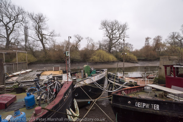
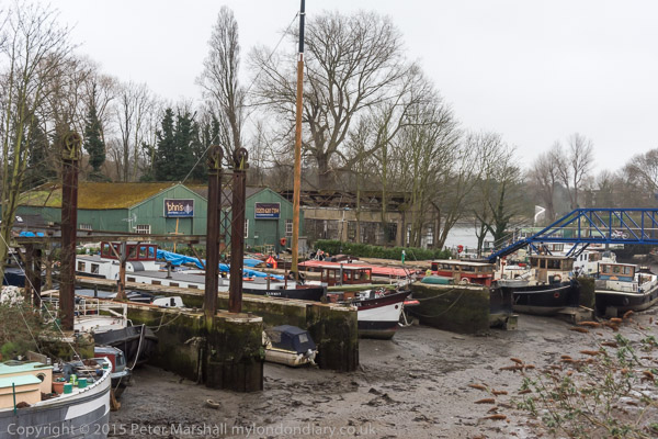
Cluster Bombs, Acton, Spain & Kilburn: On Saturday 17th July 2004 I did rather a lot of travelling around London, beginning in Trafalgar Square with a shoe pyramid against cluster bombs, then going to Acton to look at a project London Arts Café had helped with (I think I was its treasurer at the time) which took me rather longer than expected so I didn’t stay long to make sure I was back on the South Bank for the Spanish Civil War commemoration. Then out to Kilburn for a festival in Grange Park.
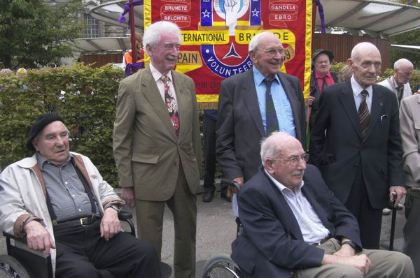
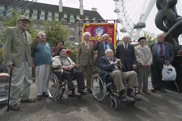
But I took few photographs except at the Spanish Civil War event, which was attended by at least nine of those who had gone to Spain as well as many from the families of those no longer living.
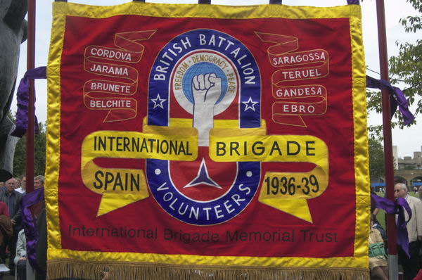
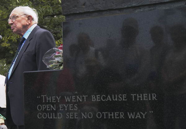
The rich and wealthy elites outside Spain feared the rebellion against the church, landowners and bosses by the peasants and working classes supporting the elected Spanish government against the fascist armies might give their those they were exploiting ideas,, Workers and intellectuals here and elsewhere saw clearly what was happening and many “went because their open eyes could see no other way.” Over 30,000 volunteers went to fight in the International Brigades, including more than 2,500 from Britain, although our government tried to prevent them. Probably around five thousand of the volunteers died in Spain and many, many more were injured.
Here is what I wrote on My London Diary back then, with the usual corrections and a few pictures, with links to rather more still on My London Diary.
Handicap International
Pyramid of Shoes, Trafalgar Square
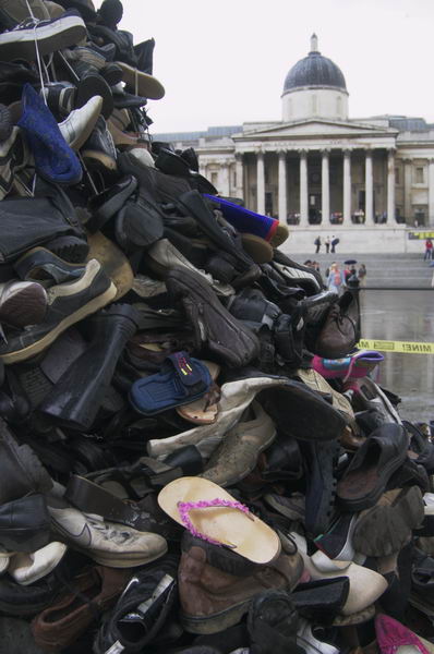
Saturday saw a repeat of last year’s shoe pyramid in Trafalgar Square, Handicap International campaigning against the use of cluster bombs, weapons that largely maim innocent women and children, which governments, including our own, are continuing to insist to use. So our taxes are now still killing and disabling innocent kids in Iraq from the invasion last year.
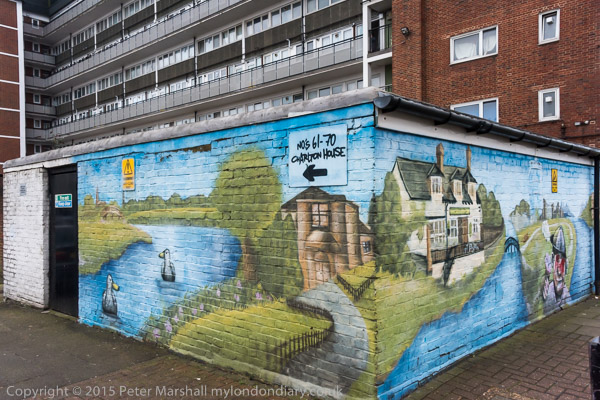
Public Art in Acton
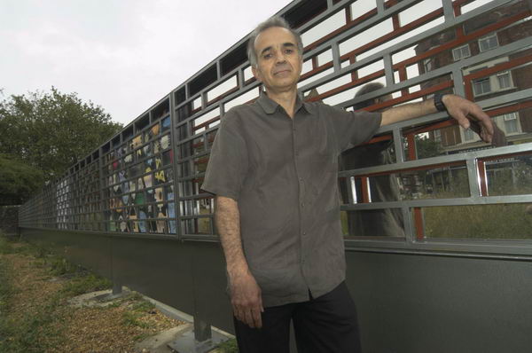
In Acton it was carnival day, but I didn’t have time to watch. I did manage to go and see the screen which Mohamed (Mamily) Sheibani has designed to screen off the waste area at the rear of the Oaks Shopping Centre in Churchfield Road. This was a project carried out by Acton Action with the help of Acton Arts And Media, the London Arts Café, the Churchfield Road Community Association and the shopping centre. Not a big thing, but the kind of small local project that makes an impact – we just need a few thousand more like it in London.
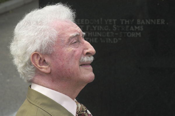
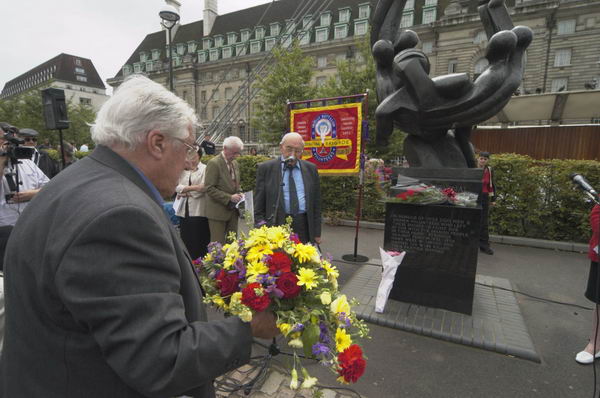
Spanish Civil War International Brigades Memorial Event
Jubilee Gardens, Waterloo,
who fought in the Spanish Civil war
The Spanish Civil War started in 1936, and while governments including ours made the wrong decisions [in part] based on incorrect intelligence, as over Iraq. The rights and wrongs of the matter were clear to most of those who took an interest, especially on the left.
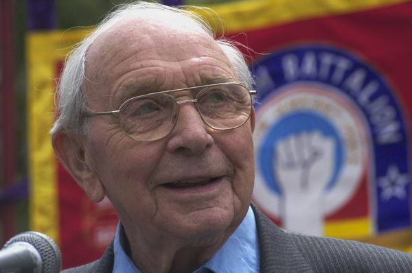
2,600 British men had the courage to go and join the International Brigade in the fight against fascism, and today we were again paying tribute to them. There are still a few living, and those who turned up were remarkably fit and alert considering their age.
Veteran Jack Jones chaired the event, and Ana Perez from the Madrid Amigos spoke movingly.
YET FREEDOM! YET THY BANNER
TORN, BUT FLYING, STREAMS
LIKE THE THUNDER-STORM
AGAINST THE WIND
Veteran Moe Fishman from Manhattan, still a peace activist, brought greetings from the peace movement in America and praise for the strength of the British people in demonstrating against the invasion of Iraq – a movement now carried from the streets to the ballot box.
Kilburn Festival
Grange Park, Kilburn

Kilburn High Road is one of the more interesting high streets of London. Too poor to have been swamped by the chains, it retains its own character and wide range of shops of various types. Perhaps more a place to look and stroll (as I did) rather than photograph.

They were having a festival in grange park, which included some of the artists who are to create a mural by the tube station demonstrating their skills and giving the local people a chance to influence the mural design.
Flickr – Facebook – My London Diary – Hull Photos – Lea Valley – Paris
London’s Industrial Heritage – London Photos
All photographs on this page are copyright © Peter Marshall.
Contact me to buy prints or licence to reproduce.