Posts Tagged ‘boats’

An Afternoon At The Seaside – Saundersfoot

Friday, September 13th, 2024

An Afternoon At The Seaside: Last week I was staying with friends in a holiday cottage in Narberth, Pembrokeshire, and on Sunday 1st September after a late lunch we drove the roughly seven miles down to the coast at Saundersfoot.

An Afternoon At The Seaside

Saundersfoot is a small seaside resort a few miles from its much larger neighbour Tenby but despite its size seems to have everything needed for a day at the seaside, including something that seems rare these days, sewage-free bathing, with a good sandy beach that gets cleaned by every high tide. But none of us swam there.

An Afternoon At The Seaside

There were at least five coal mines in the area in the nineteenth century, producing some of the finest quality anthracite, with tramways bringing it down to the beach for shipping out. In 1829 Parliament gave permission to the Saundersfoot Railway and Harbour Company for the building of a harbour to export coal and other local goods, bringing in iron ore to produce pig iron.

An Afternoon At The Seaside

The mines have long closed but the harbour is still there, now with private moorings, and still used by a few fishermen and for pleasure trips around the bay, as well as the sailing club.

An Afternoon At The Seaside

Saundersfoot is also almost on the railway, with a station over a mile to the north bearing its name, but with so few trains to be almost useless. And in winter the trains are often replaced by buses.

We were able to park on the seafront, with just a footpath between us an the beach and decided to walk the short distance to the harbour.

We walked along the pier to the mouth of the harbour, then back to the town where we found a shop selling proper ice cream in a number of interesting flavours.

Then we walked along the other side of the harbour to the harbour mouth. There is another smaller beach to the south of the harbour.

Back in town (or rather large village) we followed the map on the detailed leaflet we had on Saundersfoot to look at its three nineteenth century chapels. The Congregational one is now converted to residential use, the Wesley Methodist still in business and the Baptist had a small notice announcing a temporary closure and inviting people to instead worship with the Methodists.

On our way into the village we had passed the parish church around three-quarters of a mile from the beach but didn’t stop to look at this Grade II* building with a medieval tower.

When we returned to the beach and lent on the promenade railings to look at the beach, now almost all covered by the sea. I took a few last pictures, though it’s now probably regarded as a crime to photograph people – particularly children – enjoying themselves at the seaside.

The previous day we had shared a rail replacement taxi from Carmarthen with a woman who was travelling to visit her daughter in Kilgetty, the next village to Saundersfoot and probably the only person apart from our group in Pembrokeshire that we knew. We found her looking out over the sea from same railing as us and had a short conversation.

More pictures from Saundersfoot.
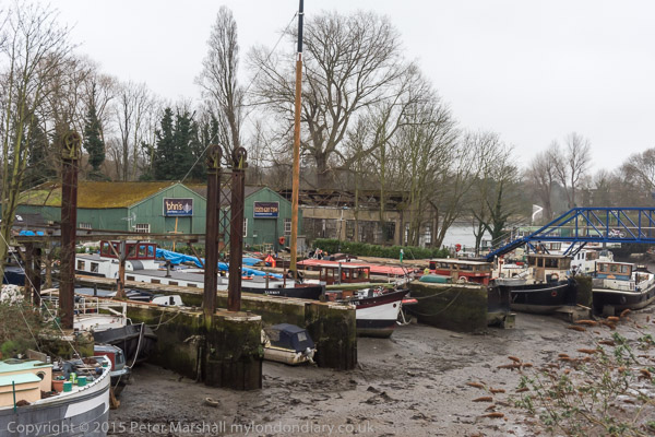
Riverside Brentford – 2016

Tuesday, March 26th, 2024

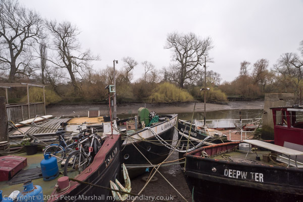
Riverside Brentford – Saturday 26th March 2016

Riverside Brentford - 2016

As a child I grew up in Middlesex, by then a rather truncated county on the north and west of London, though once it had included the cities of London and Westminster and many of London’s Metropolitan boroughs north of the Thames and west of the River Lea. Brentford, a couple of miles from where I was born, was the nearest thing the county had to a county town, though it had few if any of the normal attributes of one, with no town-hall or other public building.

Riverside Brentford - 2016

Often on Bank Holidays our father would take us on a 237 bus from Hounslow to Kew Bridge Station, the route going through Brentford High Street where it was often held up as we gazed through the top deck windows at the sites. Under the railway bridge leading to Brentford Docks where we might see a steam hauled goods train, over the canal bridge where the locks and dock area were normally busy with barges,past the Beehive on the corner of Half Acre with its tower topped by a giant beehive and on through the noisy, smelly gas works to Kew Bridge.

Riverside Brentford - 2016

We walked across Kew Bridge and then turned down the side of Kew Green to the gate of Kew Gardens, where a penny – an old penny, 240 to the pound led us into the extensive gardens where we could wander all day. This was before the days of garden centres and my father would always have a small pair of scissors in his pocket to take the odd cutting or pick up a seed or two on our walks.

Riverside Brentford - 2016

Later, in the early and mid 1950’s I would ride my bicycle around much of Middlesex and Surrey – and that included Brentford, but I think it was only much later when I became a photographer that I really explored the area and found out what an important communication link it had been. Brentford is where the inland waterways system with the busy Grand Union Canal joined the River Thames, just a few miles upriver from the great Port of London.

In 1978 three of my photographs from Brentford were published in Creative Camera Collection: No. 5, a prestigious collection of contemporary photography published by Coo Press, the publishers of the monthly magazine Creative Camera and edited by Colin Osman and Peter Turner. It wasn’t the first time my work had been published but was great to be on the pages with some very well known photographers, including one who much later became a friend, John Benton-Harris.

Brentford has changed greatly since then, with much of the riverside now lined with expensive flats rather than commerce and industry. The gasworks site became a riverside park and an arts centre, where I took part in and helped organise a number of exhibitions. But there is still enough of the old Brentford untouched, though less each time I go there.

I first returned in the 1990s, when I was teaching a few miles down the road, bringing students to see shows there and to wander around the area taking pictures. Later I came back for walks on my own or with friends, such as this one on Saturday 26th March 2016 with my elder son. Brentford hadn’t been my first choice by railway engineering works that week end made travelling out further to the east of London impossible.

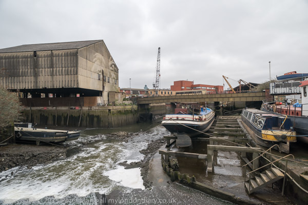
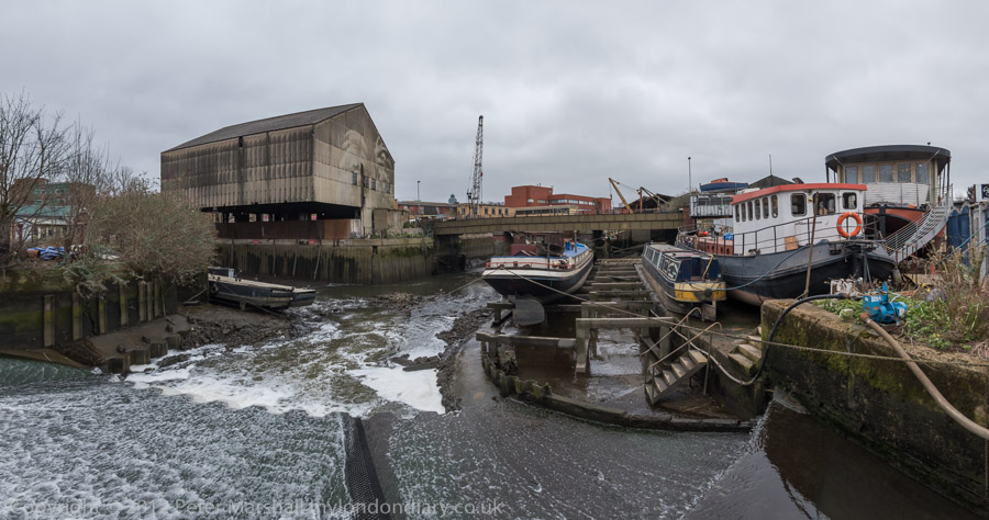
As well as making ‘normal’ pictures with lenses giving a horizontal angle of view of between 10 and 84 degrees (focal lengths 20 to 200mm) there were some pictures where I felt an even wider view was needed and I made some panoramss with a roughly 145 degree angle of view. The pictures above and below illustrate the difference.

We didn’t end our walk in Brentford, but continued on past Syon House to Isleworth where we ate our sandwiches in a relatively sheltered square before following the Duke of Northumberland’s River through Mogden Sewage Works to Kneller Park and then Whitton Station for the train home. You can see a much wider range of pictures online on My London Diary at these three links:
Syon, Isleworth & Mogden
Riverside Brentford Panoramas
Riverside Brentford


FlickrFacebookMy London DiaryHull PhotosLea ValleyParis
London’s Industrial HeritageLondon Photos

All photographs on this page are copyright © Peter Marshall.
Contact me to buy prints or licence to reproduce.


Boxing Day Pictures

Sunday, December 26th, 2021

Boxing Day Pictures I took in earlier years – mainly on our normal annual walks from Staines to Old Windsor. It’s a family tradition, a walk we’ve made most yearssince we moved here in 1974, though not always taking the same route. This year is one of the few years we won’t be making it.

2010

2011

2012

2013

2014

2015

2016

2017

2018

2019

2020

There are more pictures from all of these walks – except that in 2020 – on My London Diary. Click on the picture for any of the other years to go to more about the walks and more pictures.


North Pole & Heron Quay

Saturday, November 20th, 2021

The North Pole, Manilla Street, Millwall, Tower Hamlets, 1988 88-6b-22-positive_2400
The North Pole, Manilla Street, Millwall, Tower Hamlets, 1988 88-6b-22

Continuing my walk around the West India Docks I walked down from Marsh Wall to Manilla St, where I think you can still find The North Pole, a beer house built in the 1860s, on the corner at No 74. It closed as a pub in 2014, and I suspect the building’s days are numbered.

Cuba St, Millwall, Tower Hamlets, 1988 88-6b-23-positive_2400
Cuba St, Millwall, Tower Hamlets, 1988 88-6b-23

Nothing, or almost nothing in this picture of Cuba St has survived the redevelopment of this street on the fringe of the West India Docks. In the far distance you can just make out the distinctive frontage of the building on the corner of Cuba St and Westferry Road, the first few feet of which have been incorporated into a modern red-brick block and is now an Indian Restaurant. It seems to be much more than the usual facade, with the older building integrated into the development, Regatta Point, which is on a rather smaller scale than much of the new building, only 5 storeys of shops with flats above.

Docklands Enterprise, Wendy Ann Taylor, Sculpture, Heron Quays, Marsh Wall, Tower Hamlets, 1988 88-6b-24-positive_2400
Docklands Enterprise, Wendy Ann Taylor, Sculpture, South Dock, Marsh Wall, Tower Hamlets, 1988 88-6b-24

Wendy Ann Taylor, born 1945 claims to have been as one of the first artists of her generation to “take art out of the galleries and onto the streets”’ and has made a number of sculptures around London and in several of the new towns. This sculpture was commissioned by the LDDC and the Docklands Business Club and dates from 1987. It is still in place, although everything in the background of this picture has been replaced by newer and much taller developments. I took the shape emaphasised in my picture and repeated at right angles in her work as representing the river around the Isle of Dogs and the vertical as enterprise reaching for the sky.

Heron Quay, DLR, Middle Dock, West India Docks, Tower Hamlets, 1988 88-6b-14-positive_2400
Heron Quay, DLR, South Dock, West India Docks, Tower Hamlets, 1988 88-6b-14

You can still just about see the DLR as it goes across South Dock here but Heron Quay station is now completely engulfed in tall office blocks, the water now looking enclosed rather than open as it was. The distant gasholder at right at Greenwich has also now gone, though long invisible from here.

Heron Quay, West India Docks, Tower Hamlets, 1988 88-6c-63-positive_2400
Heron Quay, South Dock, West India Docks, Tower Hamlets, 1988 88-6c-63

I think it is a long time since any boats were moored here.

Heron Quay, West India Docks, Tower Hamlets, 1988 88-6c-65-positive_2400
Heron Quay, West India Docks, Tower Hamlets, 1988 88-6c-65

This picture is looking along Middle Dock, with the north side of the buildings, long demolished, of Heron Quay at right.

I continued my walk to the North Dock – and a few pictures in a later post.

Click on any of the pictures to see a larger version in my album 1988 London Photos, from where you can browse the album. The pictures there are largely ordered by my negative reference numbers, which do not in detail reflect the order in which the pictures were taken used in the posts here.


More Canal Pans

Friday, September 27th, 2019

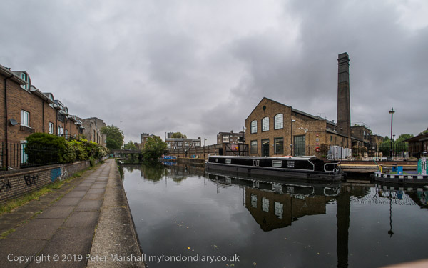
Photographing protests and other events generally keeps me pretty busy and for some years I’ve had little time for anything else, along of course putting some of my earlier work online and writing this blog and keeping My London Diary almost up-to-date. But one project that I’ve managed to do a little work now and then on is making panoramic images of London’s canals – and I hope to use a few of these in a show next year.

My first panoramic project, back in 1992 when I bought my first panoramic camera was on the DLR extension then being built from Poplar to Beckton. Prints from this were shown at the Museum of London back then, and a few are now in their collection – and one is in the current show, Secret Rivers at the Museum of London Docklands.

I’d chosen to work in panorama (using a Japanese Widelux camera) because I thought that the essentially linear nature of the railway was particularly suited to the panoramic format, and it seems to me that the same applies to photographing the canals. I’m now working of course with digital, and the pictures I’m making don’t natively come in a panoramic format as the camera sensor is either 3:2 (with the Nikons) or 4:3 in the pictures I’ve made with the Olympus EM5 MkII.

The character of the cylindrical perspective that I’m currently working with (others are possible) means that the image curvature required to give the wide angle of view (around 145°) increases towards the top and bottom of the image, and using a 4:3 or similar format makes it more noticeable than a more normal panoramic format such as 2.5:1. So I often crop the images to a more panoramic aspect, often 1.9:1 which can give a more natural look.

Cropping the image also has another advantage. In making these images it is important to keep the camera level – aided by indicators in the viewfinder at bottom and left of the image. Doing so means that the horizon will always be a horizontal line splitting the image into two equal halves, and this can make a set of images a little monotonous. When cropping the images, it is possible to move this above or below the centre line. In days largely long past, landscape photographers used cameras with a rising or falling front to acheive the same goal, and for much of my black and white work on film I used a 35mm shift lens which could do the same.

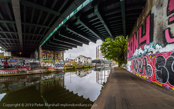
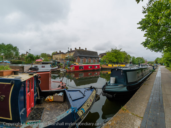
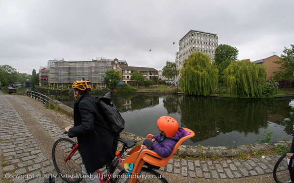
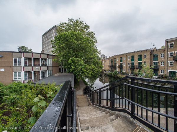
These pictures were taken between the end of a protest in Hackney and my visit to an Open Studio event at the Chisenhale Studios in Bethnal Green to which I walked. I began the walk along the canal in one of my favourite spots where Mare St becomes Cambridge Heath Road and goes over the canal and then walked east along the Regent’s Canal towpath to the junction with the Hertford Union Canal. I had time to go a little beyond the studios before turning around and returning to leave the canal and make my way to the studios. By the time I got there the rain was beginning to come down fairly steadily and I’d walked around a mile and a half.

More pictures at Bethnal Green Canal Walk


All photographs on this and my other sites, unless otherwise stated, are taken by and copyright of Peter Marshall, and are available for reproduction or can be bought as prints.

There are no adverts on this site and it receives no sponsorship, and I like to keep it that way. But it does take a considerable amount of my time and thought, and if you enjoy reading it, please share on social media.
And small donations via Paypal – perhaps the cost of a beer – would be appreciated.