Battlebridge, Canalside and Barnsbury – 1990

Battlebridge, Canalside and Barnsbury continues my walk which began at Kings Cross on Sunday February 11th 1990 with the post Kings Cross and Pentonville 1990.

Battlebridge Basin, Pentonville, Islington, 1990, 90-2b-11

Battlebridge Basin on the Regent’s Canal was opened at the same time as the Camden Town to Limehouse stretch of the canal in 1820, though the buildings around it took a couple of years longer to complete. In 1815 the landowner William Horsefall contracted with the canal company to allow them to dump the soil extracted from the Islington Tunnel a short distance away on his land, and he used this to form the basin.

It seems odd that you should need earth to form a basin, but it was needed to raise the ground level around it as part of the 480ft by 155ft basin is above the level of the streets around. Horsefall got an Act of Parliament to fill the basin with water from the canal and by 1822 it was surrounded by industrial premises, including timber yards. Among later occupants were W J Plaistowe & Co, jam, marmalade and preserve makers, here until 1926, and at Albert Wharf on the northeast corner were Cooper & Sewell (c1847-1880) and J Mowlem & Co (c1880-1922).

The best-known building on the basin was the warehouse built around 1860 by ice-cream maker Carlo Gatti to store ice brought from Norway, which since 1992 houses the London Canal Museum. In a Key Stage 2 teaching resource on their site is an excellent plan showing the uses of the different areas around the basin in the late 19th century.

Unlike other canal basins in London this was privately owned, known first of all as Horsefall Basin, then Maiden Lane Basin before taking its current name – the old name for the Kings Cross area, which had a bridge over the River Fleet. There seems to be no agreement as to which battle this was named after but few beleive the popular legend it was fought by Boudicea. In 1978 a group of boat owners came together so set up moorings here which over the years since have developed into a substantial marina.

Mercantile House, All Saints St, Pentonville, Islington, 1990, 90-2b-14

My previous post on this walk showed an overall picture of Mercantile House and gave a little of its history. In 1990 the whole site was undergoing redevelopment as you can see in pictures below. Mercantile House was retained.

All Saints St, Pentonville, Islington, 1990, 90-2b-13

I photographed Bartlett Ltd, Export Packers in 1979 from the canal towpath and wrote a little about Battlebridge Basin and Bartlett’s works then and wrote:

Although many of the canal-side buildings in the area have been replaced, a warehouse on the basin of Bartlett Export Packers survives in greatly altered form as Albert Dock. The works buildings in this picture, at the end of New Wharf Road, have been replaced by those of Ice Wharf, three blocks with 94 apartments in a highly regulated private development with 24 hour concierge service and a private, gated underground parking space where a 2 bed flat overlooking the canal could be yours for only £1,195,000.

Demolition of the buildings on All Saints Street whichg meets New Wharf Road at its west end provided me this view of part of Bartletts from here.

Regent's Canal, View West, from, Caledonian Rd, Pentonville, Islington, 90-2c-64
Regent’s Canal, View West, from, Caledonian Rd, Pentonville, Islington, 90-2c-64

From Thornhill Bridge on the Caledonian Road over the canal I could see the cleared development site and, in the distance St Pancras Hotel, the Post Office Tower and other buildings. At the left are the back of buildings on Caledonian Rd.

Regent's Canal, View West, from, Caledonian Rd, Pentonville, Islington, 1990, 90-2c-65
Regent’s Canal, View West, from, Caledonian Rd, Pentonville, Islington, 1990, 90-2c-65

A second view west from Thornhill Bridge includes Bartlett’s water tank and canalside buildings.

Thornhill Crescent, Barnsbury, Islington, 1990, 90-2c-52

I walked on north up Caledonian Road to Thornhill Crescent at the northern end of Thornhill Square, once of the well-known Barnsbury Squares, though it certainly is not square – together they are more of an oval, narrowing towards the southern end. Wikipedia calls it “an unusual large ovoid ellipse“.

Much of the land around here was owned by the Thornhill family who had come from Yorkshire and let to dairy farmers. George Thornhill began Thornhill Square in 1847, and Samuel Pocock, one of those rich farmers began Thronhill Crescent around 1849.

Lived in at first by prosperous middle class households, the area became run-down by the middle of the last century with many properties in multiple occupation and high levels of street crime. But Islington became fashionable in the 1960 and 70s and gentrification led many of those living to purchase the freeholds and the area went upmarket. Some flats now sell for over a million pounds and entire houses over two million.

More from Barnsbury in the next post in this series.


FlickrFacebookMy London DiaryHull PhotosLea ValleyParis
London’s Industrial HeritageLondon Photos

All photographs on this page are copyright © Peter Marshall.
Contact me to buy prints or licence to reproduce.


An Afternoon At The Seaside – Saundersfoot

An Afternoon At The Seaside: Last week I was staying with friends in a holiday cottage in Narberth, Pembrokeshire, and on Sunday 1st September after a late lunch we drove the roughly seven miles down to the coast at Saundersfoot.

An Afternoon At The Seaside

Saundersfoot is a small seaside resort a few miles from its much larger neighbour Tenby but despite its size seems to have everything needed for a day at the seaside, including something that seems rare these days, sewage-free bathing, with a good sandy beach that gets cleaned by every high tide. But none of us swam there.

An Afternoon At The Seaside

There were at least five coal mines in the area in the nineteenth century, producing some of the finest quality anthracite, with tramways bringing it down to the beach for shipping out. In 1829 Parliament gave permission to the Saundersfoot Railway and Harbour Company for the building of a harbour to export coal and other local goods, bringing in iron ore to produce pig iron.

An Afternoon At The Seaside

The mines have long closed but the harbour is still there, now with private moorings, and still used by a few fishermen and for pleasure trips around the bay, as well as the sailing club.

An Afternoon At The Seaside

Saundersfoot is also almost on the railway, with a station over a mile to the north bearing its name, but with so few trains to be almost useless. And in winter the trains are often replaced by buses.

We were able to park on the seafront, with just a footpath between us an the beach and decided to walk the short distance to the harbour.

We walked along the pier to the mouth of the harbour, then back to the town where we found a shop selling proper ice cream in a number of interesting flavours.

Then we walked along the other side of the harbour to the harbour mouth. There is another smaller beach to the south of the harbour.

Back in town (or rather large village) we followed the map on the detailed leaflet we had on Saundersfoot to look at its three nineteenth century chapels. The Congregational one is now converted to residential use, the Wesley Methodist still in business and the Baptist had a small notice announcing a temporary closure and inviting people to instead worship with the Methodists.

On our way into the village we had passed the parish church around three-quarters of a mile from the beach but didn’t stop to look at this Grade II* building with a medieval tower.

When we returned to the beach and lent on the promenade railings to look at the beach, now almost all covered by the sea. I took a few last pictures, though it’s now probably regarded as a crime to photograph people – particularly children – enjoying themselves at the seaside.

The previous day we had shared a rail replacement taxi from Carmarthen with a woman who was travelling to visit her daughter in Kilgetty, the next village to Saundersfoot and probably the only person apart from our group in Pembrokeshire that we knew. We found her looking out over the sea from same railing as us and had a short conversation.

More pictures from Saundersfoot.

Windsor & Eton

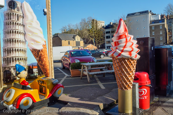
I suppose this isn’t everybody’s idea of a picture of Windsor Castle, but it does rather amuse me, and I was rather brought up with Noddy, who I now realise was at times terribly racist. Noddy was created by Enid Blyton when I was only four, and her last book about him was published in the year I went to university, though since then he has been kept more or less alive on TV and through what is still a best-selling franchise. Mr Golly, who serviced Noddy’s little car seems to have disappeared in the 1990s, and the Gollies who stole Noddy’s car and the song book strongly featuring the n-word are no longer mentioned. It was in the mid 1960s that the racist, classist and xenophobic nature of her books first came under attack. And Windsor Castle is a little less prominent than that Pisan tower.

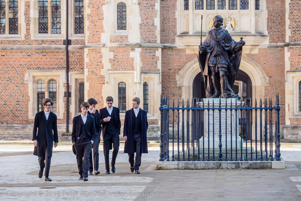
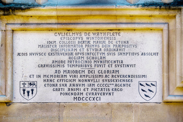
Eton is of course at the very heart of our English class system, and was appropriated by the wealthy from the school founded by Guliemus De Wayneflete for the education of poor boys – as the plaque records.

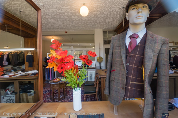
Much of Eton revolves around the school, and perhaps the most obvious signs of that, other than the school buildings themselves are the tailors shops, though it’s hard to imagine anyone actually buying anything in them.

Eton is a ridiculously wealthy and privileged place, though the school does offer some scholarships to gifted poor children, and we were once encouraged by his primary headmaster to put our elder son forward for one. I don’t think he would have survived, either the preparatory school that scholarship boys start at to repair some of the ravages of the state system and certainly not the school itself.

As you walk back towards Windsor, sanity does start to return and there is at least one decent pub where we lunched before returning over the pedestrianised bridge to Windsor, itself a curious place under the shadow of royalty and the military, and also a town full of tourists.

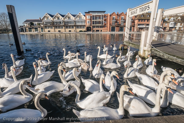
The swans were massing where tourists feed them, across the Thames from the Eton College boat house. I walked to the bus stop to return to the real world.


There are no adverts on this site and it receives no sponsorship, and I like to keep it that way. But it does take a considerable amount of my time and thought, and if you enjoy reading it, please share on social media.
And small donations via Paypal – perhaps the cost of a beer – would be appreciated.

All photographs on this and my other sites, unless otherwise stated, are taken by and copyright of Peter Marshall, and are available for reproduction or can be bought as prints.

To order prints or reproduce images