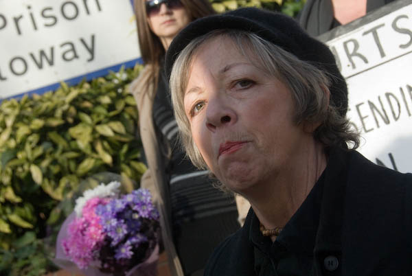
Pauline Campbell Protests At Holloway: On Wednesday 16 January 2008, Pauline Campbell was one of a small group of campaigners at the entrance to Holloway Prison following the death of 24-year-old woman Jaime Pearce in the prison the previous month. She was the eighth woman to die in prison in 2025. Only 4 months later in May 2008 I was stunned by the news that Pauline herself had been found dead on her daughter’s grave.
I wrote a lengthy piece about her and her campaigning at the time of the protest at Holloway which I’ll reproduce here, together with a few of the pictures. I had some problems taking pictures, both because of being obstructed and pushed by police and also technical issues with my Nikon flash.
Protest Against Deaths in Prison
Holloway Prison, London. Wednesday 16 January
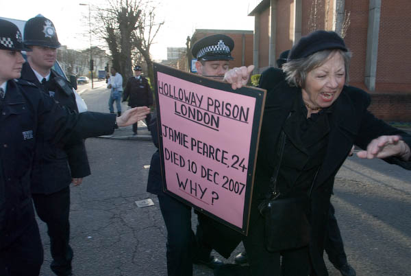
Jamie Pearce* died in Holloway Prison on 10 December 2007, aged only 24. She was the eighth woman to die in jail in 2007. Eventually there will be an inquest which may provide information about how and why she died. Prisons have a duty to take care of everyone entrusted to them, and any death represents a failure. Marie Cox, aged 34, had also died in Holloway just a few months earlier on 30 June 2007. “To lose both” in such a short time – to borrow a phrase from Mr Wilde, “looks like carelessness.”
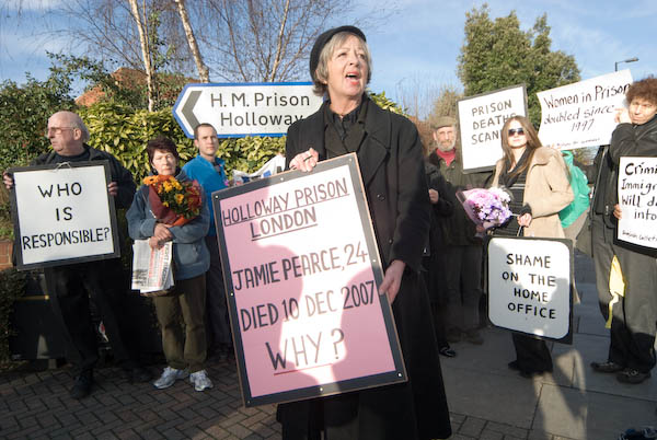
A small group of demonstrators gathered at the entrance to Holloway on the afternoon of Wednesday 16 January to display banners and lay flowers in memory of Jamie Pearce, although very little seems to be known about this young woman. [more about her in the written evidence from INQUEST to the Justice Committee.]
Two of those present were mothers whose children had died in jail, the organiser of the protest, Pauline Campbell, and Gwen Calvert, whose son Paul died on remand in Pentonville in 2004. The jury at his inquest gave a damning verdict against the prison, finding “systematic failures, incomplete paperwork, lack of communication, disablement of cell bells, breach of security…”
Sarah Campbell was only 18 when she died in Styal prison in 2003, her death recorded by the prison authorities as “self-inflicted.” Two years later the inquest found that her death was caused by antidepressant prescription drug poisoning and said that there was a “failure in the duty of care” and that “avoidable delays” in summoning an ambulance contributed to her death.
I first met Pauline Campbell when she spoke powerfully about her daughter’s death at the United Families and Friends protest against deaths in custody in Trafalgar Square in October 2003. During the afternoon at Holloway she quoted to me something I had written in October 2006, and which I had actually forgotten. “One small piece of positive news came from Pauline Campbell, whose daughter Sarah Campbell died in Styal prison in 2003. She said ‘After nearly four years of my struggle for justice – in a highly unusual move, the Home Office have finally admitted responsibility for the death of my daughter Sarah Campbell, including liability for breach of Sarah’s human rights under the European Convention on Human Rights. Don’t give up the fight.”
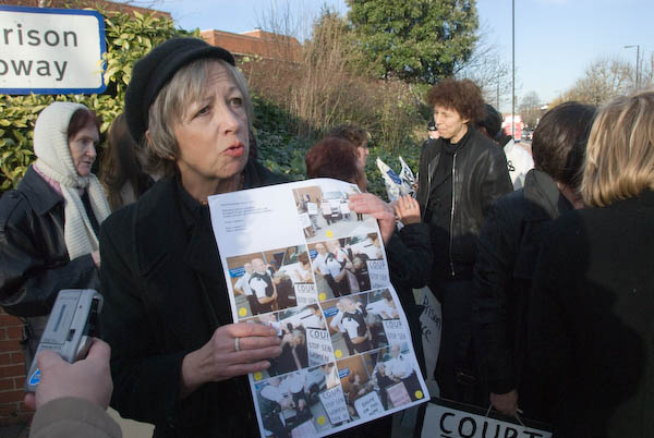
It was a fight that took Pauline to many protests around the country on behalf of other women who have died in prison and numerous arrests, with recognition by the 2005 Emma Humphreys Memorial Prize for her campaigning. She also became a trustee of the Howard League for Penal Reform. After one of her 14 arrests she was brought to a criminal trial in September 2007 and acquitted when the judge threw the case out of court.
Since Sarah Campbell’s death in 2003, forty women prisoners have died. We’ve suffered for many years under successive governments who have courted tabloid approval for being ‘tough’ by criminalising and banging up many more women and men with little regard for worsening conditions in prisons. Positive ideas and programmes have largely been sidelined, and the incredible number of prisoners with mental health problems largely brushed under the carpet. It’s a system that is failing, one one whose failings actually greatly compounds the problem by increasing re-conviction rates.
An inspector and seven police officers lined the roadway leading into Holloway, restricting it to a small area of pavement – and then periodically complained that the pavement was being obstructed. They did allow an adjoining area of pavement normally open to the public but apparently on prison property to be used briefly for photographs, but then made their own job considerably harder by insisting that the demonstrator and press moved back onto the relatively narrow pavement.

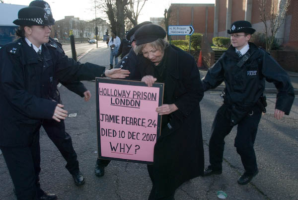
At intervals through the long afternoon, SERCO vans came to bring more prisoners to jail. As they did so, Pauline Campbell rushed forward with her double-sided placard demanding ‘HOLLOWAY PRISON LONDON JAMIE PEARCE, 24 Died 10 DEC 2007 WHY?’ and the line of police stopped her.
The first time this happened she was pushed very forcefully by the Inspector, sending her flying to the ground. It looked for a moment as if we were going to see a repeat of the disgraceful treatment given to her at the p;revious year’s demonstration here (I wasn’t present, but I have watched the video and seen the photos) but the police appeared to have rethought their approach, keeping hold of her and preventing her going through the police line rather than pushing her away.

The atmosphere during the demonstration was quite unlike any other I’ve been to; in many ways it was more like some soirée with Pauline Campbell as an attentive host, talking to people, introducing everyone to the others present and keeping track notes of everyone’s details in her notebook. The police too came in for a great deal of her attention, although some seemed rather resistant to her attempts to educate them. Some at least resented being taken away from other duties to police this event.

But at least some of the blame for what is happening must fall on police and prison staff who run the business and are in a position to observe its many failings first hand. It’s hard to see why prison governors, chief constables, leaders of the various professional associations for prison workers and police aren’t far more active in campaigning for reform – and it would be good to see some of them standing beside Pauline Campbell.
More pictures on My London Diary at Protest Against Deaths in Prison
* Later Pauline found that the prison had not even got her name right on the death certificate and that she was JAIME Pearce. What does it say for ‘prison care’ if they do not even care enough to enter prisoners names correctly?
Flickr – Facebook – My London Diary – Hull Photos – Lea Valley – Paris
London’s Industrial Heritage – London Photos
All photographs on this page are copyright © Peter Marshall.
Contact me to buy prints or licence to reproduce.


