Posts Tagged ‘Industrial Archaeology’

Bermondsey Equinox 2015

Wednesday, March 20th, 2024

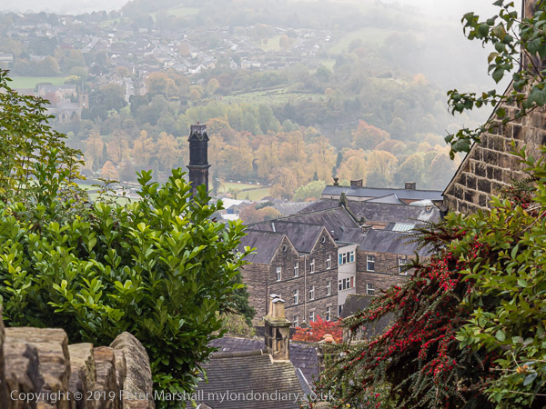
Bermondsey Equinox: Spring, or rather Astronomical Spring, officially starts today, 20th March, though meteorologists see things differently and start it on March 1st and the weather has its own ideas. Botanists too make up their own minds by looking at plants.

Bermondsey Equinox

Today is the Spring Equinox, which I always assumed meant equal lengths of day and night, but checking the tables I find that today we get 24 minutes more day than night.

Bermondsey Equinox

The actual definition of the Equinox is apparently the moment when the Sun is directly above the equator and the Earth’s rotational axis passes through from being tilted towards the southern hemisphere to the north. So it really is just a moment, this year at 3.06 am UTC 20th March. Most years it falls on 20th March, but in 2007 it was on the 21st in the UK, and this year will be on the 19th across the USA.

Bermondsey Equinox

But watch out for Druids, particularly should you be near Tower Hill, where in some previous years I’ve photographed their celebrations which begin at noon, I think Greenwich Mean Time.

Bermondsey Equinox

It’s an interesting event to watch, and doubtless important for those taking part, and also good to photograph at least once or twice, but when you’ve done it a few times difficult to find anything new to say.

So I won’t be there today. And I won’t write about it here, as last year I posted Druid Order – Spring Equinox at Tower Hill and you can still read all about it there as well on the various other posts here and on My London Diary.

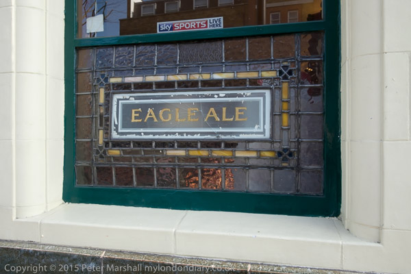
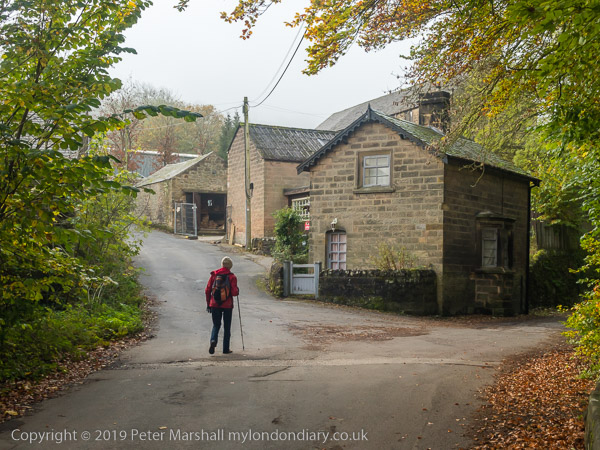
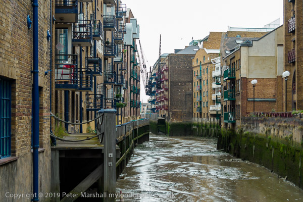
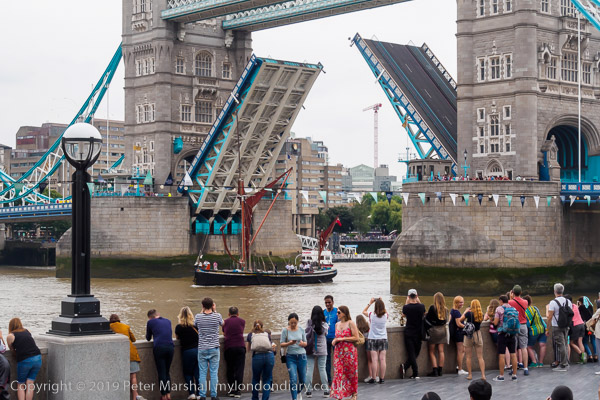
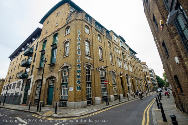
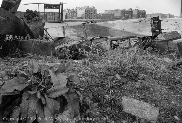
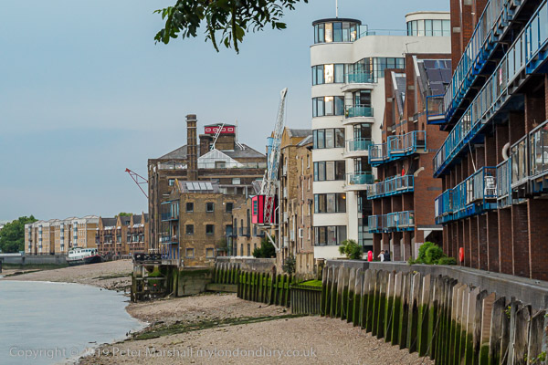
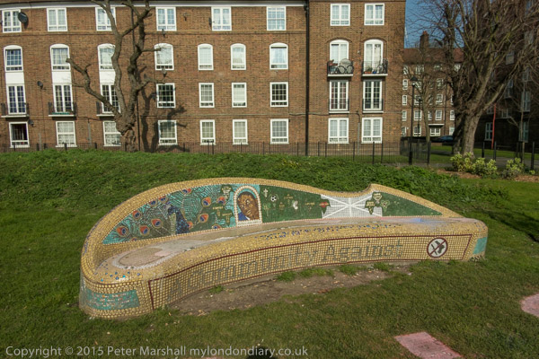
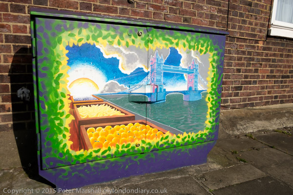
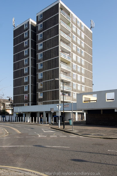
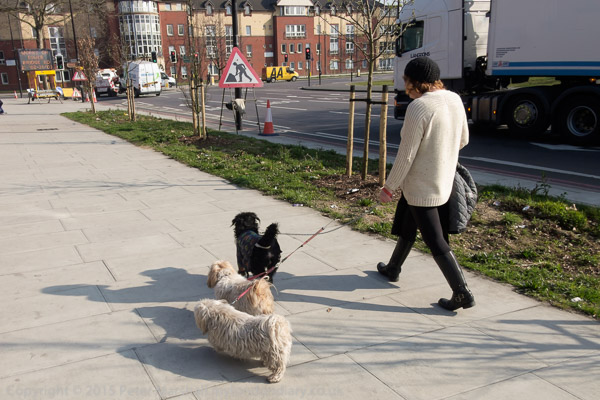
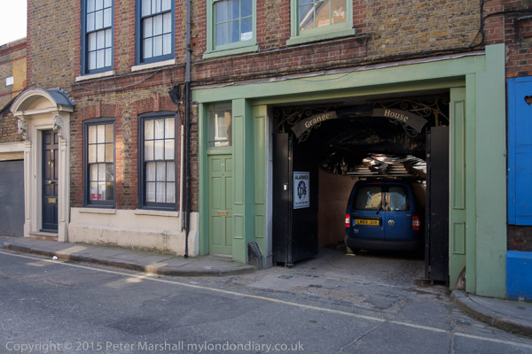
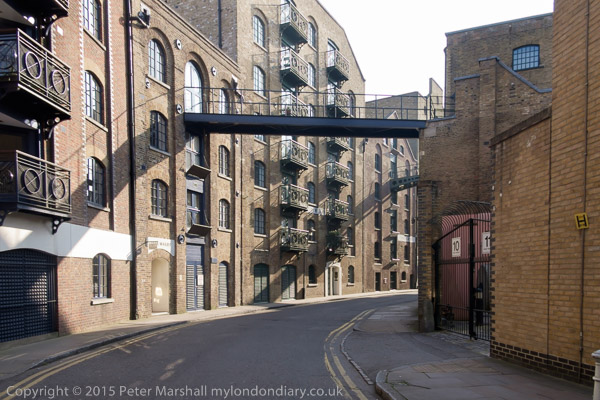
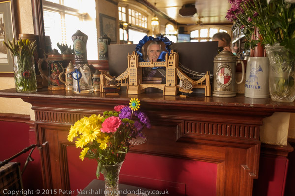
Back in 2015 I didn’t go to Tower Hill but was instead on the opposite side of the River Thames in Bermondsey, out for a walk around one of my favourite areas of London with a few photographer friends.

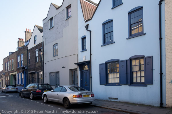
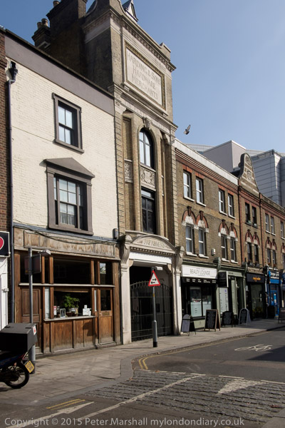
As I wrote then, it was “really just an excuse to meet up, go to a couple of pubs and then end up with a meal” and though it was a fine afternoon I don’t think any of us took many pictures. I’d photographed the area fairly extensively in previous years and had even written a leaflet with a walk for part of it.

The leaflet came about back in the dark ages of computing, when Desk Top Publishing had more or less just been invented and I was teaching an evening class in the use of Aldus Pagemaker, bought up by Adobe in 1994 who then killed it and brought out Indesign, more powerful but far more difficult to use. West Bermondsey – The leather area was an industrial archaeology walk which I made use of to illustrate some of my lessons.

Over the next few years I printed hundreds of copies on my Epson Dot-Matrix printer – which accounts for the crude illustrations – and sold them at 20p a time – hardly a money spinner but it covered my costs. They were bought and given out by local historian Stephen Humphrey (1952-2017), chief archivist at Southwark’s Local Studies Library for 30 years on his local history walks and sold at the Bermondsey festival. I met Stephen who wrote a number of publications on the history of the area a few times – and had visited him in the Library when researching the leaflet, which also relied on information from a walk led by Tim Smith for the Greater London Industrial Archaeology Society where it is one of a very long list of interesting walks in London.

The area has changed considerably since I wrote it, but most of what is mentioned remains despite considerable gentrification. You can find several hundreds of my older images of Bermondsey in colour and black and white on Flickr – including those used in illustrating the leaflet in much better reproduction.

There are a few more images from my 2015 walk on My London Diary at Bermondsey Walk.


FlickrFacebookMy London DiaryHull PhotosLea ValleyParis
London’s Industrial HeritageLondon Photos

All photographs on this page are copyright © Peter Marshall.
Contact me to buy prints or licence to reproduce.


Albion Yard and Balfe Street, 1989

Sunday, April 9th, 2023

Albion Yard and Balfe Street: My walk around King’s Cross on Saturday 8th April 1989 continues. The previous post was Along the Cally & York Way. I was taking part in a walk led by the Greater London Industrial Archaeology Society, GLIAS.

York Way area Pentonville, Islington, 1989 89-4e-34
Albion Yard, York Way, Pentonville, Islington, 1989 89-4e-34

I cannot now remember if we took an alley from York Way to enter Albion Yard or if we turned east along Railway Street, from where there was another entrance. But I think this building was on our route into Albion Yard, and is now still present either in Albion Yard or the connected Ironworks Yard.

Neither of these yards is named on the old larre-scale OS maps, and only Albion Yard appears on my old street atlas. A few yards away from the Balfe Street entrance on the corner with Caledonian Road The Albion pub opened in 1845 when Balfe Street was called Albion St but the yard was simply labelled on the 1877 map as ‘Blue Manufactury.’ The Albion building is still there though by the time of this walk known as Malt & Hops. For some years it was the Ruby Lounge wine bar, then a Be At One cocktail bar and is now home to the Institute of Physics.

Albion Yard, Balfe St, Pentonville, Islington, 1989 89-4e-35

The name ‘Albion’ is the oldest known name for the mainland of Britain, in use at least since it was recorded by Greek geographers around 6,000 years ago to distinguished it from Ireland. They are thought to have got the name from the Celts and it was Romanised as Albion.

Some believe it came from a word meaning white and relate it to the ‘White Cliffs of Dover’ but it seems more likely to have a different origin simply meaning ‘land’ or ‘world’, and possibly the same root that also led to Alps and Albania.

Albion Yard, Balfe St, Pentonville, Islington, 1989 89-4e-36

Albion largely survives in modern English simply in the name ‘Alba’ used by Scottish separatists and in Celtic languages for Scotland.

But Albion is the England of myths, with the fantasies of Geoffrey of Monmouth’s 12th-century Historia Regum Britanniae being repeated as fact in histories in the five centuries that followed. But most important for its continued popularity was the work of visionary poet and printmaker William Blake and his ‘Jerusalem‘, subtitled ‘The Emanation of the Giant Albion‘ published in just as six copies before his death in 1827. Later many have come to regard him as the greatest artist Britain has ever produced.

Albion Yard, Balfe St, Pentonville, Islington, 1989 89-4e-21

Albion Yard had entrances from York Way, Caledonia St, Balfe St and Railway St and was the interior of this block of four streets. The entrances and a few of the buildings that were present in 1989 still exist though in rather different state, but the character of the area, now labelled ‘Regent Quarter’ is very different.

Albion Yard, Balfe St, Pentonville, Islington, 1989 89-4e-22

An property group’s site provides the following description:

“Regents Quarter is a development of almost six acres of land next to Kings Cross Station that and has been transformed into a living working community. Victorian workshops have been converted into loft style apartments, sitting comfortably alongside ultra modern business and residential spaces…

This sought after gated development boasts a lovely entrance hall further benefitting from a 24 hour concierge/security service.”

Albion Yard, Balfe St, Pentonville, Islington, 1989 89-4e-24

Some of the properties were still in use as small workshops but others are clearly derelict. I was intrigued by the heads of mannequins visible in the first floor with a door on which the name MODRENO had been hand-painted. This photograph had a sign painted on the wall ‘NO PARKING MODRENO LOADING BAY – SIGNED LECKY’S DUMMY MODELS’. You can find out much more on Modreno at Foxxhunting – Modreno.

Albion Yard, Balfe St, Pentonville, Islington, 1989 89-4e-12
Leaving Albion Yard to Balfe St, Pentonville, Islington, 1989 89-4e-12

You can view a very detailed presentation of the proposed redevelopment of the whole area, which includes a plans and a number of photographs of the current Albion Yard, part of what will be called Jahn Court. You can recognise this and other buildings in my pictures in the photographs there.

Entrance to Albion Yard, Balfe St, Pentonville, Islington, 1989 89-4e-14

The mid 19th century house at left and the adjoining arch with its inscription ‘WORKS & MILLS’ and the date 1846 is Grade II listed. Balfe St was formerly Albion St, and was renamed after the composer of the opera The Bohemian Girl, William Balfe in 1938.

My King’s Cross walk with GLIAS will continue in a later post

The first post on this walk was Kings Cross, St George’s Gardens & More.


Industrial Archaeology: Gloucestershire, 1988

Tuesday, December 7th, 2021

Lock gates, Lydney Harbour, 1988 88-7a-62-positive_2400
Lock gates, Lydney Harbour, 1988 88-7a-62

Some time in 1977 I visited Kew Bridge Engines in Green Dragon Lane, Brentford and was greatly impressed by the huge beam engines there, once used to pump water to the top of the tower. I had joined a local camera club, and they were running a photographic competition in conjunction with the site and allowed us free access. One of my pictures ended up with the second prize (rather to the surprise and disgust of many club members as I wasn’t really a ‘club photographer’) and also got printed in Amateur Photographer. You can see this and many other pictures on my web site London’s Industrial Heritage.

Blast furnace, Gunns Mills, Flaxley, Forest of Dean, 1988 88-7b-63-positive_2400
Blast furnace, Gunns Mills, Flaxley, Forest of Dean, 1988 88-7b-63

But it was there, either on that visit or a later one when I took my young sons and friends to Kew Bridge Engines for a birthday treat that I picked up a leaflet about the Greater London Industrial Archaeology Society, and I’ve been a member ever since. Though none of us to this day know how to pronounce GLIAS. And as I say on the web site set up for me by one of those two young boys 25 years on, “I’m not really an industrial archaeologist, but over the last twenty-five years I’ve photographed many things that interest industrial archaeologists.”

Gloucester Docks, 1988 88-7b-65-positive_2400
Gloucester Docks, 1988 88-7b-65

At least one of those boys came with me on a coach trip organised by GLIAS in June 1988 to Gloucestershire where we visited Lydney Harbour, Gunns Mills at Flaxley in the Forest of Dean, Gloucester Docks, the Old Sharpness Canal entrance and Sharpness Docks. It was a long day out, and we arrived back in London only just in time to run for the last train to Staines.

Old Sharpness Canal entrance, 198888-7b-21-positive_2400
Old Sharpness Canal entrance, 1988 88-7b-21

The weather wasn’t ideal, with some quite heavy rain at times, but I still took around a hundred pictures, and there are 29 of them in my album ‘GLIAS trip, Gloucestershire, 1988‘ some perhaps more interesting for their IA content than as photographs. I can’t tell you a great deal about the industrial archaeology, but I think some make interesting photographs, and others are welcome to make more technical comments either here or better on the album.

Old Sharpness Canal entrance, 1988 88-7b-24-positive_2400
Old Sharpness Canal entrance, 1988 88-7b-24
Sharpness Docks, 1988 88-7c-51-positive_2400
Sharpness Docks, 1988 88-7c-51
Sharpness Docks, 1988 88-7b-16-positive_2400
Sharpness Docks, 1988 88-7b-16

More at ‘GLIAS trip, Gloucestershire, 1988


Industrial Archaelogy 1988

Monday, October 26th, 2020

Some photographs from a GLIAS (Greater London Industrial Archaeology Society) coach trip to Gloucestershire in 1988. For most of the time it rained, rather restricting my photography.

Lock gates, Lydney Harbour, 1988 88-7a-62-positive_2400

Lydney Harbour was built in 1810-3 to carry iron ore and coal from the Forest of Dean. These were brought to the harbour by a tramway built in 1809. Coal continued to be shipped from here until 1960 and the harbour only closed in 1977. It was scheduled as an ancient monument in 1985 and later reopened for leisure use More recently there have been some restoration work and a £2.1m Destination Lydney Harbour project began in June 2020 to develop the area for recreation and tourism. An outer Sea gate from the River Severn leads into a Tidal basin, then a lock connects to the dock and Lydney canal. The upper lock gate is a double gate to protect against high tides in the estuary.

The harbour is the mouth of the River Lyd, and a canal leads a mile inland to Lydney. The swing bridge across the canal between the upper and lower parts of the dock was Grade II listed in 1988. Apparently timber was still carried in barges along the canal until around 1980.

Cookson Terrace, Harbour Rd, Lydney, 1988 88-7a-43-positive_2400

Cookson Terrace on Harbour Rd is a row of cottages built in 1858 as a hotel and housing by the Severn and Wye Railway and Canal Company, Grade II listed in 1988.

Blast furnace, Gunns Mills, Flaxley, Forest of Dean, 1988 88-7b-63-positive_2400

Gunns Mills, Flaxley, Forest of Dean, Gloucestershire is a Grade II* Listed Building and a Scheduled Ancient Monument, being probably the oldest surviving blast furnace in the country, dating to 1683. The mill was named after William Gunne who owned an earlier mill on the site. A charcoal blast furnace built here in 1629 was demolished by Parliament in 1650. The furnace was rebuilt in 1683 but went out of use in 1743 when this became a paper mill which closed in 1879, after which some buildings on the site were used as farm buildings.

Gloucester Docks, 1988 88-7b-55-positive_2400

The main site for our visit was Gloucester Docks, a remarkable collection of fifteen Victorian dock buildings around the main basin, built in 1827 as the terminus of the ship canal from Sharpness, and the Barge Arm, provided at the same time to stop barges cluttering up the dock. A new dock, the Victoria Dock, was added in 1847 and further warehouses were added to deal with the increased foreign imports after the 1846 repeal of the Corn Laws.

As the size of vessels increased a new dock was built at Sharpness; larger vessels were unloaded there, with some goods being carried by barges up the canal, while smaller ships continued to use the canal. The docks remained busy until the 1960s but commercial traffic had largely disappeared by the 1980s. Since then the dock has become of popular leisure and residential area both for boaters and tourists.

Old Sharpness Canal entrance, 1988 88-7b-24-positive_2400

The Gloucester and Sharpness Canal was for some years the broadest and deepest canal in the world, intended to be 18ft deep and 86.5ft wide. Authorised in 1793, building was held up by financial difficulties and it was only completed in 1827. 16.3 miles long, it avoided a large loop in the River Severn with a dangerous bend. By 1905 traffic along it had reached 1 million tons a year. Our coach took us for a brief visit to the Old Sharpness Canal entrance, opened in 1827 but no longer in use, before going to Sharpness Dock, opened in 1874 to allow larger ships which could not use the canal to dock. This is still a working dock and most of the older buildings have been replaced by more modern structures.

Sharpness Docks, 1988 88-7c-51-positive_2400

I don’t actually remember much of that visit, but the photographs remain, around a hundred of them, though I’ve only included around 30 in the album. I do remember our coach back to London being held up on the motorway and arriving back in central London hours later than planned, having to run across Waterloo station to just jump on the last train home, minutes before midnight.

More pictures from the trip in a Flickr Album.


All photographs on this and my other sites, unless otherwise stated, are taken by and copyright of Peter Marshall, and are available for reproduction or can be bought as prints.


Lumsdale and Matlock

Tuesday, June 23rd, 2020

We had a day before we left Matlock when we were not looking after grandchildren and went on a walk. I’d been to Lumsdale before on my own at the end of 2018, but Linda hadn’t so we decided to walk up there .

The beginnings of our Industrial revolution were driven by water power, before the age of steam, and valleys like Lumsdale were where it began. The Bentley Brook which runs down the valley is a relatively small stream, but the valley falls quite rapidly and its water flow could be harnessed by a series of mills on its descent.

Importantly, its flow was pretty reliable through the year, and could be maintained at a pretty constant level by damning its flow to build ponds at the top of the valley, two of which are still there, though the top pond above them is now dry.

We climbed gradually up the valley, going past the derelict structures of several mills. This picture is looking down from the top of the falls in the picture above, which was taken from roughly where you can just see a person in a red jacket. There are few places with any guard rails and the rocks were damp and slightly slippery, and I was hanging onto a small tree but still didn’t feel too safe, and had to move back from the edge.

Higher up things seem rather safer, and the flow of the river more a result of man-made activities, including a dam to create a large holding pond. There is a second pond a little higher up the valley, and higher still I photographed the remains of another dam, which burst in 1947 and has not been repaired. There are useful explanatory boards at key points on the extensive site, but it remains for the most part open and unchanged for people to walk around, unlike some other ‘heritage’ sites.

We walked across from Lumsdale to Matlock Bank, stopping for lunch at the Duke of Wellington on the Chesterfield Rd before going down Rockside Steps and past the old tram depot to Bank Rd and down to the river.

It wasn’t a very long walk, but was full of interest, as I hope the pictures at Lumsdale & Matlock on My London Diary show.


All photographs on this and my other sites, unless otherwise stated, are taken by and copyright of Peter Marshall, and are available for reproduction or can be bought as prints.


GLIAS 50

Wednesday, December 11th, 2019

I think I joined the Greater London Industrial Archaelogy Society (GLIAS) in around 1979, forty years ago, but it had then been going for 10 years. I’ve not been the most active of members, particularly in recent years when I’ve been too busy with other things, but over the years I’ve been on numerous walks, several outings, attended talks and lectures and even made some tiny contributions. I still enjoy reading the newsletters and occasional publications of the group.

The various walks usually took me back to areas of London I’d already explored when taking photographs, and they often made me much better informed about buildings I had already photographed. I’ve not been on any lately as they almost always take place when I’m now working. But in previous years, the walks were often followed by the publication of small walk leaflets giving the route and pointing out the IA features.

The first of these walk leaflets was for Tower Hill to Rotherhithe and this anniversary event more or less retraced its steps, led by one of the two original authors, Prof David Perrett, now Chairman and Vice-President of GLIAS. It was a walk I’d first taken – without the aid of the leaflet – in the opposite direction back in 1983 (though I’d photographed parts of the area previously) and quite a few pictures from that are now online on my London Photographs site.

This area on Bermondsey Wall has changed considerably since then, though the riverside of Wapping seen at the top of the image still looks much the same. Of course you can’t see it from this same point, which I think is now occupied by expensive flats.

Inspired by these walk leaflets I went on to produce one of my own, a folded A4 sheet printed on thin card by my laser printer, largely as an exercise in Desktop Publishing which I was then teaching a course on.

Over the next few years I made and sold over well over 500 copies, charging I think 20p for each of them, though I never got the cash for some that were sold locally in Bermondsey (it rankled though the money was insignificant.) My best paying customer was a local historian who used them for several years for the guided walks he did on the local area. I think it is now seriously out of date, but ‘West Bermondsey – The Leather Area‘ has for a long time been available as a free download. (PDF)

The first time I put images from the area on line was in a site called ‘London’s Industrial Heritage‘, designed for me by my elder son, and you can see some pictures from this area from the links on the Southwark page.

I haven’t put many of the pictures from the walk on My London Diary, but there are a few more at GLIAS 50th anniversary walk. If you live in or around London and have any interest in industrial archaeology you would find GLIAS worth joining – and it has a very reasonable annual subscription of £14 (£17 for family membership.)


All photographs on this and my other sites, unless otherwise stated, are taken by and copyright of Peter Marshall, and are available for reproduction or can be bought as prints.

There are no adverts on this site and it receives no sponsorship, and I like to keep it that way. But it does take a considerable amount of my time and thought, and if you enjoy reading it, please share on social media.
And small donations via Paypal – perhaps the cost of a beer – would be appreciated.